Nixon’s Station, Ilkley Moor, West Yorkshire

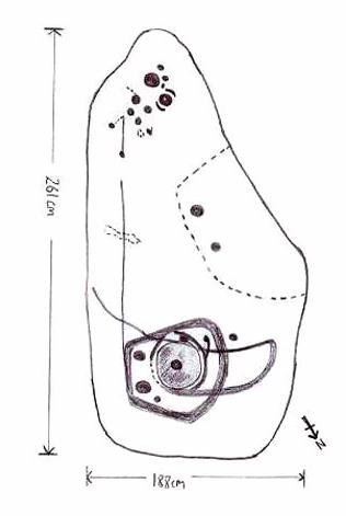
Cairn:  OS Grid Reference – SE 11468 45224

Getting Here

The denuded remains of a once giant tomb

This is the highest point of the moors, 1320 feet up. There’s various ways of getting there: I’d favour the wander up to Twelve Apostles then taking the 15 minute walk west to the triangulation point which marks the spot.  If you reach the large rocky outcrop of the Thimble Stones, you’ve gone too far; although you can walk past the Thimbles, if you’ve started your walk from the two radio masts atop of the moor where the old Roman road hits the dirt-track.  Either way, unless you’re damn stupid, this is an easy spot to find!

Archaeology & History

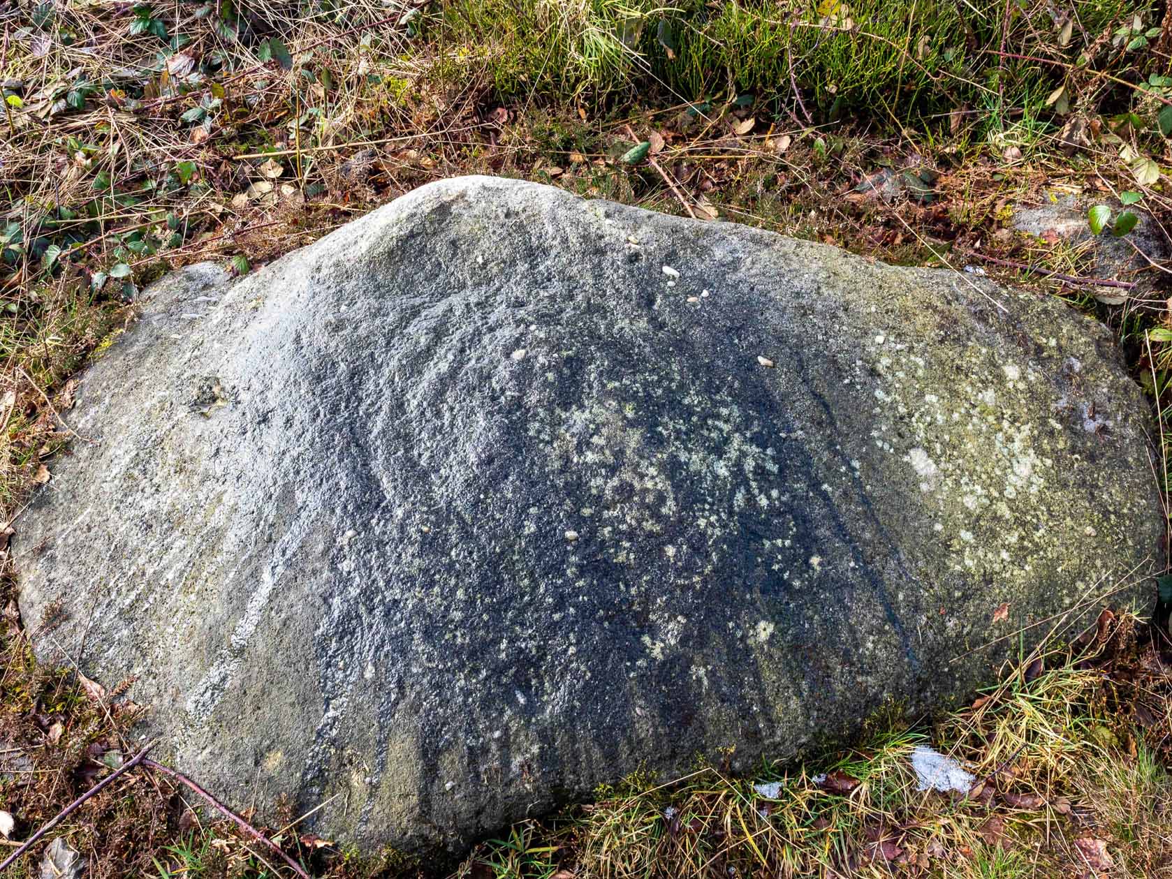
Although today there’s little to be seen, when Collyer & Turner (1885) described the place it was 175 yards in circumference! Bloody huge! When Harry Speight got here in 1900, it had shrunk slightly to 150 yards. Now however, almost all the stones have been robbed.  I first came here when I was just 11 years old and remember it was a decent size even then – at least as large as the Little Skirtful and Great Skirtful of Stones more than a mile to the east.  Today however, unless you knew it was once a giant cairn, you wouldn’t give it a second look.

It’s quite appalling what’s happened to this site thanks to the sheer ignorance and neglect of the local archaeologist in tandem with his paymasters at Bradford Council: 90% of the site has been utterly vandalised and destroyed as a result of these incompetent idiots in the last 20 years.  Nowadays, all you can make out here is the raised earth for about 10 yards surrounding the trig-point.  It seems that most of the stones that comprised this giant cairn have been taken for use in walling, and to prop up the stupid paved footpaths which the local Council and its affiliated halfwits are slowly building o’er these hills.*  Morons!

Aar Dave on top o’ t’ moors

I’m not quite sure why it was called Nixon’s Station.  It was J. Atkinson Busfield (1875) who mentioned this name, quite casually in his fine local history work, as if local folk had known it as such for sometime.  There was also an inference of it being the resting place of some old general, but I’ve found nor heard anything more along such lines — though worra superb place for your spirit to roam free…..

If anyone has any old photos of this once giant prehistoric site, it would be good to see it in its old glory once again.  When I wandered up here as a kid, I never carried things like a camera about (being a Luddite by nature!).

References:

  1. Busfield, J.A., Fragments Relating to the History of Bingley Parish, Bradford 1875.
  2. Collyer, R. & Turner, J.H., Ilkley, Ancient & Modern, Otley 1885.
  3. Speight, Harry, Upper Wharfedale, London 1900.

© Paul Bennett, The Northern Antiquarian

* Anyone know exactly which idiots are responsible for the stone footpaths being laid over the moors here? They’re damn stupid and cause even more erosion and damage to the environment and prehistoric heritage up here, as anyone with an ounce of common sense can see. Can someone please get them stopped!?


Morphing Stone, Dacre, North Yorkshire

Cup-and-Ring Stone:  OS Grid Reference – SE 18559 61795

Also known as:

  1. Snoopy Stone
  2. Eastwoods Rough Carving
  3. IAG 638a (Boughey)

Getting Here

Mr Stroud's drawing of the stone
Mr Stroud’s drawing of the stone

Various ways to get here.  I s’ppose the easiest is from Dacre village.  If you go just past Sunny House, take the footpath on your right & walk along it, roughly straight across a number of fields, until you hit the footpath known as the Nidderdale Way.  The field you’re now in should be scattered with numerous rocks all over the place (if it aint, you’re in the wrong place), reaching down towards the trees.  Walk straight towards the trees for another 100 yards and the carving is somewhere hereabouts under your nose!  You’re very close! If, however, you decide to walk up the Nidderdale Way from Dacre Banks, the field you need is the one immediately to your right just before you reach the Monk Ing Road trackway.  The Tadpole Stone (or Eastwoods Rough II carving) is in the same field, close to the Nidderdale Way path — check that out aswell!

Archaeology & History

This is a large carving I found in April, 2006, in the company of rock-art student Richard Stroud (who sent us the pictures).  Twas in the midst of a fine day wandering about checking some of the ‘known’ sites in the area, when we happened across two or three previously unknown sites — and as the day wore on, just before we were gonna head for home, this little beauty poked the edge of its head out of the turf!  It had the pair of us in near rapture, with numerous “Wow’s” and excitable expletives coming from our mouths! We’re easily pleased us rock-art doods — but then it is a beauty when you first see it.

Morphing Stone carving (photo © Richard Stroud)
Morphing Stone, Dacre (photo © Richard Stroud)

We came here several times in the weeks following its initial discovery, and it seemed that on each visit, we found an additional aspect to the carving.  It seemed to keep changing each time we came here — hence the name ‘Morphing Stone’!

The prime feature in the carving is the very large oval-shaped ‘ring’ with huge carved bowl in the middle and several outlying cups-markings around it.  Although it’s not plain to see in the photos, there’s a large tongue-shaped protuberance jutting out from one side of the main ringed feature.  You can also see a small cluster of cup-marks on the top-right of the rock: from here — though it isn’t easy to see in the photo — a long straight line links up with the edge of the major central ring.  Other lines run off on the top of the main feature and there are several other cup-markings on different parts of the stone.  It’s obviously best to see the carving “in the flesh”, so to speak, to get a good impression of what it actually looks like.  And, to those of you who might wanna venture up here, there are several others nearby.

A year or two after rediscovering the carving, rock art student Keith Boughey (2007) described the stone, saying:

“Measuring 2.61m from N-S and 1.88m from W-E at its greatest extent, the carved surface carries quite a complex design… At its N end is a large cup/basin with an approximate diameter of 25-30cm, surrounded by a ring that may or may not be complete: 2 cups have been incorporated into the ring on its N and W side. W of this ring a groove leads off S to a further possible cup. On the E side of the large central cup are 3 further cups of varying size. These motifs are all enclosed within a wide groove, which forms almost a dome pattern. Out of the ring, a further groove runs NW out of the design, bisecting the enclosing groove, curving round to form a handle shape before running back in towards the large central cup. The groove shows signs of continuing E towards the edge of the stone. Just outside the W edge of the enclosing dome is one well-defined cup. S of this, in a slight depression, are 2 further cups of differing size. A straight groove appears to run SW out of the enclosing dome shape on its E side towards further motifs on the stone’s S side. The groove may run into an area of cup marks, but there appears to be a break before it continues. When exposed, the carvings looked quite fresh and sharp, suggesting that they had remained covered for some considerable time – possible since antiquity or at least from a time in the prehistoric past when cup-and-ring-markings had begun to lose their significance and were no longer required to be visible in the landscape.”

To those of you who like the new computer images of cup-and-rings, the three below are samples from a number of such images done after the stone had been discovered.  Intriguingly, the long line running between the cluster of cups to the large cup-and-ring doesn’t show up too well; but the barely perceptible line running out, zigzag-fashion, from the large central cup-and-ring, shows up much clearer than when looking with the naked eye.

                          Morphing Stone Nikon Morphing4
References:

  1. Boughey, K., “Prehistoric Rock Art: Four New Discoveries in Nidderdale,” in Prehistoric Research Section Bulletin, no.44, Yorkshire Archaeological Society 2007.

© Paul Bennett, The Northern Antiquarian


Weecher Stone Circle, Faweather, Baildon, West Yorkshire

Stone Circle (destroyed):  OS Grid Reference – SE 1372 4196

Getting Here

Although destroyed, to those who wanna check the locale, from Bingley take the Eldwick road and keep going all the way up to Dick Hudson’s public house, right on the edge of the moor.  From here, go left (east) on the road for less than a mile until you reach the reservoir/lake on your right.  Take the dirt-track down here for 100 yards and stop!  It was somewhere here!

Archaeology & History

I first went looking for this site when I was a kid (about 13 years old), but soon discovered that it had been destroyed.  The first person to write about it was lucky enough to see it when it was still there.  Harry Speight came here around 1890 and described,

“descending (from Pennythorn Hill) towards Faweather we enter (by permission) a field at Birch Close Farm, and here we find evidence of an extensive stone circle, some of the large unhewn stones having been built into an adjoining wall. In the next field is a rock sculpture with…cup and ring marks.”

This cup-marked stone still exists at Faweather, though has now been enclosed by a garden. The occupiers are quite friendly and are willing to let you look at the stone if you ask kindly.  Anyway…..by the time Butler Wood wrote about the place in 1905, he was telling that “the finest stone circle in the Rombald’s Moor area was demolished some years ago.”

The local historian W.E. Preston, marking an old map of the region with an “X,” wrote:

“NOTE! The circle was destroyed here during construction of the Baildon Waterworks, 1892. Diameter 25 yards. It consisted of a wall of rubble with upright stones at frequent intervals.”

Subsequent descriptions of the site in 1905, 1929 and 1946, cited Weecher to be 27 yards across.  My last search for any remains of this circle was in 1990 when I explored every wall in the region, hoping to find one or two of the old uprights, but they had all gone. Sadly, there appear to be no drawings or illustrations of the site either…

Folklore

This stone circle was one of at least four circles that played a part in one of the most impressive leys I have seen! Starting at the circle in Hirst Woods, Saltaire, the alignment goes north, crossing the Brackenhall circle, a few other Bronze Age sites, across the site of Weecher, and finally terminates at the Great Skirtful giant tomb a short distance north of here.

References:

  1. Bennett, Paul, The Old Stones of Elmet, Capall Bann: Milverton 2001.
  2. Cowling, E.T., Rombald’s Way, William Walker: Otley 1946.
  3. Gray, Johnnie, Through Airedale from Goole to Malham, Walker & Laycock: Leeds 1891.
  4. Raistrick, Arthur, ‘The Bronze Age in West Yorkshire,’ in YAJ 1929.
  5. Wood, Butler, ‘Prehistoric Antiquities of the Bradford District,’ in Bradford Antiquary, 2, 1905.

© Paul Bennett, The Northern Antiquarian


Middleton Moor Carving (454), North Yorkshire

Cup-Marked Stone:  OS Grid Reference – SE 10980 51284

Archaeology & History

Carving no. 454

About 10 yards north of the old boundary stone on the Middle Ridge heading to the western end of Dryas Dike and about 10-15 yards east of the Middleton 453 carving, is this small rounded rock with between 12 and 15 cup-markings on its north and north-eastern sides.  Several curious deep ridges run down across the rock which some ascribe as being man-made – but to me they’re Nature’s fine handiwork, although I may be wrong…

References:

  1. Boughey, Keith & Vickerman, E.A., Prehistoric Rock Art of the West Riding, WYAS 2003.

© Paul BennettThe Northern Antiquarian

Middleton Moor Carving (453), North Yorkshire

Cup-and-Line Stone:  OS Grid Reference – SE 10968 51279

Archaeology & History

Carving no. 453

Named boringly after the catalogue number given it in Boughey & Vickerman’s (2003) survey, this is another of the many small cup-marked stones clustered at the western end of the ridge between Delves Beck and Dryas Dike, below the moorland slope up to the Old Pike and Beamsley Beacon.  It’s one of the more impressive of the carvings in this locale, albeit when it’s highlighted, as in the photos shown here (apparently done by one of the photographers in the Ilkley rock art group, I was told).  It’s perhaps better seen when the sun is low and the stone’s been wet, which shows the shallow undulations of the cup-marks and wavy line that seems to split the main group of twelve cup-marks  at the top northern side of the stone, from the two on its south side.  There seems to be another wavy line carved above the main cluster, but this is difficult to make out.

References:

  1. Boughey, Keith & Vickerman, E.A., Prehistoric Rock Art of the West Riding, WYAS 2003.

© Paul BennettThe Northern Antiquarian

Knotties Stone, Otley Chevin, West Yorkshire

Cup-and-Ring Stone:  OS Grid Reference – SE 20772 44181

Also Known as:

  1. Carving no. 396 (Boughey & Vickerman)

Getting Here

Knotties stone (photo, James Elkington)

From The Royalty hotel, walk along the footpath onto the Chevin itself, turning left then walk about 350 yards east, past the small copse of trees.  Just north of the main path before the land slopes down you’ll find it.  It’s carved on an earthfast rock about 6 feet long.

Archaeology & History

This is an excellent carving if you’re into cup-and-rings!  Eric Cowling (1940) first described the stone* in an article for the Yorkshire Archaeology Society.  Although it’s somewhat faded, when the stone’s wet and the sun’s low on the horizon, you can make out more rings than just the three which Boughey & Vickerman (2003) described in their survey.

Folklore

Knotties Stone (E.T. Cowling)

Although the Chevin itself has a tradition of ‘supposed’ heathen goings-on in bygone days, the carving has nothing specific said about it.  Although one intriguing bit of info comes from the old Otley historian, Harold Walker (1974), who said that, “blocks of stone were sent from (the) Chevin to form the foundations of the Houses of Parliament”!

Those lying deviants probably smashed up a few bits of extra rock art when they did this — not that those sort of people give a shit about anything unless it’s about money.

References:

  1. Boughey, Keith & Vickerman, E.A., Prehistoric Rock Art of the West Riding, WYAS 2003.
  2. Cowling, E.T., ‘A Classification of West Yorkshire “Cup-and-Ring” Stones,’ in Archaeology Journal, 97, 1940.
  3. Cowling, E.T., Rombald’s Way, William Walker: Otley 1946.
  4. Hotham, John Paul, Halos and Horizons, Hotham Publishing: Leeds 2021.
  5. Walker, Harold, This Little Town of Otley, Olicana: Otley 1974.

* Graeme Chappell tells me that this carving was named after Cowling’s nickname, Knotty!

© Paul Bennett, The Northern Antiquarian 


Kelpie’s Stane, Corgarff, Aberdeenshire

Legendary Rock:  OS Grid Reference – NJ 264 087

Also known as:

  1. Kelpie Stone

Folklore

The old Scottish folklorist, A.A. MacGregor, described this legendary rock, “by the Bridge of Luib, on the River Don,” in his classic Peat Fire Flame. (1937)  One of the numerous ‘holed stones,’ it was one of countless rocks in our isles imbued with animistic spirit essence, akin to similar rocks found in all of the other cultures in the world.  MacGregor told how,

“It happened that a man summoned to the death-bed of a relative came to this crossing-place just after torrential floods had carried away the bridge. When he was on the point of abandoning all hope of reaching the opposite bank, a tall man appeared from nowhere and volunteered to carry him across. The distracted homecomer accepted the assistance proffered. But, when he and his carrier reached mid-river, the latter reverted to the form of the river kelpie and endeavoured to drag him down to the river’s bed. The victim managed to escape. As he scrambled to the bank, the infuriated kelpie hurled after him the huge boulder that to this day goes by the name of the Kelpie’s Stane.”

But the stone was also known to possess healing and magickal properties, as evidenced from MacPherson’s (1929) chronicle, which told:

“Somewhere near Dinnet was the Kelpie Stone. Childless women passed through its 18 inch (46cm) hole to concieve. A noble lady performed the task to no avail; only when she repeated it in the same direction as the river flow did the charm work.”

Close by are several other intriguing place-names which may at some time have had some archaeo-mythic relevance to this legendary rock. On the hill above is the old Carn Lian; the water course nearby is the Allt na Ciste; but most intriguingly we find the Bog of the Old Woman, or the Moine Cailleach a half-mile to the east.

References:

  1. MacGregor, Alisdair Alpin, The Peat-Fire Flame, Ettrick Press: Edinburgh 1937.
  2. McPherson, Joseph M., Primitive Beliefs in the North-East of Scotland, Longmans, Green & Co: London 1929.

© Paul Bennett, The Northern Antiquarian


Exley Head Cross, Keighley, West Yorkshire

Cross:  OS Grid Reference – SE 04818 40146

Getting Here

Exley Head Cross base, at roadside

From Keighley town centre, take the main road to Oakworth (B6143) and you’ll see it right by the main roadside, about a mile up on the left-hand side upon a small grassy area in Exley Head, just past the turning up to Wheathead.

Archaeology & History

The upright stone monolith, or cross, which would once have stood here has long since disappeared.  All we are left with today is the large cross-base by the roadside: roughly squared, with a large hollow at the centre in which the upright stone cross originally stood erect!  In the past, a number of archaeologists and historians have speculated that the Exley Head Cross dated from as early as the 9th up till the 15th century. We may never find out for certain, though it’s likely a post-Domesday medieval relic.  It’s position at the roadside gives it the category of being a ‘Wayside Cross’ and it is likely one in a deliberate sequence that were placed along the ancient route from above Keighley, to Oakworth and over the border into Lancashire, near Wycoller and beyond.

Close-up of Exley Head Cross base

Quite why it was placed here is something we may never know: though it is close by an old crossroads and could have replaced an earlier heathen site, but I’ve found no records to indicate this. Its position in the landscape would also have been more impressive before the housing was here, previously giving a wide open view of the Aire Valley below.  I’d be grateful for any more info on this site.

References:

  1. Brigg, J.J. & Villy, F., “Three Ancient Crosses near Keighley,” in Bradford Antiquary, New Series 6, 1921.

© Paul Bennett, The Northern Antiquarian


Hitching Stone, Keighley Moor, West Yorkshire

Legendary Rock:  OS Grid Reference – SD 98665 41698

Getting Here

Hitching Stone through fog and snow
Hitching Stone through fog & snow

The easiest way to get here is via Cowling – though you can approach the place via moorland roads from Sutton-in-Craven, Oakworth and Keighley, but Cowling’s the closest place (so we’ll take it from there).  Turn east off the A6068 up Old Lane at the Ickornshaw side of town and go up the steep and winding road until you hit the moors.  Just as the road levels out with walling on either side of the road, there’s some rough ground to your left.  You can park here.  You’ll blatantly see our Hitching Stone on the moorland a few hundred yards above you on the other side of the road.  Walk up the usually boggy footpath straight to it!

Archaeology & History

For me, this is a superb place! Each time I come here the place becomes even more and more attractive — it’s like it’s calling me with greater strength with each visit.  But that aside…

Supposedly the largest single boulder in Yorkshire, it possesses several legends, aligns with the sacred Pendle Hill in Lancashire, is an omphalos (centre of the universe spot) and has other good points too! My first visit here was near the end of the Great Drought of 1995.  All of the streams and springs had dried up on the moors but, on the very top of this huge rock, measuring at least 8 feet by 4 feet across (and 3 feet deep) was a large pool of water, not unlike a bath, in which a couple of you could easily bathe (and do more besides, if the fancy takes you!).  It was surreal!  Water-boatmen and other insects were living in this curious pool on top of the rock.  Yet all other water supplies for miles around had long since dried-up.  It didn’t really seem to make sense.

Crystalline tunnel in the Hitching Stone

On the west-facing side of the boulder, about 8 feet up, is a curious deep recess known as the Druid’s or Priest’s Chair, into which initiates were sat (facing Pendle Hill, down which it seems the equinox sun “rolls”) and is believed, said Harry Speight, “to have some connection with Druidical worship, to which tradition assigns a place on these moors.” If you climb up and inside the Priest’s Chair section you’ll notice a curious “tunnel” that runs down through the boulder, about 12 feet long, emerging near the northern base of the rock and out onto the moor itself.  This curious tunnel through the rock is due to the softer rock of a fossilised tree (Lepidodendron) crumbling away — and not, as Will Keighley (1858) believed, “the mould or matrix of a great fish.” When we visited the stone the other day in the snow, we noticed how the inner surface of this tunnel was shimmering throughout its length as if coated in a beautiful crystalline lattice (you can sort-of make this out in the image here, where the numerous bright spots on the photo are where the rock was lit up). Twas gorgeous!

The Hitching Stone, looking north

The boulder lies at the meeting of five boundaries, and was the starting point for horse-racing event until the end of the 19th century.  A short distance away “are two smaller stones, the one on the east called ‘Kidstone’, the other ‘Navaxstone’, which stands at the terminus of the race-course.” (Keighley 1858)  Lammas fairs were also held here, though were stopped in 1870.

The cup-marked Winter Hill Stone a few hundred yards to the northeast, which I previously thought aligned with this site around winter solstice, but which happens to be a few degrees of arc off-line, would have indicated a very early mythic relationship, but this thought may now have to be put to bed.  I’ve not checked whether the winter solstice alignment shown in the photo below (with the Hitching Stone being shown on the near-horizon as the sun rose on winter solstice, 2010, from Winter Hill Stone) would have been closer in neolithic times or not.  Summat to check out sometime in the future maybe…

This aside, there is little doubt that this was an important sacred site to our ancestors.

Folklore

Winter Solstice sunrise, 2010 (from Winter Hill Stone)

Legend has it that the Hitching Stone used to sit on Ilkley Moor. But it was outside the rocky house of a great witch who, fed up by the constant intrusion the boulder made to her life, tried all sorts of ways to move it, but without success. So one day, using magick, she stuck her wand (or broomstick) into the very rock itself and threw it several miles from one side of the valley to the other until it landed where it still sits, on Keighley Moor.

A variation on the same tale tells that she pushed it up the hill from the Aire valley bottom. The “hole” running through the stone is supposed to be where our old witch shoved her broomstick!

References:

  1. Bennett, Paul, The Old Stones of Elmet, Capall Bann: Milverton 2001.
  2. Gray, Johnnie, Through Airedale form Goole to Malham, G.F. Sewell: Bradford 1891.
  3. Keighley, William, Keighley, Past and Present, R. Aked: Keighley 1858.
  4. Wood, Eric, Cowling: A Moorland Parish, Cowling Local History Society 1980.

© Paul Bennett, The Northern Antiquarian


High Carr Rocks, Keighley, West Yorkshire

Cup-and-Ring Stones:  OS Grid Reference – SE 0578 4395

Getting Here

High Carr Cup-Markings (1 & 2)

Loadsa ways to get to this little outcrop, which the Boughey & Vickerman survey (2003) says comprises of five different carvings (CRs 33-37).  I’m not so sure misself.  When Stuart Feather first found these in the 1950s, he only thought three stones were carved, which I think is the more accurate.

Most folk would probably prefer to walk down the slope from Holden Gate down the footpath past Jaytail Farm, then dropping down to the very bottom of the fields (south) where you’ll see a small knoll with a cluster of rocks just in front of the tree-line.  But I wandered up thru the ‘Private’ (ahem!) woodland, wet-thru in the pouring rain, and clambered over the wall right to the very spot (the old dowser’s ‘seek-and-find-rock-art’ nose worked again!).

Archaeology & History

High Carr Cup-Marked Stone
High Carr Cup-Marked Stone – from Hedge’s Carved Rocks on Rombald’s Moor

Listed in John Hedge’s (1986) survey as carvings 1-5, I’d say there’s one “definite” carving here, but the others – comprising simply of cups – are a little dubious.  The main carving has at least six definite cup-markings, found on the rock at the highest point of the knoll at the bottom of the field.  The drawing in Hedge’s survey shows as many as 12 cups on this stone, but I’m not totally convinced.  Another stone right next to the main one has, perhaps, a cup-marking or two on it – but again, these may be natural.

Of the other alleged carvings, it was difficult to work out as they were literally covered in tons of cow-shit. It seems this rock-outcrop is the local bovine toilet!  A lovely secluded place though, with plenty of wildlife to see.  Next stop from here: the great Holden waterfalls!

References:

  1. Boughey, K. & Vickerman, E.A., Prehistoric Rock Art of the West Riding, WYMCC: Wakefield 2003.
  2. Feather, S., ‘Three Bronze Age Rock Carvings near Keighley,’ in CHAGB 4:3, 1959.
  3. Hedges, John D., The Carved Rocks on Rombald’s Moor, WYMCC: Wakefield 1986.

© Paul Bennett, The Northern Antiquarian