Horncliffe Circle, Hawskworth Moor, West Yorkshire

Stone Circle:  OS Grid Reference – SE 13335 43532

Getting Here

Get to the famous Dick Hudson’s pub on the south-side of Ilkley Moor and go east for about 700 yards till you get to Weecher reservoir (posh doods go yachting there).  From here cross the road and walk on for 150 yards till you reach the stile which takes you onto the moors. Walk!  Follow the footpath and you’ll go over another wall before eventually hitting the beautiful fresh waters of Horncliffe Well (this has never dried up – even in the summers of ’76 and ’95).  Sit here for a while before heading for the circle which is on the east-side of the moorland fence just a coupla hundred yards up onto the moor (you’ll cross a coupla streams before reaching the site).  You’ll know you’re close when, to your left by the fence, you’ll see a boundary stone with the name ‘Thos. Pulleyn’ engraved on it.

Archaeology & History
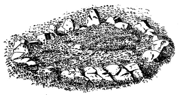
Early drawing of Horncliffe Circle (Speight 1898)

Horncliffe is a bittova strange site, inasmuch as we don’t honestly know precisely what it is, nor its age.  It used to be categorized as a ‘stone circle’, but this was abandoned many moons ago.  The inner circle of this ellipse-shaped monument was thought to have perhaps contained a burial, but Victorian excavations here found no such evidence; no burials have ever been found, though fires were evidently burned in the small central ring.

Nowadays I’m of the opinion that this was more for living-in, than any ritual site.  It ‘smells’ like that anyway (modern OS-maps now term it as an ‘enclosure’); and this may be borne out by the ancient name of the trackway travelling north from here called ‘Castle Gate’, meaning ‘entrance or path by the fortification.’  Faint ‘cup-markings’ reported by Harry Speight (1898) on the outer edge of the ring are very likely Nature’s handiwork.

Horncliffe is a double-ringed ellipse structure, surrounded on its northern side by a natural embankment of earth.  It was first mentioned in J.N.M. Colls’ (1846) survey, but more was said of it by James Wardell in 1869, who told that,

“there is a circle of stones of various sizes, from three-feet to five-feet in height; they are chiefly set upon their edges and are of sandstone grit.  This circle is forty-three feet in diameter and within it there is a smaller circle, composed of stones of the same composition…and set in the same manner.”

A few years later, the Yorkshire literary giant Harry Speight (1898) penned his first words about this curious circle, saying:

“The best example of a stone circle in the vicinity of Bingley lies on the moor close to the parish boundary, on land belonging to Mr Fawkes, of Farnley Hall.  It is a complete circle, consisting of about twenty stones, placed close together (a very unusual arrangement), from two to four feet high, the circumference being about 35 yards.  An excavation was made in the middle of it some years ago, when bits of flint were found, but no trace of burial.  It is built on a slight slope of the moor, facing the south, and is now much concealed by heather.  It is, doubtless, the oldest known evidence of man’s handiwork remaining in the neighbourhood of Bingley, and there is small doubt that it was originally intended to fence a burial, such “Druids’ Circles” being primarily meant to enclose places of sepulchre in the same way that walled enclosures came to be adopted round our churchyards.  A large flat stone on the top side, about three yards distant, is marked with cups and channels, and probably was in the centre of the circle originally.”

When Arthur Raistrick (1929) visited the circle, his measurements differed somewhat from those of Mr Wardell, telling the site to have diameters of 25 feet (east-west) and 32 feet (north-south), with 46 stones in the outer ring and 17 in the inner circle.

This is one of many sites on these moors that I slept at over the years when I was a kid.  It used to be a really peaceful spot that was rarely troubled by other visitors (not sure if it’s still the same though).

Folklore

Although we have nothing specific to the circle, around the nearby Horncliffe Well a coupla hundred yards away we had accounts told us by the old warden whose job it was to look after this moorland, that will-o-the-wisps had been seen here.  There is a seeming alignment to the equinoxes from here to Reva Hill – though this is more fortuitous than deliberate.  A dowsing survey found aquastats in and around the circle, but no plan of these were ever made.

References:

  1. Bennett, Paul, The Old Stones of Elmet, Capall Bann: Milverton 2001.
  2. Colls, J.N.M., ‘Letter upon some Early Remains Discovered in Yorkshire,’ in Archaeologia 31, 1846.
  3. Raistrick, Arthur, ‘The Bronze Age in West Yorkshire,’ in YAJ 1929.
  4. Speight, Harry, Chronicles and Stories of Old Bingley, Elliot Stock: London 1898.
  5. Wardell, James, Historical Notices on Ilkley, Rombald’s Moor, Baildon Common, etc., Leeds 1869.

© Paul Bennett, The Northern Antiquarian

Werneth Low, Hyde, Lancashire

Settlement (destroyed):  OS Grid Reference – SJ 959 928

Archaeology & History

Known by this name – Werneth – since at least the 12th century, place-name masters Ekwall, Smith and others have tended to think the place derives from a hypothetical British word, *verno-, meaning alder trees – though I aint so sure misself.

It’s been difficult to ascertain the precise nature of this prehistoric arena. Many mesolithic flint finds and old stone axes have been found around the area, but it seems primarily to have developed into a neolithic and Bronze Age settlement and burial site. A number of cairns were once here, and both rounded and linear earthwork features occur in the area; but there’s been considerable disturbance in and around the site and without in-depth archaeo-surveillance, much remains hidden.

References:

  1. Abraham, John Harris, Hidden Prehistory around the North West, Kindle 2012.
  2. Ekwall, E., The Place-Names of Lancashire, Manchester University Press 1922.
  3. Marriott, W., The Antiquities of Lyme and its Vicinity, Stockport 1810.
  4. Nevell, Michael, Tameside before 1066, TMBC 1992.

© Paul Bennett, The Northern Antiquarian 


Stanwick Fortifications, North Yorkshire

Settlement:  OS Grid Reference – NZ 1783 1229

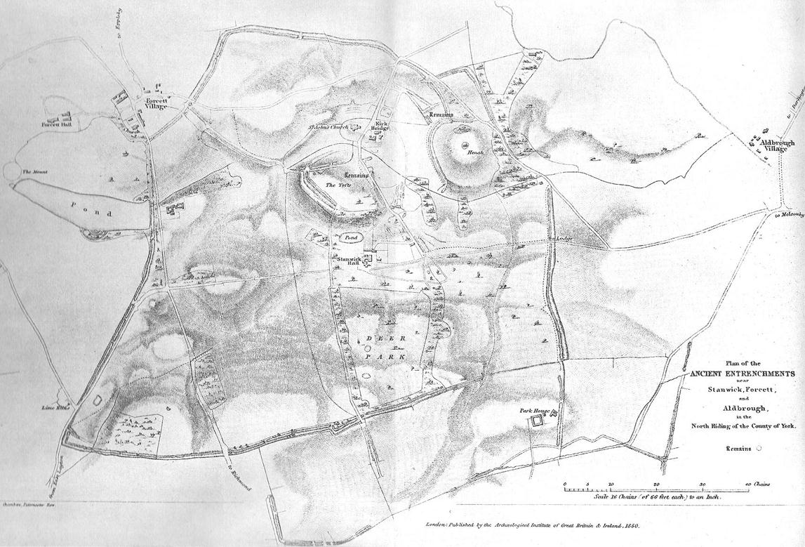
1850 map of village & earthworks

Getting Here

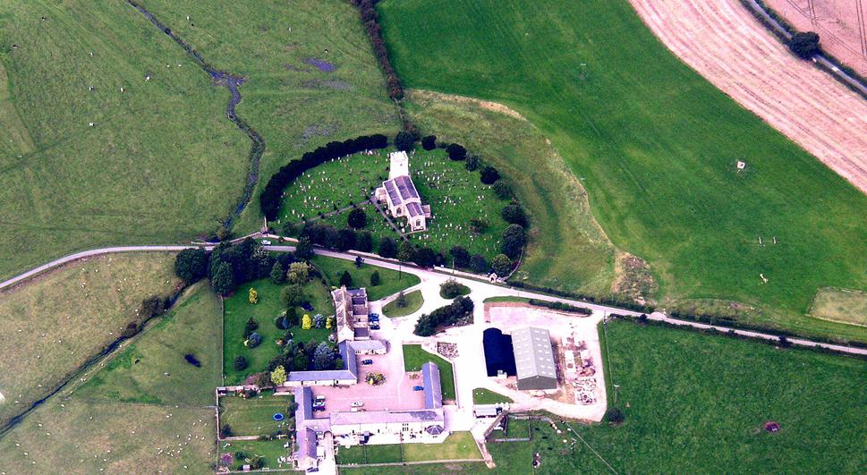
From Scotch Corner on the A1, head on the A66 and take the first right up to and straight thru Melsonby village at the crossroads and on for a few more miles till you hit the hamlet of Stanwick-St.-John.  You’re now in the middle of the fortifications and earthworks! (check the map, right) Get to the nearby church of St. John’s and you’re on what once could have been a henge.

Archaeology & History

Although the Roman’s came here, the origins of this huge enclosure and settlement — between the hamlets of Eppleby and Stanwick St. John — are at least Iron Age.  It’s very probable that this place has been used by people since at least the Bronze Age, if not earlier — but let’s keep to playing safe (for a change) and repeat what the professionals have found!  Stanwick was recorded in Domesday as Stenwege and Steinwege, which A.H. Smith (1928) and later etymologists tell us means “stone walls,” which obviously relates “to some ancient rock entrenchments found in the township”, or the Stanwick Fortifications no less!

Sir Mortimer Wheeler’s (1954) account of the history and excavation of these huge ramparts found that it was a centre of some importance to the Brigantians. His view was that it was the rebel stronghold of the Brigantian figure called Venutius, ex-partner of the Queen Cartimandua.  Archaeologists who did further work here in the 1980s concluded that it was one of Cartimandua’s “estates” — possibly even the original capital city of Brigantia.

Church on the circular henge-like remains (phot courtesy Pete Glastonbury)
Church on the henge-like remains (photo © Pete Glastonbury)

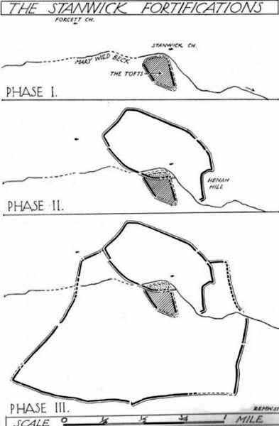
The settlement was enlarged and fortified considerably upon the arrival of the Romans in the first century. Splitting them into three phases, the earliest Phase I area (Iron Age) covered 17-acres; Phase II was extended over 130 acres; and Phase 3 extended the enclosure over another 600 acres.  A further extension of earthworks appears to have occurred, but Wheeler believed them to have been constructed at a much later period.  To allow for a decent discourse on this huge site and its multiperiod settlement, I’m gonna quote extensively Mr Wheeler’s (1954) text on the site, who headed a team of archaeologists in the summers of 1951 and 1952 and explored various sections of this huge arena.

In the introduction to his work, Mortimer briefly mentioned the finding of some chariot burials found close by, though less certain is the exact spot where these important remains came from.  He wrote:

“Of the three accounts, the earliest, dating from shortly after the discovery, states that the objects ‘were deposited together in a pit at a depth of about five feet within the entrenchment at Stanwick.  Near by large iron hoops were found.’  Two years later MacLauchlan showed the find-spot on his map…as a little to the northeast of Lower Langdale, well outside the main Stanwick earthworks, and, in spite of variant accounts, his evidence may be regarded as authoritative.”

Nothing more is said of these finds throughout the book.  Instead, Mortimer guides us through their dig, beginning with the structural sequence of the extensive earthworks that constitute Stanwick’s fortifications, from Phase 1 onwards, saying:

Plan showing 3-phase evolution of Stanwick earthworks from the Iron Age period at the top, to Phase 3 works in the 1st century AD (from Wheeler’s ‘Stanwick Fortifications’, 1954)

Phase I.  The nucleus of the whole system is a fortified enclosure, some 17 acres in extent, situated to the south of Stanwick Church and the Mary Wild beck, on and around a low hill known as ‘The Tofts’… The name ‘Tofts’ is defined by the Oxford Dictionary as “Site of a homestead”, or “An eminence, knoll or hillock in a flat region; esp. one suitable for the site of a house.”  Appropriately the field is described by the farmer as a ‘dirty’ one; it produces an abundant crop of nettles which have to be cut twice a year and are a common sequel to ancient occupation.  The enclosure is, or rather was, roughly triangular on plan, conforming approximately with the mild contours of the hill and to that extent meriting the exaggerated designation of ‘hill-fort.’  On the west its rampart and ditch are excellently preserved in a stretch of plantation known as ‘The Terrace’ or ‘The Duchess’s Walk’, where the single bank of unrevetted earthwork rises some 24ft above the ditch… The southern corner has been almost completely obliterated, but a part of it can be traced faintly in the walled garden southeast of the The Terrace.  A stretch of the eastern side still stands up boldly beside the road from Stanwick Church to (the former) Stanwick Hall, but a large part of this side has been demolished for the making of the road, and some dumps of earth immediately east of Church Lodge may be a result of this process.  The northern side approached but stopped short of the brook, and is marked by remains of a counterscarp bank… The main rampart was here thrown into the ditch anciently, doubtless when this portion of the work was included in and superseded by the work of Phase II.  Near the northwestern corner was a stone-flanked entrance, now partially obscured by the northern end-wall of the Terrace plantation.  The rampart was of earth, apparently without stone or timber revetment, the ditch was V-shaped save where, on the northern or lowest side, its completion in depth was stopped by water and the counterscarp bank already referred to was added as compensation.

Phase II.  Subsequently, at a moment which will be defined in the sequel as not later than AD 60, the hill-fort was supplemented by a new enclosure over 130 acres in extent, so designed as to outline the slight ridge north of the brook, to bend inward round the nearer foot of Henah Hill on the east, and farther west to cut off the northern end of the hill-fort, obviously in order to enclose the brook and its margin hereabouts.  Southeast of Stanwick Church, the marshy course of the brook for a distance of over 300 yards was regarded as a sufficient obstacle, without rampart and ditch, though whether supplemented by a palisade is not known.  As already indicated, that part of the Phase I earthwork which now lay inside the new enclosure was largely obliterated by filling its rampart into its ditch.

The enclosure constituting Phase II had an entrance near its western corner…where 50ft of the ditch, partially rock-cut, were cleared with notable results… There may have been another entrance under the present road-junction immediately east of the Stanwick vicarage, in the middle of the northern side, or less probably, at an existing gap 150 yards further to the southeast.  The rampart was of earth, aligned initially at the back on a small marking-out trench and bank; in front it was revetted with a vertical drystone wall.  The ditch was cut in the boulder-clay and partially in the underlying limestone…

Phase III.  At a date which will be defined as about a dozen years later (c. AD 72), a similar though longer system, enclosing a further 600 acres, was added to Phase II.  It impinges almost at a right angle upon, and implies the pre-existence of, Phase II on the east, and terminates upon the ditch of Phase II on the west.  An entrance can be seen near the middle of the southern side, and less certainly a gap in Forcett Park may represent a second entrance in the western side.  Further stretches of the mary Wild beck were included. The rampart, like that of Site A, incorporated a marking-out trench and bank at the rear, and was fronted with a vertical stone revetment.

Phase IV.  To the southern side of Phase III was added at an unknown period an enclosure of some 100 acres, now subdivided by traces of a double earthwork extending southwards from a point east  of the southern entrance of Phase III… This double earthwork however, is of an entirely different character from those already considered, and appears indeed to overlap the rampart of Phase III at a point where the latter had already been broken through.  It is comparable with some of the double banks which constitute or are incorporated in the Scots Dike at Lower Langdale, farther east; and the Phase IV enclosure is in fact linked with the Scots Dike by a semi-obliterated ditch extending eastwards from its southeastern corner.  Phase IV…may, as has been suspected, relate to the Anglo-Saxon period.”

References:

  1. Smith, A.H., The Place-Names of the North Riding of Yorkshire, Cambridge University Press 1928.
  2. Wheeler, Mortimer, ‘The Stanwick Excavations, 1951,’ in Antiquaries Journal, January 1952.
  3. The Stanwick Fortifications, North Riding of Yorkshire, OUP & Society of Antiquaries: London 1954.

Links: – Stanwick Iron Age Hillfort – For an extensive overview of the archaeology of this large site, you can do no better than this web-page.

© Paul Bennett, The Northern Antiquarian

Torr Mor, Applecross, Ross & Cromarty

Settlement: OS Grid Reference – NG 709 431

Getting Here

Pretty easy to get to.  Go south through the village for a half-mile until you reach the hall by the fire station, sat back on the left-hadn side of the road a few hundred yards past Loch a’ Mhuillinn.  Stop here and walk up the slope behind the hall for a hundred yards or so.  Walk about!

Archaeology & History

The OS-coordinate here is a loose one. It centres on the notable hillock of Torr Mor, around which are a number of hut circles (at NG 7097 4293; NG 7139 4303; NG 7087 4309; NG 7088 4310 and NG 7090 4320) which are each in a relatively good condition and are thought to date from at least the Iron Age. When I visited them, the bracken had encroached on all but one of them (the last in the list above), which was about 30 feet across.

North of here are several curious-looking heaps of stones which need closer examination when the vegetation has died away. At first glance they would seem to be cairns, i.e. tombs. No such prehistoric graveyard has been found anywhere on the peninsula as yet – but considering the existence of the settlements in the area at Sand, you’d think there’d be one somewhere!

© Paul Bennett, The Northern Antiquarian

Great Skirtful Ring, Burley Moor, West Yorkshire

Enclosure:  OS Grid Reference – SE 1415 4452

Getting Here

Follow the directions to reach the Great Skirtful of Stones giant cairn (very worryingly being encroached upon, illegally [it’s a protected monument], by employees of Bradford Council digging tracks into its edges).  Walk less than 100 yards to the east, down the slight moorland slope (Leeds & Otley Chevin are in the distance).  You’re here!

Archaeology & History

This is a very intriguing site.  Intriguing because we don’t actually know what it is!  It’s best seen at the end of winter, shortly after the heather-burning’s been done; but if there’s been no burning here, after a year or two it’s almost impossible to find!

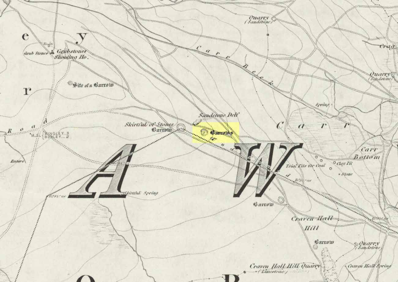
Great Skirtful Ring on 1851 map
Colls’ 1846 plan

Despite it being only a short distance east of the Great Skirtful giant cairn, very little has been written about it (a surprise in itself!) – but this is down the failings of archaeological professionals  in the area, who still neglect this incredible prehistoric arean.  It was first described in Mr J.N.M. Colls’ (1846) survey of sites in the region, where he thought it to be a prehistoric camp.  Several years later the Ordnance Survey lads visited here and deemed it to be prehistoric barrows, which doesn’t seem true.  Nearly a hundred years later, the great northern antiquarian Eric Cowling (1946) who saw fit to describe it as an “enclosure” — so I’m copying his idea so I don’t get into too much trouble!  Thinking it to be a Bronze Age monument, he wrote:

“On the main ridge of Rombald’s Moor and about eighty yards to the east of the Great Skirtful barrow, is a small circular enclosure with a diameter of twenty yards.  There appears to have been an entrance on the eastern side, which is protected by a short length of banking to the east.”

Aerial image, 2002
Aerial image, 2009
Aerial image, 2009

The “length of banking” he described didn’t seem apparent when we visited the site yesterday (23.3.09), but we intend a further exploration of this and the adjacent monuments in the coming weeks and hope to locate it!

Interestingly, the archaeologists Faull & Moorhouse (1981:1:103), in their otherwise fine survey, actually doubted this place as having any prehistoric status, without giving any reason why—which was a big mistake. No doubt they spent too much time in offices and board meetings instead of getting out a bit more!  Unless evidence to the contrary can be strongly presented, this site must be classed as undoubtedly prehistoric in nature (Bronze Age or Iron Age certainly) and almost certainly had something to do with rituals of the dead.

Great Skirtful Ring embankment
Southern edge of the ring

From outer edge to outer edge the ‘ring’ measures 102 feet across, N-S, and with a rough maximum 101 feet E-W, being diameter, being some 300 feet in circumference.  When you look at the site at ground level it appears to be an almost perfect ring, consisting of an embankment little more than 2 feet high at the most, with entrances both east and west. However, as the aerial images show, the perfect circle aint quite so perfect!  But at ground level, there’s a certain uniformity about it.  The embankment is in very good condition around much of the ring, with only slight damage in certain parts.  The western opening strongly implies a direct relationship with the Great Skirtful cairn — which would infer this monument to have more of a ritual nature rather than the simple domestic enclosure, inferred by Colls and Cowling.  Adding to this we find a tumulus 100 yards east and the remains of several other cairns nearby, making the site almost hemmed in by death-sites.  A prehistoric cemetery is a short distance further down the moorland slopes to the east. Add also the fact that the Burley Moor stone avenue runs immediately south and the death-motif has to be increased.

What do I think it is? Not sure! The thought that it’s a previously unrecognized henge has crossed my mind…but henge monuments aren’t things that I’m very clued-up on, so wouldn’t like to say for sure.  If there are any university archaeology students out there who are into getting their feet dirty, give this site a look-over.  It’s intriguing, in very good condition, and could do with an accurate ID!

References:

  1. Bennett, Paul, The Old Stones of Elmet, Capall Bann: Chieveley 2001.
  2. Colls, J.N.M., ‘Letter upon some Early Remains Discovered in Yorkshire,’ in Archaeologia, volume 31, 1846.
  3. Cowling, Eric T., Rombald’s Way, William Walker: Otley 1946.
  4. Faull, M.L. & Moorhouse, S.A. (eds), West Yorkshire: An Archaeological Survey – volume 1, WYMCC: Wakefield 1981.

© Paul Bennett, The Northern Antiquarian 


Dewbottoms, Arncliffe, North Yorkshire

Settlement:  OS Grid Reference – SD 9132 6950

Getting Here

From Grassington go north up the B6160, turning left to Arncliffe, and parking up by the pub.  Take the footpath past it and onto the rocky ridge to your SW for a mile-and-half.  Dew Bottoms settlement is on the wide ridge between the two decent streams dropping back into the valley road below.  Look round!

Archaeology & History

The remains of this prehistoric settlement first seem to have been described by Arthur Raistrick and Paul Holmes. (1961)  They told that:

“the principal field is approximately 120 feet square, enclosed by a massive boulder and gravel bank, probably the foundation of a substantial stockade.  The field is now mostly bare limestone pavement.  Four smaller fields adjoin it on the north and west.  Circular huts with drystone walls still about 3 freet 6 inches high before excavation, covered by collapsed material suggesting an original height of 5 feet, are placed, two of them in the course of the field wall and two in the junction of three field walls.  The huts are about 10 feet internal diameter, the walls about 3 feet thick.  A very fine quartzite hone was the only find in the huts.  There are two rectangular stone-built enclosures, 20ft by 10ft, and 15ft by 8ft, and several small rectangular enclosures, probably buildings, with walls of boulders and turf, using one wall of a field as a common back wall.  The whole site suggests a compact family farm.”

A few years later the site was visited and later described by Miss D. Charlesworth at the annual meeting of the Archaeological Society in July 1968, and is one of several found on the hills 2-3 miles southwest of Arncliffe village. Miss Charlesworth told:

“This site also faces north and covers an area of about 330 by 280ft, much of it now bare limestone. There are eight rectangular buildings and four circular huts associated with a large enclosure about 120ft square, with five smaller enclosures adjoining it.”

References:

  1. Charlesworth, D., ‘Iron Age Settlements and Field Systems,’ in Proceedings of the Archaeological Journal, 125, 1968.
  2. Raistrick, Arthur & Holmes, Paul F., Archaeology of Malham Moor, Headley Brothers: London 1961.

© Paul BennettThe Northern Antiquarian


Crow Well enclosure, Denton Moor, North Yorkshire

Settlement:  OS grid reference – SE 1417 5199

Getting Here

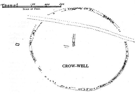
Crow Well settlement (Cowling 1946)

Using the OS-map as a guide, from Denton village head up the road northwest, past Moorside Farm and onto the moor.  Before you reach the rise of Lippersley Pike you’ll reach the Crow Well itself (completely covered over by Yorkshire Water’s handiwork, stopping anyone from drinking the previously fresh waters here).  In the middle of nowhere, just above the completely ruined well, is the old shooter’s cottage and from here, Eric Cowling (1946) told us to look in the heather immediately east. When Richard Stroud and I ventured here a few years back (2.8.5) we couldn’t find a thing — though a vaguely reminiscent structure seemed possible 300 yards away.

Archaeology & History

If the heather’s deep, you’ll have little chance of seeing the site as Eric Cowling (1946) obviously did!  He described and illustrated this place — so was fortunate enough to have ventured here following the heather-burning.

The site is not a stone circle, but what Cowling thought to be an Iron Age settlement: ellipsoid in shape and nearly 400 feet across; it’s obviously an  impressive archaeological site when visible (akin to the Snowden Carr settlement a couple of miles east).  In all probability the site is much earlier than Iron Age.

An aerial image of the site indicates its size to be very close to Cowling’s initial measurements.  The ‘settlement’ is quite huge, with the walling or defining edges being between 4 and 6 yards across in places, with double-walled sections akin to that found at the Brackenhall circle on Shipley Glen, just over 8 miles (13km) to the south.  However, it’s probably much older than its Brackenhall compatriot.  Its maximum diameters measure 130.5 yards (119.3m) roughly east-west and 98.5 yards (90m) roughly north-south, with an external circumference of about 345 yards (315m).  This is a big fella!  Near its centre is a well-defined ring, or ellipse, measuring approximately 20 yards (18.3m) north-south and 18 yards (17.5m) east-west.

It’s difficult to say what this might be without a site analysis, and we need the heather burning back at this site to enable a good inspection of the place!  We may be looking at Denton Moor’s equivalent of the Woofa Bank Enclosure just over 4 miles (6.5km) to the south, above Ilkley, with its host of cup-and-rings and surrounding cairns.  A good inspection of this site is long long overdue…

Hereabouts Cowling also found other remains dating from the neolithic period, including walling, cairns, hut circles and cup-and-ring stones.  He thought that “the name Crow-well appears to be the modern equivalent of ‘the circle of the well'” — and although I doubted this in my Old Stones of Elmet, I have since come to realise the truth of his words!

References:

  1. Bennett, Paul, The Old Stones of Elmet, Capall Bann: Milverton 2001.
  2. Cowling, Eric T., Rombald’s Way: A Prehistory of Mid-Wharfedale, William Walker: Otley 1946.

© Paul Bennett, The Northern Antiquarian
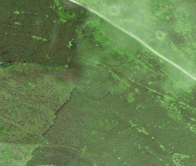

Crosley Wood, Gilstead, Bingley, West Yorkshire

Enclosure / Settlement:  OS Grid Reference – SE 1186 3859

Getting Here

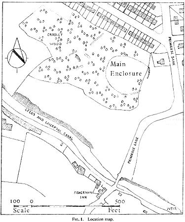
Along the main Aire Valley road (A650) between Cottingley and Bingley, turn right by Beckfoot Grammar School and wander along and up the winding road, over the canal bridge where the Fisherman’s pub is on Primrose Lane.  On the slope above you amidst the scatter of trees on the left-hand side of the road is this Romano-British site (the map below should help).  Check it out!

Archaeology & History

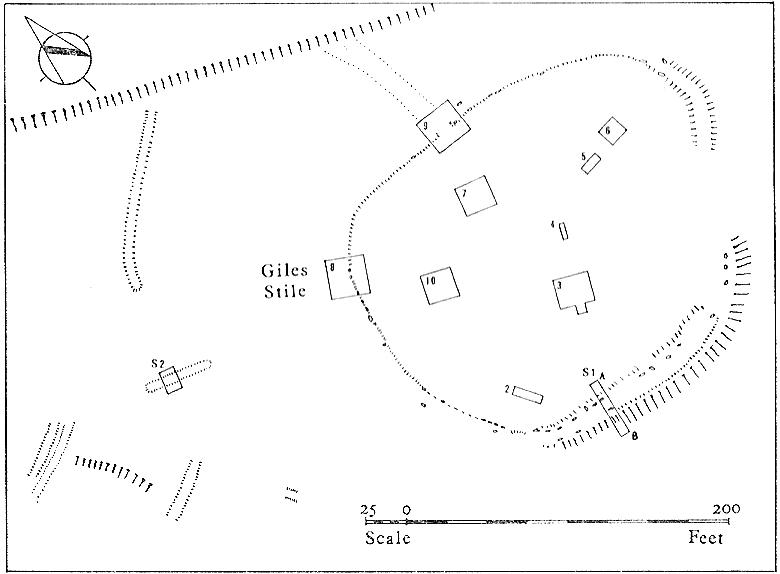
Excavated in the 1960s by the archaeologist P. Mayes, this little-known but reasonably well-preserved enclosure-cum-settlement comprises of a large oval of stone walling, double in places, about 200 feet across at its widest point.

Crosley Wood ground plan (YAJ 42, 1967)
Crosley Woods map (YAJ 42, 1967)

Thought to have been constructed sometime between the Iron Age and Romano-British period, for some reason one of the stones on the western edge has long been given the name of the ‘Giles Stone’ or Stile — though nobody knows for certain why.  It’s about three-feet tall with a smaller upright by its side.  Any other remains that might once have been here were destroyed by the housing estate that sits above here.  When Mr Mayes (1967) and his associates did their work here, cutting across sections of the walling, he told:

“The best preserved section of wall was amongst the trees on the lines of the south wall of the enclosure and included the boulders of both the inner and the outer faces of the wall.  A trench 6ft by 38ft was laid out at right angles to it.  The turf was removed showing the boulders of the wall with the smaller stone filling between them.  On either side of the wall was a relatively small quantity of loosely tumbled stones, the angle of rest of which suggested the wall as their source of origin… Careful examination of the wall filling failed to show any sign of post settings.”

Mr Mayes said that it was “doubtful whether the Crosley Wood site, dated by one pot to the late 3rd or early 4th century AD, was ever conceived of as an occupation site.”  In reference to his excavations he continued, “Certainly no evidence of settled living was found” here, concluding:

“It seems probable that the main enclosure at Crosley Wood served as a cattle pound; its defensive potential being invalidated by the scarp to the north, whilst the short stretches of external walling are all that remains of a rectilinear field system for arable or pastoral farming.”

References:

  1. Mayes, P., ‘Excavations at Crosley Wood, Bingley,’ in Yorkshire Archaeology Journal, volume 42, 1967.

© Paul Bennett, The Northern Antiquarian
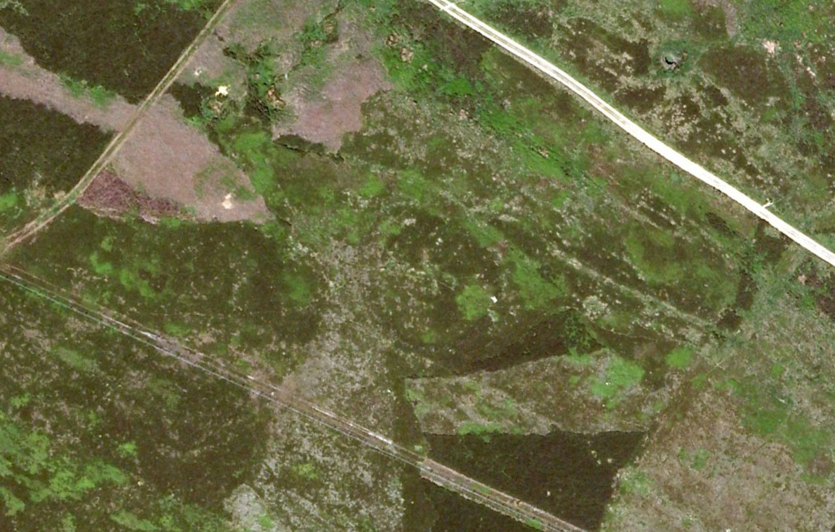

Brackenhall Circle, Baildon Moor, West Yorkshire

Enclosure:  OS Grid Reference – SE 1305 3908

Also Known as:

  1. Brackenhall Ring
  2. Catstones Ring
  3. Soldier’s Trench

Getting Here

To get here, ask all and sundry where Shipley Glen is and, once there, head to the Brackenhall Countryside Centre. It’s less than 100 yards past it, right on the roadside (a coupla nice birches sit in its edge).

Archaeology & History

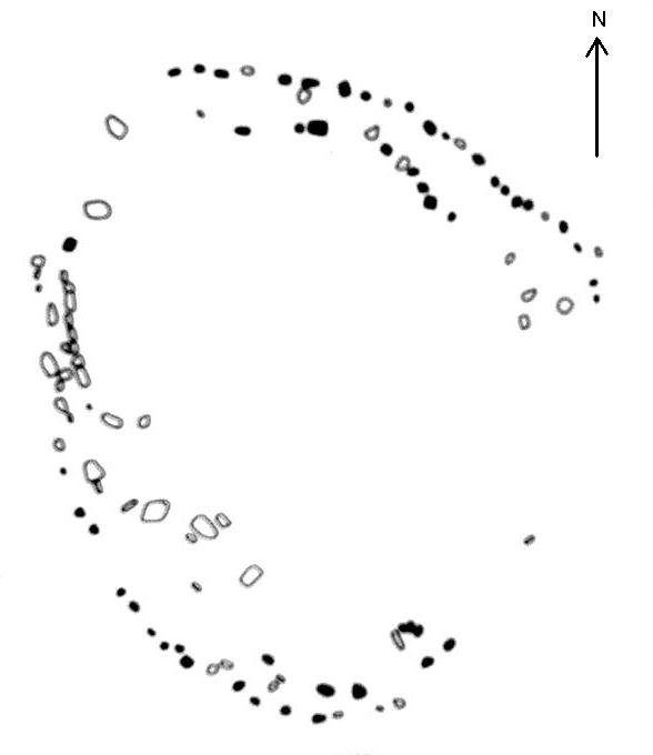
Lay-out of the Catstone's Ring (North is an approximation)
Lay-out of Catstone’s Ring

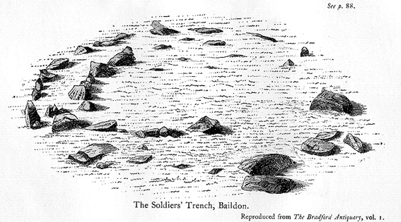
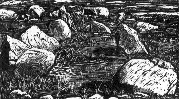
Described by many local writers over the years and marked on modern OS-maps as ‘The Soldier’s Trench,’ this curious double-ring of stones has long been somewhat of an archaeological anomaly.  The archaeologist John Barnatt thought it to be “almost certainly an enclosure, of indeterminate age”; and similarly so by Faull and Moorhouse (1981), who described it as a settlement or enclosure.  It has previously been classified as a ‘stone circle’ by archaeologists, and although I’ve added it to the listing of such sites here on TNA, I do so as a historical tradition, as the site aint a true megalithic ring.  Although we don’t know exactly what it was used for, we’re better using the term ‘enclosure’ for it.

The first description of the place was by J.N.M. Colls (1846).  When the pseudonymous Johnnie Gray (a.k.a. Harry Speight) got here he wrote:

“It comprises portion of an earthwork (which was perfect a few years ago), raised between two concentric circles, whose grater circumference is 137 yards, and diameter 57 yards north to south, and 39 yards east to west… There are unmistakable evidences about it of immense fires.”

Earliest known image (Glossop 1882)

At least two of the stones in this double-ringed complex have cup-markings etched on them; though Boughey and Vickerman (2003) report a third such carving, but doubt its authenticity.  They may be right.

Folklore

The other name for this site, the Soldier’s Trench, comes from an old tale which relates to the place being used as a camp by a group of soldier’s the night before they went into battle.

Drawing by John la Page (1951)

The site stands right next to a prominent geological fault (as any visitor clearly sees!).  It’s likely that this cleft in the Earth is one of the causative factors in the creation of numerous UFO phenomena that have been reported hereabouts through the years.  One large spherical object with a very slight ‘tail’ to the rear, travelled slowly over this site in the 1980s and was watched for several minutes slowly following the geological ridge up and round Baildon Hill to the north, fading back to Earth and eventually out of sight.

References:

  1. Baildon, W. Paley, Baildon and the Baildons – parts 1-15, Adelphi Press: London 1913-1926.
  2. Bennett, Paul, The Old Stones of Elmet, Capall Bann: Milverton 2001.
  3. Boughey, Keith & Vickerman, E.A., Prehistoric Rock Art of the West Riding, WYAS 2003.
  4. Colls, J.N.M., ‘Letter upon some Early Remains Discovered in Yorkshire,’ in Archaeologia 31, 1846.
  5. Faull, M.L. & Moorhouse, S.A. (eds.), West Yorkshire: An Archaeological Survey to AD 1500 – 4 volumes, WYMCC: Wakefield 1981.
  6. Glossop, William, ‘Ancient British Remains on Baildon Moor,’ in Bradford Antiquary, 1882.
  7. Gray, Johnnie, Through Airedale from Goole to Malham, Elliott Stock: London 1891.
  8. Hedges, John (ed.), The Carved Rocks on Rombald’s Moor, WYMCC: Wakefield 1986.
  9. la Page, John, The Story of Baildon, Byles: Bradford 1951.

© Paul Bennett, The Northern Antiquarian
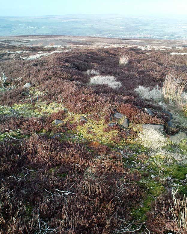

Blue Scar Settlement, Arncliffe, North Yorkshire

Settlement:  OS Grid Reference – SD 9319 7102

Getting Here

Pretty easy really.  From Arncliffe village, walk up the Monk’s Road footpath, heading for the rocky mass immediately south.  Once you get onto the moor edge, veer straight up to your right and keep walking till you hit the rocks.  Look around!

Archaeology & History

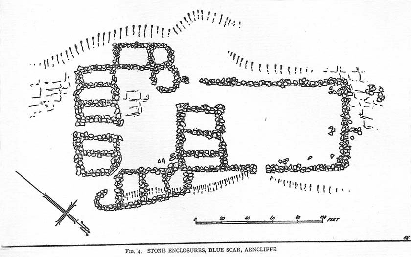
Drawing of main part of the settlement (Raistrick 1929)

Described by Miss D. Charlesworth at one of the annual meetings of the Archaeological Society in July 1968, this ‘settlement’ is found immediately south of Arncliffe village, literally 1000 feet up on the hillside and has a field system attached to it.  When Charlesworth described this place, it had not been excavated, though her description of the place very much echoed those of Raistrick & Chapman (1929) nearly forty years earlier.  She wrote:

“It faces north and east over the Skirfare valley, sheltered by the bulk of Parson’s Pulpit. The most interesting feature is the rectangular enclosure west of the sunken road. The walls are built of limestone some 5ft wide at the base and standing 2-3ft (tall). The huts are grouped round a courtyard at the south-eastern end and have a large stockyard attached to them. Of the 14 huts, only two are circular (those in the northwest corner), and one on the east side is approximately a circle. The remainder are rectangular, approximately 30 by 12ft.”

Although the sites is generally ascribed as Iron Age to Romano-British in date, it seems evident that these buildings were used in much later centuries — perhaps until late medieval periods.  Other remains of similar size and stature can be found scattered on the hills near here (I’ll add them on TNA at sometime in the future).

References:

  1. Charlesworth, D., ‘Iron Age Settlements and Field Systems,’ in Proceedings of the Archaeological Journal, 125: 1968.
  2. Raistrick, Arthur & Chapman, S.E., ‘The Lynchet Groups of Upper Wharfedale, Yorkshire,’ in Antiquity, volume 3, 1929.

© Paul Bennett, The Northern Antiquarian