Holed Stone, West Overton, Wiltshire

Enclosure & Stone:  OS Grid Reference – SU 1285 7151
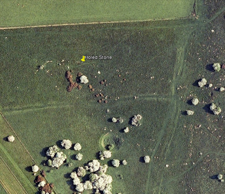
Aerial image of site

Getting Here

Follow the same directions as if you’re visiting the Polisher Stone at the top-end of Overton Down where it meets Fyfield Down.  From here, walk down the slope for a hundred yards or so where you’ll notice, just above the long grassy level, a line of ancient walling running nearly east to west.  It’s very close to the yellow marker in the attached aerial image shot to the right.  If you walk along this line of walling you’ll find what you’re looking for.

Archaeology & History
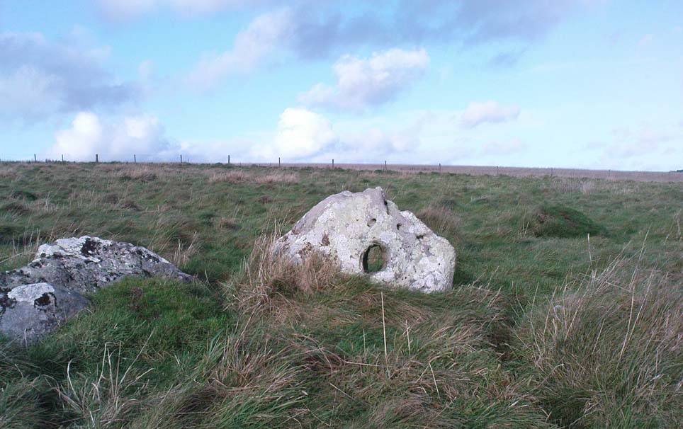
Overton’s Holed Stone

As I’ve only been here once, and briefly — under the guidance of the Avebury expert Pete Glastonbury — my bearings on this site may need revising.  There are two distinct sections of walling here: one has been excavated by Peter Fowler and his team; the other hasn’t. (correct me if I’m wrong Pete)  And in Fowler’s (2000) fine survey of this area he does not describe this very distinct holed-stone in the line of walling, or adjacent “linear ditch F4”, as it was called.  But then, many archaeologists don’t tend to find items such as these of any interest (unless their education stretches to other arenas, which isn’t usually the case). But the stone seems to be in a section of walling that isn’t in their survey; standing out in aerial imagery as a less well-defined, but still obvious line of walling that is closer to the fence, 70-80 yards north, with a decidedly Iron-Age look about it!

But, precision aside! — as you can see in the photos, the holed stone here isn’t very tall — less than 2 feet high; though we don’t know how deep the stone is set into the ground.  This spot is on my “must visit again” list for the next time we’re down here!

Folklore

Veritable vagabonds, Mikki, June, PeteG & Geoff, readying themselves for fertility rites!

There’s nowt specific to this stone, nor line of walling, nor settlement (as far as I know), but it seems right to mention the fact that in British and European folklore and peasant traditions, that holed stones just like the one found here have always been imbued with aspects of fertility — for obvious reasons. Others like this have also acquired portentous abilities; whilst others have become places where deeds and bonds were struck, with the stone playing ‘witness’ to promises made.

References:

  1. Fowler, Peter, Landscape Plotted and Pierced: Landscape History and Local Archaeology in Fyfield and Overton, Wiltshire, Society of Antiquaries: London 2000.

© Paul Bennett, The Northern Antiquarian

Black Hill Enclosure, Middleton Moor, North Yorkshire

Enclosure:  OS Grid Reference – SE 11757 51949

Getting Here

Just below Black Hill in the Middleton Moor Enclosure, little more than 10 yards east of the footpath on the east side of Loftshaw Gill, the slope drops down and into a slight ‘bowl’ in the landscape.  Here it is!

Archaeology & History

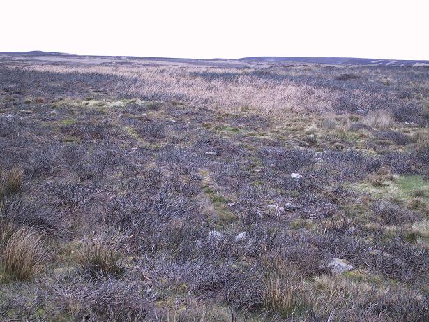
This is a previously undiscovered prehistoric settlement, enclosure, or something along those lines!  We came across it in April 2005 and is found amidst the mixed heather and bracken and has a scattering of small stones, as if in the wake of a dried stream from bygone times.  But whatever stream might once have been here, it’s long since fallen back to Earth — but at a point where a few rushes (Juncus conglomeratus) can be seen we find the aged remains of a large oval enclosure.

Similar in form to the other remains located up here by Eric Cowling (1946) in the 1930s and ’40s, when Richard Stroud and I first found this, structural remains of distinct lengths of walling were visible – but once the vegetation started growing back here again, it was almost impossible to discern.

Faint remains of enclosure walling

The main archaeological remains comprises of an oval-shaped structure, with what seemed liked a distinct Bronze Age note stamped on the walling — though it could be earlier, but without excavation it’s impossible to say. Most of the walling was just above ground-level, making it difficult to appreciate in the photo. It measures approximately 40 feet north-south and 33 feet east-west. The walling itself averages between 18-24 inches wide and was no more than one-foot tall at the highest.  Near the middle of the enclosure there were further sections of walling indicating different ‘rooms’ in the overall structure of things here.

Like I say, we unfortunately couldn’t get a decent image of this site cos the vegetation was already covering it up. So if you wanna see it, gerrup there soon after the heather burning’s been done here — otherwise it’s gonna be at least another year before you getta chance to see anything.  In Richard Stroud’s photo here, you’re looking at the bottom curve of the enclosure. You can just make out the line of walling near the centre of the picture, and two-thirds the way to the right you can see the enclosure wall curve closer to the bottom of the photo. (the site obviously requires a much better assessment from someone far more competent than me!)

References:

  1. Cowling, E.T., Rombald’s Way, William Walker: Otley 1946.

© Paul Bennett, The Northern Antiquarian


Hollin Tree Hill, Askwith Moor, North Yorkshire

Settlement:  OS Grid Reference – SE 1671 5067

Getting Here

Very troublesome to locate when the heather’s deep. To get here take the Askwith Moor Road heading north and park-up at the big gritted parking spot halfway along. Cross the road (west) and walk up a little and onto the moorland track.  When you hit the triangulation pillar, walk down (left) onto the moor, heading for the small rise in the land a few hundred yards away. Once there, start walking down its sloping south-face, watching for any evidence after 100 yards. Be vigilant!

Archaeology & History

One of 4 hut circles in very good state of preservation

This small settlement was first found on 18 July, 2004, when a small group of us, in search of the troublesome Man Stone carving, were lucky to be on the moors shortly after the heather had been burnt back, amidst this archaeologically rich area of Askwith Moor, on the northern end of Hollin Tree Hill.

There were at least four hut circles found here (on the right of the track as you walk up the slope), with one in particular — the northernmost of the group — in a very good state of preservation.  This particular circle measured approximately 20 feet in diameter, with an entrance to the south side.  It is marked by a low earthfast boulder on the northeast side, visible even when the heather is deep.

Although we counted four such circles, it’s very likely that an intensive search would uncover more remains on this hillside.  In revisiting this site in October 2016, the heather had grown back over the entire complex and the circles were very difficult to see; but we were able to discern the one on the very top of the hill (the one in the photo).  The other hut circles, lower down the slopes, were notable only by zigzagging back and forth until we walked onto loose walling.

© Paul Bennett, The Northern Antiquarian


North Ring, Mucking, Stanford-le-Hope, Essex

Enclosure (destroyed):  OS Grid Reference – TQ 675 811

Archaeology & History

North Ring, Mucking (after Brown, 2001)

This large circular enclosure, measuring about 120 feet across, seemed to be a small settlement with several internal structures (fences, pits, cremations and a sunken-floored structure) that was first excavated in 1978 and described as a Bronze Age enclosure.  Akin to a henge monument in some ways, this small settlement site had two entrances: one on the east and the other opposite on its west side.  However, the main ‘entrance’ was on the eastern (sunrise) side, where post-holes laid a pathway over the ditch and into the structure itself.

The excavation on the eastern side of site revealed two periods of construction with associated structures, including three circular buildings.  Some excavations to the east produced evidence for a range of contemporary activities.  The assemblage of Late Bronze Age material included pottery, metalwork, cremation remains, sickle moulds and equipment for salt production.  For further info and imagery, see the Link below.

References:

  1. Bond, Dermot, Excavation at the North Ring, Mucking, Essex, East Anglian Archaeology 1988.
  2. Brown, N., “The Late Bronze Age Enclosure at Springfield Lyons in its Landscape Context,” in Essex Archaeology & History, volume 32, 2001.

Links

  1. North Ring, Mucking

© Paul Bennett, The Northern Antiquarian

Springfield Lyons, Chelmsford, Essex

Enclosure:  OS Grid Reference – TL 7357 0818

Archaeology & History

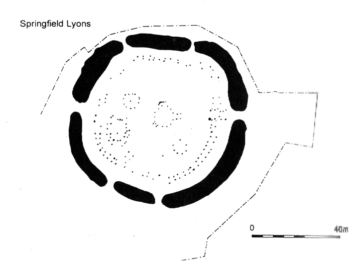
Springfield Lyons enclosure (after Brown, 2001)

We’ve known that there was an excessive number of prehistoric archaeological sites in and around the Chelmsford region for quite a long time now, but defining precisely the age and nature of the finds takes some doing! (as you’d expect)  It hasn’t helped, of course, with the housing estates and other ecologically destructive building operations in and around the area, screwing up a more accurate and patient assessment of the material there.  And this predicament was exemplified with the Springfield Lyons neolithic causewayed enclosure just as much as at the Springfield Cursus and other sites nearby.

Although excavations here found a large, deep ditch with impressive ramparts and entrance, in Oswald, Dyer & Barber’s (2001) survey of these giant monuments, they defined the remains here as “probable,” pending further investigations.  But the site was primarily defined by the large deep ditch, broken in several places round its edges with the ’causeways’ built leading onto the site.  The enclosure gave good views over the small valley from here and had streams running either side of it.

Adjacent to the site were the remains of a “small circular enclosure with multiple entrances,” saying that excavation here,

“has proved that it is of late Bronze Age date and might be interepreted variously as a defended settlement, or a ritual monument.”

This external small enclosure site was then conjectured, quite spuriously it’s gotta be said, to be a mini-version of the great causewayed enclosure monument, saying:

“Its siting and form both hint that it could have been a conscious imitation of, or re-invention of, the perceived form of the earthworks of the neolithic enclosure.”

I like the idea, it’s gotta be said — but without direct evidence we’ve gotta take this idea with a large pinch of salt!

…to be continued…

References:

  1. Brown, N., ‘The Archaeology of Essex 1500 – 500 BC,’ in Bedwin, O. (ed.), The Archaeology of Essex, ECC: Chelmsford 1996.
  2. Brown, N., “The Late Bronze Age Enclosure at Springfield Lyons in its Landscape Context,” in Essex Archaeology & History, volume 32, 2001.
  3. Oswald, Alastair, Dyer, Caroline & Barber, Martyn, The Creation of Monuments: Neolithic Causewayed Enclosures in the British Isles, EH: Swindon 2001.
  4. Priddy, D., ‘Excavations in Essex, 1987,’ in Essex Archaeology & History, 19, 1988.

© Paul Bennett, The Northern Antiquarian

Stanbury Hill Enclosure, Bingley Moor, West Yorkshire

Enclosures:  OS Grid Reference – SE 109 433

Getting Here

Follow the same directions as to find the Lunar Stone, Spotted Stone, etc.  Go thru East Morton village up the steep moorland road, east, and where the road levels out there’s a right turn and a trackway on your left which leads onto the moor.  Go ½-mile up this track till you hit a moorland ‘footpath’ signpost.  Stop here and walk due west (left) for a coupla hundred yards.  If the heather’s grown back you aint much chance of finding owt – but if there’s only low growth, amble about zigzagging – and keep your eyes peeled!

Archaeology & History

Section of cairn rubble & walling

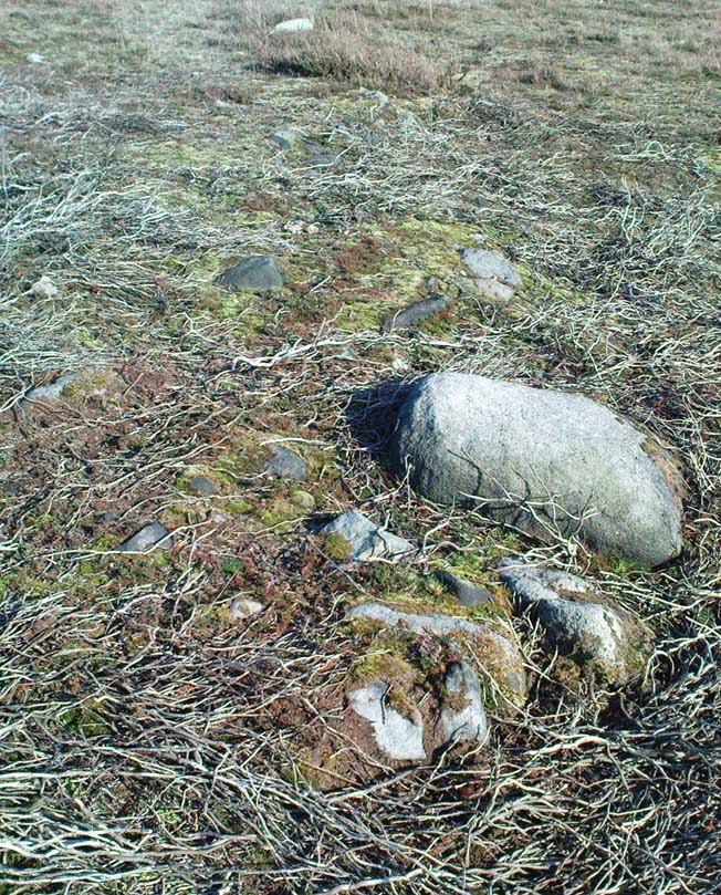
Although there’s been no written record of the Stanbury Hill remains until very recently, it seems quite probable that Mr Stuart Feather would have come across at least parts of these remains when he uncovered the rock-art in the same vicinity, but he never made public his finds.  He was a diligent researcher and finder of cup-and-ring stones, nose to the ground sorta chap, and it would be odd for him to miss the other remains on this hill.  For as we now know, there are undeniable evidences of considerable neolithic and/or Bronze Age walling scattered along (mainly) the southern side of Stanbury Hill, running mainly along an east-west axis, but there are also examples of the walling running roughly north-south.  In at least one position near the western end of the ridge, halfway down the south-facing slope, is what seems to be the unmistakable trace of an enclosed hearth.  At the time of writing a series of archaeological digs are, slowly, being done hereabouts, so it will be good to read their final evaluations.

Very close to some parts of the walling we find the remains of old cairns, and at least one cup-and-ring stone has been carved along the axis of one line of walling (it reminded me very much of the Bronze Age settlement remains found at Snowden Moor, over the northerly horizon, in the Washburn Valley).  Several other previously unreported cup-marked stones have also been found here (we’ll highlight them on TNA in the coming weeks).

Upon first impression the remains found upon and around Stanbury Hill seem more related to mortuary practices than what we’d call ‘domestic’ living practices, as the prevelance of carvings and cairns indicates.  But we’ve gotta be cautious here, as in many sites the dead were kept with the living; and as we find in many traditional or aboriginal cultures, the land of spirits and that of the living are much more closely allied than in our profane ‘Western’ paradigm.

More from this site in due course…

© Paul Bennett, The Northern Antiquarian

Yarnbury Settlement, Grassington, North Yorkshire

Settlement:  OS Grid Reference – SE 012 655

Getting Here

Dead easy.  Take the road up through Grassington village, up Moor Lane, onto the grassy tops towards Yarnbury.  As the road levels out, and before you reach the tree-border of Yarnbury house, there’s a field on your left-hand side, opposite the one where the Yarnbury Henge lives.  If y’ go in there to check out this walling, shut the effing gate!

Archaeology & History

Section of walling, Yarnbury

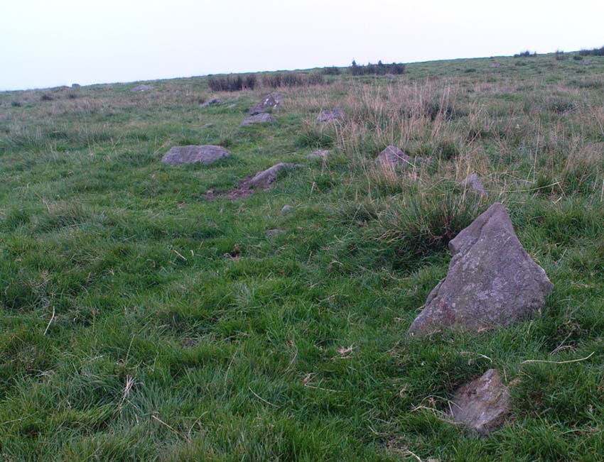
It appears that there’s little information on the remains of what seems to be some Iron Age walling a few hundred yards away, northwest of the little Yarnbury ‘henge’ monument.  Mikki Potts noticed it first of all, in one of the Northern Antiquarian ambles here t’other day.  The walling is quite distinct and typical of finds elsewhere, particularly the excessive Iron Age and Bronze Age walling remains less than a mile west of here, down the slopes near Grasssington.  At least two lines of walling are clearly apparent, running roughly northeast-southwest.  Another section runs off towards the extant walling back towards the road.  But more intriguing (for me anyway!), is what seems to be the remains of an old circle less than 100 yards north, on the other side of the footpath in the same field.

We didn’t spend too much time here and so another visit is obviously needed for further exploratory wanderings, but there appear to be further remains.  Although much of the terrain hereabouts is scattered with an excess of medieval archaeological relics — including some disused shafts at the very top of this same field — this section of walling has all the hallmarks of a much earlier period.  (sadly, a lot of the early mine-workings up here has destroyed a considerable amount our earlier prehistoric heritage).  As one local told us a a coupla weeks back, “There’s loadsa stuff up here which aint in the record books!”

Certainly seems like it!

(In the event that these remains turn out to be of a later period, this profile entry will be removed from TNA.)

© Paul Bennett, The Northern Antiquarian

Stoop Hill, Askwith Moor, North Yorkshire

Hut Circle:  OS Grid Reference – SE 1739 5076

Getting Here

From the Askwith Moor dusty parking spot, walk up the road for 160 yards where, on each side of the road, you’ll see a straight line running across the moors.  On the left-side (west) walk onto the moor for 50-60 yards along this line, then dead straight west into the heather for another 50-60 yards and look around.  It’s hard to see if the heather’s grown.

Archaeology & History

Found by Richard Stroud on July 20, 2004, this single hut circle is in faint evidence.  About twenty feet across with a section of the low walling either missing, or more probably buried in the peat.  Although no other hut-circles were immediately visible, this was probably because of the excessive heather-growth.  I have little doubt that others will be close to this one, as the area is littered with prehistoric sites.  The petroglyph catalogued as Askwith Moor 529 is very close to this hut circle.

© Paul BennettThe Northern Antiquarian

Castle Hill, Upper Cumberworth, West Yorkshire

Settlement:  OS Grid Reference – SE 2042 0697

Getting Here

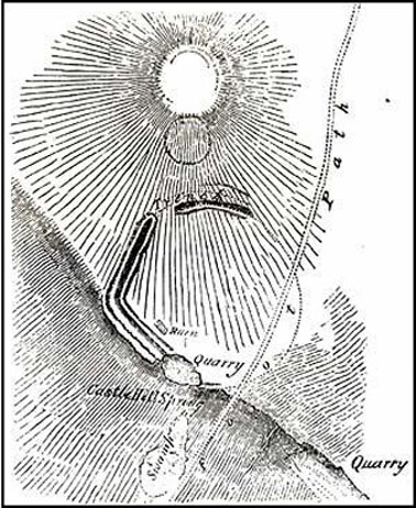
Morehouse’s 1861 plan

Taking the A629 road between Shepley and Ingbirchworth, as you hit the staggered crossroads at High Flatts, take the west turn up the slightly sloping straight road of Windmill Lane.  Just where the road ‘kinks’ at a small bend, stop and look into the field on your left.

Archaeology & History

Deemed by some as a hillfort, and others as settlement remains, what little are left of the remaining earthworks here were first described by local historian Henry Morehouse in 1861.  Found about a mile west of Upper Denby, the site was described in the Victoria County History as being “on a commanding though not exactly a defensive situation on the slope of a hill.” This remark coming from the belief (and that’s all it is) that this was an Iron Age castle site.  In 1924 James Petch said of it,

“The earthwork seems originally to have been almost square, and two sides and an angle remain. The external ditch is from ten to twelve feet broad in its present state.”

While Faull & Moorhouse (1981) tell of there being “evidence for Neolithic activity” here, modern surveyors reckon it as an old prehistoric settlement — which makes sense; though little of the site remains to be seen today.

References:

  1. Faull, M.L. & Moorhouse, S.A., West Yorkshire: An Archaeological Survey, I, WYMCC: Wakefield 1981.
  2. Morehouse, Henry James, History and Antiquities of the Parish of Kirkburton and the Graveship of Holme, Roebuck: Huddersfield 1861.
  3. Petch, James A., Early Man in the District of Huddersfield, Huddersfield 1924.

© Paul Bennett, The Northern Antiquarian


Avon Reservoir, Dean Moor, South Brent, Devon

Settlements (destroyed):  OS Grid Reference – SX 677 653

Archaeology & History

Prior to the submergence of one of the many prehistoric settlements in and around the waters of the Avon Reservoir, excavation work was carried out by Lady Aileen Fox between 1954 and 1956 on behalf of the Ministry of Works. The excavation notes in the Proceedings of the Prehistoric Society for 1957 told what Lady Fox and her fellow archaeologists found at the site that was due to be submerged:

“The walled enclosure of 2½ acres contained nine huts from 15-20 feet in diameter and three pens built against the outer wall.  The huts were roofed in the same way as those as Kestor, having a central post and a ring of six or seven uprights supporting the main rafters.  Part of the settlement was incorporated into a medieval farmstead, but the prehistoric occupation proved to be from the local Late Bronze Age.”

Since that report, a number of other prehistoric settlement sites have been found on the surrounding moorland heights (as a quick look at the OS-map clearly shows).  Obviously a very busy place in ancient days!

References:

  1. Clark, J.G.D. (ed.), “Notes on Excavations in Eire, England, Northern Ireland, Scotland and Wales during 1956,” in Proceedings of the Prehistoric Society, volume 23, 1957.

© Paul Bennett, The Northern Antiquarian