To search for any sites in the northern counties of England (previously known as Brigantia), click on the list of relevant counties, below. Please note that not all these english counties were truly in Brigantia, but they came close to its southern edges; and as parts of them tickle the edges of the southern Pennines, I thought they should be included. Hope that’s OK with everyone!
Same direction as the Lunar Stone: from East Morton village take the moorland road, east, up the steep hill. Where the road levels out there’s a right turn and a trackway on your left which leads onto the moor. Go up this track and keep walking till you hit a moorland ‘footpath’ signpost. Stop here and walk due west (left) onto the gently sloping rise of Stanbury Hill. Keep walking for a 250 yards or so, where the land has sloped gently down to the end of the spur; and just 50 yards before it drops down to the stream below, you’ll find a cluster of rocks scattered about. One of the stones here is this one!
Archaeology & History
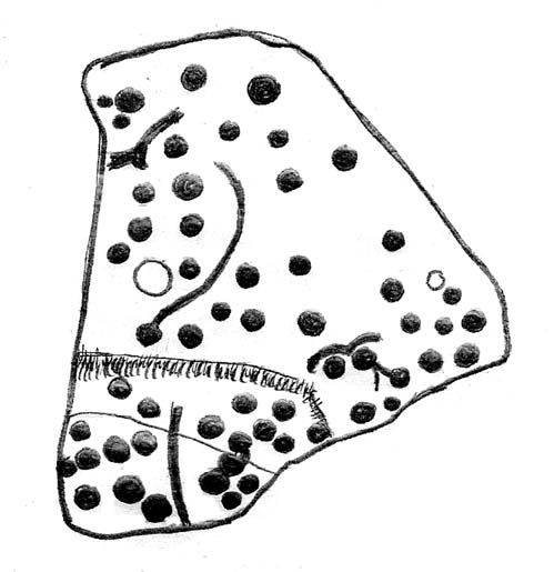
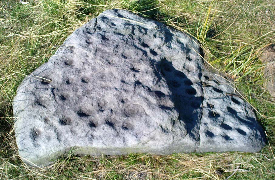
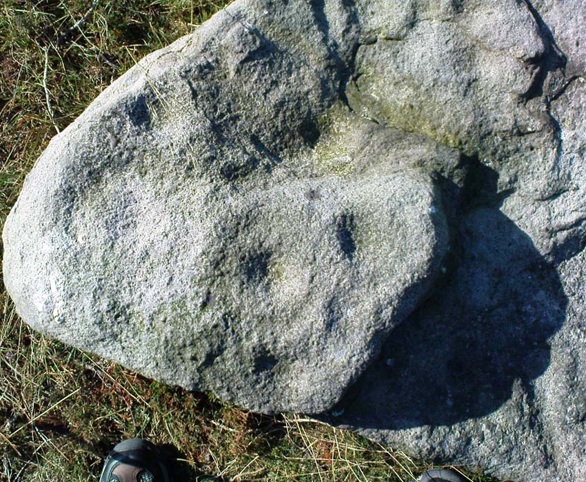
First reported by Stuart Feather in 1977, this is an excellent carving with an apt title suiting its appearence. Just 13-14 yards west (towards the cluster of other carvings very close by) are the denuded remains of what looks like a robbed cairn. Initially I thought that the archaeologists had been here and turned it over – but it seems not!
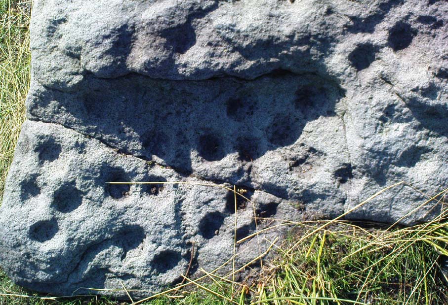
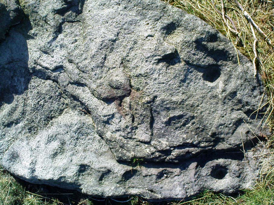
Spotted Stone – looking westClose-up of NE section
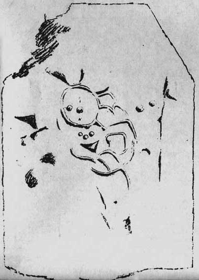
There are between 55 and 61 cup-markings etched onto this stone, with several short lines and ringlets; with one small ridge of two curves ‘arching’ over a couple of cups giving the impression of owl’s eyes! (O.G.S. Crawford would have loved this one in his book, The Eye Goddess!) The stone gave me the distinct impression that it had either once stood upright, or else was part of a burial; and the finding of a prehistoric cairn just a few yards to the west reinforced this thought (although, gotta be said, knowing that cup-&-rings and death is a common theme upon these moors, it’s likely to sometimes afflict my ability to see these carvings with fresh eyes each time I come across them). Added to this is that the carving is in a very good state of preservation, with a considerable lack of general erosion on the cup-marks (as found on the majority of carved rocks on these moors) adding considerably to the thought that this might have once served part of a tomb, or perhaps cist cover and only been brought to the surface in quite recent years. This seems undeniable.
Unless, of course, this carving was etched sometime in the last century…
References:
Boughey, Keith & Vickerman, E.A., Prehistoric Rock Art of the West Riding, WYAS 2003.
Hedges, John (ed.), The Carved Rocks of Rombald’s Moor, WYMCC: Wakefield 1986.
From East Morton village, take the moorland road, east, and up the steep hill. Where the road levels out there’s a right turn, plus (more importantly!) a trackway on your left which leads onto the moor. Go up this traclk and keep walking till you hit a moorland ‘footpath’ signpost. Stop here and walk due west (your left) onto the gently sloping rise of Stanbury Hill. Keep walking for a 250 yards or so, where the land has sloped gently down to the end of the spur; and just 50 yards before it drops down tot he stream below you’ll find a cluster of rocks scattered about. One of the stones here is this one!
Archaeology & History
This is an excellent carving first recorded, it seems, by Stuart Feather in 1977, as cited in the Yorkshire Archaeology Journal’s ‘Listings’ for 1978. It can be found some 27 yards west of a prehistoric cairn near the top of the ridge (14 yards east of the same cairn is the Spotted Stone carving).
Lunar Stone carvingSoutheast section, with 3 cup-and-rings?
We have to assume that when Mr Feather first located this stone that the faint cup-and-rings on the topmost southeast section of the rock had been exposed to the elements from Day 1, so to speak: as the designs here are quite faint and well-worn. Another not unreasonable assumption is that Mr Feather then proceeded to dig away at the rest of the rock, exposing other features on the stone which had laid under the soil for countless centuries, as the northernmost part of the carving has minimal erosion effects on it. Indeed, unless this is true, we have to start thinking that the carving was made over quite lengthy periods of time, due solely to the greater and lesser effects of weathering on different sections of the stone.
As seen in both the diagram and photos, this is a quite extravagent design. Consisting of several cup-and-rings, aswell as a double-ring, it is found amidst a small cluster of equally impressive, albeit very different carved rocks, all appearing to have a quite specific relationship with death and ritual. This and the other stones are found on the western end of a small serpentine ridge of land (Stanbury Hill), with streams flowing on the north and western sides and small remains of marshland to the south. The geomantic feature here, if relevant, relates to movements between the Earth, water, death and the setting sun: quite potent and important issues in the lives of the neolithic and Bronze Age peoples who lived hereby.
Northern section of carving – with calendrical cups?
The title of this stone carving — the Lunar Stone — should be quite evident: the design has all the hallmarks of celestial lunar movements around the ridge of the heavens; or here, pictured along the edges of the rock (symbolic of the firmament), upon and amidst which the moon travels in its rhythmic motion through the heavens. But don’t take that too seriously: it’s just an imaginative flutter that struck my otherwise distraught inability to know what I’m talking about!
References:
Hedges, John (ed.), The Carved Rocks of Rombald’s Moor, WYMCC: Wakefield 1986.
From East Morton village, take the moorland road, east, and up the steep hill. Where the road levels out there’s a right turn, plus (more importantly!) a trackway on your left which leads onto the moor. Go up here, past the top of the tree-line; on for another 100 yards or so, then turn left into the heather. You’ll notice the upright stone from the path, even if the heather’s deep. Check it out!
Archaeology & History
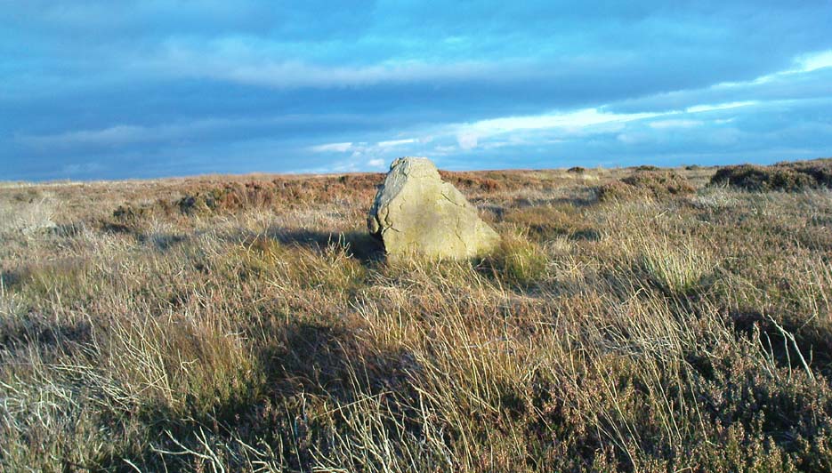
Todmoor Stone – looking eastTodmoor Stone – looking south
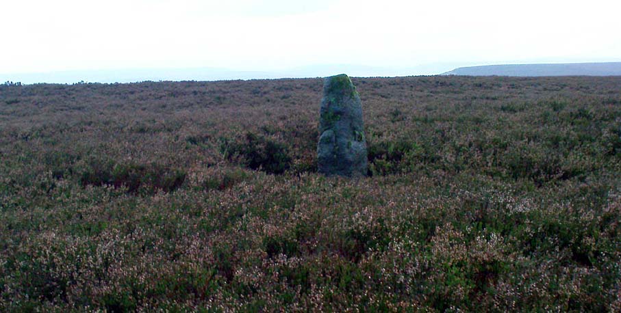
Nowt’s been said of this stone elsewhere — probably cos it’s in that halfway height between being classed as an authentic monolith, and that other of ‘dubious status’ (hence the reason I’ve highlighted this in inverted commas!). But an additional reason that this three-foot-tall stone needs describing is the close association it has with cup-and-ring stones very close by; along with some previously unrecognised prehistoric walling and at least one Bronze Age cairn some twenty yards to the north. We even find two distinctly archetypal ‘standing stone’ characters laid down in the heather 10 yards to the north, more than 4-feet long. It’s a good looking stone and has a chunkier upright bedfellow in the heather some twenty yards to the west. Along with the adjacent prehistoric remains here, the stone’s worth checking out!
The word Todmor was earlier spelt as ‘Todmerstones’ (1849) and is thought to relate to it being, in some form or another, ‘the boundary stones of the fox/es’. The nearest boundary line is about 100 yards west of here.
References:
Smith, A.H., The Place-Names of ther West Riding of Yorkshire – volume 4, Cambridge University Press 1961.
Dead easy. Take the road up through Grassington village, up Moor Lane, onto the grassy tops towards Yarnbury. As the road levels out, and before you reach the tree-border of Yarnbury house, there’s a field on your left-hand side, opposite the one where the Yarnbury Henge lives. If y’ go in there to check out this walling, shut the effing gate!
Archaeology & History
Section of walling, Yarnbury
It appears that there’s little information on the remains of what seems to be some Iron Age walling a few hundred yards away, northwest of the little Yarnbury ‘henge’ monument. Mikki Potts noticed it first of all, in one of the Northern Antiquarian ambles here t’other day. The walling is quite distinct and typical of finds elsewhere, particularly the excessive Iron Age and Bronze Age walling remains less than a mile west of here, down the slopes near Grasssington. At least two lines of walling are clearly apparent, running roughly northeast-southwest. Another section runs off towards the extant walling back towards the road. But more intriguing (for me anyway!), is what seems to be the remains of an old circle less than 100 yards north, on the other side of the footpath in the same field.
We didn’t spend too much time here and so another visit is obviously needed for further exploratory wanderings, but there appear to be further remains. Although much of the terrain hereabouts is scattered with an excess of medieval archaeological relics — including some disused shafts at the very top of this same field — this section of walling has all the hallmarks of a much earlier period. (sadly, a lot of the early mine-workings up here has destroyed a considerable amount our earlier prehistoric heritage). As one local told us a a coupla weeks back, “There’s loadsa stuff up here which aint in the record books!”
Certainly seems like it!
(In the event that these remains turn out to be of a later period, this profile entry will be removed from TNA.)
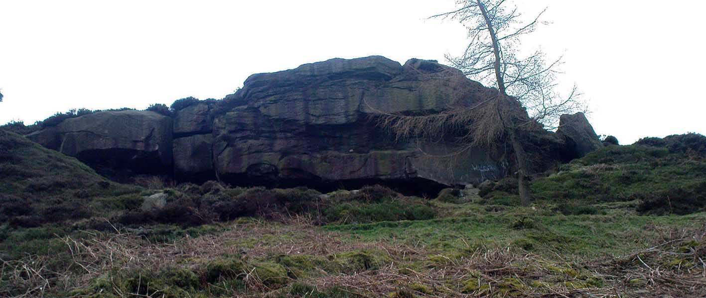
Head up to the Cow & Calf Rocks and walk to the large disused quarry round the back (west). You’ll notice a scattered copse of old pine trees on the edge where the hill slope drops back down towards Ilkley; and there, two raised hillocks (unquarried bits) rise up where the pine trees grow. The carvings are on the flat rocks atop of one of the two hillocks. If you’re walking up from Ilkley, once you’ve crossed the cattle-grid in the road and the moorland slope opens up above you, just walk uphill towards the copse of trees and watch out for the rock outcrop in the picture here.
Archaeology & History
Very well-known to locals, folklorists and archaeologists alike, the remains of these old glyphs have caught the attention of artists, historians and Forteans alike for the images and tales surrounding them. It was obvious that in times past, that the carved remains that we see today would have extended considerably further, but the quarrying destroyed much of it. Indeed, we’re lucky to have this small section of carved rock still intact!
The rocks were first described as the Hanging Stones in the local parish records of 1645, and their name probably derives from the old-english word hangra, meaning ‘a wood on a steep hill-side,’ which is very apt here. The first known description of the site as possessing cup-and-rings appears to have been in a small article in the local Leeds Mercury newspaper in 1871. Several years later J. Romilly Allen (1879) wrote a lengthier descripton of the site:
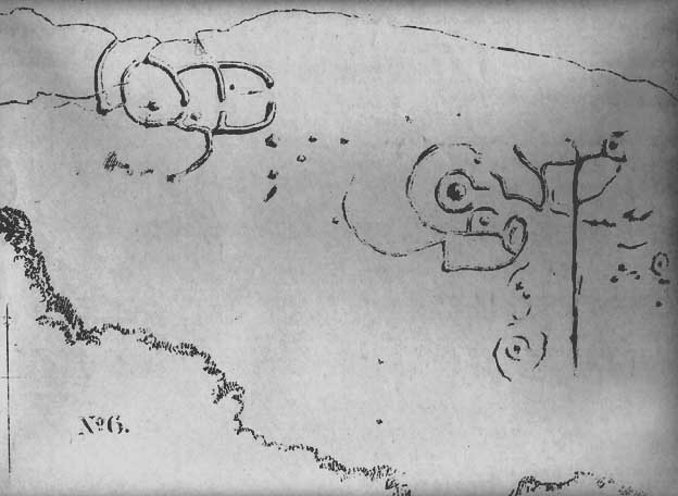
“The crags from which these masses have been detached are known by the name of hanging stones, and at their eastern extremity is a large quarry. Between this quarry and the overhanging edge of the cliff a portion of the horizontal surface of the rock was some years ago bared of turf, thereby disclosing the group of cup and ring sculptures shown on the accompanying drawing. It will be seen that the design consists of twenty-five cups of various sizes, from 1 to 3 inches in diameter. Seven of the cups are surrounded by incomplete rings, many of them being connected by an irregular arrangement of grooves. The pattern and execution are of such a rude nature as almost to suggest the idea of the whole having been left in an unfinished state. The sides of the grooves are not by any means smooth, and would seem to have been produced by a process of vertical punching, rather than by means of a tool held sideways.”
Allen and other archaeologists from this period saw some considerable relevance in the position of this and the many other cup-and-rings along this geological ridge, telling:
“The views obtained from all points over Wharfedale are exceedingly grand, and this fact should not be lost sight of in studying remains that may have been connected with religious observances, of which Nature worship formed a part.”
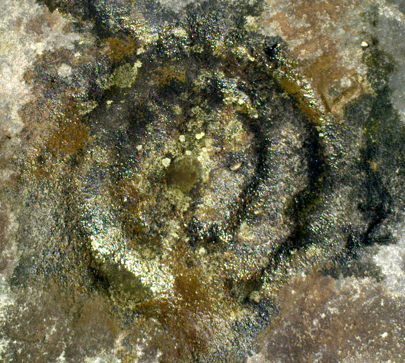
J. Romilly Allen’s 1879 drawing of the carvingsWater-assisted double-ring on eastern rock
A common sense point that seemed long-lost to many archaeologists, adrift as they went in their measurements of lithics and samples of data charts for quite a number of years. In recent years however, this animistic simplicity has awakened again and they’ve brought this attribute back into their vogue. Let’s hope they don’t lose sight of it again!
There are tons of other archaeological references to this fine set of carvings, but none add anything significant to anyone’s understanding of the nature of the designs. We must turn to psychoanthropology, comparative religion and folklore if we want to even begin making any realistic ‘sense’ (if that’s the right word!) of this and other cup-and-rings. Curiously, the nature of this and other carvings is a remit archaeology has yet to correctly engage itself in.
Hanging Stones with “21st century informal unauthorised carvings”
On a very worrying note, we need to draw attention to what amounts to the local Ilkley Parish Council officially sanctioning vandalism on the Hanging Stones, other prehistoric carvings and uncarved rocks across Ilkley Moor. As we can see on a couple of photos here, recent vandalism has been enacted on this supposedly protected monument. Certain ‘officials’ occasionally get their headlines in the local Press acting as if they’re concerned about the welfare of the ancient monuments up here, but in all honesty, some of them really don’t give a damn. The recent vandalism on this stone and others has now been officially recognised as an acceptable “tradition” and a form of — get this! — “twentieth / twenty-first century informal unauthorised carving” and has been deemed acceptable by Ilkley Parish Council as a means to validate more unwanted carving on the moorland “in the name of art”! Of course, their way of looking at this has been worth quite a lot of money to a small group of already wealthy people. But with Tom Lonsdale and Ilkley Council validating or redesignated ‘vandalism’ as “twenty-first century informal unauthorised carvings”, this legitimizes and encourages others to follow in their shallow-minded ignorant footpath, enabling others with little more than a pretentious ‘care’ for both environment and monuments to add their own form of ‘art’ on cup-and-ring carvings, or other rocks on the moors.
Hanging Stones with more “21st century informal unauthorised carvings”
You can see in some recent vandalism — sorry, traditional “twentieth / twenty-first century informal unauthorised carving” — at the top-right of the Hanging Stones photo to the side, a very ornate ‘Celtic’-style addition, akin to the quality carved by well-known stone-mason Pip Hall who, coincidentally, has now been granted a lot of money to “officially” carve her own work on another stone further down the valley from here. With Miss Hall, Mr Lonsdale, poet Simon Armitage and Ilkley Parish Council each playing their individual part in encouraging what is ostensibly vandalism…errr…sorry – I keep getting it wrong – I mean traditional “twentieth / twenty-first century informal unauthorised carving” on the Hanging Stones monument and other cup-and-ring stones on the moor, we can perhaps expect a growth industry in this field…..especially if you’re wanting to make more money for yourself in the name of art or poetry. And if you apply to Rachel Feldberg of the Ilkley Arts Festival, you may get good money for your work… Seriously! (this is no joke either)
Please contact Ilkley Parish Council and other relevant authorities and express your dismay at their lack of insight and concern for the knock-on effects of their decisions on this matter. Other plans to infringe even further onto Ilkley Moor are in the business pipeline…
Folklore
Just underneath the carved overhanging rocks (walk off the knoll to the bottom of the rocks, facing the town), is a small recess or sheltered cavity which, told Harry Speight (1900),has
“From time immemorial (been) known as ‘Fairies’ Kirk’, and traditions of it having been tenanted by those tiny sprites, the fairies, still exist among old people in the neighbourhood.”
Tradition goes on to tell that when the Saxons arrived here, they were wont to build a christian church by the Hanging Stones, but the little people strongly resented this and fought hard against the invading forces. As the Saxons started building the edifice of the new religion, during the night the fairy folk took down the stones and moved them into the valley below. In the morning when the Saxons found this had happened, they carried the stones back up to begin building again; but each night, the fairy folk emerged and again took the stones to the valley bottom again. Eventually, after much hardship, the Saxon folk gave up the idea of building on the Fairie’s Kirk, as it was known, and the church that still remains in Ilkley centre was decided as an easier place to build their edifice.
Traditions such as this (of fairies moving stones back to whence they came, or away from ancient archaeological sites) are found throughout Britain and appear to be simple representations of the indigenous peasant hill-folk who strongly objected to their own sacred sites (rocks, trees, wells, etc) being supplanted by the invading religious force.
In more recent years the observation of curious light phenomena over these rocks have been seen, both over here and the Cow & Calf Rocks…
References:
Allen, J.R., ‘The Prehistoric Rock Sculptures of Ilkley,’ in Journal of the British Archaeological Association, vol.35, 1879.
Bennett, Paul, The Old Stones of Elmet, Capall Bann: Milveton 2001.
Bogg, Edmund, Higher Wharfeland, James Miles: Leeds 1904.
Collyer, Robert & Turner, J. Horsfall, Ilkley: Ancient and Modern, William Walker: Otley 1885.
Gelling, Margaret, Place-Names in the Landscape, Phoenix: London 2000.
Hedges, John (ed.), The Carved Rocks of Rombald’s Moor, WYMCC: Wakefield 1986.
Leeds Mercury, ‘Prehistoric Remains at Ilkley’, 20 April, 1871.
Michell, John, The Earth Spirit: Its Ways, Shrines and Mysteries, Thames & Hudson: London 1975.
Size Nicholas, The Haunted Moor, William Walker: Otley 1934.
Smith, A.H., English Place-Name Elements – volume 1, Cambridge University Press 1956.
Speight, Harry, Upper Wharfedale, Elliott Stock: London 1900.
From Ripponden, taken the steep road up to Barkisland, but at the crossroads just before the village, turn right (south) and keep going for a mile till you reach the reservoir. At the far-end of the reservoir, take the track down by its side and follow the footpath that bends round the edge of the grasslands. Go up onto this small moorland and, once you’re on the level, head towards where you’ll see a large pile of stones a coupla hundred yards away. That’s it!
Archaeology & History
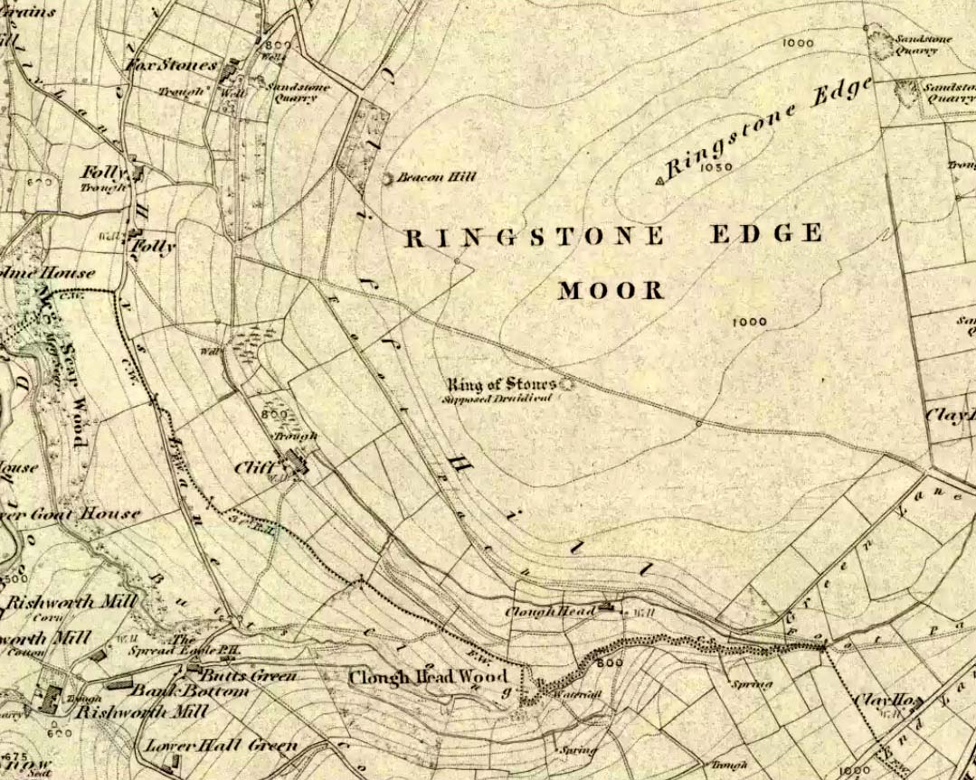
If we visit this site today, all we are left with is a scattered mass (or perhaps that should that be ‘mess’) of many hundreds of stones: the last remnants of what once would have been a proud circle of one form or another upon this small moorland plain. Its significance was such that the very moor on which its remains are scattered, was named after it: the Ringstone Edge Moor. But as with many sites from our megalithic period, this old place is but a shadow of its former self.
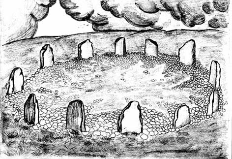
Gone are the upright monoliths which, tradition relates, once surrounded this low scattered circle of small loose stones (which would have made it look not unlike the wonderful stone circle of Temple Wood, Argyll). These standing stones were, so the folk record tells, removed near the end of the 18th century for use in some walling.
Described variously as a stone circle, ring cairn, cairn circle, an enclosure, and more, the site first seems to have been written about in 1775 by the great historian John Watson. When he was vicar of the local parish in Halifax (not far from here) this “ring of stones” as he called them, was “called the Wolf-fold.” Nearly one hundred years later, in F.A. Leyland’s superb commentary to Watson’s work, he wrote,
“The stones which constituted the circle at the time of their removal stood upwards of three feet…and the remain formed a striking object on the moor. The original number of stones of which the circle was formed is unknown, having long been in ruin and reduced in quantity before being finally removed. This was effected about twelve years since by the present tenant of the dam.” – that is, around 1859.
However, when Crabtree (1836) described the circle a decade or two earlier, he made no mention of such standing stones — although we must consider that Crabtree was very much like many modern academic archaeologists who tended to copy the works of others, much less than getting out in the field to see for himself.
At the beginning of the 20th century, the lore telling of the standing stones’ demise was repeated by local historian John Priestley (1903), when he said that: “all the large stones…were carted away about forty years ago” — that is, around 1863.
So it would seem that the very final destruction of the standing stones here, occurred sometime during the four year gap which Messrs. Leyland and Priestley describe.
More than fifty years later, Huddersfield historian James Petch (1924) came here to explore whatever remains he could find, and told:
“On top of a flat plateau on this moor, with an extensive view on all sides save on the north, where there is a gentle slope for some hundreds of yards up to the summit of the hill, there are distinct traces of a circular ring of small stones. Pygmie flints have been picked up within a yard or two, but the only other fact to be noted about this earthwork is that there is a tradition to the effect that much earth has been removed from this site. It is not altogether impossible that this is a scanty remnant of a round barrow.”
This latter remark of Mr Petch seems most probable. The excessive scatter of small stones typifies the remains of many of the Pennine giant cairns, from the Little Skirtful on Burley Moor and giant tombs of the Black Hills near Skipton, to the similar monuments of our Devil’s Apronful, Pendle, etc, etc.
Close to this cairn circle, wrote Sidney Jackson (1968), there used to be the remains of an Iron Age settlement, “marked by wall foundations (but) is now covered by the waters of Ringstone Reservoir.”
Folklore
There is very little folklore that I’ve found here. Watson (1775) throws the usual idea that the place was a site of druidical worship; but other than that we only have a local Ripponden writer’s account, which told that there was once the ghost of a white lady that was once said to walk along the path somewhere between here and the Beacon Hill tumulus, a short distance to the north.
Various ways to get here. From Worsthorne village, go east, up past the church, uphill following the dead straight path. After about 600 yards there’s a crossing in the footpath: go left here and walk another coupla hundred yards, over 2 walls, and after you’ve past the second wall you’ll notice the earthworks in the ground to your right. That’s it!
Archaeology & History
There’s nowt much to see here to be honest. It was included in Walter Bennett’s (1946) survey of ROMAN remains (oh dear) in the region — and his archaeological description of this place certainly seems to imply it was those doods (the Romans) who built this structure and not our neolithic ancestors. He wrote:
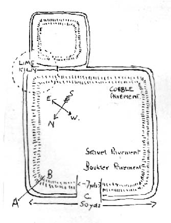
“Ringstones is a rectangular enclosure 50 yards square, surrounded by a mound or rampart 2 yards wide and one yard high, and an outer ditch two yards wide. Sepereated from the main enclosure by the ditch on the southeast side is another enclosure 18 yards square. Excavations made in 1925 gave the following information: a gateway, seven yards wide, was paved with boulder stones regularly laid on a gravel foundation, and on the south side of the gateway flat stones were sunk below the general floor level to act as a drain; a regular course of large stones flanked the gateway entrance on either side, and a foundation or irregular boulder stones was laid outside the gateway between the rampart and the ditch: inside the enclosure and 9 inches below the present grass surface., a floor had been made of gravel in some places and of flat stones or cobbles in others; the rampart was of earth and stones; a well-constructed road, 7 feet wide, ran from the earthwork in the direction of Bottin Farm, wich is situated on the Worsthorne-Roggerham road.”
There used to be a rough circle of stones on top of the site (probably giving the place its name), but these were apparently from the old remains of a lime-kiln from the 16th or 17th century — not prehistory. There is, therefore, a case that this site may not be prehistoric as archaeologists have classed it — and if the ground-plan above is anything to go by, you’d have to say it looks less than promising. More diggings are needed!
Takes a bitta finding – especially if some dood’s knocked it down again (as happens up here). Best thing to do is get to the Miller’s Grave prehistoric cairn, which is only a few hundred yards away. From Miller’s Grave, walk due west for 200 yards till you hit once a ditched footpaths, where you should turn right. A short distance along you’ll hit a 5-foot-tall boundary stone called the Greenwood Stone with ‘1775’ carved on one side. From here, walk due south into the heather for 75 yards. You’re very close!
Archaeology & History
We resurrected this old standing stone in 1996, several years after first discovering it laid amidst the heather in the early 1990s. It appeared to mark an old boundary line (no longer used) betwixt Wadsworth Moor and Midgley Moor, but its nature is distinctly prehistoric. The remains of a small hut circle (seemingly Bronze Age, though excavation is needed) can be found a short distance to the west, though this is hard to find when the heather has grown. Other seemingly prehistoric remains scatter the ground nearby, none of which have received the attention of archaeologists.
Greenwood ‘B’ on a grey day
As you can see from these grey, rain-swept images, this upright stone is well-weathered (though we need to visit here again soon and get some better photos). It stands some 4-feet tall and may have accompanied one or two other monoliths close by. The suggestion by one Peter Evans that the Greenwood B stone stood “possibly at the centre of a stone circle” is sadly untrue (soz Peter); though it probably had some relationship with the Millers Grave cairn site, a few hundred yards equinox east.
References:
Bennett, Paul, The Old Stones of Elmet, Capall Bann: Milverton 2001.
Easy to find if you go at the right time of year — very troublesome to find if you go at the wrong time! Check the place out at the end of winter, beginning of Spring. It’s at the top end of Shipley Glen, just past where the road bends round and goes uphill. About 50 yards up, on the left side of the road walk into the grasslands for less than 100 yards. Look around!
Archaeology & History
An intriguing site this one. Intriguing as it wasn’t in the archaeological registers when I first came across it — and I’m really unsure whether it’s in there now. It probably has, as John Barnatt came here with some earth-mystery folk in 1982! But when I first visited this site in 1975 it seemed no one knew about it — and little has changed since then.
It is an enclosed ring of stones less than 30 feet across with an earth embankment separating it from what seems like a secondary ring on its outer edge, a foot or two away. This didn’t appear to surround the complete ring and may have been damaged. It had an appearance similar in size, shape and form to the Roms Law and Harden Moor sites, and thankfully in reasonable condition. I don’t think any excavation has yet been performed here though.
There are a number of other small standing stones on the outskirts of this ring that may have some relationship with the site, but we need excavation to prove one way or the other. Several very well-preserved cup-marked stones are close by.
Folklore
Intriguing to those of you who are fascinated by alignments between sites, or ‘leys’, as an impressive lines runs through this site. Starting at the little known Hirst Woods Circle and terminating at the giant Great Skirtful of Stones cairn, once passing over the now destroyed Weecher circle and the Brackenhall Green ring on its way.
References:
Bennett, Paul, The Old Stones of Elmet, Capall Bann: Chieveley 2001.
From the Askwith Moor dusty parking spot, walk up the road for 160 yards where, on each side of the road, you’ll see a straight line running across the moors. On the left-side (west) walk onto the moor for 50-60 yards along this line, then dead straight west into the heather for another 50-60 yards and look around. It’s hard to see if the heather’s grown.
Archaeology & History
Found by Richard Stroud on July 20, 2004, this single hut circle is in faint evidence. About twenty feet across with a section of the low walling either missing, or more probably buried in the peat. Although no other hut-circles were immediately visible, this was probably because of the excessive heather-growth. I have little doubt that others will be close to this one, as the area is littered with prehistoric sites. The petroglyph catalogued as Askwith Moor 529 is very close to this hut circle.