Linton Church, Grassington, North Yorkshire

‘Standing Stone’:  OS Grid Reference – SE 00426 63176

Getting Here

Pretty easy really. Get to the ancient St. Michael’s Church on the dead-end road just outside of Linton village.  As you approach it, look into the field on your right.  Y’ can’t miss it!

Archaeology & History
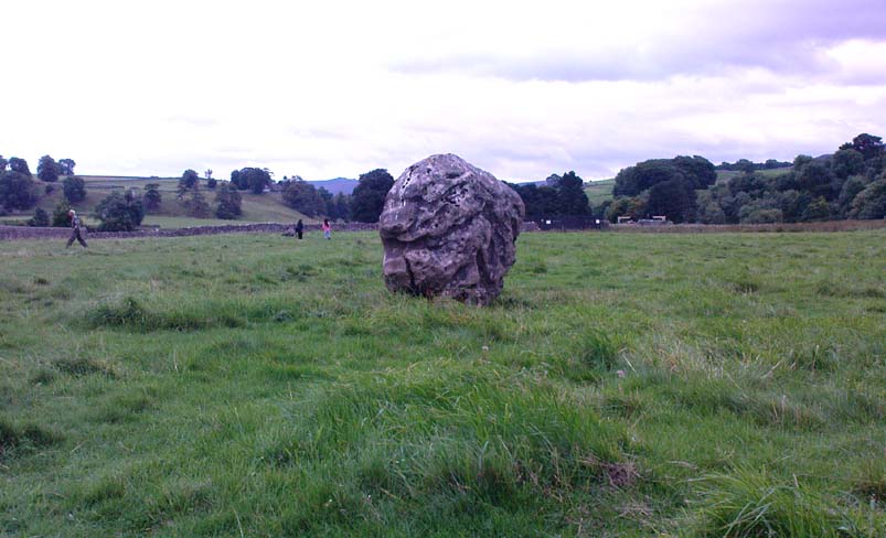
Linton 'Standing Stone'
Linton ‘Standing Stone’

This is an oddity.  It could perhaps be little more than one of the Norber erratics found a few miles further north — but it looks more like a smaller version of one of the Avebury sarsens!  Just under six-feet tall, it was shown to me by Adrian Lord yesterday (when the heavens subsequently opened and an outstanding downpour-and-half followed), who’d come across it only a week or two earlier themselves when they visited the ancient church next door.  The stone certainly aint in any archaeology registers (no surprise there); and as one local man we spoke to yesterday told us, “there used to be several other standing stones in the same field, cos I remember ’em when I was a kid. ” The gent we spoke to seemed to know just about everything about the local archaeology and history of the area (one of those “damn good locals” you’re sometimes lucky to find!).  He told us that the other stones which used to be there had been moved by the local farmer over the years, for use in his walls.  So it seems that this is the last one standing.  What looks like several other fallen stones can be seen further down the field, just next to the church.  But this one’s pretty impressive.
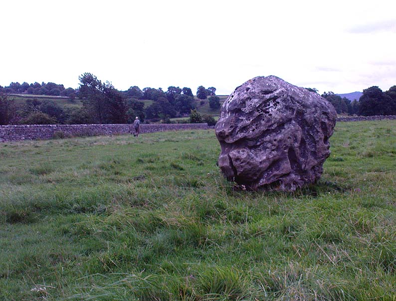
Close-up of gnarled rock
Looking south-ish!
Looking south-ish!

The church of St. Michael next door was, tells the information inside, built upon some old pagan site — which gives added thought to this upright stone perhaps being the ruin of an old circle, or summat along those lines.  The church, incidentally, is built right next to the River Wharfe.

Not far from here we find an almost inexhaustible supply of prehistoric remains at Grassington and district (less than a mile north).  A huge excess of Bronze- and Iron Age remains scatter the fields all round the town.  And aswell as the Yarnbury henge close by, there is — our local man told us,  “another one which no-one knows abaat, not far away”!

Folklore

The folklore of this area is prodigious!  There is faerie-lore, underworld tales, healing wells, black-dogs, ghosts, earthlights – tons of the damn stuff.  But with such a mass of prehistoric remains, that aint too surprising.  And although there appears no direct reference to this particular stone (cos I can’t find a damn reference about it), the old Yorkshire history magus, Harry Speight (1900), wrote of something a short distance away along the lane from the church.  He told that,

“In the field-wall beside the road may be seen some huge glacial boulders, and there is one very large one standing alone in the adjoining field, which from one point of view bears a striking resemblance to a human visage; and a notion prevails among the young folk of the neighbourhood that this stone will fall on its face when it hears the cock crow.”

Just the sort of lore we find attached to some other standing stones in certain parts of the country.  And in fact, from some angles, this ‘ere stone has the simulacrum of a face upon it; so this could be the one Speight mentions (though his directions would be, unusually, a little out).

There are heathen oddities about the church aswell: distinctly pre-christian ones.  An old “posset-pot” was used for local families to drink from after the celebration of a birth, wedding or funeral here.  And at Hallowtide – the old heathen New Year’s Day,

“certain herbs possessed the power of enabling those who were inclined to see their future husbands or wives, or even recognizing who was to die in the near future.”

And in an invocation of the great heathen god (the Church called it the devil), Speight also went on to tell that:

“The practice at Linton was to walk seven times round the church when the doomed one would appear.”

In a watered down version of this, local people found guilty of minor transgressions in and around Linton (thieves, fighters, piss-heads, etc),

“was compelled to seek expiation by walking three time around Linton Church.”
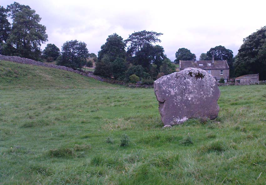
Linton stone05This would allegedly cure them of their ‘sins’!  Rush-bearing ceremonies were also enacted here.  On the hill above, the faerie-folk lived.  And until recently, time itself was still being measured by the three stages of the day: sunrise, midday and sunset; avoiding the modern contrivances of the clock, and maintaining the old pre-christian tradition of time-keeping.  Much more remains hidden…

References:

  1. Speight, Harry, Upper Wharfedale, Elliott Stock: London 1900.

© Paul Bennett, The Northern Antiquarian


Slaithwaite Cross, West Yorkshire

Cross:  OS Grid Reference – SE 077 139?

Archaeology & History

The great Huddersfield historian, Philip Ahier (1948), in describing the lack of documentary evidence for several crosses in the neighbouring region, “at Deighton, Cowcliffe, Marsh and Golcar,” found out that,

“One did exist at Slaithwaite in front of the Manor House in the early past of the last century.  In March 1931, the base of this cross, commonly known as the Dial Stone, was removed to Doughlas in the Isle of Man, where it rested in the garden of Mr Harry Wood; in August 1939, it was brought back to Slaithwaite and now stands in the Recreation Park.”

However, this site differs from another two that I’ve found records for on the outskirts of this township.  Does anyone know what became of this old stone cross?  Izzit still about?  Its folk-name of the Dial Stone may make it a little easier to locate — but at the same time it does bring up the query, Why was it called that?

References:

  1. Ahier, Philip, The Story of the Three Parish Churches of St. Peter the Apostle, Huddersfield – volume 1, Advertiser Press: Huddersfield 1948.

© Paul Bennett, The Northern Antiquarian 

Thornborough Cursus, North Yorkshire

Cursus Monument:  OS Grid Reference – SE 286 794

Archaeology & History

In the midst of the great henge monuments at Thornborough — specifically, the central henge — archaeologist Ian Longworth (1965) said there “was built …a still earlier structure known as a cursus.”  This giant monument was one of the earlier such sites located in Britain.  Longworth continued, saying:

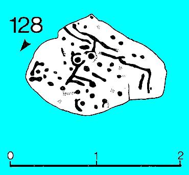
“This was a ceremonial avenue, running for nearly a mile in a northeast / southwesterly direction.  The avenue is defined by ditches 144 feet apart with a bank running along the inside of each ditch.  The ditches are now completely filled with plough soil and, as with other cursus monuments in the county, were discovered from the air as two dark lines in the cereal crop… Probably used for ritual ceremonies, no clues remain to show what actually took place.”

Thornborough Cursus (& henges)

This cursus runs almost at right angles to the alignment of the three Thornborough Henges, on the southern side of the central henge, and was first found through the aerial photography of J.K. St. Joseph between 1945 and 1952. When excavation work was carried out, “a crouched burial was found in a stone cist within the southwest end” of the cursus.  This end of the monument is rounded, like the Stonehenge Cursus; whilst the northeast end of the monument has not been located. The southwest end of the cursus begins at OS grid-reference SE 2799 7906 and its northeasterly end is roughly at SE 2881 7954.  The middle of the known cursus is roughly in Thornborough’s central henge.

Paul Devereux (1989) said that the monument, “which had become silted-up and grass-covered by the time the henge was built, had two main orientations, with a curvilinear, irregular section just to the east of the henge.”  Although Norris Ward (1969) thought that the cursus actually went all the way down the River Ure, it stops some distance beforehand, though may obviously have had some important relationship with the waters.

References:

  1. Longworth, Ian H., Regional Archaeologies: Yorkshire, Cory, Adams & Mackay: London 1965.
  2. Pennick, N. & Devereux, P., Lines on the Landscape, Hale: London 1989.
  3. Thomas, Charles, ‘Folklore from a Northern Henge Monument,’ in Folklore Journal, volume 64:3, 1953.
  4. Ward, Norrie, Yorkshire’s Mine, J.M. Dent: London 1969.

© Paul Bennett, The Northern Antiquarian

Rosette Stone, Ilkley Moor, West Yorkshire

Cup-and-Ring Stone:  OS Grid Reference – SE 12822 46190

Also Known as:

  1. Carving no.128 (Hedges)
  2. Carving no.285 (Boughey & Vickerman)

Getting Here

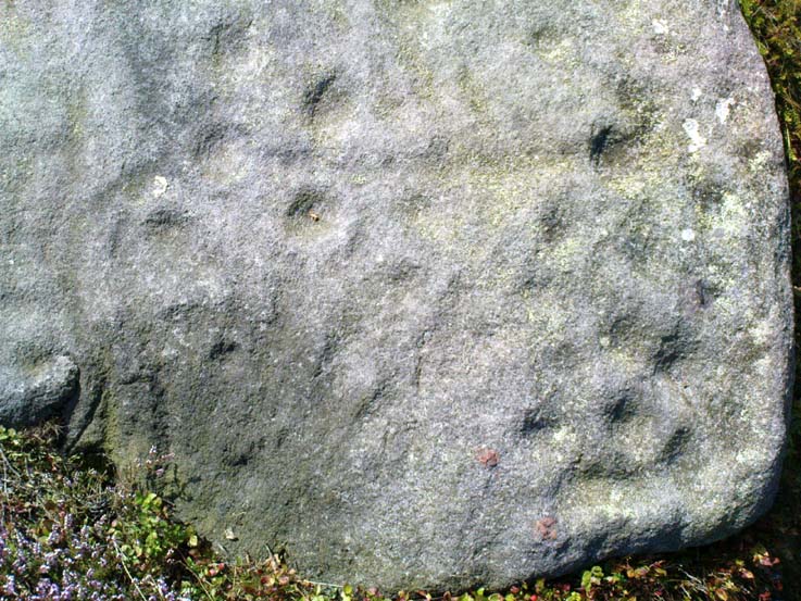
Rosette Carving (after Hedges 1986)

Follow the directions to reach the giant Haystack Rock, then follow the footpath west along the moor-edge, round where it bends keeping along the edge of the stream (Backstone Beck) below.  A couple of hundred yards after the bend, right by the side of the path.  You’ll see it! (if you hit the clearly defined ‘enclosure’ walling, you’ve gone too far)

Archaeology & History

No — not the Rosetta Stone; but it is a lovely carved rock this one.  Best seen (as usual) when the rock’s wet and the sun’s heading for (or just emerged from) the horizon — but much of this image is visible even when She’s cloudy.

Close-up of 'rosette' and other CnRs
Close-up of ‘rosette’ design & and other CnRs
The Rosette Stone
The Rosette Stone carving

First mentioned in literary terms (surprisingly) by M.J. Walker (1956), in a short write-up following one of the Bradford Archaeology Group’s moorland walks up here.  Nearly six-feet along its longest axis, there are more than 30 cup-marks on this stone, at least three with rings; plus a variety of lines linking some cups to others.  At its northern tip is the lovely little ‘rosette’ design, as archaeologists have called it.  Others have seen this part of the design as a solar image; a flower; the Pleiades; a ring — take your pick!  It is a lovely carving though (if you’re a sad person like me, who’s into these sorta things!).  What relevance – if any – it may have had to the ‘enclosure’ within whose edges it sits, is anyone’s guess!

Excavations done close by (focusing mainly on the prehistoric ‘enclosure’ within whose domain this and other carvings occur) uncovered remains of old grooved ware pottery and the remains of flints. (Edwards & Bradley 1999)

The one thing we realise from looking at this design is the difference seen between the ‘accurate’ illustration drawn by archaeologists, and the flesh and blood of the stone itself, in situ.  The living rock has much greater form and expression than anything which our desire for accuracy possesses.  This aint knocking any attempt to portray the cups, rings and lines on paper correctly to show what the design originally looked like; merely that there’s a world of difference between the experiential vision of the carving and that done with graphic accuracy.  But we all know that anyway – so please forgive my little sojourn into speaking the bleedin’ obvious!

References:

  1. Boughey, Keith & Vickerman, E.A., Prehistoric Rock Art of the West Riding, WYAS 2003.
  2. Edwards, Gavin & Bradley, Richard, ‘Rock Carvings and Neolithic Artefacts on Ilkley Moor, West Yorkshire,’ in Grooved Ware in Britain and Ireland (edited by Cleal, R. & MacSween, A.), Oxbow: Oxford 1999.
  3. Hedges, John (ed.), The Carved Rocks on Rombald’s Moor, WYMCC: Wakefield 1986.
  4. Walker, M.J., ‘Ilkley Boulders Tour,’ in Bradford’s Cartwright Hall Archaeology Group Bulletin, 2, 1956.

© Paul Bennett, The Northern Antiquarian

Gill Head Boulder, Ilkley Moor, West Yorkshire

Cup-and-Ring Stone:  OS Grid Reference – SE 1256 4602

Also Known as:

  1. Carving no.117 (Hedges)
  2. Carving no.274 (Boughey & Vickerman)

Getting Here

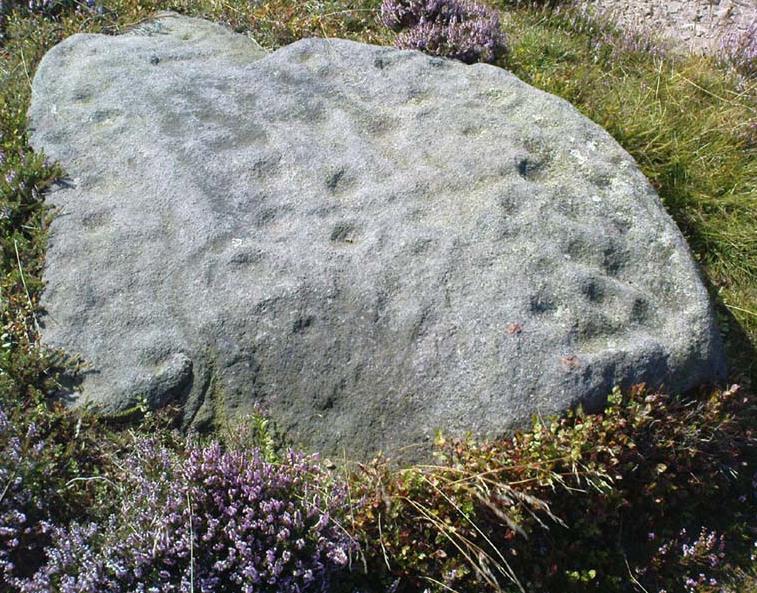
Line of cups on the Gill Head boulder

Pretty easy to find.  Follow directions to reach the great cup-and-ring marked Haystack Rock, then follow the footpath west and drop down the slope, crossing the stream of the Backstone Beck below you, the up the steepish slope and turn sharp left when you hit the footpath before the top of this slope.  Walk onto the moor!  You’ll walk right past the cup-and-ring marked ‘carving 283’ on this path, then the ruinous Backstone Circle a bit further along (50 yds to your right), but keep walking for another 100 yards until you see a large boulder a few yeards to the left of the footpath.  That’s it!

Archaeology & History

I first came across this as a kid, sometime in my early to mid-teens, pottering about, looking at any old rock that caught my eye.  And this one isn’t hard to miss really.  One of the best memories I’ve got of this stone was when a bunch of us came walkabout up here, sometime in the autumn, when the heavens poured all day long to saturation-point — even for those in all their protective gear, such good as it was in the late ’80s to early ’90s.  There started out a fair bunch of us—between 20-30 folk—with numbers dwindling sharply when we reached the Apostles.  But this stone was visited way before that!  Along with Bob Trubshaw, Graeme Chappell, Kaledon Naddair, Edna Whelan and a troop of other mad-folk, we stopped for a while to consider this old rock, with only three cups really visible that day.  The others (those cited by the archaeo’s) weren’t picked out, as I remember.  But She was pissing-it-down and the wind was really giving-it-some, so we didn’t stop here for long!  We all agreed though: it was a nice, worn cup-marked stone.

Gill Head rock carving
Gill Head carving (after Hedges 1986)

John Hedges and the Ilkley Archaeology bunch had cited it as ‘cup-and-ring’ in their fine work — the first time this old carving had been in print since it was first etched!  A few years later when Messrs Boughey & Vickerman (2003) checked it for their survey, no new features had been noted and they just copied Hedge’s earlier notes.  Indeed, it’s just a large boulder with a few archetypal cupmarks on it when it first greets the eyes.  Nowt special—and with no companions either.

This is another one mainly for the mad-folk and purists amongst us.

References:

  1. Boughey, Keith & Vickerman, E.A., Prehistoric Rock Art of the West Riding, WYAS 2003.
  2. Hedges, John (ed.), The Carved Rocks on Rombald’s Moor, WYMCC: Wakefield 1986.

© Paul Bennett, The Northern Antiquarian

Druid’s Oak, Caton, Lancashire

Legendary Tree:  OS Grid Reference — SD 5297 6467

Also Known as:

  1. Caton Oak
  2. Fish Stones Oak

Getting Here

The Druid's or Caton Oak
The Druid’s or Caton Oak

Dead easy! Near the western end of Caton village, right on the edge of the main road (A683) running through the village (south-side of the road), enclosed by railings, you’ll see the remains of this ancient tree, just by the side of the stream.  Keep your eyes peeled!

Archaeology & History

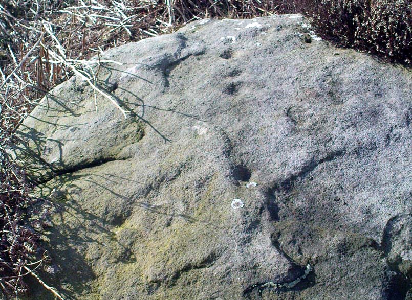
The small scruffy-looking remnant of an oak standing here by the roadside in Caton village, surrounded by protective railings, is the dying remnants of the old tree, standing upon the sandstone steps which were known as the Fish Stones: a curious monument that has been listed as a protected monument by the Dept of National Heritage.  A small plaque on the side tells:

“The three semi-circular sandstone steps, shaded by the oak tree, were used in medieval times by the monks of Cockersand Abbey to display and sell fish caught from the River Lune.  The ancient oak tree, reputed to date back to the time of the druids, and the Fish Stones, have become a landmark and Symbol of Caton.”

Druid's Oak, Caton
Druid’s Oak, Caton

This was probably the local moot spot for villagers and those living in outlying farms and hills in medieval times.  No doubt a market of some sort was also once here; perhaps even an old cross, as the Fish Stones have all the appearance of some village cross steps.  I’ve found little else about this old tree, nor any folklore (but aint looked too hard if truth be had!).  There’s surely more to be said about this once sacred tree.

More sites related in folklore to druids can be found not too far away at the collapsed cairn near Bordley; the Druid’s Altar and nearby Druid’s Well on the outskirts of Bingley; the Druid’s Stone of Bungay in Suffolk and many more…

© Paul Bennett, The Northern Antiquarian 


Market Cross, Thornton-le-Dale, North Yorkshire

Cross:  OS Grid Reference – SE 8340 8304

Getting Here

Dead easy.  Take the A170 road from Pickering to Thornton-le-Dale and as you go into the large village, you’ll hit the old crossroads with the village green.  Here be your cross!

Archaeology & History

Shown on the 1854 OS-map, I first came across a description of this old site in Creaser & Rushton’s (1972) scarce but lovely little work on the history of the old village here, where they told that,

“A cross has stood here since John de Eston in 1281 had the grant of a Tuesday market and two yearly fairs.  It was repaired in 1820.  Every year, the Abbot of Whitby unloaded 1500 red and 1500 white herrings here from his packhorse ponies for transhipment to the Master of St. Leonard’s Hospital at York.”

Or at least, that’s what he got folk to write down in the record-books!  Close by were the old village stocks of the village (whose usage should be resurrected in many parts of this country nowadays).

References:

  1. Creaser, A. & Rushton, J.H., A Guide and History of Thornton-le-Dale, Pickering, Yorkshire, E. Dewing: Pickering 1972.

© Paul Bennett, The Northern Antiquarian

Hagg Woods, Thongsbridge, Holmfirth, West Yorkshire

Cairns:  OS Grid Reference – SE 1493 1026

Getting Here

Take the A6024 road south out of Huddersfield for about 4 miles, past the turnings to Honley, and when you reach a section where the road runs through a nice bitta woodland, stop! Go into the woods on the western side of the road near the bottom end where a footpath runs up to Haggs Farm. The cairnfield is about 100 yards up into the woods, evidenced by small overgrown heaps in a small cluster.  Good luck!

Archaeology & History

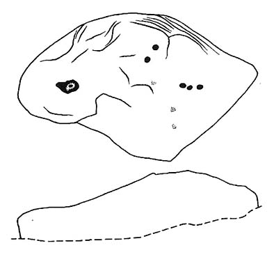
These are pretty difficult to locate even when the vegetation isn’t covering them!  But if you’re diligent and enjoy a good foray in searching for archaeological remains, you might uncover summat.  For here are the scattered remains of what was once a group of seven cairns with adjacent ring-banks, last excavated in the early 1960s by Neil Lunn and other members of the Huddersfield & District Archaeology Society.  Little by way of datable material was found, although one of them did “reveal features typical of some Bronze Age barrows.” Beneath this one they found “the remains of a hut or shelter with a succession of small hearths and a group of stone-packed postholes.”

It would be nice to find out the precise status of this area as few other remains seem in evidence, which can’t be right surely?

References:

  1. Barnes, B., Man and the Changing Landscape, University of Liverpool 1982.
  2. Lunn, N., ‘Account of Recent Fieldwork in the Honley Area,’ Hudds Dist. Archaeo. Soc., 13, 1963.

© Paul Bennett, The Northern Antiquarian


Esholt Lane Carving, Esholt, Bradford, West Yorkshire

Cup-Marked Stone:  OS Grid Reference – SE 1743 3975

Also Known as:

  1. Carving no.10 (Boughey & Vickerman)

Getting Here

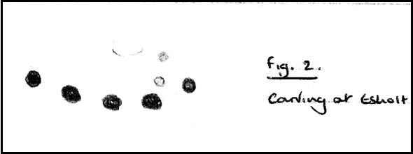
Seemingly not visible anymore, but directions given by a Miss N. Hutchinson in the early 1960s worked for me and Dave Pendleton when we checked this out at the end of our teens.  We had to look around till we found it, based on the following directions.  The carving was found “on top of a low dry wall on Esholt Lane, Esholt…on the stretch of road from the junction of Gill Beck with the River Aire to the stone-built barn on the left-side of the road, that is, going towards Esholt.”

Archaeology & History

Esholt Lane Carving, Bradford

First described by Miss Hutchinson in a letter she sent to Sydney Jackson (1964), editor of Bradford Archaeology group newsletter.  When we first found this small carving (not far from where we grew up) we were at the end of our teens, and followed the directions cited in the Cartwright Hall Archaeology Group Bulletin (see above).  The carved design was typical of the primary arcs found in many of the Baildon Moor cup-and-ring carvings a bit further up the hill, but with two other small faint cup-markings on it.  According to Boughey & Vickerman (2003), the carving’s now been hidden in a section of walling that’s been rebuilt.  The drawing here is from one of my unpublished notebooks. (1984)

References:

  1. Bennett, Paul, Ramblings of Archaeological Remnants in West Yorkshire, unpublished: Shipley 1984.
  2. Boughey, Keith & Vickerman, E.A., Prehistoric Rock Art of the West Riding, WYAS 2003.
  3. Jackson, Sydney, ‘Cup-Marked Rock – Esholt Discovery,’ in Bradford Cartwright Hall Archaeology Group Bulletin, 9:4, 1964.

© Paul Bennett, The Northern Antiquarian

Line Stone, Skyreholme, Appletreewick, North Yorkshire

Cup-Marked Stone:  OS Grid Reference – SE 0732 6251

Also Known as:

  1. Carving no.401 (Boughey & Vickerman)

Getting Here

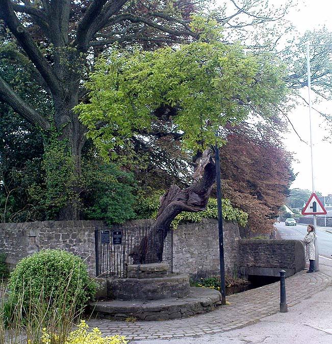
Skyreholme 401 carving (photo © Richard Stroud)

Along the B6265 Pateley Bridge-Grassington road, roughly halfway between Stump Cross Caverns and the turn down to Skyreholme and Appletreewick (New Lane) is a dirt-track on your right-hand side called Black Hill Road. Walk along here for a few hundred yards till y’ reach the gate on the right. A track meanders downhill to the psilocybin-rich pastures of Nussey Green. Several hundred yards down, to the right-hand side of the track, we find this stone and its several nearby companions. Look around – you’ll find it!

Archaeology & History

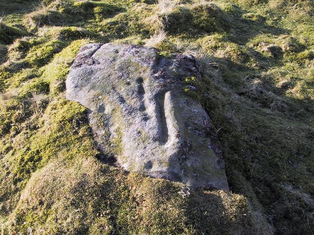
I like this carving — I think because of the initial impression it gave, which was one of numeracy and linearity: an unusual quality for a cup-and-ring stone. Those of you with an astronomical or mathematical slant may have a similar response.

Line Stone Carving, Skyreholme

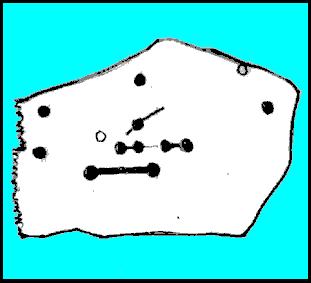
The stone was first described in one of Stuart Feather’s (1964) many short notices.  Its existence then remained dormant until it was eventually listed in Boughey & Vickerman’s (2003) survey on the West Riding rock-art, where they catalogued it as ‘stone no.401.’  The carving comprises of two parallel lines—one quite deep—with cup-marks at either end; one of the lines having another 2 cups along it. A third line at an angle has one or two cups along it aswell.  Several other single cups scatter the rock (forgive my crap drawing of it!).

References:

  1. Boughey, Keith & Vickerman, E.A., Prehistoric Rock Art of the West Riding, WYAS 2003.
  2. Feather, Stuart, ‘Appletreewick (WR),’ in Yorkshire Archaeology Journal 41, 1964.

© Paul Bennett, The Northern Antiquarian