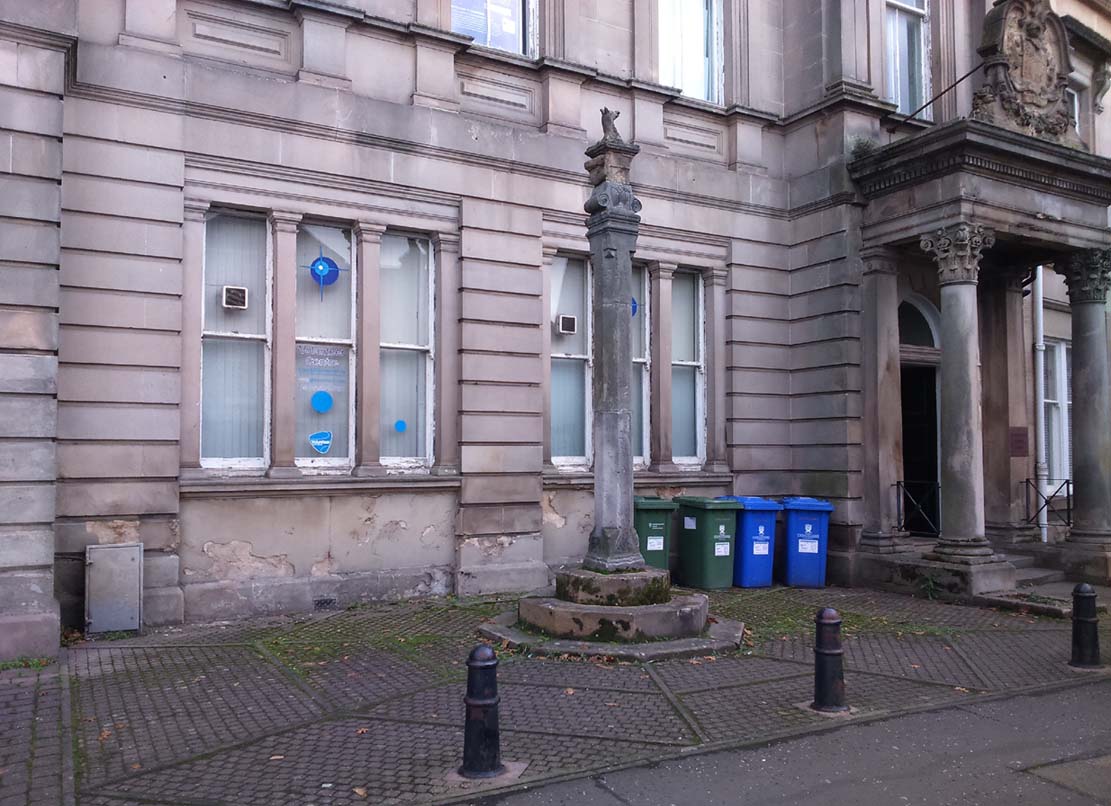
Get into the small town of Alloa, where the buses stand at Shillinghill. From here walk southwest down Mill Street, which runs into Bank Street. Keep your eyes peeled on your right-hand side, where outside one of the old municipal buildings you’ll see it standing upright.
Archaeology & History
Although now standing against the old buildings halfway down Bank Street, Alloa’s Mercat or Burgh Cross was initially set up at the crossroads 162 yards (148m) away, where Mar Street meets Mill Street and Bank Street. It was moved to its present position sometime in the 1880s and knowledge of its early history is scant.
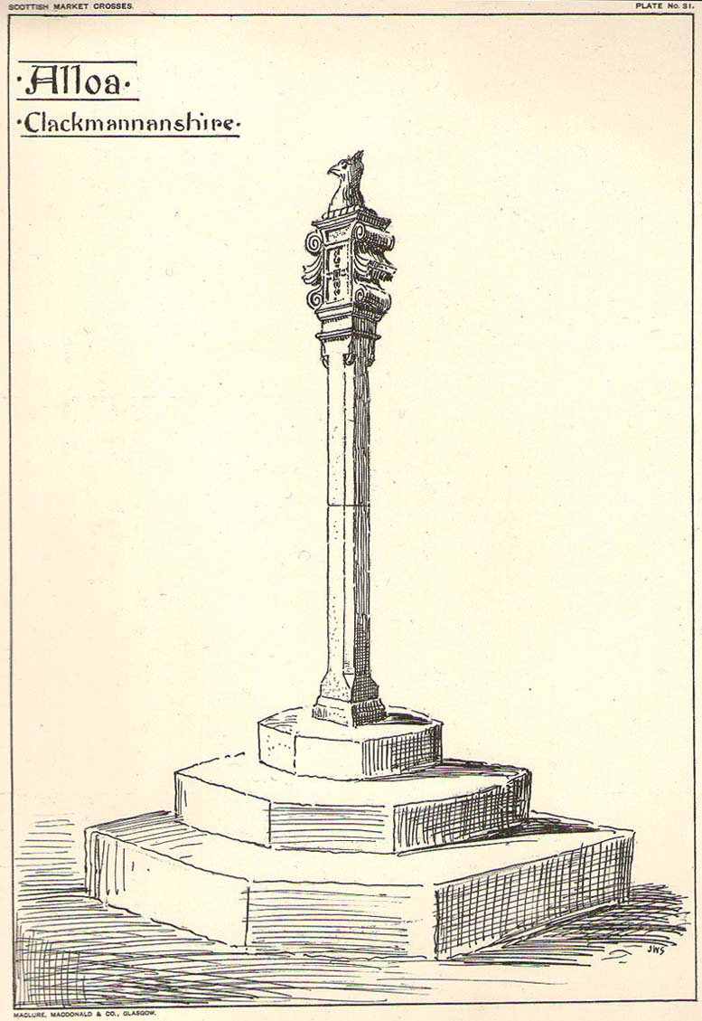
Standing some ten feet high, the monument was described in John Small’s (1900) rare magnum opus, in which he detailed the architectural features of the monument, telling us that,
John Small’s sketch
“The shaft, which rests on a base and three steps, is of the usual square section, with splayed angles, stoped at top and bottom, the top stop being rather peculiar.
The head of the Cross is composed of an oblong stone set upright, characteristic of the late type seen in Keikleour and Kinrossie. The oblong is ornamented at the sides with debased volutes and acanthus leaves, the whole crowned by a wreath from which rises a griffin’s head, part of the supporters of the Arms of the Lords of the Manor, Lord Mar and Kellie.”
References:
Anonymous, The Alloa Illustrated Family Almanac, MacGregor & Steedman: Alloa 1887.
Mair, Craig, Mercat Cross and Tolbooth, John Donald: Edinburgh 1988.
Royal Commission on the Ancient & Historical Monuments, Scotland, Inventory of Monuments and Constructions in the Counties of Fife, Kinross and Clackmannan, HMSO: Edinburgh 1933.
Small, John W., Scottish Market Crosses, Eneas Mackay: Stirling 1900.
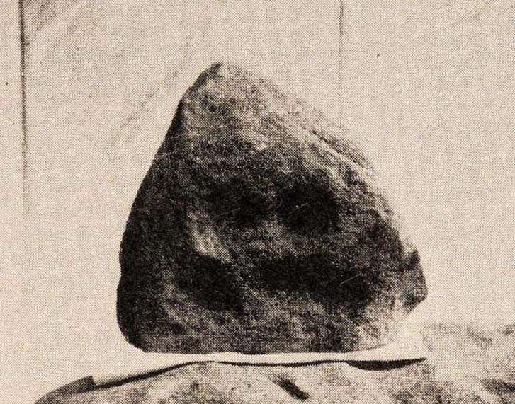
Inside the once prominent prehistoric tomb on the Cow Keeper’s Field, the northern antiquarians William Hornsby and John Laverick (1920) came across two small petroglyphs in association with a cremation burial, several feet south of the central cist: the Cow Keeper’s Field 2 carving, plus this small, triangular-shaped stone, 8in by 6in, consisting of five standard cup-marks, with two of the cups (as the photo shows) connected to each other. It is akin to the numerous ‘portable’ cup-marked stones which, in other cultures, were deposited onto cairns in remembrance of the ancestral spirits of the tomb. Such widespread practices may also have occurred here. Petroglyph researcher and writer Graeme Chappell (2017) informed us that the carving “is in storage in the Dorman museum in Middlesborough.”
References:
Brown, Paul & Chappell, Graeme, Prehistoric Rock Art in the North York Moors, Tempus: Stroud 2005.
Chappell, Graeme, Personal communication, October 4, 2017.
Crawford, G.M., Bronze Age Burial Mounds in Cleveland, Cleveland County Council 1990.
Elgee, Frank, Early Man in North-East Yorkshire, John Bellows: Gloucester 1930.
Hornsby, William & Laverick, John D., “British Barrows round Boulby,” in Yorkshire Archaeological Journal, volume 25, 1920.
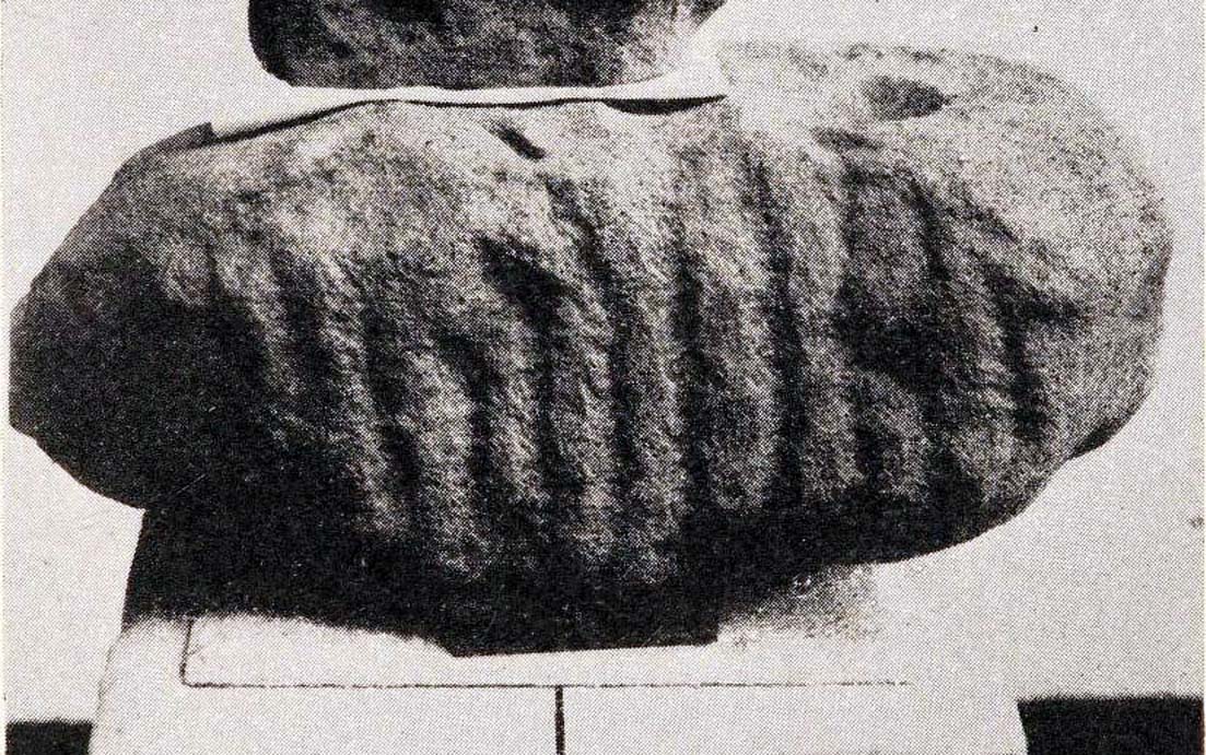
Inside the once prominent prehistoric tumulus on the Cow Keeper’s Field (now destroyed), the northern antiquarians William Hornsby and John Laverick (1920) came across two small portable petroglyphs: the Cow Keeper’s Field 1 carving, plus this “peculiarly marked stone” as they put it, some “5ft south of the centre” where a cist, or stone-lined burial existed. Measuring 18in by 7in, the rock carving consists of at least one large cup-marking which is clearly evident on top of the stone, plus what seems to be another one next to it, half-covered. Along the side of the stone, a series of twelve roughly parallel lines have been carved out, running down to the bottom of the stone. Rock art researcher and writer Graeme Chappell (2017) tells us the carving is supposed to be “in storage in the Dorman museum in Middlesborough,” although no one has seen it in years. It would be worthwhile if fellow research students could visit the said museum to recover this and other portable cup-marked stones that were found in the area.
References:
Brown, Paul & Chappell, Graeme, Prehistoric Rock Art in the North York Moors, Tempus: Stroud 2005.
Chappell, Graeme, Personal communication, October 4, 2017.
Crawford, G.M., Bronze Age Burial Mounds in Cleveland, Cleveland County Council 1990.
Elgee, Frank, Early Man in North-East Yorkshire, John Bellows: Gloucester 1930.
Hornsby, William & Laverick, John D., “British Barrows round Boulby,” in Yorkshire Archaeological Journal, volume 25, 1920.
This prehistoric tomb was one in a cluster of tumuli in the Boulby district, uncovered by the northern antiquarians, William Hornsby and John Laverick in 1918. Most of them have subsequently been destroyed – this one included. When they visited the site, they described it as “a barrow…with a diameter of 36 feet.” Once they began digging into it,
“at the centre we found a cist, the top of which was 2ft 7in below the present surface. The cist lay north 64° west, and south 64° east. It had no cover and the slab at the north-west end was wanting. The cist measured: side 3ft 6in, end 3ft 2in. Its depth was 2ft 2in. In it we found nothing except sandstone chips. With these there was no admixture of soil. Above the cist and covering a space of 5 ft by 5 ft there was a layer of burnt earth and black ashes (of furze bushes). At a distance of 5 ft south of the centre, and 1ft 10in below the present surface, there was a burnt burial, 20in in diameter. With this we found many flint chips, a shale pendant, and the peculiarly marked stone” we’ve called, simply the Cow Keeper’s Field 2 carving.
A second cup-marked stone was also found inside the tomb, a few feet south of the cist. When G.M. Crawford went to survey the burial mound in the late 1970s, he reported “there is no trace of it” and “has probably been destroyed by ploughing.”
References:
Brown, Paul & Chappell, Graeme, Prehistoric Rock Art in the North York Moors, Tempus: Stroud 2005.
Crawford, G.M., Bronze Age Burial Mounds in Cleveland, Cleveland County Council 1990.
Elgee, Frank, Early Man in North-East Yorkshire, John Bellows: Gloucester 1930.
Hornsby, William & Laverick, John D., “British Barrows round Boulby,” in Yorkshire Archaeological Journal, volume 25, 1920.
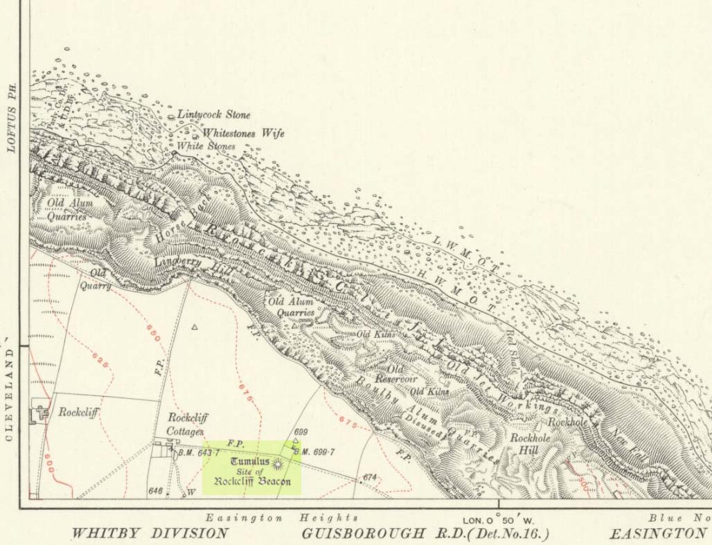
Occupying a prominent position above the ever-closer North Sea, upon which an old beacon was subsequently placed, this denuded prehistoric tomb was first surveyed by the Ordnance Survey lads in 1913, and subsequently in an essay by Messers Hornsby & Laverick (1920) on the ancient sites of Boulby, east of Easington. This was the first one they explored, calling it ‘Mound No.1.” They located it,
“due south of the ‘Soldier’s Garth’ in the east corner of the field called The Falls. It was a cairn with a diameter of 50ft. Two-and-a-half feet northwest of the centre peg, at a depth of 21 inches below the present surface, there was an unaccompanied burnt burial, which occupied a space of 15in by 18in. In a centre cut 7ft 6in by 6ft, at a depth of 3ft 6in, we found much burnt bone and many potsherds of the Bronze Age type, scattered over the whole space of the trench, down to a further depth of 3ft 10½in. In the south corner there were four stones set on edge and running in a direct (straight) line. The interment had been placed upon the clay, the soil of the original surface having been cleaned off. With this burial we found a good flint made from a polished celt and worn smooth at the point—possibly through having been used for striking fire on iron pyrites—many chips and several cupstones.”
The “several” cup-marked stones they describe at the end seem to have been lost; perhaps sleeping in some museum cellar somewhere (does anyone know?).
This cairn was one in a complex of eight that Frank Elgee (1930) suggested may have been laid out deliberately in the form of the constellation of Ursa Major, or The Plough, also known as ‘Charles Wain’.
References:
Brown, Paul & Chappell, Graeme, Prehistoric Rock Art in the North York Moors, Tempus: Stroud 2005.
Crawford, G.M., Bronze Age Burial Mounds in Cleveland, Cleveland County Council 1990.
Elgee, Frank, Early Man in North-East Yorkshire, John Bellows: Gloucester 1930.
Hornsby, William & Laverick, John D., “British Barrows round Boulby,” in Yorkshire Archaeological Journal, volume 25, 1920.
Stone Circle (destroyed): OS Grid Reference – SK 26 94
Archaeology & History
This lost ring of stones was one many sites that could once be found in this area. It was written about in John Watson’s (1776) essay on the local antiquities, where, in describing places he thought were druidical remains (like the prehistoric Bar Dike and Apronful of Stones cairn), he told that
“There is something also of this sort on the other side of Bardike on Bradfield Common; in particular a circle of about eight yards diameter composed of twelve stones, and a confused heap in the centre, near Handsome Cross, and the faint remains of two larger not far off.”
Subsequent local historians like Joseph Hunter (1819) and Harold Armitage (1939) mention the place, with Armitage giving the impression that remains of it could be seen in his lifetime, but today we are at a loss to known its exact position and nature. By the sound of Watson’s initial description, this circle sounded as if a cairn of some sort was in the centre, giving it more a funerary nature than an open stone circle. But we don’t know for certain. This is also what John Barnatt (1990) posited in his local survey.
Based on the landscape, an initial analysis would place the circle most probably at SK 2615 9424, close to where the Handsome Cross itself stood—but this is conjectural. The natural landscape hereby has been ruined by extensive farming and forestry, so any remains of it seem improbable.
References:
Armitage, Harold, Early Man in Hallamshire, Sampson Low: London 1939.
Barnatt, John, Stone Circles of Britain – volume 2, BAR: Oxford 1989.
Barnatt, John, The Henges, Stone Circles and Ringcairns of the Peak District, University of Sheffield 1990.
Hunter, Joseph, Hallamshire: The History and Topography of the Parish of Sheffield, Lackington: London 1819.
Morgan, Paul & Vicki, Rock around the Peak, Sigma 2001.
Smith, A.H., The Place-Names of the West Riding of Yorkshire– volume 1, Cambridge University Press 1961.
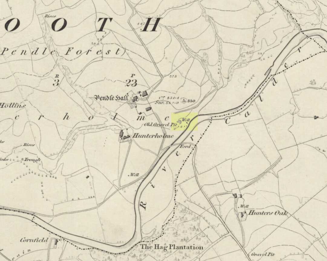
On the north-side of the River Calder, a short distance above the riverbank below Pendle Hall—as shown on the earliest OS-map of the area, but without a name—the local history writer, Joe Bates (1926), told us about this “spring of icy cold water”, which, in bygone years, “used to be called Robin Hood’s Well.” (Having moved out of the area, I’m not able to say whether this site is still visible. Can any local folk illuminate us on the matter?)
Folklore
Like many other sacred and healing wells across Britain, Bates (1926) said that the waters from Robin Hood’s Well,
“was at one time considered a specific for certain ailments of the eyes.”
References:
Bates, Joe, Rambles twixt Pendle and Holme, Nelson 1926.
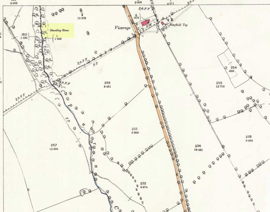
Following a request to see if anyone could locate a lost standing stone in Fence (in the Forest of Pendle) not far from my home, I took up the challenge to locate this relic. One evening in July 2017, I decided to go take a look and having studied all maps I was fairly sure of its old position. Upon finding the deep ravine and the old field boundaries, I followed the line of old mature beech trees (perhaps 250-300 years old) that shroud the deep clough. Behind the biggest beech tree, but now some 10 feet down the slope, there I found the said standing stone, now recumbent and partly stuck into the earth due to its weight (approx 1.5 tonne).
Spurn Clough Stone, laid halfway down the slope
It appears to have either fallen on its own accord as the steep sides of clough are soft clays, unstable and eroding, or it has been pushed out of the way by a previous landowner. It is made of millstone grit and is likely a glacial erratic from off the top of the local fells; it is not of the same type of fine gain flaggy bedrock that exists in the river below. There are no more similar boulders within the clough other than a few small boulders in the bed of the stream. This stone is big: being about 4ft by 3ft and 5ft long that is visible, with considerably more into the banking.
Exact position of the stone on the 1893 OS-map
I think it is worth approaching the local landowner to seek his approval to try and re-erect this standing stone in a position away from the crest of the ravine. It obviously was locally important and worthy of noting on the OS Map of 1848 and was not cut up and used as local walling stone, so it either was a boundary marker or held other folklore significance.
Research so far indicates no name is attached to the standing stone, but nearby is a ‘Hoarstones Lodge’ mentioned as a place for the Pendle witches to meet and the ravine and stream is called Spurn Clough, so I feel it apt to name it the Spurn Clough Standing Stone—unless I uncover another name used for the stone. It’s nice to locate a lost standing stone!
Now I throw open the question: should it be restored to its upright position and made safe from falling down the clough?
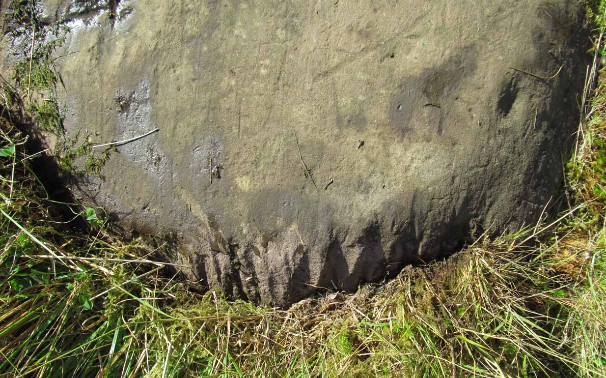
Along the A81 road from Port of Menteith to Aberfoyle, watch out for the small road in the trees running at an angle sharply uphill, nearly opposite Portend, up to Coldon and higher. Keep going, bearing right past Mondowie and stopping at the dirt-track 100 yards or so further up on the left. Walk up this dirt-track for ⅔ mile, and just before reaching the planted forestry, turn right along another dirt-track. Less than 200 yards along there’s a large sycamore tree, and about 20 yards below it (south) are several open flat rock surfaces. This is the most westerly of them.
Archaeology & History
…and again
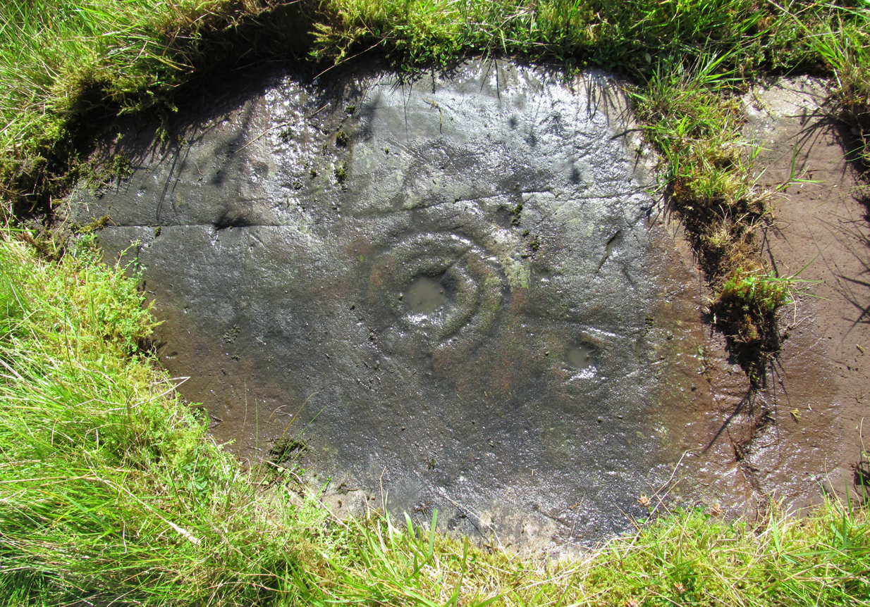
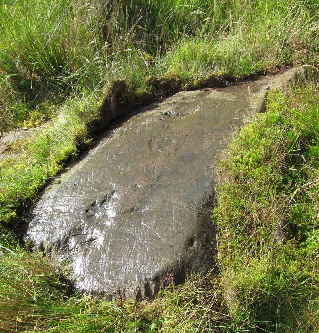
On this small smooth rock surface we find an almost archetypal cup-and-ring stone, whose design consists of a double cup-and-ring and a faint cup-and-ring. The double-ring has several seemingly natural small fissures in the rock running at various angles into the central cup from the outside; and there are two faint ones running from the double-rings outwards to the cup-mark in the single-ring, framing the central cupmark in the middle. It may have been that these scratches on the rock gave rise to the position of the cupmark in this petroglyph. It’s difficult to see whether or not the single cup-and-ring was ever completed.
Canmore’s description of this petroglyph tells simply: “The larger of the two is 180mm in diameter and has two rings around a cup that is 70mm in diameter and 15mm deep. The smaller has one ring around a cup.”
Once you’ve seen this, have a look at the Over Glenny (6) carving, about 10 yards east of here.
Along the A81 road from Port of Menteith to Aberfoyle, watch out for the small road in the trees running at an angle sharply uphill, nearly opposite Portend, up to Coldon and higher. Keep going, bearing right past Mondowie and stopping at the dirt-track 100 yards or so further up on the left (and ignore the english fuckers up here who might say “you’re not allowed to park here”, as Scottish government regulation allows you to do so unless you block the road). Walk up this dirt-track for ⅔ mile, and just before reaching the planted forestry, turn right along another dirt-track. Less than 200 yards along there’s a large sycamore tree, and about 20 yards below it (south) is the carving you’re looking for.
Archaeology & History
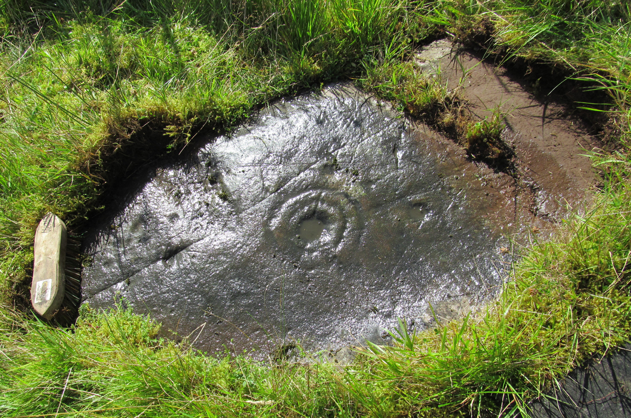
It’s difficult keeping up with the carvings in this region to the north of the Lake of Menteith, as we find new unrecorded ones on every visit, maintaining the tradition of fellow rock art students Maarten van Hoek, Kaledon Naddair, George Currie, Jan Broewer and the rest—and we know that there’s more of them hidden away. This one doesn’t seem to be in the Canmore listings, but I put that down to the fact that they’ve got a grid-reference wrong somewhere, as it’s pretty plain to see. Although, to be honest, in the rather vague descriptions of other adjacent carvings (Over Glenny 5 and 7), this carving is in-between them, so you’d expect it to be listed. Anyway, that aside…
Looking down at the ringsClose-up of faint rings
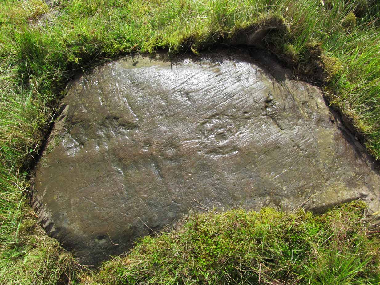
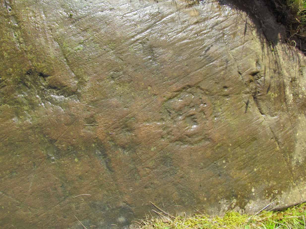
This long flat exposed rock surface has two primary cup-and-rings upon it: one cup with a double-ring, and the other standard cup-and-ring; there are also two single cup-markings on the stone: one near the middle of the rock and the other on its lower-right side. The main element is the double-cup-and-ring, which appears to be incomplete—not only in terms of its design, but also, as you can see in the photos, seems unfinished. From the central double-ring, a faint carved line runs out from the centre and into the other faint, incomplete, single cup-and-ring.
Series of metal-sharpening groovesArty-farty sketch of the design
At the bottom of the stone (as with several others hereby) a curious set of deep scars have been cut into the edge of the rock. They’re unmistakable when you see them. They have probably been created by metal artifacts being sharpened along the bottom of the rock—many many times by the look of it. These deep cuts reminded me of the more famous Polisher Stone, down Avebury-way. They may be explained by the fact that, several centuries ago, a battle occurred here and some of the men gathered in the area before the attack. It would seem as if this and the other cup-and-ring stones were used to sharpen their blades before going into battle. Whether this was done because of some local lore which imbued these stones with some sort of magick, we do not know. Folklore here seems curiously scarce (english incomers destroyed local traditions, as writers were telling us in the 19th century), apart from the well-known one of the area being rife with fairies: Robert Kirk’s famous The Secret Commonwealth of Elves, Fauns and Faeries (1691) was written three miles west of here, at Aberfoyle.