Counter Hill, Addingham, West Yorkshire

Enclosure:  OS Grid Reference – SE 051 501

Getting Here
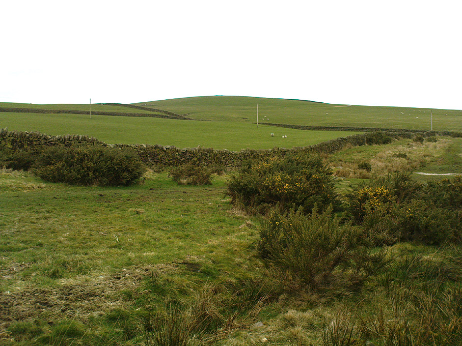
Counter Hill, looking north

You can come from various angles to approach this site, but I reckon the best is from along the old trackway of Parson’s Lane, between Addingham and Marchup.  From Silsden go up the long hill (A6034) towards Addingham until the hill levels out, then turn left on Cringles Lane (keep your eyes peeled!) for about 500 yards until you reach the Millenium Way or Parson’s Lane track, to your right.  As you walk along this usually boggy old track, the rounded green hill ahead, to the left, if where you’re heading.  Less than 100 yards past the little tumulus of High Marchup there’s a stile on your left that takes you into the field.  You’ll notice the depression that runs across near the top, at an angle.  That’s part of the earthworks!

Archaeology & History

The Counter Hill earthworks just over the far western edge of Rombald’s Moor – thought to be Iron Age – are truly gigantic.   More than ¾-mile across along its longest NW-SE axis, and a half-mile from north-south at its widest point, this huge ellipse-shaped earthwork surrounds the rounded peaked hill that gives the site its name: Counter Hill.  And although Harry Speight (1900) thought the hill got its name from the old Celtic conaltradh, or Irish conaltra, as in the ‘hill of debate or conversation’ — a possibility — the place-name master Mr Smith (1961) reckoned its name comes from little other than ‘cow turd hill’!  We may never know for sure…

Earthworks south of Counter Hill
Cowling’s 1946 plan

The Lancashire historian Thomas Dunham Whitaker (1878) appears to have been one of the first people to describe the Counter Hill remains, though due to the sheer size of the encampment he thought that it was Roman in nature.  Within the huge enclosure we also find two large inner enclosures, known as the Round Dikes and the Marchup earthworks.  Whitaker’s description of Counter Hill told:

“There are two encampments, on different sides of the hill, about half a mile from each other: one in the township of Addingham, the other in the parish of Kildwick; the first commanding a direct view of Wharfedale, the second an oblique one of Airedale; but though invisible to each other, both look down aslant upon Castleburg (Nesfield) and Ilkley.  Within the camp on Addingham Moor are a tumulus and a perennial spring; but by a position very unusual in such encampments, it is commanded on the west by a higher ground, rising immediately from the foss.  The inconvenience, however, is remedied by an expedient altogether new, so far as I have observed, in Roman castramentation, which is a line of circumvallation, enclosing both camps, and surround the whole hill: an area, probably, of 200 acres.  A garrison calculated for the defence of such an outline must have been nothing less than an army.  But it would be of great use in confining the horses and other cattle necessary for the soldiers’ use, which, in the unenclosed state of the country at the time, might otherwise have wandered many miles without interruption.  The outlines of these remains is very irregular; it is well known, however, that in their summer encampments the Romans were far from confining themselves to a quadrangular figure, and when we consider their situation near the Street, and the anxious attention with which they have been placed, so as to be in view of Ilkley or Castleburg, there can be little danger of a mistake in ascribing them to that people.”
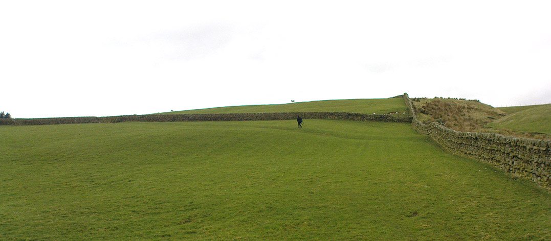
Counter Hill earthworks, looking west

And though Whitaker’s sincerity and carefully worded logic for the period is quite erudite (much moreso than the greater majority of historians in modern times), his proclamation of the Counter Hill earthworks as Roman is very probably wrong (soz Tom).  The embankments are much more probably Iron Age in nature and are very probably the result of indigenous tribal-folk than that of the incoming Romans.  Most modern archaeologists and historians tend to see the entrenchments as being from such a period and I have to concur.

Folklore

The old antiquarian Edmund Bogg (1904) wrote that the Counter Hill earthworks were built as a result “of the struggle between the Anglians and the Celt,” long ago.  The great Yorkshire historian Harry Speight (1900) narrated similar lore just a few years earlier, but told that the tradition was  “of how the Romans drove the natives from this commanding site of Counter Hill.”

References:

  1. Bogg, Edmund, Higher Wharfeland: The Dale of Romance, James Miles: Leeds 1904.
  2. Cowling, Eric T., Rombald’s Way, William Walker: Otley 1946.
  3. Fletcher, J.S., A Pictureseque History of Yorkshire – Part IX, J.M. Dent: London 1901.
  4. Smith, A.H., The Place-Names of the West Riding of Yorkshire – volume 6, Cambridge University Press 1961.
  5. Speight, Harry, Upper Wharfedale, Elliott Stock: London 1900.
  6. Whitaker, T.D., The History and Antiquities of the Deanery of Craven, 3rd edition, Joseph Dodgson: Leeds 1878.

© Paul Bennett, The Northern Antiquarian
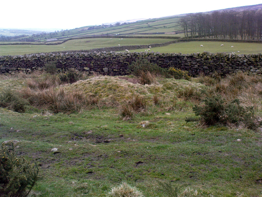

High Marchup, Silsden, West Yorkshire

Tumulus:  OS Grid Reference – SE 0501 4949

Also Known as:

  1. Parson’s Lane Tumulus

Getting Here

High Marchup tumulus

From Silsden go up the long hill (A6034) towards Addingham until the hill levels out, then turn left on Cringles Lane (keep your eyes peeled!) for about 500 yards until you reach the Millenium Way footpath, or rather, green lane track, to your right.  Walk along this usually boggy old road for another 400 yards until you’re level with the small copse of trees below the field (about 100 yards away).  The slightly raised ditched mound on the left side of the track ahead of you is what you’re after!

Archaeology & History

Unless this old tomb was pointed out, you probably wouldn’t give the place a second glance.  It’s a seemingly isolated singular round tomb, subsided on top and surrounded by a small ditch, running into the edge of the walling.  Gorse bushes and a few rocks are around the edges of the site.  Harry Speight (1900) described this old tomb as a

“lonely isolated mound, to be seen in Parson Lane about a hundred yards west of the Celtic boundary, Black Beck, where some old dying chief has called his friends around him bidding them, “heap the stones of his renown that they may speak to other years.”  It is a tumulus 80 feet in circumference and does not seem to have been disturbed.”

In Faull and Moorhouse’s (1981) magnum opus they describe the site as “the denuded remains of a ditched round barrow,” but say little else.  It may have had some relationship with the settlement remains in and around the huge Counter Hill complex, immediately north.

References:

  1. Cowling, E.T., Rombald’s Way: A Prehistory of Mid-Wharfedale, William Walker: Otley 1946.
  2. Faull, M.L. & Moorhouse, S.A. (eds.), West Yorkshire: An Archaeological Guide to AD 1500 (4 volumes), WYMCC: Wakefield 1981.
  3. Speight, Harry, Upper Wharfedale, Elliott Stock: London 1900.

© Paul Bennett, The Northern Antiquarian

Caspar Stone, Middleton Moor, North Yorkshire

Cup-Marked Stone:  OS Grid Reference – SE 10879 51405

Archaeology & History

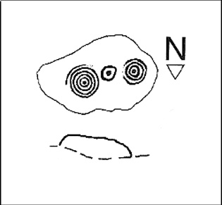
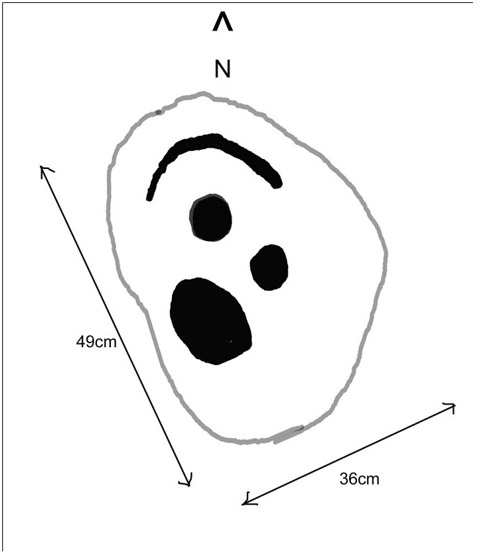
Caspar Stone drawing © M.Short & R.Stroud
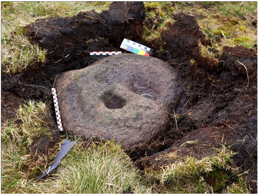
Caspar Stone unearthed © M.Short & R. Stroud

This carving was discovered very recently following an exploration of recognised sites on Middleton Moor by rock art student Mike Short on March 28, 2010.  Found amidst a cluster of other carved rocks, it was located after he noticed a small piece of stone poking out of the peat and — as happens to those folk obsessed by these ‘ere carvings — he decided to dig round the stone and cut the turf back to see if there was anything carved on the rock, as there are other cup-and-rings are close by.  Thankfully, after a bit of effort digging round the stone, Mike found the carving we see in the images here! (courtesy of Mike and Richard Stroud).   With a distinctly ‘facial’ appearance (hence the name), the following notes were written describing the new find:

“Small roughly oval dome-shaped medium grit rock approx. 49cm X 36cm, at and below soil level. Two cups, one of which is conical and deep (55mm deep and 65-75mm diameter) and of similar profile to one of the cups on No. 458; small shallow bowl-like depression with possible peck marks; curving groove on northern edge.”

When Mike finished with their drawings and measurements, the stone was covered back over and left in situ.  Although I aint seen the carving ‘in the flesh’ misself yet (we’re gonna have a look next week) it gives me the impression it had some association with burials.

References:

  1. Short, Mike & Stroud, Richard, “Report of New Carved Rock (‘Caspar’) on Middleton Moor,” April 2010.

© Paul Bennett, The Northern Antiquarian

Wray Stone (314), Ilkley Moor, West Yorkshire

Cup-Marked Stone:  OS Grid Reference – SE 13173 46585

Also Known as:

  1. Carving no.150 (Hedges)
  2. Carving no.314 (Boughey & Vickerman)

Getting Here

Take the road up across from Ilkley train station uphill towards the moor until you reach great rocks on your right.  From here, the Cow & Calf Stones car park (packed with tourists and litter everywhere these days), go up the steep footpath onto the moor.  As you level out looking across the first moorland ridge, to your left is a rounded hillock.  Go into the heather there and near its small peak and you’ll find what you’re looking for.

Archaeology & History

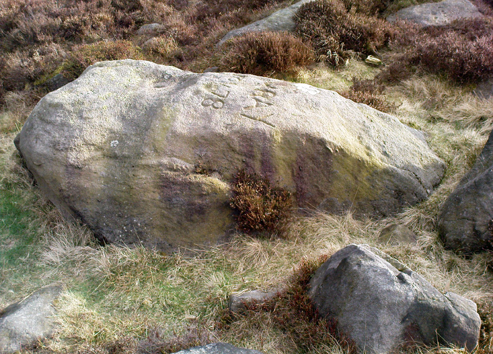
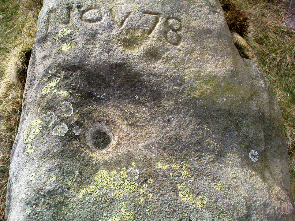
This is a nice big stone, found amidst a clump of other stones, that gives the distinct impression of once being a large cairn or similar artificial prehistoric feature.  But that’s wishful thinking on my behalf…  This long fat 10-foot long rock has the distinct signature of someone who thought it a good idea to carve his little name on the carving in 1978, as the name of the rock tells: “Wray Nov 78” — vandalism which the local Ilkley Parish Council and local businessman Tom Lonsdale validate as little more than “twenty-first century informal unauthorised carving.”  Beneath the great artist’s signature we find two distinct cup-marks above a large rounded bowl, inside of which seems to be the impression of an old ring, but this seems due to the actions of water and lichen.  There are perhaps another two faded cup-markings alongside those distinctly visible.  In Hedges (1986) survey he described the “top flat surface has three cups and one basin” — so let’s play safe and go with that!

Close-up of cups, bowl & modern etching

It’s a good stone, sat upon a fine ridge with distinctive views for miles both east and west along the valley of the Wharfe, and north to the ancient settlements and burial grounds of Middleton Moor on the other side of the River Wharfe.  From here, behind and up onto Ilkley Moor, unfolds its greater mythic history, scattered and hidden over differing ages.  In years past, this site was a fine one for reflection and insight.  Today, one must venture further and to other sites for such quiet realities. Close by you can find the double-ringed carving of stone 318 and other faded cup-mark stones nearby.

References:

  1. Boughey, Keith & Vickerman, E.A., Prehistoric Rock Art of the West Riding, WYAS: Wakefield 2003.
  2. Cowling, E.T., Rombald’s Way: A Prehistory of Mid-Wharfedale, William Walker: Otley 1946.
  3. Hedges, John (ed.), The Carved Rocks on Rombalds Moor, WYMCC: Wakefield 1986.

© Paul Bennett, The Northern Antiquarian

Counter Hill Carving, Silsden, West Yorkshire

Cup-Marked Stone:  OS Grid Reference – SE 0463 4995

Also Known as:

  1. Carving no.31 (Boughey & Vickerman)

Getting Here

Cowling’s 1946 drawing

From Silsden go up the long hill (A6034) towards Addingham until the hill levels out, then turn left on Cringles Lane (keep your eyes peeled!) for a half-mile where you need to veer right along Banks Lane and go 100 yards past Moorcock Farm Hall where the footpath takes you into the fields on your right.  Walk down the line of the wallings, thru the gate, and keep following down until you reach a cluster of large rocks.  Stop here and look over the wall where you’ll see one of the boulders poking its head out on the other side.  That’s it!

Archaeology & History

First discovered by Eric Cowling in the late 1930s during one of his explorations of the immense Counter Hill earthworks (thought to be Iron Age), whose remains can still be seen encircling the peaked hill close by.  The stone is found in the edge of the walling halfway down the field towards the Marchup enclosure and is just inside the outer edge of the Counter Hill ditched enclosure surrounding the hill above you. (on the other side of the wall from the carving, you can make out the remains of the faint line of the ditch running pretty straight up towards the next wall)

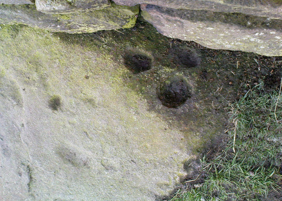
Cluster of cups by walling
Counter Hill carving from above

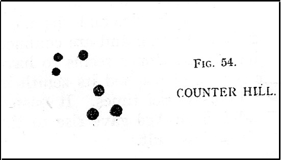
At the top eastern edge of the stone is a clear cluster of 3 cup-markings, just as the rock meets the walling.  A much more faint group is visible to the left.  Cowling (1946) suggesting that the three-cup-cluster “shows the final form of the fylfot symbol,” i.e., the three-armed swastika.  Boughey & Vickerman (2003) meanwhile suggest that one of the two clusters are “doubtful (possibly recent?).”

When we came to this site yesterday, the day was overcast and cloudy.  But it seemed there may be more to this carving than has previously been recorded.  What may be a faint ring seemed possible near the middle of the stone, with a natural crack running through it (you can just about make it out in the photo on the right).  There also seemed to be other faint lines on the rock, but until we’ve been here again with better lighting conditions, the two groups of 3-cups is the symbolic state of play for this stone!

References:

  1. Boughey, Keith & Vickerman, E.A., Prehistoric Rock Art of the West Riding, WYAS: Wakefield 2003.
  2. Cowling, E.T., Rombald’s Way: A Prehistory of Mid-Wharfedale, William Walker: Otley 1946.
  3. Hedges, John (ed.), The Carved Rocks on Rombalds Moor, WYMCC: Wakefield 1986.

© Paul Bennett, The Northern Antiquarian

Middleton Moor Carving (006), North Yorkshire

Cup-Marked Stone:  OS Grid Reference – SE 12292 52144

Getting Here

Middleton Moor CR-006

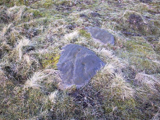
Another off-the-beaten track site!  Follow the directions to reach the Middleton Moor 001 carving, then walk due east for about 500 yards until you reach the distinct footpath that’s the Roman Road.  Once here, zigzag along its edge on the western side, up and down hereabouts.  Keep looking around till you see the stone shown in Richard’s photo here!

Archaeology & History

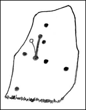
First found in April 2005, this medium-sized flattish stone is just 10 yards west of the prehistoric trackway which cuts across the moors  — later used as a Roman road — on Middle Gill Bents.  A somewhat simplistic design, it was found by Richard Stroud when we were exploring some of the many other carvings up here, and looking for previously unrecorded ones hiding in the heather.  Carved onto this stone are eight, perhaps nine cup-markings, with grooved lines connecting at least two of them.  That’s it!

© Paul Bennett, The Northern Antiquarian

Middleton Moor Carving (441), North Yorkshire

Cup-and-Ring Stone:  OS Grid Reference – SE 10887 51381


Getting Here

From the back of Moor End Farm on the south-side of Langbar village, follow the Long Ridge footpath up onto the moor. Walk along the path until its starts dipping down again, onto the moor proper and where another footpath crosses and goes down into the small valley of the Dryas Dike stream, follow it – though only for about 75 yards, heading diagonally into the heather slowly towards the stream.  You’re getting close!

Archaeology & History

Crude drawing of CR441

Yet another small carving found amidst a decent cluster of cup-and-rings and other archaeological remains near the top of Dryas Dike, this stone was first described in the Boughey & Vickerman (2003) survey.  It’s located about 10 yards below Middleton Moor CR-440, above the stream of Dryas Dike.  It’s a simple design, comprising of a central groove with a cup at either end and several other cups either side of this central line.  (cheers to Richard Stroud for use of his photo).

References:

  1. Boughey, Keith & Vickerman, E.A., Prehistoric Rock Art of the West Riding, WYAS 2003.

© Paul Bennett, The Northern Antiquarian

Middleton Moor Carving (482), North Yorkshire

Cup-and-Ring Stone:  OS Grid Reference – SE 11600 51455

Also Known as:

  1. Owl Carving

Getting Here

Multiple-ringed carving (© Richard Stroud)

Best approached from the south, up Hardings Lane, then where its bends and the track of Parks Lane goes onto the moor, follow it.  Onto the moor, keep on the track as it follows the walling until you reach the gate on your right.  From here you’re close: head into the grasses and heather (left) not far off the western edge of the footpath at the eastern end of Dryas Dike.  Look around!

Archaeology & History

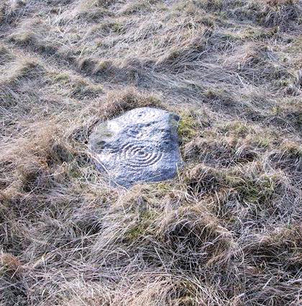
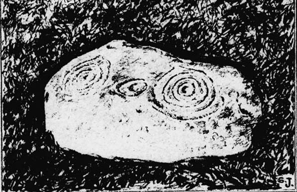
This lovely looking carving “quite near to the footpath and enclosed fields above March Ghyll reservoir,” was first described by Stuart Feather. (1965)  It can be found on a small flat stone and is easily obscured if the grasses are long – but it’s worth searching for.  It’s an archetypal cup-and-ring stone, consisting of a cup-and-five rings, a cup-and-ring, and a cup-and-three rings — though they are rather faint and can be missed in bad light.  As with other carvings, it’s best to splash water over it (as me & Richard did in the photo above) so you can see it a bit clearer.  Feather (1965) told us:

“The symbols are very fine, consisting of three cup-and-rings.  One of them, a quadruple, concentrically-circled cup with part of a fifth, unfinished ring.  The cup is very shallow, 1 inch across, and the circles…½ inch wide and shallow, with an overall diameter of 8 inch for the four circles; 9 inch with the other unfinished section.  The single cup-and-ring has a cup ¾-inch in diameter, ½-inch deep and a 4-inch diameter ring somewhat broader than the other rings on the rock and abutting on the north side against a slightly raised part of the rock surface.”

Sidney Jackson’s drawing
Boughey & Vickerman’s drawing

The triple-ringed cup is of similar dimensions to the larger example, with the cup being 1½ inch across and deep, with the circles being 7 to 7½-inch across.

About a half-mile northeast of here is the old Langbar Stone where I got the distinct impression that the same person was responsible for both of these carvings.  God knows why!

References:

  1. Boughey, Keith & Vickerman, E.A., Prehistoric Rock Art of the West Riding, WYAS 2003.
  2. Feather, Stuart, ‘Mid-Wharfedale Cup-and-Ring Markings: No.32-3, Middleton Moor,’ in the Cartwright Hall Archaeology group Bulletin, February 1965.

© Paul Bennett, The Northern Antiquarian 


Smiley Stone Carving, Middleton Moor, North Yorkshire

Cup-and-Ring Stone:  OS Grid Reference – SE 10923 51269

Also Known as:

  1. Carving no.446 (Boughey & Vickerman)

Getting Here

Near the western end of the Middle Ridge, south of Dryas Dike, it’s probably best reached following the same directions to find carving no.435, walking past it but then following the footpath down onto the moor 100 yards further down the slope. Walk along here for about 200 yards till you get to the boundary stone.  You’re close!

Archaeology & History

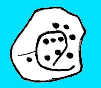
Sketch of carving 446
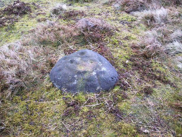
Smiley Stone carving

First described by Stuart Feather and described by him in 1966, this small rounded stone comprises of nine or ten cup-markings with a long, enclosing line that circuitously goes around four or five of them.  It’s a curious-looking design which, from one angle, gives the impression of a smiley face — hence the name (this is Boughey & Vickerman’s name for it — not mine!).

References:

  1. Boughey, Keith & Vickerman, E.A., Prehistoric Rock Art of the West Riding, WYAS 2003.
  2. Feather, Stuart, ‘Mid-Wharfedale Cup-and-Ring Markings – no.43 and 44: Middleton Moor, Ilkley,’ in Cartwright Hall Archaeology Group Bulletin, 11:4, 1966.

© Paul Bennett, The Northern Antiquarian


Black Hill Enclosure, Middleton Moor, North Yorkshire

Enclosure:  OS Grid Reference – SE 11757 51949

Getting Here

Just below Black Hill in the Middleton Moor Enclosure, little more than 10 yards east of the footpath on the east side of Loftshaw Gill, the slope drops down and into a slight ‘bowl’ in the landscape.  Here it is!

Archaeology & History

This is a previously undiscovered prehistoric settlement, enclosure, or something along those lines!  We came across it in April 2005 and is found amidst the mixed heather and bracken and has a scattering of small stones, as if in the wake of a dried stream from bygone times.  But whatever stream might once have been here, it’s long since fallen back to Earth — but at a point where a few rushes (Juncus conglomeratus) can be seen we find the aged remains of a large oval enclosure.

Similar in form to the other remains located up here by Eric Cowling (1946) in the 1930s and ’40s, when Richard Stroud and I first found this, structural remains of distinct lengths of walling were visible – but once the vegetation started growing back here again, it was almost impossible to discern.

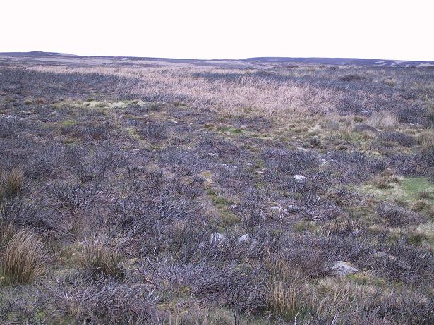
Faint remains of enclosure walling

The main archaeological remains comprises of an oval-shaped structure, with what seemed liked a distinct Bronze Age note stamped on the walling — though it could be earlier, but without excavation it’s impossible to say. Most of the walling was just above ground-level, making it difficult to appreciate in the photo. It measures approximately 40 feet north-south and 33 feet east-west. The walling itself averages between 18-24 inches wide and was no more than one-foot tall at the highest.  Near the middle of the enclosure there were further sections of walling indicating different ‘rooms’ in the overall structure of things here.

Like I say, we unfortunately couldn’t get a decent image of this site cos the vegetation was already covering it up. So if you wanna see it, gerrup there soon after the heather burning’s been done here — otherwise it’s gonna be at least another year before you getta chance to see anything.  In Richard Stroud’s photo here, you’re looking at the bottom curve of the enclosure. You can just make out the line of walling near the centre of the picture, and two-thirds the way to the right you can see the enclosure wall curve closer to the bottom of the photo. (the site obviously requires a much better assessment from someone far more competent than me!)

References:

  1. Cowling, E.T., Rombald’s Way, William Walker: Otley 1946.

© Paul Bennett, The Northern Antiquarian