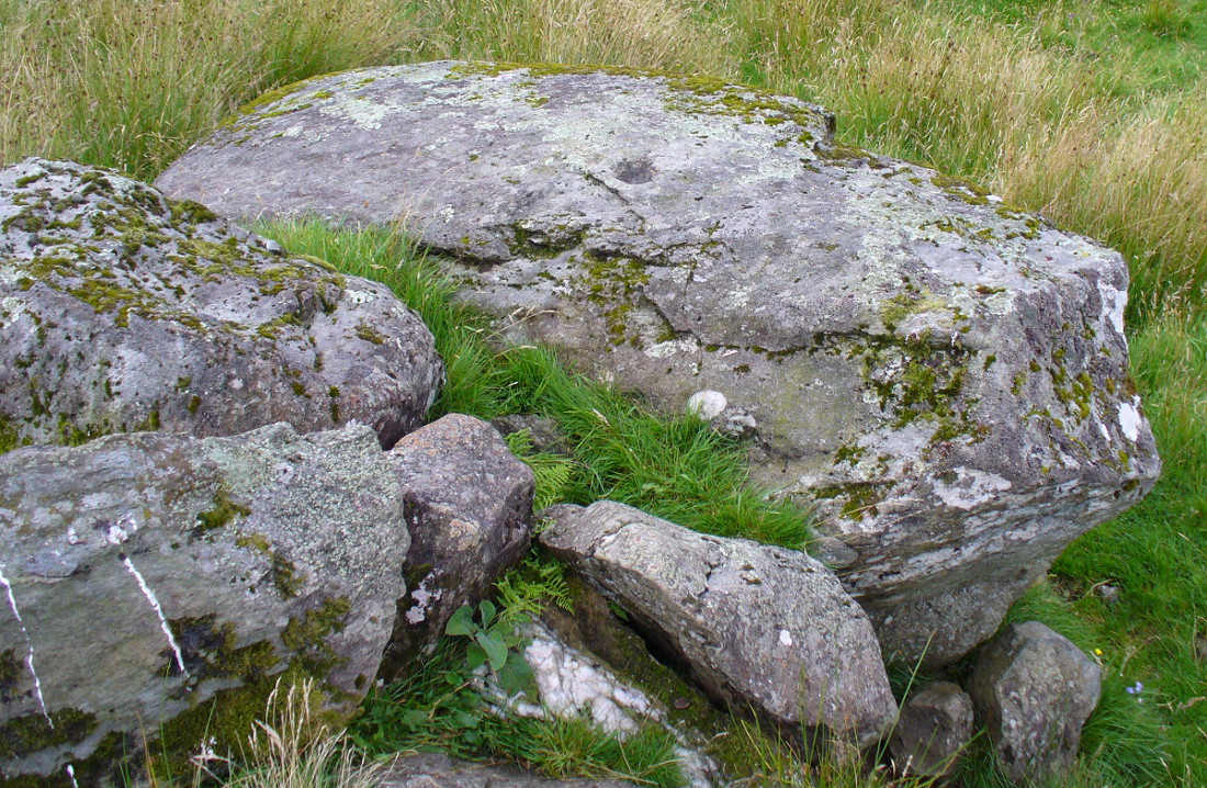
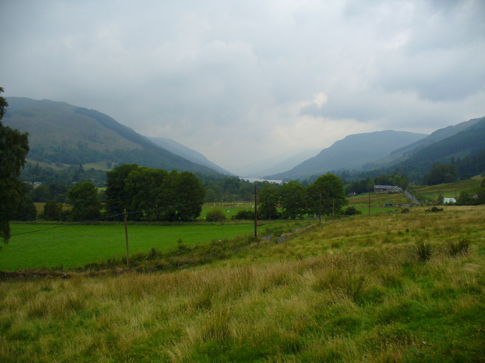
Dunmoid, Dalginross, Comrie, Perthshire

Stone Circle:  OS Grid Reference – NN 78030 21266
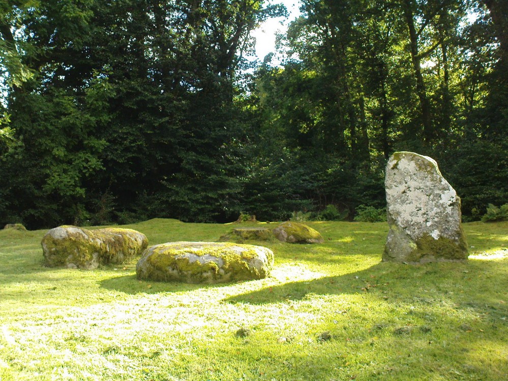
Dunmoid Circle, Comrie

Also Known as:

  1. Canmore ID 24857
  2. The Court Knoll
  3. Dalginross
  4. Dunmhoid
  5. Judgement Mound
  6. Muirend
  7. Roundel

Getting Here

From the main road running through lovely Comrie, take the south B827 road over the old river bridge.  Go dead straight for several hundred yards until the road bends right; but take the left turn here.  100 yards or so along note the trees on your right, and the road begins to swerve round here. Just round the corner in the trees, the stones are in the clearing right by the roadside. You can’t miss them! (if you hit the graveyard, you’ve gone past them)

Archaeology & History

This is a truly lovely, almost warming enclosed megalithic site—albeit damaged by the ruin of centuries; but on the occasions I’ve been here it feels quite nurturing and elicits a quite natural meditative state.  Whether or not this is due to the surround of trees, or the natural electromagnetic field, or just me, I dunno….
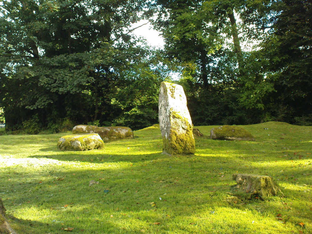
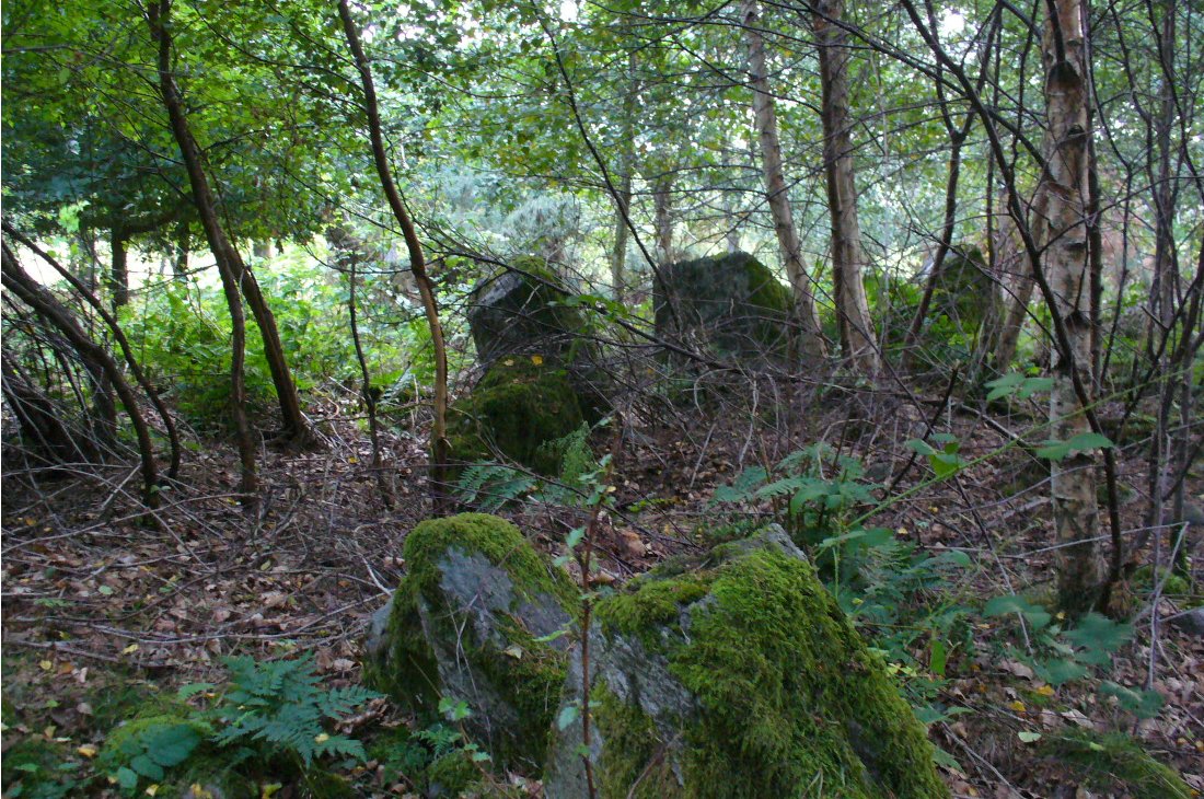
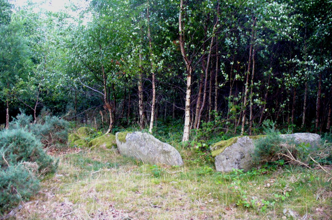
Dunmoid Circle, looking SE
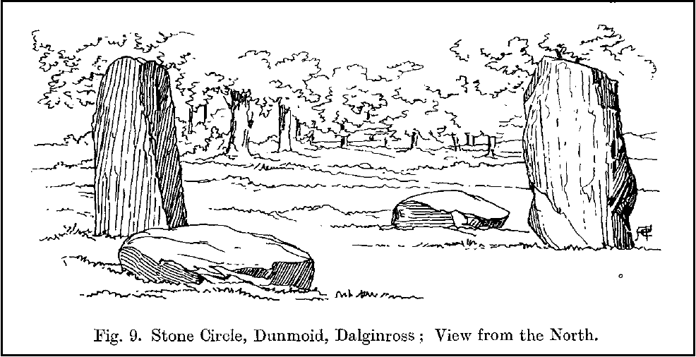
Dunmoid from the North (Coles 1911)

The ‘circle’ is constructed upon a flat rounded section of ground, surrounded by a ditch on two-thirds of its edges, very reminiscent of a typical henge monument—but there is no mention of this in modern surveys.  One of the earliest accounts of Dunmoid was written by John MacPherson (1896) who gave us as much of the known history of the site as is still known by any modern academic.  He wrote:

“At the west side of the new cemetery, close to the public road, there is a curious round knoll, which at one time must have been used as a place for the burial of the dead.  The attention of the writer of this was drawn to it about twenty years ago.  There were three large slabs of stone lying upon the ground, which apparently had been at some former period placed erect by some loving hands to mark the last resting-place of some departed friend or hero.  By the aid of some of the Comrie masons the stones were placed in a standing position.  Curious to know what lay beneath the surface, we dug up the earth in front of the largest slab, and came upon a stone cist placed north and south, 7 inches long, 1 foot 8 inches broad, and 1 foot 3 inches deep.  The only remains discovered was a thigh-bone, but whether it at one time formed a part of the leg of a Celt, a Roman, or a Saxon we could not tell. An old man who then lived in the village of Comrie told us that in his young days the same mound was dug up, when an urn filled with ashes was discovered.  This, perhaps, would indicate that it formed a place of burial for Romans rather than for Caledonians.  The spot is called Dunmoid, or ‘hill of judgment.'”
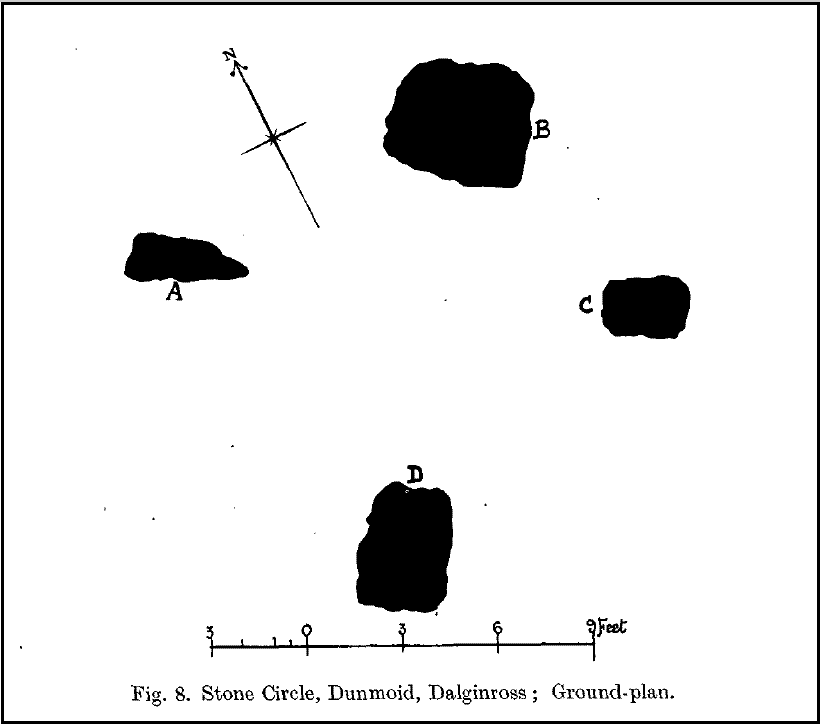
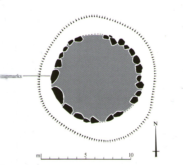
Fred Coles 1991 plan
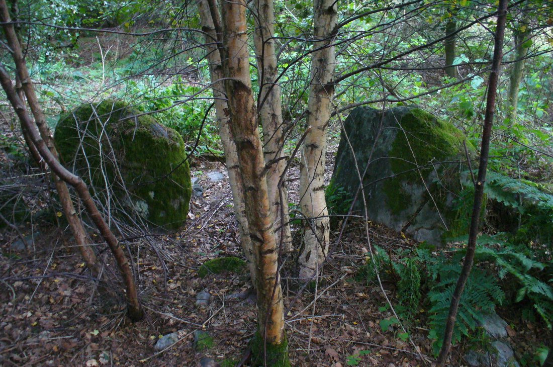
Dunmoid from SE (Coles 1911)

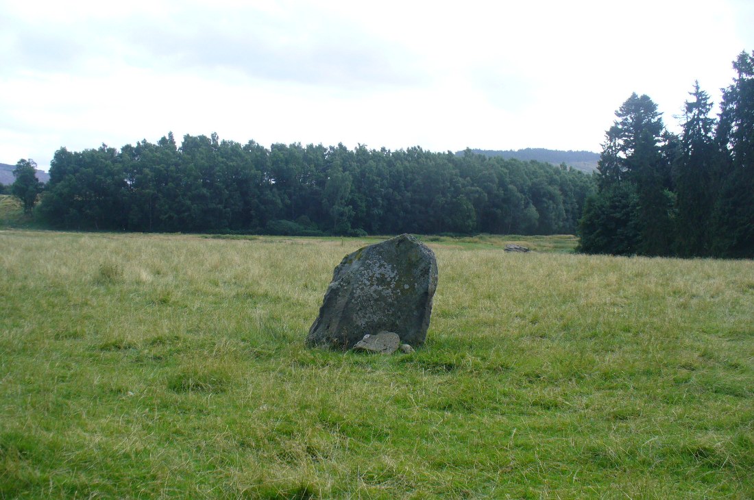
The circle gained the attention of the prolific Fred Coles (1911) in his Perthshire surveys, whose drawings and measurements are still repeated in the modern textbooks more than a century later.  When he visited the site, two of the stones were still upright, but today only one still stands.  In Aubrey Burl’s (1988) survey on ‘four-poster’ stone circles, he reiterated Coles’ words, telling:

“Originally four stone stood at the corners of a rectangle on a mound some 75ft (23m) across and 2ft (60cm) high.  Coles’ plan showed the NW stone standing 5ft 4ins (1.6m) high and the SE, opposite, 5ft 2ins (1.6m), with the thick NW stone prostrate, 4ft 6ins (1.4m) long, with the more slender SW pillar also supine and 4ft (1.2m) long.  The longer SE and NW sides of the oblong were roughly 9ft 6ins (2.9m) long and the others 9ft (2.7m) in length.  The circle on which the stones had been placed had a diameter 13ft 2ins (4m), of which the Megalithic Yard is not an integer.”

The circle is included in Andrew Finlayson’s (2010) modern survey of the region.

References:

  1. Burl, Aubrey, Four Posters: Bronze Age Stone Circles of Western Europe, BAR 195: Oxford 1988.
  2. Finlayson, Andrew, The Stones of Strathearn, One Tree Island: Comrie 2010.
  3. Hunter, John (Ed.), Chronicles of Strathearn, David Philips: Crieff 1896.
  4. Hutchison, A.F., “The Standing Stones of Stirling District,” in The Stirling Antiquary, volume 1, 1893.
  5. MacPherson, John, “At the Head of Strathearn,” in Chronicles of Strathearn, Crieff 1896.

© Paul Bennett, The Northern Antiquarian

Tulloch, Doune, Perthshire

Tumulus:  OS Grid Reference – NN 71782 01194

Also Known as:

  1. Canmore ID 24771

Getting Here

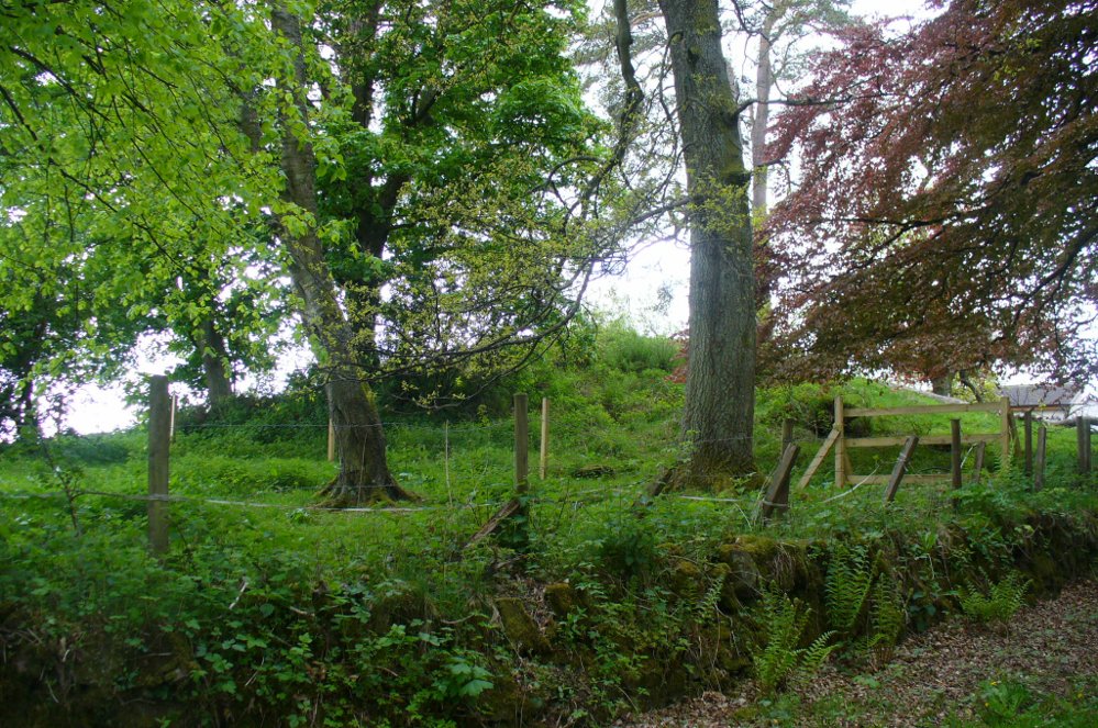
Tulloch Knowe from the road

Head out of Doune village and take the A84 to Stirling. Just a few hundred yards along, over the old river bridge, take the first right along the B8032 (don’t head into Deanston).  Barely 500 yards along on the left-hand side, between the farmhouse and a small group of houses, note the large tree-lined mound in the middle, just over the fence.  It’s quite a big fella – you can’t really miss it.

Archaeology & History

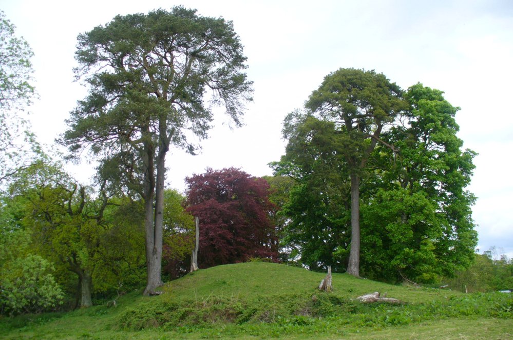
The mound and its trees

This is an almost archetypal fairy mound of a monument—and a mighty one at that!—living quietly in the field with its olde trees for company.  Despite its size, it has brought little by way of archaeological attention and has, to my knowledge, never been excavated.  Probably a Bronze Age burial mound, the tomb stands more than 15 feet high and is some 30 yards across east-west and 35 yards north-south.  The Royal Commission (1979) listing of the mound says simply that “this large cairn measures 34m in diameter and up to 5m high.”

References:

  1. Royal Commission on the Ancient & Historical Monuments of Scotland, Archaeological Sites and Monuments of Stirling District, Central Region, Society of Antiquaries of Scotland 1979.

© Paul Bennett, The Northern Antiquarian

Dargill, Crieff, Perthshire

Standing Stone:  OS Grid Reference – NN 85918 20054

Also Known as:

  1. Canmore ID 25443

Getting Here

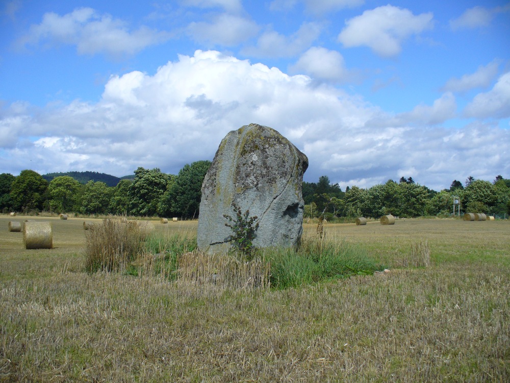
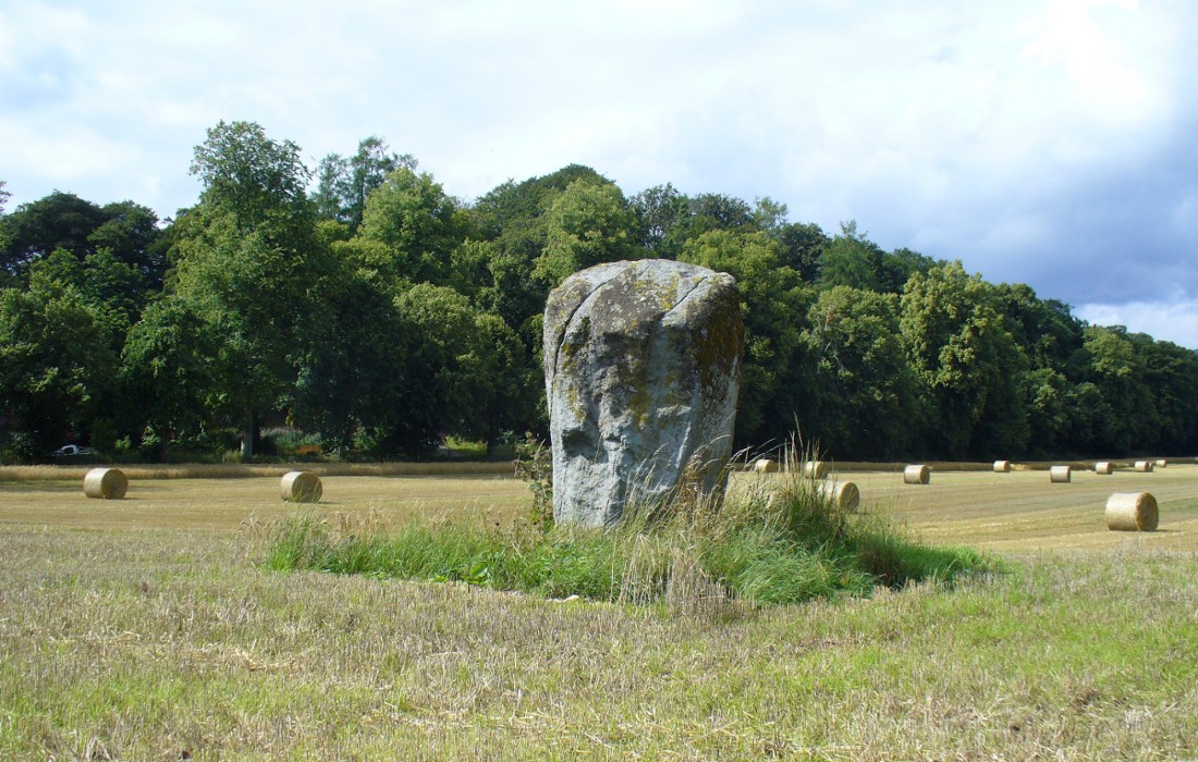
Dargill Standing Stone

Take the A822 straight road south out of Crieff and as you pass the garden centre on your right and the fields and trees begin either side of the road, you need to watch out in the field on your left-hand side.  Just a couple of hundred yards after passing beyond the garden centre, stop.  Look in the field there and you’ll see the object in question. You can’t really miss him!

Archaeology & History

As you approach or leave Crieff along the A822 you can easily pass this stone by. Which would be a pity, as it’s quite a giant standing alone just above the slight ridge in the field.  And in times gone by, not only were there other standing stones here as companions, but a cluster of other prehistoric pits, enclosures and linear markings were all around this very spot.  Some of them are visible as faint crop-marks even today, but they remain unexcavated and we are left (presently) in the dark as to their nature.

Dargill stone, looking NW
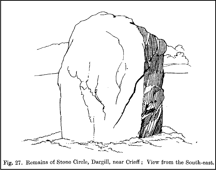
Old drawing by Fred Coles

The standing stone itself is a real beauty!  A huge fat fella, standing nearly eight feet tall, looking proudly across the field in all directions and gazing into the northern hills, where the wanderer’s eye naturally falls… In earlier years, the great megalithic explorer Fred Coles told of two other stones standing hereby—although they are not noted on the earliest OS-map of the area.  Nevertheless he wrote the following:

“This place-name deserves brief notice.  It is pronounced by persons in the locality as if it were spelt like the Irish name Dargle, having the stress on the first syllable.  The site is in a field between the main road from Crieff to Auchterarder and Dargill Island on the river Earn, at the height of 121 feet above sea-level…  There is here an indistinct mound, not now easily traceable, nor of any considerable height; but it is significant to have to report that up to 1909, when a new tenant entered the farm, two other great Stones were standing.  These were removed by the newcomer, much to the surprise and indignation (I was told) of the neighbours.  The remaining monolith is an unusually square and massive oblong block of schist, girthing over 16 feet, and standing clear of the ground 7 feet 8 inches in height.  Its eastern edge is rough and riven into long vertical hollows; but the other sides are, on the whole, smooth.  I append a view from the south-east.”

More recently the Dargill stone was described in Andy Finlayson’s (2010) excellent photo-history guide to the megaliths of the region.

Folklore

In recent years this great stone has received the attention of local ley hunter David Cowan, who dowsed here and found ‘earth energies.’ These are in fact water-lines: the primary dowsing response and not related to leys.

References:

  1. Coles, F.R., “Report on stone circles in Perthshire principally Strathearn,” in Proceedings of the Society of Antiquaries, Scotland, volume 45, 1911.
  2. Cowan, David, Ley Lines and Earth Energies, Adventures Unlimited 2003.
  3. Finlayson, Andrew, The Stones of Strathearn, One Tree Island: Comrie 2010.

© Paul Bennett, The Northern Antiquarian 

Hill of Ballunie, Kettins, Perthshire

Stone Circle (destroyed):  OS Grid Reference – NO 265 389

Also Known as:

  1. Canmore ID 30549

Archaeology & History

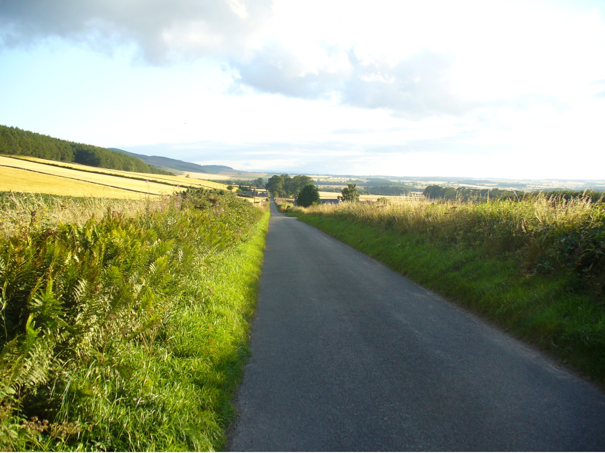
Looking dead straight from the Hill of Ballunie to Leys.

There seems to be nothing left of the stone circle described in Andrew Jervise’s (1879) immense work which, sadly, only described this stone circle in passing.  He told us simply that hereby, “are also the remains of stone circles upon the hill of Ballunie,” which is just a few hundred yards along the road from the magnificent Keillor Pictish symbol stone.  When we visited the place not long ago, no trace of any stones were visible hereby. The site is not listed in Burl’s (2000) magnum opus.

However, ley-hunters will love this place.  Not only was this lost circle located at the edge of a dead straight road, running from the Keillor standing stone a short distant east, but as it runs downhill it reaches, a couple of miles below, the hamlet called Leys.

References:

  1. Jervise, Andrew, Epitaphs and Inscriptions from Burial Grounds and Old Buildings in the North-East of Scotland – volume 2, Edmonston & Douglas: Edinburgh 1875.

© Paul Bennett, The Northern Antiquarian

Ninewells, Caputh, Perthshire

Ring Cairn:  OS Grid Reference – NO 0757 4360

Also Known as:

  1. Canmore ID 27115
  2. Nine Wells

Getting Here

Outer edge of the overgrown Ninewells circle

From Dunkeld, head out for a mile or so on the long and winding A923 road, taking your first road right along the Craigie and Caputh road, south of the Loch of Lowes.  Go along here for about 2 miles, watching out for the little road to Black Hill on your left, where you can park up (if you hit a road junction, you’ve gone too far). Across the road, note the copse of trees.  Go in there along the walling for about 50-70 yards, past the curious gathering of rounded stones, then walk into the trees where the giant fir trees stand. You’re damn close!

Archaeology & History

This is an excellent site, hiding away in a scattered copse of woodland, with young trees inside and very old ones in close proximity to its outer edge.  We visited the place for the first time in the middle of summer, not knowing anything about it, and found Nature had covered much of the place in Her usual clothes of fern, bramble, gorse and other vegetation.  Yet despite this, the site was superb!  In a very good state of preservation this ring of small stones is more than 30 feet across, though the stones making up the ring are only small.  Within the ring itself you’ll find many young birch trees growing over a mass of small rounded rocks, typical of cairn material such as found at other prehistoric sites of this nature up and down our northern counties, from the overgrown Roms Law, to Temple Wood and many others.  No evidence of internal burial or cist of any form was noted on our visit, nor mentioned in the Canmore survey.

Section of the Ninewells ring
Plan of the Ninewells ring (after RCAHMS)

Although rightly classed as a cairn circle or ring-cairn, I’ve seen sites like this labelled as ‘stone circles’ in the past — and it’s easy to see why once you’re inside this!  If the internal scatter of cairn-material had been cleared in earlier centuries—as with many others—this site would be classed as a typical stone circle.  Curiously it hasn’t fared too well in archaeological surveys, but thankfully the Scottish Royal Commission (1994) lads included the site in theirs, telling us,

“This cairn measures 10m in diameter and 0.75m in height and has a near-complete kerb of large contiguous boulders and slabs set on edge.  The kerb is graded so that the largest, though not the tallest stones are situated in the southwestern quadrant, and one of the stones on the west bears four cupmarks.  Today the cairn material is roughly level with the top of the kerbstones, but there is no evidence to suggest that it has been heavily robbed and it was probably never much higher.  Concentric with the kerb there is an external platform about 0.2m high.  This type of feature is more usually associated with Clava ring-cairns and passage graves around Inverness, which are believed to be of late Neolithic date; but, despite the disturbance of the centre of the Ninewells cairn, there is no evidence of stones defining an internal court.”

Two of the largest stones

Some broken quartz stones were also found inside this ring.  The cup-marked stone on the west side of the circle has an entry of its own.  Whether or not the ‘opening’ or lack of stones in the north of the ring was intentional can only be known with certainty if an excavation happens here; suffice to say that North is the airt or direction most commonly representative of the Land of the Dead in many early northern cultures, which may explain this. A truly fascinating site…

The name ‘Ninewells’ derives from a cluster of healing springs of water that once flowed nearby.  Several legendary waters with this name can be found in this part of southern Perthshire.

References:

  1. Royal Commission on the Ancient & Historical Monuments of Scotland, South-East Perth: An Archaeological Landscape, HMSO: Edinburgh 1994.

© Paul Bennett, The Northern Antiquarian

Buttergask, Kirkton of Collace, Perthshire

Souterrain:  OS Grid Reference – NO 210 340

Archaeology & History

In seeking out some of the monuments in the area north of Collace village, we enquired upon one of the landowners for anything they might know of the sites we were looking at.  Whereupon (as happens occasionally), the gent concerned—a local man—after ascertaining that we weren’t from the National Trust or a similar group, informed us that many years ago he was ploughing the field over where a small subsidence had been, when his tractor fell into a large hole that appeared in the ground due to the weight of his vehicle!  It was a souterrain, he told us; but once he managed to retrieve his tractor from the hole in the ground by calling upon one of his neighbours, he completely covered it and filled it in again.

Despite him telling us to keep it to ourselves, it does appear that aerial photography from the 1990s seems to have uncovered the location of the site.  Indeed, by the look of things, there may be more than one!

© Paul BennettThe Northern Antiquarian

Dunkeld Park, Dunkeld, Perthshire

Standing Stone:  OS Grid Reference – NO 01426 42994

Also Known as:

  1. Canmore ID 27205
  2. Dunkeld House
  3. Pulney Lodge

Getting Here

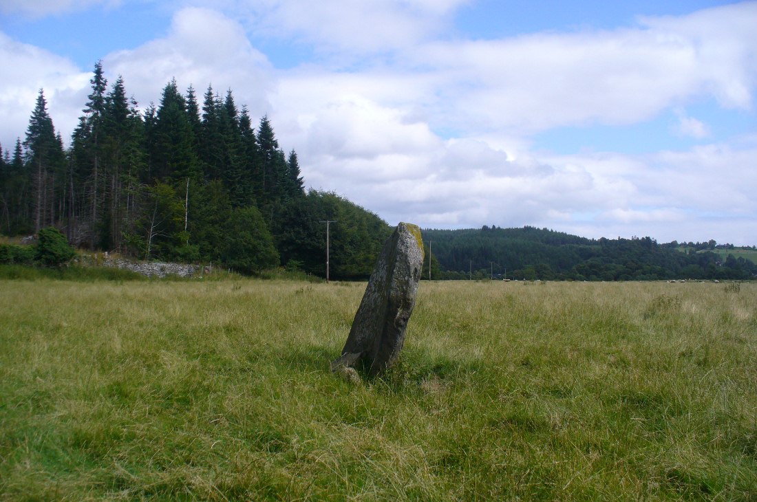
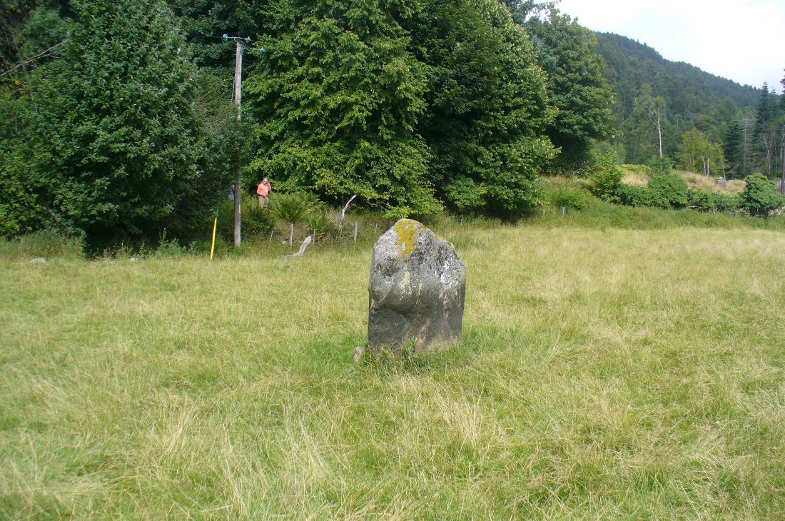
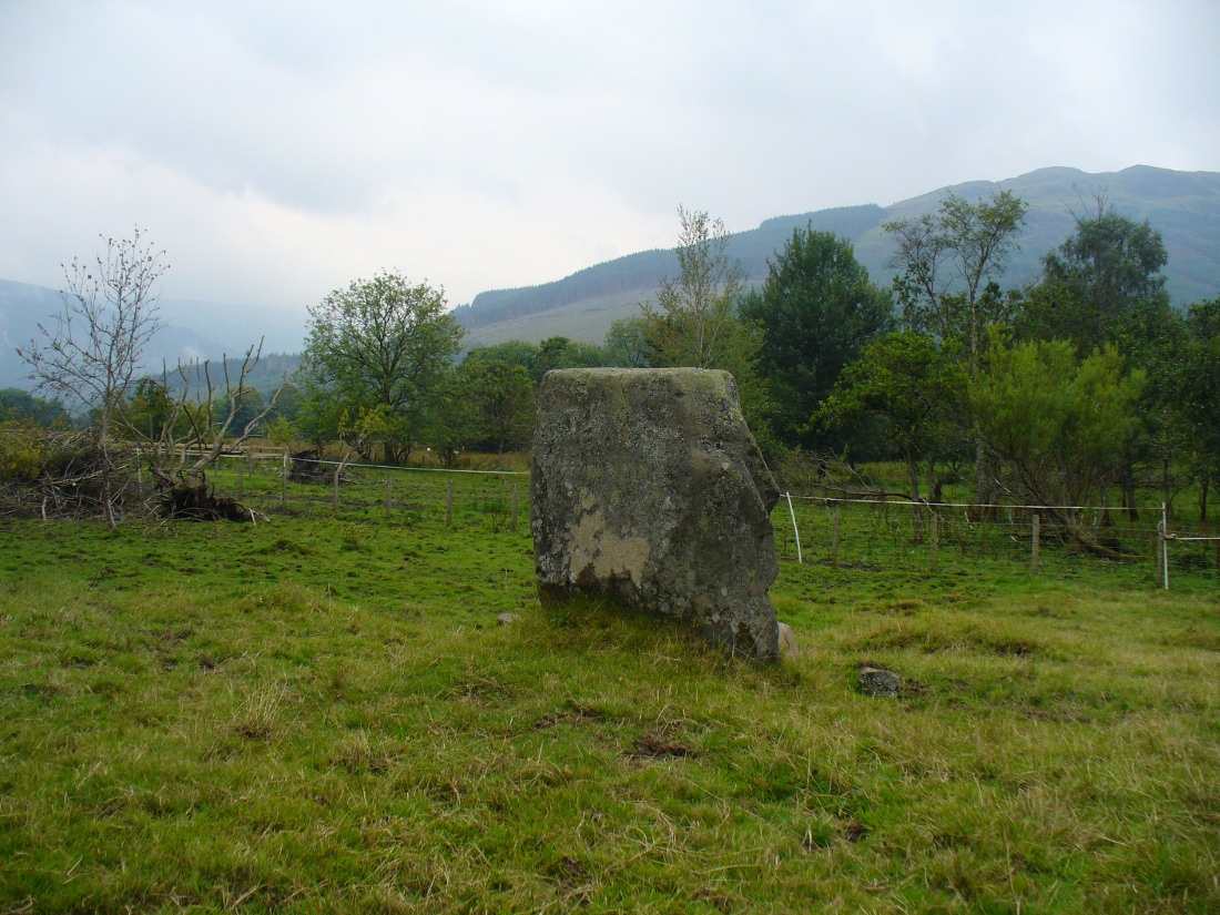
Dunkeld Park monolith

Take the A923 road through Dunkeld and across the river, making sure that where the road veers sharply to the right as you go out of town, you go the left as the road bends round.  100 yards along, past the trees on your left, fields open up. A few hundred yards along on the left, you’ll note the small standing stone about 50 yards in the field below the wall, getting close to some trees again. That’s the spot!

Archaeology & History

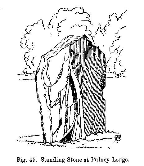
The stone is given only a passing mention in the Royal Commission’s (1994) poor work on the region, describing neither its height nor form and erroneously relating it to what is probably a much earlier series of pit alignments in the same field.  Thankfully we had a better description from the early 20th century antiquarian Fred Cole (1908) who visited and drew the site and who told us:

Standing stone, looking NE
Dunkeld Stone looking north

“This Stone is marked on the Ordnance Map in a field behind the Lodge, at a height above sea-level of 300 feet, and styled “sepulchral.”  In size and character it much resembles the Kilmoraich monolith, and seems to have stood solitary for ages.  It is a roughly oblong slab of schist, set with its longer axis nearly east and west, the north face measuring 4 feet and the south 4 feet 9 inches, and the basal girth about 10 feet 7 inches.  It is 4 feet 9 inches in height.  The grandly-timbered policies of the ducal estate enclose this site on all sides.  In the illustration…the Stone is drawn as seen from the east.”

Close to the walling on the WNW just a few yards away, we see a cluster of small rounded stones and a couple of larger stones, much overgrown, giving the impression that they were field clearance.  There is a possibility that they may have had something to do with the standing stone in earlier times; the small stones being very worn and perhaps being part of a cairn—although there seems little evidence of this in the on-line aerial surveys.  The stone was also mentioned in Elizabeth Stewart’s Dunkeld (1926), where she wrote:

“In the park near Polney Loch, one mile from Dunkeld, is a Standing Stone, quite noticeable from the Highland road. This monolith is one of those styled sepulchral, and is a rough oblong slab of schist, its basal girth being 10 feet 7 inches, and its height 4 feet 9 inches. Mr. Coles, who describes this stone in the “Proceedings of the Society of Antiquaries”, supposes it to have been part of a circle. It is not far from the ancient stronghold on King’s Seat.”

References:

  1. Coles, Fred, “Report on Stone Circles Surveyed in Perthshire – Northeastern Section,” in Proceedings of the Society of Antiquaries of Scotland, volume 42, 1908.
  2. Royal Commission on the Ancient & Historical Monuments of Scotland, South-East Perth: An Archaeological Landscape, HMSO: Edinburgh 1994.
  3. Stewart, Elizabeth, Dunkeld: An Ancient City, Munro Press 1926.

© Paul Bennett, The Northern Antiquarian 

Puidrac, Balquhidder, Perthshire

Standing Stone:  OS Grid References – NN 54058 20794

Also Known as:

  1. Canmore ID 24141

Getting Here

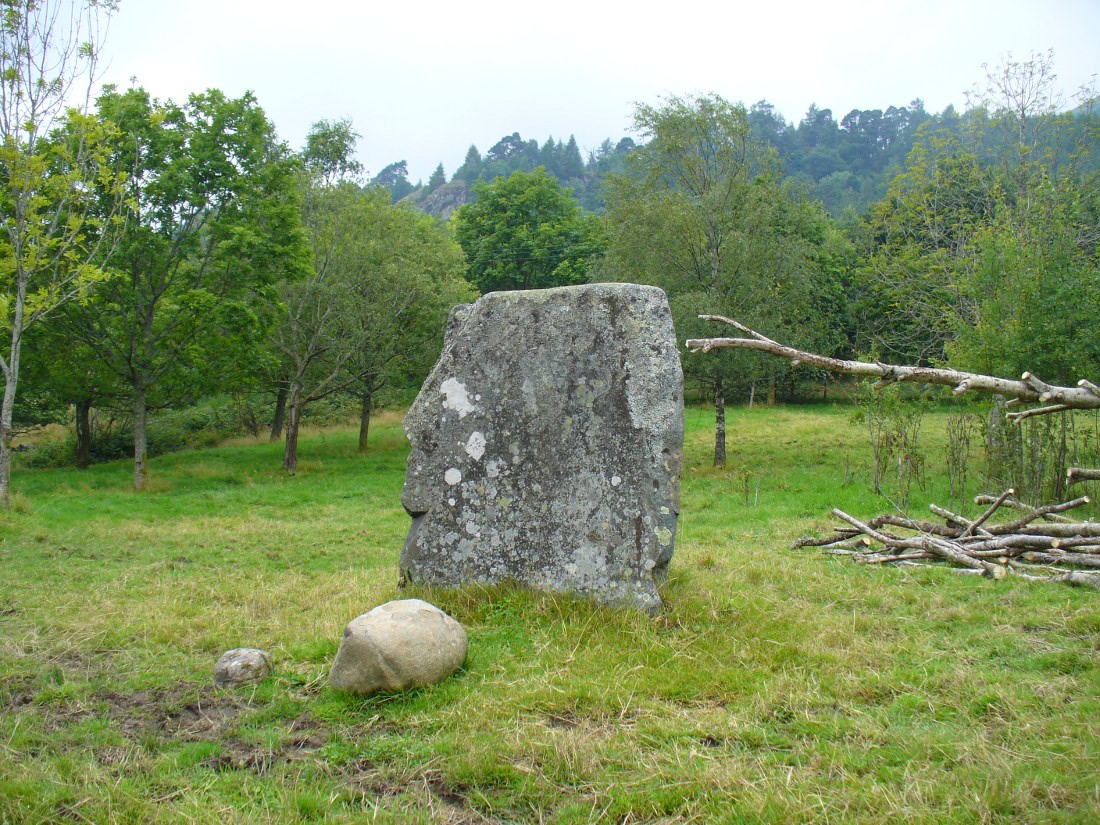
Puidrac Stone, looking SE

From Balquhidder village, take the road east towards Auchtubh as if you’re gonna visit the Priest’s Stone, just past the house of Tom na Cruich on the right-hand side of the road. When you get to the house, if you ask the owners there how best to get to the stone, they are very friendly and very helpful in pointing you in the right direction.

Archaeology & History

This solitary standing stone first seems to be mentioned in J.W. Gow’s (1887) essay on the prehistoric antiquities of this part of Rob Roy’s country.  Found below the house and hillock where the old gallows used to be, he told:

“On the level ground below (Tom na Croich) …there is a prominent monolith, standing about 4½ feet above ground, quite flat, on the top. It is shaped like a wedge, with the edge to the east, and is famous in Balquhidder as the place where trials of strength took place.”

Note the stones in the next field
Note the stones in next field
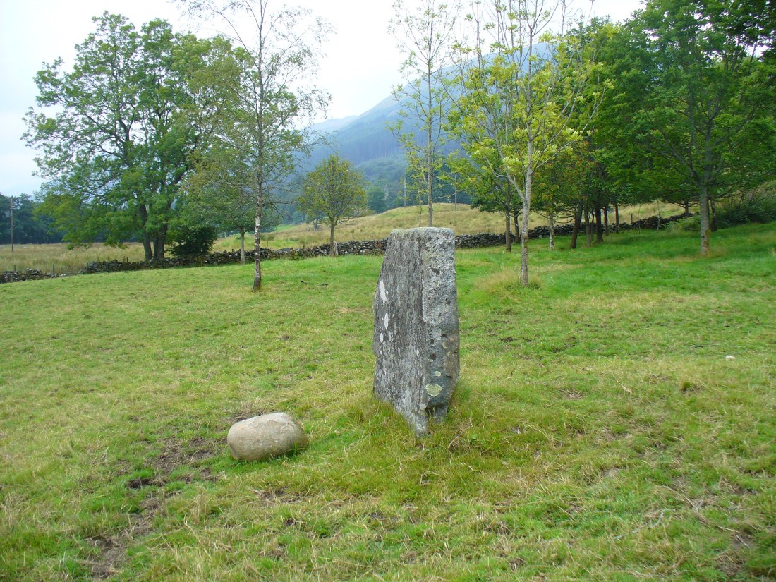
Puidrac Stone, looking north
Puidrac Stone, looking N

Below the standing stone is a small rock, whose predecessor played an important part in some local traditions relating to this site. (see ‘Folklore’ below)  Also, due west of here in the next field, you will be able to see a couple of seemingly upright stones in the tall reeds 200 yards away, which early records say were part of a stone circle—now much in ruin—known as Clachan Aoraidh or the Worshipping Stones.  There is the possibility that this single stone was an outlier to the circle.  It’s astronomy might be worth checking….

Folklore

When we visited the stone last week, the owners of the house above asked if we’d managed “to lift the stone”—and I wondered what they meant at first, until they told us the folklore about the site.  They narrated the tale almost exactly as it had been described first of all in J.W. Gow’s (1887) essay, which said the following:

A new ‘lifting stone’ in front of Puidrac

“It is shaped like a wedge, with the edge to the east, and is famous in Balquhidder as the place where trials of strength took place.  A large round water-worn boulder, named after the district, ‘Puderag’, and weighing between two and three hundredweight, was the testing stone, which had to be lifted and placed on the top of the standing stone. There used to be a step about 18 inches from the top, on the east side of the stone, on which the lifting stone rested in its progress to the top. This step or ledge was broken off about thirty years ago, as told to me by the person who actually did it, and the breadth of the stone was thereby reduced about 8 inches. This particular mode of developing and testing the strength of the young men of the district has now fallen into disuse, and the lifting-stone game is a thing of the past.  A former minister of the parish pronounced it a dangerous pastime.  Many persons were permanently injured by their efforts to raise the stone, and it is said that he caused it to be thrown into the river, but others said it was built into the manse dyke, where it still remains.  There were similar stones at Monachyle, at Strathyre, and at Callander, and no doubt in every district round about, but the man who could lift ‘Puderag’ was a strong man and a champion.”

The present stone that is positioned on the ground below the standing stone was put here in much more recent times.

References:

  1. Gow, James M., “Notes in Balquhidder: Saint Angus, Curing Wells, Cup-Marked Stones, etc”, in Proceedings of the Society of Antiquaries Scotland, volume 21, 1887.

AcknowledgementsTo Kenny and Laura for their help and guidance here. Huge thanks!

© Paul Bennett, The Northern Antiquarian

Wester Auchleskine, Balquhidder, Perthshire

Cup-Marked Stone:  OS Grid Reference – NN 54584 20876

Also Known as:

  1. Canmore ID 24154

Getting Here

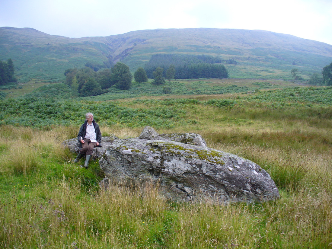
Wester Auchleskine cup-marked stone

From Balquhidder village, walk eastwards along the road for a few hundred yards until you reach Auchleskine Farm on your left.  A short distance past here there’s a gate taking you into the rough field on the left. Go through here and note a large clump of rocks diagonally up the slope about 100 yards away.  That’s your spot!

Archaeology & History

Very little has been said of this large cup-marked stone, just up from the road near Balquhidder.  It was first found and described in J.M. Gow’s (1887) fine essay on the local antiquities of the area, where he told:

“About 400 yards directly east from the farm-house there is a group of three large water-worn boulders of coarse mica-schist, with veins of quartz, the largest of which is about 15 feet long, 7 feet broad, and nearly 5 feet above ground. On the top of this stone there are seven cup-marks of various sizes. The largest are 5 inches in diameter and 2 inches deep; the smaller ones are shallower and from 1½ to 2½ inches in diameter. There may have been more marks on this stone, as a portion of the top near the marks has been broken off, and there are several other faint hollows, but, in my opinion, not sufficiently pronounced to indicate that they ever were cups.”

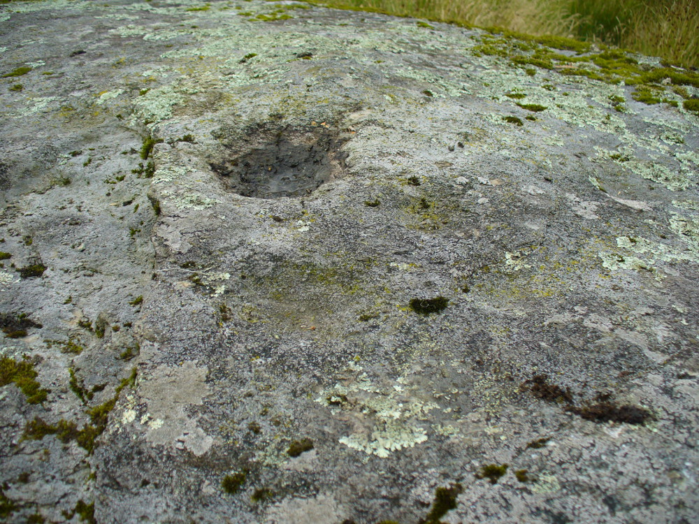
Cupmarks on top of the rock
The carving from above

Although his caution on the number of cups on the stone is to be commended, it was obvious during our visit to the site a few days ago that there are at least 18 cup-marks on the surface of this large rock.  There may be more (the grey cloudy day and misty light wasn’t good in allowing us to see the carving clearly). The most pronounced of the cups are on the very top of the stone, whilst others were carved mainly on the eastern slope of the rock.

At least two other cup-marked stones occur at the farmhouse itself, whilst on the road immediately below was once the cup-marked healing stone known as Clach nan Sul. It’s likely that other carvings are hiding away in the hills hereby…

References:

  1. Gow, James M., “Notes in Balquhidder: Saint Angus, Curing Wells, Cup-Marked Stones, etc”, in Proceedings of the Society of Antiquaries Scotland, volume 21, 1887.

© Paul BennettThe Northern Antiquarian 

Clach nan Sul, Balquhidder, Perthshire

Cup-Marked Stone (destroyed):  OS Grid Reference – NN 5456 2084

Also Known as:

  1. Canmore ID 24150
  2. Stone of the Eyes

Archaeology & History

Looking down Balquhidder Glen from the Clach nan Sul's old home
Looking down Balquhidder Glen from Clach nan Sul’s old home

Apparently destroyed, although some remains of the stone were said to be seen in the walling by the roadside; but when visiting this spot a few days ago the summer vegetation had completely covered any potential finds here.  The stone fell foul of the usual self-righteous industrialists when the track alongside which it had sat for countless centuries was turned into a road and the stone was “blasted”.  It was found some 20 yards below the large cup-marked stone known as Wester Auchleskine, seen amidst the clump of rocks in the field above.

The stone was described in MacKinlay’s (1893) fine survey on Scottish holy wells due to the healing properties of the waters that collected into the rock basin here.  The earliest record of the site that I’ve found comes from the hallowed papers of the Scottish Society of Antiquaries, where—in J.M. Gow’s (1887) rambles just east of Balquidder—he told us the following:

“Going still further east to the first turning of the road beyond the farmhouse of Wester Auchleskine, and on the left-hand side, there used to be a large boulder with a natural cavity in its side, famous as a curing well for sore eyes.  This stone was called “Clach nan sul” (the Stone of the Eyes).  In 1878 the road trustees caused it to be blasted, as it was supposed to be a danger in the dark to passing vehicles.  Its fragments were broken up, and used as road metal.”

Whether or not the site known as the Priest’s Basin, or Basan an Sagairt—a couple of hundred yards west by the roadside—was of a similar nature, or an attempt by christians to draw people away from the old healing Clach nan Sul and use this other one instead, we do not know.  There are numerous accounts of other stones in this mountainous region of Scotland where rocks-with-hollows filled with water were attributed with healing properties, like the Whooping Cough Stone at Struan, the Measles Stone at Fearnan, and many others.

Folklore

The folklore described by Mr Gow was reiterated in MacKinlay’s (1893) survey. He also told how,

“The hollow in the Clach-nan-Sul at Balquhidder…contained small coins placed there by those who sought a cure for their sore eyes. Mr J. Macintosh Gow was told by some one in the district that ‘people, when going to church, having forgotten their small change, used in passing to put their hands in the well and find a coin.’  Mr Gow’s informant mentioned that he had done so himself.”

References:

  1. Gow, James M., “Notes in Balquhidder: Saint Angus, Curing Wells, Cup-Marked Stones, etc”, in Proceedings of the Society of Antiquaries Scotland, volume 21, 1887.
  2. MacKinlay, James M., Folklore of Scottish Lochs and Springs, William Hodge: Glasgow 1893.

© Paul Bennett, The Northern Antiquarian