Healing Well (lost): OS Grid Reference – TQ 315 817
Also Known as:
Fagge’s Well
Archaeology & History
First described in local church records from around 1190 AD (Webb 1921) as Fageswelle; then again a few years later in early crime records of the region (Hardy & Page, 1892) as Fackeswell, there were a number of other references to this lost water source, which could once be found near the Skinners Well and the more famous Clerks Well, Finsbury. Gover, Mawer & Stenton (1942) believed the site owed its title to some long-forgotten local name, though could give no specifics. (i.e., they didn’t know!) The old dialect word ‘fag’, relating to old grass is as good a meaning as any!
The site was described by John Stow in his Survey of London, 1603, saying it was “near unto Smithfield by Charterhouse, lately dammed up.” In Mr Foord’s (1910) excellent work on the subject, he told that,
“In 1197 certain lands are described as lying between the garden of the Hospitallers and Smithfield Bar, “super rivulum de Fackeswell,” and other lands as between that brook and ‘Chikennelane’… This fixes the position of Faggeswell Brook as approximately at the boundary of the City.”
Further information about this site would be much appreciated. The grid-reference for this site is an approximation.
References:
Foord, Alfred Stanley, Springs, Streams and Spas of London: History and Association, T. Fisher Unwin: London 1910.
Gover, J.E.B., Mawer, Allen & Stenton, F.M., The Place-Names of Middlesex, Cambridge University Press 1942.
Hardy, W.J. & Page, W. (eds), A Calendar of Feet of Fines for London and Middlesex, 1197-1569 – volume 1, Hardy & Page: London 1892.
Sunderland, Septimus, Old London Spas, Baths and Wells, John Bale: London 1915.
Webb, E.A. (ed.), The Records of St. Bartholomew’s Priory, and of the Church and Parish of St. Bartholomew the Great, West Smithfield – volume 1, Humphrey Milford: Oxford 1921.
Healing Well (lost): OS Grid Reference – TQ 313 822
Archaeology & History
Like oh so many of the healthy old springs and streams in that dreadful metropolis, the blood and natural health of Skinner’s Well was killed long ago by the self-righteous arrogance of Industrialists. Even its precise whereabouts seems to have been forgotten… So we thank the written words of antiquarians to keep its memory alive.
Mentioned as far back as 1197 AD in early fine records of the region (Hardy & Page, 1892) as Skinnereswell — and thereafter in various local history records from 1200, 1244, 1385 and constantly from thereon — the place-name authorities Gover, Mawer & Stenton (1942) told that the prefix ‘skinner’, “clearly derive from personal names,” from “the occupational name skinner, of Scandinavian origin.” But this isn’t to everyone’s etymological fancy! When A.S. Foord (1910) sought for information on this healing spring, he found the same 1197 account, in which
“Skinners’ Well is there described as lying in the valley between the Nun’s Priory and the Holeburn, in which was a large fish-pond… Strype, in his continuation of Stow’s Survey (1720) say, ‘Skinners’ Well is almost quite lost, and so it was in Stow’s time. But I am certainly informed by a knowing parishioner that it lies to the west of the church (of St. James, Clerkenwell), enclosed within certain houses there.’ The parish would fain recover the well again, but cannot tell where the pipes lie. But Dr Rogers, who formerly lived in an house there, showed Mr Edmund Howard…marks in a wall in the close where, as he affirmed, the pipes lay, that it might be known after his death.”
Mr Sunderland (1915) thought Skinners Well a probable holy well, “because Mystery Plays were were performed yearly around it by the Skinners of London.” Citing as evidence the earlier words of John Stow in his Survey of London, 1603, which he narrated:
“In the year 1390…I read, the parish clerks of London, on the 18th July, played interludes at Skinners Well, near unto Clerkes’ Well, which play continued for three days together; the king, queen and nobles being present. Also in the year 1409…they played a play at the Skinners Well, which lasted eight days, and was of matter from the creation of the world. There were to see the same the most part of the nobles and gentles in England, etc.”
Whether this “matter from the creation of the world” was a tale of a Biblical nature, or more related to indigenous creation myths of the waters and lands around Skinners Well, we have no way of knowing.
References:
Foord, Alfred Stanley, Springs, Streams and Spas of London: History and Association, T. Fisher Unwin: London 1910.
Gover, J.E.B., Mawer, Allen & Stenton, F.M., The Place-Names of Middlesex, Cambridge University Press 1942.
Hardy, W.J. & Page, W. (eds), A Calendar of Feet of Fines for London and Middlesex, 1197-1569 – volume 1, Hardy & Page: London 1892.
MacLagan, David, Creation Myths, Thames & Hudson: London 1977.
Sunderland, Septimus, Old London Spas, Baths and Wells, John Bale: London 1915.
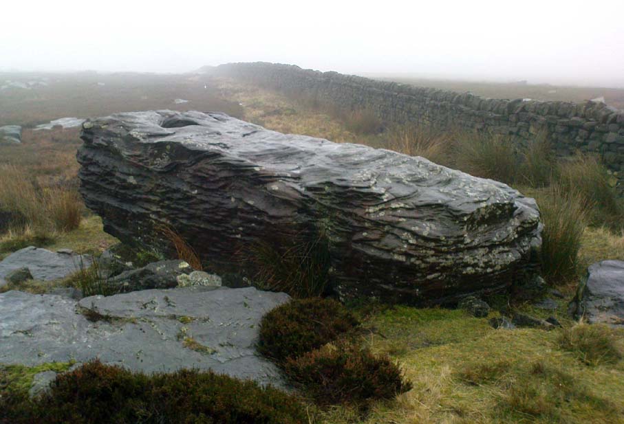
There are two large boulders here, one of which was deemed the Ashlar many moons back. You can approach it from the lazy way: park y’ car at the top of the road by the Whetstone Gate TV masts and walk east right along the boundary path till you get here. The better way is from Twelve Apostles: from there walk a coupla hundred yards north to the Lanshaw Lad boundary stone, where a small path heads west. Along here for another coupla hundred yards, then hit the footpath south for the roughly the same distance again. You’ve arrived!
Archaeology & History
The Ashlar Chair is ascribed in folklore, said Harry Speight (1892), “to be a relic of druidism,” as one of its titles in ages past was the Druid’s Chair. In the nineteenth century it also became known as the Etching Stone, (Smith 1961-63) but it has retained its present title for more than two hundred years. Shaped more like a couch than a chair, its present title—the Ashlar—is important in ritual Freemasonry, which has two aspects to it: the ‘rough’ and the ‘perfect’. The first represents the neophyte; the latter, the illumined one. Oaths are sworn on the ashlar, and laws are spoken from it. In its higher aspect it is representative of the spiritual maturity of evolved man.
Ashlar Chair on 1851 map
Although there are no public records as to who gave the site its present name, the land which lays before it, The Square, is an even greater indicator that this rock was was considerably more than just a curious place-name, for the open moorland that is overseen from Ashlar Chair—The Square — is 396,000 square yards of flat open heathlands that have never been archaeologically explored. The Square is also one of the most important elements of Freemasonry: representing the manifest universe, its laws are spoken from the Ashlar. (Jones 1950)
Between the two of them, represented here in the landscape near the very tops of these moors, we have a form of late geomancy, although the names of our geomancers are nowhere to be found. It is obvious though, simply from the name of the land, that dramatic ritual of some form was enacted here. In recent times, ritual magickians from differing Orders have found the place most effective, as have wiccan folk and other pagans who have frequented it at the summer solstice. The possibility that some members of the Grand Lodge of ALL England (a legendary Masonic Order, said by the modern London masons not to have existed until the eighteenth century) gave this place its name is not unreasonable. Records show that in the fourteenth century at least one member of the Order, Sir Walter Hawksworth, frequented ritual circles on these moors; and another member of the same Lodge from the nearby Washburn valley was an ally to the Pendle and Washburn witches who, we know, met on these moors at Twelve Apostles stone circle and probably the Ashlar. But it proves nothing I suppose. (I tend to believe (not a necessarily healthy viewpoint) that the Grand Lodge did use the Ashlar as one of their moot points, along with the Pendle and Washburn witches.)
Its primary geomantic attribute is as an omphalos. Geographically the Ashlar Chair is the meeting-point of Bingley, Burley, Morton and Ilkley moors and, metaphorically speaking, when you stand here you are outside the confines of the four worlds yet still a purveyor of them.
Nature’s cups-and-grooves on the Ashlar
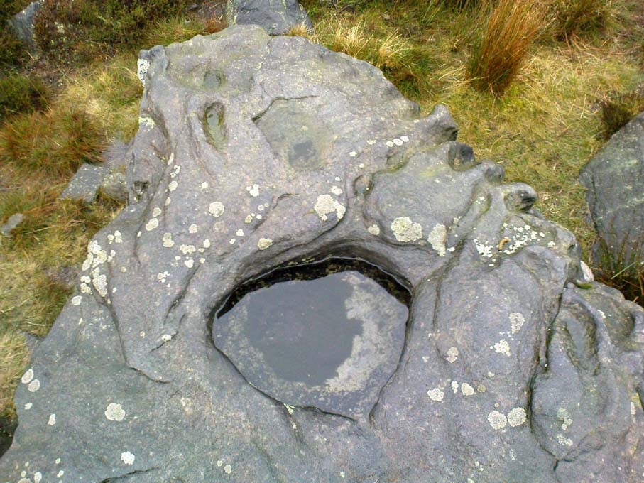
Upon the large rock itself it are carved the faint initials, “MM, BTP, ISP and IG, 1826.” Several early records described cup-and-ring designs on the Ashlar: firstly in Forrest & Grainge’s (1868) archaeological tour; then in Collyer & Turner’s Ilkley (1885); and lastly by the great Yorkshire historian and topographer Harry Speight (1892, 1900), who said “it bears numerous cups and channels.” Although we can see some of these on top of the Ashlar, they are mainly Nature’s handiwork. It is possible that some man-made cup-and-rings once existed on the rock, but if so they have eroded over time.
References:
Bennett, Paul, The Old Stones of Elmet, Capall Bann: Milverton 2001.
Collyer, Robert & Turner, J.H., Ilkley Ancient & Modern, William Walker: Leeds 1885.
Forrest, C. & Grainge, William, A Ramble on Rumbald’s Moor, among the Dwellings, Cairns and Circles of the Ancient Britons in the Summer of 1867 – Part 1, W.T. Lamb: Wakefield 1868.
Jones, Bernard E., Freemason’s Guide and Compendium, Harrap: London 1950.
Speight, Harry, Chronicles & Stories of Old Bingley and District, Elliott Stock: London 1892.
Speight, Harry, Upper Wharfedale, Elliott Stock: London 1900.
On the A65 road from Skipton to Gargrave, just at the eastern end of Gargrave, take the small Eshton Road running north over the canal. Go through Eshton itself, making sure you bear right at the small road a few hundred yards past the old village. Keep your eyes peeled a few hundred yards down as you hit the river bridge and stop here. Just 50 yards before this is a parking spot where some Water Board building stands. Walk back up the road barely 20 yards and you’ll see, right by the roadside, a small clear pool on your left, encircled by trees. Go through the little stile here and you’re right by the water’s side!
Archaeology & History
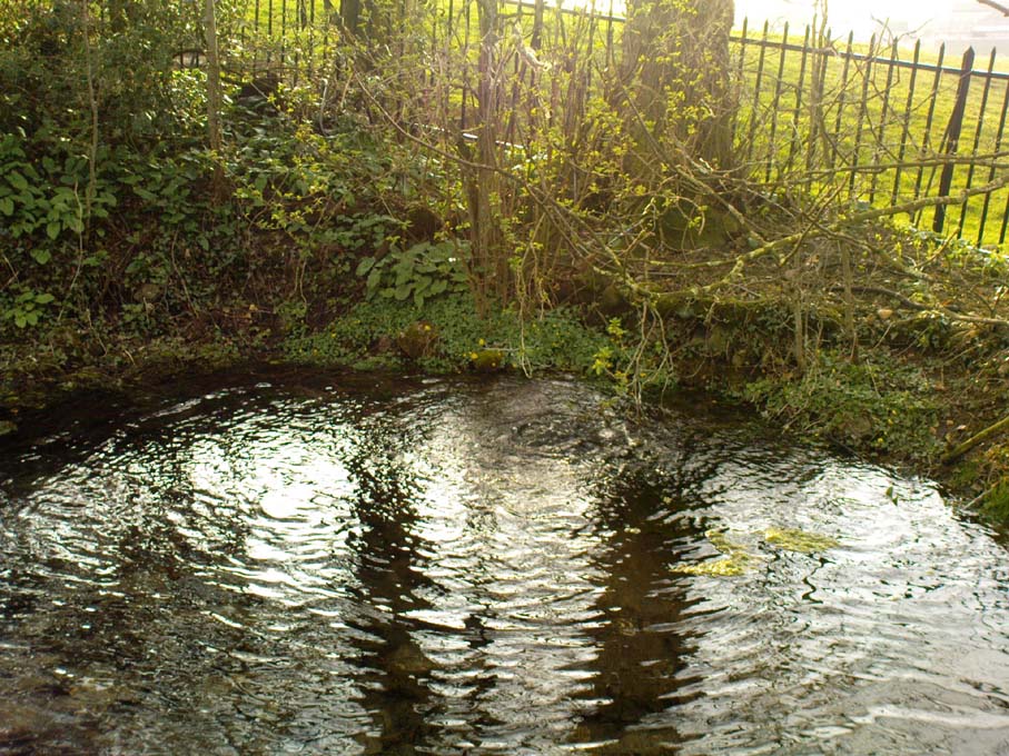
This is actually a listed monument (unusual for wells up North!), just off the roadside between Nappa Bridge and Eshton Hall. Two or three old stone heads (deemed to be ‘Celtic’ in age and origin, though I had my doubts) have recently been stolen from this holy pool close to where the water emerges from the ground, just beneath the surface. You can see where the water bubbles up strongly from the Earth when you visit here, forming the small pool in front of it, around which at certain times of year people still attach ‘memaws’ (an old word for ritual ‘offerings’) on the small shrubs. If you drink from here, just where the water bubbles up (careful not to fall in!), it’s freezing — but tastes absolutely gorgeous! And better than any tap-water you’ll ever drink!
Mentioned briefly in Mr Hope’s (1893) fine early survey; the earliest description of this site in relation to the mythic ‘Helen’ dates from 1429, where T.D. Whitaker (1878) described the dedication to an adjacent chapel, long gone. Whitaker’s wrote:
“…One of the most copious springs in the kingdom, St. Helen’s Well fills at its source a circular basin twenty feet in circumference, from the whole bottom of which it boils up without any visible augmentation in the wettest seasons, or diminution in the driest. In hot weather the exhalations from its surface are very conspicuous. But the most remarkable circumstance about this spring is that, with no petrifying quality in its own basin, after a course of about two hundred yards over a common pebbly channel, during which it receives no visible accession from any other source, it petrifies strongly where it is precipitated down a steep descent into the brook. To this well anciently belonged a chapel, with the same dedication; for in the year 1429, a commission relating to the manor of Flasby sat “in capella beate Elene de Essheton; and on the opposite side of the road to the spring is a close called the Chapel Field. This was probably not unendowed, for I met with certain lands in Areton, anciently called Seynt Helen Lands.”
When the old countryman Halliwell Sutcliffe (1939) talked of this healing spring, his tone was more in keeping with the ways of local folk. Sutcliffe loved the hills and dales and old places to such an extent that they were a part of his very bones. And this comes through when he mentions this site. Telling where to find the waters, he continued:
“Its sanctuary is guarded by a low mossy wall. Neglected for years out of mind, it retains still clear traces of what it was in older times. An unfailing spring comes softly up among stones carved with heart-whole joy in chiselling. Scattered now, these stones were once in orderly array about what is not a well, in the usual sense, but rather a wide rock-pool, deep here and shallow there, with little trees that murmur in the breeze above. Give yourself to this place, frankly and with the simplicity is asks. It does not preach or scold, or rustle with the threat of unguessed ambushes among the grassy margin. Out of its inmost heart it gives you all it knows of life.”
Old well in the field
In the field across the road where the chapel was said to have been, we find another stone-lined fresh-water well bubbling from the ground into a stone trough (at grid-ref SD 93118 56958). The waters here are also good and refreshing. But whether this fine water source had any tales told of it, or curative properties (it will have done), history has sadly betrayed its voice.
Folklore
The waters here have long been reputed as medicinal. R.C. Hope (1893) said “this well was a certain cure for sore and weak eyes.” Whitaker and others told there to be hangings of rags and other offerings (known in Yorkshire as ‘memaws’). Sutcliffe described,
“The pilgrims coming with their sores, of body and soul… The Well heard tales that were foul with infamies of the world beyond its sanctuary. Men came with blood-guilt on their hands, and in their souls a blackness and a terror. Women knelt here in bleak extremity of shame. The Well heard all, and from its own unsullied depths sent up the waters of great healing. And the little chant of victory began to stir about the pilgrims’ hearts…and afterwards the chant gained in volume. It seemed to them that they were marching side by side with countless, lusty warriors who aforetime had battled for the foothold up the hills. And, after that, a peace unbelievable, and the quiet music of Helen’s Well, as her waters ran to bless the farmward lands below. All this is there for you to understand today, if you will let the Well explain the richness of her heritage, the abiding mystery of her power to solace and to heal.”
And so it is with many old springs… The rite of memaws enacted at St. Helen’s Well is a truly archaic one: whereby a person bringing a cloth or stone or coin — using basic principles of sympathetic magick — asks the spirit of the waters to cleanse them of their illness and pass it to the rags that are tied to the adjacent tree; or perhaps some wish, or desire, or fortune, be given in exchange for a coin or something if personal value. The waters must then be drunk, or immerse yourself into the freezing pool; and if the person leaving such offerings is truly sincere in their requests, the spirit of the water may indeed act for the benefit of those concerned.
Such memaws at St. Helen’s Well are still left by local people and, unfortunately, some of those idiotic plastic pagans, who actually visit here and tie pieces of artificial material to the hawthorn and other trees, which actually pollutes the Earth and kills the spirit here. Whilst the intent may be good, please, if you’re gonna leave offerings here, make sure that the rags you leave are totally biodegradable. The magical effectiveness of your intent is almost worthless if the material left is toxic to the environment and will certainly have a wholly negative effect on the spirit of the placehere. Please consider this to ensure the sacred nature of this site.
…to be continued…
References:
Hope, Robert Charles, Legendary Lore of the Holy Wells of England, Elliott Stock: London 1893.
Smith, A.H., The Place-Names of the West Riding of Yorkshire– volume 6, Cambridge University Press 1961.
Sutcliffe, Halliwell, The Striding Dales, Frederick Warne: London 1939.
Whelan, Edna, The Magic and Mystery of Holy Wells, Capall Bann: Chieveley 2001.
Whelan, Edna & Taylor, Ian, Yorkshire Holy Wells and Sacred Springs, Northern Lights: Dunnington 1989.
Whitaker, T.D., The History and Antiquities of the Deanery of Craven, Joseph Dodgson: Leeds 1878.
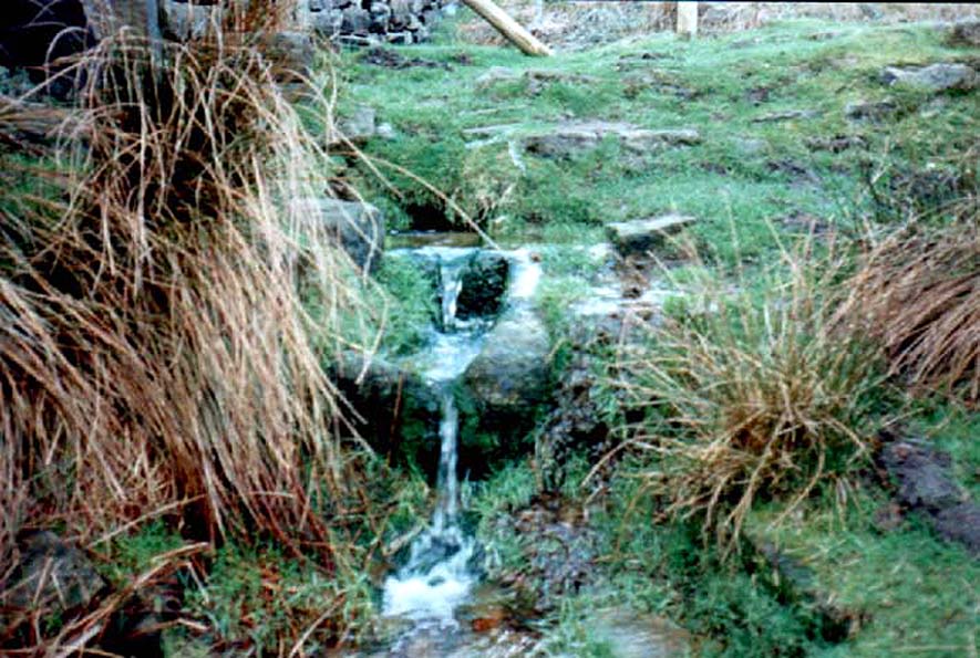
From the famous Dick Hudson’s pub on the south side of Ilkley Moor, take the road right (east) for a half-mile until you reach the large Weecher Reservoir just off the roadside on your right. Less than 300 yards past the reservoir, a footpath takes you onto the moor itself. Walk up the path for about ⅔-mile — crossing one wall, then walking roughly parallel with another on your right — until you reach a crossing of paths where there are 2 gates or stiles. Take the lower of the two stiles, through the wall, but below the fence. You’ll see an awful Yorkshire Water cover, which has just about destroyed the once-fine well that had always flowed here. Below this, by the wallside, are the trickling remains of our old healing spring.
Archaeology & History
When I was a young boy, Horncliffe Well was the site we would visit every weekend as our first stopping-spot on our regular ventures exploring these moorlands — “from Wrose to Rombalds,” as we use to call it! The old well was always very plentiful, strong-flowing, cold and truly refreshing. It was undoubtedly the best water source on the entire Rombalds Moor region, never drying up. Even in the great droughts of 1976 and 1995, after all others had just about failed, the waters at Horncliffe were still flowing as strong as ever, as they had always done. But not anymore…
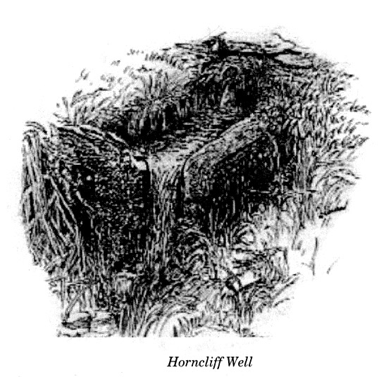
Edna Whelan’s old drawing
First described in land records of 1273 CE, this has always been a well of great repute and oral tradition told that this great old well never ran dry. It marked the ancient boundary point where the moorlands of Hawksworth, Burley and Bingley all meet. By name alone it is associated with the nearby and curious Horncliffe Circle, whose status itself is unclear (the circle seems more a place of refuge or living than a true ritual site).
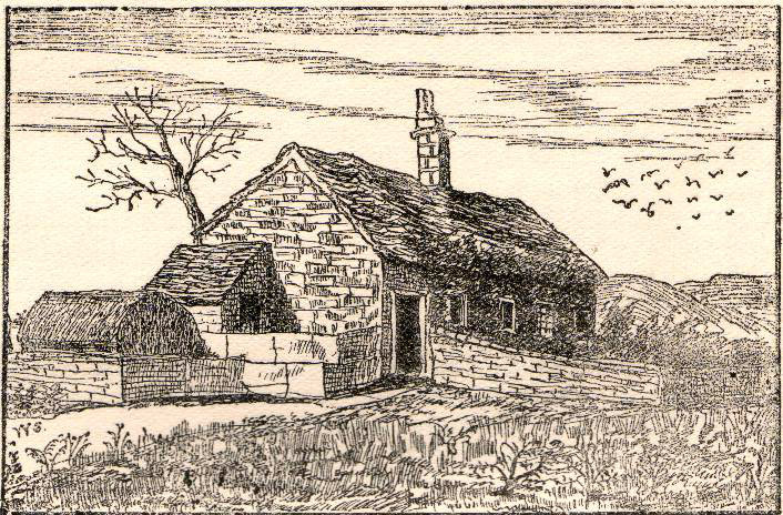
Horncliffe House around 1801
The remains of old buildings on the flat just above where the waters once flowed were built in much more recent centuries. The building appears to have been started around 1799, for E.E. Dodds (1985) told that in 1800 it was used as a school for several years by local teacher Joshua Briggs. J. Horsfall Turner (1907) published a copy of an old drawing of the school, as it was soon after construction.
Horncliffe Well was dug into by the privatized water company known as Yorkshire Water (owned by rich greedy fuckers) in the 1990s, who channelled most of its endless supply away for commercial benefit. When their company was stealing the water from the moors, the workmen snapped an old markstone at its base next to the adjacent Horncliffe House (in ruins). The waters had always flowed fast and freely, but after Yorkshire Water had finished their ‘work’ here, the great majority of Horncliffe’s water supply subsided considerably, leaving walkers, birds and animals to suffer from its demise. In all sincerity, it’s to be hoped that good people someday will visit this once-fine site and return it to its previous healthy status.
Folklore
When we were kids we came here every weekend and got to know the old ranger who we’d meet either here or at the adjacent Horncliffe Circle, 250 yards NNE, where we’d sit and eat. In the mid-1970s, he told us that the old well was once a site where the fairy-folk would play, around Mayday (beltane). And though in later years I’ve sought for any information about this in all early antiquarian books that cover this area, I’ve never found any mention of this tale in print. The old ranger knew the moors and its history better than anyone I’ve ever known and many old stories died with him after his death.
References:
Bennett, Paul, The Old Stones of Elmet, Capall Bann: Chieveley 2003.
Dodd, E.E., Bingley: A Yorkshire Town through Nine Centuries, M.T.D. Rigg: Guiseley 1985.
Laurence, Alastair, A History of Menston and Hawksworth, Smith Settle: Otley 1991.
Turner, J. Horsfall, Idle Upper Chapel Burial Registers and Graveyard Inscriptions, Harrison & Son: Bingley 1907.
Whelan, Edna, The Magic and Mystery of Holy Wells, Capall Bann: Chieveley 2001.
Whelan, Edna & Taylor, Ian, Yorkshire Holy Wells and Sacred Springs, Northern Lights: Dunnington 1989.
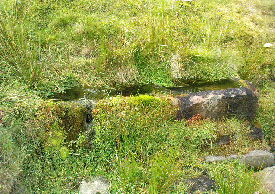
Take the B6478 road between Clitheroe and Newton, heading up north out of Clitheroe until you’re on the very top of the hill with fine views, mainly north and west. There’s a car-park about here, on the right-hand side of the road. From here, walk further along the road for about 200 yards, keeping your eyes peeled for the large stone trough at the left-hand side of the road. That’s it!
Archaeology & History
When we met up with John Dixon in the summer of this year, to wander on the nearby hills in search of old monuments, this was the first spot he showed us — and the waters were flowing nicely and tasted alright aswell! But its history is not widely know. Jessica Lofthouse (1976) described the place, saying:
“In the days of horse and pedestrian traffic none passed Walloper Well without stopping to ‘quaff the clear crystal.’ Long ago, hill men, hunters, forest wardens and farmers off to Clitheroe markets and fairs, pedlars, lead miners from the nearby workings, all met here. The name is thought-provoking. Why Walloper? From a word meaning a ‘fresh bubbling spring’, which this is, fresh from the moorside into stone troughs. Age, wartime army practice and vandalism of 1974 made renewal of the trough necessary, but the flow has been constant. One must drink, just as one throws pennies into the Roman fountain, to ensure one comes back again.
“The true derivation does not satisfy everyone. One can choose. A man and his wife climbed towards Walloper with raised voices, she nagging, he protesting. A pedlar watched them. “I’ll tell thee what I’d do if she were my wife. I’d wallop her, wallop her, wallop her well.” A song which every local singer was once compelled to have in his repertoire told the same story. The chorus sums up the reason for the name:
“…lovers of tell, each beau to his belle
The olden time story of Walloper Well.
The mason who built it in love with a maid
Who brought him his dinner one day, so tis said,
Was struggling to kiss her when over the Fell
A pedlar then passing cried, ‘Wallop her well’.”
References:
Byrne, Clifford H., Mineral Springs and Holy Wells of North-East Lancashire, unpublished manuscript, 1972.
Lofthouse, North Country Folklore, Robert Hale: London 1976.
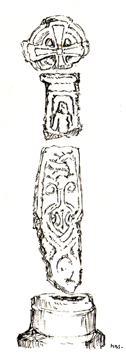
As with many old churches, St. James’ at the northern side of the village has remains of old cross fragments that can be seen inside. They were described at some length in W.S. Calverley’s (1899) excellent work on such monuments. Mr Langham (1972) also gave a good account of the respective cross fragments in his short work on this history of the church, listing the sections as a, b, c, d and e. He wrote:
“a) the greater part of a wheel-head, the reverse side of which has a sunk centre instead of a raised boss, making it a five hole cross. Calverley remarks, “a rarity in the district.”
“b) probably the top of a shaft having on its face a panel with a defaced figure, and conventional ornaments on the side.
“c) probably the lower part of a shaft with figures in two panels, and with incised interlacing designs on the reverse side “of late Scandinavian type, resembling fibulae of the Viking Age.” On the face, the lower panel is Christ risen or rising from the tomb. He is trampling on a serpent and carries a palm of victory in his left hand. The panel above has two figures, suggested by Calverley to be “either John or Mary, or two angels.”
“d) the neck of a cross. Calverley notes that the execution of the wheel-head and the shaft-fragments was by a hacking not a chiselling method, and he makes the comment: “The shafts and head at Burton are similar in workmanship to those at Halton. The Halton crosses and not Norse in style, but are like late pre-Norman work in Yorkshire, where the Danes lived.”
“e) a part of a second shaft with a zigzag pattern. Calverley says that “it is neatly chiselled, and the designs suggests a Norman date, although it seems to belong to a cross of Saxon type.” The Royal Commission volume dates it as the 10th or 11th century.”
St James church cross (by M.D.S. Brown-Smith)
The Royal Commission volume dates the cross shafts as “probably late 10th century.” Sir Nikolaus Pevsner in a recent book, Guide to Cumberland and Westmorland states specifically that, “Christ, the Virgin and St. John are on the Burton-in-Kendale cross.” This is too explicit a statement in view of the deterioration in the detail.
Nearby to the northeast used found to be the remains of a holy well dedicated to St. Helen. Does anyone have further information about it?
References:
Calverley, W.S., Notes on the Early Sculptured Crosses, Shrines and Monuments in the Early in the Present Diocese of Carlisle, T. Wilson: Kendal 1899.
Langham, John G., Parish Church of St. James, Burton-in-Kendal, Mayoh Press: Carnforth 1972.
Take the B6246 road northwest out of Whalley, or else east from Hurst Green, until you hit the little village of Great Mitton, with its churchyard in the middle. Go into the churchyard and you’ll find this weird-looking cross!
Archaeology & History
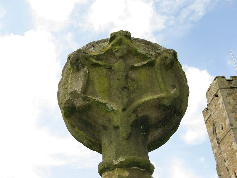
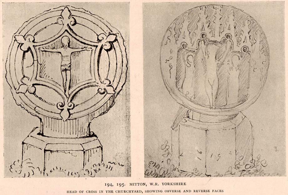
The curious-looking upright in the churchyard here has a mixed history by all accounts. The oldest portion of the cross is universally ascribed to be the top section, rediscovered when it was dug up “shortly before 1801.” (Ackerley 1947) It possesses a carving of the crucifixion on one side, and some curious figures carved on the other, which some ascribe to being Jesus, but could well be the triple female element which would still have been prevalent in peasant culture at the time it’s thought to have been carved. The original shaft carrying the ‘cross’ had long since been destroyed and so, according to Jessica Lofthouse (1946),
“In 1897 it was ‘re-erected to commemorate the 1300th anniversary of the reintroduction of christianity into Britain,’ with the new shaft we see today. This is the oldest relic in Mitton.”
In J. Buckler’s early 1841 drawing of both sides of the carved cross-head we can see in greater detail the nature of the medieval rock art and this was described in Aymer Vallance’s (1920) decorative analysis of carved crosses in England. He told that
“the cross-head at Mitton, Yorkshire…is peculiar inasmuch as the crucifixion is sculptured on both faces, but in totally different fashions. That on the west face has the arms stretched horizontally, within a sexfoil frame, and might well be of the thirteenth century. Whereas the sculpture on the east face, though much more weatherworn, is of a style that could not have been designed before the fourteenth, or perhaps even the fifteenth century. The arms of the Christ in this instance are drawn upwards in an unusually oblique direction. It is impossible that these two representations could have been executed at one and the same date. The circular outline of the head, too, is peculiar, and suggestive rather of a gable-cross than of a standing cross. Possibly the west face only was sculptured in the first instance, for a gable-cross, the sculpture on the east face being added later in order to adapt the stone for the head of a churchyard cross.”
Although I’ve gotta say that the three carved figures with the upright arms strikes me more as three females than any crucified character and may be an early depiction of the three Mary’s.
One of the early ministers at Mitton church was none other than John Webster, who wrote the highly influential work, Displaying of Supposed Witchcraft, which denounced much of the Church’s obsession and murder of countless people under the auspice of some spurious devil and demonological bollocks which, even today, some still suffer to endure. Webster was only at Mitton for a few years, before moving into deeper Yorkshire and setting up at Kildwick.
References:
Ackerley, Frederick George, A History of the Parish of Mitton, Aberdeen University Press 1947.
Lofthouse, Jessica, Three Rivers, Robert Hale: London 1946.
Vallance, Aymer, Old Crosses and Lychgates, Batsford: London 1920.
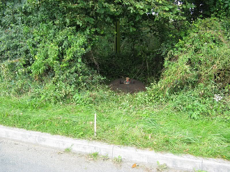
From Great Mitton village, go up (north) the slightly winding B6243 road for a mile, then take the left turn up the minor country lane, for about 300 yards, till you reach a tiny crossroad of tracks, one leading down to Scott House and the other up to Withgill Farm. Stop here! You’re damn close. From what our man ‘QDanT’ says, this is now to be found behind the hedge by the roadside, on the side of the road where the track runs up to Withgill Farm, tucked low and overgrown close to the ground. Good luck!
Archaeology & History
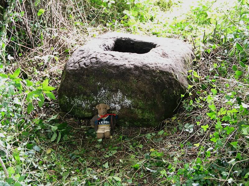
Described by Mr Ackerley (1947) as being found
“in the coppice beside the gate to Withgill is the base of another road-side cross,”
Cross-base (after QDanT)
all but overgrown by ivy and lost to the causal eye. Thankfully our man Danny got on his bike and found the remains of the little fella, all-but invisible beneath the vegetative growth! Beneath the vegetation, John Dixon told there to be “some interesting 17th century graffiti,” but there’s not much that remains of the old cross.
Folklore
There is a curious story about a legendary church that was once supposed to have been up the track on the hill just above here at the farm. The story goes,
“that when Mitton church was built, it ought to have been built on Withgill Knowle: that there was a church somewhere about there, and that the stones from it were carted down to Mitton in one night and used in building the present church.”
This bitta folklore is a motif found commonly at prehistoric sites, where stones from our ancient places were uprooted and moved (destroyed) to give way to the new christian mythos. To my knowledge, no such prehistoric sites are known hereby. Mr Dixon – over to you dear sir!
References:
Ackerley, Frederick George, A History of the Parish of Mitton in the West Riding of Yorkshire, Aberdeen University Press 1947.
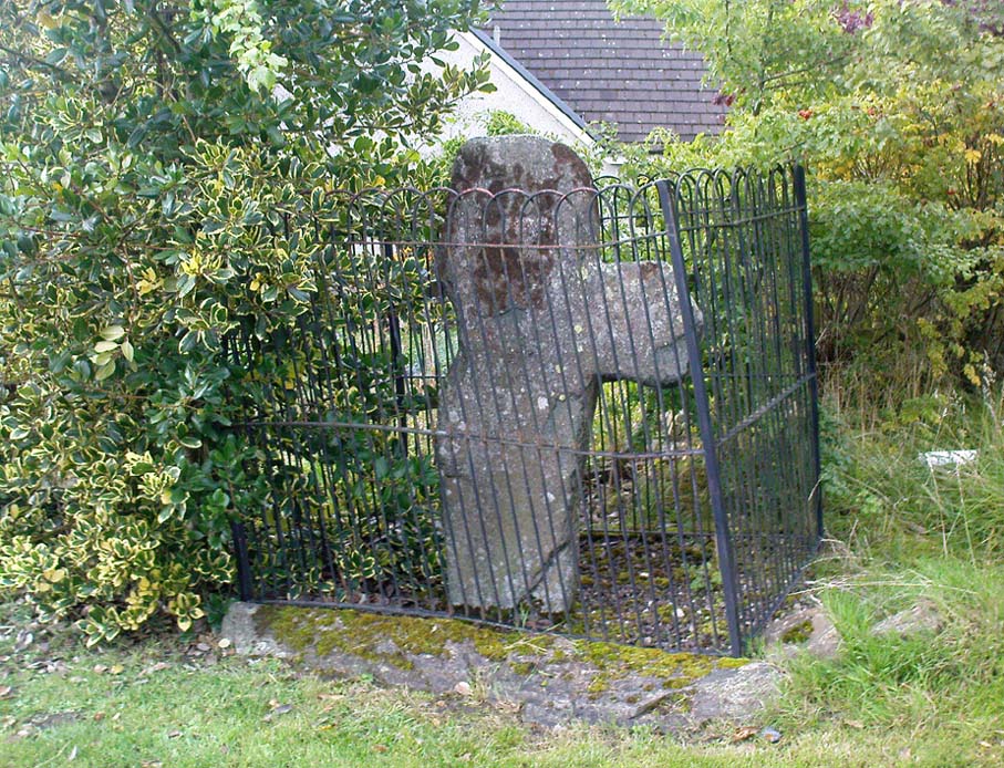
From Aberfeldy, take the B846 road over the river bridge, past Weem, a couple of miles down the valley until you see the small road on the right which leads up to the ancient hamlet of Dull. Go up and round the corner until you reach the centre of the village; and here the road turns back downhill. At this point, right by the roadside, entrapped within old railings, you’ll see the Cross of Dull.
Archaeology & History
Dull Cross behind bars
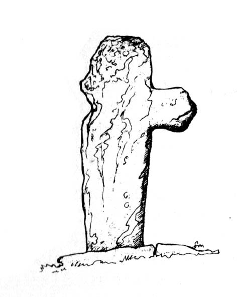
Standing more than three feet tall, the remains of this old cross with one of its extended arms broke off in previous centuries, was one of three such monuments that used to stand in the valley. This and its associates were, according to christian legend, placed as markers at an ancient centre of christian learning at Dull around the time of Adamnam (who died in Glen Lyon in 704 AD). The area was said to be an early druid college, which was later incorporated into early christian teachings. Hilary Wheater (1981) also told that in previous centuries, if anyone fell foul of the law,
“Within the boundaries of these crosses debtors, offenders or miscreants were protected from retribution. One of the crosses stands in the centre of Dull village to this day, having been used as a market cross in more recent times, and the other two, having been stolen for use as gateposts during the (19th) century, were placed in the old kirk at Weem for safety.”
References:
Stuart, John, The Sculptured Stones of Scotland, Aberdeen 1856.
Wheater, Hilary, Aberfeldy to Glenlyon, Appin Publications: Aberfeldy 1981.