Rocking Stone, Warley Moor, Halifax, West Yorkshire

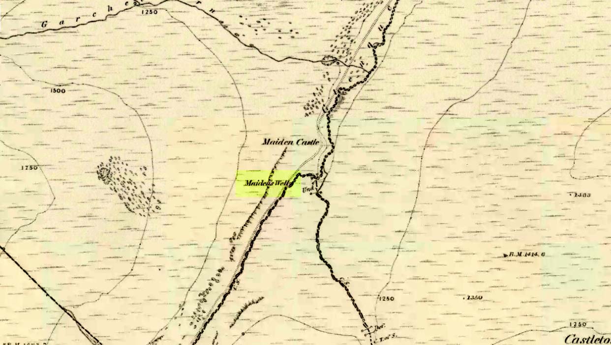
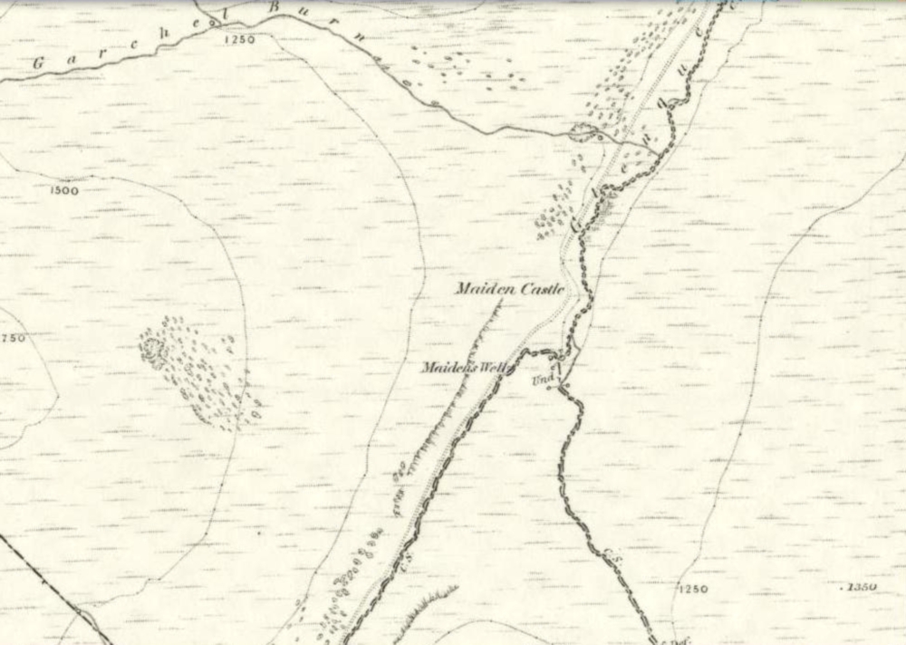
Legendary Rock:  OS Grid Reference – SE 03399 30199

Also Known as:

  1. Sleepy Lowe

Getting Here

The old rocking stone, on the right
Looking east at the stone

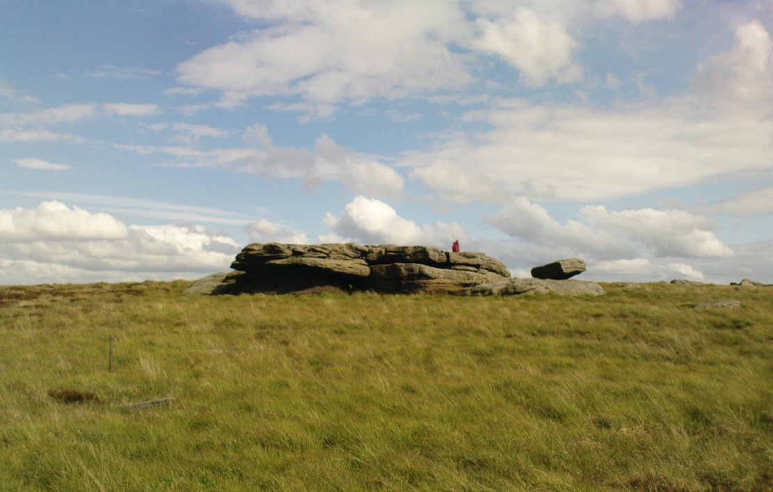
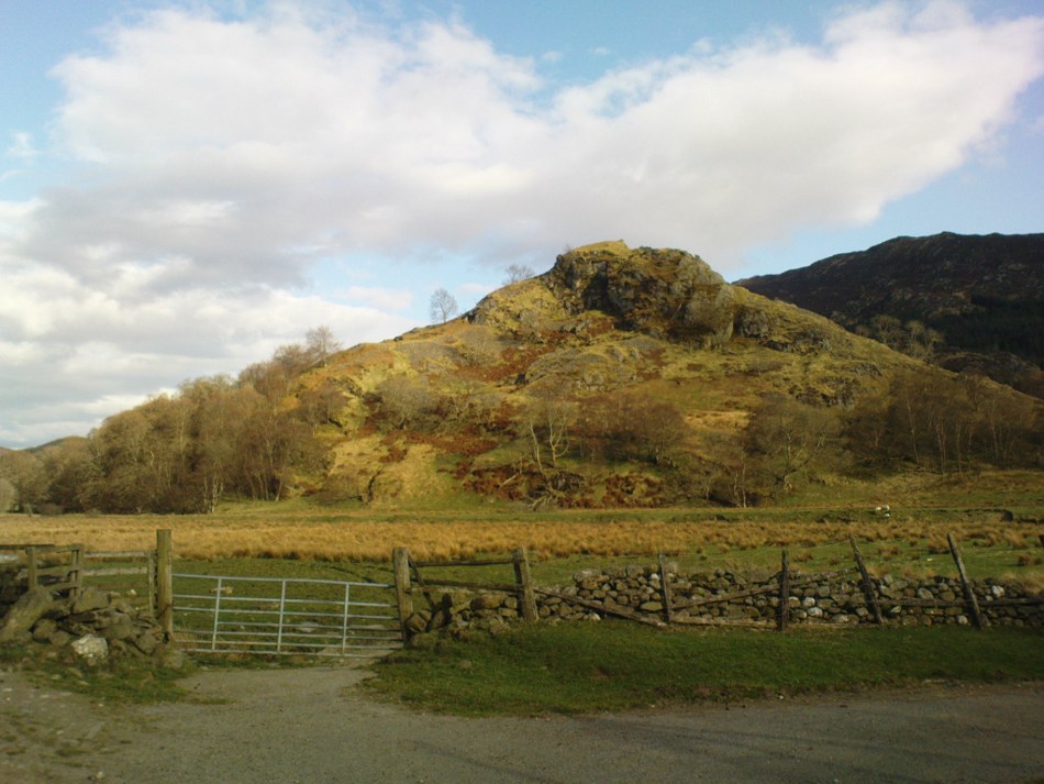
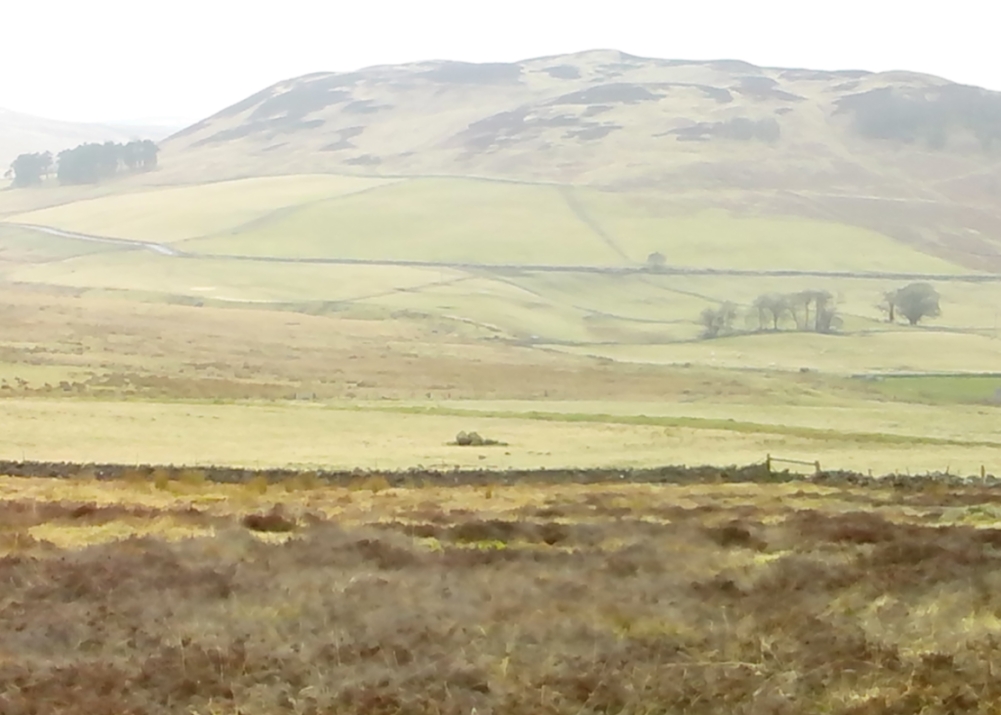
From Denholme, take the A6033 Hebden Bridge road up, but shortly past the great bend turn off right up the steep road towards the moorland windmills until you reach the flat dirt-tracked road, past the reservoir below.  A coupla hundred yards past the track to the reservoir, take the footpath south into the tribbly grasslands and moor.  A few hundred yards down you’ll note the large rock outcrop ahead of you. The rocking stone is there!

Archaeology & History

The old rocking stone

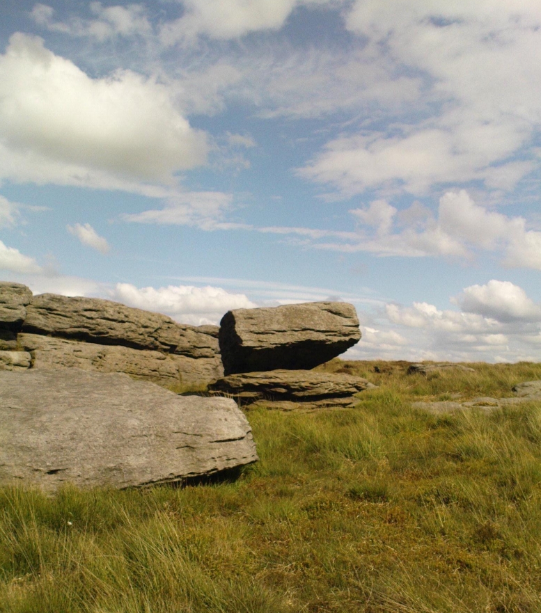
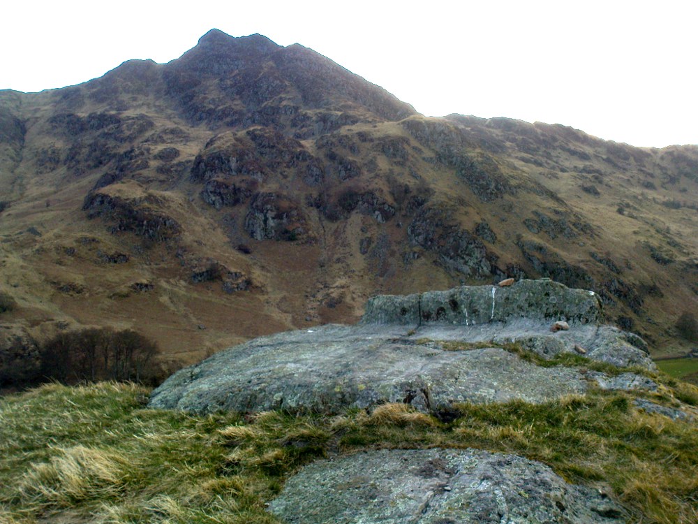
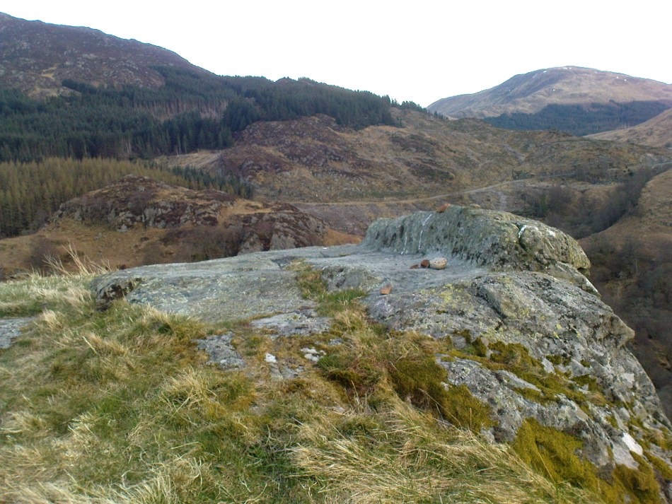
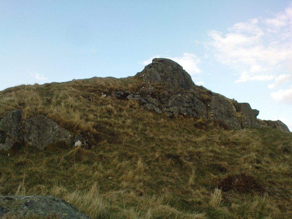
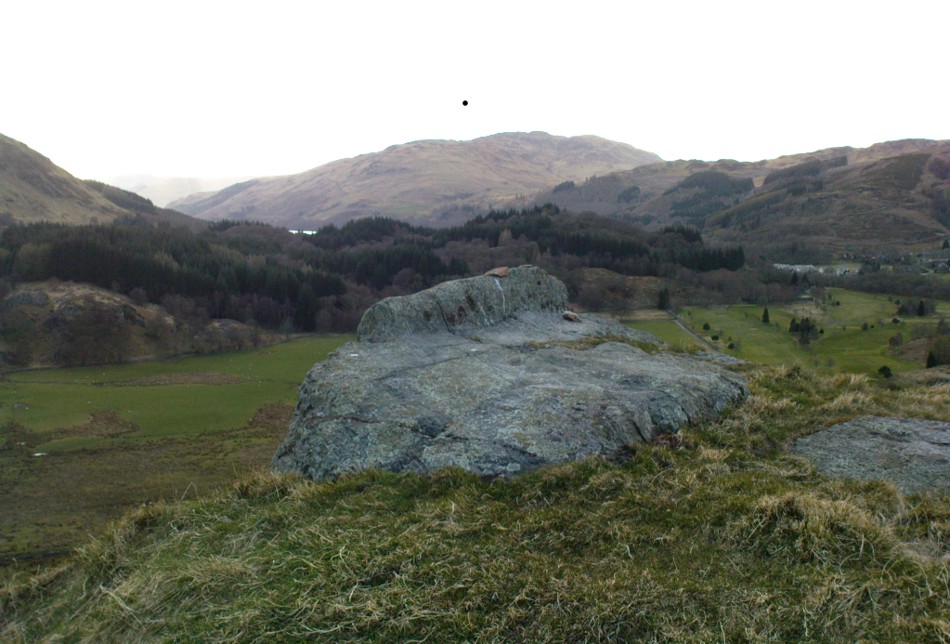
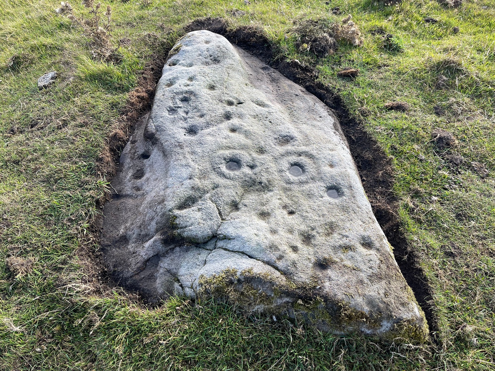
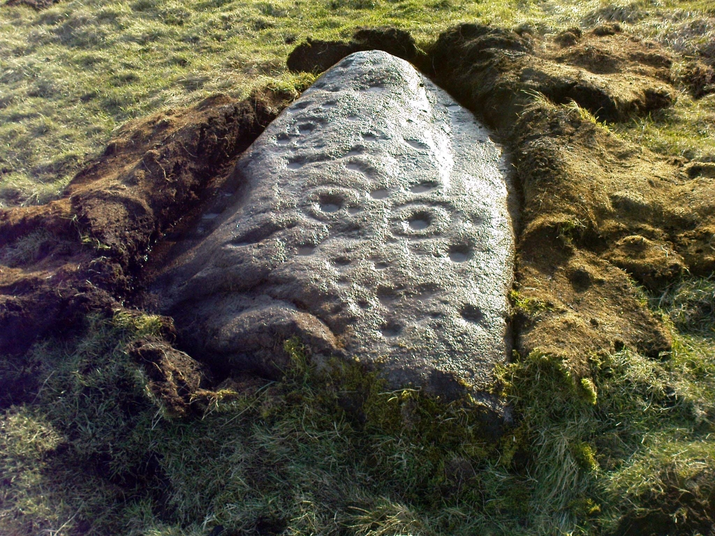
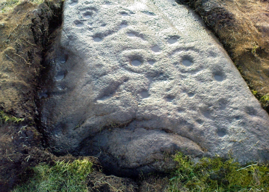
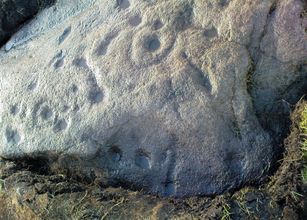
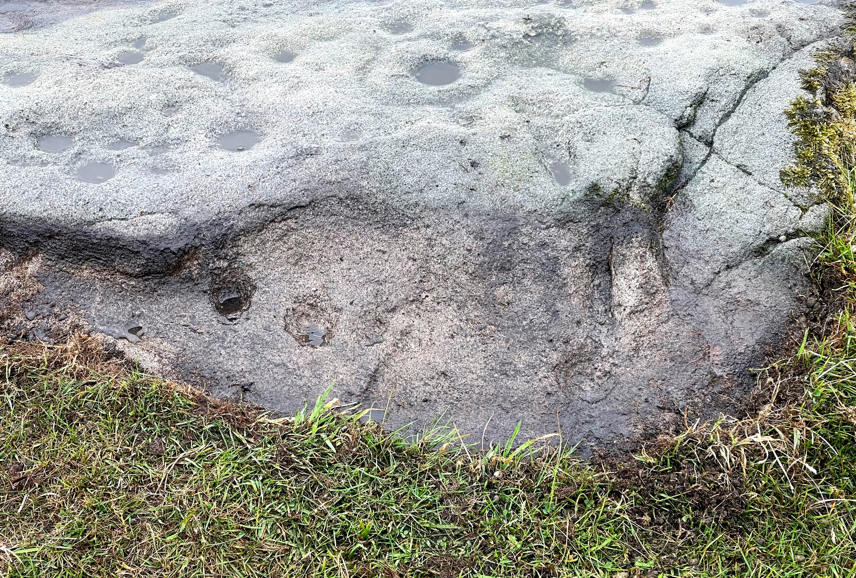
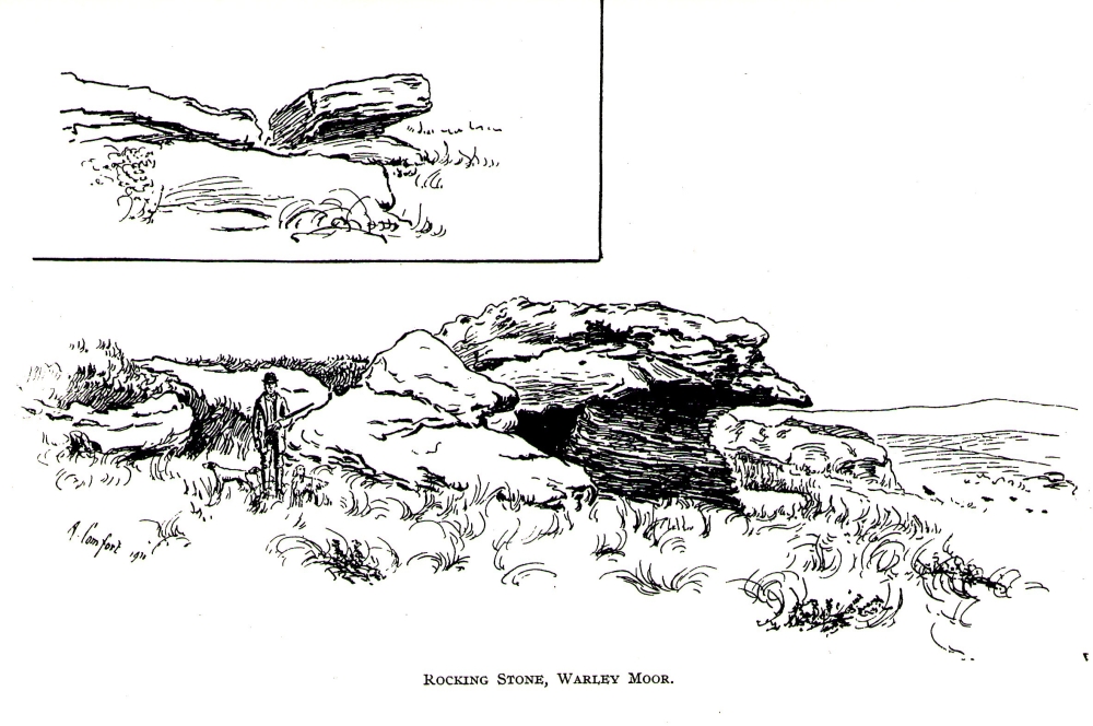
A small moorland arena with a neglected history. Many lost memories surround this site, with barely legible ruins from medieval and Victorian periods prevailing against scanty snippets of neolithic and Bronze Age rumours and remains.  The rocking stone here—which moves slightly with a bit of effort—sits amidst a gathering of other large rocks, some of which have debatable cup-markings on their smoothly eroded surfaces.

Our rocking stone, resting 1350 feet (411m) above seal level, was first mentioned in John Watson’s (1775) magnum opus, who gave a quite lengthy description of the site, telling us that,

“On a common called Saltonstall-moor, is what the country people call the Rocking-stone… The height of this on the west side (which is the highest) is, as I remember, about three yards and a half.  It is a large piece of rock, one end of which rests on several stones, between two of which is a pebble of a different grit, seemingly put there for a support, and so placed that it could not possibly be taken out without breaking, or removing the rocks, so that in all probability they have been laid together by art.  It ought to be observed, that the stone in question, from the form and position of it, could never be a rocking stone, though it is always distinguished by that name.  The true rocking stone appeared to me to lie a small distance from it, thrown off its centre.  The other part of this stone is laid upon a kind of pedestal, broad at the bottom, but narrow in the middle; and round this pedestal is a passage which, from every appearance, seems to have been formed by art, but for what purpose is the question.”

Dubious cupmarks
Dubious cups
Watson's 1775 drawing of the Rocking Stone
Watson’s 1775 drawing of the Rocking Stone

Watson then goes onto remark about other rocking stones in Cornwall and further afield with attendant “druid basins” on them, noting that there were also “rock basins” found here on Warley Moor, a few of which had been “worked into this rocking stone,” which he thought, “helps to prove that the Druids used it.”  And although these rock basins are large and numerous over several of the rocks on this plateau, like the cup-markings that also scatter the surfaces, they would seem to be Nature’s handiwork.

Turner's 1913 drawing
Turner’s 1913 drawing

Some 60 years later when the literary thief John Crabtree (1836) plagiarized Watson’s words verbatim into his much lesser tome, it seemed obvious he’d never ventured to explore the site.  But in the much more valuable historical expansion written by John Leyland around 1867, he at least visited the site and found the old stone, “still resting on its shady pedestal.” Later still, when Whiteley Turner (1913) ventured this way on one of his moorland bimbles, he added nothing more to the mythic history of these west-facing megaliths…

Folklore

Still reputed locally to have been a site used by the druids; a local newspaper account in the 1970s also told how local people thought this place to be “haunted by goblins.”

References:

  1. Bennett, Paul, The Old Stones of Elmet, Capall Bann: Milverton 2001.
  2. Crabtree, John, Concise History of the Parish and Vicarage of Halifax, Hartley & Walker: Halifax 1836.
  3. Leyland, F.A., The History and Antiquities of the Parish of Halifax, by the Reverend John Watson, M.A., R.Leyland: Halifax n.d. (c.1867).
  4. Smith, A.H., The Place-Names of the West Riding of Yorkshire – volume 3, Cambridge University Press 1961.
  5. Turner, Whiteley, A Spring-Time Saunter round and about Bronte Lane, Halifax Courier 1913.
  6. Watson, John, The History and Antiquities of the Parish of Halifax, T. Lowndes: London 1775.

© Paul BennettThe Northern Antiquarian


St. Fillan’s Chair, Dundurn, Comrie, Perthshire

Legendary Rock:  OS Grid Reference – NN 7081 2325

Also Known as:

  1. Canmore ID 24876
  2. Dundurn
  3. Fillan’s Chair
  4. St. Fillan’s Bed

Getting Here

Dundurn, near St. Fillans

Not hard to find. Between the small towns of Comrie and St. Fillans along the A85 road, keep your eyes peeled for the small but rocky crags that rise in front of the background of dramatic mountains not far from the roadside to the south. It looks truly majestic even on a dull day. Just as you reach the eastern edge of St. Fillans village, take the small road over the river-bridge and go to the golf club. Walk past the golf club itself, keeping along the track that leads you to Dundurn hill.  It’s easy enough. Then climb to the very top of the hill where you’ll find this curious, large, flat bed-like rock right in front of you!

Archaeology & History

The rocky bed or 'chair' of St Fillan
St Fillan’s rocky bed or ‘chair’

The archaeological data for St. Fillan’s Chair relates more to the folklore practices of the people upon Dundurn hill than anything else and ostensibly little can be said by such students. The place is more satisfying for geologists than archaeologists, who would adore the rocky fluctuations and geophysical propensities with greater verve than any archaeologist could muster! For this rocky bed-shaped feature is a fascinating structure whose only potential interest to archaeologists are what may be a couple of reduced cup-marks on the top of the stone (and even then, such potential rock art is more the province of religious historians and anthropologists than archaeologists).

Small quartz offerings left on St Fillan's Chair at Beltane
Small quartz offerings left on St Fillan’s Chair at Beltane
The view of the Chair from below
View of the Chair from below

But this ‘bed’ or ‘chair’, as it was locally known, was – and it seems, still is – important in the social history of the area, as its folklore clearly tells.  The ‘chair’ plays an important part in the holistic role of Dundurn as a hill, a fort, a healing centre, an inauguration site, and very probably an omphalos: a sacred centre whereupon the ordination of shamans, kings and the cosmos as a whole was brought to bear here… (these features will be explored in greater depth when I write a singular profile of Dundurn as a ‘fort’).

Folklore

Looking west over St Fillan's Chair
Looking west over St Fillan’s Chair

The character of St. Fillan was described by James Cockburn (1954) as “an Irish Pict” and the “son of a King – his father being Angus mac Nadfraich who died in battle in 490 AD.”  Quite an important dood in his day! The relationship this early christian figure had with this Chair was in its supposedly curative properties.  Yeah…you read it right: curative properties!  As with countless rocks all over the world, some of Nature’s outcrop boulders were imbued with a spirit of their own and, when conditions and/or the cycle of the spirit ‘awoke’, healing attributes could be gained from the place. And such was the case at St. Fillan’s Chair, especially on Beltane morning (May 1).  And some element of this traditional pilgrimage is still done; for when the author Marion Woolley and I visited the site on Mayday 2013, it was obvious that some people had been up earlier that Beltane morning and left some offerings of quartz stones on the top end of the bed.

The earliest written reference of this medicinal virtue was told in the Old Statistical Account of Perthshire (1791):

The rock on the summit of the hill, formed, of itself, a chair for the saint, which still remains. Those who complain of rheumatism in the back, must ascend the hill, sit in this chair, then lie down on their back, and be pulled by the legs to the bottom of the hill. This operation is still performed, and reckoned very efficacious.

More than a hundred years later, the sites was still being used and was described in similar vein in MacKinlay’s (1893) excellent study:

“On the top of green Dunfillan, in the parish of Comrie, is a rocky seat known in the district as Fillan’s Chair. Here, according to tradition, the saint sat and gave his blessing to the country around. Towards the end of last century, and doubtless even later, this chair was associated with a superstitious remedy for rheumatism in the back. The person to be cured sat in the chair, and then, lying on his back, was dragged down the hill by the legs. The influence of the saint lingering about the spot was believed to ensure recovery.”

The origins of this dramatic rite were probably pre-christian in nature and we should have little doubt that St. Fillan replaced the figure of a shaman or local medicine woman of some sort. The ritual “dragging down the hill” may be some faint remnant of initiation rites…

References:

  1. Cockburn, James H., The Celtic Church in Dunblane, Friends of Dunblane Cathedral 1954.
  2. Eliade, Mircea, Rites and Symbols of Initiation, Spring: Woodstock 1995.
  3. Finlayson, Andrew, The Stones of Strathearn, One Tree Island: Comrie 2010.
  4. Hunter, John, Chronicles of Strathearn, David Philips: Crieff 1896.
  5. MacKinlay, James M., Folklore of Scottish Lochs and Springs, William Hodge: Glasgow 1893.
  6. Shearer, John, Antiquities of Strathearn, David Philips: Crieff, 1883.
  7. Skene, William F., Celtic Scotland (3 volumes), Edmonston & Douglas: Edinburgh 1876-1880.
  8. Toulson, Shirley, Celtic Journeys in Scotland and the North of England, Fount: London 1995.

Links:

  1. Nataraja’s Foot: The Curious Incident of Dundurn

© Pual BennettThe Northern Antiquarian


Wizard’s Stone, Dollar, Clackmannanshire

Legendary Stone:  OS Grid Reference – NS 9656 9904

Getting Here

Wizard's Stone on the 1866 OS map
Wizard’s Stone on 1866 OS map

From Dollar town centre, take the road up to the gorgeous Castle Campbell, but instead of turning up towards the castle, keep on the road, uphill, for another quarter-mile.  As the road begins to level out, a small field and driveway on your left heads up to Kiloran house. Stop here, and note the stone in the field, right by the fence alongside the footpath which runs uphill by the field-side up into the woods.  That’s the Wizard’s Stone.

Archaeology & History

The small Wizard's Stone, Dollar
The Wizard’s Stone, Dollar

This site doesn’t seem to be the remains of an authentic prehistoric standing stone (unlike the one along the same ridge a mile east at Castleton), but is more of a memorial rock relating to some witch traisl that occurred here several centuries ago.  By virtue of this, I felt it needed to be included on TNA.

Not listed by Canmore, the stone is found in an area with a rich cluster of heathen place-names—most intriguing of which is the ‘Lochy Launds’ woodland, right above where this Wizard’s Stone now rests.  The stone has been broken into smaller pieces in recent years—as the photos here show—and the small standing stone which remains is barely 3 feet tall at the edge of the field.

The local writer and historian Rennie McOwan (1989) told that it marked the spot where a warlock was burned in the 16th century.  Years later, a local land-owner called John Moir erected the stone here as a memorial to the event.  This was subsequently echoed by fellow local history writer Bruce Baillie (1998), when he wrote:

“A large whinstone in a field in a field is known as ‘The Wizard’s Stone’, having been set there by one of the Moirs to take the place of a rotting stake said to mark the spot where the last Dollar witch (and, naturally, the last Scots one), named Forrester, was burnt, though this is probably folk confusion with the vicar of Dollar, Thomas Forrest.”

Angus Watson (1995) could find no early references of this stone, other than it being mentioned in the 1860 Ordnance Survey Name Book.  Further information on the site would be most welcome.

Folklore

Wizard's Stone, looking down to the road
Wizard’s Stone, looking down to the road

Reputedly one of the haunts and gathering places of the witches of the area, this spot was also known as Lochyfaulds, which the place-name giant W.J. Watson (1926) tell us means the ‘place of the Black Goddess,’ like the “Valley of the Black Goddess” of Glen Lochay, 40 miles to the northwest of here near Killin.  Modern folklore ascribed the wizard here to have been Merlin—as highlighted in the adjacent place-name of “Merlin Park.”

References:

  1. Baillie, Bruce, History of Dollar, DMT: Dollar 1998.
  2. McOwan, Rennie, The Green Hills, CDL: Alloa 1989.
  3. Watson, Angus, The Ochils: Placenames, History, Tradition, PKDL: Perth 1995.
  4. Watson, W.J., The History of the Celtic Place-names of Scotland, Edinburgh 1926.

© Paul Bennett, The Northern Antiquarian


Maiden’s Well, Glendevon, Perthshire

Sacred Well: OS Grid Reference – NN 9703 0139

Also Known as:

  1. Maiden Well
Maidens Well on 1866 map

Getting Here

Follow the same directions as if you’re going to the Maiden Castle fairy hill.  About 100 yards before reaching the hill, on the right-hand side of the footpath between the tree-line and the small stream, you’ll see a small pool of water. That is the Maiden’s Well.

Archaeology & History

Maiden's Well - and the fairy haunt of Maiden Castle hill behind
Maiden’s Well & the fairy haunt of Maiden Castle hill behind

A mile northeast of the faerie-haunted Butter Well, just on the border of Clackmannanshire and Perthshire, we find this little-known magickal spring.  More than a century ago, the story of this remote well was heard about hundreds of miles away by one Rev. Andrew Clark of Oxford, “who heard it from the late sexton of the parish of Dollar, in the county of Clackmannan” and who then mentioned its existence to the great Victorian Celtic scholar John Rhys (1901), who subsequently wrote of it as being “a fine spring bordered with flat stones, in the middle of a neat, turfy spot”, close to the legendary faerie hall of Maiden Castle. The well itself has now given birth to a pool whose waters, so folklore and text ascribe, always provides good clear water even in the height of summer.

The local historian Hugh Haliburton (1905) told that the well obtained its name from a princess who was held captive in Castle Campbell in the valley to the southwest, and that she was sometimes allowed out of prison by her captors, to walk to the well and drink its waters.

Folklore

This tale has been mentioned by various historians and, no doubt, has some religious relevance to the faerie lore of Maiden Castle, close by, Bruce Baillie (1998) told:

“A story associated with it states that it is haunted by the spirit of a beautiful maiden which only appears at night and, should any male attempt to kiss her, coronary thrombosis occurs.”!

The Maiden's Well pool
The Maiden’s Well pool

Earlier accounts tell of magickal rites that could be used to invoke the beautiful maiden, but once again dire consequences may befall the poor practitioner.

To this day, local people visit the well and make offerings to the spirit of the waters, as you’ll see if you come here.  Some of the remains here are very old; and a visit not long ago indicated that offerings were made even when surrounded by depths of snow in the middle of a freezing winter.

References:

  1. Baillie, Bruce, History of Dollar, DMT: Dollar 1998.
  2. Fergusson, R. Menzies, The Ochil Fairy Tales, Clackmannan District Libaries 1985.
  3. Haliburton, Hugh, Excursions in Prose and Verse, G.A. Morton: Edinburgh 1905.
  4. Rhys, John, Celtic Folklore – Welsh and Manx: volume 1, Oxford University Press 1901.
  5. Watson, Angus, The Ochils: Placenames, History, Tradition, PKDC: Perth 1995.

© Paul BennettThe Northern Antiquarian


Maiden Castle, Glendevon, Perthshire

Legendary Hill: OS Grid Reference – NN 9710 0141

Also Known as:

  1. Maiden’s Castle

Getting Here

1860 map showing Maiden Castle (and the Maiden's Well)
1860 map showing Maiden Castle (and the Maiden’s Well)

Take the small steep road uphill from the town of Dollar in Clackmannanshire towards Castle Campbell. Less than 100 yards above the small parking spot by the small white house near the top of the hill, turn to walk up the footpath on your right above the house, following the edge of the depleted forestry plantation parallel with the valley.  Cross the valley a few hundred yards up, but keep to path on the other side that stays parallel with the stream.  You’ll hit a small rocky glen a half-mile up. Walk thru it, alongside the very edge of the forest till the trees break and there’s a gap in the hills.  You’ve just walked past the Maiden’s Well and in front of you is a large natural rounded hill, which the footpath bends around. This hill is the Maiden Castle. (if you walk round this, a view into the eastern hills and a small lake opens up ahead of you)

Archaeology & History

The fairy hill of Maiden Castle

A large rounded hill marking the opening of Glenquey to the north and the Glen of Care to the south. Although ascribed in place-names old and new as a ‘castle’, there are no remains as such left here to account for this title. Angus Watson (1995) tells of the possibility of the place deriving its name from the Gaelic Creag Ingheann, or maiden crag. In Bruce Baillie’s (1998) survey of the area, in trying to give some relevance to the place-name, he points out that whilst no hillfort or cairn that might help account for the folklore (see below),

“Large-scale maps indicate a spot opposite on Hillfoot Hill as Greig’s Grave. There would seem to be something ancient here but of what nature it is, at the moment, impossible to say.”

When we visited the place yesterday, snow still covered much of the ground hereby, so we couldn’t do our usual explorations seeking for old sites (even the hut circles 100 yards away were covered over). The legendary healing waters of the Maiden’s Well are below here, by the side of the burn.

Folklore

This large rounded hillock was evidently a place of some importance in bygone days if the folktale here is anything to go by. Although the story echoes the some of the core sequences of modern ‘close encounter’ abduction events, other ingredients here tell of more arcane peasant rites that were once part of the social structure of our ancient heathen tribes:

“A piper, carrying his pipes, was crossing from Glendevon to Dollar in the grey of the evening. He crossed the Garchil (a little stream running into the Quaich), and looked at the Maiden Castle and saw only the grey hillside and heard only the wind soughing through the bent. But when he had passed beyond it, he suddenly heard a burst of lively music and turned round to look at what was causing it. And there, instead of the dark knoll which he had seen a few moments before, he beheld a great castle, with lights blaring from the windows, and heard the noise of dancing issuing from the open door. He went back somewhat incautiously to get a closer view, and a procession issuing at that moment from the Castle’s open door, he was caught up and taken into a great hall ablaze with lights, while people were dancing on the floor. He was at once asked to pipe to them and was forced to do so, but agreed to do so only for a day or two. At last getting anxious, because he knew his people would be wondering why he had not come back in the morning, as he had promised to do, he asked permission to return home. The faeries seemed to sympathise with his anxiety and promised to let him go if he played a favourite tune of his, which they seemed fond of, to their satisfaction. He played his very best. The dance went fast and furious, and at its close he was greeted with loud applause. On his release he found himself alone in the grey of the evening, beside the dark hillock, and no sound was heard save the purr of the burn and the soughing of the wind through the bent. Instead of completing his journey to Dollar, he walked hastily back to Glendevon in order to relieve his folk’s anxiety. He entered his father’s house and found no kent face there. On his protesting that he only gone away for a day or two before, and waxing loud in his bewildered talk, a grey old man was aroused from a doze beside the fire, and told how he had heard when a boy from his father that a piper had gone away to Dollar on a quiet evening, but had never been seen or heard since, nor any trace of him found. It turned out the piper had been in the ‘Castle’ for a hundred years.”

The Fortean experts John Keel (1971) and Jacques Vallee (1970) both contended, quite rightly, that some aspects of the ancient encounters related in such folklore has strong parallels to modern UFO ‘abduction’ events. In addition, Paul Devereux (1989) cites that such events occur where strong geomagnetic forces exist in proximity to rock outcrops, as found here.

There is the additional feature in these stories of the music of both faerie and pipers alike, whose revelling jigs carry the mortal out of time and, when returning back to human life, find no one recognises them.  This is a condition of some rites of passage in traditional societies, where mothers and fathers no longer recognise their child after they have been through the rituals after visiting spirit-lands and returning as adults for the first time: an element in our faerie-lore that has been overlooked in assessing the nature of these fascinating tales.

References:

  1. Baillie, Bruce, History of Dollar, DMT: Dollar 1998.
  2. Devereux, Paul, Earthlights Revelations, Blandford: London 1989.
  3. Fergusson, R. Menzies, The Ochil Fairy Tales, David Nutt 1912.
  4. Keel, John A., UFOs: Operation Trojan Horse, Souvenir Press: London 1971.
  5. Rhys, John, Celtic Folklore – Welsh and Manx: volume 1, Oxford University Press 1901.
  6. Vallee, Jacques, Passport to Magonia: From Folklore to Flying Saucers, Tandem: London 1975.
  7. Watson, Angus, The Ochils: Placenames, History, Tradition, PKDC: Perth 1995.

© Paul BennettThe Northern Antiquarian


Giant’s Knowe, Culloch, Muthill, Perthshire

Cairn (destroyed):  OS Grid Reference – NN 7848 1762

Also Known as:

  1. Canmore ID 24797
  2. Crock-nafion
  3. Fingalian’s Knowe

Archaeology & History

Landscape of the Giant's Knowe (image credit, Marion Woolley)
Landscape of Giants Knowe (photo by Marion Woolley)

Amidst the colourful and nurturing landscape close to the gigantic Dunruchan standing stones and just along the road from the solitary Craigneich stone, in the field across the road above Straid farmhouse could once be seen a fascinating-sounding prehistoric site that has sadly been destroyed.  Some of the remains of this old monument can be found in the field-clearance of stones just over the fence, above the top of the field (many fields round here have scatterings of large stone clearings at the field edges), but we have no detailed accounts of the site.  It was mentioned in early notes by the Ordnance Survey to have been,

“A large circular heap of small stone and gravel entirely removed in 1831. An urn filled with ashes and several stone coffins were found under it.”

The local historian John Shearer (1883) later told us that,

“A small mound of earth on the farm of Strayd, called Crock-nafion or the Giant’s Knowe, or the Fingalian’s Knowe, was cleared away several years ago.  An urn containing burnt bones was discovered.”

Any additional information about this site and its folklore, would be greatly appreciated.

Folklore

To the west along Glen Artney whence our view takes us from here, old legend told that the valley was once the abode of a great giant who lived in a cave in one of the mountains thereby.  In mythic lore, giants were the creation deities of hills, mountains and other geological forms, whose narratives were overturned and demonized by the incoming christian cult many centuries ago.  It is likely that this once great tomb was deemed as the burial-place of our local giant – which would make this prehistoric site neolithic in age.  But — logical though it is — this idea is pure speculation…

References:

  1. Hunter, John, Chronicles of Strathearn, David Philips: Crieff 1896.
  2. Shearer, John, Antiquities of Strathearn, David Philips: Crieff, 1883.

© Paul BennettThe Northern Antiquarian


Fairy Stone, Fourstones, Northumberland

Legendary Stone:  OS Grid Reference – NY 893 680

Archaeology & History

Thought to have been destroyed in the 19th century, folklorists and historians alike didn’t seem to be able to locate this little-known folklore relic, which is still alive and well in one of the fields by the village.  The exact nature of the stone isn’t known for certain.  Legend reputes it to have been one of the four boundary stones which gave the village its name; it was also said that they were Roman altars and the Fairy Stone was one of them, which was moved from the village boundary during the Rebellion of 1715 and placed nearer the centre.

Folklorist M.C. Balfour (1904) seemed to think that stone had gone when he wrote about it.  Writing about it in the past tense, he told,

“The Fairy Stone however, certainly had an existence, for a person, 80 years of age, remembered its situation to the south of the village, near the old road, and that it was squared, and had a square “cistern hewn out of its top,” which was called the Fairy Trough, and traditionally said to have had a pillar fixed in it.”

But when former Ley Hunter editor Paul Screeton (1982) came looking for the stone in the late 1970s, he was fortunate in coming across an old local:

“Some time ago while looking for the Fairy Stone at Fourstones…I came across a farmer who pointed it out and remarked that a few years previously when the road was widened the local lengthsman made sure it was not destroyed, though it had to be moved a short distance.”

Folklore

Of the four boundary stones surrounding the village, they were “supposed to have been formed to hold holy water,” said Balfour (1904).  But the title Fairy Stone given to one of them had this tale to account for it:

“A couple of miles or more down the South Tyne is Fourstones, so called because of four stones, said to have been Roman altars, having been used to mark its boundaries. A romantic use was made of one of these stones in the early days of “The Fifteen.” Every evening, as dusk fell, a little figure, clad in green, stole up to the ancient altar, which had been slightly hollowed out, and, taking out a packet, laid another in its place. The mysterious packets, placed there so secretly, were letters from the Jacobites of the neighbourhood to each other; and the little figure in green was a boy who acted as messenger for them. No wonder that the people of the district gave this altar the name of the ‘Fairy Stone’.”

References:

  1. Balfour, M.C., Country Folk-lore volume 4: Examples of Printed Folk-lore Concerning Northumberland, David Nutt: London 1904.
  2. Screeton, Paul, “The Long Man of Wilmington,” in The Ley Hunter, no.92, 1982.
  3. Terry, Jean F., Northumberland Yesterday and Today, Andrew Reid: Newcastle 1913.
  4. Watson, Godfrey, Northumberland Place Names, Sandhill: Morpeth 1995.

Acknowledgements:  Big thanks to Paul Screeton for the grid-reference!

© Paul BennettThe Northern Antiquarian


Fraggle Rock, Hawksworth Moor, West Yorkshire

Cup-and-Ring Stone:  OS Grid Reference — SE 15094 43502

Getting Here

Fraggle Rock, Reva Hill

Probably the easiest (direction wise) is if you’re coming from Dick Hudson’s public house on the southern road surrounding Rombalds Moor. From the pub, head left (east) along Otley Road (passing Weecher reservoir) for 1.9 miles (3.1km) until you reach Reva reservoir where a track leads you to the waters.  A small parking spot is on the left-side of the road. From here, go through the gate and along the footpath across the field for nearly 300 yards to the next gate; go through here and walk to your right for about 60 yards where uyou’ll reach a small straight dyke (keep your eyes peeled!) running NW (to your left): walk along here for nearly 200 yards until it hits another shallow dyke bearing right; follow this dead straight for 35 yards after which it changes direction, but you need to keep walking straight on forward for another 60 yards or so.  Look around!

Archaeology & History

Early photo of the carving
First photo of the carving

This carving is one in a cluster of previously unrecorded petroglyphs, uncovered in the summer of 2011 during a Northern Antiquarian bimble on the northern edge of Rombald’s Moor.  The carvings were found as a bi-product of uncovering a previously undiscovered cairn circle, close to the Twelve Apostles stone circle.  In assessing and exploring the newly-found circle, it was noticed that a small opening in the near horizon highlighted a rise in the landscape barely a mile away.  This ‘opening’ in the land was not visible if you walked 25 yards either side of the cairn circle – but was very notable at the circle itself.

“We need to have a look at that site,” I said.  “It’s position looks to have been relevant to this circle.” (or words to that effect) And a couple of weeks later we met up and walked to the place in question.

Fraggle Rock carving, looking west
Fraggle Rock carving, looking south

Within five minutes we came across a couple of previously unrecorded cup-marked stones, of simple design, right in line with the cairn circle.  As we walked around this spot, then headed back in the direction of the circle, a cluster of small stones were noticed on the slope.  One had what looked like a single cup-marking near its edge, but the rest of the rock was completely covered in vegetation.  Paul Hornby and Michala Potts had, by now, already found several other previously unrecorded cup-marked stones close by; but as I carefully rolled back the vegetation at the edge of this particular rock, cups-and-rings and carved lines seemed to be covering most of its surface.  It was a good one!

Face on the Fraggle Rock

We called it the Fraggle Rock after noticing that when you look at the stone from one end, the two main cup-and-rings are likes two large eyes carved above a large natural down-turning ‘mouth’ feature, similar to some of the creatures’ faces on the muppets or the similar kid’s TV show, Fraggle Rock! (sad aren’t we!?)  The photo here shows you what we mean.

The primary design consists of at least 3 cup-and-rings, 2 partial cup-and-rings, 28 cups and several carved lines along which some cup-markings are linked to others.  The most notable of the carved lines is the longest (barely visible in the photos), running from a single cup-mark at the southernmost rounded end of the stone, almost straight and parallel with a natural ridge or dip along the rock, until it meets the largest of the cup-and-rings (one of the eyes on the Fraggle’s face!).  Don’t ask me why, but for some reason this long faint line seemed the most perplexing element of the carving.

Eastern edge, with cups at ground level
Eastern edge with low cups
Cup-marks on rock edge

Most of the design is carved on the upper face of the stone, but a small part of the rock dips into the ground on its eastern side and a small group of cups and a single carved line, in a very good state of preservation, are etched right at the edge of the stone.  Unusual.  Another faint cup-and-ring is less than 100 yards west; and a fascinating cup-and-lines stone, with at least four long carved ridges running like hair from the top of the stone into the Earth, is a short distance to the north.  A number of others are in this and adjacent fields.

References:

  1. Jack, Jim, “Old Fraggle Rock is Found on Burley Moor,” in Ilkley Gazette, March 4, 2013.

© Paul Bennett, The Northern Antiquarian 


High Cross, Shrewsbury, Shropshire

Cross (destroyed):  OS Grid Reference – SJ 492 126

Also Known as:

  1. Butter Cross
  2. The Cross

Archaeology & History

This long-lost medieval ornamented cross, found not far from the legendary Grope Cunt Lane (I kid you not) was located close to the middle of old Shrewsbury town, “at the junction of Pride Hill, Castle St and St. Mary’s St,” according to the 1902 OS-map of the region.

Although Shrewsbury’s High Cross is believed to have been built in the 12th or 13th century, we don’t know for sure when it was first erected — and indeed, written records of the place don’t appear to begin until the year 1557, where it was described as the ‘Hye Crosse.’  A few years later in the Parish Registers for the Lichfield diocese, dated 1590, the monument was mentioned again as ‘the Highe Crosse’; and subsequent accounts of it are found in various local history accounts from 1695 to 1799.

The site was named as the Butter Cross in street-name listings of 1804, telling it as a site where this food was sold and we know that the High Cross was the centre of a local market and social gathering place in previous centuries.  Gelling (2004) told that “the medieval cross was taken down in 1705, but the name continued to be applied to structures which replaced it, and which were used as a market place for dairy produce.”

In earlier times, the High Cross is said in legend to have been where executions were enacted.  Alfred Rimmer (1875) narrates the oft-told tale of those who died here, saying:

“The High Cross of Shrewsbury has long been destroyed, but its place is pointed out in old documents.  Unhappily, it is not connected with pleasant associations, for before it the last of the British princes, David, a brother of Llewellyn, was cruelly put to death by Edward I; and at a later period many of the nobility who were taken at the battle of Shrewsbury were there executed, the High Cross being considered the most appropriate place for such a spectacle.”

The prince that Rimmer mentions was Dafydd III, the last prince of Wales, executed in the year 1283.

References:

  1. Gelling, Margaret, The Place-Names of Shropshire – volume 4, EPNS: Nottingham 2004.
  2. Hobbs, J.L., Shrewsbury Street Names, Wilding & Son: Shrewsbury 1954.
  3. Rimmer, Alfred, Ancient Stone Crosses of England, Virtue: London 1875.

© Paul Bennett, The Northern Antiquarian


St. Fillan’s Well, Comrie, Perthshire

Holy Well: OS Grid Reference – NN 7080 2327

Also Known as:

  1. Well of St. Fillans

Archaeology & History

Found by the legendary hill of Dundurn, east of Loch Earn, this legendary healing site has been written about by many historians, both local and national. An early account of it was given by the local priest, Rev. Mr McDiarmid, minister of the parish of Comrie at the end of the 18th century, who informed those compiling the Old Statistical Account of the area, the following information:

“This spring, tradition reports, reared its head on the top of Dun Fholain (Fillan’s Hill) for a long time, doing much good, but in disgust (probably at the Reformation) it removed suddenly to the foot of a rock, a quarter of a mile to the southward, where it still remains, humbled, but not forsaken. It is still visited by valetudinary people, especially on the 1st of May and the 1st of August. No fewer than seventy persons visited it in May and August, 1791. The invalids, whether men, women, or children, walk or are carried round the well three times in a direction Deishal—that is from east to west, according to the course of the sun. They also drink of the water and bathe in it. These operations are accounted a certain remedy for various diseases. They are particularly efficacious for curing barrenness, on which account it is frequently visited by those who are very desirous of offspring. All the invalids throw a white stone on the Saint’s cairn, and leave behind them as tokens of their gratitude and confidence some rags of linen or woollen cloth. The rock on the summit of the hill formed of itself a chair for the Saint, which still remains. Those who complain of rheumatism in the back must ascend the hill, sit in this chair, then lie down on their back, and be pulled down by the legs to the bottom of the hill. This operation is still performed, and reckoned very efficacious. At the foot of the hill there is a basin made by the Saint on the top of a large stone, which seldom wants water even in the greatest drought, and all who are distressed with sore eyes must wash them three times with this water.”

We see from this early account that there’s a discrepancy regarding the location of St. Fillan’s Well, as the modern accounts indicate it to be at the top of the craggy hill. In some upland regions this occurred so as to maintain a sense of secrecy about the location of local sites, so ensuring they were not affected or disturbed by outsiders or incomers, who not only disrespected local customs and rites, but tried changing or altering them to their new ways. It also kept the local gods and spirits of the sites protected from tourism and the profane. This may explain the difference in locations described by Rev. McDiarmid.

About one hundred years after McDiarmid’s account, another priest called Tom Armstrong (1896) wrote a piece in the Chronicles of Strathearn (1896) all about this holy well, saying:

“People are prone to believe that the dirty pool of stagnant water which still remains in the driest summer on the top of St. Fillan’s Hill is the famous spring to which pilgrims at one time resorted. Any one who examines it will not fail to observe that it has all the appearance of an artificially built well, and must have been kept in order and preservation for a purpose. Tradition confirms the belief that this was at one time the well, but not always.”

The hill on which it is found was an ancient dun or fort, built in prehistoric times, making you wonder how far back in time its magickal abilities were known about.

References:

  1. Armstrong, Thomas, “By the Well of St. Fillan,” in Chronicles of Strathearn (David Phillips: Crieff 1896).
  2. Gordon, Seton, Highways and Byways in the Central Highlands, MacMillan: London 1948.
  3. Hunter, John, et al, Chronicles of Strathearn, David Phillips: Crieff 1896.
  4. Morris, Ruth & Frank, Scottish Healing Wells, Alethea: Sandy 1982.

© Paul BennettThe Northern Antiquarian