Cheetham Close, Egerton, Lancashire

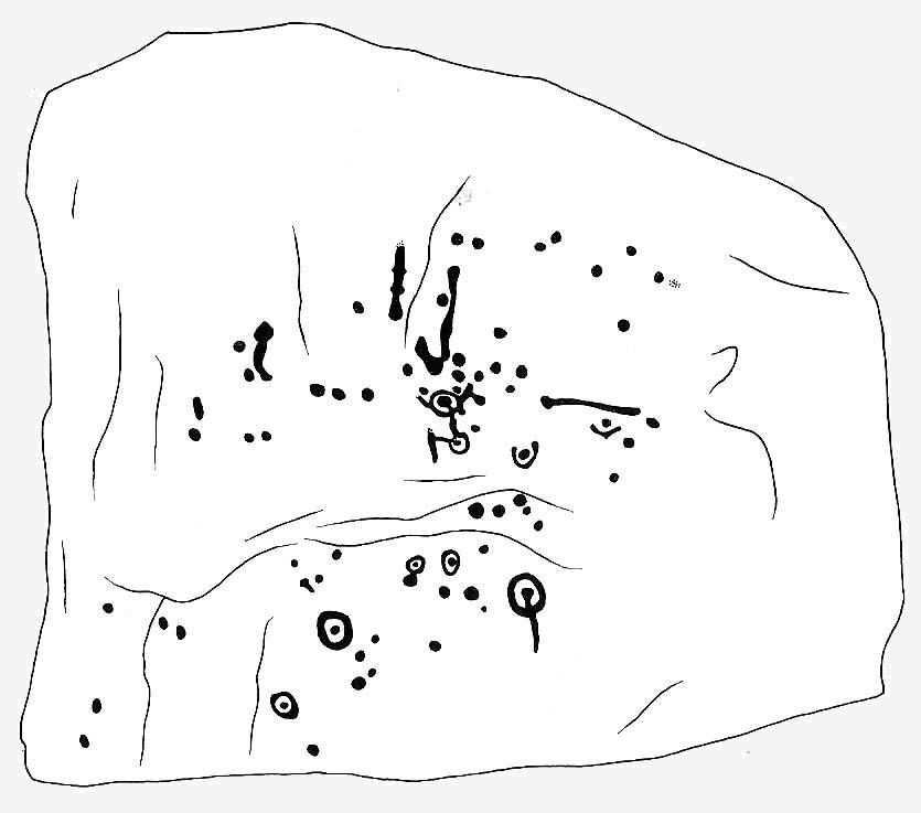
Stone Circle:  OS Grid Reference – SD 7164 1589

Also known as:

  1. Chapeltown
  2. Chetham Close

Getting Here

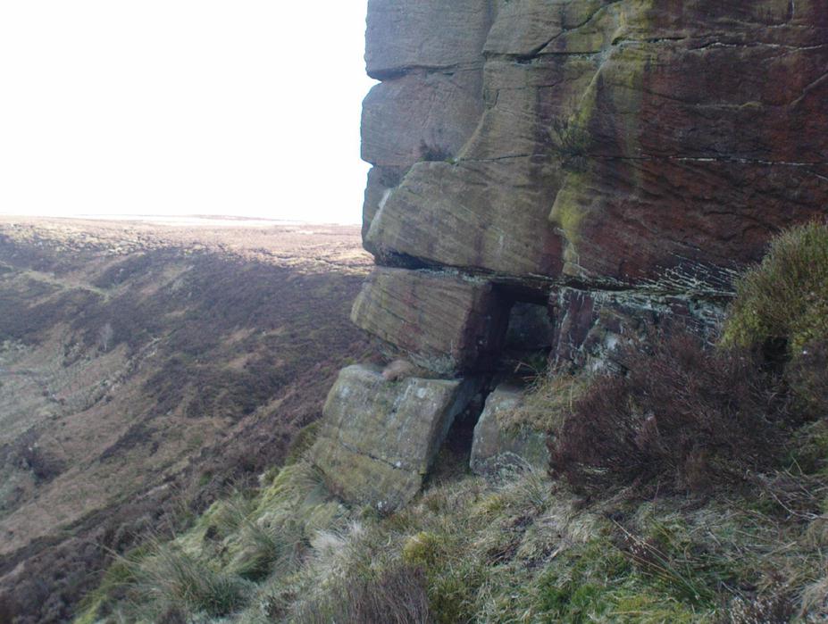
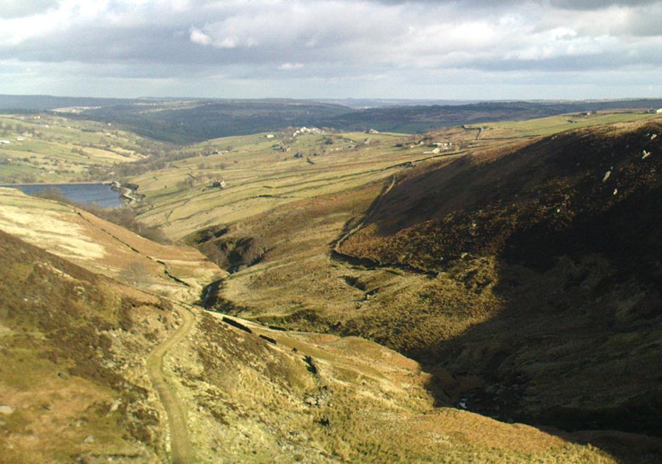
Various ways to get here, probably the easiest is by taking the A639 north from Bolton, up to Turton & Entwhistle Reservoir.  Park up in the layby and walk onto the hills behind you (south), right near the very top.  Look around!

Archaeology & History

A long article by Major Gilbert J. French — ‘The Stone Circles on Chetham’s Close’ — in one of our northern antiquarian journals of 1894, told us a great deal about the sad remains of this once proud circle.  I have reproduced the main body of the article here (with minor editing), which I hope is of interest to local historians and archaeologists around Bolton:

Early drawing of this now-ruined site

From time immemorial the existence of a so-called Druidical circle upon the top of Chetham’s Close has been recognised, and at one time the monuments of this circle must have been very pronounced and prominent. Within the last quarter of a century, however, the stones have been sadly mutilated and in part destroyed. This was chiefly done by the tenant farmer of the late owner, Mr. James Kay, who objected to people visiting the situation. Mr. Kay was communicated with, but did little or nothing to prevent the mutilation. I am glad to say that the present owner has expressed his intention of faithfully restoring and protecting the circle, and by the aid of the plan taken in 1871 by Mr. Thomas Greenhalgh, of Thornydikes, near Bolton, will have little trouble in doing so.

Writing to me on August 9th, 1890, he says: “I have this afternoon spent some time on the site of the Druidical circle with Mr. Edmund Ashworth, and, with the assistance of Mr. Greenhalgh’s plan, we have clearly made out the position of the circle. I am glad to find there are sufficient stones and remains of stones to enable this to be done, and it seems that there are similar stones close at hand to complete the circle.”

By the courtesy of Mr. J. P. Earwaker, I have had placed in my hands an early description of the circle, published in 1829 (August 11th) in the first volume of the Cambrian Society, and contributed by a writer who signs himself ‘Elvaeliad.’ He says:

“In the parish of Bolton-le- Moors is a hill named Turton Heights, and on the south-east end of it is a large sheep pasture, which goes by the name of Chetham’s Close. Nearly on the summit of this close, but inclining to the north-east, are the remains of a bardic temple, the diameter of which is about seventeen yards. There are only six stones of the circle remaining, and these are sorely mutilated either by time or the hand of man. The circle is as perfect as if traced by the compasses of Newton or La Place; and, what is rather singular, an upright stone stands about thirty-seven yards nearly east from its outward verge and another about seventeen yards due south. The ‘maen gorsedd’ has disappeared as well as some other stones forming the circle, and, from the oozy nature of the ground, I am inclined to believe that independent of the mutilations mentioned, the surface of the earth has risen considerably since the circle was first constructed. The views to the north and east are very fine, but bounded by hills rising and swelling above each other. Towards the south and south-east are seen Bolton and Manchester, with their busy populations; a considerable part of fertile Cheshire, Mow Hill in Staffordshire, and lofty ranges of mountains both in Derbyshire and Yorkshire; and were it not for Edgar¹ or Winter Hill on the west Penmaenmawr frowning upon the sea, Moel y Vammeau, and the bicapitated head of Snowdon would be distinctly visible on a clear day.

“Frequently have I visited this interesting spot, and, amidst the silence and solitude which reign there, thought of ‘the days of former years.’ Here have the bards in their different orders often met and performed their various rites and mysteries, with their uni-coloured robes flowing before the breeze. Here have hundreds, probably thousands, standing without the circle observed the solemn proceedings, and listened with deep attention to the maxims and doctrines which philosophers and Druids delivered. Since those periods, what changes, what revolutions have taken place! How often has the blue lightning flashed and the thunder rolled over this sacred spot! Kingdoms have risen and fallen, emperors have been throned and dethroned, arts and sciences have retrograded and advanced, and various and awful occurrences have taken place; but these rude stones, though severely shattered, still remain as attestations of the religious and philosophical views of the ancient Briton. But where are the founders of this monument and those who worshipped there ? The sages who often proclaimed within this circle,

Y gwir yn erbyn y byd,’ are gone the way of all flesh. “Our fathers, where are they? The prophets, do they live for ever?”

“About a mile and a half from this bardic temple a neighbour and friend of mine, whilst digging a drain, about twenty years ago (1819), discovered the head of an old British standard, which is now in my possession. It is of copper, the head of which is shaped like an axe, and the other end has a double groove in which the flagstaff entered, and, by that means, became firmly fixed. Its weight is fourteen ounces and a half, but was evidently heavier when perfect, as the ring on its side through which the cord of the flag ran is broken off, and the lower end of the groove has been also mutilated. Its figure, though not an exact one, may be seen in Gough’s edition of Camden’s Britannia, vol. ii., p. 501, pi. xviii., figure 13. From traces still remaining it is evident that a Roman road passed within two hundred yards where this relic was found. Now, my opinion is that the Romans and Britons met there in hostile array, and with their flags unfurled; that in the action which took place the Roman soldiers, for soldiers are ever the same, dashed at the British flag and cut it down, and that, owing to the tumult, the confusion, and the boggy nature of the ground, the standard head was broken off, sunk into the earth, and was lost.” (This account was then signed ‘Elvaeliad’, August 11th, 1829.)

Thus ends this chronicler, and his testimony is useful as corroborating that of subsequent generations.

In 1871 Mr. Thomas Greenhalgh, of Thornydikes, Bolton, prepared the following account of the circle, which was read before the British Archaeological Association, on June I4th of that year, and is published in the twenty-seventh volume of the transactions of that society:

“The township of Turton, like many others in southwest Lancashire, is largely occupied by lofty moorland hills the home of the grouse and the lapwing. Amongst these wilds is a range of high ground standing more distinct from the other moors than is usual with hills of this nature. The range is divided into two parts by a slight depression. That portion to the north is named Turton Heights, and is stated by the Ordnance Survey to be one thousand one hundred feet above the sea. The southern half is known as Chetham Close, from its having been the property of that old Lancashire worthy, Humphrey Chetham. This part is twenty-five feet lower than Turton Heights, and the depression spoken of above sinks about thirty feet lower still. The summit of each is a sort of table-land, sloping gently towards the depression just named, and extending both together about a mile from north to south by a quarter of a mile from east to west.

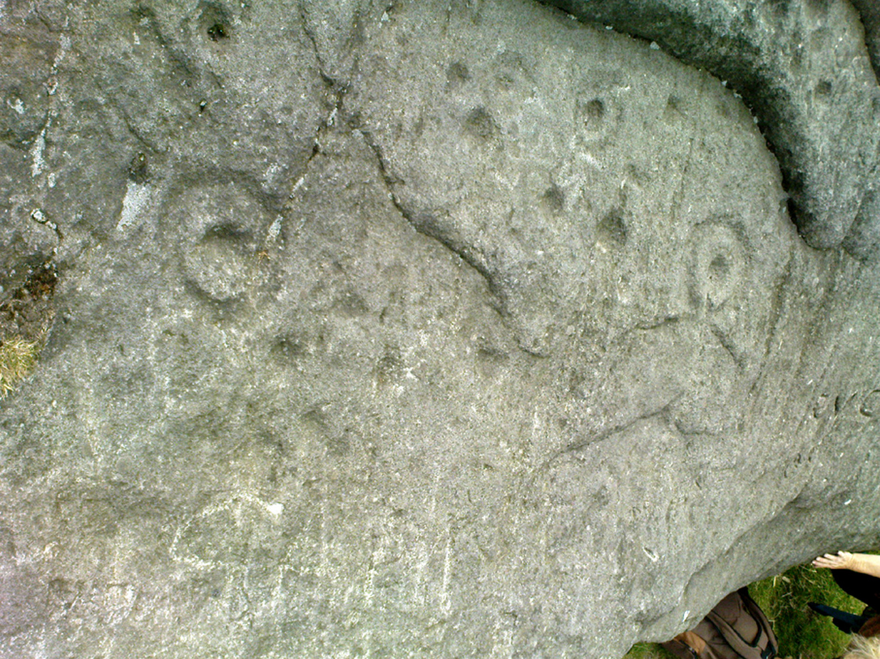
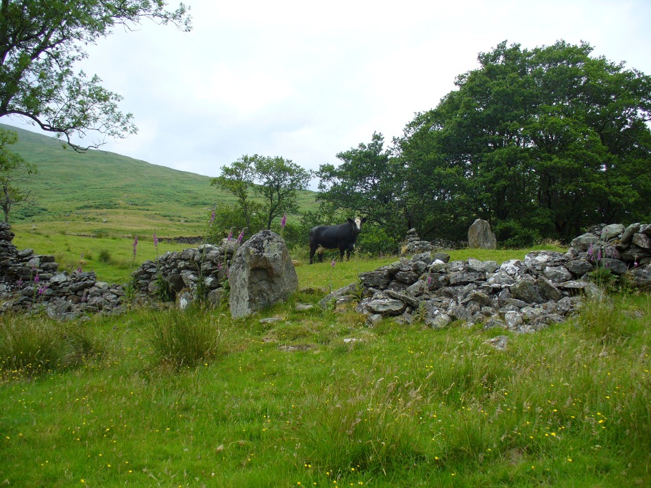
“Nearly in the centre of the northerly slope of Chetham Close and at an elevation of one thousand and sixty feet stand several stones of a Druidical circle. This circle, I should judge, originally consisted of eleven stones. Of these seven are still standing in a more or less perfect state. The diameter of the circle is small, being only fifty-one feet six inches. So the stones are, as might be expected, small likewise. The tallest is fifty-five inches by eighteen inches wide, and the shortest (number four) eight inches only in height. At the distance of forty-five feet, south-west from the outside of the circle, stands a solitary stone, nineteen inches high by ten inches wide, and southsouth-east at a distance of one hundred and two feet another stone, thirty-five inches high by seventeen inches wide. The stones vary in thickness from nine inches to fifteen inches.

“The position of the stones is circular, with vacant spots, and their dimensions and shapes vary. The table-land gradually rises from the circle in a southsouth-east direction and a short distance past the outlying stone a height of one thousand and seventy-five feet is attained, and a quarter of a mile further on a view is to be got, with a clear atmosphere, which towards the south is bounded only by the powers of vision. From this spot the ancient people who erected the circle must have often gazed on a scene which persons now familiar with south Lancashire would find it impossible to realise. The valleys and even the sides of the hills were clothed with trees, the oak and birch predominating, whilst the margins of the numerous streams and swamps were overhung by the alder; the wild boar and doubtless the wolf roamed in the woods, and smaller game abounded in the more open parts. The numerous waters throughout the district would be alive with fish, amongst which the salmon might be numbered; for when the country was better wooded and entirely uncultivated the large rainfall of the district (now about a mean of fifty-five inches) would be still more copious, and keep the streams full of water.

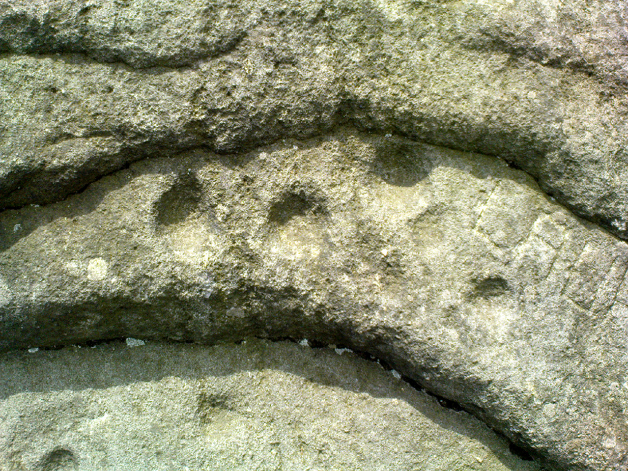
“The last few centuries have, however, wrought a wonderful change in the scene, which has been the most rapid since the introduction of machinery into the country; and from the same spot may now be seen the habitations, comprised in towns, villages, and farmhouses, of hundreds of thousands of human beings. Unfortunately, however, there are still to be found amongst us persons as barbarous in some respects as the rude people who erected the circle. These were rude in their ideas of building; the others barbarous in wantonly destroying that which time had made more interesting than the palaces of kings. Up to the spring of last year the circle appeared to have suffered little for ages; but at that time rambling over the moors I turned aside to take another look at the circle. Not that I thought of anything having happened, but for old acquaintance sake; when to my surprise I noticed a framework of wood within the circle, and upon reaching the spot itself what my disgust and astonishment were may be easily imagined, when I found two of the stones broken almost to fragments, and several others damaged. This could only have been effected by the aid of a heavy hammer, as the stories broken were before strong and sound. Fortunately, they were not rooted up so their places are still seen in the group. One very small one has apparently been in the state it now is for a long time.

“I at once communicated my unpleasant discovery to the owner of the land, James Kay, Esq., of Turton Tower, who instituted an enquiry, and traced it to some members of a picnic party, who had made use of the ground without asking leave. A few more such wanton pieces of mischief, and this interesting relic, like many others of its class, will be irrecoverably destroyed.

“About a mile from the circle, north-west from it and on a much lower level, eight hundred and ninety feet above the sea, is a flat piece of bog, called ‘Charter’s Moss.’ Here was found, about 1810, a bronze British celt. It was discovered by a man whilst digging turf, as I am told, at four feet from the surface. Having taken a careful drawing of it, I found, upon comparing it with similar objects in the British Museum, that in cases Nos.13 to 20, ‘British Antiquities Department,’ there were several closely resembling it, and one [No.315 Z] the all but exact representation of it. The Rev. Probert, in whose possession it had been for nearly half a century, and who resided a few hundred yards from the spot where it was dug up, died recently (then 1871), and bequeathed it to New College,² Gordon Square, London.”

I have no doubt that the British celt referred to in this account by Mr. Greenhalgh is the same as that mentioned in the previous description by ‘Elvaeliad,’ and I conjecture that this is the nom de guerre of the same Rev. William Probert referred to, who was a literary man, and the author of Ancient Laws of Cambria (1823) and other works. I am glad to say that this celt was kindly given up by the authorities of Manchester New College, and has been placed in the Chadwick Museum, Bolton. It is also interesting to note that a similar specimen was found in a quarry on Cockey Moor, near Ainsworth, about three miles from and in view of the circle, by Dr. Denham, about 1839. It is still in the possession of his family.

Mr. Matthew Dawes, of Bolton, also wrote a description of the circle, which was read before the Historic Society, in 1852. He says: “I accompanied Sir Henry Dryden to visit these remains in 1850. At that time there remained six stones upright, varying in height from one foot six inches to four feet, and in thickness from eleven inches to two feet. Judging from the relative distances of those remaining three stones have been taken away. At one hundred and fifteen feet south-east from the circle is a single stone and at eighty-two feet south-west is another, and between these two stones is an assemblage of smaller stones only just appearing out of the boggy soil.”

It has long been supposed that this circle of upright stones was the only one on the site; indeed, the late Mr. Scholes, in his recently published History of Bolton (1892, p.11), says only one circle is known about Bolton.

The adjacent 'cairn circle', in 1894
The adjacent ‘cairn circle’, in 1894

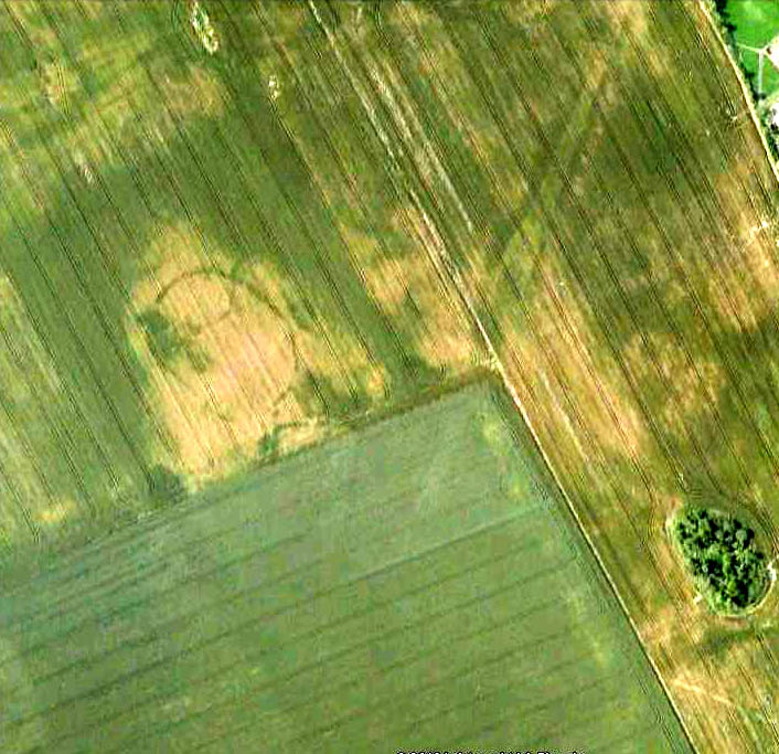
In June of last year, in company with Mr. Thomas Hardcastle, I visited the site, and noticed what was evidently another circle. This we perceived from the stones cropping up in places and from the nature of the turf. I find that the same opinion was formed by a member of the Manchester Literary Club (the late Mr. E. Kirk), who, in a paper read before the club, in November, 1878, says: “There are two circles, the more northerly formed of large individual stones, set diadem or corona fashion, the other of smaller stones, as if it had been a walled enclosure with a pile in the centre.” This observation is quite correct, and a removal of the surface of the earth last June to a depth of three to six inches revealed a perfect stone-walled circle, as shown in the illustration. This circle is larger than the upright one, being exactly twenty-four yards across (the size of similar stone circles, ex. gr., the circle at Zennor, Cornwall). It lies to the south-west of the upright circle and is twenty yards from the outlying westerly stone of same, and is twelve yards from the outlying southerly stone of same, and is on slightly higher ground than the first circle. The circle is faced on both inside and outside by large flat stones, and the space within is occupied by smaller stones. I can find no trace of mortar nor marks of tools, nor do I find any gateway or opening to the circle, although the whole of it has not yet been laid bare. The circling wall is of an average width or thickness of four feet. The stones are the ordinary grit stone of the district. The removal of part of the earth within the circle has shown a number of stones lying there and there is also a large collection in the exact centre. It is most symmetrically round, and the wall is very evenly and regularly constructed.

I think there is no doubt but that it is of later date than the upright circle and may have been subsequently used as a place of worship.

Possibly it may, in accordance with the theory of Dr. Colley March, have been a place for mortuary exposure before subsequent sepulture, and it is interesting to note that the Three Lowes in the valley below and about half a mile away are reputed Barrows. No bones or remains of any sort have yet been found, but so far only the upper surface lies exposed. Its situation and shape preclude the idea of its being a sheep-fold, and from its dimensions it is not likely to have been a watch tower or a “burgh.” Possibly it may be the site of a collection of ancient British dwellings, clustered together, and defended by the enclosing wall. The owner, Mr. Hardcastle, intends to make careful excavations, and from these some further information and enlightenment will probably be thrown upon the origin of what is undoubtedly a most interesting and important archaeological discovery.

Notes:

1. This is evidently the origin of the name of the adjacent township, “Egerton.” I have seen the place, “Edgar’s town,” marked in (fifteenth century) Lancashire maps.
2. Now the Manchester College, Oxford (Unitarian).

References:

  1. Abraham, John Harris, Hidden Prehistory around the North West, Kindle 2012.
  2. Barnes, Bernard, Man and the Changing Landscape, Merseyside County Council 1982.
  3. Burl, Aubrey, The Stone Circles of Britain, Ireland and Brittany, Yale University Press 2000.
  4. Dixon, John, Journeys through Brigantia – volume 11: East Lancashire Pennines, Aussteiger Publications: Barnoldswick 2003.
  5. French, Major G.J., ‘The Stone Circles on Chetham’s Close,’ in Transactions of the Lancashire and Cheshire Antiquarian Society, 1894.

© Paul Bennett, The Northern Antiquarian


Haystack Rock, Ilkley Moor, West Yorkshire

Cup-and-Ring Stone:  OS Grid Reference – SE 13027 46310

Also known as:

  1. Carving no.141 (Hedges 1986)
  2. Carving no.302 (Boughey & Vickerman 2003)
  3. Cottage Rock

Getting Here

The Haystack Rock
The Haystack Rock

Dead easy to find this one!  Get to the Cow & Calf Hotel and walk up the slope onto the moor ahead of you.  If you want a direction-pointer, head for the large, seemingly overhanging rocks which are the Pancake Stone, at the top of the ridge, but a few hundred yards to the right (west).  Once you reach the level on the moor proper, you’ll see this large haystack-shaped boulder close by.  That’s it!

Archaeology & History

This tends to be one of the spots I stop at when doing my tourist walks, to i) let folk get their breath back after ambling from the car park, via Hanging Stones and Map Stone; ii) to drink in the view, and, iii) to begin acquainting themselves with the landscape as it was when this stone was carved (over many decades, perhaps longer), and the animistic cosmology underlying people’s notions of their land.  It can be quite an education…

Haystack Rock, with crushed man underneath
Haystack Rock crushes local man
Fertility symbol, or Rorschach response?

The Haystack Rock was a very important boulder in the mythic landscape on this plain. It stands near the western end of the Green Crag Necropolis: a huge area of land on these moors where, quite simply, the people of these hills laid their dead.  Effectively, the Haystack Rock stands on the edge of Ilkley Moor’s “Land of the Dead”.*

Highlighting this quite firmly, we find that prehistoric walling ‘separates’ this great boulder from the other part of the Plain close to its east and southern sides (walling on its western side is as yet unproven).  It was a boulder that was specifically sectioned-off, away from any tombs.  All along this Plain are numerous small cairns, many with rock-art nearby, and certain parts of the Plain are split into sections by ancient walling (though a precise map of the walling, tombs and rock-art on this moorland ridge has yet to be done).

J.Romilly Allen's 1879 images
J.Romilly Allen’s 1879 images

As far as the textbooks are concerned, we find the first mention of this great carved boulder came from J. Romilly Allen at the end of the 1870s.  By 1900, a number of people had been here and written of its grandeur; but, as with cup-and-rings in general, its non-linear form and design elicited the usual notions of bewilderment, druids and puzzled ideas.  Much like today really!

Drawing of the central design (after Hedges, 1986)
Drawing of the central design (Hedges, 1986)

But this is a big and decent carving, with about 60 single cup-markings, 10 cup-and-rings, and various twizzly grooves and lines linking cups to others, and others going to seemingly nowhere.   Some of these lines, of course, may be weathering, or weathered channels emerging from once shorter lines.  We might never really know for sure what the original carving actually looked like.  On the north-facing side is what looks like a decidedly human figurine etched onto this great boulder, in good old cup-and-ring style. I’ve shown this to a few hundred people and they all seem to make the same remark: it’s a woman with her legs wide open — an early form of sheela-na-gig on Ilkley Moor no less! But whether this was intentional (many folk think so), or just us seeing something we want to see (men in particular!), we might never know.

Ancient cup-marks with vandal marks
More cup-and-rings with vandal marks

The black-and-white illustration above that shows what seems to be just about all elements of the carving in considerable detail, may well be accurate, but it’s nothing compared to seeing the carving first-hand.  When it comes to ancient rock-art, detailed drawings are one thing, but the real thing is altogether much much better!  Check it out and see for yourself…

Folklore

I’m not too sure what credibility we should give to Nicholas Size’s (1934) extravagant claims, but this was one of the sites he alleged to have seen visions of druidic rites and ghostly figures!

References:

  1. Allen, J. Romilly, ‘The Prehistoric Rock Sculptures of Ilkley,’ in Journal of the British Archaeological Association, 35, 1879.
  2. Bennett, Paul, The Old Stones of Elmet, Capall Bann: Chieveley 2001.
  3. Boughey, Keith & Vickerman, E.A., Prehistoric Rock art of the West Riding, WYAS: Wakefield 2003.
  4. Forrest,C. & Grainge, William, A Ramble on Rumbald’s Moor, part 3, Wakefield 1869.
  5. Hedges, John, The Carved Rocks on Rombalds Moor, WYMCC: Wakefield 1986.
  6. Size, Nicholas, The Haunted Moor, William Walker: Otley 1934.

* It’s gotta be pointed out that Ilkley Moor’s ‘Land of the Dead’ extends much further than just the Green Crag.  Much of the extended land above here to the south was an important area, where at some places rites of the dead were performed.  The supposed ‘settlement’ nearby (as well as the lesser known one on the moor west of here, on the moor above Ilkley Crags, near Cranshaw Thorn Hill) was likely to be a place where the dead were rested for a period.  But more about that in the section on the Green Crag Settlement…

© Paul Bennett, The Northern Antiquarian


Ponden Kirk, Stanbury Moor, West Yorkshire

Legendary Rocks:  OS Grid Reference – SD 97969 36483

Also known as:

  1. Penistone Crags
  2. Wuthering Heights
View towards Ponden Kirk, at end of the valley in the distance
View towards Ponden Kirk, top o’ t’ valley in t’ distance

Getting Here

Go west through Stanbury village towards Lancashire for a mile till you reach the end of Ponden Reservoir.  Where the water ends, follow the small track up to, and past, Whitestone Farm, till you reach the stream.  Follow the valley up…

Archaeology & History

As the great Yorkshire historian J. Horsfall Turner (1879) told, “Ponden Kirk consists of a ledge of high rocks, dry in summer, but forming a stupendous cataract after heavy rain.  It was here that Mrs Nicholls (Currer Bell) caught a severe cold shortly before her death.”  The site is a fine one – not to be attempted from the base by unfit doods, unless you’re really serious about your climbing!  But to those of us who like clambering up rocks and wholesome scenery, walk to the site via the stream (Ponden Clough Beck) and get to the cleft in the rock face.  Tis a truly fine place!

Ponden Kirk, from below
Ponden Kirk from below

In 1913, one writer posited the notion that the opening in the rocks through which local folk crawl (see Folklore, below) “is seemingly artificial” – which aint quite true, sadly.

Once on the tops above the Kirk, you’ve one helluva decent view, be it raining or sunny.  On the far northeastern horizon arises the great omphalos of Almscliffe Crags; and next to that is the elongated top of Baildon Hill; and a little further northeast is Otley Chevin.  It would be good to visit here on a few of the old heathen days and watch the sunrise, just to see if there are any intriguing solar observations to be made! (take a tent though – or p’raps, if you’re like us, don’t bother, but you’ll be bloody cold for the night!)  The only potential sunrises of heathen significance appear to be midsummer and Beltane….

Ponden Kirk on 1851 map

For me at least, one of the things which gives this site an intriguing form of sanctity is the fact that the Kirk itself forms the head at the end of the valley.  It is a very fine ritual site and would obviously have had much more to be said of it than just the heathen marriage rites which are left today.  The forces of wind and rain scream from its height, and in the valley beneath the chime of the gentlest echoes resonate, giving an altogether different ‘spirit’ amidst the same land.  Those old cherubs of ‘male’ and ‘female’ spirit commune potently here – no doubt being the ingredients which gave form to the marriage customs… Those of you into feng-shui (the real stuff, not the modern bollox) and genius loci should spend time with the water and rocks here and you’ll see what I mean.  Archaeologists amongst you, if you dare, should amble aimlessly here for sometime…for many hours, a few times, and give yourselves a notion of the ‘ritual landscapes’ you like to write about from the safety of your textbooks, to get a bittova better notion of what ‘experiencing the land’ is actually about.

Ponden Kirk’s opening

This rocky outcrop was also said to be the place that Emily Bronte used in her Wuthering Heights novel as the place called Penistone Crags.  A couple of other local writers have also added this legendary place in their tales aswell.

Folklore

Alleged by Elizabeth Southwart (1923) “to be of druidical origin,” the first literary note of this great rock outcrop appears to come from the reverend James Whalley (1869) of Todmorden, who in his romantic amblings over the moorlands here, told that if any gentleman wants to get married,

“he must by all means pay a visit to Ponden Kirk… Here ‘they marry single ones!’  Any lady or gentleman who can successfully ‘go through one part of the rock’ (which is quite possible) is declared to all intents and purposes duly married according to the forms and ceremonies of Ponden Kirk.”

The view from the top

His wording here seems to imply that the event of passing through the rocky opening, is in itself a confirmation of the ceremony of marriage, not needing the blessing of some strange christian rites.  If so, this tradition would be a very ancient one indeed, making the stone the witness to the marriage event.  This would be a rite witnessed by the stones themselves: a universal heathen attribute found in most of the ancient traditional cultures.  But this curious unwritten history was to be echoed a decade later by that great Yorkshire historian, J. Horsfall Turner (1879), who told us that,

“at Ponden Kirk, as at Ripon Minster, a curious wedding ceremony is frequently observed.  It consists in dragging one’s-self through a crevice in the rock, the successful performance of which betokens a speedy nuptial… The place is now frequently called ‘Wuthering Heights.  Apart from the association of such names as Crimlesworth and Oakden (see the Alcomden Stones), fancy easily ascribes a druidical settlement at the Kirk.”

A not unreasonable assumption – though nothing of this nature, of yet, has been found.

That other great Yorkshire writer, Harry Speight — aka Johnnie Gray (1891) — echoed the same folklore telling how,

“The natives of these parts have a saying, ‘Let’s go to Ponden Kirk where they wed odd ‘uns,’ which has its origin in an old custom of passing through an enormous boulder… The belief is that if you pass through it, you will never die single.  No one knows how the rock acquired its name, but the Saxon kirk suggests a temple of worship, possibly extending back to the druidical times.”

Old drawing of Ponden Kirk by T. MacKenzie, c.1923
Ponden Kirk – by T. MacKenzie, c.1923

A few years later, Mr Whiteley Turner came here and he too affirmed the old wedding rites, also telling that “according to tradition, maidens (some say bachelors too) who successfully creep through the aperture will be married within the year.”  This bit of info also shows that the rocks also had oracular properties – a function known at countless other sites.

The proximity of Robin’s Hood Well, just a couple of hundred yards away, beckons for association with the Ponden Kirk – which it obviously had… But that’s a tale to be told elsewhere…

References:

  1. Bennett, Paul, The Old Stones of Elmet, Capall Bann: Milverton 2001.
  2. Craven, Joseph, A Bronte Moorland Village and its People: A History of Stanbury, Rydal: Keighley 1907.
  3. Crawley, Ernest, The Mystic Rose: A Study of Primitive Marriage, Watts & Co: London 1932.
  4. Gray, Johnnie, Through Airedale from Goole to Malham, Walker & Laycock Leeds 1891.
  5. Southwart, Elizabeth, Bronte Moors and Villages, Bodley Head: London 1923.
  6. Turner, J. Horsfall, Haworth, Past and Present, J.S. Jowett: Brighouse 1879.
  7. Turner, Whiteley, A Spring-time Saunter Round and about Bronte Land, Halifax Courier 1913.
  8. Whalley, James, The Wild Moor, Edward Baines: Leeds 1869.

Acknowledgements:  Many thanks to Judith Spolander for her correction on my Bronte glitch.

© Paul Bennett, The Northern Antiquarian 


Neriby, Bridgend, Islay

Standing Stone (destroyed):  OS Grid Reference – NR 3595 6053

Also Known as:

  1. Canmore ID 37722

Archaeology & History

This is another standing stone whose days are seemingly long gone.  It was last recorded in 1878 as being about 300 yards northwest of the old farmhouse at Neriby.  The old stone stood more than six-feet tall, but appears to have gone.  Anyone journeying this way might wanna scour the ground to see if the fella’s remains can be seen lying around anywhere – though the fact that an old quarry was dug hereabouts doesn’t bode well for a successful hunt.  If we’re lucky, the stone may have been buried or laid into  nearby walling.  There is, however, remains of an old tumulus a bit further up the way…

References:

  1. Royal Commission on the Ancient & Historical Monuments of Scotland, Argyll – volume 5: Islay, Jura, Colonsay and Oronsay, HMSO: Edinburgh 1984.

© Paul Bennett, The Northern Antiquarian

Hastings Hill Cursus, Sunderland, Durham

Cursus: OS Grid Reference – NZ 3555 5381

Also known as:

  1. Hasting Hill

Archaeology & History

Aerial view of Hasting Hill cursus & enclosure remains

This site was discovered in the 1980s, following aerial surveying of the region.  The survey uncovered a number of previously unknown archaeological monuments in relative proximity to each other; the Hastings Hill cursus being just one.  There was also a causewayed enclosure and some round barrows some 700 yards south of Hastings Hill Farm. Although no distinctive remains of the earthworks can still be seen on the surface, limited excavation confirmed that significant remains survive beneath the ground. (in the aerial image here, note that the cursus in question aint the long thin crop-mark running to the top-left, but is the small, slightly rounded-end linear feature nearly touching the bottom-right of the oval enclosure)

A brief description of the remains on the Sunderland Council website gives the following information:

“Sections of the ditches of both the cursus and causewayed enclosure were excavated by the Department of Archaeology, University of Durham in 1980. The cursus is orientated north-south. At its northern terminus the cursus is 47m wide and is defined by a 1m wide, asymmetrical ‘V’ shaped ditch, which was 0.4m deep. The southern terminus has not been identified, but the cursus is at least 400m long. The causewayed enclosure lies 10m north west of the northern terminus of the cursus. It is an irregular oval, 92m by 65m, with its long axis orientated north-west, south-east defined by a 1m-2.2m wide ditch, which is 0.2m-0.3m deep. It has entrances in the north west and south east perimeter of the enclosure. One of the round barrows, which is 9m in diameter, is on the eastern perimeter of the enclosure. The other round barrow ditches are located just east of the cursus, 400m south of the causewayed enclosure. One of these has been measured at 20m-22m diameter. The cursus, causewayed enclosure and round barrows are interpreted as being of Neolithic date.”

References:

  1. Horne, P.D., MacLeod, P. & Oswald, A., ‘A Probable Neolithic Causewayed Enclosure in the North of England,’ in Antiquity Journal, March 2001.

© Paul Bennett, The Northern Antiquarian


Cow & Calf (& Bull) Rocks, Ilkley Moor, West Yorkshire

Legendary Rocks:  OS Grid Reference – SE 1306 4679

Getting Here

Dead easy!  Get to Ilkley train station and look across the road to your left, cross it and walk along.  100 yards on is Cowpasture Road.  Walk up it!  You’ll be at the rocks in 10-15 minutes.

Archaeology & History

Cow & Calf Rocks from above - thanks to Jason Hawke's superb 'Yorkshire from the Air'
Cow & Calf Rocks from above – thanks to Ian Hay’s superb ‘Yorkshire from the Air’

There’s nowt specifically archaeocentric directly relating to these great rocks — well, nowt that’s been found out about anyway! — though all around here over the last coupla centuries people have found numerous flints, and we have various examples of rock-art (cup-and-rings) carved on rocks close by.  There have been attempts to verify what may be cup-marks on both the Cow and the Calf — with the old master, Harry Speight (1900) telling how there used to be remains of cups and lines on the rocks, but apart from some well-worn ‘cups’ on some of the edges, these seem hard to find.  For worrits worth: if Speight said there were some carvings here, its more than likely true.

I think the main relationship ancient man would have had with this great rock outcrop would have been a ritual one: the rocks themselves had no need of human imprints: their size and nature would deem them of great spirit indeed, to anyone with an ounce of feeling.  Not sure that’s the way most modern folk would see things – but that’s to be expected I s’ppose!

Folklore

These grand rocks once had the even greater Bull Rock as a close companion. It was on top of this, wrote Eric Lodge (1939:40), that,

“the only point in the immediate vicinity of Ilkley from which a view of York Minster was obtainable. ‘Tis some sixty years ago, however, that a local tradesman recognised its value in building stone, and despite strong protests, quarried it for the construction of the Crescent Hotel, situated at the corner of Brook Street and Leeds Road in Ilkley.”

The matter was described in the Leeds Mercury in 1899, thus:

“About the year 1850 an act of vandalism was perpetrated at Ilkley, which would have been impossible in these days, when the Ilkley Local Board watches with such a keen eye anything that may enhance the historical interest of this rapidly increasing watering-place.

“Below the two huge rocks known as ‘The Cow and Calf,’ which have attracted thousands of visitors and invalids on to the breezy heights whereon they stand, stood a rock larger than the Calf, which was known as the ‘Bull.’  It was much nearer the highway than the Calf…

“The ‘Bull’ rock had its name cut in large letters on the side that lay nearest the road, and it is much to be regretted that an unfortunate dispute between the owners of the free-hold and the lord of the manor, in which the former won the day, gave them the right to break up this noble rock and cart it away for building purposes. It is said that the Crescent Hotel was mainly built from this stone, so some idea may be formed of its vast size and proportions.”

Incredible – they’ve turned a gigantic sacred rock into a large hotel! (and I’ve never been in it) Let’s hope it’s haunted to buggery!  Does anyone know any Fortean history about the place?

Another legend tells that one day the local giant, Rombald (who gave his name to these moors and lived up here, somewhere, with his even greater but unnamed wife), decided to meet a friend a few miles away to the east, at Almscliffe Crags.  So in just one step he strode over the Wharfe valley right across to the legendary crags, but he slightly stumbled and in doing so, left he footprint embedded on the face of the Cow Rock, which can still be seen today.

In modern times, the Cow & Calf have been the centre for occasional UFO, or earthlight sightings.  But this appears to go back a bit earlier than when such curious light-forms were thought of as visiting ETs; for good old Nicholas Size (1936) reported seeing burning lights and curious figures up here — but when he saw these lights they took the form of druids and pagan spirits.  One wonders what they’ll morph into next!

References:

  1. Bennett, Paul, The Old Stones of Elmet, Capall Bann: Milverton 2001.
  2. Collyer, Robert & Turner, J. Horsfall, Ilkley Ancient and Modern,William Walker: Otley 1885.
  3. Cowling, E.T., Rombald’s Way, William Walker: Otley 1946.
  4. Hay, Ian & Pritchard, Lisa, Yorkshire from the Air, Myriad: London 2005.
  5. Lodge, Eric, Yorkshire Walks, Arthur Wigley: Leeds 1939.
  6. Size, Nicholas, The Haunted Moor, William Walker: Otley 1936.
  7. Speight, Harry, Upper Wharfedale, Elliott Stock: London 1900.

© Paul Bennett, The Northern Antiquarian


Shawton, Chapeltown, Lanarkshire

Standing Stone (destroyed): OS Grid Reference – NS 681 490

Archaeology & History

This is another Lanarkshire monolith that’s gone, but which was described first of all in the 19th century in the Ordnance Survey place-name book for the county.  The Scottish Royal Commission (1978) lads—who tried locating the site in September, 1973—told that,

“no trace now survives of the stone, 1.4m in height (i.e., about four-and-half feet tall – Ed.), that once stood in a field beside the public road about 120m northeast of Shawton Farmhouse.”

References:

  1. Royal Commission on the Ancient & Historical Monuments, Scotland, Lanarkshire: Prehistoric and Roman Monuments, HMSO: Edinburgh 1978.

© Paul BennettThe Northern Antiquarian


Clarkston Farm, Dillarburn, Lesmahagow, Lanarkshire

Standing Stone (destroyed):  OS Grid Reference – NS 832 426

Archaeology & History

The first reference I found of this once-proud standing stone was in the early pages of the Glasgow Archaeological Society’s Transactions, from 1897; but when the Royal Commission lads came to look for the site in 1971, it had long-since been destroyed.  Thankfully we have various folklore relics to tell us more!

Folklore

In Robert Chambers’ Popular Rhymes (1826), he told us several intriguing pieces of folklore about this once great monolith, writing:

“On the farm of Clerkston, in the parish of Lesmahagow, there had existed since creation an immense stone, or saxum, which, being deeply bedded in the middle of a good field, at a great distance from any other rocks, was productive of infinite inconvenience to the husbandman, and defrauded the proprietor of a considerable portion of territory.

“Beneath this stone, it was believed by the country people of the last generation, that there was secreted a vast treasure, in the shape of “a kettle-full, a boot-full, and a bull-hide-full,” of gold; all which got the ordinary name, reason unknown, of “katie Neevie’s hoord.” The credibility of this popular tradition was attested by a rhyme to the following effect:

Between Dillerhill and Crossfoord,
Here Lies Katie Neevie’s Hoord.

“Many efforts had been made, according to the gossips, to remove the stone, and get at the treasure; but all were baffled by the bodily appearance of the enemy of mankind, who, by breathing intolerable flame in the faces of those making the attempt, obliged them to desisted. Thus well guarded, the legacy of Mrs. Katherine Niven lay for centuries as snug as if it had been deposited in Chancery; and it was not till at least an hundred years after the last despairing effort had been made that the charm was at length broke.

“Mr James Prentice, the present farmer of Clerkston, had the address to convince several Irishmen, who had served him during the harvest, of the truth of the said rhyme; and, by expatiating upon the supposed immensity of the treasure, wrought up their curiosity and their cupidity to such a pitch, that they resolved, with his permission, to break the stone in pieces, and make themselves master of whatever might be found below. On the day after the kirn, therefore, the poor fellows provided themselves with a well-loaded gun, for the protection of their persons from the Devil, and fell to work, with punches and mallets, to blow up and utterly destroy the huge stone which alone intervened between them and everlasting affluence.

“They laboured the whole day, without provoking any visit from Satan, and at last succeeded in fairly eradicating the stone from the field which it had so long encumbered; when they became at once convinced of the fallacy of the rhyme, of the craft of Mr. Prentice, and of their own deluded credulity.”

References:

  1. Chambers, Robert, The Popular Rhymes of Scotland, William Hunter: Edinburgh 1826.
  2. Royal Commission for the Ancient & Historical Monuments of Scotland, Lanarkshire: Prehistoric and Roman Monuments, HMSO: Edinburgh 1978.

© Paul Bennett, The Northern Antiquarian


Old Woman’s Well, Guisborough, North Yorkshire

Holy Well (lost): OS Grid Reference – NZ 610 180

Getting Here

The grid reference here is an approximation, but the old well was definitely somewhere very close by, as evidenced by the place-name of the farmhouse. But if you wanna get here and wander about in the hope that you can re-locate this once sacred water source, go up the B1269 road north of Guisborough for about a mile. Carling Howe farmhouse is on the left-hand side of the road. Obviously the old well is somewhere close by…

Archaeology & History

The information I have of this site comes from old place-name listings. I found the reference in the directory for North Yorkshire by A.H. Smith (1928), in his entry for the etymology of ‘Carling Howe’ at Guisborough.  Smith ascribes the references of ‘Kerlinghou’ (which itself appears to have been lost) to mean the ‘Old woman’s mound’ and variants thereof, also saying, “There is an unidentified place in this township called Kerlingkelde,” (12th century ref. Guisborough Cartulary)—the ‘Old Woman’s Well’.  Very commonly in this part of Yorkshire—as at many other locations in northern England—a hou or howe (and variants thereof) relates to a prehistoric tomb – which is probably what we had here: a prehistoric Old Woman’s Grave with an associated Old Woman’s Well in close attendance.

The ‘old woman’ element in this name very probably relates to that primal mythic deity, the cailleach, the great prima mater of indigenous heathen folk, beloved mainly in Scottish and Irish lore, where her copious name and tales resonate to this day. This “well of the Old Woman, or cailleach“, would have been a place of particular importance in the mythic cosmology of our ancestors, but its precise whereabouts seems forgotten. There is a plentiful supply of water around Carling Howe Farm, one or more of which may once have been the site of this well. However, a lot of quarrying operations occurred here in the not-too-distant past, and this may have irreparably damaged our ability to accurately find the site – though perhaps a perusal of old field-maps could be productive.

It would also be good if we could locate the original whereabouts of the old tomb here which gave the place its name – the ‘Carling Howe’.  Other ‘howe’ sites in East and North Yorkshire turn out to be prehistoric burials and I have little doubt that the same occurred here.

References:

  1. o’ Crualaoich, Gearoid, The Book of the Cailleach, Cork University Press 2003.
  2. Smith, A.H., The Place-Names of the North Riding of Yorkshire, Cambridge University Press 1928.

© Paul Bennett, The Northern Antiquarian


Tirai, Glen Lochay, Perthshire

Standing Stones:  OS Grid Reference – NN 5308 3670

Also Known as:

  1. Canmore ID 24172

Getting Here

Standing stones of Tirai

From Killin, travel down Glen Lochay, past Stag Cottage or Duncroisk and over the shallow river of Allt Dhun Croisg.  If you’re in a car you can park up a 100 yards past the river bridge and walk up the track from here.  After a 10 minute walk, above the trees you come to the derelict village of Tirai* where, until recently, you were greeted by a tall totem-pole of a gnarled tree (it was superb!) which is now Earth-lain, and a fine view of the evolving hills.  Here amidst the ruins we also find a standing stone or two.

Archaeology & History

The village of Tirai was deserted sometime in the 19th century (due to the disgusting clearances of the English), but at least two standing stones still live amidst its ruins.  The tallest is nearly four-feet tall in the middle of the grassy patch and is much used by grateful cattle to rub themselves against when midges and horseflies drive them mad!  The Scottish Royal Commission lads reckon the megaliths here are,

“possibly a survivor of a stone circle as a similar stone is used nearby as a gate-post to an enclosure and several other large stones have been incorporated in the walls of the surrounding buildings.”

This may well be so – but it is equally possible that these are merely the remains of standing stones which once stood along this ridge and which were taken for use in the village.

One of the Tirai standing stones

Of the remaining standing stones in this idyllic setting – the Royal Commission fellas counted possibly four of ’em – all are roughly the same size, between 3 and 4 feet high.  Johnstone & Wood (1996) also think the stones here may once have related to a prehistoric cairn in the village.

This is an utterly beautiful arena, even in the heights of winter.  The village sits on the rear slopes behind the old cailleach, and there are plenty of cup-and-ring carvings, both known and unknown scattering the rocks and nearby hills.  The curious Duncroisk Crosses carving is just visible from here, on the other side of the rocky gorge.  Lost tales and lost sites abound here also.  I did sit and wonder though… Considering that the villagers here left the old standing stones in place until very recent centuries at the heart of their hamlet, what uses did they make of it, or what tales did it speak?  Or had the purge of the Church already taken its toll…?

References:

  1. Gillies, William A., In Famed Breadalbane, Munro Press: Perth 1938.
  2. Johnstone, A.S.K. & Wood, J.S., ‘An Archaeological Field Survey of Deserted Townships at Tirai, Glen Lochay, Killin,’ Association of Certificated Field Archaeologists (Glasgow University) Occasional Paper no 9 (1996).

* The place-name Tirai means ‘land of good luck or joy,’ which truly speaks well of its spirit and setting to me.

© Paul Bennett, The Northern Antiquarian