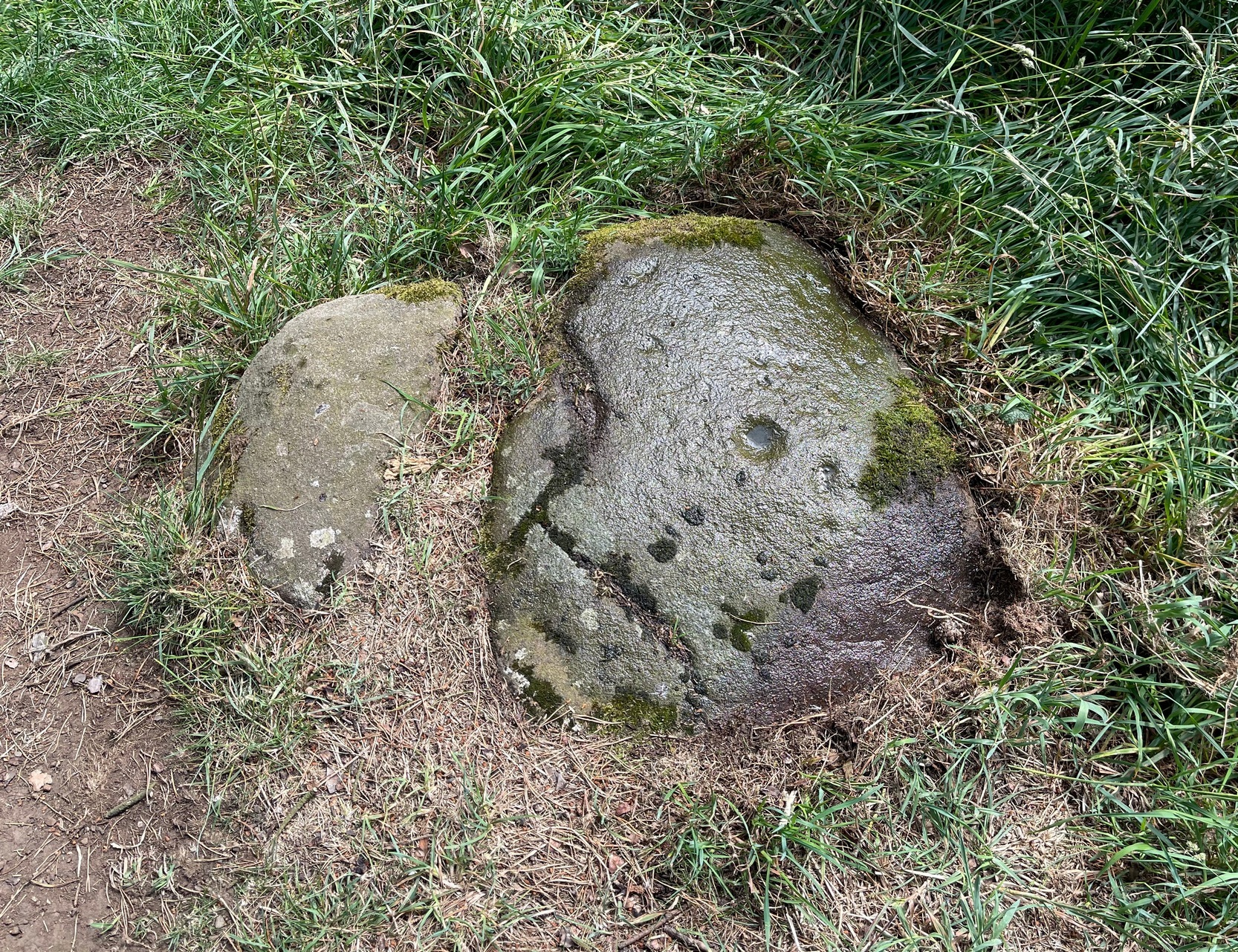
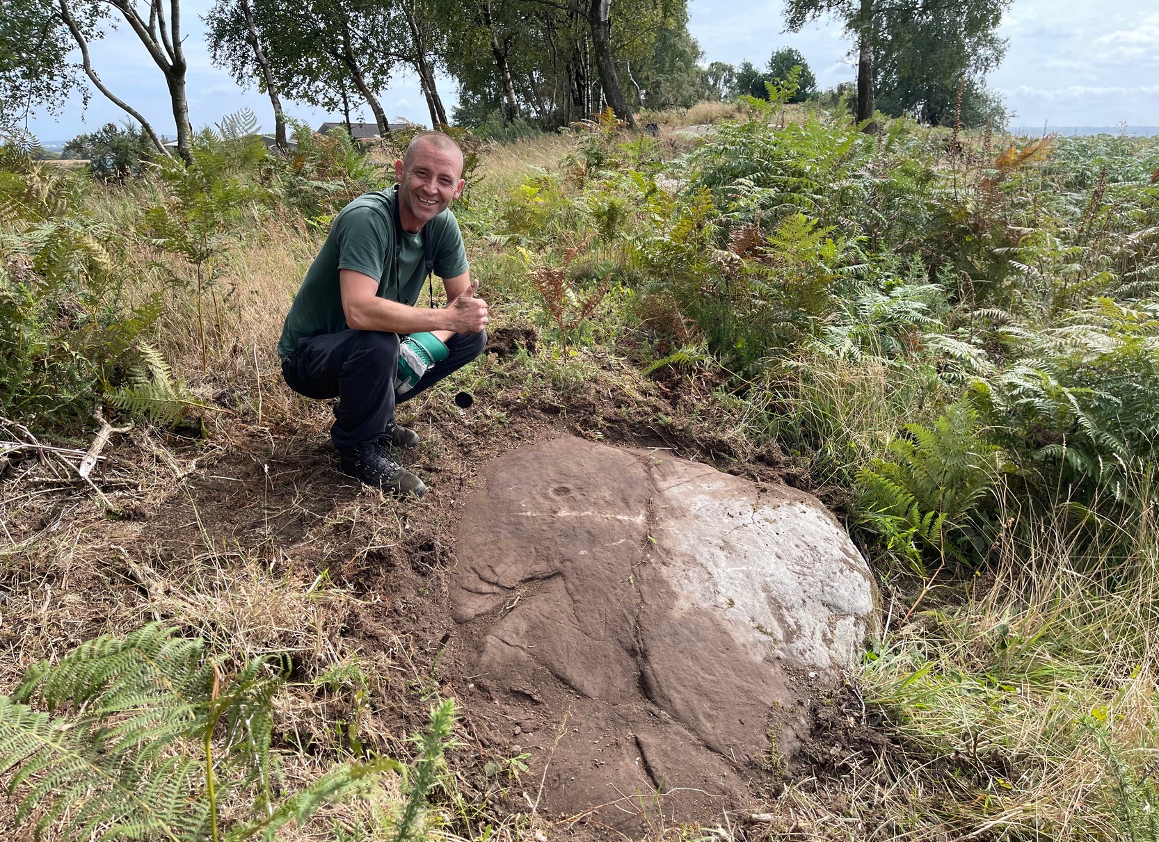
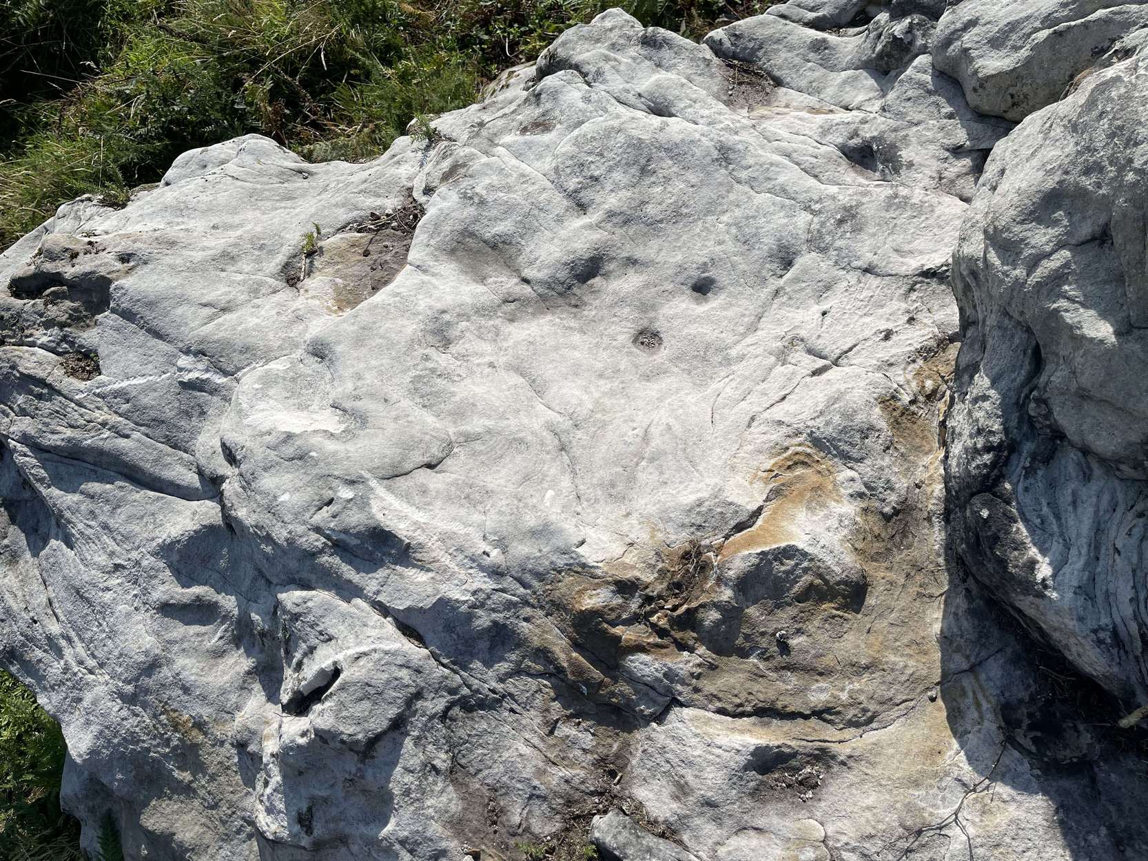
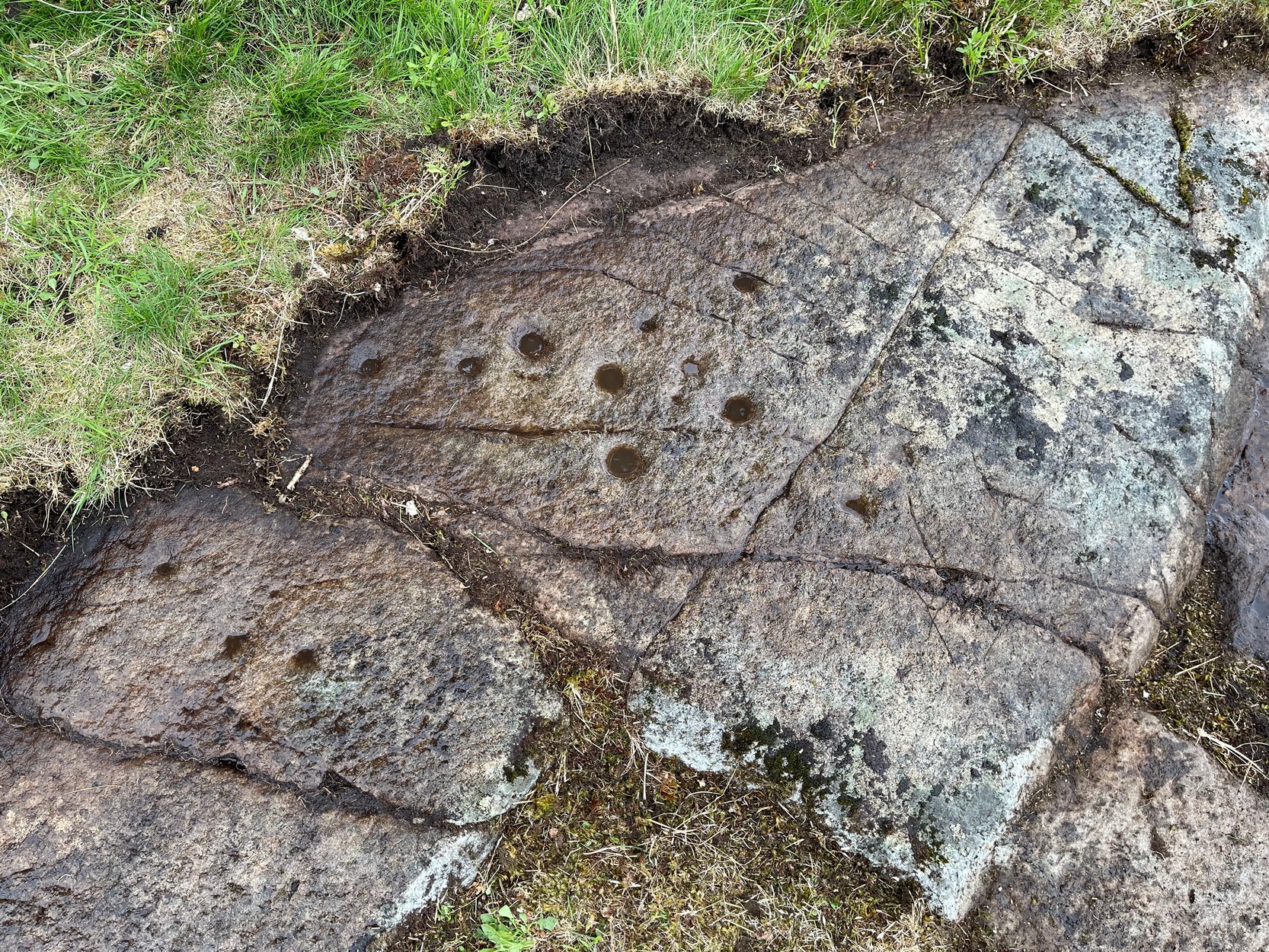
Found just a few strides away from the most impressive cup-and-ring stone at Tormain, is this quite un-impressive example and can easily be ignored. This simple cup-marked stone, first mentioned in Romilly Allen’s (1882) survey as “Stone B”,
“…lies 10 feet 3 inches to the north of stone A, and measures 4 feet by 2 feet 3 inches. It has a single cup cut on it.”
Tormain 2 “carving”Tormain 2 “carving”
Despite this being included in archaeological surveys as prehistoric, I’m unsure regarding the archaic authenticity of this single cup-mark and wonder whether it was just the result of idle dabblings by one of the quarrymen here in the 19th century. The lack of erosion leads me to suspect this. It has the appearance of cup-marks that have been carved by students at several different places in Britain (South Yorkshire, West Yorkshire, Perthshire, Renfrewshire, etc) over the last forty years. I’m quite happy to be wrong though! When the Royal Commission (1929) survey mentioned “a single cup on one boulder,” this may have been the one they were referring to.
Royal Commission Ancient & Historical Monuments of Scotland, Inventory of Monuments and Constructions in the Counties of Midlothian and West Lothian, HMSO: Edinburgh 1929.
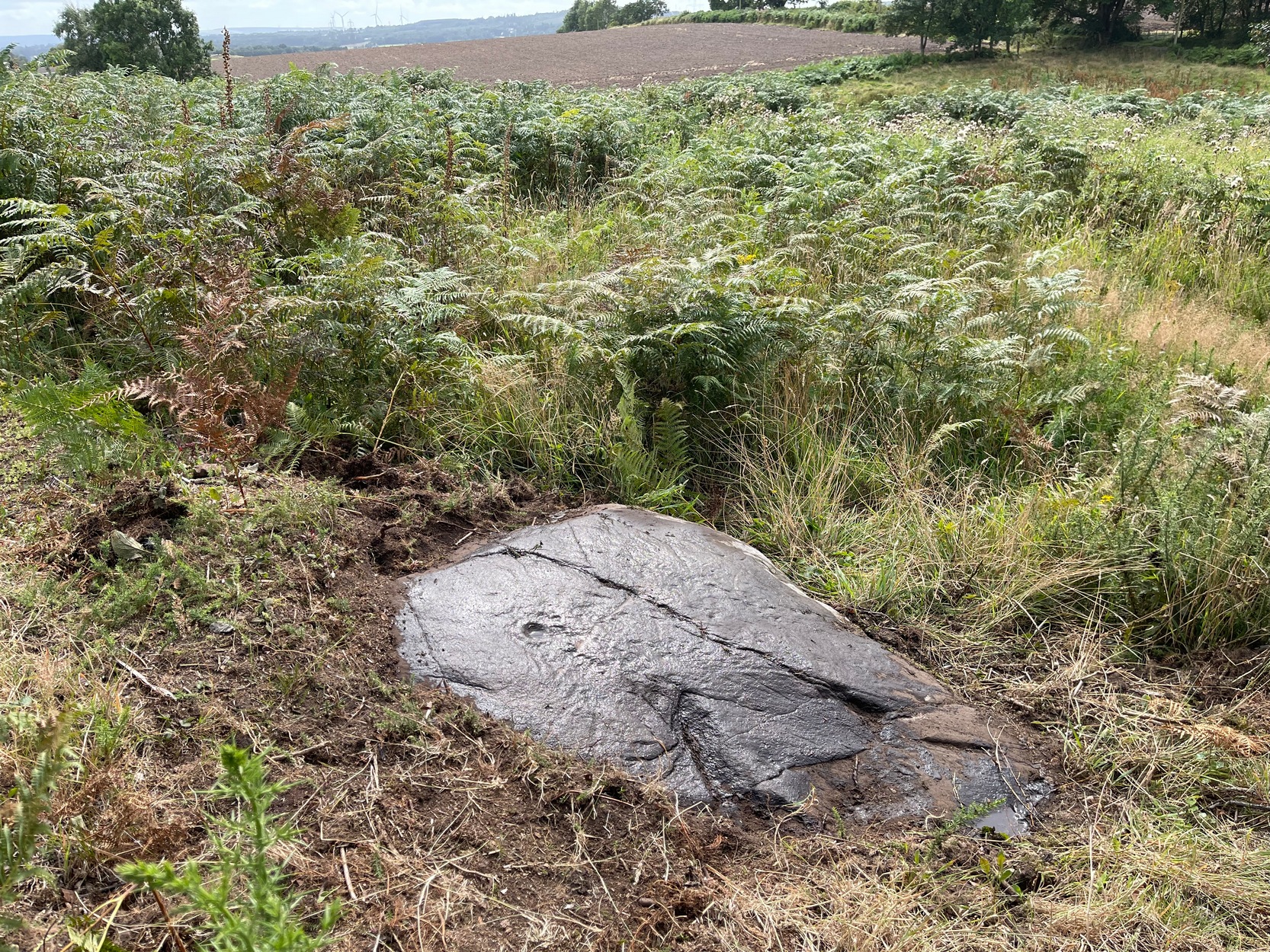
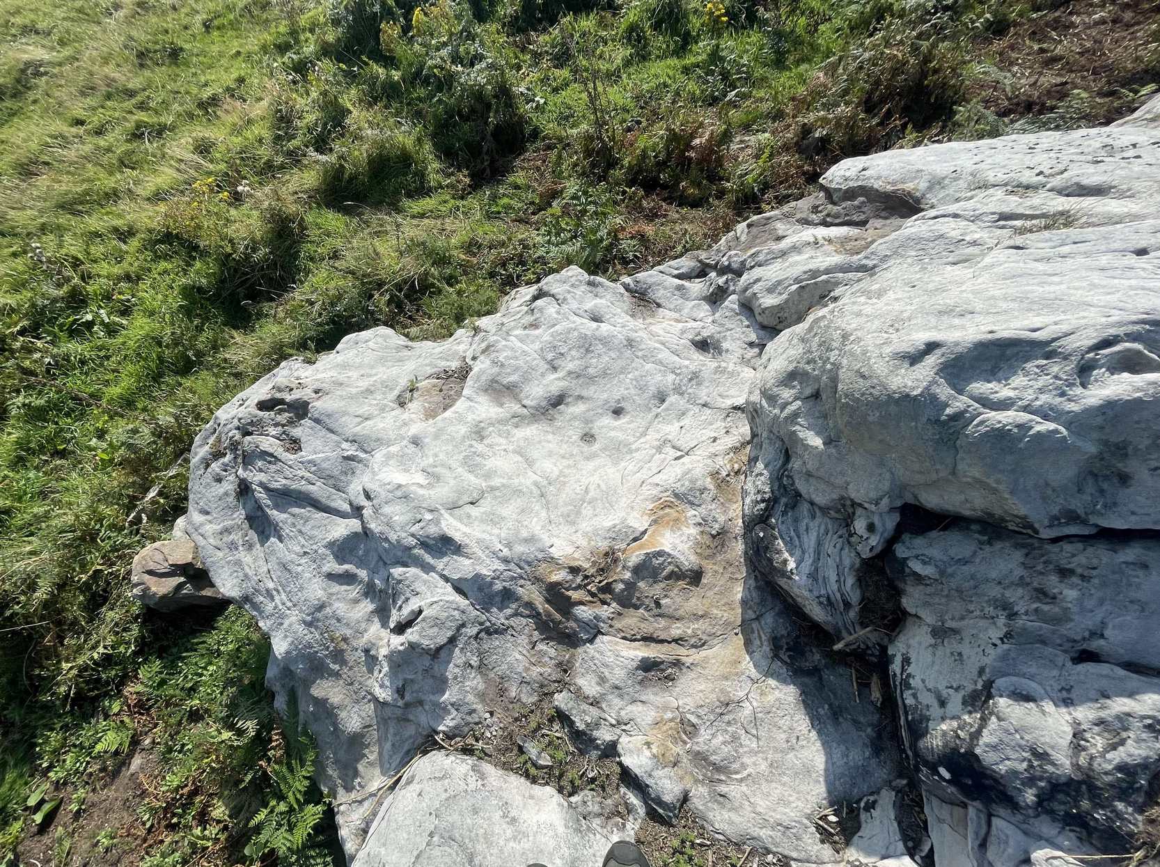
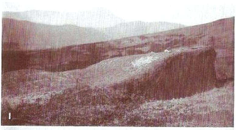
If you start from the Castleton (2) carving, in the first small birch copse closest to the road, walk to its southeast side where there’s a small break before the next small birch copse begins which runs along the raised rocky crag to the southeast. Walk along the back lower east-side of these birches for about 100 yards until you reach a break in the copse (the next lot of trees are another 30-40 yards further on) and from here walk up the slope onto the first flat piece of rock on the crag itself. Zigzag hereabouts until you’re about two or three yards from the edge.
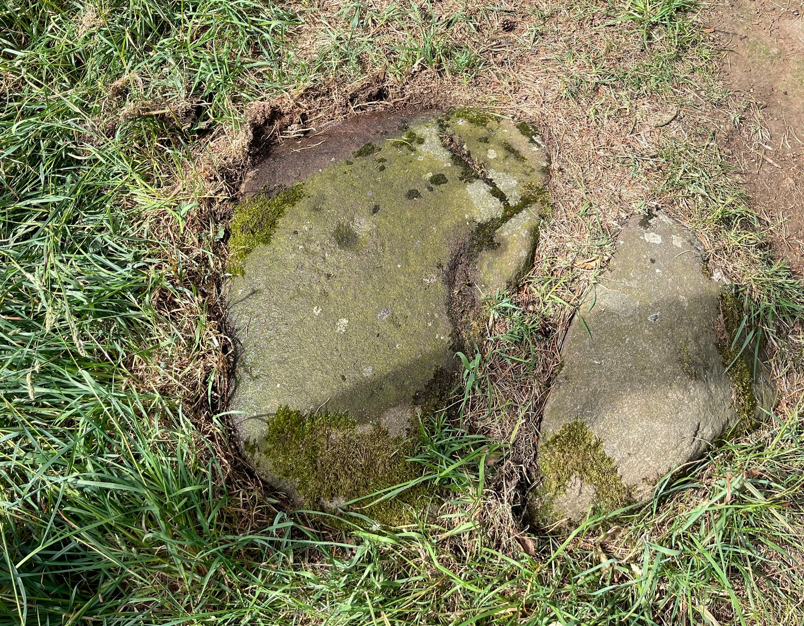
Archaeology & History
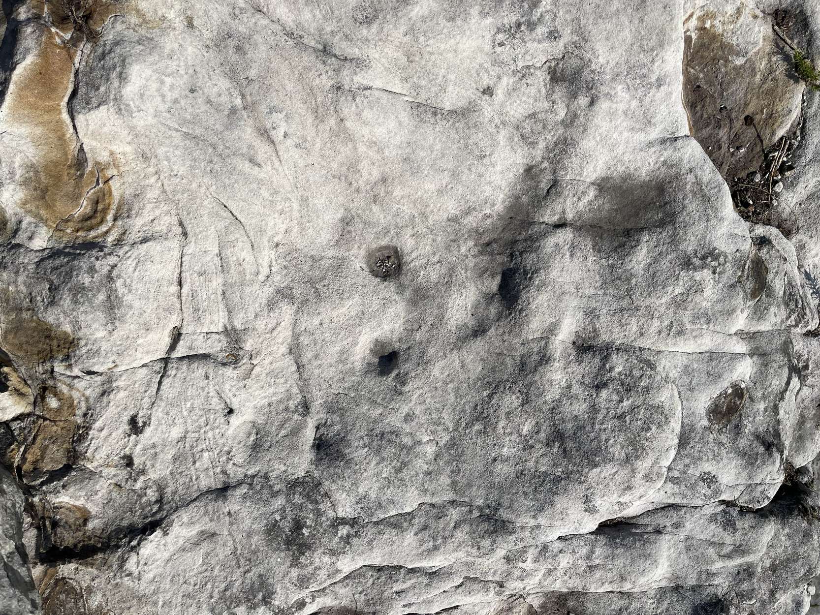
Single cup-and-ring
Once this rock surface is covered again by Nature’s carpet, you’ll struggle to find it. Unlike many of its more ornate neighbours, this seems to be a lonely solitary cup-and-ring design, cut near the edge of a large level piece of otherwise blank rock. Numerous geological nicks and scratches scatter the same surface, but the carved element is easy enough to see, as the photos here show. It was rediscovered in the 1980s by Morris & van Hoek (1986) who described it simply as “a single cup and one ring, 8cm in diameter on horizontal rock.” There may well be additional elements to this design beneath the soil.
References:
Morris, Ronald W.B. & van Hoek, Maarten, “Stirling District: Castleton 4d; Castleton 5e,” in Discovery & Excavation, Scotland, 1986.
Acknowledgments: Massive thanks to Thomas Cleland for helping to make this site visible again.
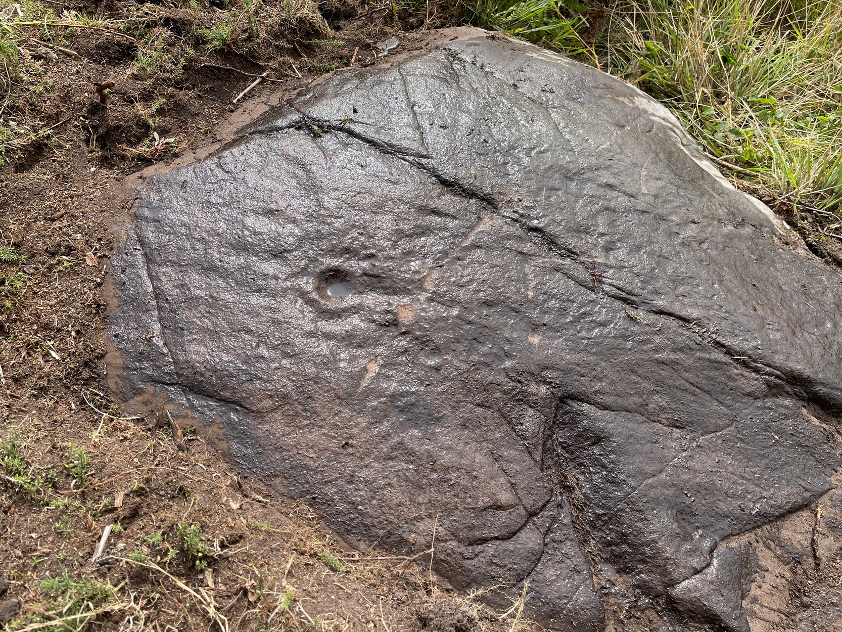
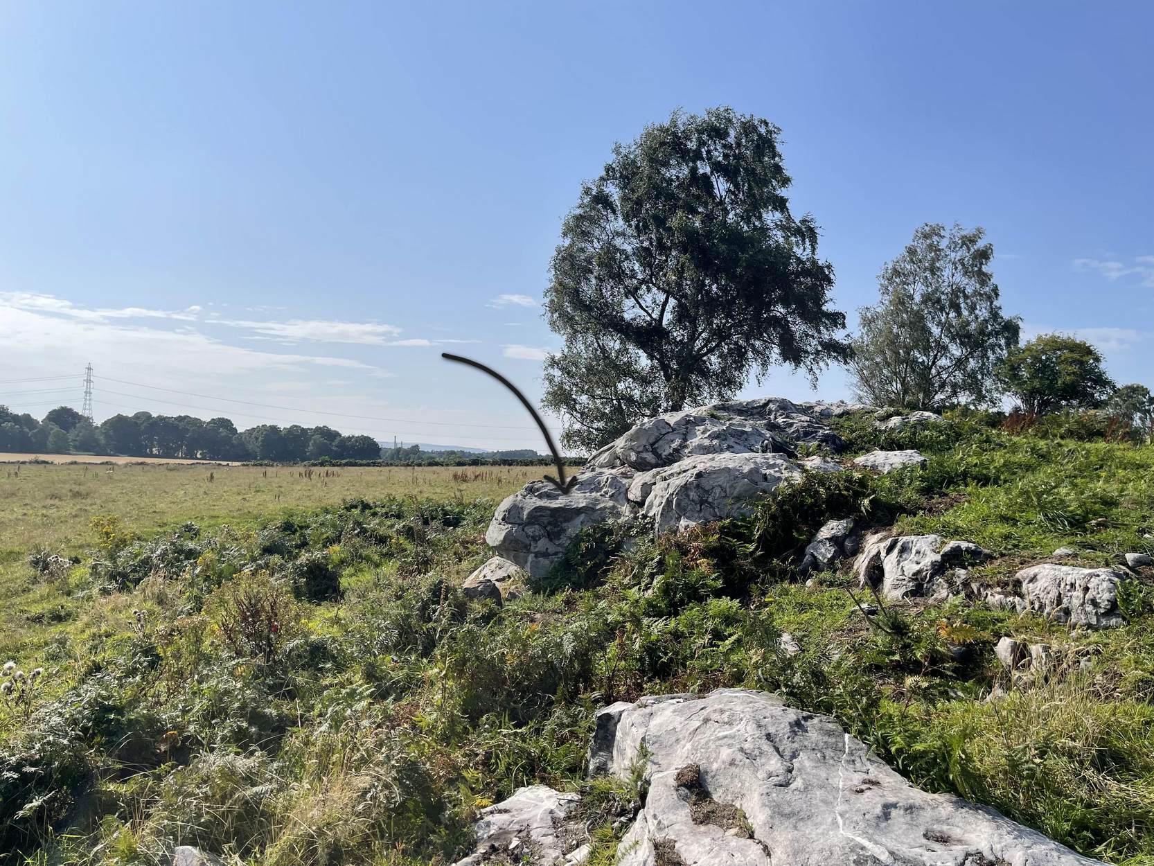
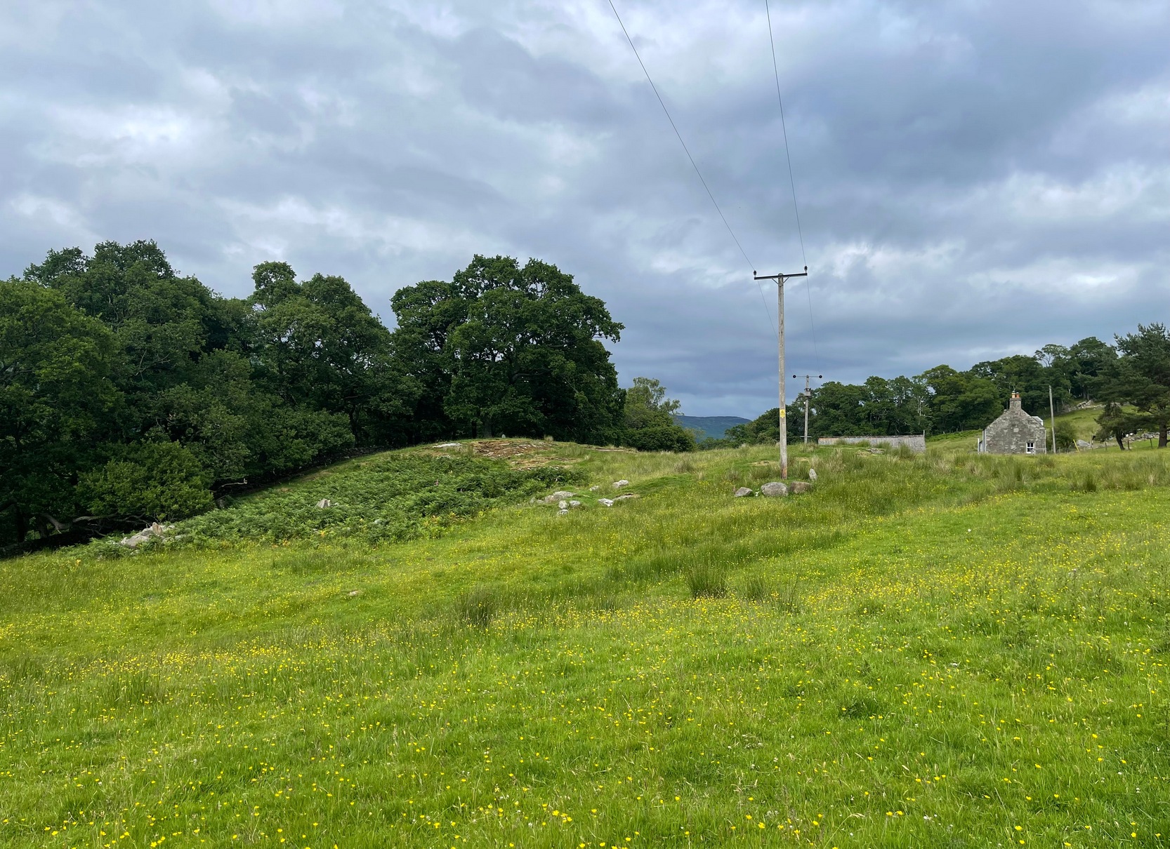
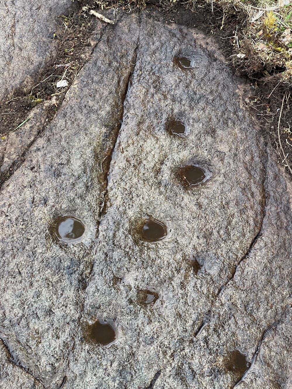
Start from the Castleton (2) carving, in the first small birch copse closest to the road and walk to its southeast side where there’s a small break in the trees before the next small birch copse begins, which runs along the raised rocky crag to the southeast. Walk to the front or western side of the trees there and along the very edge of the low crag. About thirty yards along, right on the edge of where the rocks begin, look for the smooth sloping earthfast boulder (about 20 yards before the mighty nine-ringer of Castleton 7). Rummage around and you’ll find it.
Archaeology & History
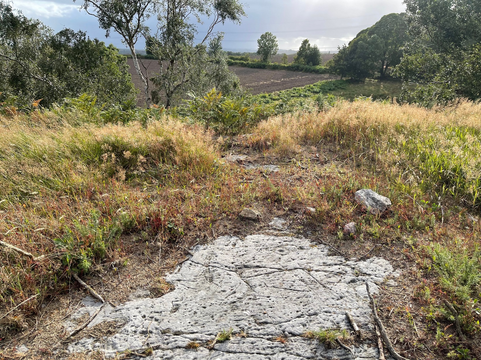
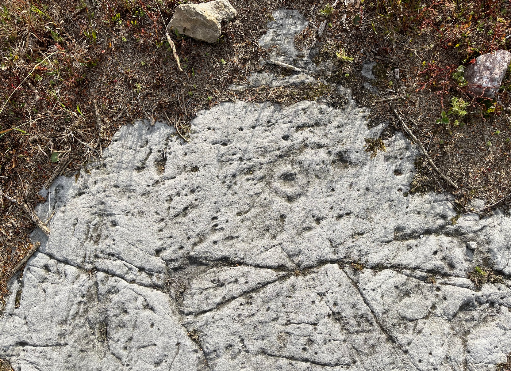
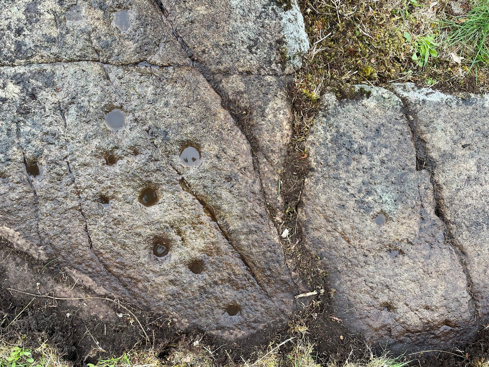
Castleton (7e) carving
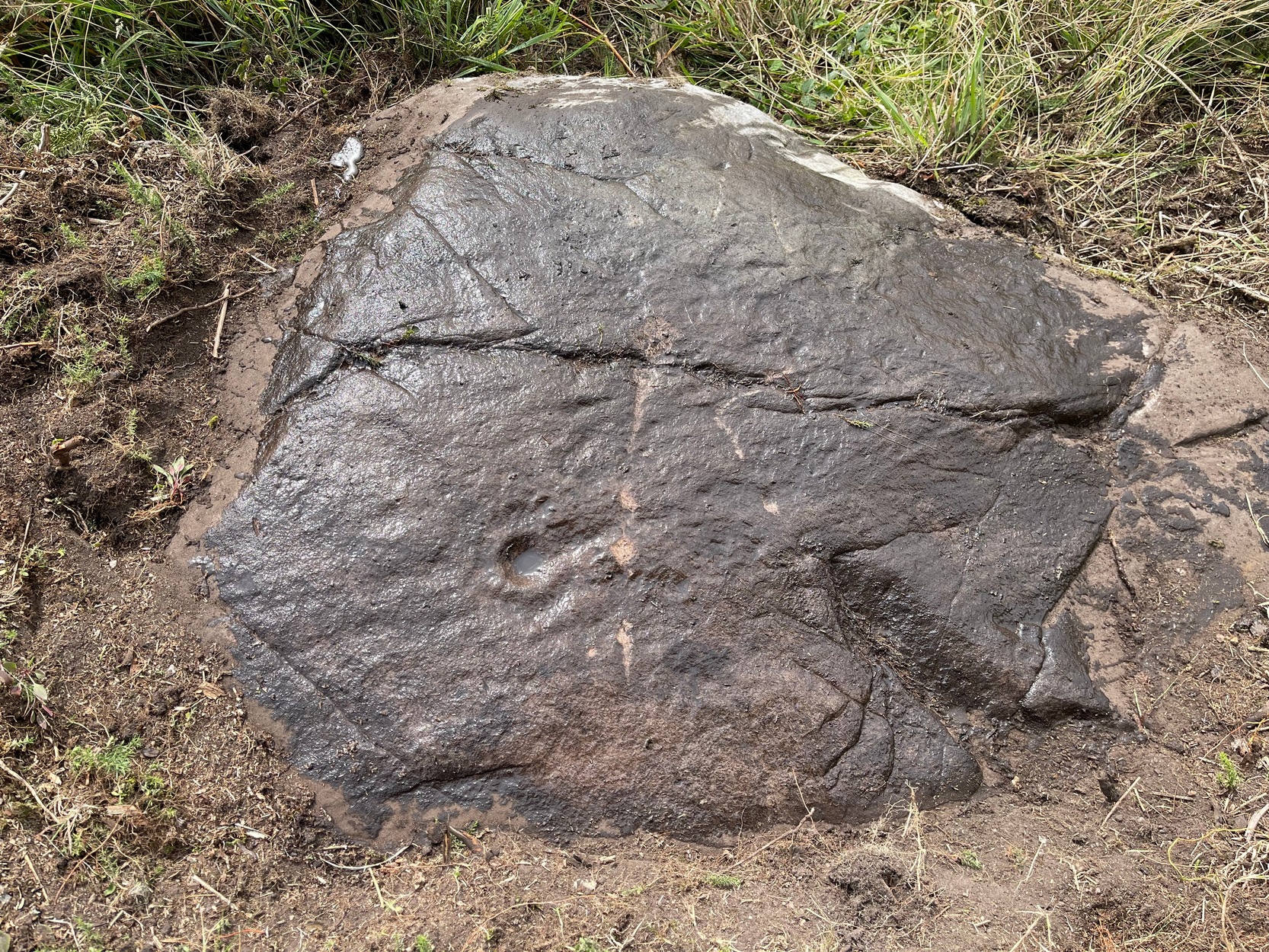
This newly recorded petroglyph was rediscovered by Thomas Cleland on August 6, 2025. Initially it was thought to consist of just a single cup-and-ring with an opening from which a carved line ran outwards; but, once wet, there seemed to be the beginning of an outer second-ring on its left-side. You can see it clearly in the photos. And, the more we looked, the more it seemed there were one or two other very faded elements.
Above the main cup-and-ring is a faint, shallow cup-marking and surrounding this appears to be an incomplete dumb-bell-shaped ‘ring’ that you can only just make out in the photos. It’s very faded and would seem to pre-date the primary design by some considerable time (unless, of course, it was merely ‘outlined’, so to speak and never completed).
Cup & ring & faint ‘bell’Cup & ring & faint ‘bell’
Both Tom and I are convinced that there’s more to this carving than is presently visible. The rock is covered in deeply compacted soil and it would require a lot of work to uncover the rest of it. A job for the future maybe…..
Note to self: This carving and all the others in the Castleton complex need to be fully re-catalogued as their indexing is haphazard through various academic tomes and websites.
Acknowledgements: Massive thanks to Thomas Cleland for locating this carving, for the first time in millenia. 🙂
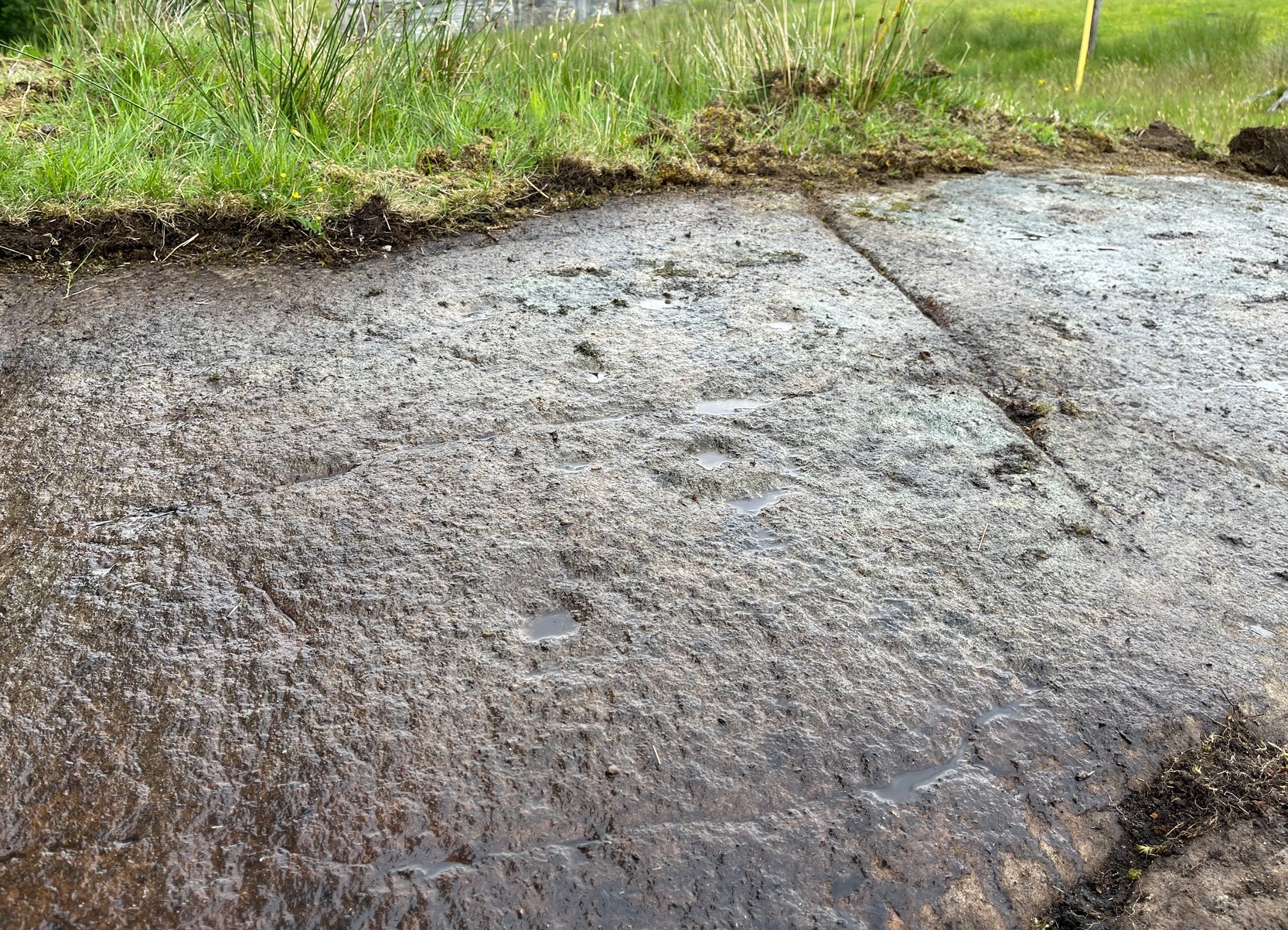
Follow the directions as if you’re visiting the impressive multi-ringed design of the Castleton (10) carving. Once there, walk south-east along the geological ridge for 45 yards where the small cliff drops down to the field. Just where this drop occurs, on a lower horizontal level of the rock face (only a small section) you’ll notice two distinct “cups”. You can’t really miss it!
Archaeology & History
This very basic cup-marked stone was, until recently, covered in dense gorse, making access to the site almost impossible. But following a fire that happened here not too long ago, the smoldering remains needed to be cleared and, once the job was done, we were able to see the two distinct ‘cups’ that were first described in Maarten van Hoek’s (1996) survey. But the cups that he described are, most likely, little more than Nature’s handiwork. I’m somewhat skeptical of them as being the real deal. In the same survey, he added another site, which are just natural bowls in the rock just over 100 yards southwest of here as being cup-marks — which they’re not!
References:
van Hoek, M.A.M.,”Prehistoric Rock Art around Castleton Farm, Airth,” in Forth Naturalist & Historian, volume 19, 1996.
Roughly halfway between Blair Atholl and Pitlochry on the B8079 road is the village of Killiecrankie where, at the junction, you should take the road which leads you over the River Garry. Crossing the river, follow the minor road swerving to the right and after nearly 200 yards bear left up the very minor road. 200 yards up there’s a hairpin bend; keep going up for about another 150 yards then walk into the overgrown grassland on your right where, just above an old hawthorn, a single notable rock protrudes. Y’ can’t really miss it!
Archaeology & History
Some of the cups visible in poor light
On my visit here recently, the day was grey and overcast which, in tandem with there being a reasonably decent cover of mosses living on the stone, prevented me from seeing the complete design of this petroglyph. I was thankful that it’s not an overly impressive one, so couldn’t be too disappointed. It was was rediscovered in recent years by George Currie (2005) on one of his many forays, which, in his typically evocative language, he described as: “Rock, 1.5 x 0.9 x 0.7m, a few metres W of the Tenandry road; 24 cups, largest 50 x 18mm.” Most of the cup-marks are a good depth and easy to see when you’re stood next to it. Sadly my photos didn’t manage to capture them too well.
A notable hut circle can be seen a short distance away up the slope, barely visible in the summertime. The carving may have been executed by the people living there. This is the only recorded cup-marked stone anywhere near here which, as rock art junkies will tell you, is unusual. Where there’s one, others tend to be living close by. Happy hunting!
References:
Currie, George, “Perth and Kinross: Balrobbie,” in Discovery & Excavation Scotland, volume 6 (New Series) 2005.
Acknowledgements:Huge thanks for use of the Ordnance Survey map in this site profile, reproduced with the kind permission of the National Library of Scotland.
In Miss Maitland’s (1935) article on the Ledard Stone carving, she also made a brief mention of “another cup-marked stone (that) lies on the edge of the burn, beyond the one described, above Loch Ard.” She gave no further information about this second stone. It remains lost and sounds to be only a short distance further uphill and on the west-side of the burn. If any local explorers are able to find this carving please let us know and, if possible, add some info and photos of it on our Facebook page. (the grid-reference for this site profile is an approximation)
References:
Maitland, Mrs, “Cup Marked Stones”, in The Scottish Country Woman, 1935.
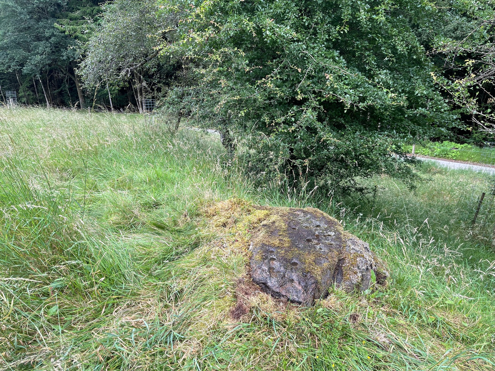
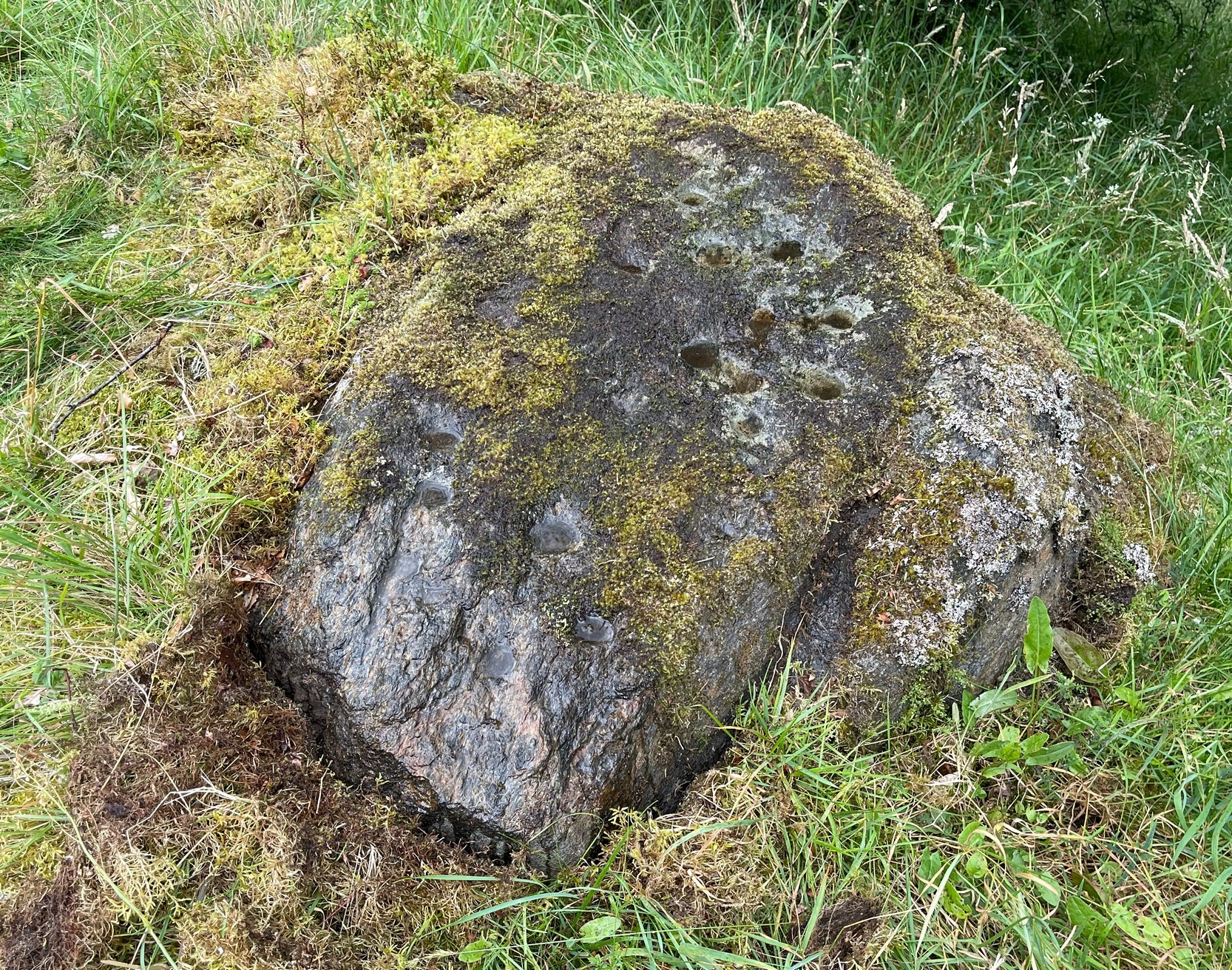
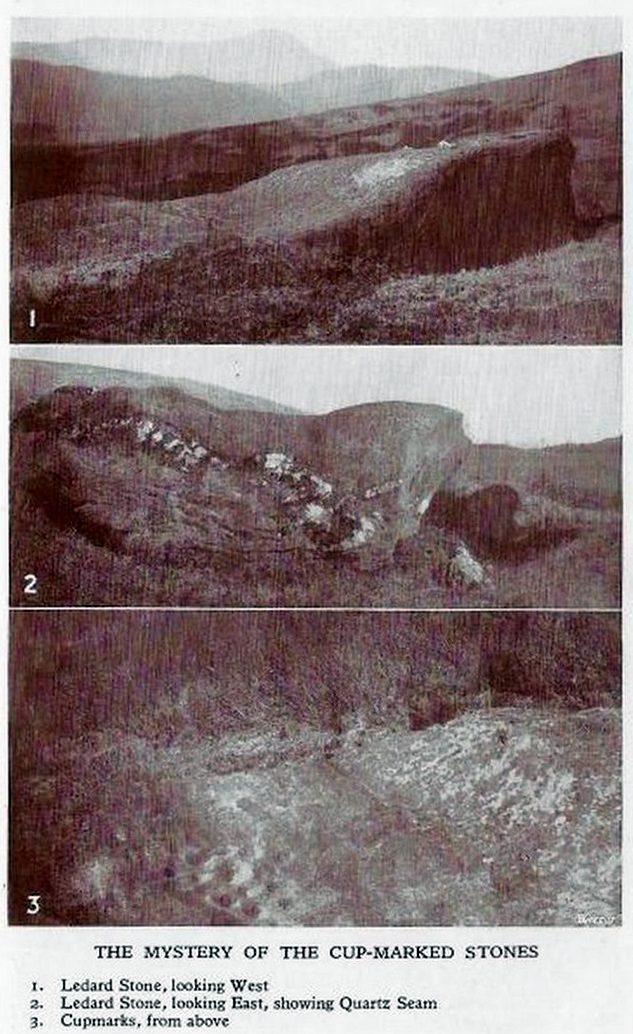
This carving hasn’t seen the light of day, seemingly, since it was first reported by a local lady, a Miss Maitland in the 1930s—and who, it transpires, uncovered a number of petroglyphs in this neck of the woods. She found it on one of her many forays in the mountains hereby and took some old photos of it—although they’ve not reproduced too well for the sake of the site profile. (apologies)
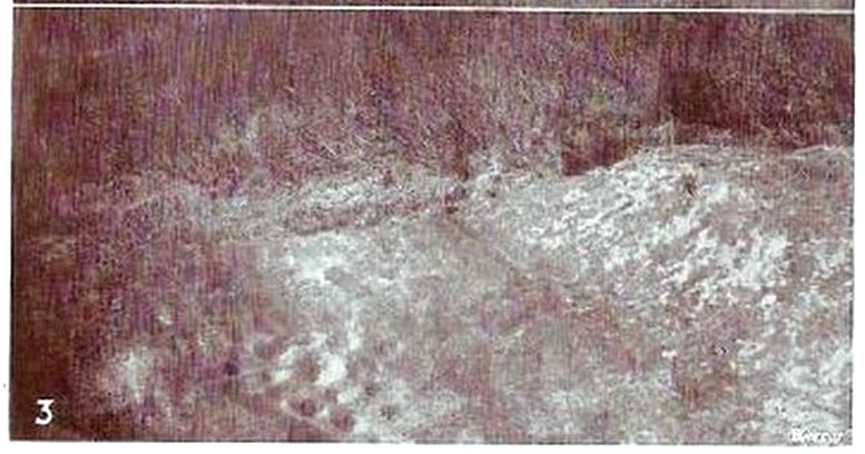
Since Miss Maitland’s days, the hillside has been covered in forestry plantation, making it extremely difficult to locate the carving. However, due to the reasonably large size of the stone, it should still be there (smaller cup-and-ring stones have been damaged and destroyed by forestry over the years); and as we can see in the middle photo, a long thick vein of quartz runs roughly along the middle of the stone—an ingredient which may have been significant for the people who carved the stone. In her article in the Scottish Country Woman magazine, Miss Maitland told:
cup-marks, bottom left
Ledard Stone
“On the hill directly behind Ledard, on the north side of Loch Ard, a little to the west of the burn and a little to the east of the first grouse-butt, exactly 700 feet above sea level, lies a large boulder. Ice has smoothed and fashioned it and on the worn surface may be seen twenty-one, or so, small round hollows, varying in size and depth. The pattern made is roughly diamond-shaped, pointing directly east and west. I saw them for the first time as the sun was setting on New Year’s Eve, 1932. It was a solemn moment, for as far as I know no one else had looked upon them with such joy, and even awe, for perhaps a thousand years!”
She may have been right. And by the sound of her words, she’d certainly caught the petroglyph bug!
Anyhow, the carving doesn’t appear to have been seen since then. A “cup-marked boulder” was noted in the Royal Commission’s (1979) listings, but with no further details. We assume it must be the same carving, although they never visited it. It’s also possible that they were referring to another lost cup-marked stone a short distance further up the hill from here. If any local explorers are able to re-locate the carving, please let us know, and maybe add some info and photos of it on our Facebook page.
References:
Maitland, Mrs, “Cup Marked Stones”, in The Scottish Country Woman, 1935.
Royal Commission Ancient & Historical Monuments of Scotland, Archaeological Sites and Monuments of Stirling District, Central Region, Society of Antiquaries of Scotland 1979.
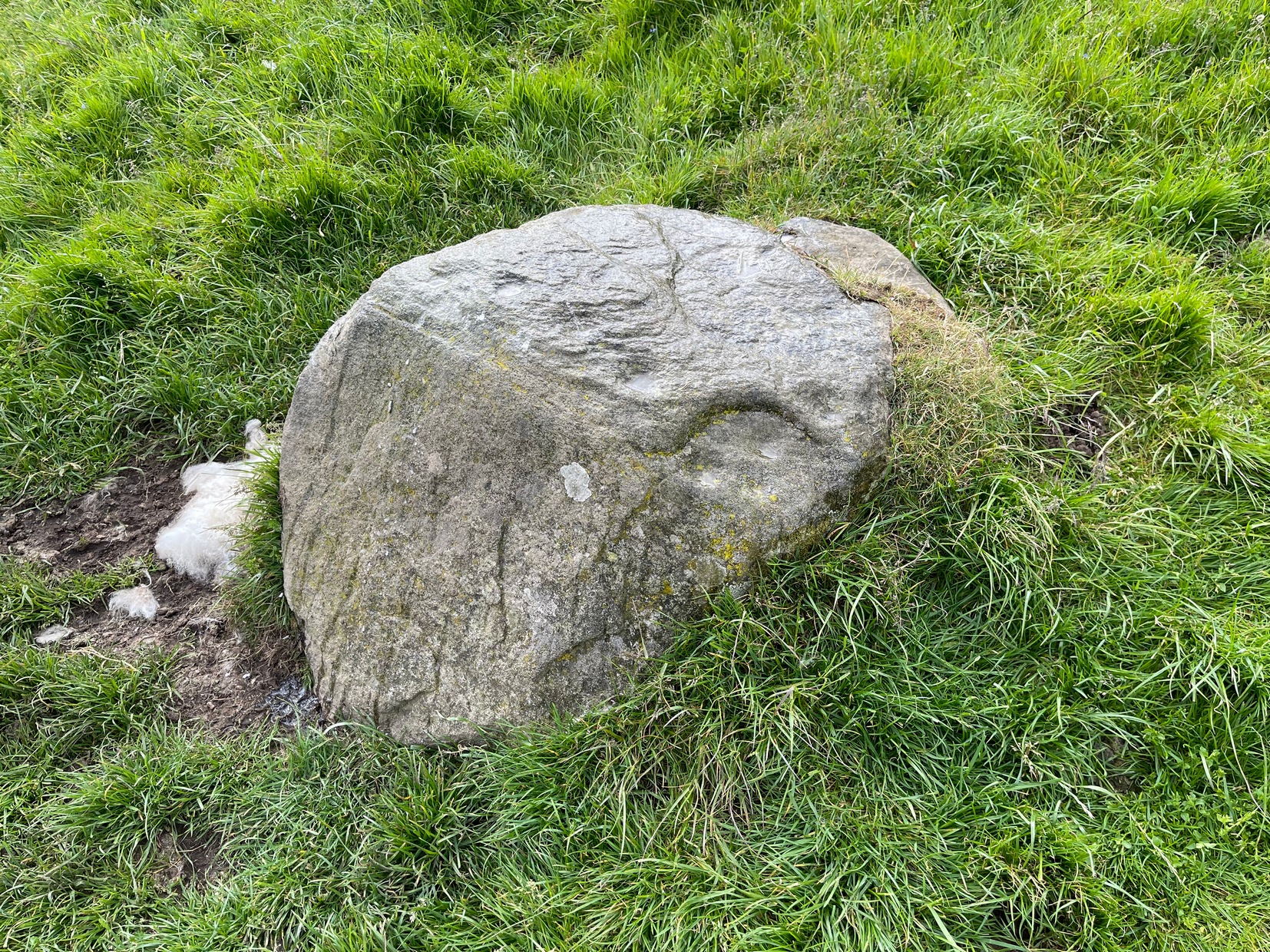
Take the same directions as if you’re visiting the Tormain (1) carving (the best one of the bunch here), but about five yards before reaching it, to your immediate left, just at the edge of where the hill drops down slightly, you’ll see a small flat rock poking out of the ground that may have been cut and quarried at some time in the past. That’s the one!
Archaeology & History
This small compact design looks like a typical cup-marked stone with the usual scatter of cups in no seeming order—until, that is, you walk around it and look at it from different angles, whereupon you’ll notice that a couple of distinct deep carved lines have been cut in a cross formation, with cup-marks at the ends of the crucifix. My view of this is that cup-marks were done first, probably in the standard Bronze Age period, and the ‘cross’ was cut into the stone at a much later date, probably during the early christian era. The depth of the lines which create the ‘cross’ is deep and thin at the bottom, suggesting a metal tool, which seems to have been cut into an natural crack. Visitors here will notice a small drill-hole near the edge of the stone which seems to have been done by local quarrymen, probably in the 19th century.
It was first described in Romilly Allen’s (1882) article on the Tormain stones. He called it ‘Stone E’ and told that it
Location of Tormain 5
Cups, lines & cross form
“is situated about half-way between stones A and D, and is furthest to the east. It measures 1 foot 4 inches by 1 foot 9 inches, and projects 1 foot above the turf. Its upper surface is flat, and on it are carved eight cups varying in diameter from 1 to 2½ inches. There are two connecting grooves between three of the cups, forming a rude cross. Another cup has a channel leading over the edge of the stone.”
In November 1927, the Royal Commission dudes visited the carving (and its companions), but they had to roll back the turf to see it clearly. On the stone they saw that “at least nine or ten cup-markings, in some cases with connecting gutters, are still more or less clearly outlined.”
Carving highlighted (Morris ’82)
Ron Morris’s old photo
When Ron Morris (1981) visited here, he highlighted the carving in chalk to get a decent impression of the design, as the attached photo here shows. Many traditional cultures ritually paint their carvings at set times of the year, in traditions that go back many centuries—perhaps even millenia. In all probability the same thing was done at some of the British petroglyphs, although there are no remaining traditions. Anyhow, Morris described it succinctly as:
“½m square, ¼m high…on which are: eight cups up to 7cm (3 in) diameter and 4cm (1½ in) deep and some grooves, to of which connect some of the cups to form a well-defined Cross.”
The stone was looked at by the great rock art explorer Kaledon Naddair of Edinburgh, but sadly I’m unable to locate his report and the fine illustrations that always tended to accompany them. If you’re reading this sir, give us your valuable input!
Beckensall, Stan, Rock Carvings of Northern Britain, Shire: Princess Risborough 1986.
Beckensall, Stan, British Prehistoric Rock Art, Tempus: Stroud 1999.
Feachem, Richard, Guide to Prehistoric Scotland, Batsford 1977.
Hadingham Evan, Ancient Carvings in Britain: A Mystery, Garnstone: London 1974.
Morris, Ronald W.B., “The Cup-and-Ring and Similar Early Sculptures of Scotland; Part 2 – The Rest of Scotland except Kintyre,” in Transactions of the Ancient Monuments Society, volume 16, 1969.
Morris, Ronald W.B., The Prehistoric Rock Art of Southern Scotland, BAR: Oxford 1981.
Royal Commission Ancient & Historical Monuments of Scotland, Inventory of Monuments and Constructions in the Counties of Midlothian and West Lothian, HMSO: Edinburgh 1929.
Acknowledgements: Huge thanks to Jan Carrington for use of her photos. 🙂
Go along the minor single-track road on the south-side of Loch Earn (between Edinample and the ugly Lochearn Leisure Park) and roughly halfway along the loch, there’s rough parking near Ardvorlich House (the starting spot for walking up Ben Vorlich). Walk east past the track to Ardvorlich, staying on the lochside road, for about 400 yards and then go up the dirt-track on your right. Walk up here for about 200 yards and, before you reach the trees, notice a small gate in the walling above you on your right, about 70 yards up the slope. Go through here and bear immediately left, up to the large oak on the large dome of rock. From the oak, with your back to the wall, take about 10 steps forward. You’re here!
Archaeology & History
Deep cups & faint rings
The singular short reference to this impressive design was by George Currie (2011) who told us that it “bears at least 17 cup marks, three of which have single rings.” But there are in fact six of them with rings, possibly seven—with a few additional cup-marks scattered across the wider rock surface. It’s quite impressive, although on our visit here the daylight was gray and so the photos I have of the site do not do it justice. The sun popped out a couple of times, but only for a few minutes and we weren’t able to take advantage of it quickly enough.
The distinctive section of this petroglyph are the deep cup-marks on its northern side: fourteen of them, three of which have faded shallow rings around them—or rather, uneven oval-shaped surroundings. The cup-marks have obviously been worked and re-worked over the centuries, whereas the rings were given less repetitive attention, for whatever reason. This is a pattern found at a great number of cup-and-ring stones across the country.
Shallow cups, faint ringsAnother angle of deep cups
From this cluster of deep cups, walk two or three yards south onto the slightly lower smooth rock surface, where we find a much less pronounced scatter of several shallow cup-marks—may be five, may be six—but three of them have faint rings around them. They were difficult to see on our visit here due to the poor light. There’s what may be another incomplete cup-and-ring another two or three yards further along on the same rock face: a cup, certainly; the faint ring, perhaps. We need to revisit this in better light.
The rock surface continues for quite some distance all round here in the shape of a large dome, much of it covered in vegetation of varying depths. There are openings showing the bare rock and, at several other spots there are several other cup-marks, although none are as deep as the ones we’ve just described. On the edge of one piece, about three yards north of the deep cups, a couple of worn cup-marks are near the edge of one rise; two others are clearly notable a yard or so WNW of the deep cups; whilst there are several other single cups near and not-so-near of the main design. It all requires a lot more work before we see the entire picture.
It’s a gorgeous site: silent with the feel of winds and waters and the scree of buzzards touching the senses: elements that, at some petroglyphs, had mythic relevance…
References:
Currie, George, “Comrie: Balimeanach (BC 2), Cup-marked Rock”, in Discovery & Excavation Scotland, New series – volume 12, 2011.
Acknowledgements:Huge thanks for use of the Ordnance Survey map in this site profile, reproduced with the kind permission of the National Library of Scotland.
Along the A822 road from the Gilmerton junction on the outskirts of Crieff, heading up towards the Sma’ Glen, after literally 1¾ miles (2.8km) on the right-side of the road you need to follow the route to reach the Connachan rock art cluster by walking up the dirt-track leading up past Connachan Farm. Walk past the carving of Connachan (2) and up the track past Connachan (4), then onto the level ground and walk right to the low-lying ruined Connachan cairn. From here, look up the gentle slope to the fence. A small-ish stone protrudes out 40 yards away. Head straight for it!
Archaeology & History
Close-up of line of cups
You’ll check this out when you’re doing your tour of this petroglyph cluster and sit here to admire the view. It’s the last of the small bunch of carvings, on level ground, close to the denuded cairns. It consists of just eight cup-marks, all of which are carved close to the edge of the stone on its upper sloping surface; although this doesn’t tally with Margaret Stewart’s (1967) description of any of the carvings hereby. There’s nowt much more to be said about it to be honest; apart from saying how it’s highly likely that other carvings remain hidden, undiscovered, not far from this stone along the edge of these hills.
References:
Stewart, Margaret E.C., “Connachan, Crieff – Cup Marks and Hut Circle,” in Discovery & Excavation, Scotland, 1967.