Cup-Marked Stone: OS Grid Reference – SE 0745 4470
Getting Here
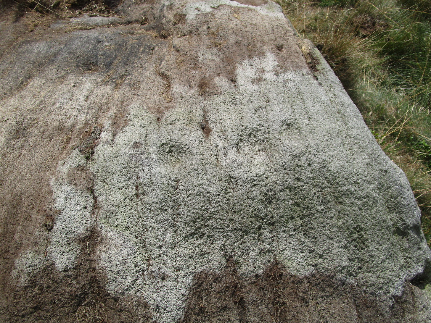
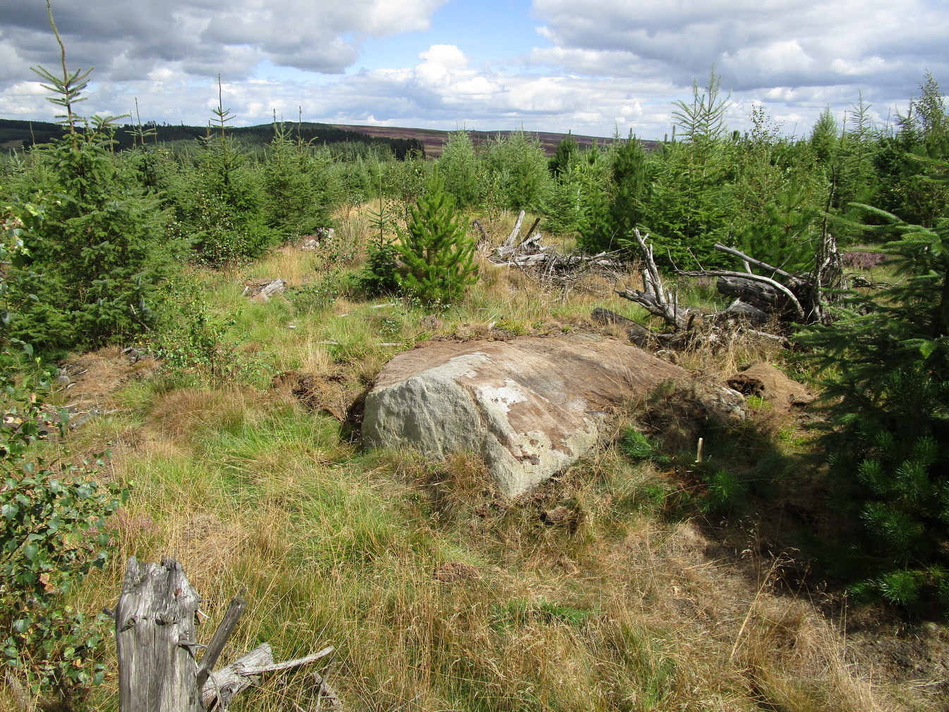
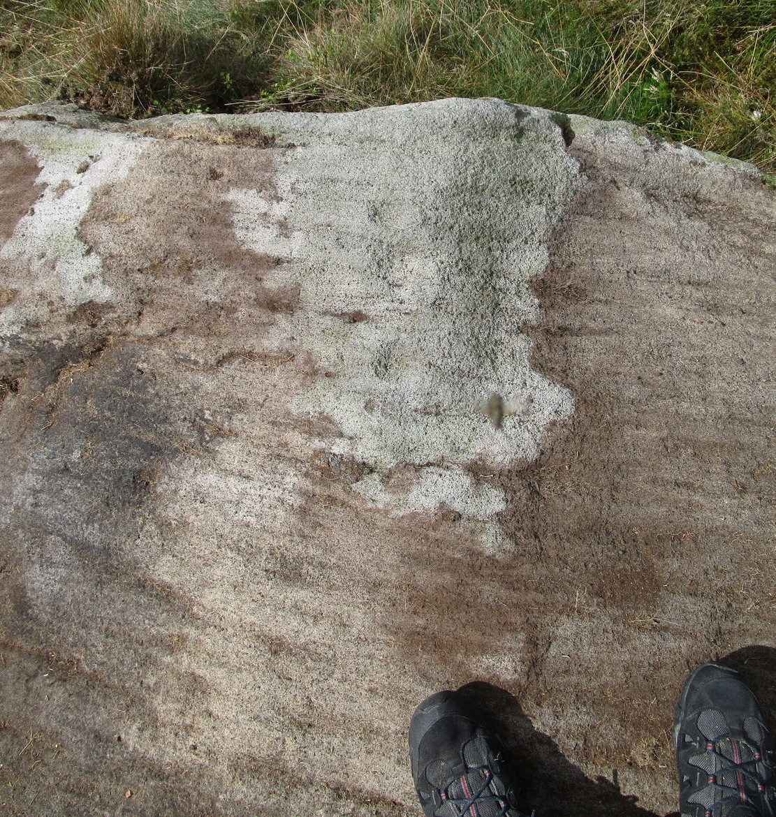
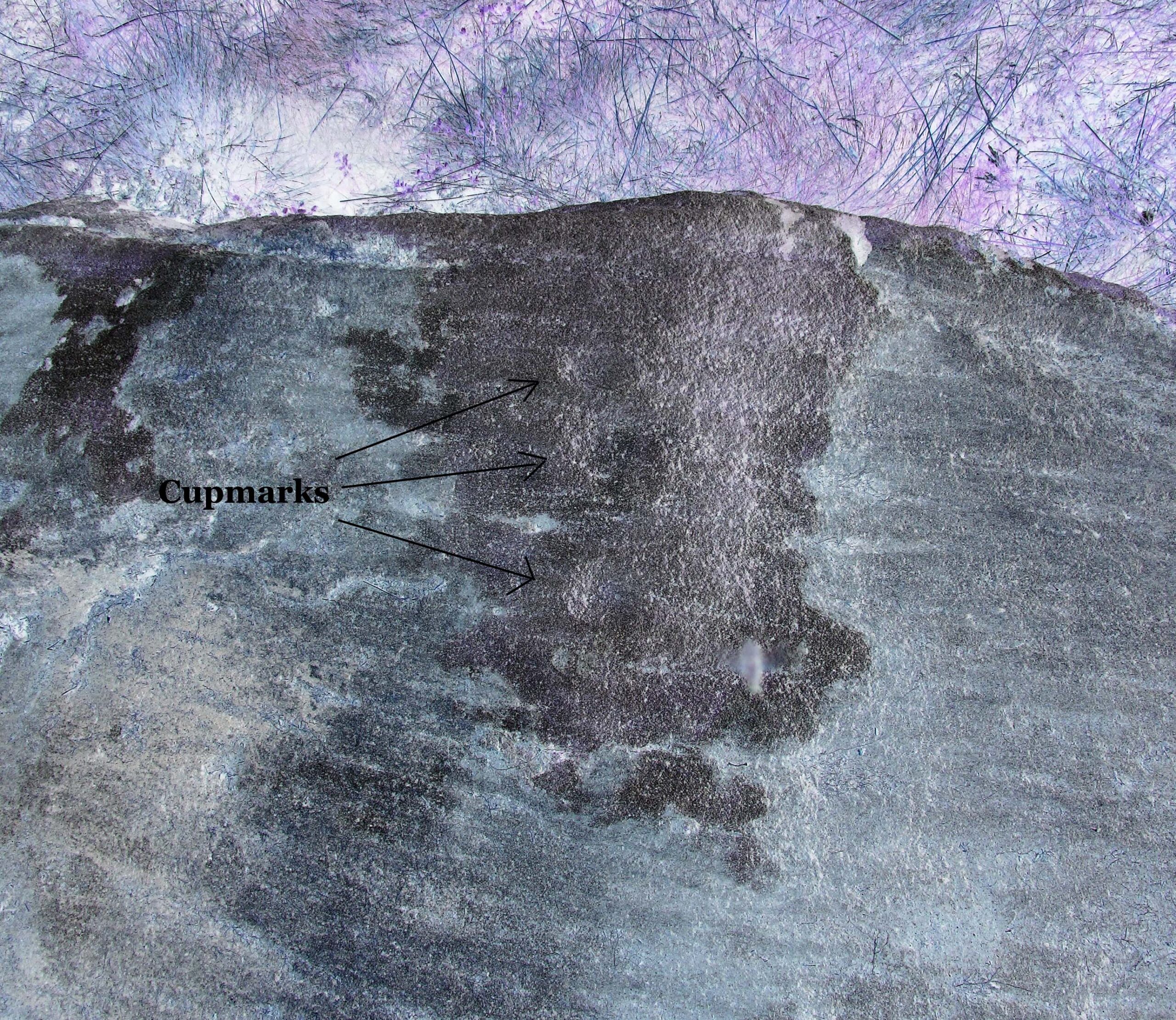
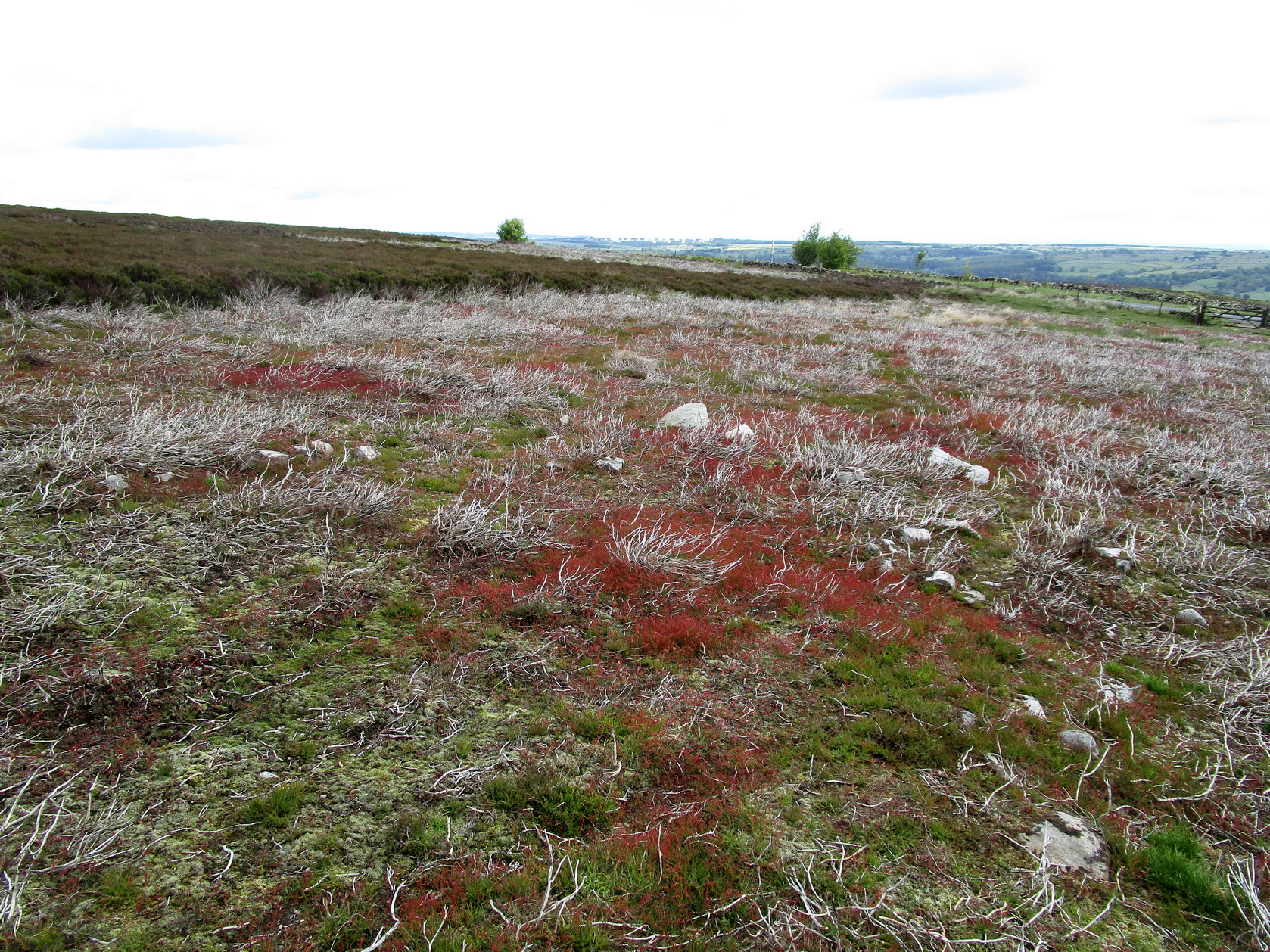
Rivock Top stone
Best approached via the Wondjina Stone, then over the wall and follow the geological ridge that bends into the trees. It’s difficult to find amidst the dense forest and is another one of those carvings that’s probably only for the purists amongst you.
Archaeology & History
If you’re doing the Rivock rock art tour, you might as well give this a go once you’ve checked ou the decent ones nearby. Here, on a rather large stone we find, on its uppermost ridge, three faint cup-marks next to each other in a very slight curve. The cup-mark in the middle is slightly larger than its two compatriots and might be natural. If you were to wet the rock when the sunlight is just right, you’ll probably get a better idea of its real appearance—otherwise we’ll have to let the computer-gadget lads suss it out!
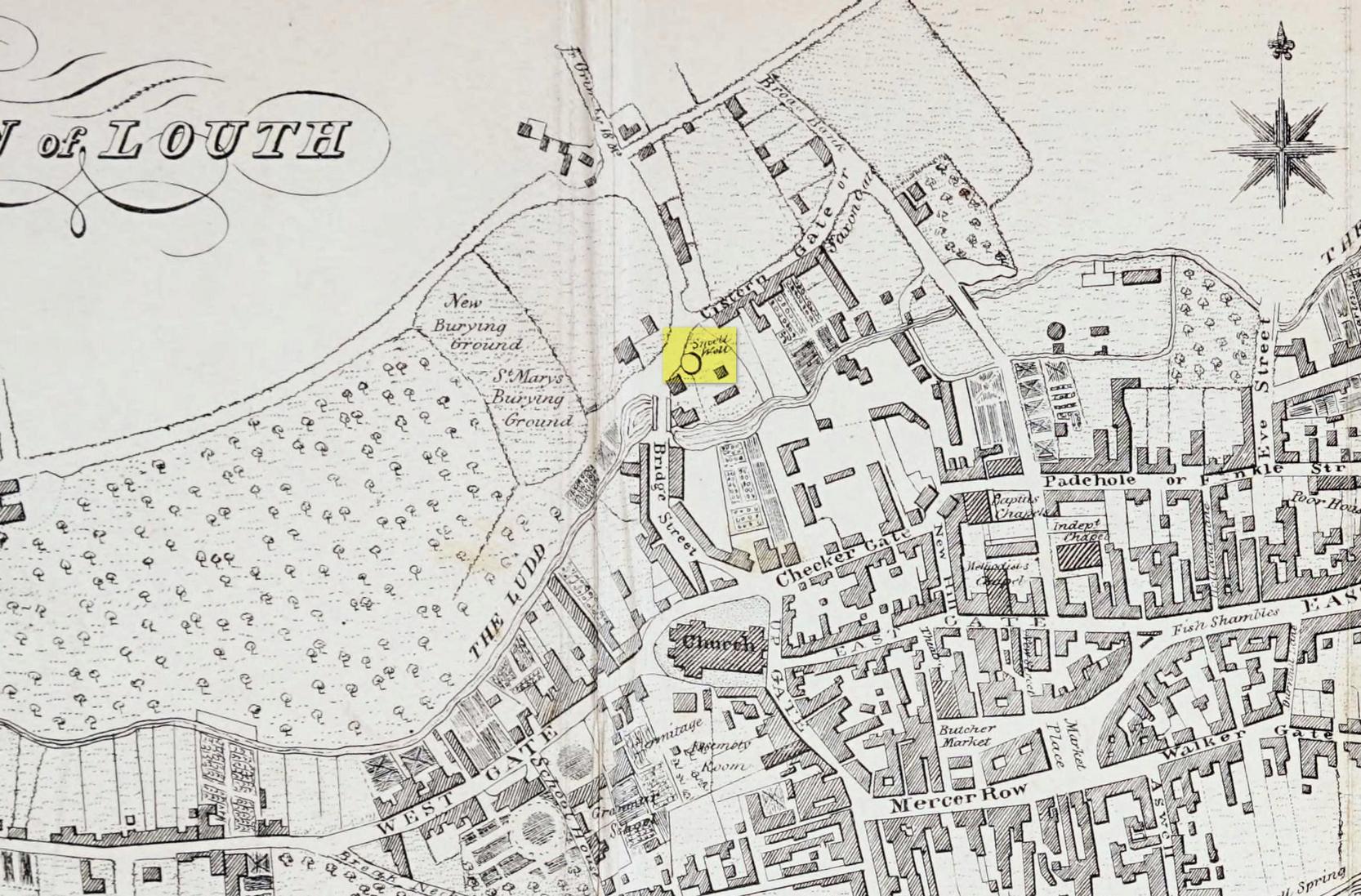
Sacred Wells (destroyed): OS Grid Reference – TF 32603 87555
Also Known as:
Little Wells
Archaeology & History
Small Well on 1834 map
Of the three wells in old Louth around which local ceremonies occurred, the Small Wells were apparently the least impressive. Its ritualised compatriots south of the River Lud in St. Helen’s Well and the Ash Well (the Aswell in modern Louth place-names) were reportedly the much better water supplies in bygone times. The site was highlighted on a map of the town in Robert Bayley’s (1834) history of the area, showing it as a small pool just below the Cistern Gate road; but when the Ordnance Survey lads came here later in the 19th century it had already gone.
It’s category here as a “sacred” well is due to it being annually decorated with garlands of flowers, commonly known today as well-dressing. Such wells tend to be places of pre-christian rites, attended by local people at dawn usually at Beltane or at Midsummer (St John’s Eve); but I’ve been unable to find out which was the sacred day when the waters here were honoured. All that we have left to tell us of the rites is from old township notes that said how,
““The small wells,” a cluster of little springs on the north of the town, shared in the honours of green boughs and popular huzzahs” the traditions held at the wells of St. Helen and Aswell a half-mile to the south.
A brief 16th century account told of a local man being paid for the adornment of the Small Wells: one “Henery Forman received for dressing small wells for a yeare – xiid” – or 12 pennies in old money. Not bad at all in them days!
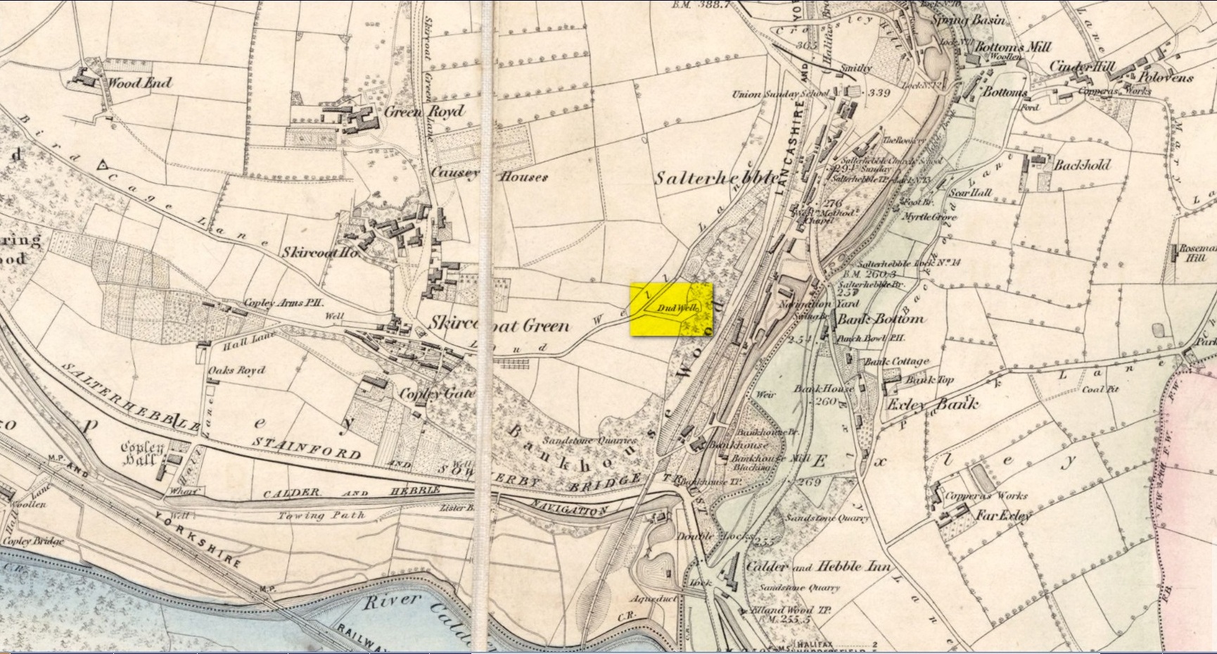
This curiously-named old water source may have an equally curious history behind it – albeit forgotten. Shown on the 1854 OS-map of the area and giving its s name to Dudwell Lane, we can see how an old path led from the road to the well and nowhere else.
It’s the word “dud” that holds our attention here; for if we hasten to the immensely erudite Joseph Wright (1900) in his gigantic survey of northern dialect, we find that the word relates to “a rag, piece of cloth; pl. clothes, esp. shabby, ragged, or dirty clothing.” This is echoed in another Yorkshire dialect work by Morris (1892) who told that the word meant “clothes (or) rags.” Several other Victorian writers tell us variations on this meaning (one adds old shoes to the list!), but in all instances it relates to dud being a rag, whereas the plural duds are rags or scruffy clothes. Naathen (to use another old dialect word), those of us who know a thing or two abaat olde wells are very very familiar with their association to old rags that were hanged on the surrounding trees as offerings to the spirits of the water—the genius loci—to aid in the hope or desire of something, or merely as respect to the waters for their beneficient properties. (this sometimes occurred ritually at set times in the calendar)
Dud Well on 1854 OS-map
The Dud Well was obviously of considerable local repute, for just a couple of years after it was shown on the earliest OS-map, a local bailiff called Samuel Rhodes built The Dudwell house close to the waters, which he named “in honour of the magnificent and never-failing spring of pure, bright, sparkling water in the wells close by.”
There is a possible alternative meaning to the word dud, which is that some dood called ‘Duda’ left his name here! This seems much more speculative and unlikely than the use of a local dialect term. Hopefully a local historian amongst you might perhaps be able to find out more.
References:
Morris, M.C.F., Yorkshire Folk-Talk, Henry Frowde: London 1892.
Wright, Joseph, English Dialect Dictionary – volume 2, Henry Frowde: London 1900.
Sacred Well (lost): OS Grid reference – SW 4614 3259
Archaeology & History
It’s difficult to know what to make of this site: whether it was merely a healing well or whether it possessed greater esoteric functions. In all likelihood it was the latter as many so-called “wishing wells” in earlier centuries possessed oracular attributes. It’s also difficult to work out precisely where this well happened to be, as we know little about it apart from the singular reference of Quiller-Couch (1894), who told simply that,
“There was also a wishing-well in the Bone Valley; it is now only a small stream, and is not used for purposes of divination.”
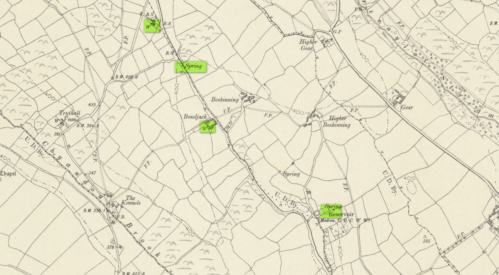
Hidden spring on 1878 map
Line of wells on 1908 map
There were a number of wells along the Bone Valley road highlighted on the early OS-map, all of which may have been known to Quiller-Couch at the time, three of which appeared to have streams emerging from them back then: one just above Bosoljack (SW 4556 3319) and one below it (SW 4571 3292), each just off the roadside; but then a slightly more enticing one is hidden a little further down the lane and up the tinier lane to Higher Boskinning, in the trees on the right (east). Shown on the first OS-map as a simple “spring”, a small stream runs from it and then into the larger Bone Valley Brook which runs towards Penzance. The solace and quietude of this spot would seem much more favourable than the other two…. but my impressions may be wrong. It would be good if someone could find this old place…
References:
Quiller-Couch, M. & L., The Holy Wells of Cornwall, C.J. Clark: London 1894.
Russell, Vivien, West Penwith Survey, Cornwall Archaeological Society 1971.
Acknowledgements: Big thanks for use of the early edition OS-map in this site profile, Reproduced with the kind permission of the National Library of Scotland.
Holy Well (lost): OS Grid reference – SW 4025 3062
Archaeology & History
Just over a mile northwest of the superb Sancreed Well, we find documentary evidence from 1778 recording the field-name of Chapel Well Close here, although there seems to be no remaining spring or well and nothing is shown on the early OS-maps. Official records define it as a “medieval well” and speculate that it may have been associated with the nearby Boscence Chapel and possibly dedicated to St. Winwaloe.
References:
Anon., The Church and Parish of Sancreed in the County of Cornwall, Brewer: Sancreed c.1960.
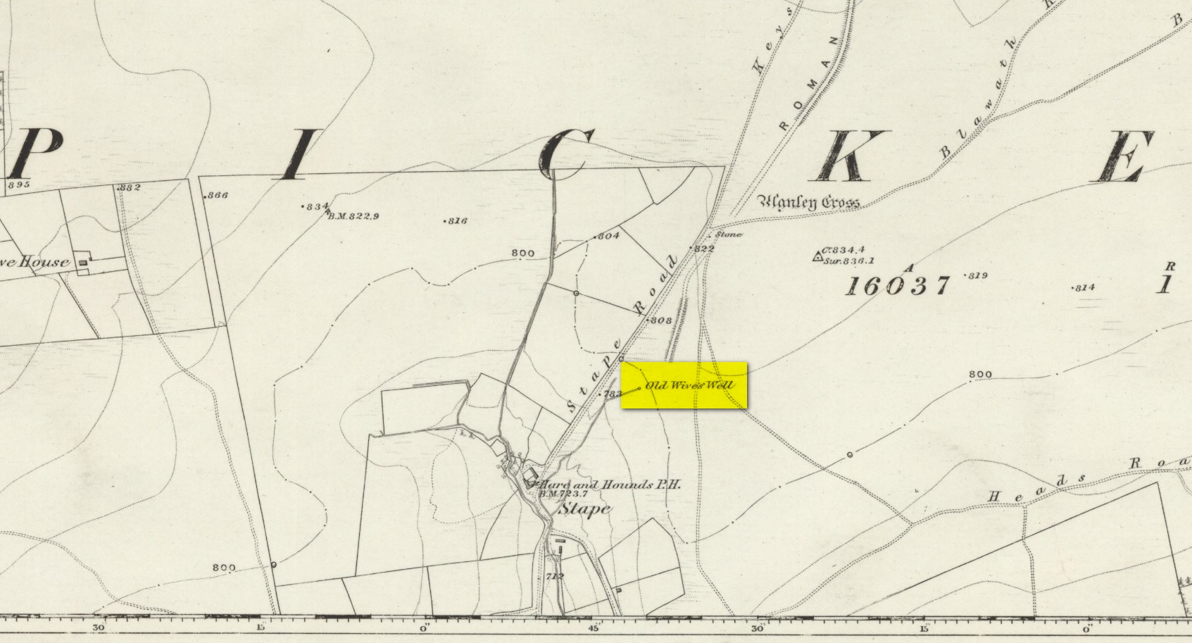
The history of the site is scanty to say the least. It first seems to have been recorded when the Ordnance Survey lads came here in the 1840s, although they left no record as to why the site was given such a dedication. It’s a decidedly pre-christian title as the name “old Wife” is usually indicative in northern counties as being related to the primal Earth deity of northern England and lowland Scotland (when we reach the Highlands and Ireland, She becomes known—amongst other names—as the cailleach). However, apart from its name we have no additional information. Neither the holy wells writer Edna Whelan (1989; 2001), nor hydrolatry researcher Graeme Chappell were been able to find anything about the place in their own researches. And so we must go on name alone…
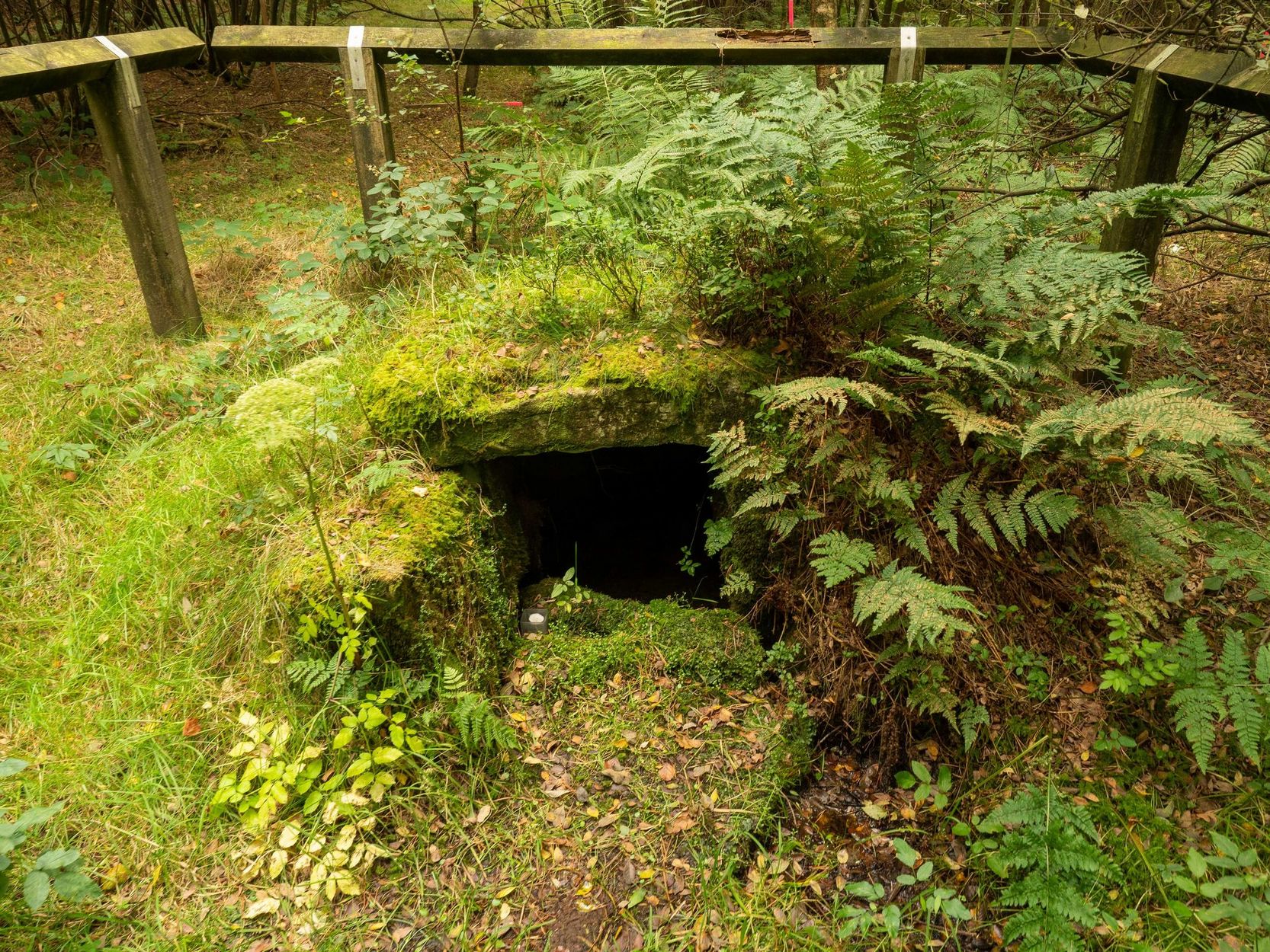
The waters bubble up into a small stone-lined chamber with the words Nattie Fontein carved into the lintel. This is something of a mystery in itself, for, as Edna Whelan (1989) told,
“it would be most unusual for the word fonten to be used for a spring in North Yorkshire: ‘keld’ is the local word. The rather roughly inscribed word may be a corruption of Fons Natalis, the name of a Celtic water nymph.”
Graeme Chappell (2000) meanwhile, noticed in a visit to the site in June 1999,
“that the N and A in “NATTIE” are carved in such a way that the word could be read as “MATTIE FONTEIN” perhaps meaning “Mother Fountain”. This might then be another reference to the Old Wife?”
He then goes on to note how,
“the latin word ‘natalis‘ meaning ‘birth’ and its link with the roman Festival ‘Dies Natalis Sol Invictus‘ (day of the birth of the unconquered sun) which took place on the 25th December. Natalis also gave rise to the welsh word ‘Nadolig‘ – meaning Christmas.”
This Yuletide element has an intriguing relationship with the name of the well; for to the west of Yorkshire’s borders into Cumbria there was annual gathering known as Old Wives’ Saturday that took place on the first Saturday after Christmas, or first Saturday of the New Year in a person’s house or inn, where a feast was had to bring in the New Year; but there is no known written lore of such a tradition here.
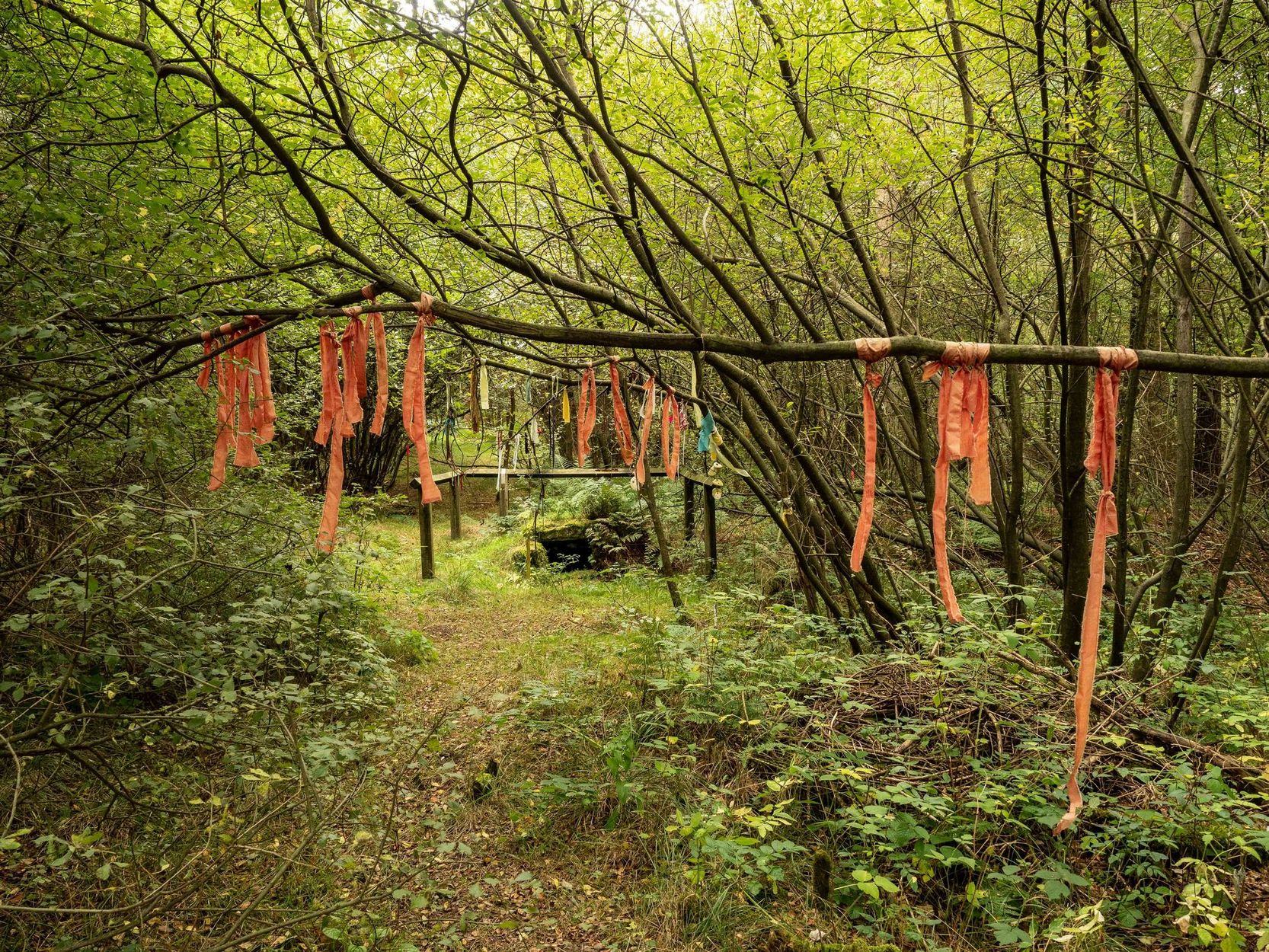
Nowadays the old tradition of hanging rags on the trees surrounding the well as offerings to the spirit of the place (known as memaws in parts of Yorkshire, and clooties in Scotland) has become a regular practice of those who hold such sites as sacred in their own way. Whelan mentioned seeing memaws here in the 1908s, but the Northern Antiquarian contributor Jon Barker told that, “The rags are a comparatively recent addition to the well, it is not a tradition there. When I used to go in the ’60s therewere no rags.”
On an even more curious note: very recently (from when this profile was written), the Northern Antiquarian contributor and photographer James Elkington visited Old Wives’ Well for the first time. It was a grey overcast day and when he arrived here, there was a woman ahead of him at the head of the well. I’ll let him tell the rest of it in his own words:
The Old Wives Well, Stape (James Elkington)
Old Wives Well at Stape (James Elkington)
“In front of the well was a lady dressed in what looked like a white nighty, she had her back to me. There was a candle lit nearby, and her hands were in the water moving slowly about like she was washing something. She had long dark shoulder length hair. As I was about 25 feet away I was sure she wasn’t aware of me, and I thought it would make a good photograph. I quietly put my bag on the ground and got my camera out, and looked up and…she was gone! I couldn’t have taken my eye off her for more than 5 or 6 seconds. I looked all around and there was no sign of her. Even if she had legged it through the woods I would have seen her. I think it was then that I realized that I may have had ‘an encounter’. I quickly took three pics of the Well and got the hell out of there!”
He rang me once he had regained his senses in a somewhat emotional state and recounted over and over what had just happened. Whether this was a visual manifestation of the genius loci of the we can’t say. But such encounters are not unknown at numerous sacred water sites all over the world. We can only hazard a guess that this is what he was fortunate to encounter.
Just a few hundred yards north is the old Mauley or Malo Cross, which may or may not have had some mythic relationship with our Old Wives…
Cross (destroyed): OS Grid reference – SD 5152 9280
Also Known as:
Cold Stone
Market Cross
Archaeology & History
Not to be confused with the carved cross fragments held in the local church, this old town cross has long since gone. It’s existence was recorded by the great Kendal historian Cornelius Nicholson (1861), but even in his day, this “obstruction” as he called it, was no longer standing. Known as the local Market Cross where all the wheeling and dealing took place—official ones, as well as the not-so-official works of local folks—it stood just off Stricklandgate,
“opposite the Covered Market, and was an obstruction in the street. There still remains a remnant of it in a stone at the corner, vulgarly called “cold stone,” where the charters and so forth were usually proclaimed. Cold stone is a corruption of “call stone;” an appendage common to most ancient towns, where all public matters were “called” prior to the “institution” of belman.”
This folk etymology of “cold” needs to kept in mind when we come across other stones of this name. …The earliest record of a market held at Kendal is from 1402, but written records of the Market Cross are scant until 1714. Such edifices tend to be architecturally ornate, but we have neither sketches nor descriptions of this lost site and must await the work of fellow researchers who may hopefully find out more.
References:
Nicholson, Cornelius, The Annals of Kendal, Whitaker & Co.: London 1861.
Smith, A.H., The Place-Names of Westmorland – volume 1, Cambridge University Press 1967.
Along the only road that crosses Askwith Moor, park up at the single carpark on the east-side of the road. Walk up the road for 350 yards and through the gate on the left-hand (west) side of the road onto the moorland. Once through the gate, walk directly west into the heather immediately below the path for some 25-30 yards. Look around!
Archaeology & History
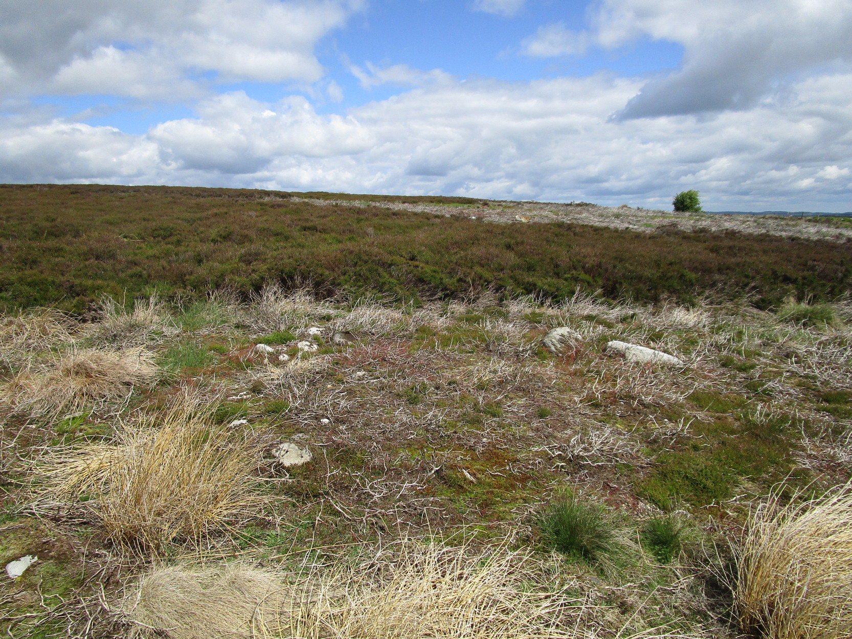
Rediscovered by Helen Summerton in May 2022 are at least two simple hut circles on this level piece of land close to the roadside, amidst this much wider and impressive prehistoric landscape.
The small ring of stones (SE 17430 50978) closest to the road is slightly more troublesome to make out due to it being more deeply embedded in the peat than its companion about 30 yards away. Comprising of typically small rubble walling, this first circle is only 4 yards across and would certainly have been fine for one person or, at a push, perhaps a small family.
Askwith Moor hut circle (2)
Askwith Moor hut circle (2)
Its companion immediately west (SE 17401 50953) is somewhat larger and slightly more elongated in shape, being 10 yards along and 5-6 yards across, as well as being in a better state of preservation. This larger hut circle has been raised on a notable artificial earth-and-rubble plinth, being one or two feet higher than the surrounding peatland. A notable internal stretch of walling only a yard or two in length exists within the southeastern side of the construction, whose nature can only be discerned upon excavation: an issue we can say applies to the many prehistoric settlements and tombs across this small moorland. It’s very likely that other settlement remains will be found close to these two hut circles.
The remains of another hut circle can be found closer to Shooting House Hill, several hundred yards away; whilst five hundred yards southwest we find a small but impressive cairnfield. There are also a good number of petroglyphs close by and on much of the surrounding landscape.
Acknowledgments: Huge thanks to Helen Summerton (not Winterton) for finding these ‘ere remains – and for the photos accompanying this site profile.
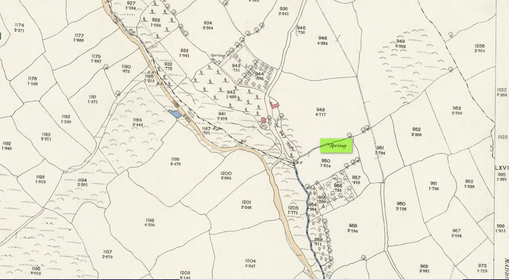
There’s a minor discrepancy of opinion as to the exact location of this site, so I’ve chosen to go right in-between the positions cited by Leggat (1987): SW 836 433, and Meyrick (1982): SW 838 434.
The site was mentioned by Charles Henderson, who told that around the year 1750 there was a medicinal well at Sunny Corner, known as “Glastonbury Well”. Its waters had the ability to “cure all disorders,” but its reputation was apparently short-lived, which would suggest that its fame beyond local villagers was concurrent to the rise of Spa Wells amongst the upper- classes at that time.
In the Leggats’ (1987) survey, no locals they spoke with had ever heard of the place; but that they “found a spring halfway up the lane adjacent to Sunnyside House which had been used in the past from time immemorial as a domestic water supply to a scattering of local cottages” and wondered if this might have been the long long Glastonbury Well…
References:
Adams, J.H., “The Mediaeval Chapels of Cornwall,” in Journal Royal Institution of Cornwall, volume 3 (new series), 1957.
Henderson, Charles, One Hundred and Nine Parishes of the Four Western Hundreds of Cornwall, Oscar Black: Truro 1955.
Leggat, P.O. & D.V., The Healing Wells: Cornish Cults and Customs, Dyllansow Truran: Redruth 1987.
Meyrick, J., A Pilgrims Guide to the Holy Wells of Cornwall, Falmouth 1982.
Cross (destroyed): OS Grid-Reference – SE 3224 4498
Archaeology & History
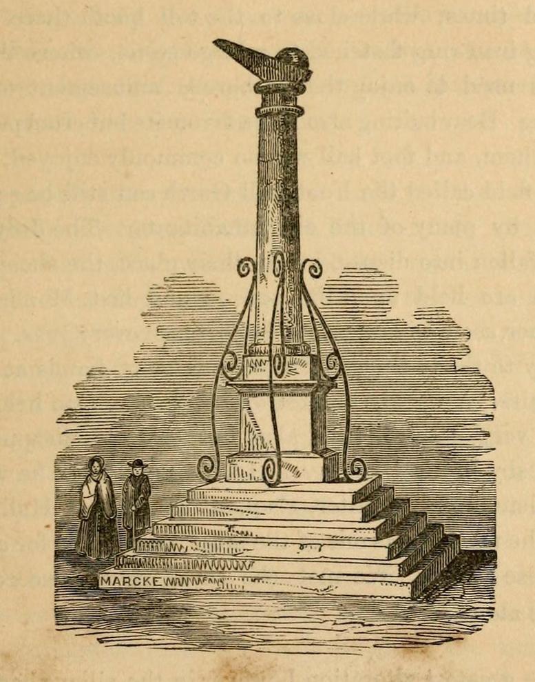
A Charter in the time of King John allowed for markets to be held in Harewood from 1209 CE onwards, “on the first day of July and the two following days, and also to hold one market there every week on the Monday.” But whether or not a market cross was erected that far back, we don’t quite know. Certainly, the edifice illustrated by John Jones (1859) in his standard work on Harewood didn’t date from such an early period! It stood close to the old road junction to Wetherby in old Harewood village, “a little below the intersection of the roads, and about fifty yards higher up than the market house.” Jones told us:
Harewood Cross (Jones 1859)
“It stood upon a large stone pedestal, and was approached by a quadrangular flight of seven steps, very broad, where the neighbouring farmers used to stand, and dispose of their butter, fowls, eggs, &c. It was re-erected, AD 1703, by John Boulter, Esq., and in the year 1804, when the road was lowered, it was taken down and destroyed. This is to be regretted, it might have been re-erected in another situation, if that was inconvenient, and would have been in the present day, not only an ornament to the village but a relic of the past, of which the villagers might have been justly proud. On the top of this cross there was a knur and spell, a game for which the village was celebrated in old times, while close to the toll booth there was a strong iron ring fastened to a large stone, where the villagers used to enjoy the barbarous amusement of bull baiting.”
References:
Bogg, Edmund, Lower Wharfeland, J. Sampson: York 1904.
Jones, John, The History and Antiquities of Harewood, Simpkin Marshall: London 1859.
Speight, Harry, Lower Wharfedale, Elliott Stock: London 1902.