Cairn (destroyed): OS Grid Reference – NT 3071 7366
Archaeology & History
The only reference I can find of this long lost cairn is in William Baird’s (1898) massive history work of the area—but even in his day he reported that “it has long since disappeared.” He wrote:
“We have a curious reference in a charter of Kelso Abbey, granted about 1466, to a cairn of stones which stood near the south-east corner of the garden wall at Mount Lodge, Portobello. In the charter, where it is referred to as forming part of the boundary of the lands of Figgate, it is described as, ‘a certain heap of stones there deposited.'”
The cairn was likely of considerable size and, said Baird, “in all probability marked the site of an ancient place of sepulture.”
References:
Baird, William, Annals of Duddingston and Portobello, Andrew Elliot: Edinburgh 1898.
Round Barrows (destroyed): OS Grid Reference – NZ 692 214
Archaeology & History
Tumuli shown on 1920 map
On top of the large plateau that is Warsett Hill, on the southwest side of the old trig-point, could once be seen a cluster of at least seven burial mounds or tumuli. The mounds are shown on the first OS-map of the area, but merely as mounds. It wasn’t until there’d been a subsequent investigation here by local historian J.C. Atkinson in the 19th century that they were highlighted on the 1920 map as “Tumuli.” Sadly, since then, they’ve all been destroyed.
Very brief notes were written on six out of the seven tombs here by William Hornsby (1917), with only one of them receiving any real attention. “Of the other six,” Crawford (1980) wrote,
“there is very little information; all were excavated by Atkinson prior to 1893, but his excavations revealed no finds and he stated that all of the mounds had been previously disturbed. They were later dug by Hornsby, who stated that although he found no sepulchral deposits, all the mounds contained flints.”
In medieval times this became a beacon site, where bonfires were lit. I can find no further information about this. (NB: This site should not to be confused with another Warsett Hill that exists two miles southeast of here above Skinningrove.)
References:
Crawford, G.M., Bronze Age Burial Mounds in Cleveland, Cleveland County Council 1980.
Hornsby, William & Stanton, R., “British Barrows near Brotton,” in Yorkshire Archaeological Journal, volume 24, 1917.
Acknowledgements:Huge thanks for use of the Ordnance Survey map in this site profile, reproduced with the kind permission of the National Library of Scotland.
Cup-and-Ring Stone (destroyed): OS Grid Reference – NU 0444 0186
Archaeology & History
In an area teeming with prehistoric sites from the neolithic and Bronze Age periods, we had a rare example here of some cup-and-rings that had been carved within a small cave or rock shelter of some kind. Sadly it got destroyed in the mid-19th century due to quarrying operations—but not before George Tate (1864; 1865) had a final sniff of the place and was very lucky to see some of the remains before they finally bit-the-dust. He told us:
“The great sandstone ridge ranges from Eglingham and Beanley across the central part of the county towards Rothbury, near to which is a cave in the rock called “Cartington Cove;” concentric circles with central hollows were incised within this cave. Mr. Williamson of Alnwick, from whom I had this information, played around them when a boy more than fifty years ago; and they were then popularly called “Cups and Saucers.” Nearly all of them have been destroyed by the wedges and hammers of quarrymen; but on visiting the spot in 1859, I found sufficient traces to confirm Mr. Williamson’s testimony.”
But they were gone a few years later thanks to the lads at the quarry. Although the site was subsequently described in Beckensall’s modern surveys (1992; 2006), nothing more was found about them.
Folklore
Whilst David Dixon (1903) reiterated Mr Tate’s notes on the “series of incised concentric circles and central hollows” here, he also mentioned an old piece of folklore:
“At Cartington Cove (is) a recess or cave which, local tradition says, is connected by a subterranean passage with Cartington Castle, three miles distant!”
Intriguing ingredients: caves – Underworld journey – north – all symbolic of Death in pre-christian lore. Just saying…
References:
Beckensall, Stan, Prehistoric Rock Motifs of Northumberland – volume 2, Abbey Press: Hexham 1992.
Beckensall, Stan, Circles in Stone: A British Prehistoric Mystery, Tempus: Stroud 2006.
Dixon, David D., Upper Coquetdale, Northumberland, Robert Redpath: Newcastle-upon-Tyne 1903.
Cup-and-Ring Stone (lost): OS Grid Reference – NT 931 302
Archaeology & History
Little is now known of this carving which was described briefly by Stan Beckensall (1983):
“A cup and ring marked stone was found in the field north of Yeavering Bell in the neighbourhood of the monolith. The last heard of it, according to the Northumberland County History (14:67) was that it was in the grounds of Ewart Park.”
The monolith he speaks of would be the one called the Battle Stone (NT 9299 3038) and Ewart Park is 2 miles ENE of here. The carving remains lost. (the grid reference where the stone was originally located is an approximation, but a pretty good one)
References:
Beckensall, Stan, Northumberland’s Prehistoric Rock Carvings – A Mystery Explained, Pendulum: Rothbury 1983.
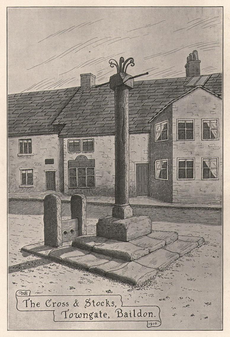
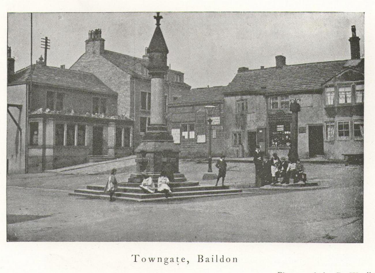
Located next to the old stocks by the main roundabout right in the middle of the town is this tall market cross, nearly ten feet high and well known to the local people. It has been described by several local historians, although its recognition as a “market cross” is slightly contentious as it seems there are no written records to indicate that a market ever existed here. The great Baildon historian, W. Paley Baildon (1912) was unable to find any info about such a market, commenting simply that “most villages…had crosses in medieval times, many of which still exist; so that the presence of a cross at Baildon is (not necessarily) evidence of a market.”
His description of its form is as valid then as it is to this day:
Old sketch, c.1900Old photo of the cross c.1900
“The cross, as we see it to-day, is not an interesting object. The square platform of two stages, with its well worn stones, looks as though it might be medieval, and part of the original work. In the centre of this is a large square block of stone, from which rises a tall cylindrical shaft.
The base is square, with chamfered corners, and a plain roll moulding at the upper edge; the cap is a plain square block, without any attempt at ornament.”
One of Bradford’s industrial historians, William Cudworth (1876) thought that the present cross replaced an earlier one, and that this one was erected by a member of the wealthy Butler family a few centuries ago. Mr Baildon wasn’t quite as sure as Mr Cudworth. Nevertheless they both agreed that this edifice replaced an earlier one. Baildon said:
“My own view is that there was probably a cross here in medieval times; that it was destroyed, either after the Reformation (as so many were), or by the Puritan soldiery during the Civil War; that the steps and perhaps the base remained; and that in the eighteenth century, when the Butlers were one of the leading families in the place, one of them may have erected a new shaft on the old site.”
In much earlier days it was said to have been surrounded by a grove of trees and a brook ran by its side. Villagers would gather here as it was “a favourite gossiping resort.” At the beginning of the 20th century, an old gas light surmounted this old relic.
References:
Baildon, W. Paley, Baildon and the Baildons – volume 1, St. Catherine’s Press: Adelphi 1912.
Cudworth, William, Round about Bradford, Thomas Brear: Bradford 1876.
la Page, John, The Story of Baildon, William Byles: Bradford 1951.
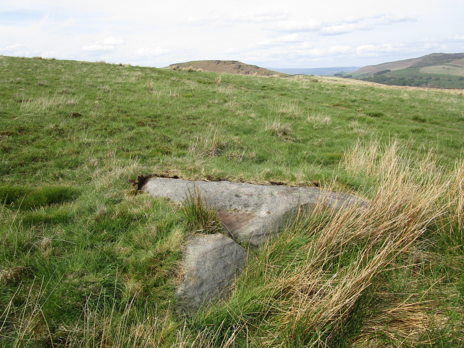
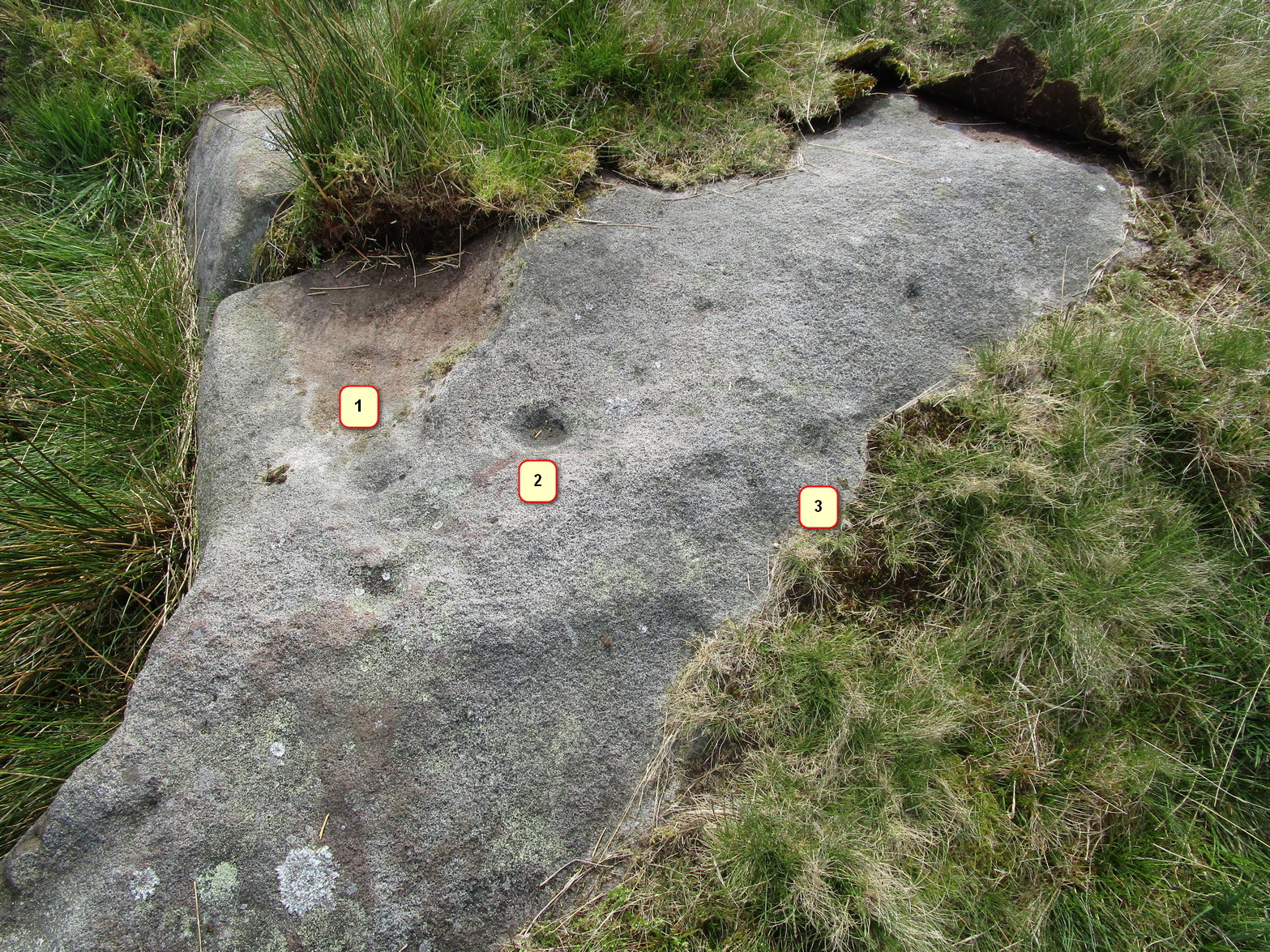
From Skipton head up the B6265 Grassington Road and after a short distance you will reach the Craven Heifer Pub on your left. About ¾-mile past the pub is a small turning on your left called Bog Lane. Go along here for about ¼-mile till you come to a sharp left bend and on the right you will see a gateway with room to park. Once here you’ll notice a sharp-pointed hill—and that’s Sharp Haw! Go through the gate, up the gravel track parallel to the wall on your left for 500 yards. Where the wall ends take the small path on your right and walk up here for ¾-mile where the path splits again. Take the right-hand path for 85 yards and the stone is on the left of the path.
Archaeology & History
Positions of cup-marks
Nowt special to look at, this is merely an elongated earthfast female stone that will be hard to find when the reeds grow high. The design consists of at least three cup-marks, with the most prominent one near the middle of the stone. A second one is shallow and on its northern side, near the middle; whilst the third one on its southern side was uncovered when we peeled back the vegetation; the peck marks are still visible. In the photo to the left I’ve placed numbers below the position of the respective cup-marks. In a cursory meander here, we found no other carvings – but that doesn’t mean there aren’t any!
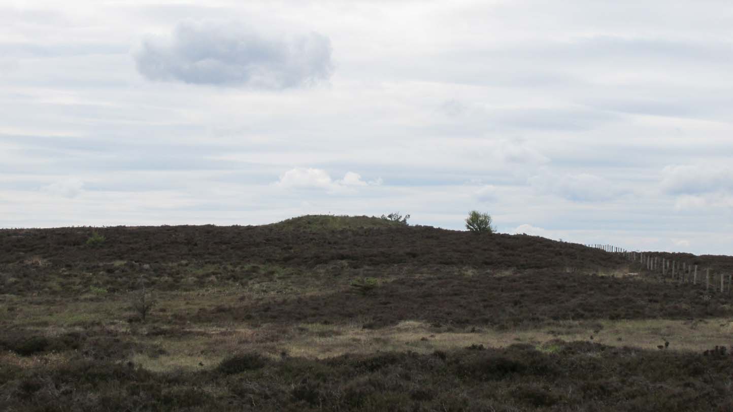
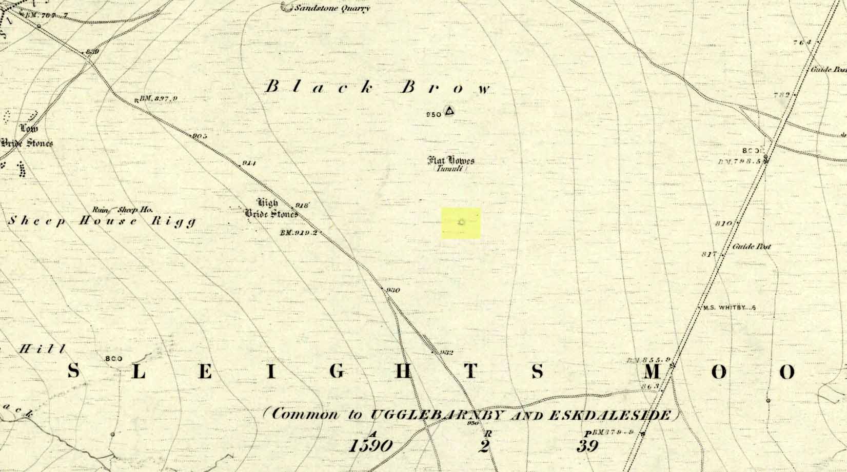
Prehistoric companion to the more pronounced Pen Howe (1) Bronze Age cairn just 20 yards to the west, this overgrown tumulus is hardly noticeable when the heather’s deep and is probably only of interest to dedicated antiquarians and geomancers. Its position in the landscape, whilst not as prominent as its companion and the nearby Breckon Howe, would still have been important to its builders and the relative proximity of the two tombs may imply a continuity of tribal companionship in the Land of the Dead. But hey! – that’s just a silly idea of mine! 🙂
Rising barely three feet above ground level, this is slightly smaller than Pen Howe (1), being just 13 yards across; and there is no indication that it has ever been dug into.
References:
Elgee, Frank, Early Man in Northeast Yorkshire, Frank Bellows: Gloucester 1930.
Acknowledgements: Big huge thanks to my Lindsay Mitchell for getting us up to see this old tomb (which is nearly as old as Linzi 🙂).
Along the A169 road between Sleights and Pickering, some two miles south of Sleights turn right as if you’re going to the tombs of Flat Howe and the Bride Stones, but just park up 80 yards along by the cattle grid. From here, a fence runs southeast and the mound is on the near skyline, just over 100 yards away. Just walk through the heather to reach it.
Archaeology & History
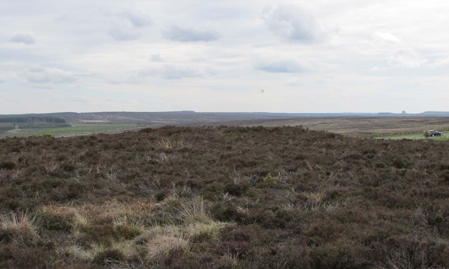
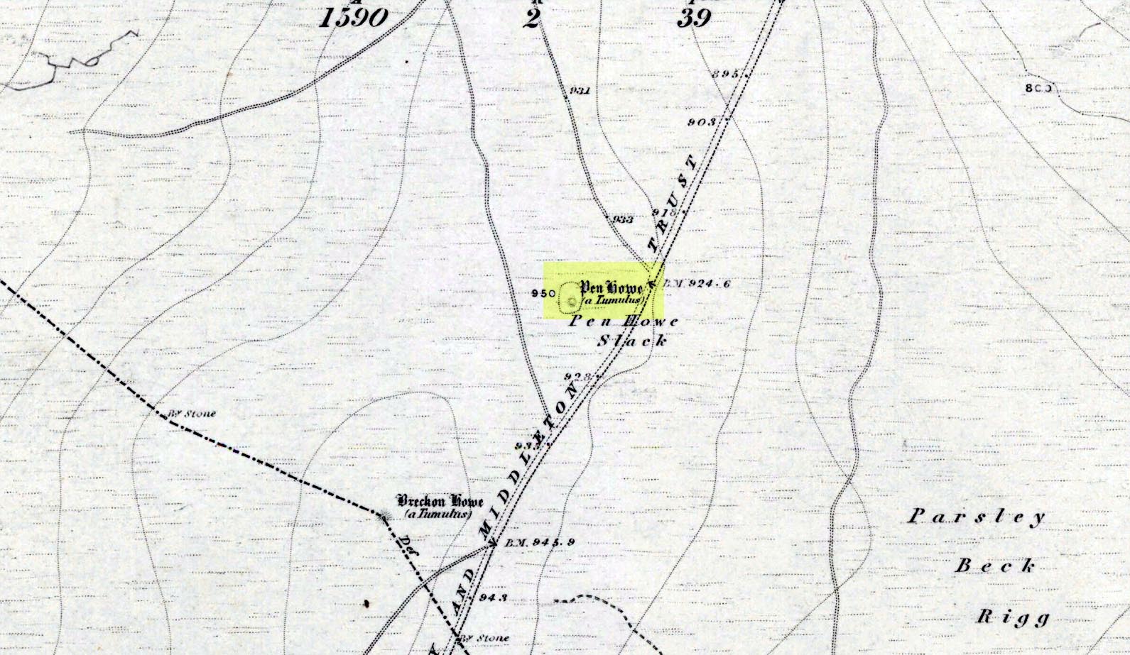
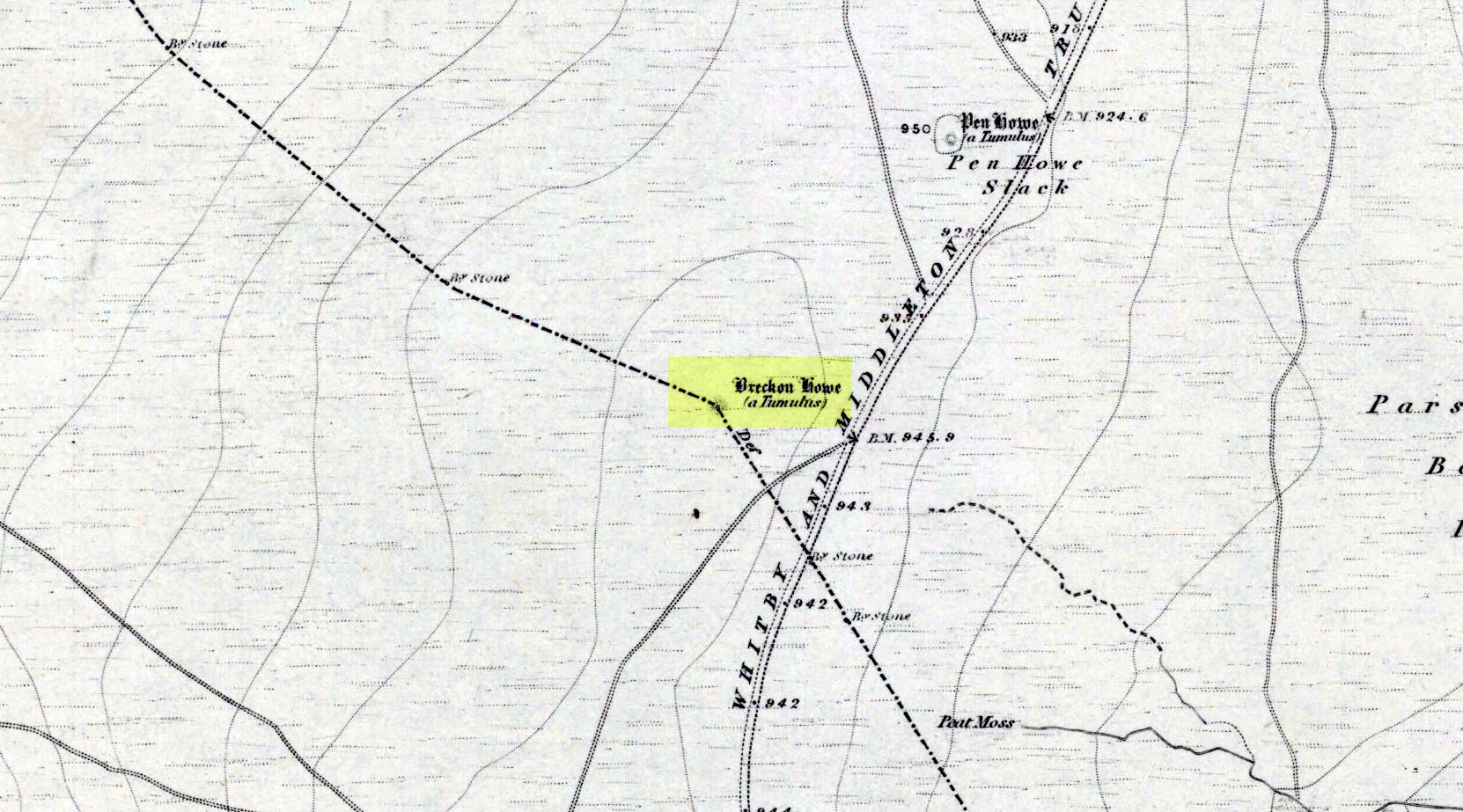
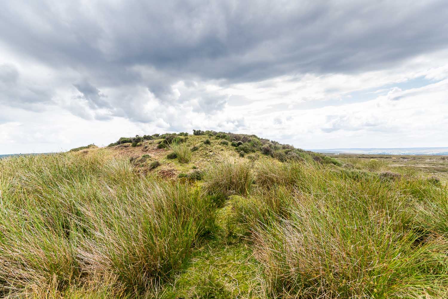
Shown on the first OS map of the area in 1853, this somewhat overgrown prehistoric tomb is one of two in close attendance to each other (see Pen Howe 2); and is some 435 yards (398m) away from the more prominent Breckon Howe tomb to the southwest. Like others on Sleights Moor, no real archaeological attention has been paid here, with Frank Elgee (1930) only giving it the slightest mention in passing.
Pen Howe on 1853 mapPen Howe, looking SE
Smaller than its nearby companions of Flat and Breckon Howe, the overgrown cairn raises about four feet above ground level and about 20 yards across. Probably Bronze Age in origin, it has a slightly concave top that gives the impression that someone at sometime in the not-too-distant past has had a bittova dig here to see if there’s owt inside. But we have no record of such a thing.
surmounted by a relatively recent boundary stone, sits at the highest point on the moors in these parts. Despite this (as with others on these moors), very little has been written about the place and it has received only minimal attention in archaeology tomes. Even the renowned pen of Frank Elgee (1912; 1930) gave it only passing mention. Perhaps it aint a bad thing to be honest.
References:
Elgee, Frank, Early Man in Northeast Yorkshire, Frank Bellows: Gloucester 1930.
Acknowledgements: Big huge thanks to my Lindsay Mitchell for getting us up to see this old tomb and its companion. (which is nearly as old as Linzi 🙂 )
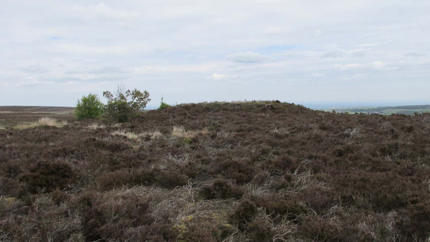
Along the A169 road between Sleights and Pickering, some two miles south of Sleights at the highest point on the moors just above the west side of the road, you’ll see a large mound with what looks like a standing stone on top of it. A minor road turns off the A169 at this point, heading southeast, and the large mound is 150 yards from the roadside. You can’t really miss it!
Archaeology & History
Shown on the first OS map of the area in 1853, this conspicuous prehistoric tomb surmounted by a relatively recent boundary stone, sits at the highest point on the moors in these parts. Despite this (as with others on these moors), very little has been written about the place and it has received only minimal attention in archaeology tomes. Even the renowned pen of Frank Elgee (1912; 1930) gave it only passing mention. Perhaps it aint a bad thing to be honest.
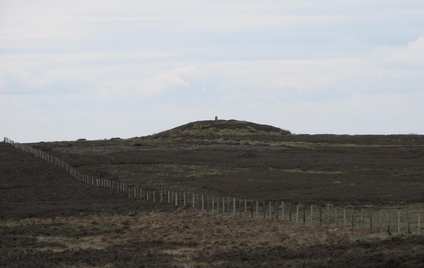
Breckon Howe, from the south
As well as being conspicuous, it’s large. Rising some six feet above the natural ground level, it measures 26 yards across its east-west axis, and 29 yards north-south, with a rough circumference of 88 yards. The boundary stone that surmounts its crown sits in a hollow that looks like it was opened up a century or two ago by antiquarians (much like ourselves). But its position of the tomb in the landscape that is most striking. The view from here is considerable, having a clear 360º view for many miles around. Other prehistoric tombs can be seen from here, but more importantly this tomb can be seen on the skyline from many others. This was probably a deliberate feature intended by its builders–and it’s not uncommon, as many of our upland regions are crowned with ancient tombs like Breckon Howe. In all likelihood this would have been the resting place of some important ancestral figure: a tribal elder or a shaman, whose spirit after death could view and travel across the landscape they inhabited in life.
Although the tomb presently sits amidst an endless sea of heather (Calluna vulgaris) typical of moorland across our northern lands, the name of the site ‘breckon’, according to George Young (1817) derives from the dialect word meaning ferns or bracken. This is echoed in Francis Kildale’s (1855) local dialect study and subsequently in Joseph Wright’s (1898) unequalled magnum opus.
Folklore
In the early 19th century, one George Calvert who lived in the area, collected as much folklore as he could, as it was dying off with the coming of the Church. One such piece told that there was once a hob who lived by this old tomb. A hob is generally known as a supernatural creature, but in this area it can also be a medicine man. Some hobs were good, others were malicious. We know not what type of hob lived lived here, but Calvert simply told us there used to be “T’ Hob of Brackken Howe”. Nowt more! It would be good to find the story behind this old character, if it hasn’t been lost entirely…
References:
Elgee, Frank, Early Man in Northeast Yorkshire, Frank Bellows: Gloucester 1930.
Elgee, Frank, The Moorlands of North-Eastern Yorkshire, A. Brown: London 1912.
Kildale, Francis, A Glossary of Yorkshire Words and Phrases Collected in Whitby and the Nieghbourhood, J.R. Smith: London 1855.
Home, Gordon, The Evolution of an English Town, J.M. Dent: London 1905.
Wright, Joseph, English Dialect Dictionary – volume 1, .Henry Frowde: London 1898.
Young, George, A History of Whitby and Streoneshalh Abbey – volume 2, Clarke & Medd: Whitby 1817.
Acknowledgements: A huge thanks to Lindsay Mitchell for getting us up to see this great tomb and its companion.
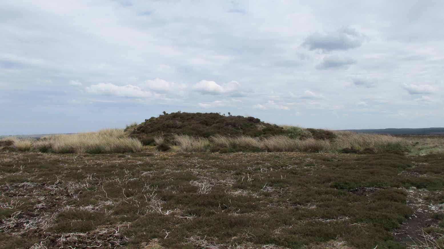
Along the A169 road that runs may miles from Whitby to Pickering, as you go through the small town of Sleights, the road gets steep for a mile or so, until you reach the moorland tops, where the road runs dead straight. After 1.2 miles (1.93km) along the straight road, a small minor road is to your right. Go along here for literally half-a-mile (0.8km) where you’ll see a small dirt-track on your right, with a locked gate. There’s room to park here. Walk straight onto the moor towards the large rounded mound about 200 yards northeast. That’s it!
Archaeology & History
Highlighted as a blip on the 1853 OS-map (see above) 250 yards south of Flat Howe (1), this is the slightly smaller of the two prehistoric cairns on this flat piece of moorland (which covered in scattered woodland at the time of its construction). It has been severely robbed of stones by some land-owning fuckwits in the 19th century, who saw fit to build a shooting hut into the tomb itself! Knob-heads! As a result, much of the content of the cairn has been severely depleted, with only its western side having any real height to it.
Flat Howe 2 looking south (photo, James Elkington)Flat Howe 2, looking east
Just like Flat Howe 1, it seems that it’s never been excavated, so we can only guess about how old it is; though it is very probably Bronze Age. The cairn is roughly 25 yards across and oval in form, but was probably more circular before those morons built their hunting lodge into it. Its western side stands some 4-5 feet tall, which was probably the uniform height all round it before it was vandalized. A few yards to the south is what may be a cup-marking on one of the flat earthfast rocks, although I’m slightly sceptical of it.
The position of the site in the landscape is a fine one: living on a large flat open expanse of land, which was probably cleared of some trees when it was first built, allowing for a very wide view in all directions, just like its companion 250 yards to the north. Well worth checking out.
Folklore
It’s worth repeating the myth we have of a place on Sleights Moor that I’ve also cited in the Flat Howe 1 site profile. Although we have nothing specific relating to this tomb, an olde creation myth tells us that the local giants, Wade and his wife Bel, left their young son (whose name seems to have been forgotten) somewhere on Sleights Moor (which aint a big place). The story was first written down by George Young (1817) in his magnum opus on Whitby and the tale was subsequently re-told by many others – Mrs Gutch (1901) for one:
“Young Wade, even when an infant, could throw a rock several tons weight to a vast distance; for one day when his mother was milking her cow near Swarthoue, the child, whom she had left on Sleights moor, became impatient for the breast, and seizing a stone of vast size, heaved it across the valley in wrath, and hit his mother with such violence, that though she was not materially hurt, her body made an impression on the stone which remained indelible, till the stone itself was broken up, a few years ago, to mend the highways!”
This rock was Bel’s Rock, whose exact location seems to have been lost.
References:
Elgee, Frank, Early Man in Northeast Yorkshire, Frank Bellows: Gloucester 1930.
Elgee, Frank, The Moorlands of North-Eastern Yorkshire, A. Brown: London 1912.
Grinsell, Leslie V., The Ancient Burial Mounds of England, Methuen: London 1936.
Gutch, Mrs, County Folk Lore – volume 2: Examples of Printed Folk-lore Concerning the North Riding of Yorkshire, York and the Ainsty, David Nutt: London 1901.
Jeffrey, P. Shaw, Whitby Lore and Legend, Home: Whitby 1923.
Roberts, Anthony, Sowers of Thunder, Rider: London 1978.
Smith, A.H., The Place-Names of the North Riding of Yorkshire, Cambridge University Press 1928.
Young, George, A History of Whitby and Streoneshalh Abbey – volume 2, Clarke & Medd: Whitby 1817.
Acknowledgements: A huge thanks to Lindsay Mitchell for getting us up to see this great tomb and its companion; and to James Elkington for use of the photograph.