Although the symbol itself is a pre-christian one, to most of us it means that dreadfully boring religious crap we’ve had to contend with since childhood. But relics of old stone crosses, which scatter Britain in huge numbers, relate to periods in our history when the xtian ways were damning the ways of our indigenous ancestors – sometimes with frightening furore: burning, hanging and torturing British people for not accepting their screwy ways. The stone crosses which we find today as archaeological relics, tended to be positioned where earlier heathen sites were found – and as a result of this, I thought it important to include such sites on TNA. But these relics took various forms, each relating to the function of the site it meant to supplant or suppress: market crosses, boundary crosses, village crosses, wayside crosses, etc. You’ll find them all here!
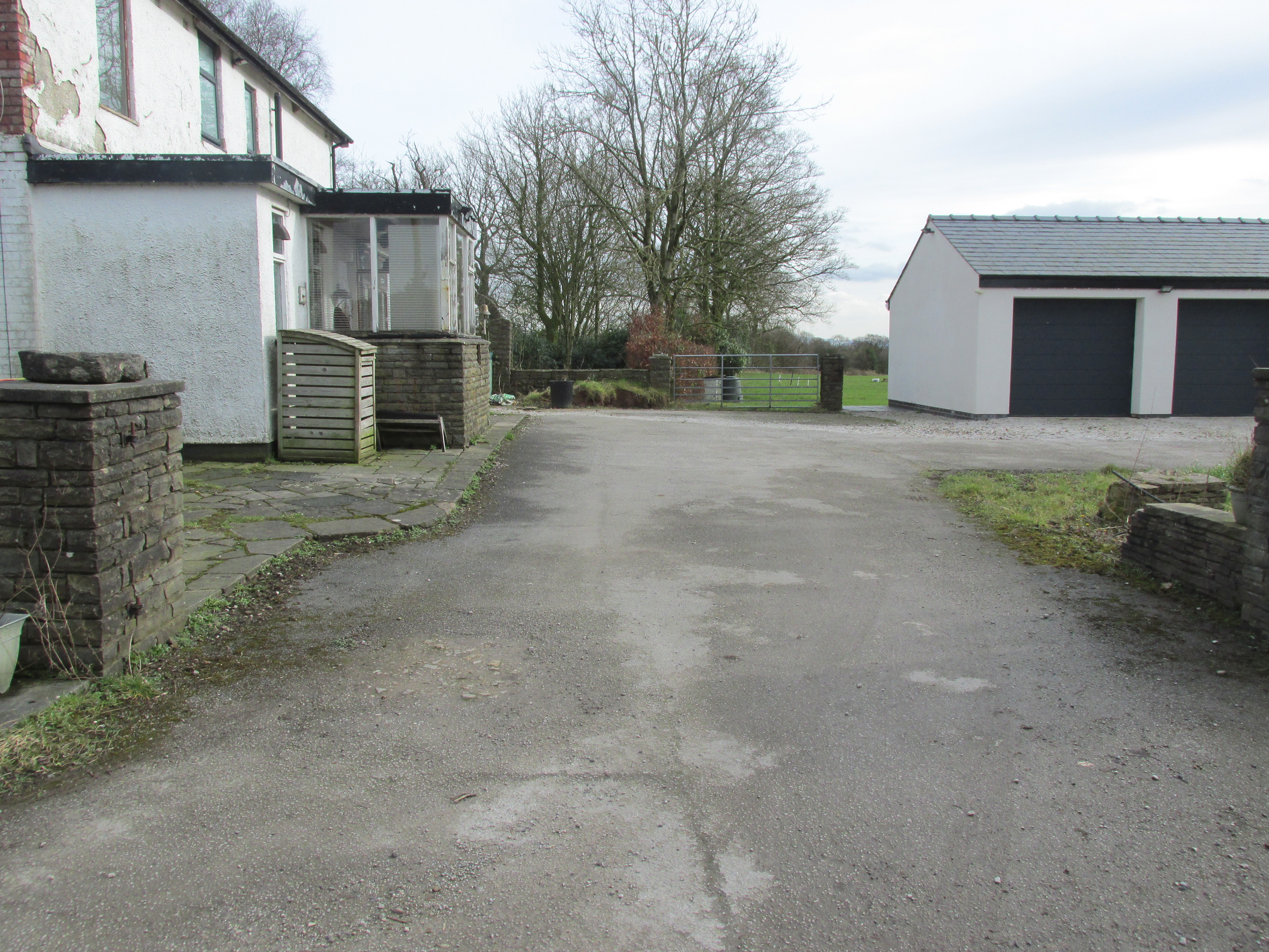
Travelling east out of Goosnargh on the B5269, go straight ahead onto Camforth Hall Lane, follow it northwards and take the left fork at Stump Cross onto Eaves Green Lane, and a lane will be seen on the left signposted Eaves Green. Walk along this lane and a white Snowcemmed house, ‘Bridle Mount’ will be seen on the left. The cross base will be found deep in the holly hedge opposite the driveway to the house.
Archaeology & History
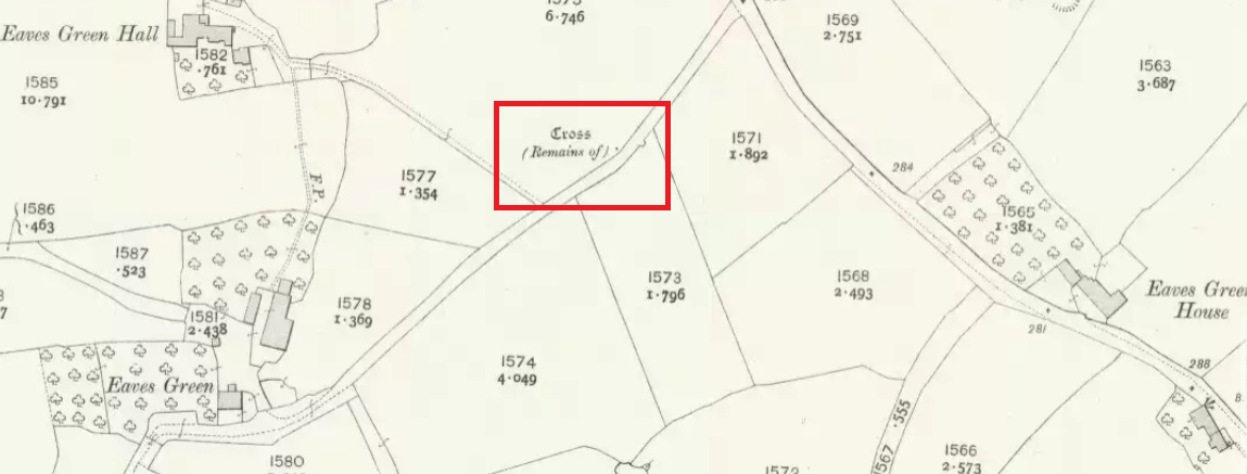
This cross was not mentioned in the 1906 edition of Henry Taylor’s Ancient Crosses andHoly Wells of Lancashire, but was nevertheless marked on the 1910 25″ OS map (the earliest at my disposal) as “Cross (Remains of)”
The 1910 25″ OS Map
In 1958, the Ministry of Works Field Investigator commented: “The socket stone of a probable way-side cross situated on rising ground in a pasture field adjoining a lane. It measures 0.8m by 0.7m and is 0.9m high with a socket 0.2m by 0.15m and 0.2m deep. There are no traces of a cross or shaft.”
To locate the Cross, turn round 180º from this spot.
The current official description describes the remains as “Now missing”…
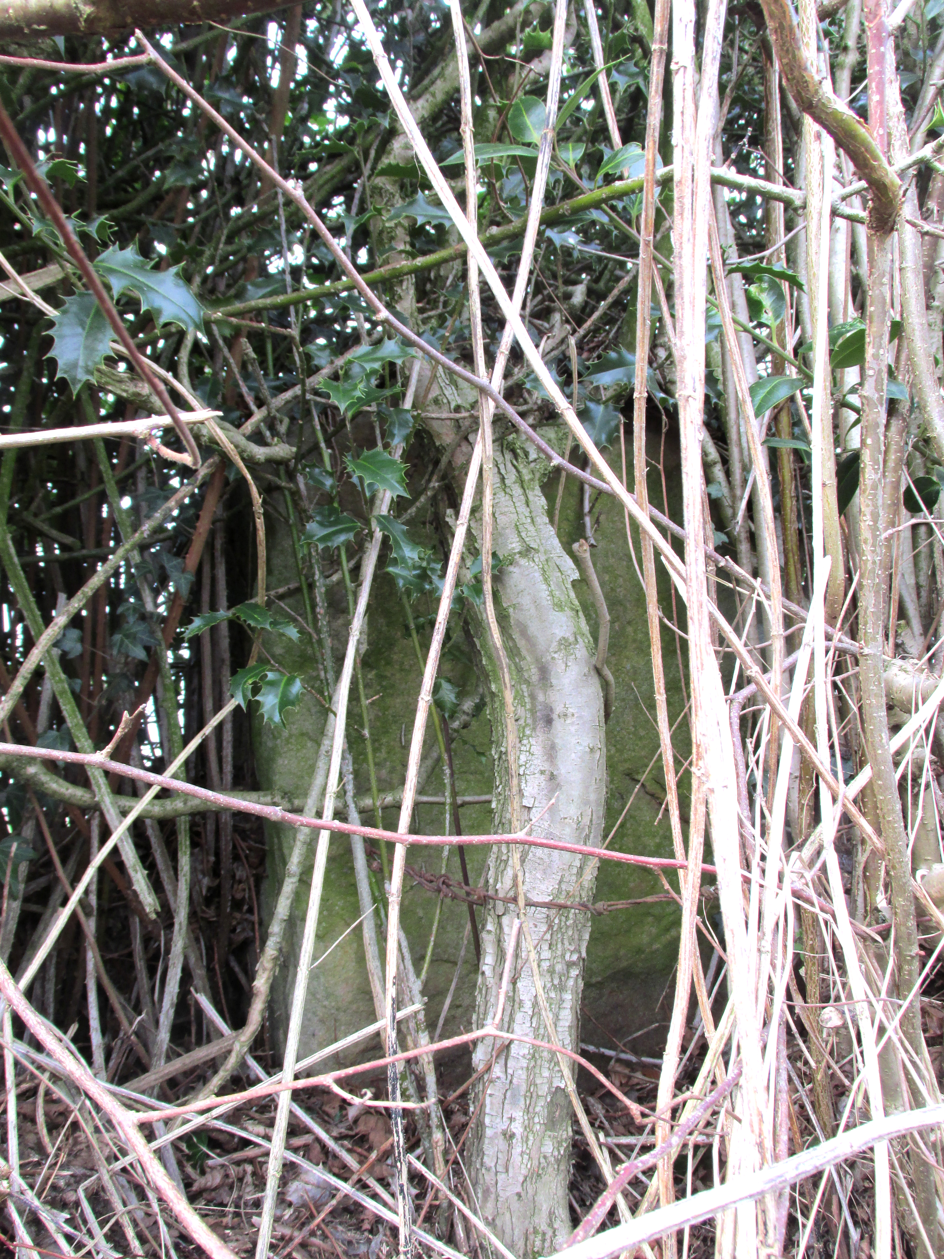
Well, no! – the intrepid TNA investigator has located it, buried deep in the boscage of a holly and ivy hedge, but he was lucky that the hedge had been very recently trimmed and he made his visit in late winter…
The Cross is registered on the Milestone Society Repository under reference: LAPR_GOO02.
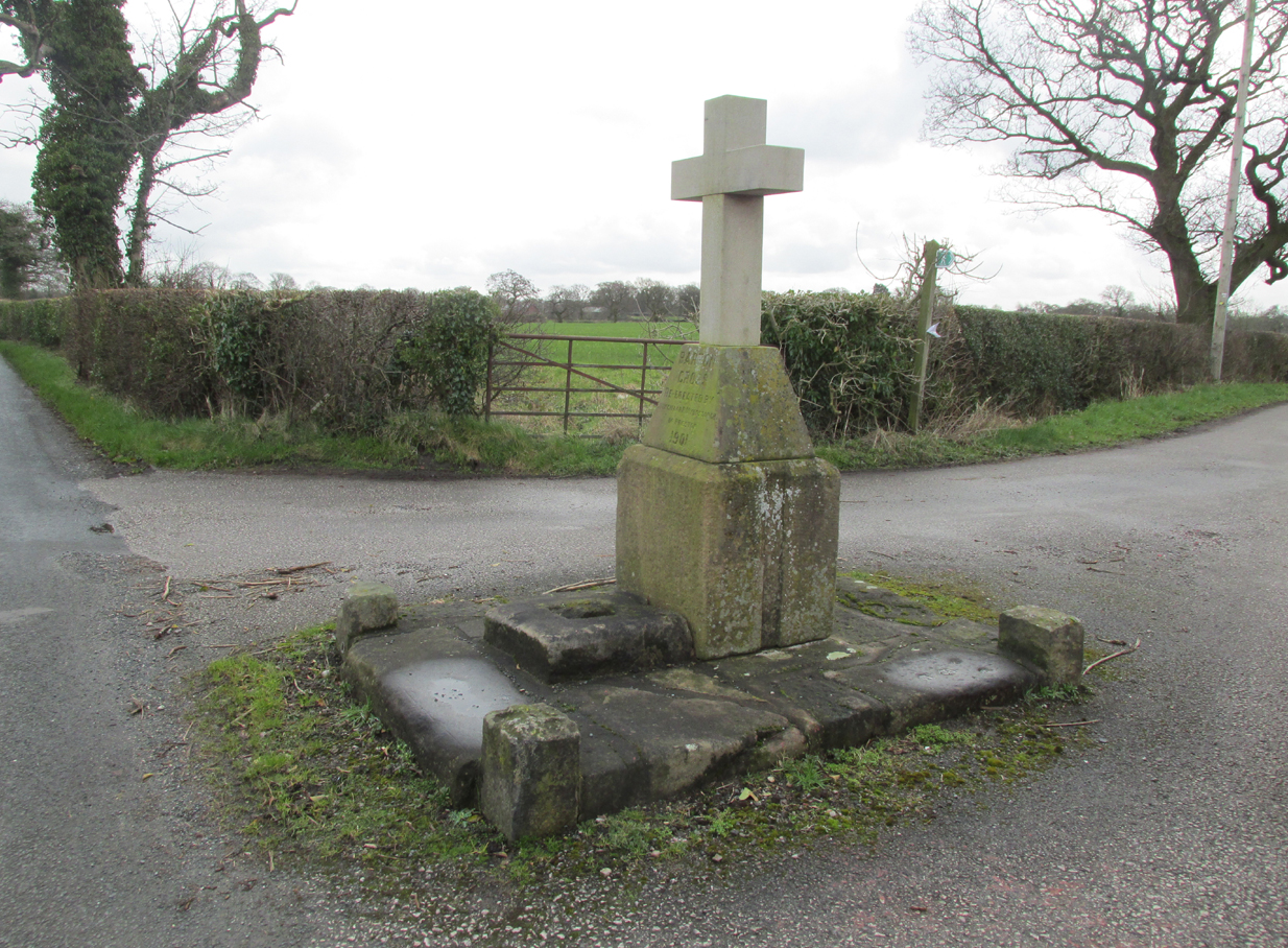
At the roadside, on the south side of Barton Lane, where it crosses the minor road joining Cross House Farm and Barton House, you’ll see the Barton Cross standing upright. You can’t miss it!.
Archaeology & History
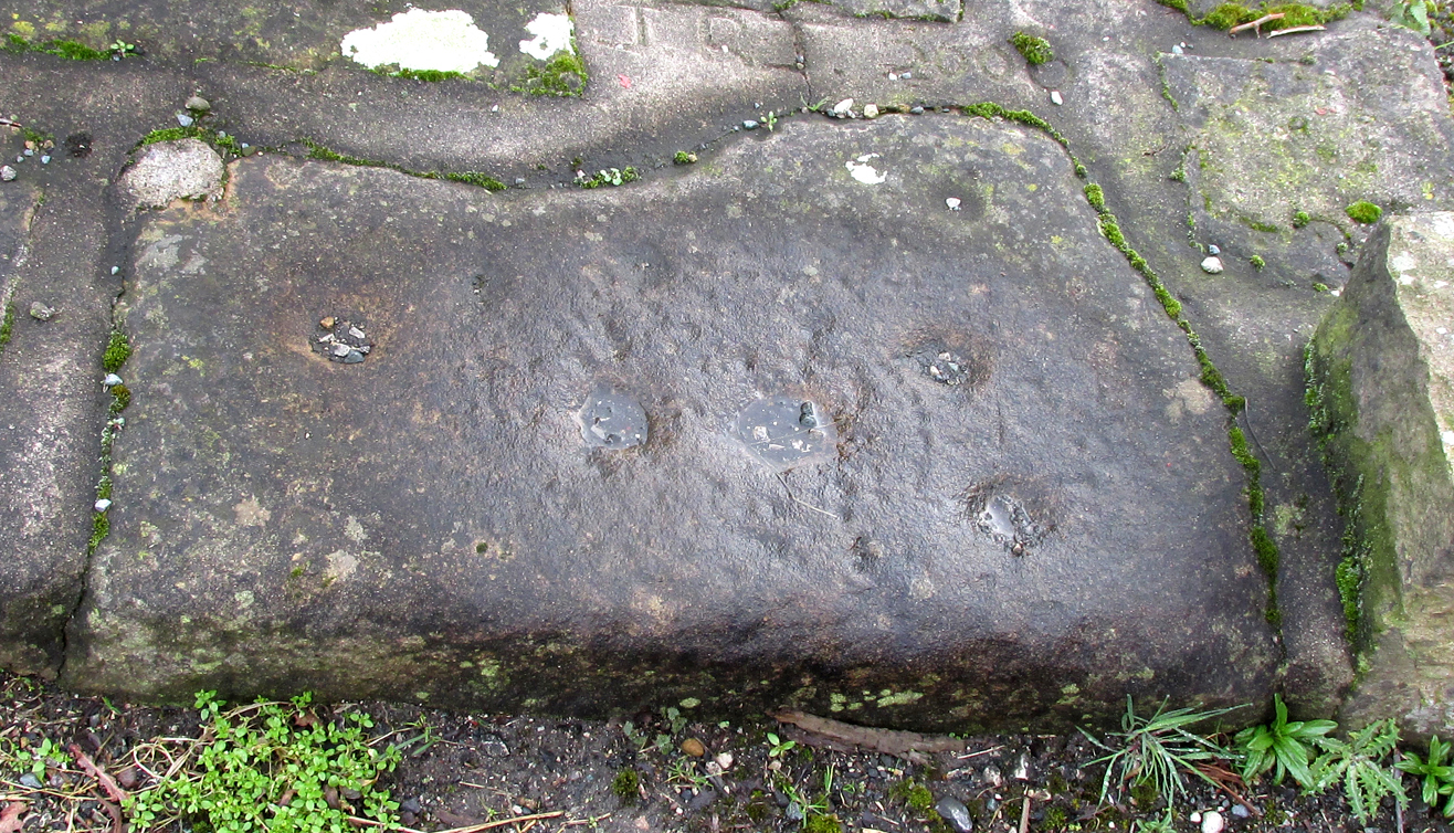
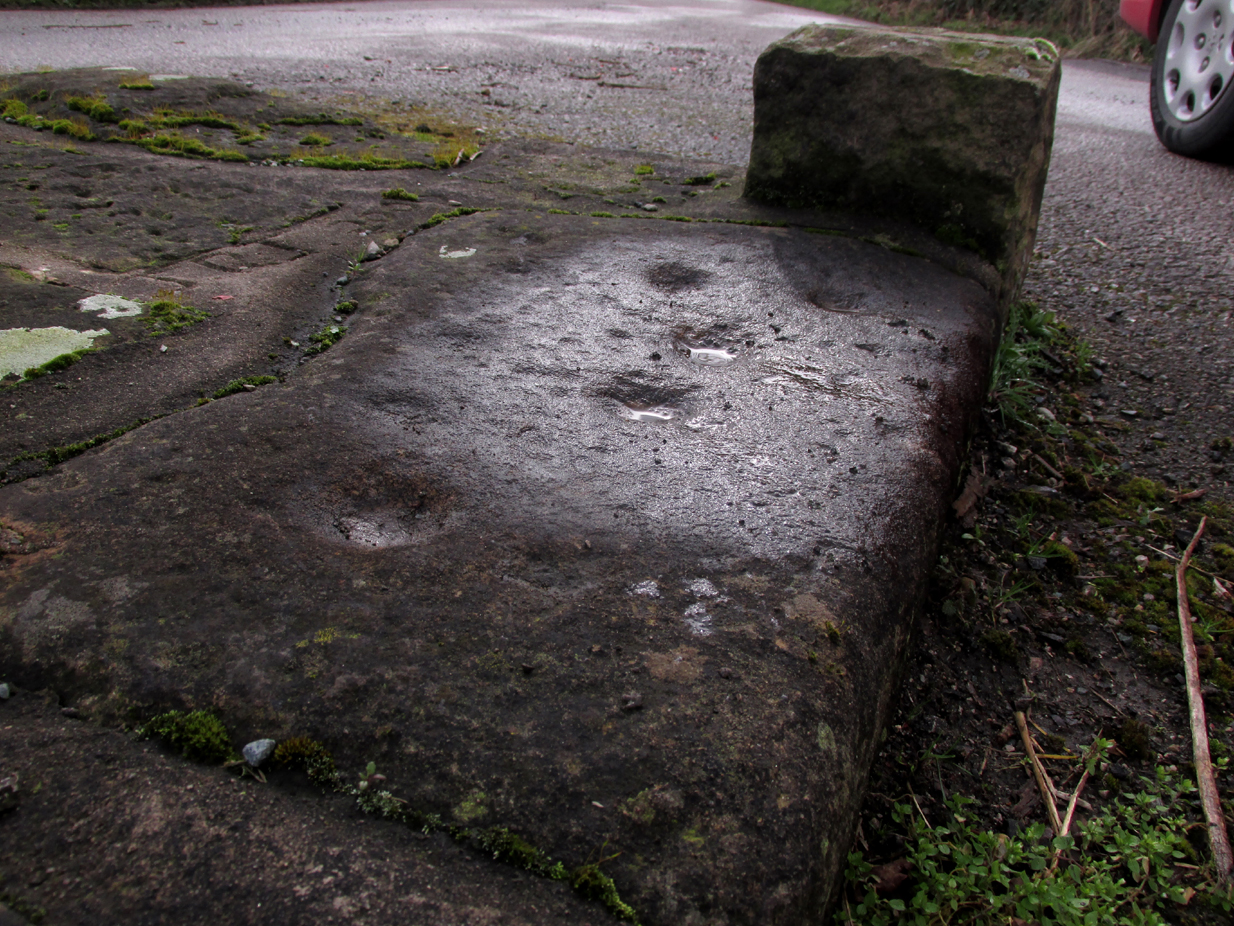
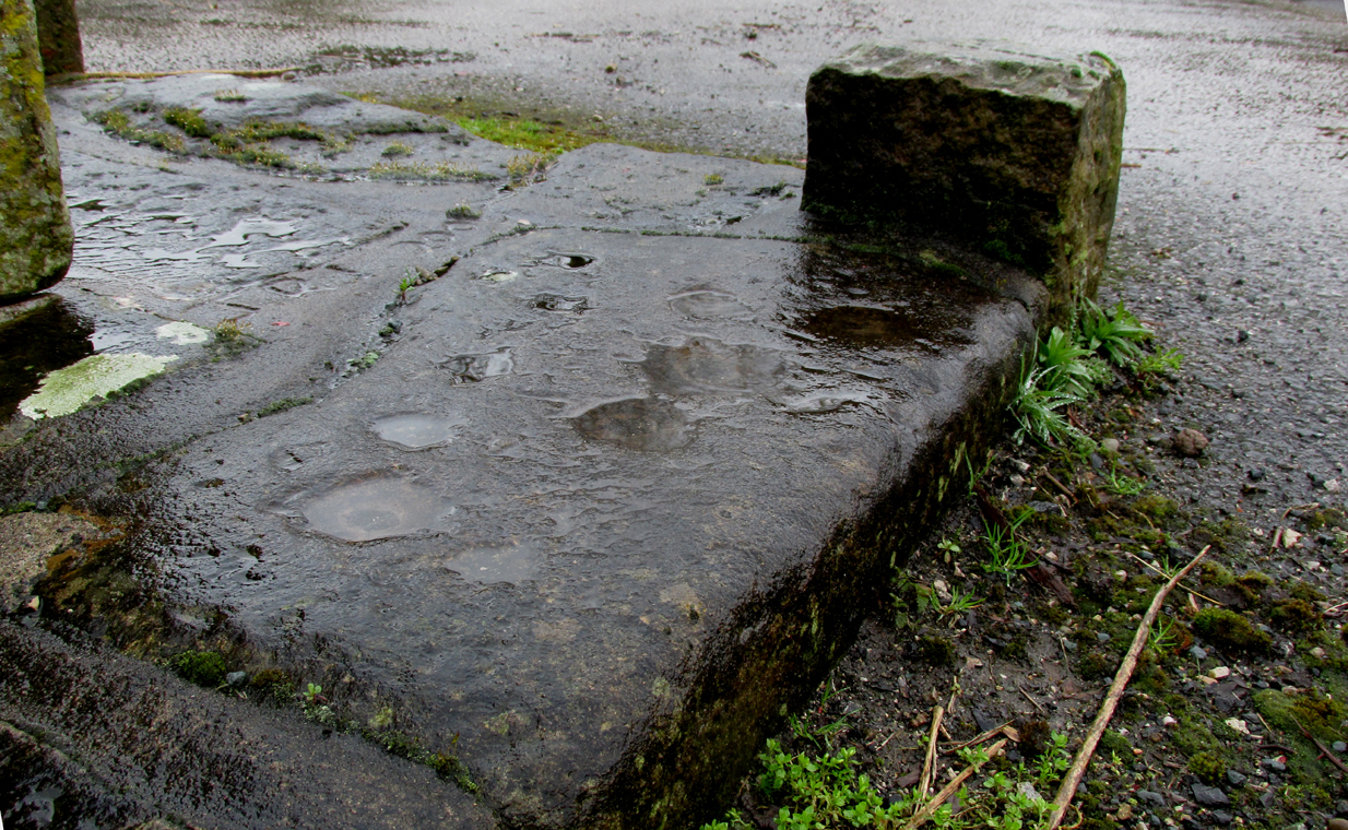
Carved stone cut to shape
Apparently never before described, this stone has very likely been removed from another locality and cut to shape to form part of the surrounding platform base to Barton Cross, where it is at the southwest corner. It has ten cup marks.
Until or unless more such stones are located, it is a unique example of rock art in this part of Lancashire.
Nine cups visible here10th cup nr camera, after rain
Henry Taylor, in his 1906 work The Ancient Crosses and Holy Wells of Lancashire writes inter alia about the Barton Cross that it had been demolished sometime after 1848, and that the base and part of of the Cross shaft had been ‘lately restored to the old site‘. Thus the cup-marked stone may or not be in its original position as part of the Cross surround, and may have just been a conveniently available slab of stone that was used, rather than a deliberate use of a pre-existing sacred stone.
References:
Taylor, Henry, The Ancient Crosses and Holy Wells of Lancashire, Sherratt & Hughes, Manchester, 1906.
Follow the same directions as if you’re visiting the Dissenter’s Well. The cross stands right next to it!
Archaeology & History
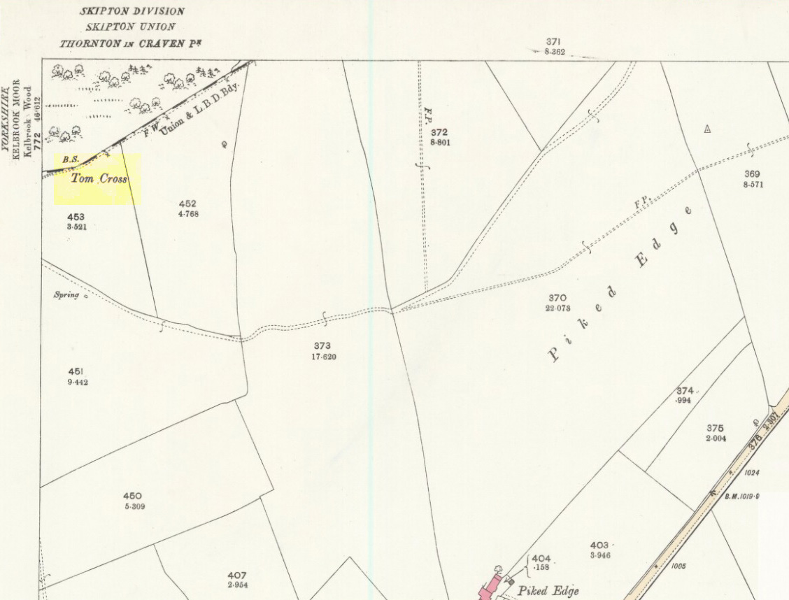
This is one of two old stone crosses with the same name within a mile of each other (the other could be found in the walling along Warley Wise Lane). Included in Taylor’s (1906) stunning magnum opus on the wells and crosses of Lancashire, the site was mentioned in a boundary dispute in the year 1592. He told how a local man called Mr Carr said,
“John Parkinson, ‘of the age of ffour score and thirtiene year or thereabouts’ stated that Tom Cross and the Graystone were by credible report the boundaries, as well of Lancashire and Yorkshire, as of the manors of Colne and Cowling.”
Years later when Clifford Byrne (1974) surveyed the crosses of East Lancashire, he gave us more details about the site, saying:
Photo by Phil WaterworthTom Cross, looking N
“Tom Cross is built into the wall hard by Copy House Farm… At the foot of the Copy House Cross is a well, carved out of a solid block of stone. The water apparently trickles into the well from a spring at the back of the wall , and the overflow spills into the field. The top section of the cross is missing, probably it was vandalized at the time of the Reformation or some time afterwards. It appears that the well was used and probably laid down by the Congregational Church dissenters from the late 17th century. At that time, a law was passed, soon to be repealed, which decreed that every man should attend his Parish Church. This meant that those who wished freedom to practise religion in their own form had to firstly attend the Parish Church and then hold a meeting privately afterwards. At that time, and under those circumstances, it was obviously sensible to meet far away from the Parish Church, and apparently Tom Cross was chosen to meet this need. The children of the Dissenters would be privately baptised in this well at the foot of the monolith into which, a cross was deeply incised.
Tom Cross is mentioned in a lawsuit in the year 1592 and a map exists dated slightly earlier which shows another cross in the area on Greystone Moor near Blacko…”
Tom Cross stone
Byrne suggested that the name ‘Tom Cross’ relates to a boundary cross, but this is not substantiated in local dialect or place-name surveys (who say nothing!). Instead, Joseph Wright (1905) gives us the possibility of Tom being simply, “a kind of rock”; although a variety of other associations relate it children’s games, customs and goblins. The word may derive from the Gaelic ‘tom’, relating to a mound, or clump, or knoll in the landscape (Watson 1926). I’d go for one of these misself. Makes sense.
References:
Byrne, Clifford H., “A Survey of the Ancient Wayside Crosses in North East Lancashire,” unpublished manuscript, 1974.
Taylor, Henry, The Ancient Crosses and Holy Wells of Lancashire, Sherratt & Hughes: Manchester 1906.
Watson, W.J., The Celtic Placenames of Scotland, Edinburgh 1926.
Wright, Joseph (ed.), English Dialect Dictionary – volume 6, Henry Frowde: Oxford 1905.
Acknowledegments: Big thanks to Chris Swales for guiding me to the site; and to the old Teddy Man, DannyTiernan.
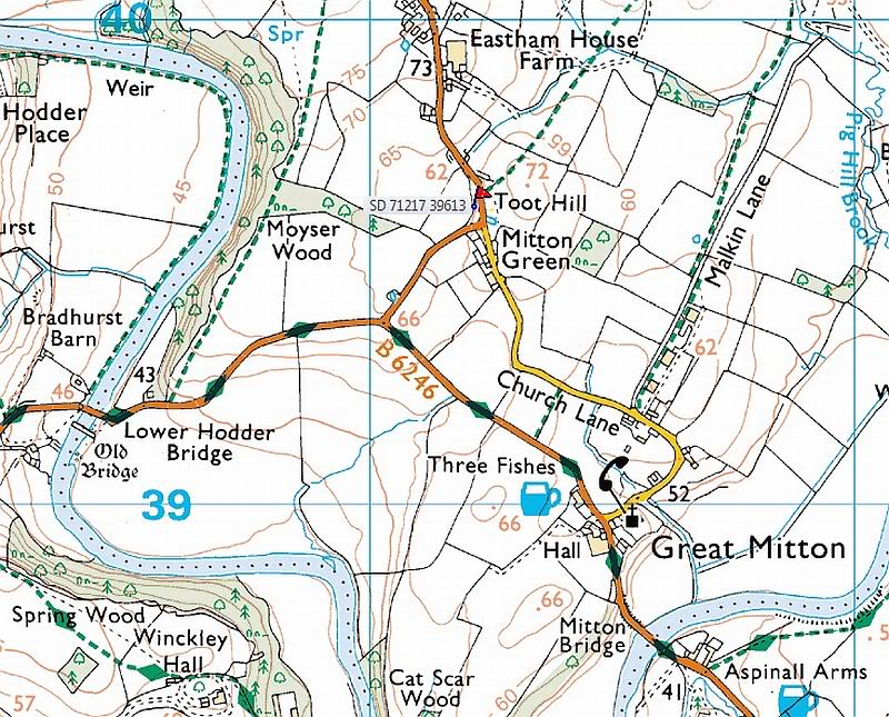
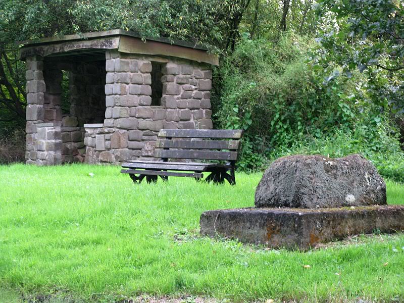
From Great Mitton village centre, take the B6246 road NW turning right up the B6243 road a quarter-mile past Great Mitton Hall. Same distance again, and just after where the road bends left, on the same side of the road you’ll see a wooden bus-stop. The site is just on the grass next to it.
Archaeology & History
The old site by the road (after QDanT)
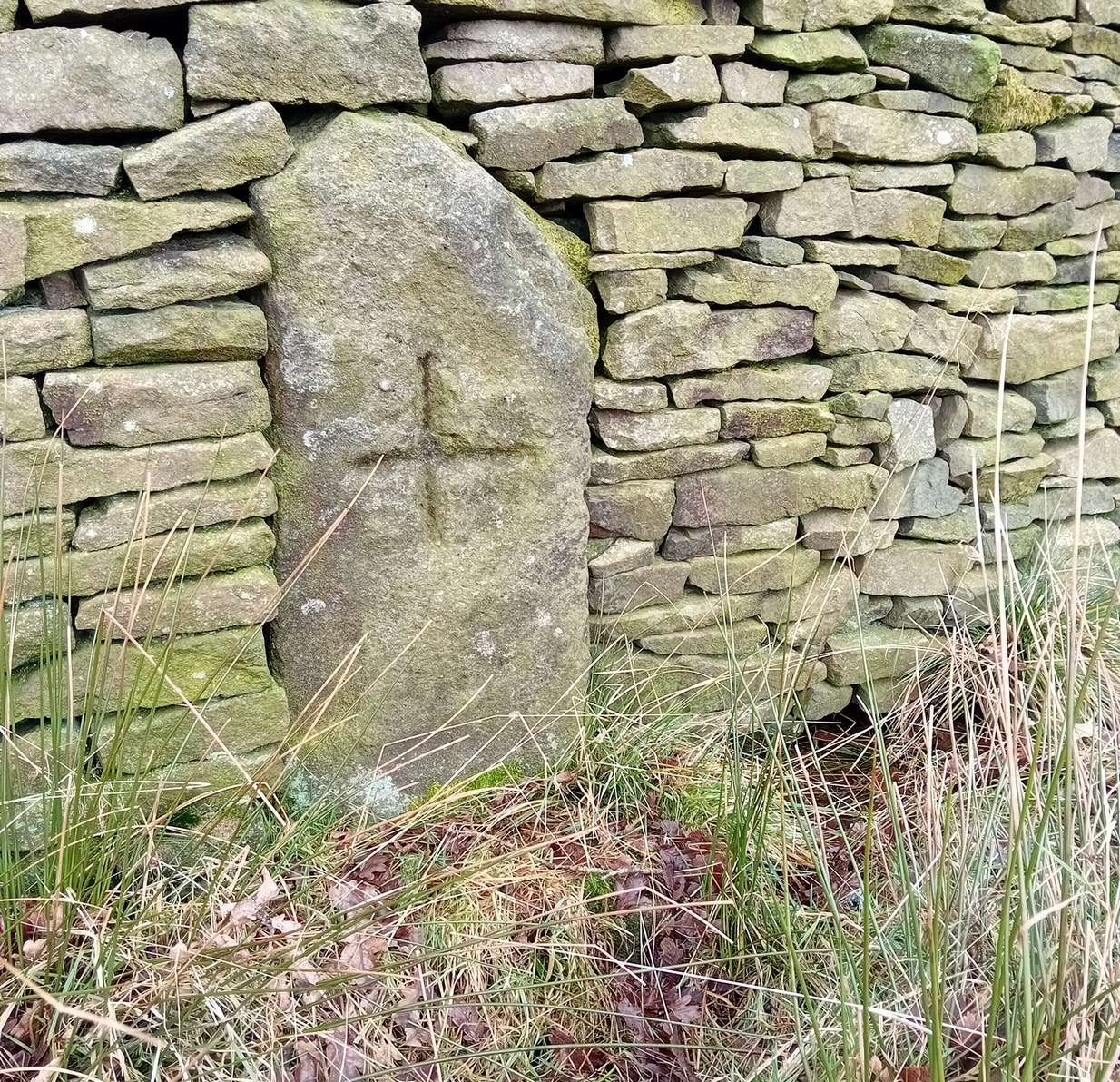
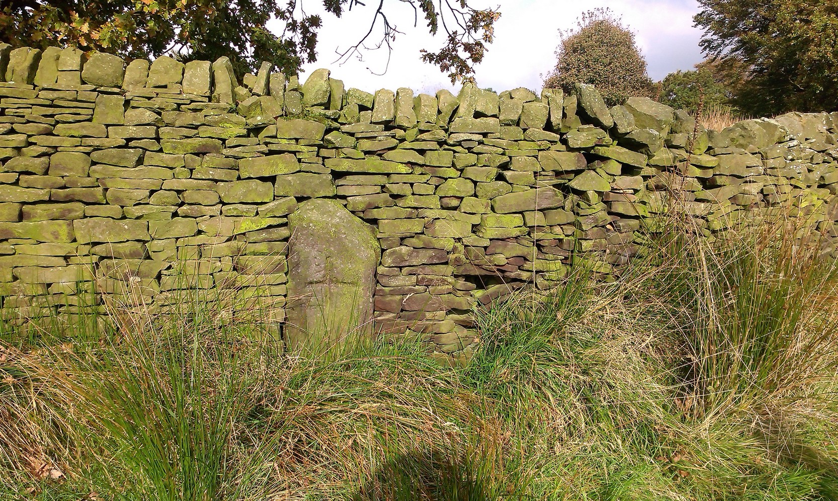
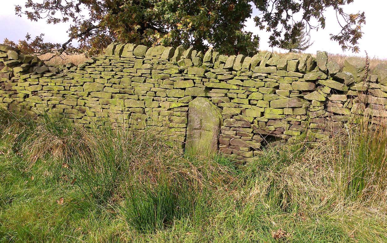
In a region with many old crosses hiding away in the landscape, we have very little history about this particular wayside cross and its stony base, found below the western edge of Toot Hill. It will no doubt have had something to do with the monks of the once-prestigious Whalley Abbey a few miles away, but we know not what! The great Lancastrian historian John Dixon would, no doubt, have known something of this place, but he is sadly no longer with us… The only thing I can presently find is a passing mention in Fred Ackerley’s (1947) local history work, who told:
“Continuing along the high road past Mitton Green one sees the base of a roadside cross and directly opposite this cross-base is Toot Hill, where in ancient times it is probable that village meetings were held.”
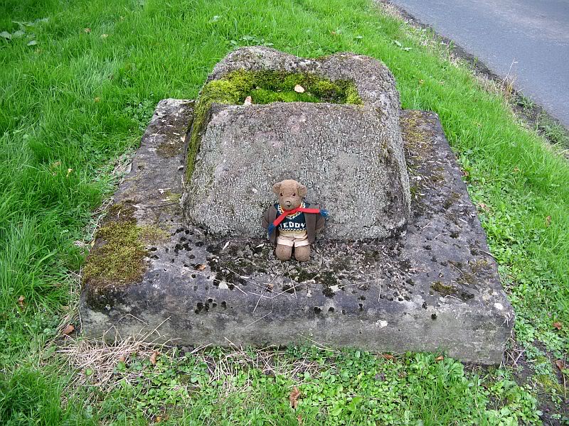
Close-up of the cross-base, with Teddy! (after QDanT)
Toot not being a just “a look-out hill” (Smith 1954), but in some cases places where ancient temples were built, “upon high totes” — though we have no record of such a temple, christian or heathen, upon this hill. So the reason for the stone cross at the bottom remains a mystery. Although, atop of the hill, we see marks very reminiscent of something much more archaic and heathen in nature, still visible in the crop-marks…
References:
Ackerley, Frederick George, A History of the Parish of Mitton in the West Riding of Yorkshire, Aberdeen University Press 1947.
Smith, A.H., English Place-Name Elements – volume 2, Cambridge University Press 1956.
Along the high moorland road between Laneshaw Bridge up towards Oakworth, on the Lancashire side of the moors a half-mile before reaching the Watersheddles reservoir, past the derelict pub until you reach the isolated Coombe Cross farmhouse on the tops. Across the road from here is a boggy footpath leading onto the moors. Walk on here for 100 yards, where the path bends left and another footpath veers up higher onto the moors. Walk up here for 20 yards and you’ll see the small monolith 10 yards away in the grassy heaths on your left.
Archaeology & History
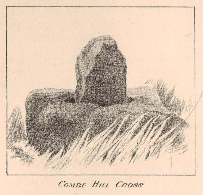
Taylor’s 1906 drawing
Found on the old route between the counties of Yorkshire and Lancashire, this little-known wayside cross has seen better days. Found in relative isolation from other monuments by the ancient trackway (Herder’s Cross is a mile WNW, and the curious Water Sheddles Cross a mile east), its history is quiet and it was ignored in the general surveys of such monuments by Rimmer (1875), Tyack (1900) and Vallance. (1920) Thankfully the giant survey of Henry Taylor (1906) did not forget it—although he seemed to know little of its story, merely telling us,
“The base-stone and part of the upright shaft of this cross stand about one hundred yards in a south-easterly direction from (Far Combe Hill Cross)… Two hundred yards south of the Combe Hill Cross occur the words, ‘Cross Bent.'”
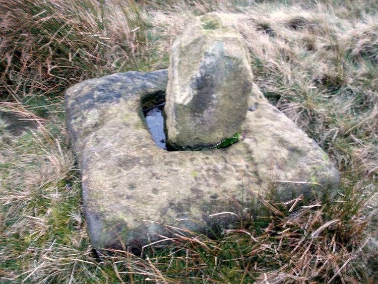
Coombe Hill Cross (photo by Ray Spencer)
The near-square stone base—about 3 feet by 3 feet—is commonly ascribed as medieval in origin and it’s thought that the remaining upright cross-stump—over 2 feet high—is probably not the original one. When fellow antiquarian Ray Spencer visited the site recently, he reported there to be “a faint inscription on the base saying COMBE HILL CROSS.”
The most detailed account of this monument was to be found in Clifford Byrne’s (1974) unpublished paper on the antiquities of the region, where he wrote:
“The pedestal of this cross with a piece of stone sitting in it which may or may not be part of the original monolith is situated on a wayside hillock… On passing the Herders Inn above Emmot, scrutiny of the left hand side of the road at the top of the next rise ahead opposite a white farmhouse will show what looks like a stumpy finger pointing to the sky. Close inspection will show that at the site sits the pedestal of a cross, apparently settled on two steps. Note that the pedestal and the supporting stones beneath have a remarkable resemblance to Carlton Cross which stands on Cross Green between Tom Cross Ainslack and Carleton village near Skipton. It may be that both monoliths were erected by the same hands. Whether the supporting blocks beneath the pedestal were for purposes of kneeling, or merely to stop the edifice sinking into the moor is…open to dispute. An ancient track passes the cross site where it splits into two: one going east towards Keighley and the other going south towards Haworth by Watersheddles Cross. A continuation of the track westwards travels along the foot of Boulsworth Hill past Iron Age burials,* along a fine set of pack horse setts, past standing stones, old lime kilns, and eventually leaving behind some remains of the Wycoller Vaccary stones near Antly Gate Farm. It tops the brow of a hill and drops down through Thursden by the Cold Well itself a a little green gate in the reservoir wall. Marquis of Colne suggested that the Combe Hill Cross dates from the time of King Stephen in the 12th century, but does not say on what he based his surmise…. If the origin of the stone is dated correctly, it has stood near Colne for over 800 years.”
References:
Byrne, Clifford, A Survey of the Ancient Wayside Crosses in North-East Lancashire, unpublished 1974.
Taylor, Henry, The Ancient Crosses and Holy Wells of Lancashire, Sherratt & Hughes: Manchester 1906.
* These Iron Age burials may be Bronze Age as we have found remains of several hut circles dating from that period in this area. PB.
Acknowledgements: Huge thanks to Ray Spencer for use of his photos and additional data for this site profile.
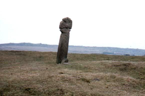
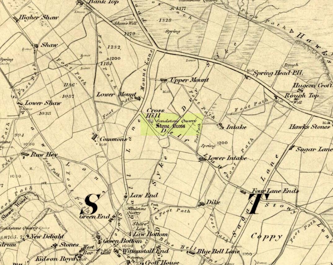
The site can be approached by going up the almost hidden long steep winding lane off the A646 in Cornholme; but if you don’t know the area it’s probably best approached from the well known Bride Stones, above Todmorden. From here, go west along the road running 100 yards or so above the Bride Stones, past the old pub, past Hawk Stones farm, and turning left downhill about a quarter-mile on. A coupla 100 yards down, there’s a track to your left. As you start walking along you’ll see a standing stone on the grassy rise in front of you on your left. That’s it!
Archaeology & History
Mount Cross on 1848 map
Said by local writer Geoff Boswell (1986) to be “the oldest religious memorial in Todmorden,” this old stone, more than 4-feet tall, is still in good condition and can be found beside the Old Causeway: a prehistoric trackway running between Lancashire and Yorkshire which is said by archaeologists to have been an old, but established trade route. It was suggested by some to have been erected as a cross as early as the 7th century. Generally known as the Mount Cross, it is also known as the Idol Cross, as legend reputes it to have been the site of pagan practices; hence its repute as being haunted. Its alleged heathen history is probably true (history records describe an old “rude stone” that was once found beneath the legendary Bride Stones nearby, which was moved many centuries back).
The Calderdale Council website tells that,
“Towards the bottom of the shaft on the NE side are what appears to be extremely faint traces of vine-scroll decoration which would suggest a fairly early date for the cross, possibly tenth or eleventh century. The irregularity of the carving overall tends to indicate that the cross is no earlier.”
Folklore
Said to have stood upon or beside a small tumulus until the 20th century. Jessica Lofthouse (1976) reported that a local farmer said of this stone. “Queer things happened here long since. They worshipped idols here.” Locally attributed to be haunted, the old stone was said to have a history of “uncanny happenings.”
References:
Bennett, P., The Old Stone Crosses of West Yorkshire, unpublished MS, 1995.
Boswell, Geoff, On the Tops around Todmorden, Delta G: Todmorden 1986.
Lofthouse, Jessica, North Country Folklore, Hale: London 1976.
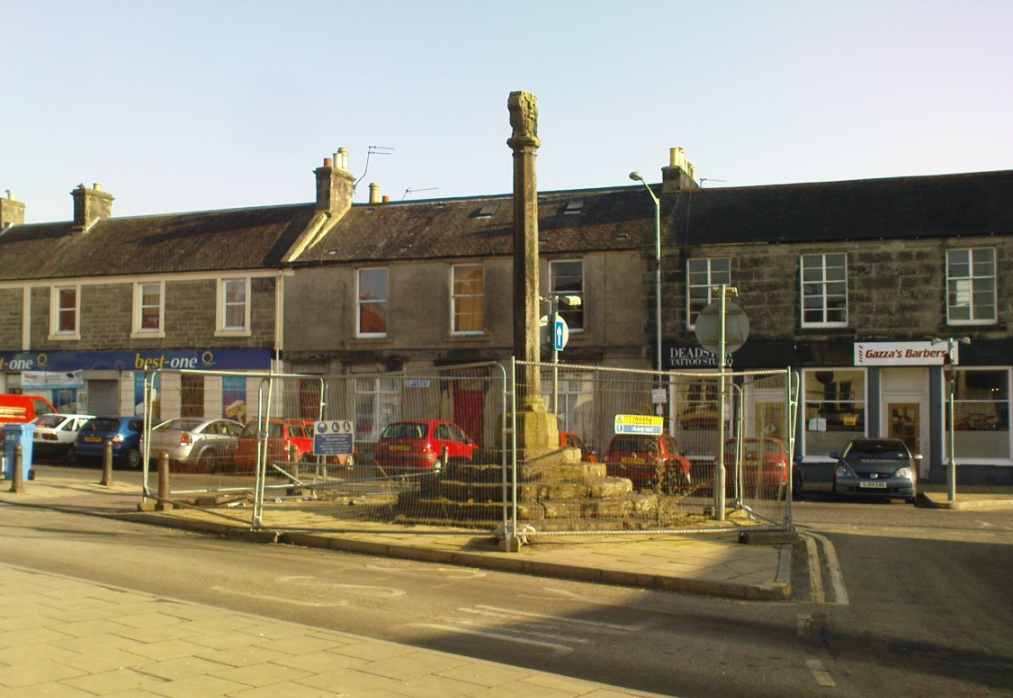
Dead easy to find. Get into the centre of the lovely little town centre of Kincardine, down High Street, and there upon its steps at the roadside, you can’t miss the it!
Archaeology & History
A few days ago when I came to have a look at this old cross (17th century according to the Royal Commission) it was surrounded by protective railings while some work was being done in the town centre. Thankfully it was a glorious bright day and allowed for some good photos!
It is a typical mercat cross, as Mair (1988) called them: a stone pillar, mounted on steps, with some sort of crowning edifice on top. The monument was described in the Royal Commission (1933) report of the region, where they wrote:
“The market cross stands at the southern end of High Street and consists of an octagonal shaft with moulded base and capital, placed on a rise of six octagonal steps, having a spread of 14½ feet. Above the square abacus is a stone sculptured with the arms of the Earls of Kincardine on the one side and a thistle ornament on the other. The arms are: Quarterly, 1st and 4th, a lion rampart; 2nd and 3rd, a saltire and chief. The shield is flanked by two men in armour as supporters, is surmounted by a coronet and helm, mantled and wreathed, and has for crest a naked arm, flexed, issuing out of a cloud and holding a man’s heart. The cross must be later than 26 December, 1647, when the Earldom was created.”
References:
Beveridge, David, Culross and Tulliallan: Its History and Antiquities – 2 volumes, William Blackwood: Edinburgh 1885.
Mair, Craig, Mercat Cross and Tolbooth, John Donald: Edinburgh 1988.
Royal Commission on the Ancient & Historical Monuments, Scotland, Inventory of Monuments and Constructions in the Counties of Fife, Kinross and Clackmannan, HMSO: Edinburgh 1933.
Small, John W., Scottish Market Crosses, Eneas Mackay: Stirling 1900.
This long-lost medieval ornamented cross, found not far from the legendary Grope Cunt Lane (I kid you not) was located close to the middle of old Shrewsbury town, “at the junction of Pride Hill, Castle St and St. Mary’s St,” according to the 1902 OS-map of the region.
Although Shrewsbury’s High Cross is believed to have been built in the 12th or 13th century, we don’t know for sure when it was first erected — and indeed, written records of the place don’t appear to begin until the year 1557, where it was described as the ‘Hye Crosse.’ A few years later in the Parish Registers for the Lichfield diocese, dated 1590, the monument was mentioned again as ‘the Highe Crosse’; and subsequent accounts of it are found in various local history accounts from 1695 to 1799.
The site was named as the Butter Cross in street-name listings of 1804, telling it as a site where this food was sold and we know that the High Cross was the centre of a local market and social gathering place in previous centuries. Gelling (2004) told that “the medieval cross was taken down in 1705, but the name continued to be applied to structures which replaced it, and which were used as a market place for dairy produce.”
In earlier times, the High Cross is said in legend to have been where executions were enacted. Alfred Rimmer (1875) narrates the oft-told tale of those who died here, saying:
“The High Cross of Shrewsbury has long been destroyed, but its place is pointed out in old documents. Unhappily, it is not connected with pleasant associations, for before it the last of the British princes, David, a brother of Llewellyn, was cruelly put to death by Edward I; and at a later period many of the nobility who were taken at the battle of Shrewsbury were there executed, the High Cross being considered the most appropriate place for such a spectacle.”
The prince that Rimmer mentions was Dafydd III, the last prince of Wales, executed in the year 1283.
References:
Gelling, Margaret, The Place-Names of Shropshire – volume 4, EPNS: Nottingham 2004.
Hobbs, J.L., Shrewsbury Street Names, Wilding & Son: Shrewsbury 1954.
Rimmer, Alfred, Ancient Stone Crosses of England, Virtue: London 1875.
A little-known early christian relic found in the driveway to East Riddlesden Hall was saved and propped up in the stable floor at the back. In 1984 however, the National Trust got round to moving it and bringing the relic to greater public attention by putting it on display in the great hall of the building. (I think you’ve gotta pay to go in and see the stone these days – which is a bittova pain if you just want to examine the carving)
Old photo of the carved stone (after Margaret Faull)
Measuring just 1 foot across and 2 feet high and carved on all sides, the design is all too familiar to those of you exploring early christian or late-Celtic art forms. Executed sometime between the 5th-10th century, on the main face of the cross we have the traditional ‘Celtic’ interlacing, with a bird-figure emerging on or around an early ‘cross’ symbol. There are a variety of interpretations of this, but none relate to any modern christian mythic structures. Indeed, we should cautiously reflect on the more pre-christian nature of this design: carved as it was at a time when the spirit of the natural world (animism) was endemic amongst all people. This carving would in some way reflect such implicit subjectivity, though perhaps have had emergent ideals relevant to the christian cult within it. However, we should be cautious about this christian idea, despite it being much in vogue by prevailing groups of consensus trance historians.
References:
Faull, Margaret L., “The Display of the Anglo-Saxon Crosses of the Keighley Area,” in Transactions of the Ancient Monuments Society, New Series no.30, 1986.
From Alloa head east along the A907 road and park up at Morrison’s supermarket a half-mile on. From here, keep walking along the same road, but make sure you go on the dirt-track running parallel with the main road, and which runs alongside the field in which this monument is clearly visible. Just make sure you only visit it when the crops aren’t growing (between September through to April is OK).
Archaeology & History
This is a highly impressive monument, but I for one doubt that it has a wholly christian origin… The fact that a stone circle was on the same ridge totally visible a couple of hundred yards away, and a cluster of Bronze Age cairns immediately west, adds to my doubt; along with the sheer size of this thing trying to grab attention to itself. You’ll have to visit it yourself and see what I mean.
The stone was first described in the Old Statistical Account of the area in 1795, and it told:
“About a mile east of the town, there is a large upright stone, 7 feet 4 inches above the surface of the ground. It is three feet broad, and thought to be very deep in the Earth. The old people used to speak of the figure of a man on horseback, which they had seen on it. If any thing of that kind, or letters (as it is said), have been formerly observed, they are now totally effaced.”
However, in a footnote to this entry, it was said that,
“when the adjacent farm was enclosing, upwards of 20 years ago, a ditch was made close to the stone, when many human bones were discovered; which proves that a battle or skirmish had some time or other taken place near that spot; and probably some man of eminence was buried hard by, as it was a common practice of the Picts on such occasions. There are two stones resembling this one, in the neighbouring parish of Alva, at no great distance from the church, but not close to one another. They are both near the foot of the Ochils.”
It seems most probable that this great cross-carved monolith had some relationship to our heathen mythic history—an idea which has been put forward by others historians in bygone times. In Daniel Wilson’s (1851) huge work, he told us:
“On ground about half a mile to the east of the town of Alloa, called the Hawkhill, is the large upright block of sandstone sculptured with a cross which is represented in the annexed engraving. It measures ten and a quarter feet in height, though little more than seven feet are now visible above ground. A similar cross is cut on both sides of the stone, as is not uncommon with such simple memorials. During the progress of agricultural operations in the immediate vicinity of this ancient cross, in the spring of 1829, Mr. Robert Bald, C.E., an intelligent Scottish antiquary, obtained permission from the Earl of Mar to make some excavations around when, at about nine feet north from the monumental stone, a rude cist was found, constructed of unhewn sandstone, measuring only three feet in length, and at each end of the cover, on the under side, a simple cross was cut. The lines which formed the crosses were not rudely executed, but straight and uniform, and evidently finished with care, though the slab itself was unusually rude and amorphous. The cist lay east and west and contained nothing but human bones greatly decayed. Drawings of the cross and a plan of the ground, executed by Mr. Bald, are in the possession of the Society of Antiquaries. Here we possess a singularly interesting example of the union of Christian and Pagan sepulchral rites: the cist laid east and west, according to the early christian custom, yet constructed of the old circumscribed dimensions, and of the rude but durable materials in use for ages before the had superseded the aboriginal Pagan creeds.”
Old drawing of the site (after Wilson 1851)Hawk Hill Cross, looking north
A few years later there was another account of this cross published in the Proceedings of the Society of Antiquaries, Scotland (1889), echoing much of what Wilson described, telling of the discoveries of many human remains found hereby. And when the Royal Commission (1933) account of the place was written after their inspection team visited the site in 1925, they told:
“This slab…is set up on a knoll about 200 yards south of the main roadway between Alloa and Clackmannan and about midway between the site of the (Hawk Hill) cairn…and that of the (Hawk Hill) stone circle… It is packed round the base with fairly large stones and stands with its broad faces east and west. A cross of Celtic form is incised on both sides, the incisions being about half an inch in depth. On the east face the shaft is made to spring directly from a base, without the intervention of a basic line. The design on the west face is similar, but the shaft here has been almost entirely obliterated by weathering. The slab is 8 feet in height, 2 feet 7½ inches in width at the base, and 9 inches in thickness.”
Notice that the more recent accounts don’t mention the horse carving: an intriguing element which was however mentioned in some early local history works of the place. Indeed, some postulate that this may have Pictish origins. They may be right. As local historian T.C. Gordon (1937), told,
“that the old people of the parish could remember seeing on the soft surface of the stone the figure of a man on horseback.”
Cross on the east faceCross on the west face
On the day I visited this stone I couldn’t make out any carved horse, but it seemed that something may once have been carved near the bottom the western face…perhaps… One writer also suggested that the nearby place-name of Gaberston may have related to this stone cross, with the word literally meaning ‘The Pillar Stone of Brath (Brude),’ which as Mr Gordon said, thus provides “the link between the stone and (the Pictish leader) Brude, and this link is strengthened when we remember that the burn that runs through Alloa is called ‘the Brathy Burn.’”
The possible Pictish motifs of a horseman were mentioned again in a letter from the local County Planning Officer to the Alloa County Clerk in 1971, along with a recommendation that the cross be removed and placed into a museum to prevent further weathering and erosion. Thankfully this suggestion was not followed through and the cross remains where it belongs: in its position in the landscape to beguile and intrigue us over its hidden commemorative past. Long may it remain upon its hill.
A very impressive site indeed…
Folklore
Thought locally to have played a part on an alignment or ley line with a little-known Druid Stone by the roadside in Alloa, the Hawk Hill cairn, and Hawk Hill stone circle to its east. The historian T.C. Gordon (1937) told that the cross marked the site where the Picts fought against the Saxons, saying:
“We know that Finguine, son of Deleroith, died in that battle in 711 AD, and maybe Brude too. A stone cross still marks the place at Hawkhill.”
References:
Gordon, T. Crouther, A Short History of Alloa, Alloa Advertiser 1937.
Lothian, James, Alloa and its Environs, Alloa Advertiser 1861.
Miller, Peter, “Notices of the Standing Stones of Alloa and Clackmanan,” in Proceedings of the Society of Antiquaries, Scotland, volume 23, 1889.
Royal Commission on the Ancient & Historical Monuments, Scotland, Inventory of Monuments and Constructions in the Counties of Fife, Kinross and Clackmannan, HMSO: Edinburgh 1933.
Wilson, Daniel, The Archaeology and Prehistoric Annals of Scotland, Sutherland & Knox: Edinburgh 1861.


")


