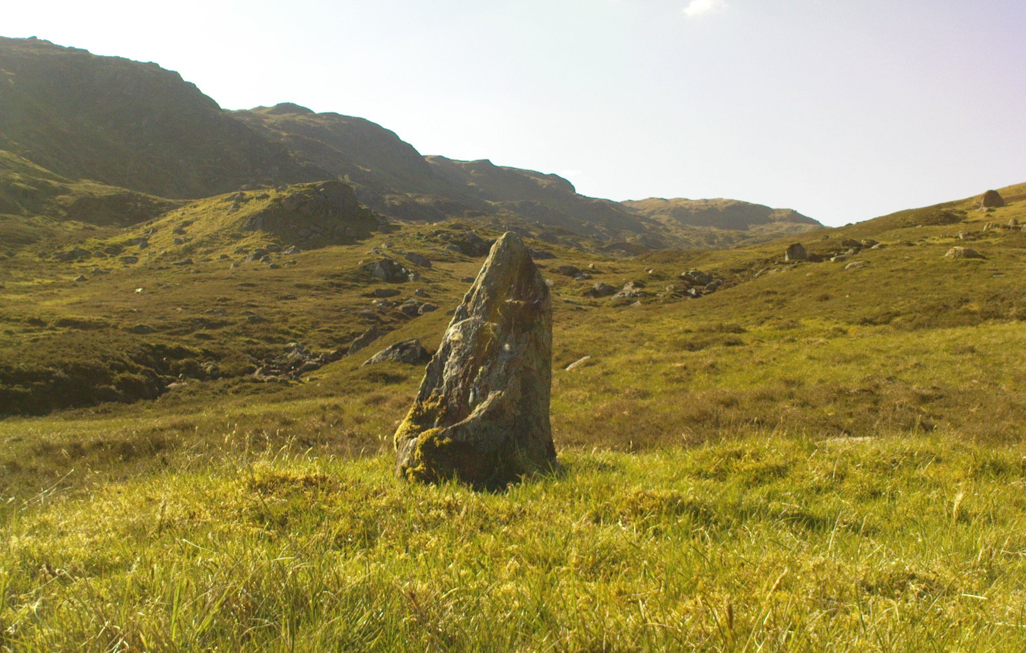
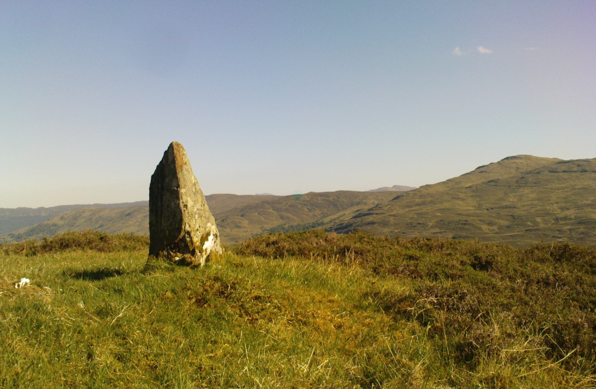
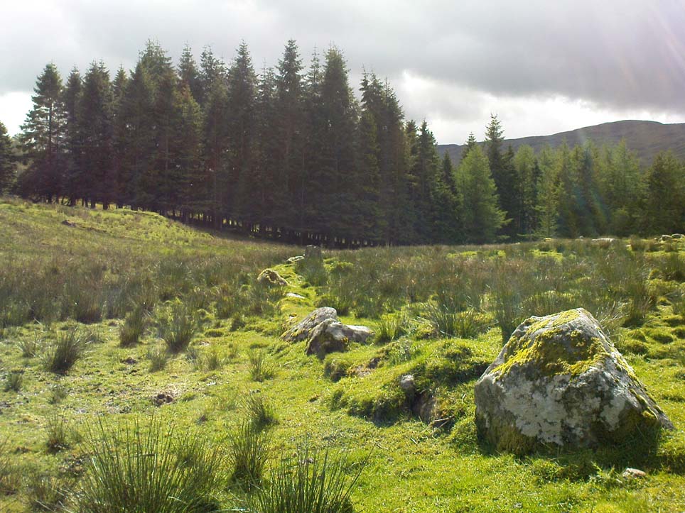
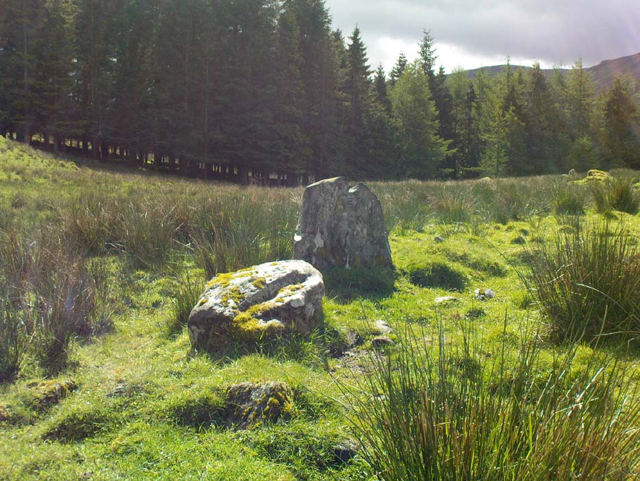
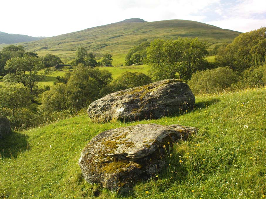
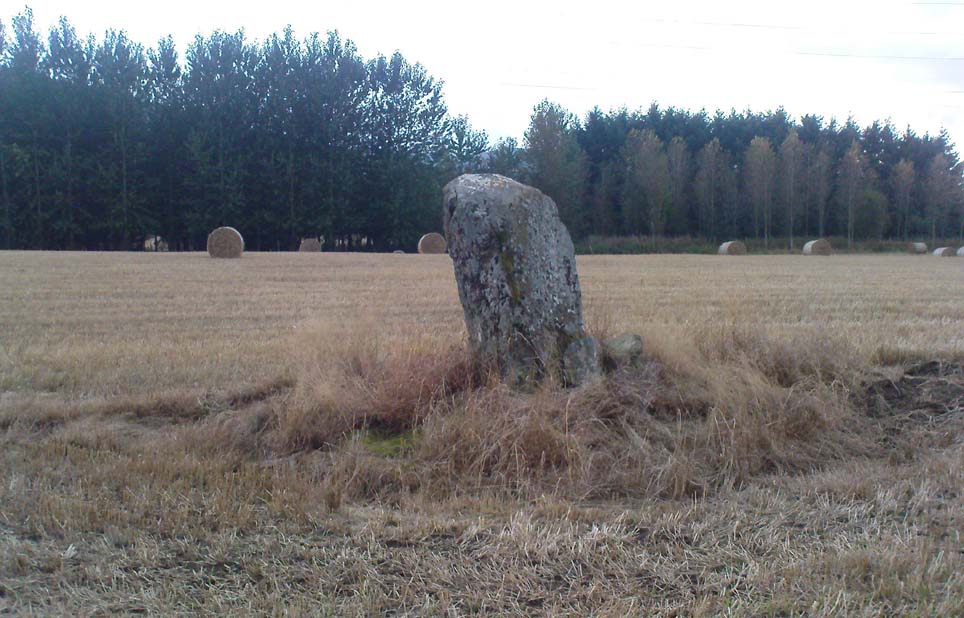
One helluva climb to reach this little fella. I simply started at Dalgirdy cottage, some 5 miles along Glen Lochay, on the right-hand side of the road. Then, walk right up the burnside, all the way up until it begins to level out and the old shielings appear. When you’ve got to where they just about finish, about 50-70 yards on the east side of the burn, you’ll see the small stone standing upright, all alone. You can’t really miss it!
Archaeology & History
Allt Ghaordaidh, looking south-ish!
No previous written records exist that describe this small standing stone, whose nature and age may be akin to that at nearby Tirai, found amidst the derelict village a couple of miles east, lower down the slopes — i.e., it may have simply been part of some of the ancient village remains and shielings found close by, either side of the rushing burn. But whether it’s only medieval or much more ancient than that, its position in the landscape alone (much like Tirai’s uprights), deserves to be known about.
There are considerable amounts of ancient remains scattering the mountains slopes all round here: some have been catalogued, but a lot of it has not. This little standing stone is at last alive again! (take good food and kit when visiting here)
Take the single-track Glen Lochay road down past the Bridge of Lochay hotel at the edge of Killin, as if you’re gonna visit the superb cup-and-ring carvings opposite Stag Cottage (or Duncroisk 1). Immediately past the garden of Stag Cottage is a small copse of trees and a couple of old wartime-looking buildings in the field above the roadside. Go up past these buildings and onto the rise at the back. You’re here.
Archaeology & History
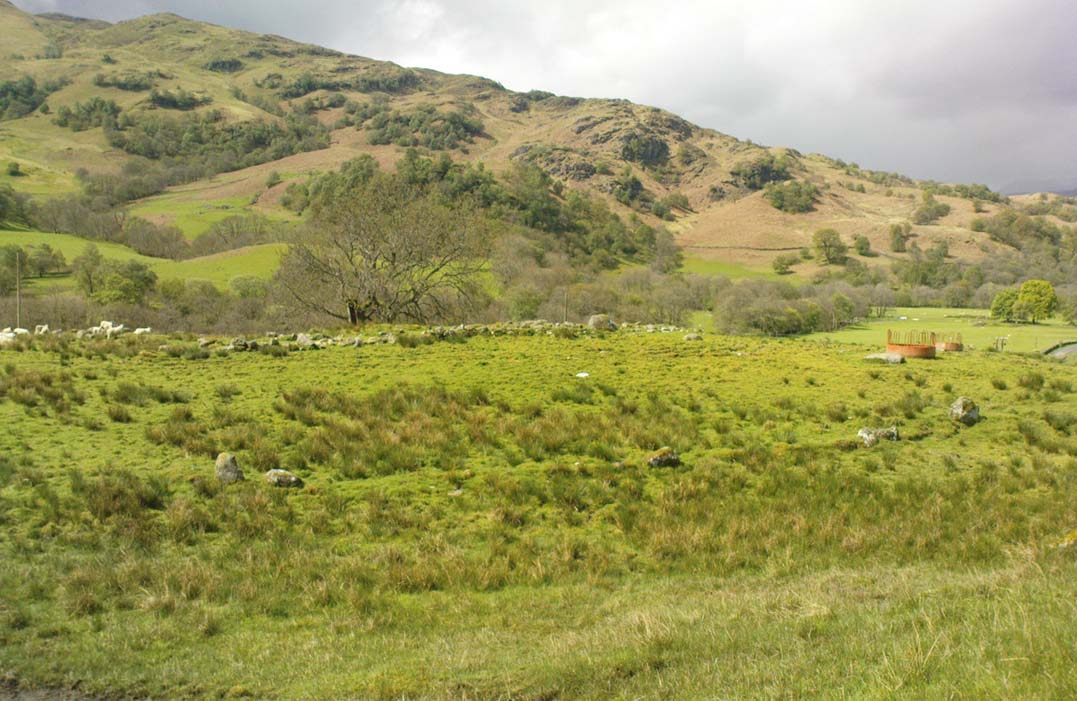
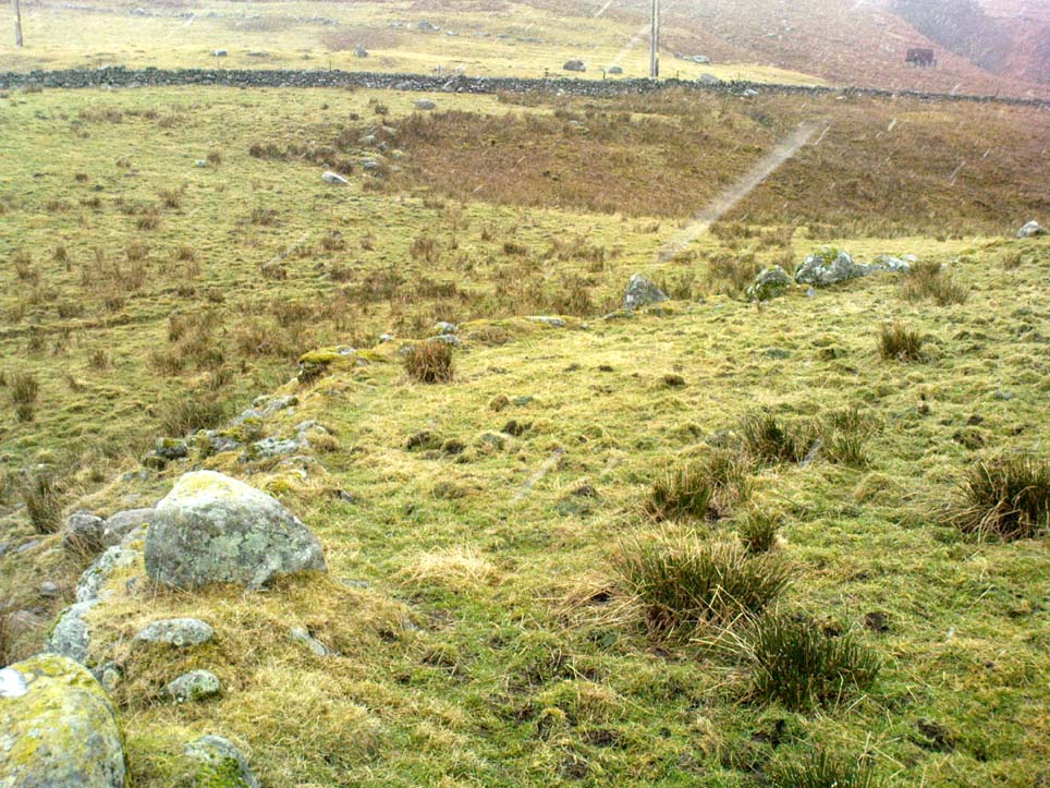
This is a fascinating site of multi-period historical usage, which Dugald MacInnes (2001) thinks may have its origins in the early Bronze Age or neolithic; but which I reckon was probably first used in the Iron Age. Either way, we have here a large interesting well-preserved prehistoric stone enclosure, that has yet to be excavated. I first came across it whilst gathering firewood from the adjacent copse and was quite puzzled by what seemed to be an extensive curved line of ancient walling running from its east to northeastern section, typical of prehistoric Iron Age walled structures common in northern England and beyond. I must have paced back and forth along a 75 yard length of this section of walling a half-dozen times, wondering what the hell this place was. And the more I looked at this section of the enclosure, the greater my conviction grew that this was constructed in prehistoric times. And thereafter came the puzzle.
Looking down at the walled enclosureNW section of walling
For along the southern walled section were a number of much more modern medieval and much later walled sections, including the remains of buildings that looked barely Victorian in age and nature. The site was obviously being used presently by the local farmer for his cattle. And so it became obvious that here was a large oval-shaped stone-walled enclosure or settlement that had been used over and over again through many centuries, with its origins seeming to be Iron Age in nature. Measuring approximately 195 yards (178m) in circumference, the structure has a maximum E-W diameter of 78 yards (71m) and N-S measurement of 44 yards (40m).
The mass of evidence for prehistoric activity is all round this hidden enclosure, with the fascinating clusters of cup-and-ring stones of Duncroisk and Corrycharmaig close by. The small standing stones of Tirai 600 yards NW, and a similar prehistoric enclosure at Tullich ¾-mile NW show ample evidence of prehistoric man in this part of Glen Lochay.
Despite the size of the place, no literary reference of it occurs before MacInnes and his team came here. His description is as follows:
“An oval enclosure, its boundaries formed principally from large water-worn boulders interspersed with drystone walling and in part by an earthen bank in the easternmost section, sits atop of a natural terrace about 155m OD. The terrace slopes steeply to the west and south and cut into the western slope is a track, the course of which cannot be determined beyond the extent of the slope. This track displays revetment in the form of stone coursing.
“The SW corner of the enclosure is angular rather than the rounded character of the other sections. The W and SW sections are composed of coarsely constructed stonework in which large, 1m wide, often 1m high, water-worn boulders at two to three metre intervals, are interspersed with smaller boulders which form crude drystone coursing.
“The NE section is formed largely of large boulders, one of which is 1.5m in width and 1.2m high by 0.8m wide. Sections of the northern part would appear to be robbed out, perhaps to construct the modern wall which lies about 25m to the north. There are no remaining large boulders there, however, which could indicate their absence in the original construction of the enclosure. The central section of the northern perimeter may be constructed of two outer skins of boulders, forming a wall about 0.9m wide, 0.4m high on its exterior, but reducing to 0.3m on its interior side. Two sections could possibly be filled with a rubble core.
“The E section is formed by a low 0.3m high earthen grass-covered bank with occasional boulders. This bank is about 0.2m high relative to the interior, but is about 0.5m to.0.8m high on its exterior side. The NW side shows on the western side more evidence of double skin, rubble construction. Close inspection of the stonework around the perimeter of the enclosure has revealed no evidence of shot-holes. However a monolith situated in the NE has been split, but this would appear to be natural. The interior of the enclosure is more or less level and grass-covered. There is however, a slight drop in level in the western third of the interior. This is defined by a linear slope which may be a lynchet.”
Northern section of enclosureUpright stone in eastern wall
Northeast of the enclosure about 40 yards away is the normal drystone walling running along the sloping hillside. But more intriguingly to archaeologists is the second line of much more ancient walling 76 yards (70m) further up the grassy slope, running at an angle across and uphill in a northwesterly direction. This line of walling has a distinctly Iron Age flavour to it and is composed of some very large upright monoliths, almost Bronze Age in nature! It continues into the next field for some 400 yards and onto Duncroisk Burn — the other side of which we find another line of ancient walling with an impressive cup-and-ring stone incorporated.
There’s tons more to be said of this region…
…to be continued…
References:
MacInnes, Dugald, An Archaeological Field Survey of a Deserted Settlement at Duncroisk Farm, Glen Lochay, Association of Certified Field Archaeologists: Glasgow 2001.
Follow the same directions to reach the Duncroisk Crosses stone. From here, look up the slope to your right and you’ll see the line of fencing running uphill. Follow this until you reach the ruined remains of the old sheepfold building. From here, look towards the tree-lined gorge of Duncroisk Burn, a few hundred yards west and walk towards it for about 50-60 yards. There’s a group of three rocks hereby, two are large, but the carving’s on the smallest one in the middle.
Archaeology & History
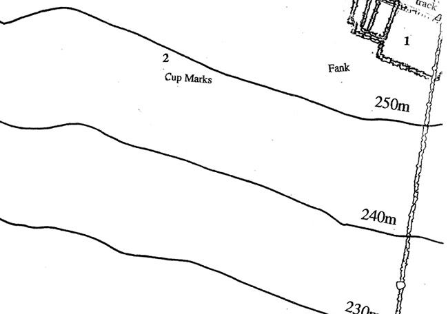
This cup-marked stone was rediscovered as a result of the fine archaeological survey work by that Glasgow bunch of Certified Field Archaeologists, in their assessment of remains in and around Duncroisk Farm. As well as mentioning — albeit briefly — the carvings of Duncroisk Farm and Duncroisk Crosses, Dugald MacInnes (2001) and his team came across another that hadn’t been recorded before. Described in their survey as ‘feature 2’, he told,
“Some 20 metres downslope from the sheep fank and about 60 metres NW from it, there is a group of large boulders. On the southeast sloping face of one of these there are three previously unrecorded cup-marks. These are oriented vertically on a northeast to southwest alignment and are no more than 4cm apart. They are all about 7cm in diameter and 2.5cm deep.”
The carved rock is a relatively small one sitting roughly in between two much larger rocks, both of which are easily visible from the Duncroisk Crosses stone less than 100 yards down the slope. It’s probably only gonna be of interest to the rock-art purists among you and some may even question its veracity, particularly the bottom of the three cups, which gives the impression of being unfinished. If you visit the site in summer and autumn it will be much harder to find, as it gets overgrown with bracken. (we did take a number of photos of this stone, but managed to somehow delete them all before saving to disk – so have gotta check it again when we next visit here)
References:
MacInnes, Dugald, An Archaeological Field Survey of a Deserted Settlement at Duncroisk Farm, Glen Lochay, Association of Certified Field Archaeologists: Glasgow 2001.
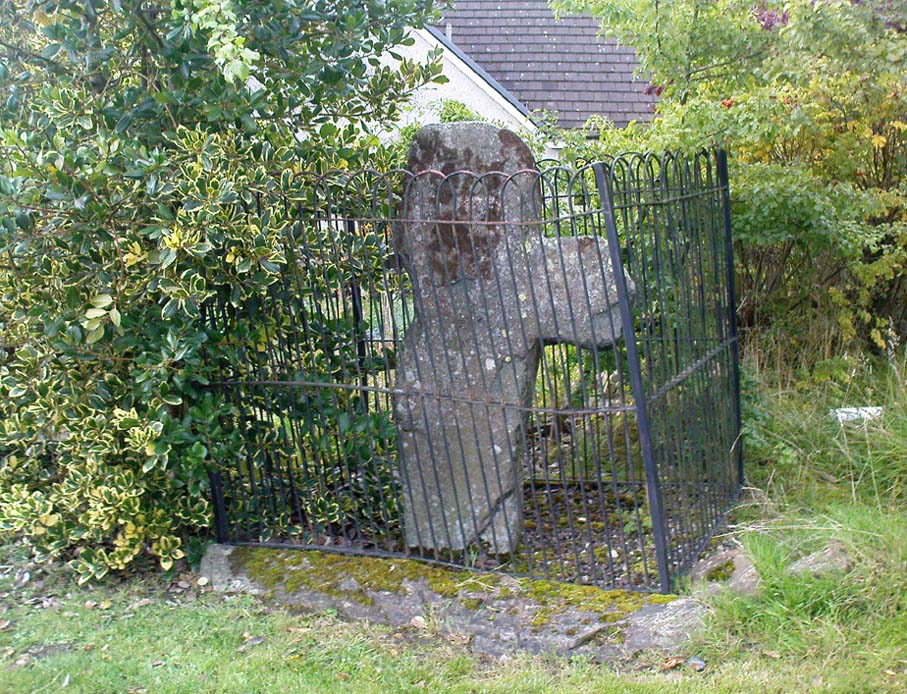
From Aberfeldy, take the B846 road over the river bridge, past Weem, a couple of miles down the valley until you see the small road on the right which leads up to the ancient hamlet of Dull. Go up and round the corner until you reach the centre of the village; and here the road turns back downhill. At this point, right by the roadside, entrapped within old railings, you’ll see the Cross of Dull.
Archaeology & History
Dull Cross behind bars
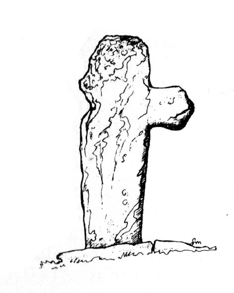
Standing more than three feet tall, the remains of this old cross with one of its extended arms broke off in previous centuries, was one of three such monuments that used to stand in the valley. This and its associates were, according to christian legend, placed as markers at an ancient centre of christian learning at Dull around the time of Adamnam (who died in Glen Lyon in 704 AD). The area was said to be an early druid college, which was later incorporated into early christian teachings. Hilary Wheater (1981) also told that in previous centuries, if anyone fell foul of the law,
“Within the boundaries of these crosses debtors, offenders or miscreants were protected from retribution. One of the crosses stands in the centre of Dull village to this day, having been used as a market cross in more recent times, and the other two, having been stolen for use as gateposts during the (19th) century, were placed in the old kirk at Weem for safety.”
References:
Stuart, John, The Sculptured Stones of Scotland, Aberdeen 1856.
Wheater, Hilary, Aberfeldy to Glenlyon, Appin Publications: Aberfeldy 1981.
Follow the same directions to get to the cup-marked stone on the slope behind Duncroisk Farm. Once here, look up the hillside and about 100 yards above you there’s the fence, and a gate in the fence. Go through that gate and walk uphill for some 20 yards where you’ll meet with a large sheet of flat sloping rock with a stream by its side. The crosses are on this rock sheet at the top left-hand side.
Archaeology & History
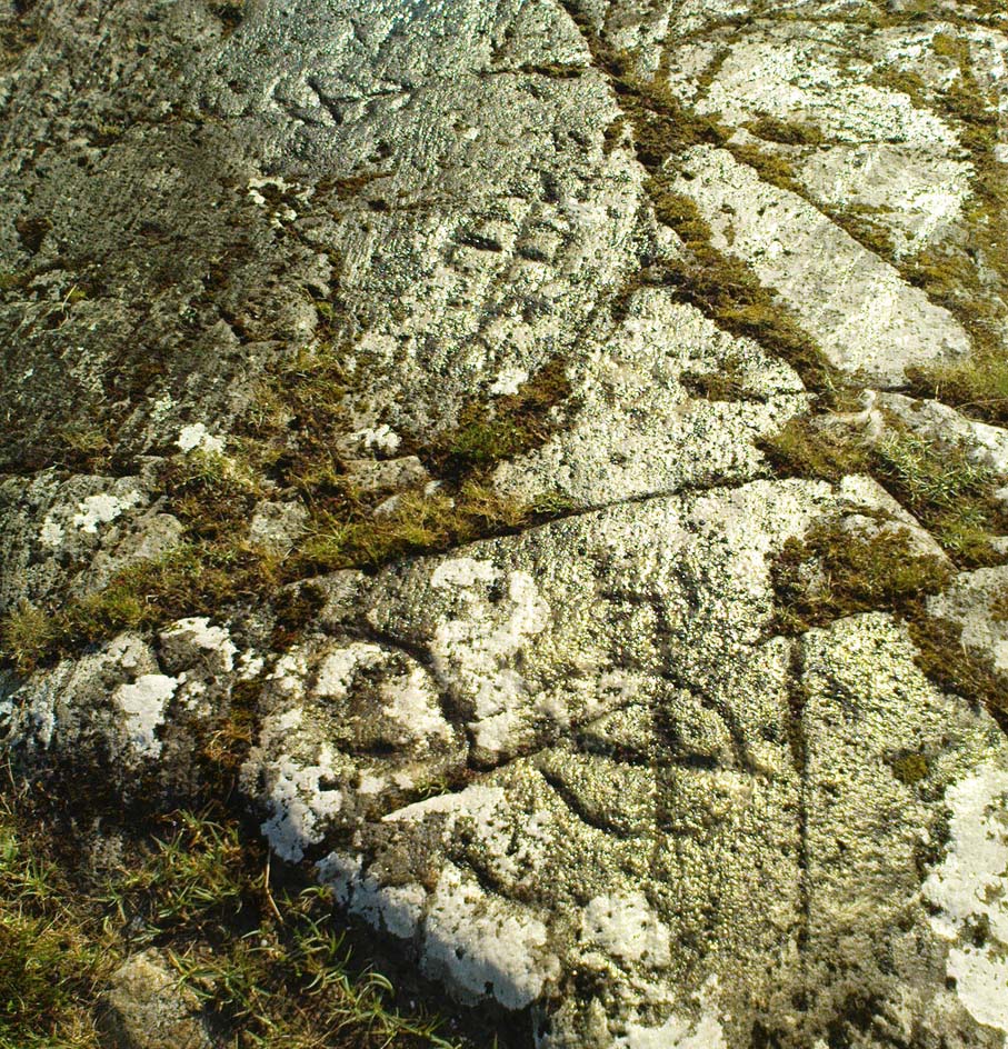
Although the stone here is pretty easy to find, the insignia carved on the rock itself can be troublesome to see. The accounts by both Cormack (1952) and Morris (1981) each recommend visiting the site around sunrise, but an hour before sunset is also profitable if you wanna see the design with any clarity. And of course, if you keep the rock-face wet (the adjacent stream is handy here) the carvings stand out even better!
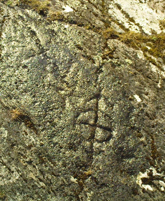
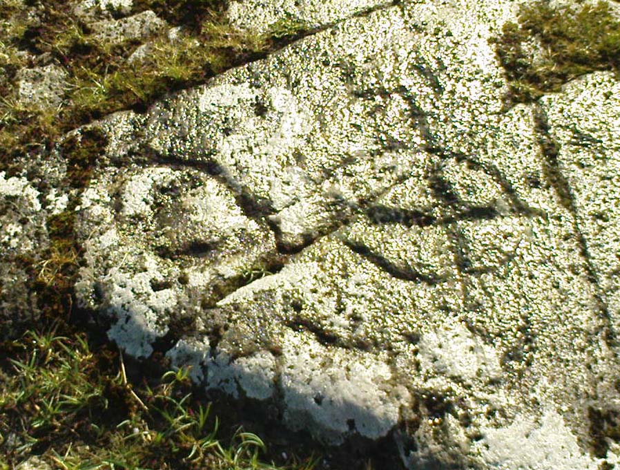
Main section of carvingSolar cross & arrow?
It’s a quite superb carving in a truly superb setting, come rain, shine or mist — but for the cup-and-ring aficionado’s amongst you this one might not get y’ going, as we’re looking at a carving that was probably born of the more recent mythic period. Although there are between two and four faded cup-markings here, the principal designs do not echo the more usual neolithic and Bronze Age carvings scattering this part of Perthshire. Instead we find very worn examples of what have been variously called “solar wheels”, “Greek crosses”, Celtic crosses, etc. We also find simple carved ‘arrows’ at the ends of both natural and man-made lines in the rock; along with very distinct ‘eye’ or vulva symbolism. (Crawford 1957) Added to this is the possibility of human figurines discernible in the carving, very similar indeed to those found in Spain (Kuhn 1956) and elsewhere.
The site was first described by E.A. Cormack (1952) who wrote the following, (slightly edited) piece:
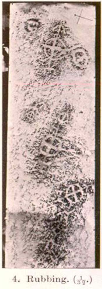
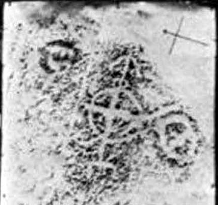
“Examination of the rough and sloping rock surface revealed an interesting group of inscribed figures, confined to an area of about 8 by 2½ feet, four of which included a cross within a circle. The figures are difficult to discern, except when thrown into relief by early morning sunlight, but are clearly demonstrated on a rubbing.
Cormack’s 1952 rubbing of the carving
“The crosses may be described in three groups:
“Group 1 — a) Near the upper edge of the rock is a cross within a circle of 8-inch diameter. The vertical axis of the cross is extended below the circle for 4 inches, resting on an ill-defined rectangular base, and upwards for 5 inches to form an arrow-head with 3-inch barbs. At the junction of the shaft of the arrow with the top of the circle is a pair of contiguous rings of about 1-inch diameter. The cross is deeply cut, to about a half-inch depth, with equal arms 4 inches long and 1 inch broad. The left arm of the cross extends beyond the circle, but this may be due to the circle being slightly excentric in relation to the cross. The lower right quadrant of the circle is marred by a natural crevice in the rock, but careful examination shows that the circle does not cut the right arm of the cross.
b) On each side of this figure is a roughly circular marking, one about 4 inches above and to the left, of 3-inch diameter, and the other 2 inches to the right, of about 5-inch diameter. In each there is an indefinite depression across the centre.
“Group 2 — a) About a foot below and to the right of Group 1 there is a boldly cut cross within a 7-inch circle. Again the vertical arm of the cross is extended above and below the circle, downwards for 5 inches to a curved arrow-head with 4-inch barbs, and upwards as an equal armed 5-inch crosslet above which is a 4-inch circle with the central axis continued through it. (The junction of this axis through the circle with the top of the small cross is slightly angled.) The main cross and circle are cut to fully half an inch in depth and one inch in breadth, but the upper part of the figure is much less distinct.
b) About 8 inches to the left of the upper part of the above figure is a very faintly incised cross within a 2½-inch circle. It is difficult to discern on the rock, but can be seen in the photograph and is very clear on the rubbing. It also appears to have an arrow-head above it.
“Group 3 — a) A foot below and to the right of Group 2 is a clearly cut cross within a 6½-inch circle. A natural cleft in the rock has been used for one axis of the cross, which lies obliquely to the others already described, and this axis terminates in an arrow-head 3 inches below the circle, and another slightly smaller arrow-head is cut 2 inches above the circle; in each case the angle formed by the arrow being towards the circle.
b) Immediately below the last cross is a curious hieroglyph not easy to make out on the rubbing, but clear in the photograph. On an 18-inch vertical axis can be seen from above downwards an arrow-head, an oblique line to the left, a faint 2-inch circle, a transverse stroke, and finally two oblique lines to the right. A natural crevice to the left of the figure rather confuses the picture.”
Ron Morris’ (1981) description wasn’t as detailed and he was initially hesitant about using the site in his rock art survey of the area, as he thought it “most likely to be early christian” in nature and period. He changed his view after talking with an associate at Bergen University, who pointed out that the symbols found here up Glen Lochay were “exactly the same as Norway’s second commonest symbol, the ‘Cross-ring’, which is contemporary with their cup-and-ring series.” Morris described the carvings here as:
“3 ‘cross-rings’ and 7 other rings, some of which have traces of crosses within them. There are also grooves, some extending from a ‘cross’-line to form an ‘arrowhead’, and one group, with ring above, rather resembles a ‘man.’ Largest ring diameter, 20cm (8in) and greatest carving depth, 1cm (½in).”
Examples of the artistic symbolism found at this ‘Duncroisk Crosses Stone’ are scattered throughout western Europe from the Bronze Age period onwards: notably at Dowth and Clonfinloch in Ireland (Brennan 1983; Coffey 1912); Jonathan’s Cave, Fife (Simpson 1867); Valcamonica, Italy (Anati 1961); and all over Norway and Sweden (Coles 2005; Gelling & Davidson 1969; Janson 1966). In more recent times we find these curious symbols etched inside the prehistoric chamber of Ty Illtud (Grinsell 1981) — but these are thought to be later additions. However, the universal nature given to such interconnecting symbols such as those found here is, simply, ritual magick. We find it across the Himalayas, Africa, north and south America – just about everywhere. It would be quite wrong to believe that the presence of an encircled ‘cross’ on this stone relates it to a christian belief system, as such a motif is found in many non- and pre-christian societies with a mythic nature akin to that of the swastika, i.e., of a world unfolding or emerging from a centre-point and the arms of the ‘cross’ outwards defining the directions and boundaries of any specified cosmology: be it landscape, heavens, spirit worlds, pregnant belly, etc.
Solar cross? Eye? Vulva?…or dancing human figure?
As Cormack (1952) described, the respective groups of carvings are integrally linked by an interconnecting line that joins the symbols in the respective groups to the other symbols. The fact that the connecting ‘lines’ are natural is meaningful in the relationship between humans and Nature; but moreover, the connecting line linking the symbols strongly implies sequential reasoning and magickal import. Indeed, these three distinct clusters (see Cormack’s rubbing) are functionally akin to magickal sigils, examples of which are found across the ancient and modern world. This is a notion that must be given serious consideration as a function in the carved stone of ‘Duncroisk 4’. Equally we can see in one section of the carving what may be a dancing human figurine, very much like rock carvings found elsewhere in Europe and beyond.
Both Erich Neumann (1973) and Alex Marshack (1972), for slightly different reasons, would also see the images carved here as early expressions of human development: either through i) the emergence of archetypal patterns and the interpretative interplay of the ego, or ii) the intellectual evolution of magickal appliance, whereby imagery and human action are recognized as meaningful in a wider natural sense. In the case of Duncroisk 4 it would more likely possess magickal import, as symbols were much more than ‘art’ and possessed meaning on several interconnecting levels, one of which being ritual function — an element that modern archaeology is slowly learning to incorporate into its analyses.
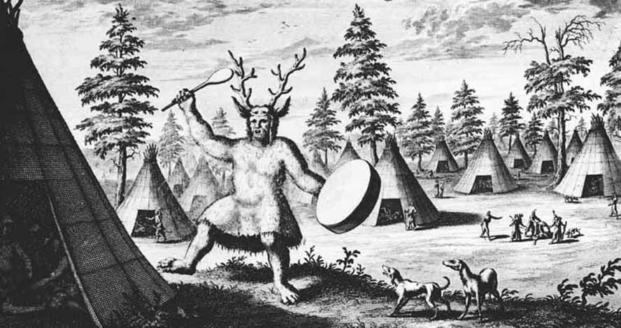
Dancing Siberian ShamanDancing shaman figure?
A more in-depth comparative essay is really needed to give a clearer exposition defining the nature of this carving… My personal view is that the carving represents, not some solar design, but one of Britain’s earliest artistic examples of human beings, in this case dancing and beating a drum or bodhran. It may indeed be the earliest pictorial example of a bodhran in the country. I’d say so. There is also the distinct possibility that the dancing figure is a shaman. We have many petroglyphs from all over the world that highlight such a character, integral to all early cultures—and this is as likely a contender as any for such a figure. (see Gough 1999; Whitley 2000, etc) It may however, be a warrior with a shield. You see the problems we can have with these damn carvings! 🙂
Folklore
This carved rock is said by local people to have been where a ‘Celtic’ saint delivered sermons to the heathen populace. The saint concerned is likely to be the one who tradition tells gave his name to the small glen immediately across the track from here: St. Charmaig. Halfway up the small glen is a small cave, barely accessible, with untouched remains of dried roots and other elements of human habitation therein. A few hundred yards to the north in old Finn’s Glen, is the forgotten Waterfall of the Oracle which sometimes isn’t even there!
References:
Anati, Emmanuel, Camonica Valley, Alfred Knopf: New York 1961.
Brennan, Martin, The Stars and the Stones: Ancient Art and Astronomy in Ireland, Thames & Hudson: London 1983.
Coffey, George, New Grange and other Incised Tumuli in Ireland, Dolphin: Poole 1977.
Coles, John, Shadows of a Northern Past: Rock Carvings of Bohuslan and Ostfold, Oxbow: Oxford 2005.
Grinsell, Leslie V., “The Later History of Ty Illtud,” in Archaeologia Cambrensis, 131, 1981.
Janson, Sverker & Westman, David, Rock-Carvings at Fiskeby, Esselte AB: Stockholm 1966.
Kuhn, Herbert, The Rock Pictures of Europe, Sidgwick & Jackson: London 1956.
Marshack, Alexander, The Roots of Civilization: The Cognitive Beginnings of Man’s First Art, Symbol and Notation, Weidenfeld & Nicolson: London 1972.
Morris, Ronald W.B., The Prehistoric Rock Art of Southern Scotland, BAR 86: Oxford 1981.Neumann, Erich, The Origins and History of Consciousness, Bollingen Princeton University Press: New York 1973.
Royal Commission on the Ancient & Historical Monuments of Scotland, Archaeological Sites and Monuments of Stirling District, Central Region, Society of Antiquaries of Scotland 1979.
Simpson, James, Archaic Sculpturings of Cups, Circles, etc., Upon Stones and Rocks in Scotland, England and other Countries, Edmonston & Douglas: Edinburgh 1867.
Whitley, D.S., The Art of the Shaman: Rock Art of California, University of Utah Press 2000.
Pretty easy to find this. Go up Glen Lochay for 3 miles or so, on the road past the brilliant Stag Cottage carvings for a couple of hundred yards where you’ll see an old run-down army-looking building and past that is a curious large wooden and wire construction. Go up the farm-track next to this, past Duncroisk Farm, taking the footpath through the gates that go up to the side and behind the farm. You’ll see a rounded grassy knoll ahead of you. Head straight for it!
Archaeology & Folklore
This carving would appear to have been described for the first time by Mr Cormack (1952) in his longer essay on the cross-marked stones nearby. He said briefly:
“On the top of a small rock-strewn knoll about 300 yards behind Duncroisk farmhouse is a recumbent boulder, at one corner of which is a group of five fairly deep cup-marks of 2- to 3-inch diameter.”
Little else has been said of the site and even Ron Morris (1981) only gave the carving a brief mention in his survey, saying in passing how “east of a prominent rocky knoll, on whose summit is a cup-marked boulder…”, as he journeyed further uphill to explore the fascinating Duncroisk 4 carving with its scant cup-marks, human figurine and other curious insignia. And although this carving is probably only worthwhile for the real fanatics amongst you, I like the place — sad fella that I am!
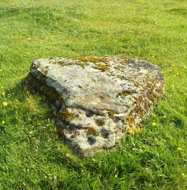
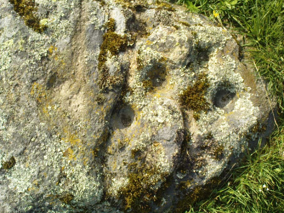
Cup-marked stone, looking southClose-up of cups
There are five very distinct cup-marks etched onto a small, almost triangular section of the rock, sat close to a couple of other larger stones on top of the grassy knoll overlooking the glen, not far from some iron age walling. The cups are etched onto the topmost (northern) section of the rock, which is defined by a natural crack running across the surface, almost splitting one part of the stone from the other. The five cups are in no discernible linear formation. A possible sixth cup-mark and extended line may have been started on the other side of the crack on the stone, but its execution was stopped for some reason. This is by no means certain though.
Of some note is the larger stone immediately adjacent on top of this knoll, which — as Paul Hornby pointed out — is encrusted full of small garnets all over its surface. This may or may not have some significance to the cup-marked stone here. According to Mr Hornby, the nearby cup-and-ring stone at Duncroisk Burn also has garnets in it.
Morris, Ronald W.B., The Prehistoric Rock Art of Southern Scotland, BAR 86: Oxford 1981.
Royal Commission on the Ancient & Historical Monuments of Scotland, Archaeological Sites and Monuments of Stirling District, Central Region, Society of Antiquaries of Scotland 1979.
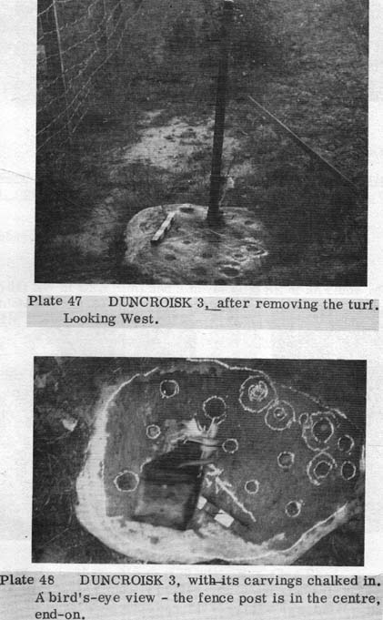
Two real ways to get here. Either (i) follow the directions to get to the Stag Cottage carvings of Duncroisk 1, then walk down to the fence by the riverside and walk along to the left for a coupla hundred yards till you reach a second metal fence-post sticking out of a rock on the other side of the deer-fencing; or (ii) from the roadside burn a coupla hundred yards along the road before you reach Stag Cottage, follow it down to the riverside, then head along the footpath behind the fencing, parallel with the river’s edge. It aint far. Within 100 yards you’ll reach the stone with the metal pole sticking out of it and the carvings are on this!
Archaeology & History
Confusingly redesignated as Duncroisk 5 carving by the usually efficient Canmore people, we’re sticking with this stone’s original name given by Ronald Morris (1981) in his British Archaeological Report of this and nearby carvings — and a quite fascinating carving this is as well!
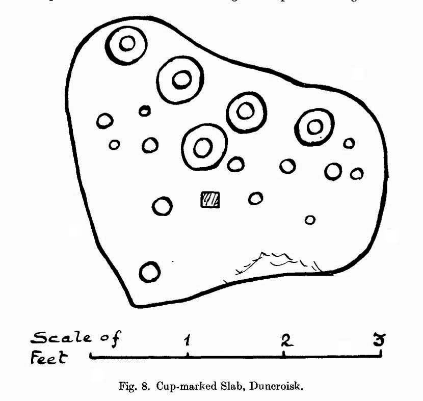
C.G. Cash’s drawingDuncroisk 3 stone
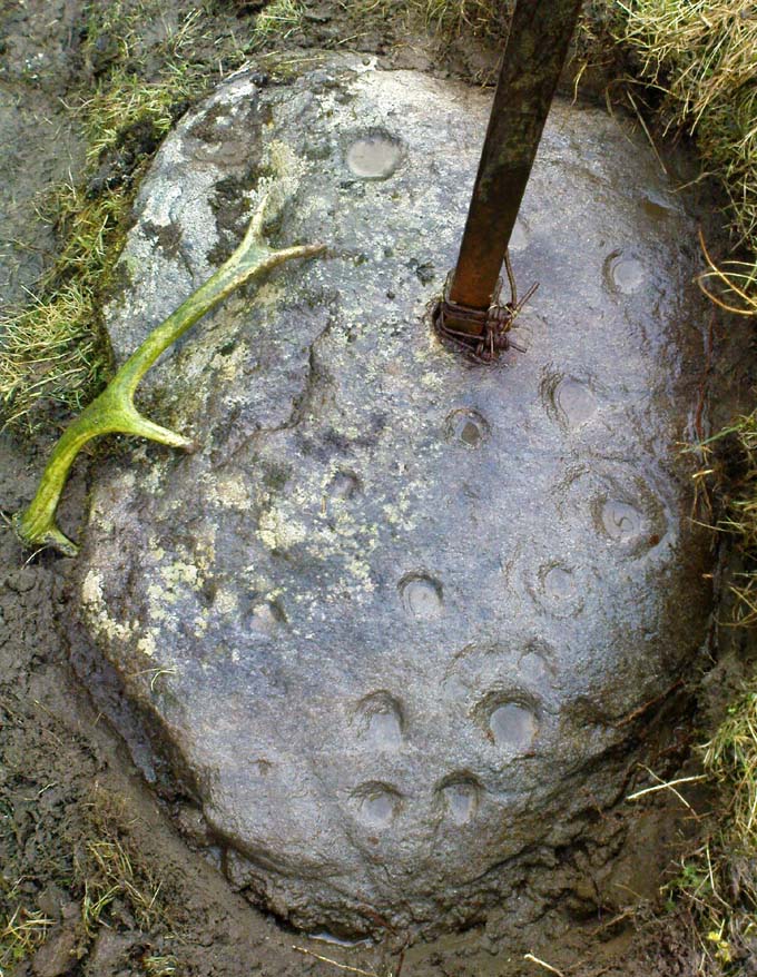
As with many cup-and-rings, erosion and lighting has a powerful effect on seeing the design correctly. On my visit here in recent months there were quite distinct additional elements in the carving which haven’t been noted by previous archaeologists. But in saying that, there were also some elements that were reported by the earliest antiquarians that proved difficult to see in the grey light of day when I was here. The earliest report of the carving by C.G. Cash (1912) told there to be five rings, whereas today only 3 or 4 are visible (though this will probably change when viewed in other lighting conditions).
When Mr Cash told of this stone in his essay on the antiquities of Killin it sounded as if it was lucky to have survived, as it had previously been dug out and left by the roadside, before then being reused by a local to fix a fence-post in! Mr Cash told us that the local,
“had used it as the foundation stone of the stretching post at the south end of the easternmost fence on the farm, and there I found it, near the brink of the river, buried in sand and turf. I cleared it and then in pouring rain crouched over it to make a hasty sketch. It bears eighteen cups, of which five are surrounded by rings. The largest cups are 2½ inches and the rings 6 inches in diameter.”
Ron Morris’ images
When I visited the place the weather was much the same as Mr Cash described: lovely teeming rain, typical of the mountains, with the surrounding trees breathing moisture onto the slopes as ever.
Years later when Ronald Morris (1981) came here he saw “4 cups-and-one-ring…probably complete rings, up to 12cm (5 in) in diameters and 10 cups up to 2cm deep.”
If you stand and face the stone, the cup-marking on its lower right side (see Morris’ old photo, above) has a pecked line running from it further to the right and down to the edge of the rock. You can clearly make it out on the top photo. This carved line also seemed to touch another carved line which can be seen running along the outer edge of the stone — although the poor light didn’t allow me to view this with absolute confidence. I’ll have another look at it again when I’m up in the area in May and hopefully confirm or deny it with greater confidence (and if anyone else gets here in the meantime, have a look and see what y’ think).
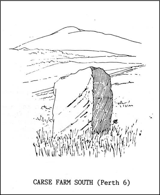
To get here, follow the same directions to reach its nearby colleague of Carse Farm south — but instead of walking down the track to where its companion is found, this small ring of stones is found a coupla hundred yards into the first field by the roadside. Unless the field’s fulla corn (in which case, give it a miss cos even if you do find it, you won’t be able to make much out), y’ can’t really miss it!
Archaeology & History
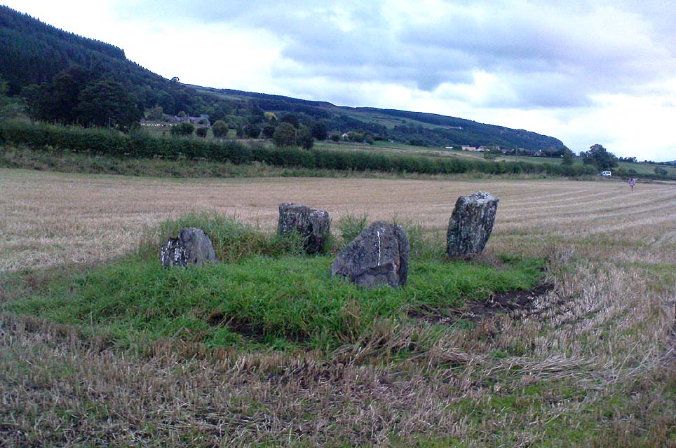
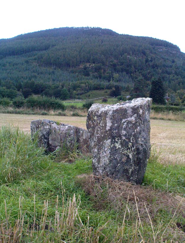
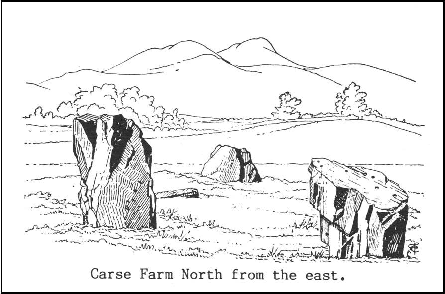
As with its nearby companion of Carse Farm south, this small “ring” of four stones is found along the Tay valley floor and, though cited as a stone circle in many archaeology tomes, should more accurately be defined as a cairn circle of sorts. Structurally akin to other four-posters, it reminded me of a distant companion in North Yorkshire more than 200 miles south: the Druids Altar at Bordley, which is also a robbed prehistoric tomb and not a stone circle. But it’s a fine little site sat amidst the majestic temple of surrounding hills on all sides, bar east, where the Tay valley reaches into the distance.
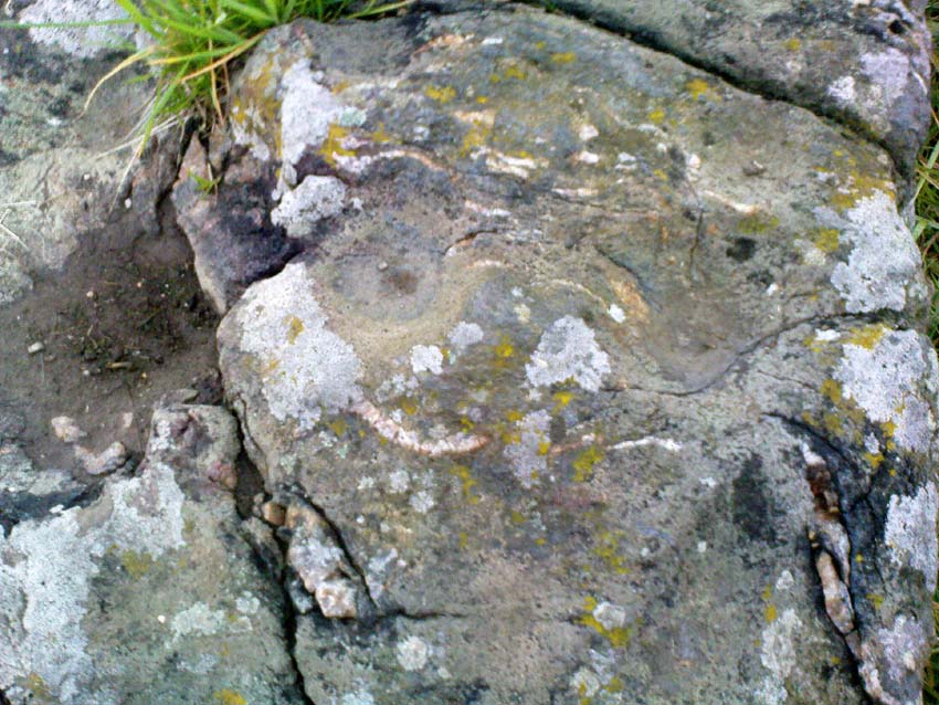
Faint cup-marksCarse Farm, looking north
Like its damaged companion in the field below, some of the stones in this circle also have well-defined cup-markings on top of the uprights; although when we visited here, low cloud and late daylight conditions prevented us from getting good images of the cup-marks concerned (as the photo of one of them here illustrates). The cup-markings are, curiously, carved on the top of the small standing stones.
Described briefly in Alexander Thom’s Megalithic Rings (1980), he regarded its geometry as “circular” in structure. Aubrey Burl (1988) gave the lengthier archaeological history of the site, telling:
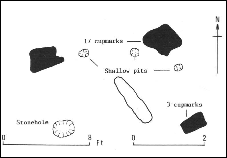
“On the ‘carse’, or lowland…this 4-poster was excavated in 1964. When Coles saw it in 1907 only three smallish stones remained standing although “it seems clear that at this site there were originally four Stones as in so many other Perthshire groups”… The SW stone was missing but halfway between the NW and SE stones a long, thin slab lay half-buried.
“Coles noticed that there were cupmarks on the tops of both the NE and SE stones. The SE had three carvings but the top of the NE had no fewer than 17, the largest ‘cup’ being 4 by 3½in (10 x 9cm). In the group were two ‘dumb-bells’. In the same field the farmer had dragged away a buried stone which was also cupmarked.* (my italics, PB)
“Of the three standing stones, the NE is 3ft 11in (1.2m) high; the SE, 5ft 1in (1.6m); and the NW, 4ft 1in (1.3m). These heights…are almost double those cited by Coles (1908: 126).
“”The 1964 excavation discovered the SW stonehole. The 5ft 10in (1.8m) long stone lying at the centre of the 4-Poster was erected in it, a task made easier by the fact that its base had been keeled… The base was unweathered showing that the stone had been toppled in quite recent times as had the stones of the two Fortingall 4-Posters…3¾ miles to the WSW. The four stones stood at the corners of a rectangle 12ft by 8ft (3.7 x 2.4m) on a long ENE-WSW axis. They also stood on the circumference of a circle 14ft 5in (4.4m) in diameter.
“A tapering pit was discovered against the inner face of the NE stone, about 2ft 6in (76cm) across and 1ft 2in (37cm) deep. It was filled with cremated bone and sticky black earth and charcoal. At the bottom, a collared urn lay on is side, its rim decorated in geometrical designs. A flint flake lay near it. Within the 4-Poster there were three shallow pits, two between the NW and NE stones, another between the SE and SW. Their edges were clean and they had been backfilled with brown loam. The excavators thought they might have “been used for stabilising props during the erection of the stones.” …As the heaviest block, that at the NW, weighed about 6 tons it would have required 20 to 30 people to drag it upright…and the use of such props would have made their insertion safer.”
Unless the people building this site were dwarves, we’ve gotta re-assess this latter remark (which Burl quotes from the earlier archaeologist’s report from the 1960s). Having personally been involved with the creation of modern stone circles with stones larger than the ones here, we know that the uprights here could have been erected by 8-10 people at the very most.
Archaeology and folklore records describe many other prehistoric sites along this section of the upper Tay valley, but it’s also very likely that other “circles” or cairns of similar structure to the two known at Carse Farm once existed close by that are not in modern literary accounts.
References:
Burl, Aubrey, Four Posters: Bronze Age Stone Circles of Western Europe, BAR 195: Oxford 1988.
Pretty easy to find – assuming it aint at the height of summer and the crops are approaching maturity, otherwise you’re only gonna see its head! But, this aside: from Aberfeldy, take the B846 road over the river bridge that bends you along the valley of the River Tay towards Appin of Dull. After some 2 miles you’ll pass the right-turn up to Dull. Go past this for another coupla hundred yards or so, watching out for the left-turn down towards the farmhouse of Carse and park up where you can (if you go past it, there’s the second turn up to Dull, again on your right, where you can turn round). As you walk down the track towards Carse Farm, watch out on your right in the field below Carse I, in the second field down. You can’t really miss it. (and the farmer here is spot on if you ask to check the stone – as long as the crops aint growing)
Archaeology & History
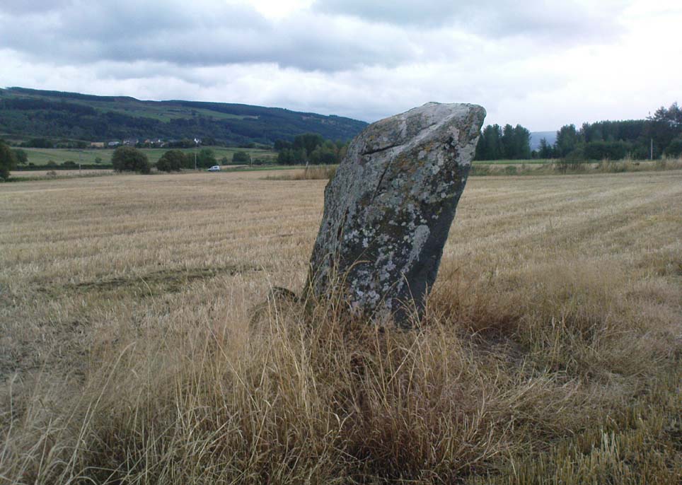
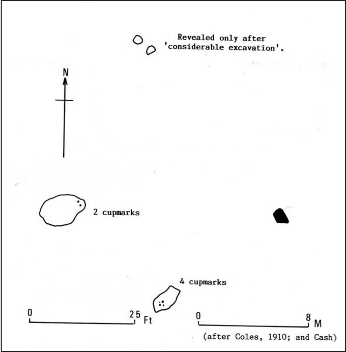
Although all that’s left of what is thought to have been a once proud stone circle is the singular upright standing stone in the middle of the field. Aubrey Burl (1988) thought that this was one of the typical “four poster”rings that scatter our isles, but I’m not so sure misself. There were other stones associated with the site when Burl described it, but these were covered over in our visit here a few months back — which is a pity, as two of the stones are reported as possessing cup-markings (if/when we revisit the site, I’ll try get some images of the respective stones and add them on TNA as individual carved stones). The site gives the distinct impression of it having a funerary character of some sort and not a true stone circle — and this was strongly suggested by some of the finds inside the “ring”, described below.
Fred Cole’s old drawingAubrey Burl’s groundplan
Both this and its associated “circle” a few hundred yards away — known as Carse Farm north — sit on a flat level of ground in the Tay valley, with rounded hills all most sides. This landscape setting was obviously of some importance to the people who put the circle here in the first place but, not living in the region, it’s difficult to assess the mythic relevance some of the hills will have obviously played in the siting of these stones.
In bygone days, it was reported that the much of the site was ploughed away due to agricultural excesses, so there was obviously much more to it in earlier centuries. Describing the solitary stone that’s left today, along with the earlier excavation results, Mr Burl (1988) wrote:
“The stone still standing, of quartziferous schist, is 6ft 3in (1.9m) high. Its longer faces are aligned NW-SE. 32ft 6in (9.9m) to its SW is a large prostate block, sub-elliptical and about 8ft long and 4ft 3in wide (2.4 x 1.3m). It has probably fallen outwards. (my italics, PB) If so, when standing near the top of its inner face were four cupmarks in a cross pattern.
“About 32ft ((9.8m) to its NW is a fallen and enormous schist slab, 11ft long and 5ft wide (3.4 x 1.5m). It also appears to have toppled outwards. Near the bottom of its inner face are two cupmarks. The situation of these three stones suggests that they once stood at the corners of a rectangle some 32ft (9.8m) square, the pillars of a huge four-poster nearly six-times the national average and with an internal area ten times bigger than the small 4-poster (Carse Farm north, PB) just to its north.
“Excavation in 1964 found the socket from which the great prostrate slab had been dragged… Cash (1911) had noted the presence of a small stone inside the ring about 20ft (6.1m) west of the standing stone. It proved to be 4ft (1.2m) square with a carefull-dressed face. It had been set upright, standing about 1ft 4in (41cm) above the ground. Three sides of the worked face ‘had been carefully chiselled away to a straight edge.’ It may have been a slab lining the inner central space of a destroyed ring-cairn. Burnt bone was found near it. There was also a rounded river pebble with a worked hollow on one side…”
Folklore
Carse Farm stone
Stewart (1964) described the site as having been “christianized” not long ago, by having the northernmost standing stone in the ring removed. This is intriguing inasmuch as “north” is the place of greatest symbolic darkness in the pre-christian mythos, and represented death and illumination in magickal terms. North was also the point taken by witches and shamans in their excursions into Underworlds, usually via the North Star, which tethered the Earth to the heavens (see Godwin’s Arktos [1993], and Grant, The Magical Revival [1973]) In the removal of this northern stone for the reasons given, that implies some magickal events or folklore were in evidence here when this took place. Anyone got any further information along these lines, or has it long since been subsumed?
References:
Burl, Aubrey, Four Posters: Bronze Age Stone Circles of Western Europe, BAR 195: Oxford 1988.
Here we have another case of another loch in Scotland that was said by local people to be inhabited by legendary water monsters. In the tale which follows we may simply have a case of a very bad accident that was, in more superstious times, bestowed upon this legendary animal. We may never know. James Kennedy (1928) told the story, saying:
“It was inhabited, like Loch Derculich, by the ‘Each Uisge‘ of Icelandic origin. On summer evenings it could be seen roaming at large on a green meadow adjacent to the tarn, and to all appearance a canny enough creature. One summer Sunday afternoon, six Strathtay girls and a boy set out from their homes to inspect the ‘Each Uisge.’ They found him, patted him on the head and neck, and this kindness is apparently relished, for it lay on the sward and allowed them to sit on its back. The boy, who had a semi-bald scabbed head, stood at a distance and watched developments. He concluded that this animal was not the genuine horse it seemed to be, and thought that it grew considerably larger than it was at first. When the Each has the six girls comfortably seated on its back, it suddenly rose, plunged into the loch, and drowned the lot. The boy immediately took to his heels and the Each after him, but fear enabled the boy to outstrip the horse, who would stop now and again in the pursuit and cry, “Fuirich mo ghille maol carrach! Fuirich mo ghille maol carrach!” — Stop, you bald scabbed-headed boy. Ultimately the Each gave up the chase, and the boy, much frightened, got safely home and related all that happened on that eventful Sunday evening. The parents of the girls found parts of their bodies floating on the waters of the loch, and the name Loch Lassie was given to it, which it retains to this day.”
References:
Kennedy, James, Folklore and Reminiscences of Strathtay and Grandtully, Munro Press: Perth 1928.