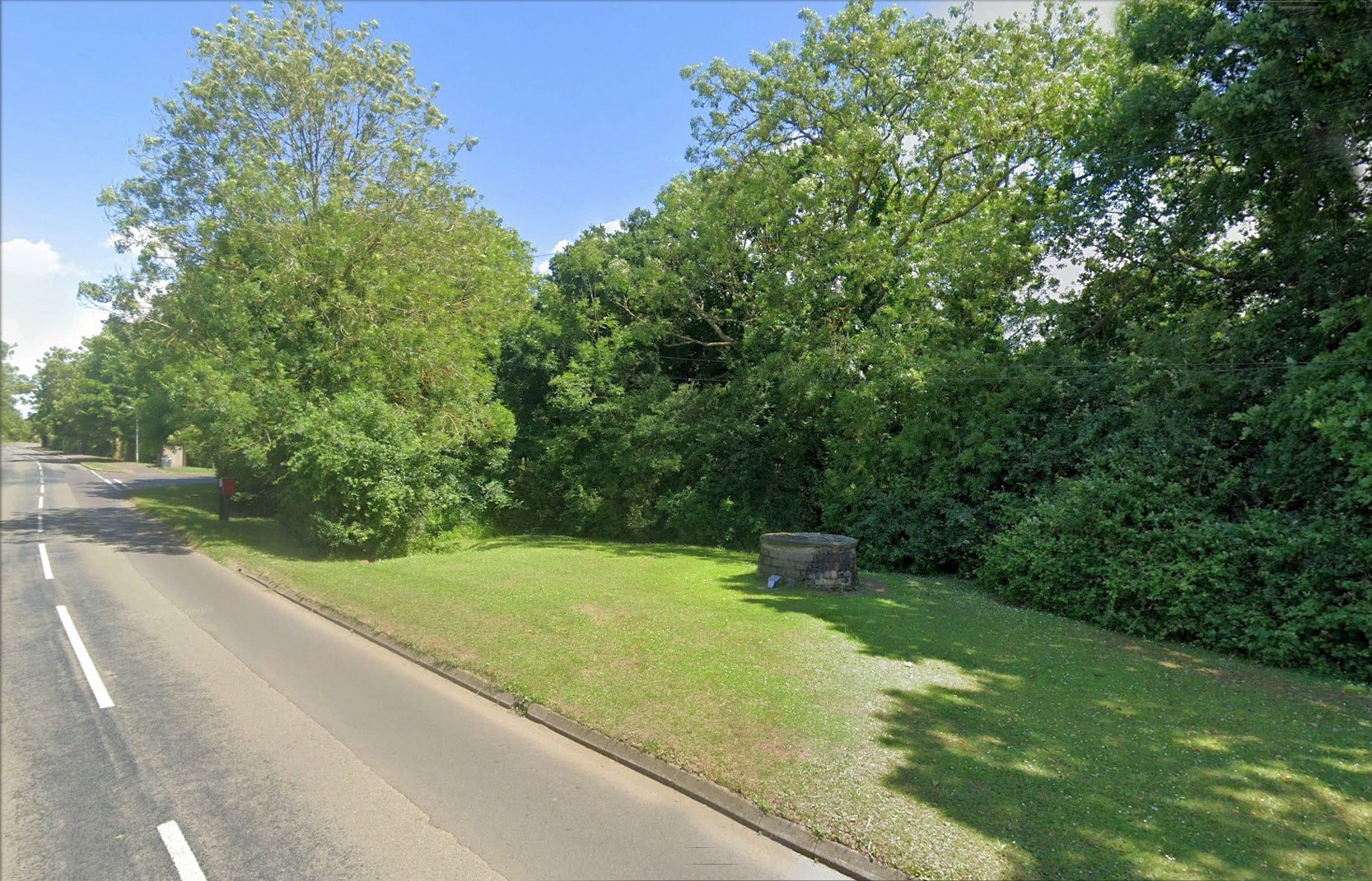
Nice ‘n easy: take the Sedgebrook Road south out of Allington village and, after a few hundred yards, just as you go past Peach Lane, keep your eyes peeled and look into the shrubs that are set back a few yards on the left-hand side of the road. Just there you’ll see a small circular stone structure with a small plague in front of it. That’s the Salt Well.
Archaeology & History
Salt Well by the roadside
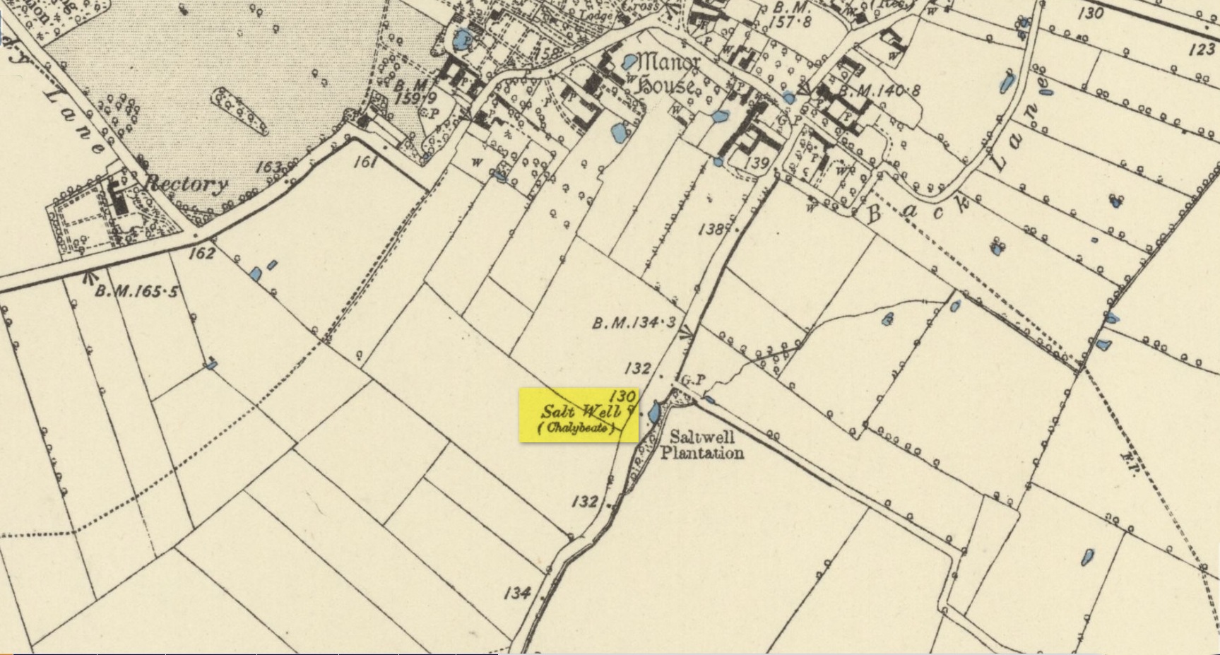
Highlighted on the early Ordnance Survey maps of the area, this chalybeate spring was known as both the Salt Well and Holy Well. Mentioned in Ian Thompson’s (1999) work, the waters here arise in a three-foot high pillbox-shaped structure, set into the grass verge just off the roadside between Allington and Sedgebrook. On the early OS-maps it is shown to have originally been on the opposite side of the road. The earliest reference to the well is from 1226 CE and, thereafter, a number of 16th Century wills are recorded making bequests for the maintenance of the well suggesting its considerable importance in bygone centuries—perhaps because it was the only local well that did not dry-up, no matter how severe the drought.
The small plaque at the side of the well states, “This spring has been a water source since the 13th Century and now remains a village landmark.” An analysis of the waters here in 1990 revealed very low levels of iron but noted a high concentration of sodium sulphate.
References:
Thompson, Ian, Lincolnshire Springs and Well, Bluestone: Scunthorpe 1999.
Acknowledgements:Huge thanks for use of the Ordnance Survey map in this site profile, reproduced with the kind permission of the National Library of Scotland.
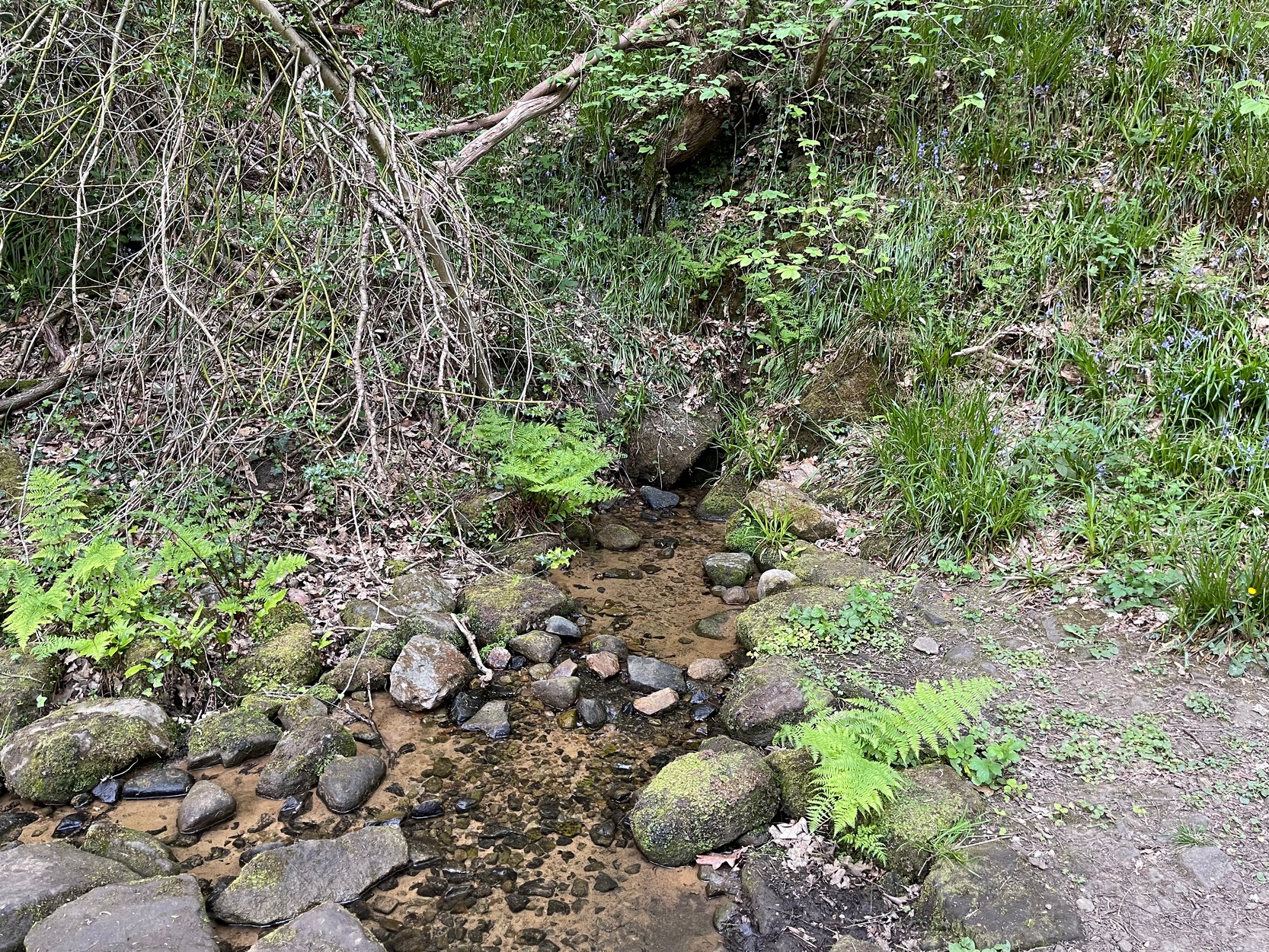
My walk up to this place took me off the main A6038 Hollins Hill road, across from the petrol station and up the scruffy disused road to the hamlet of Tong Park, bending round the houses to the right when they appear. Keep along this old track, then veer right, down the slope and along the footpath and into the trees under the railway arches, keeping on until you reach the lake on your left. At the end of the lake, cross the bridge and follow the footpath as it bends to the left and into the trees. You’ll go over a stile and then about 50 yards along, the stream that crosses the path emerges from a crack in the rocks on your right. You’re here!
Archaeology & History
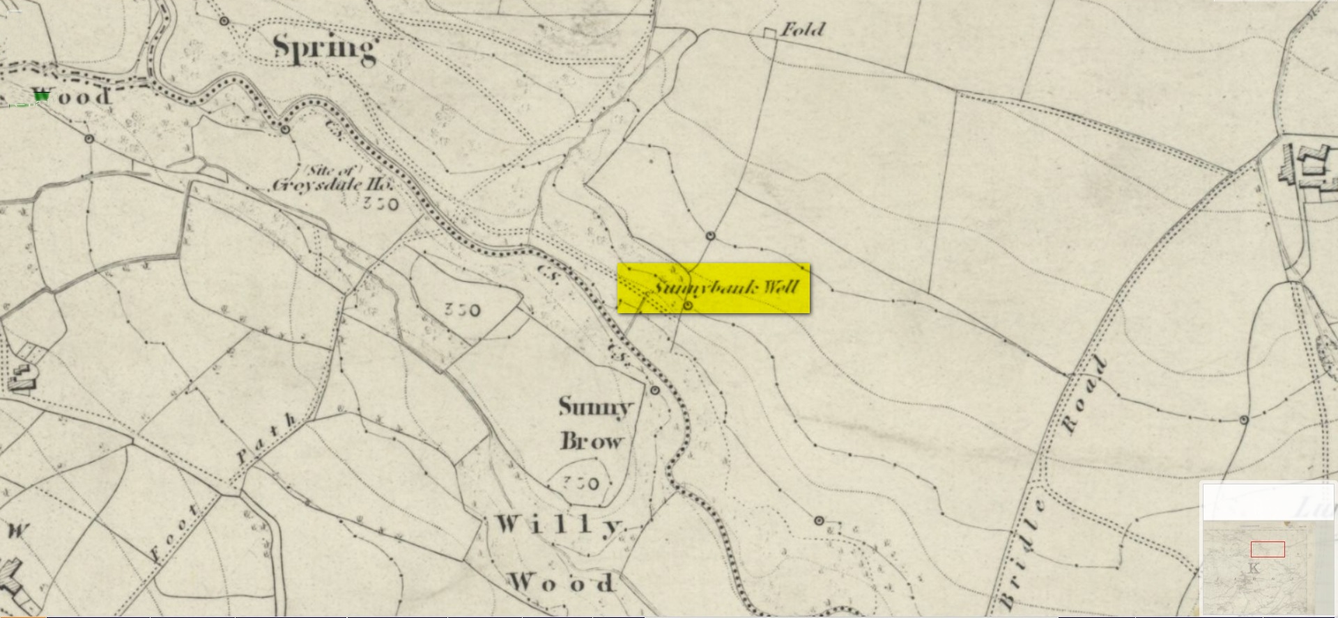
Site shown on 1852 map
All history and tradition of this site seems long gone. It was shown on the 1852 Ordnance Survey map of the region and doubtless receives its name from the location, as the spring of water emerges from beneath the sloping embankment which is a bit of a sun-trap in Spring and Summer. It makes sense. Although I can find no reference to any medicinal attributes, the waters of Sunnybank Well are cold, fresh and drinkable.
References:
Shepherd, Val, Historic Wells in and Around Bradford, HOAP: Wymeswold 1994.
Acknowledgements:Huge thanks for use of the Ordnance Survey map in this site profile, reproduced with the kind permission of the National Library of Scotland.
Holy Well (destroyed): OS Grid Reference – TL 997 254
Archaeology & History
Near the centre of the ancient city could once be found the flowing waters of St. Helen’s Well. It was described many times in various legal and land documents from as early as 1331 CE onwards, in Colchester’s Oath Book. However, descriptions of the site itself and its curative abilities were not noted. It was simply associated with St Helen’s Chapel, whose original foundations date from the 12th century.
Folklore
One tradition told that it was St Helen herself who founded the chapel here. St Helen’s feast day is Agust 18.
References:
Benham, W. Gurney (trans.), The Oath Book; or, Red Parchment Book of Colchester, Essex County Standard: Colchester 1907.
Holy Well (lost): OS Grid Reference – NY 0562 0303
Archaeology & History
Described as being “lost” in John Musther’s (2015) relatively recent survey, very little has been written about this site but, by the look of things, it may still exist—albeit in a boggy state of affairs! It was mentioned in Parker’s (1926) classic history book of the area:
“Near to Newton is a very plentiful spring which is known to have been moved further from the house than it was. Adam de Newton, son of Richard, mentions in one of his grants, “St. Helen’s Well, which is at the corner of my garden, the outfall going into Grucokesgile beck.”
Possible site of the Well
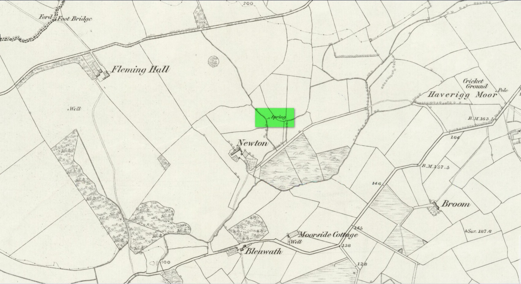
Parker found it to have been described in a local property charter in St Bee’s Register (Wilson 1915) as far back as 1220 CE. On the earliest OS-map of the area, a “Spring” is shown just above Newton, which may mark the very spot! Not far from the holy well was also a cross-marked stone called the Grey Stone (grey stones are usually boundary stones, but can also be standing stones—of which there were a lot in this neck o’ the woods).
Folklore
St. Helen’s Day was celebrated on August 18, but there seem to be no accounts of traditional customs recorded here.
References:
Harte, Jeremy, English Holy Wells – volume 2, Heart of Albion press: Wymeswold 2008.
Musther, John, Springs of Living Waters, privately printed: Keswick 2015.
Page, Jim Taylor, Cumbrian Holy Wells, North West Catholic History Society: Ormskirk 1990.
Parker, C.A. The Gosforth District: Its Antiquities and Places of Interest, Thomas Wilson: Kendal 1926.
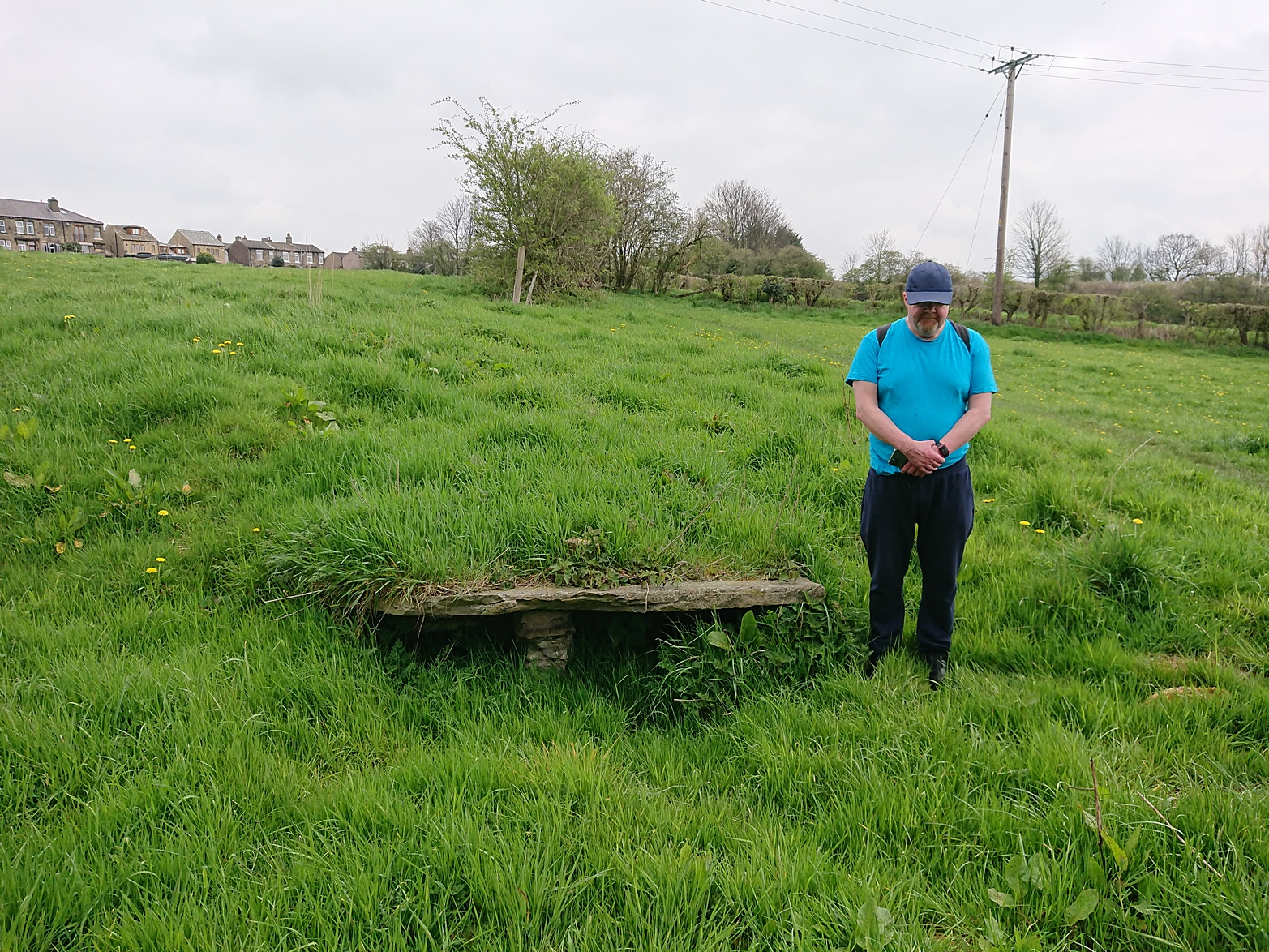
Along Halifax Road (A649), get to the Shears Inn and then take the footpath at the back of the pub that runs down the side of the fields and alongside the allotments. Less than 150 yards down, just through the stile into the edge of the field on your left, you’ll see the side-edge of a large flat stone in the grasses. Check it out!
Archaeology & History
Along with the Attack Well and Tree Root Well, this was one of three springs close to each other that gave local villagers their water supply in bygone times. When we visited here at the height of a long warm spell in the summer of 2023, there was still was a small amount of clear water trickling beneath the long flat slab of stone — although it was somewhat clogged-up with vegetation. It wouldn’t take much work to completely clean this out and use the fresh drinking water once again.
The well gained its name from its position in the land, with balk, being “a portion of a field left unploughed”, or “a strip of ground left untilled” and variants thereof.
References:
Wright, Joseph, The English Dialect Dictionary – volume 1, Henry Frowde: London 1898.
Acknowledgements: Huge thanks to the great Gary Ferner, for use of his photo and the day’s venture!
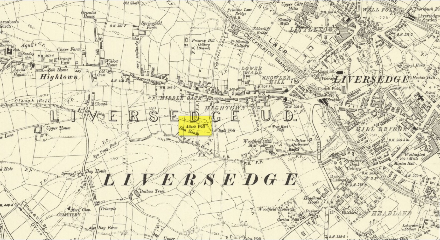
Located down the slope behind Shears Inn on Halifax Road (A649), past the stone-lined Balk Well, then round the other side of the allotments up where the footpath cuts to your right, the waters from this site can barely be found in the now large mass of brambles that make it virtually inaccessible to reach. When Gary Ferner and I visited here, it seemed that a very small pool of water existed in the hollow beneath the prickly vegetative covering—but even I didn’t struggle to get through it all and so we don’t know if the waters are still running as once they were. It was obviously one of the wells that fed local people in earlier times, but I can find no historical references to the site apart from its showing on the 1908 Ordnance Survey map.
Holy Well (destroyed): OS Grid Reference – NS 4631 7307
Also Known as:
Trees’ Well
Archaeology & History
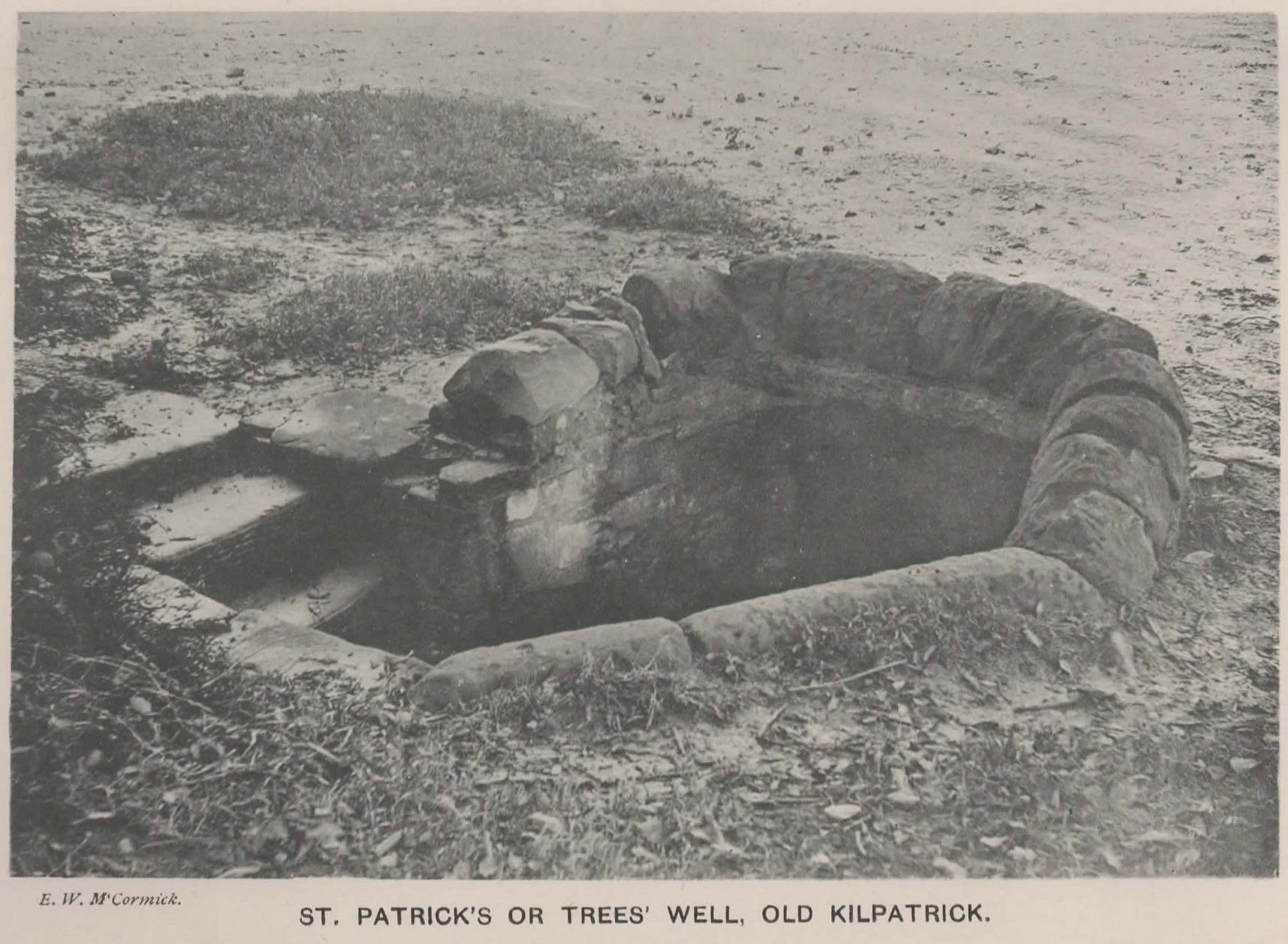
Photo of the Well in 1893
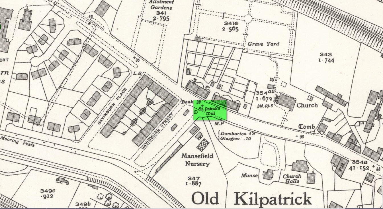
Sadly there are no longer any remains of this holy well which was found, “beside the church dedicated to St Patrick — which was said to be built on soil brought from Ireland in honor of its patron,” wrote John Bruce in 1893. He told that its waters had “been used until lately from time immemorial by the villagers, but now has been found unfit for use and consequently ordered to be closed up.” Although its waters were used for baptisms, he made no mention of any medicinal repute, which it surely would have possessed.
Site of well on 1939 map
The original position of the well, according to Mr Bruce, was “adjoining the church” but, according to the Ordnance Survey lads, when they came here in 1963 they located a drinking fountain on the other side of the road about 80 yards to the west and designated that as being St Patrick’s Well. The place had earlier been given a wooden sign saying “St Partrick’s Well.” Local tradition attributes St. Patrick as originally coming from this village, whose saint’s day is March 17.
The place was also known as Trees’Well, suggestive, perhaps, of a local person, although I can find no reference as to who or what that might have been.
References:
Bruce, John, The History of the Parish of West or Old Kilpatrick, John Smith: Glasgow 1893.
Acknowledgements:Huge thanks for use of the Ordnance Survey map in this site profile, reproduced with the kind permission of the National Library of Scotland.
Holy Well (lost): OS Grid Reference – SE 134 331 (approximation)
Archaeology & History
This site is both interesting and frustrating at the same time. Interesting inasmuch that as early as 1258 CE, “the Knights Hospitallers of St. John of Jerusalem in England, had in Allerton a manor called the manor of Crosley.” The Hospitallers, as some will know, were the immediate successors of the more famous Knights Templars. As their name suggests, their patron saint was St John, whose festival date was summer solstice and had his name given to many holy wells. But this one has left us with no name and its location has long since been lost. In J.H. Bell’s (1888) essay on the early medical history of the area he told that local people with certain afflictions, “were wont to resort to them to drink their waters for their supposed medicinal virtues: there was one between Cemetery Bridge and Crossley Hall”. But he doesn’t give its exact position. In John James’ (1841) classic History of Bradford he thinks that near the place where the local stream known as the Hebble, “there was undoubtedly in former times a Holy well,” but is unable to cite a location. No well is shown on the early maps between the old Hall and the cemetery and the only definitive reference to wells close by are in the early boundary perambulation record, which describe a Brock Well and a Cold Well. Perhaps the the most probable contender and location is cited in Harry Speight’s (aka Johnnie Gray) Pleasant Walks (1890) where, taking a route between Great Horton and Allerton, he told us to,
“go through fields on to Necropolis Road, opposite Scholemoor cemetery, turn down lane left outside cemetery, ½ mile, descending steps, cross beck (here used to be the Spa Beck public gardens, now removed higher up) and ascend, at second field, leaving the forward path and turn left, following beck with Crosley Hall and trees to right.”
The location of the said Spa Beck gardens is very close to where Mr Bell described the medicinal spring and is/was the most likely position of what James (1841) thought to be a long lost holy well. If we could get more information about the history of the Spa Well, we may be able to make more definitive statements about the place.
Sacred Well (destroyed): OS Grid Reference – SE 3953 1570
Archaeology & History
The precise whereabouts of this site isn’t known with absolute certainty, but, following research by the respected folklorist and pagan historian Steve Jones of Wakefield, the grid-reference cited here has a high degree of probability about it. I certainly agree with Steve about its location.
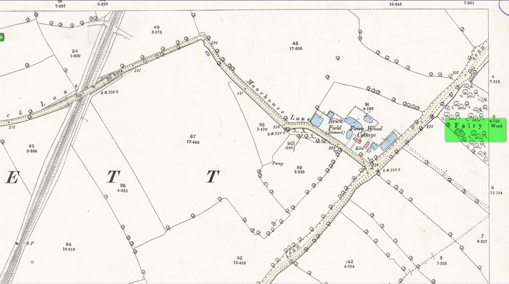
Pond in Fairy Wood, shown on the 1893 OS-mapFairy Wood near Nostell, probable home of the Well
Known about in the 19th century, I was fortunate in coming across what seems to be the only reference to the place whilst perusing the scrapbook notes of local historian John Wilson (1903). Were it not for him we would have lost all knowledge of its existence and the local tale told of it, albeit watered into a dying belief in these supernatural creatures, would have faded completely before its final physical demise. Wilson was described as a “diligent a student of local history,” who possessed a great collection of rare booklets and pamphlets on Yorkshire history and was a “careful an observer and recorder of all pertaining to past times.” Of this Fairy Well, Wilson scribed the following poem:
At Nostell is a Fairy Well,
Hard by the margin of a wood
Wherein once dwelt, as old men tell,
The little folks of fickle mood ;
Till smoke and steam denied the dell
And made them quit both wood and well.
Blythe Henry Carr, mine ancient friend,
— So bravely keeping on his feet ;
May death long spare him,
still to wend His way along the village street,
Within the cobbler’s shop to spend
A pleasant hour — mine ancient friend.
The woodman at the Priory
In old Sir Rowland’s halcyon days
Was Thomas Watson, gay and free,
Who roused with song the woodland ways
A friend of Henry Carr’s was he,
—The woodman at the Priory.
This Watson many a tale could tell
Of fairies red and fairies green,
That in the wood and by the well
On summer evenings he had seen:
Of elves that thereabouts did dwell
This Watson many a tale could tell.
Whoever heard of such a thing!
He said that persons, known to him,
At eve would flasks of liquor bring,
And leave them, lying near the brim
Of this — the wondrous Fairy Spring —
Whoever heard of such a thing !
Was ever such a tale yet told ?
He said, that, when the morning came,
Each flask lay empty, and, behold !
Near each a drunken elf. O, shame !
The vice of those of mortal mould :
— Was ever such a tale yet told ?
Then question I mine ancient friend:
“Did no one seize the tipsy sprites? ”
“Not they ! for sudden is his end
On whom the fairy vengeance lights.”
With solemn eyes that fear portend
Thus answers me mine ancient friend.
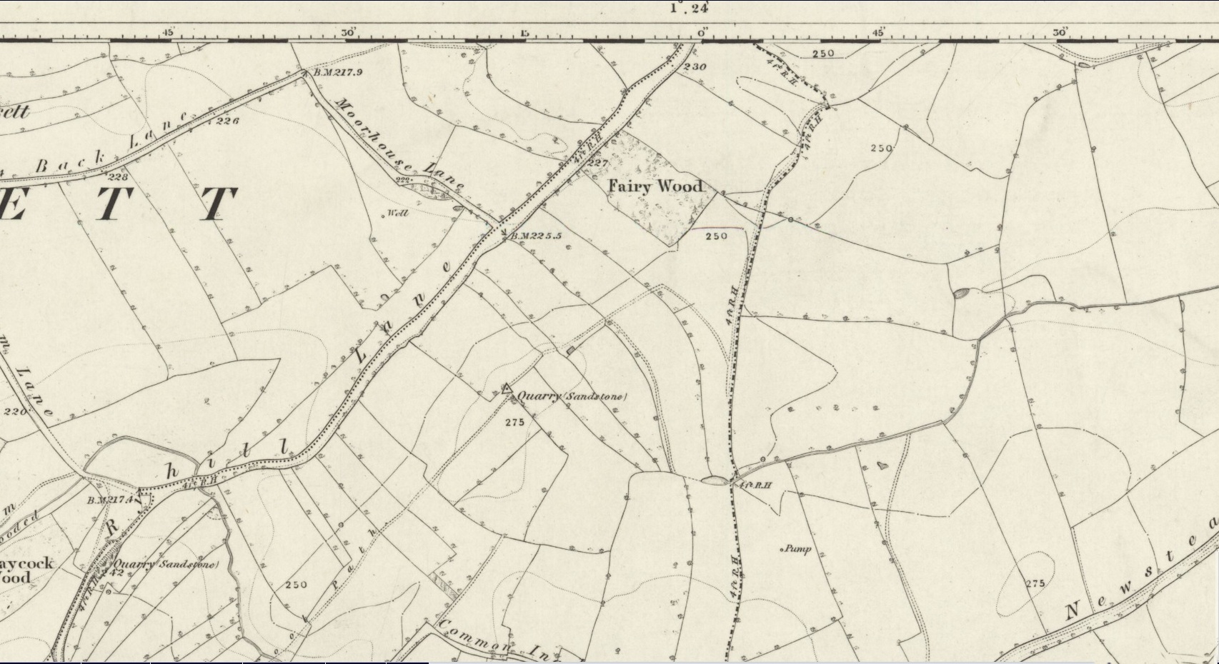
Steve Jones already knew of the Fairy Wood, which was highlighted on the 1841 and 1854 6-inch-to-the-mile OS-map of the area—but no “Well” is shown in the woods. However, as Steve discovered, following a subsequent visit by the Ordnance Survey lads in 1891, they showed on their 25-inch-to-the-mile map of the woods a distinct small pond in the trees not far from the roadside. This, he thought, was probably the Fairy Well referred to by Wilson. It would seem so. Adjacent to the woods, the 1853 Tithe Award cite the existence of a field also dedicated to the fairy folk, known simply as Fairy Close.
References:
Smith, A.H., The Place-Names of the West Riding of Yorkshire – volume 1, Cambridge University Press 1961
Huge thanks to the research by Steve Jones of Wakefield, without whose work the location of the Fairy Well would have remained a mystery. Also, thanks as always for use of the early edition OS-maps, Reproduced with the kind permission of the National Library of Scotland.
Holy Well (destroyed): OS Grid Reference – SE 6900 2841
Archaeology & History
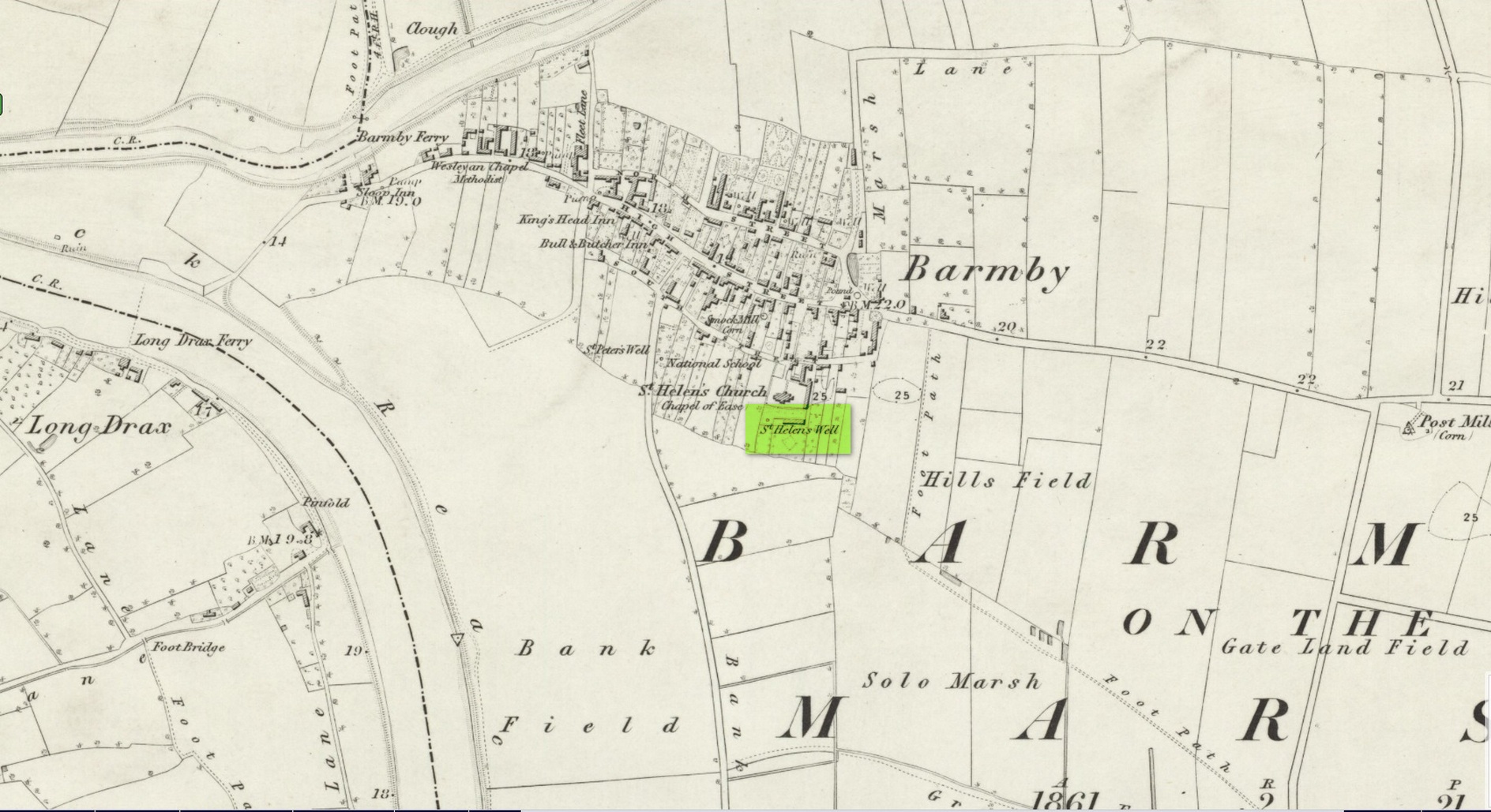
Site shown on 1853 map
One of two holy wells in Barmby village which, like its compatriot St Peter’s Well, was destroyed sometime in the 19th century. Not good! It was located in the southwest section of the graveyard of St Helen’s Church and was apparently alive and running when the Ordnance Survey lads visited here in 1851 (as shown on their 1853 map). But when the site was revisited by them in 1905, it seems to have gone. However, as with the neighbouring St Peter’s Well, there are conflicting reports as to when it was destroyed, for although the Ordnance Survey lads spoke of it in the present tense when they went there, Thomas Allen (1831) told that “within the last six years (it has) been wantonly filled up.” Despite this, less than ten years later William White mentioned it in the present tense, also saying how it was “said to possess medicinal properties.” These healing qualities were, according to Allen, due to its iron-bearing or chalybeate nature, meaning that it would revive a weak and feeble constitution. Iron-bearing wells are damn good for such things!
As the years passed, St. Helen’s Well fell into folk memory. When William Smith (1923) surveyed the many holy wells in this part of the world he found how “old parishioners have said that as school-children they both drank of and washed in its water”, but little else.
References:
Allen, Thomas, A New and Complete History of the County of York – volume 2, I.T. Hinton: London 1831.
Gutch, E., Examples of Printed Folk-lore Concerning the East Riding of Yorkshire, Folk-Lore Society: London 1912.
Harte, Jeremy, English Holy Wells – volume 2, Heart of Albion press: Wymeswold 2008.
Smith, William, Ancient Springs and Streams of the East Riding of Yorkshire, A. Brown: Hull 1923.
White, William, History, Gazetteer and Directory of the East and North Ridings of Yorkshire, R. Leader: Sheffield 1840.