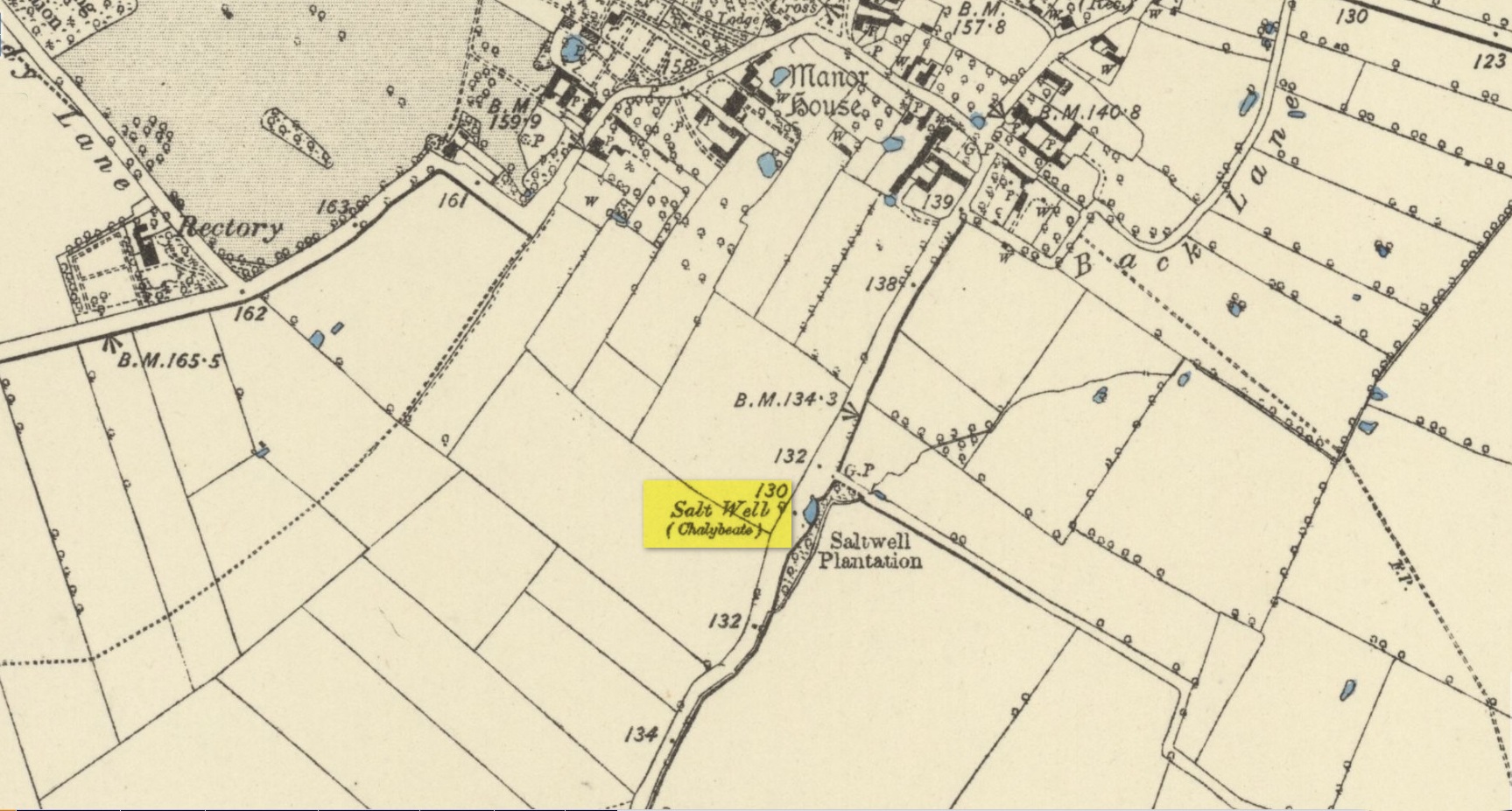
Holy Well: Ordnance Grid Reference – SK 85662 39798
Getting Here
Nice ‘n easy: take the Sedgebrook Road south out of Allington village and, after a few hundred yards, just as you go past Peach Lane, keep your eyes peeled and look into the shrubs that are set back a few yards on the left-hand side of the road. Just there you’ll see a small circular stone structure with a small plague in front of it. That’s the Salt Well.
Archaeology & History
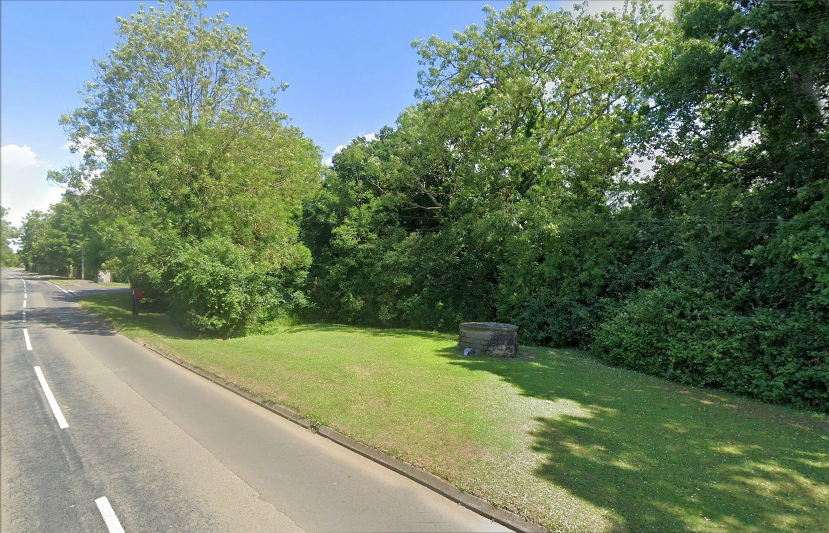
Highlighted on the early Ordnance Survey maps of the area, this chalybeate spring was known as both the Salt Well and Holy Well. Mentioned in Ian Thompson’s (1999) work, the waters here arise in a three-foot high pillbox-shaped structure, set into the grass verge just off the roadside between Allington and Sedgebrook. On the early OS-maps it is shown to have originally been on the opposite side of the road. The earliest reference to the well is from 1226 CE and, thereafter, a number of 16th Century wills are recorded making bequests for the maintenance of the well suggesting its considerable importance in bygone centuries—perhaps because it was the only local well that did not dry-up, no matter how severe the drought.
The small plaque at the side of the well states, “This spring has been a water source since the 13th Century and now remains a village landmark.” An analysis of the waters here in 1990 revealed very low levels of iron but noted a high concentration of sodium sulphate.
References:
- Thompson, Ian, Lincolnshire Springs and Well, Bluestone: Scunthorpe 1999.
Acknowledgements: Huge thanks for use of the Ordnance Survey map in this site profile, reproduced with the kind permission of the National Library of Scotland.
© Paul Bennett, The Northern Antiquarian