Along the A81 road from Port of Menteith to Aberfoyle, watch out for the small road in the trees running at an angle sharply uphill, nearly opposite Portend, up to Coldon and higher. Keep going, bearing right past Mondowie and stopping at the dirt-track 100 yards or so further up on the left (and ignore the english fuckers up here who might say “you’re not allowed to park here”, as Scottish government regulation allows you to do so unless you block the road). Walk up this dirt-track for ⅔ mile, and just before reaching the planted forestry, turn right along another dirt-track. Less than 200 yards along there’s a large sycamore tree, and about 20 yards below it (south) is the carving you’re looking for.
Archaeology & History
It’s difficult keeping up with the carvings in this region to the north of the Lake of Menteith, as we find new unrecorded ones on every visit, maintaining the tradition of fellow rock art students Maarten van Hoek, Kaledon Naddair, George Currie, Jan Broewer and the rest—and we know that there’s more of them hidden away. This one doesn’t seem to be in the Canmore listings, but I put that down to the fact that they’ve got a grid-reference wrong somewhere, as it’s pretty plain to see. Although, to be honest, in the rather vague descriptions of other adjacent carvings (Over Glenny 5 and 7), this carving is in-between them, so you’d expect it to be listed. Anyway, that aside…
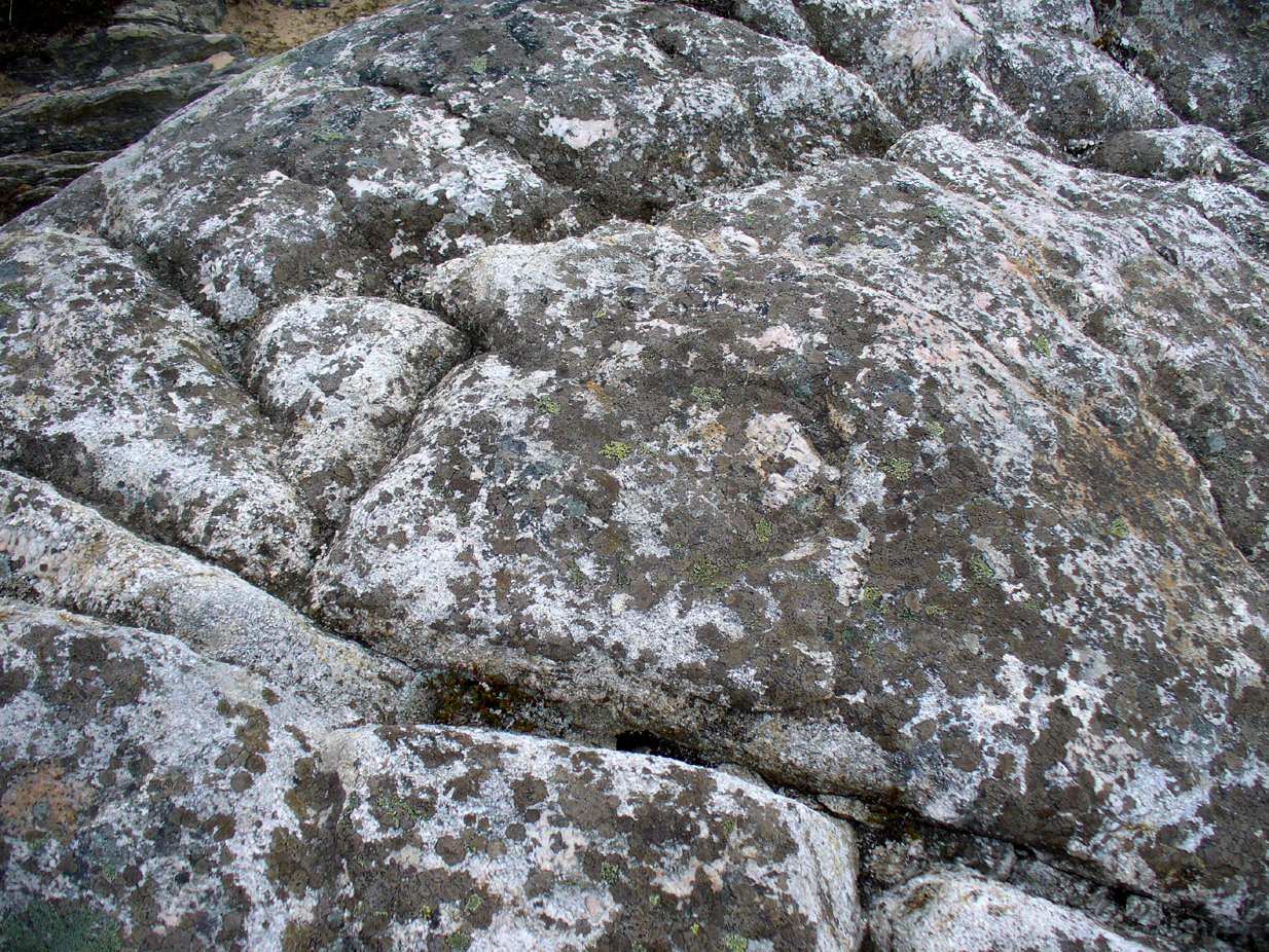
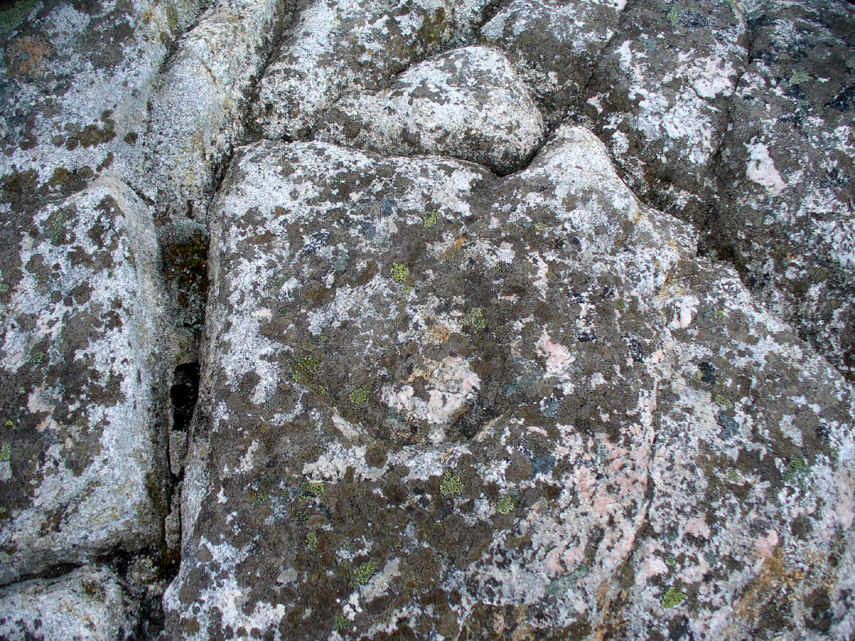
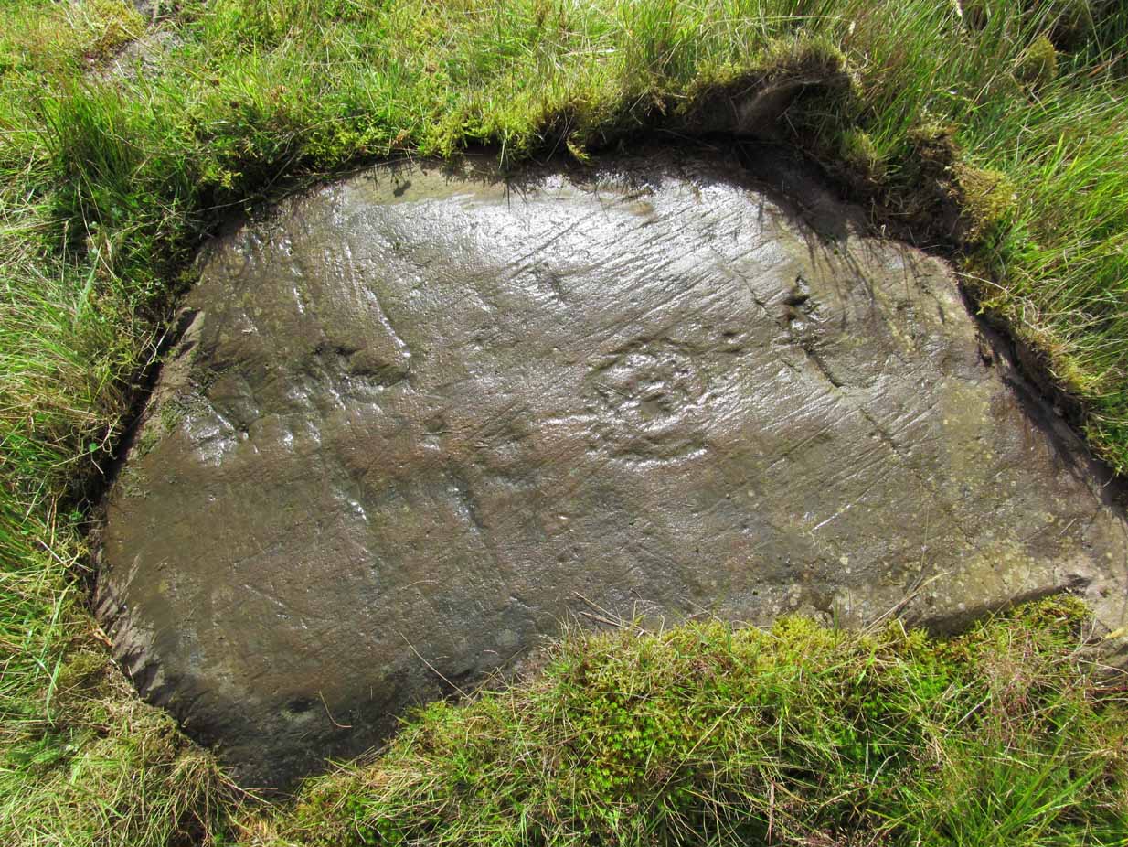
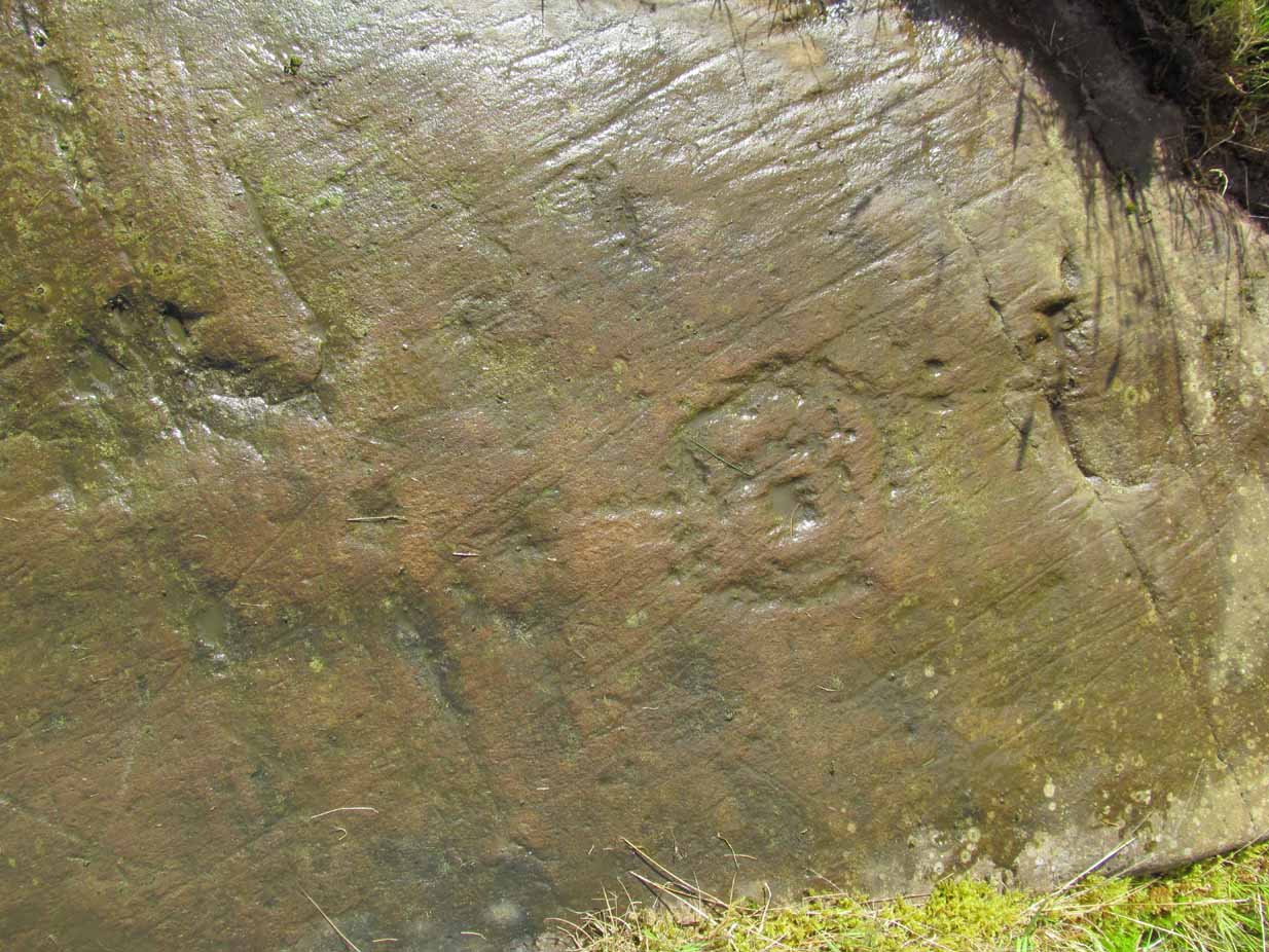
Looking down at the ringsClose-up of faint rings
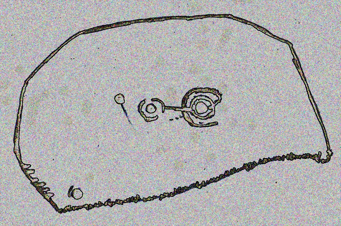
This long flat exposed rock surface has two primary cup-and-rings upon it: one cup with a double-ring, and the other standard cup-and-ring; there are also two single cup-markings on the stone: one near the middle of the rock and the other on its lower-right side. The main element is the double-cup-and-ring, which appears to be incomplete—not only in terms of its design, but also, as you can see in the photos, seems unfinished. From the central double-ring, a faint carved line runs out from the centre and into the other faint, incomplete, single cup-and-ring.
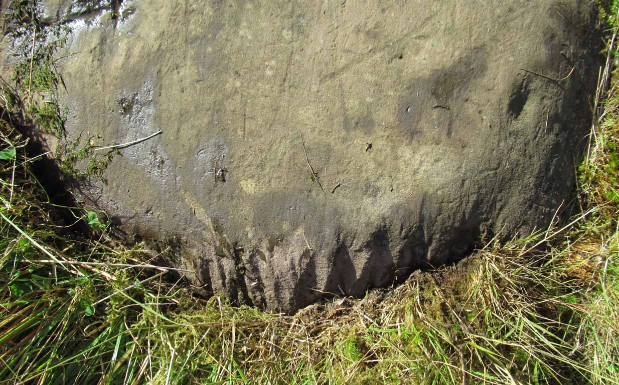
Series of metal-sharpening groovesArty-farty sketch of the design
At the bottom of the stone (as with several others hereby) a curious set of deep scars have been cut into the edge of the rock. They’re unmistakable when you see them. They have probably been created by metal artifacts being sharpened along the bottom of the rock—many many times by the look of it. These deep cuts reminded me of the more famous Polisher Stone, down Avebury-way. They may be explained by the fact that, several centuries ago, a battle occurred here and some of the men gathered in the area before the attack. It would seem as if this and the other cup-and-ring stones were used to sharpen their blades before going into battle. Whether this was done because of some local lore which imbued these stones with some sort of magick, we do not know. Folklore here seems curiously scarce (english incomers destroyed local traditions, as writers were telling us in the 19th century), apart from the well-known one of the area being rife with fairies: Robert Kirk’s famous The Secret Commonwealth of Elves, Fauns and Faeries (1691) was written three miles west of here, at Aberfoyle.
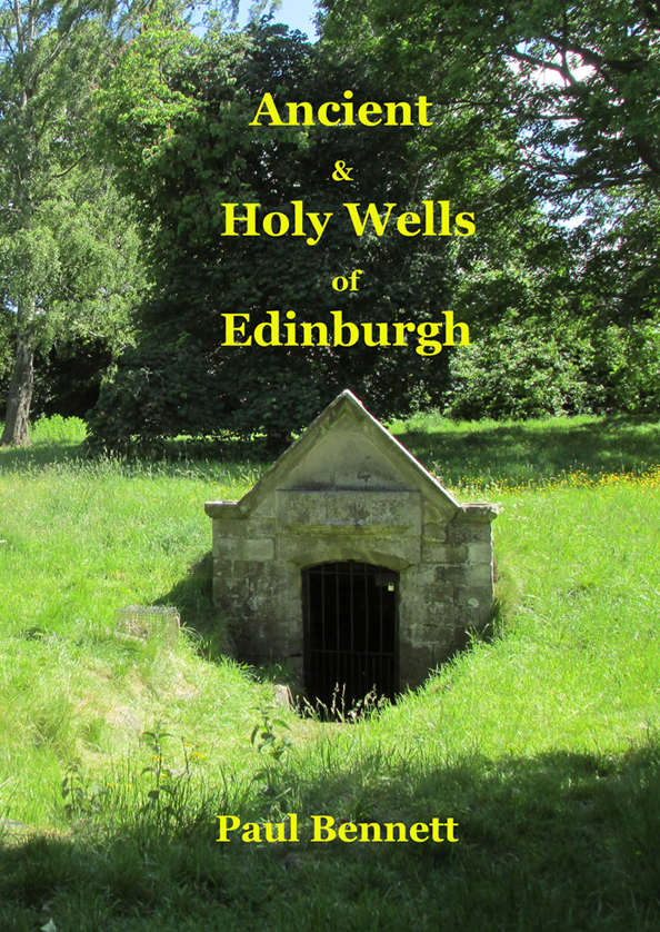
This is the first detailed guide ever written on the holy wells and healing springs in and around the ancient city of Edinburgh, Scotland. Written in a simple A-Z gazetteer style, nearly 70 individual sites are described, each with their grid-reference location, history, folklore and medicinal properties where known. Although a number them have long since fallen prey to the expanse of Industrialism, many sites can still be visited by the modern historian, pilgrim, christian, pagan or tourist.
The book opens with two introductory chapters: the first explores the origin and nature of holy wells and what they meant to local people in earlier centuries; and the next is a comparative overview of water cults worldwide. It is an invaluable guide for any student or tourist who wants to look beneath the modern history of the city and get a taste of the more archaic customs that once belonged here…
Healing Well (destroyed): OS Grid Reference – NT 49384 35696
Archaeology & History
Probable site of the Well
An all-but-forgotten well that was said to be named after a local forester and ranger in the 18th century—called Willie Bold, obviously. It was located a few steps away from the main hunting lodge in the village, known locally as the Hunter’s Ha’ (also long since gone), from which an ancient pathway ran up to the local Toothill. The Well was described in Robert Hall’s (1898) definitive history of Galashiels, albeit in the past tense, even in his day:
“Willie Bold’s well was about ten yards distant from the east end of the peel, the road which led to it being about four feet wide and fenced on both sides with a high stone wall. The well was circular and about three feet deep, but in order to reach the water, it was necessary to go down two steps. Here the village children of a past generation quenched their thirst, lifting the water with a “tinnie,” which was always returned to Willie’s house, where it remained till again required.”
In 1863, the first OS-map of the area highlights a ‘Well’ very close to the position cited by Mr Hall, which we presume must be the Well in question. .
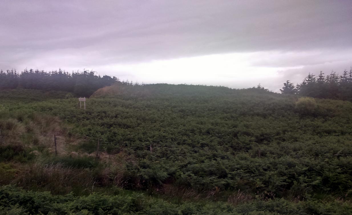
Take the Gateside Road from St Ninians or Polmaise Road out of Torbrex across the M9, heading out west onto the southern moors of Touch Hills, passing the Wallstale dun in the trees and then the Castlehill dun just off the road. Keep going uphill for just over half-a-mile, keeping your eyes peeled on the right for where the MOD lads play some of their war-games. Walk along the track here, following the line of the woods, until it gets to the spot where it doubles back on itself. Just here, about 30 yards in front of you, a rounded walled knoll gives the game away!
Archaeology & History
Artists impression of the reconstructed site (PSAS 1959)
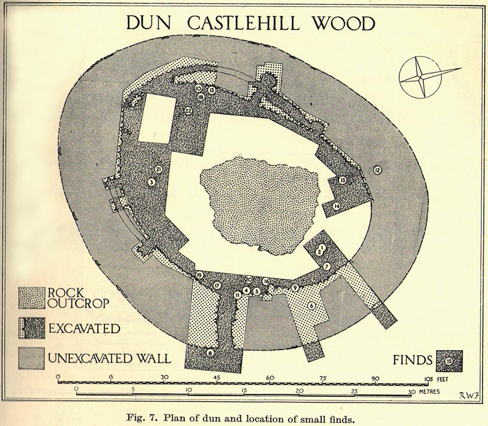
An impressive-looking site, not too far off the moorland road, it is one of more than half a dozen hillforts and duns found to the west of Stirling, all of them relatively close to each other—showing that a lot of human activity was going on here in the Iron Age and, probably, much earlier. Looking like a cross between a broch and a traditional hillfort, the site is best visited in the Winter and Spring months before the bracken starts to encroach and cover it.
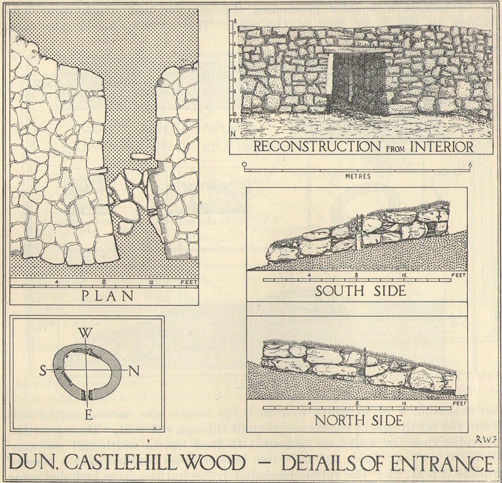
Officially rediscovered in 1952 and excavated three years later, it was thought to have been built in the 1st century AD and used for a few hundred years thereafter. As you walk up to the eastern edge of the monument, a large entrance, 4½ feet wide, allows you into the large open space within. From here, and walking around both the inner and outer walls, you get an idea of the huge amount of work it must have taken to build this structure. The walls alone which constitute the main of Castlewood Dun are, on average, 16 feet thick! The Royal Commission report for the area (summarizing the archaeological work of F.W. Feacham in the ’50s) gives the basic architectural features of the place:
“The dun is oval in plan…and measures 75ft from NE to SW, transversely within a drystone wall 16ft thick. The faces of the wall are composed of large, angular blocks, and the core of boulders, small rubble and earth. The entrance in the E arc, is provided with door-checks. Within these, the passage measures 4ft 6in in width, and outside them 3ft 9in. A few paving-stones were laid to level the rough rock surface of the passage-floor. Traces of what might have been the bottom step of a stair, rising up the inner face of the wall, were found at a point 8ft N of the entrance. The dun had no mural stair or galleries, but two sets of mural chambers were located, one in the W and the other in the S acr of the wall. The former consisted of an entrance-passage, 6ft in length, which varied in width from 2ft at the outer to 3ft at the inner end, where it opened into a circular chamber 4ft in diameter. From either side of the passage a narrow duct or flue, about 19ft in length and 1ft 6in in width, led off obliquely through the core of the wall to debouch into the interior of the dun. The construction in the S arc consisted of a similar passage, one flue and a smaller chamber. Ash and a clinker of very light weight were found in the form of deposits in both passages and all the flues. …The excavator suggested they might have been corn-drying installations.”
Groundplan of site (PSAS 1959)Entrance details (PSAS 1959)
Apart from a small piece of Roman glass, quern fragments, anvils stones and a pot lid, the excavators found very little inside the dun—not even any hearths. The walling on the southwest and western edges was built onto a small cliff, making access slightly difficult from that side.
From the site itself, views are excellent, particularly in an arc through the north, east and southeast, with the western skylines being only a short distance away. This enabled relatively easy tribal communication with people at the other brochs, duns and forts in the area, across an otherwise large but difficult landscape in prehistoric times. A few hundred yards to the northeast, on the other side of the recently planted tree-farm (forestry plantation), a large D-shaped structure—possibly Iron Age, possibly medieval— is accompanied by lines of ancient walling running down the slopes.
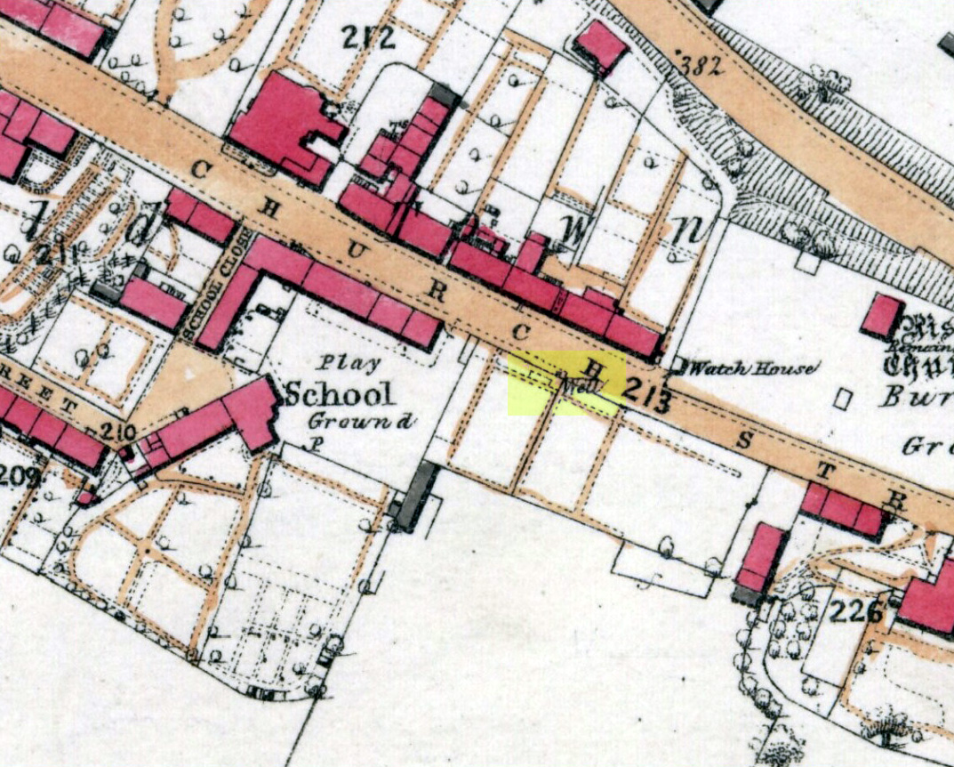
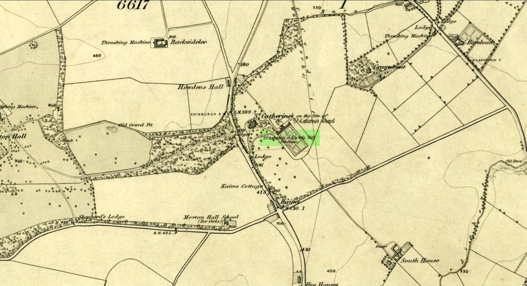
Take the A701 road from the east end of Princes Street south—down North Bridge, South Bridge, Nicolson Street, onto Liberton Road and then Liberton Gardens—towards Penicuik. 3¾ miles along, in the parish of Liberton itself, where the A701 is called Howden Hall Road, keep your eyes peeled for the turning into the Toby Carvery on your left. Park up and walk across the grass and look behind the trees ahead of you (if you can’t find it, ask the people in the pub). .
Archaeology & History
Located south of Liberton village—a few hundred yards west of the long-gone chapel erected by St. Margaret in honour of St. Catherine—this famous holy well is now in the grounds of a public house and is easily accessed. It has been described by many historians through the centuries, from Matthew Mackaile’s (1664) short work to more recent tourist guides. When the local historian George Good (1893) told about it, local lore still spoke of the old church. “These lands,” he wrote,
“belonged to a very ancient chapel dedicated to St. Catherine, which stood with its burying-ground near the modern mansion of St. Catherine’s. All trace of this chapel has disappeared, but at the end of last century its ruins were still extant. It was reputed to be the most ancient place of worship in the parish, and the ground around the chapel was consecrated for burials. Hither came annually in solemn procession the nuns from the Convent of Sciennes, a foundation due to the piety of one of the St. Clairs of Rosslyn, who may possibly have also been connected with the origin of the Chapel of St. Catherine.”
Its relationship with the world-famous Roslyn Chapel, less than 4 miles to the south, remains (to my knowledge) unproven, but it’s an association that would not be unlikely. This aside, St Catherine’s Well has a long history. Described in Hector Boece’s Latin text Scotorum Historia (1526), we have one John Bellenden to thanks for a wonderful translation into early english under the title of The History and Chronicles of Scotland in 1536. Herein one of the later editions we read, in that quaint old dyslexia:
“Nocht two miles fra Edinburgh is ane fontane dedicat to Sanct Katrine, quhair sternis of oulie springs ithandlie with sic abundance that howbeit the samin be gaderit away, it springis incontinent with gret abundance. This fontane rais throw ane drop of Sanct Katrine’s oulie, quhilk was brocht out of Monte Sinai, fra her sepulture, to Sanct Margaret, the blissit Quene of Scotland. Als sone as Sanct Margaret saw the oulie spring ithandlie, by divine miracle, in the said place, sche gart big ane chapell thair in the hounour of Sanct Katrine. This oulie has anr singulare virteu agains all maner of kankir and skawis.”
In the middle of the 17th century, its medicinal virtues were brought to the attention of the surgeon Matthew Mackaile who, in 1664, wrote:
“In the paroch of Libberton, the church whereof lyeth two miles southward from Edinburgh, there is a well at the Chapel of St. Catherine’s, which is distant from the church about a quarter of a mile, and is situate toward the south-west, whose profundity equaleth the length of a pike, and is always replete with water, and at the bottom of it there remaineth a great quantity of black oyl in some veins of the earth. His Majesty King James VI, the first monarch of Great Britain, of blessed memory, had such a great estimation of this rare well, that when he returned from England to visit his ancient kingdom of Scotland in anno 1617, he went in person to see it, and ordered that it should be built with stones from the bottom to the top, and that a door and a pair of stairs should be made for it, that men might have the more easy access into its bottom for getting of the oyl. This royal command being obeyed, the well was adorned and preserved until the year 1650, when that execrable regicide and usurper, Oliver Cromwell, with his rebellious and sacrilegious complices, did invade this kingdom, and not only defaced such rare and ancient monuments of Nature’s handiwork, but also the synagogues of the God of nature.”
St Catherine’s Well today
This historical appraisal has been echoed by other writers and is very probably accurate. Some years after Cromwell and his murderers had desecrated the land and people in this area, the well was again repaired to its former condition and slowly, quietly, people began traditionally using the site for ritual and healing once more. But over the next two hundred years, probably through religious persecution by the Church, the site was used less and less and, by the time Thomas Muir (1861) visited and wrote about it, the well-house had become “dilapidated”. A few years later when the holy wells writer J.R. Walker (1883) visited the place, he found that not only was it still,
“celebrated for the cure of cutaneous diseases, (but) it is still visited for its medicinal virtues”; and was “now carefully protected and looked after.”
In James Begg’s (1845) account of the well for the Statistical Account, he told:
“At St. Catherine’s is a well which contains a quantity of mineral oil or petroleum, obtained most probably from the spring flowing over some portion of the coal beds. This bitumous matter floats copiously on the surface of the water, and is also partially dissolved in it. The spring is reckoned medicinal by the country people, and may have some slight efficacy in cutaneous eruptions…
“At St Catherine’s, there is the famous well, before alluded to, anciently called the Balm Well. Black oily substances constantly float on the surface of the water. However many you remove they still appear to reside in this well, and it was much frequented by persons afflicted with cutaneous complaints. The nuns of the Sheens made an annual procession to it in honour of St Catharine. King James VI visited it in 1617, and ordered it to be properly enclosed and provided with a door and staircase, but it was destroyed and filled up by the soldiers of Cromwell in 1650. It has again been opened and repaired, and is now in a good state of preservation.”
The “nuns of the Sheens” who made the annual pilgrimage here were the nuns of St. Catherine’s of Sienna, in Italy! This crazy-sound journey is more than one thousand miles long and its nature and origin needs exploring in greater depth—although a “Nunnery of St. Catherine of Siena at Edinburgh” was founded in 1516 at Sciennes in Edinburgh, less than three miles away. Much easier! 🙂
It would have been more than just the healing properties of the oily waters that called the nuns across their incredible journey, but they would, no doubt, have been of considerable mythic importance. All of the early writers comment about it and seem confident in its abilities. As the Liberton historian George Good (1893) said,
“…there can be little doubt that its waters had a healing tendency. Oils when rubbed on the skin have often been found to produce most beneficial results in skin diseases. The tarry substance or petroleum mixture discovered in this spot was no doubt due to the presence of the coal or shale strata of the district. The existence of the oil-works at Straiton and elsewhere cannot fail to throw a light upon the history and peculiarities of the so-called Balm Well of St. Catherine’s, which even yet has an occasional visitor.”
This oily substance was examined for medical potential by Dr. George Wilson in the mid-19th century, who found:
“The water from St Katherine’s Well contains after filtration, in each imperial gallon, grs. 28.11 of solid matter, of which grs. 8.45 consist of soluble sulphates and chlorides of the earths and alkalies, and grs. 19.66 of insoluble calcareaous carbonates.”
I am not aware of any modern accounts of cures attached to St Catherine’s waters, but have little doubt that some people will have found it useful….
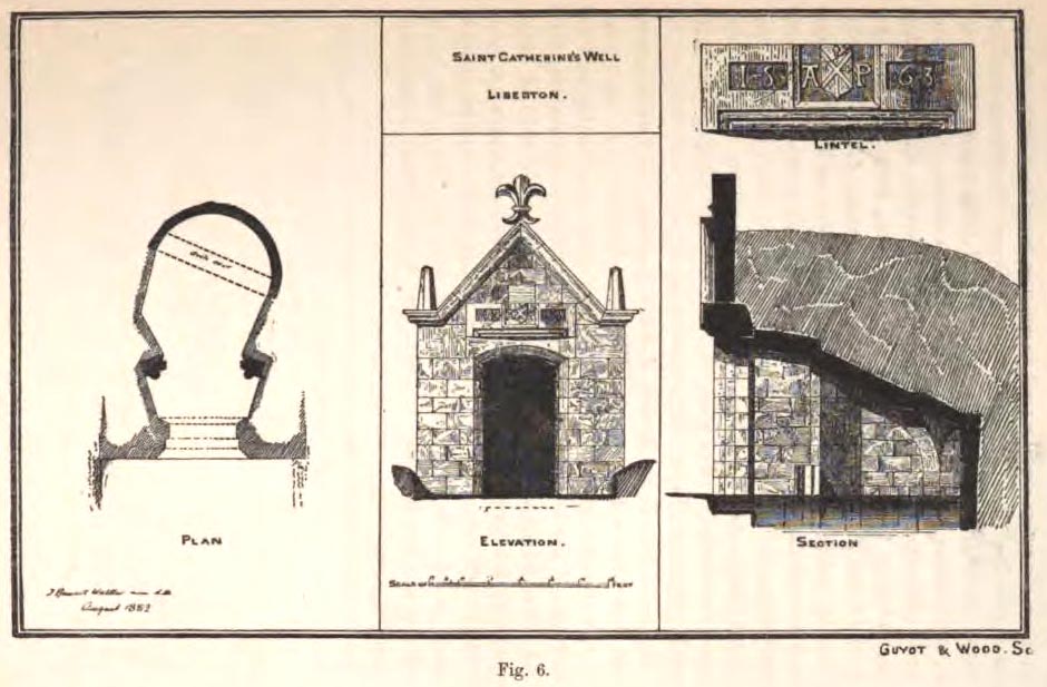
The architecture of the small well-house covering the waters would seem insubstantial, but the Royal Commission (1929) account told:
“The well is housed within a tiny vaulted structure. The Renaissance front is relatively modern, but it contains a door lintel, probably quite unconnected with the structure, on which is inscribed the date 1563 within recessed panels flanking a central panel, which contains a shield flanked by the initials A.P. The shield bears a saltire, in the sinister quarter of which is a Latin cross placed horizontally, i.e., with the shaft towards the fess point (? a merchant’s mark); the upper quarter contains a much worn object resembling a broad arrow, point uppermost.”
Plan of site in 1883
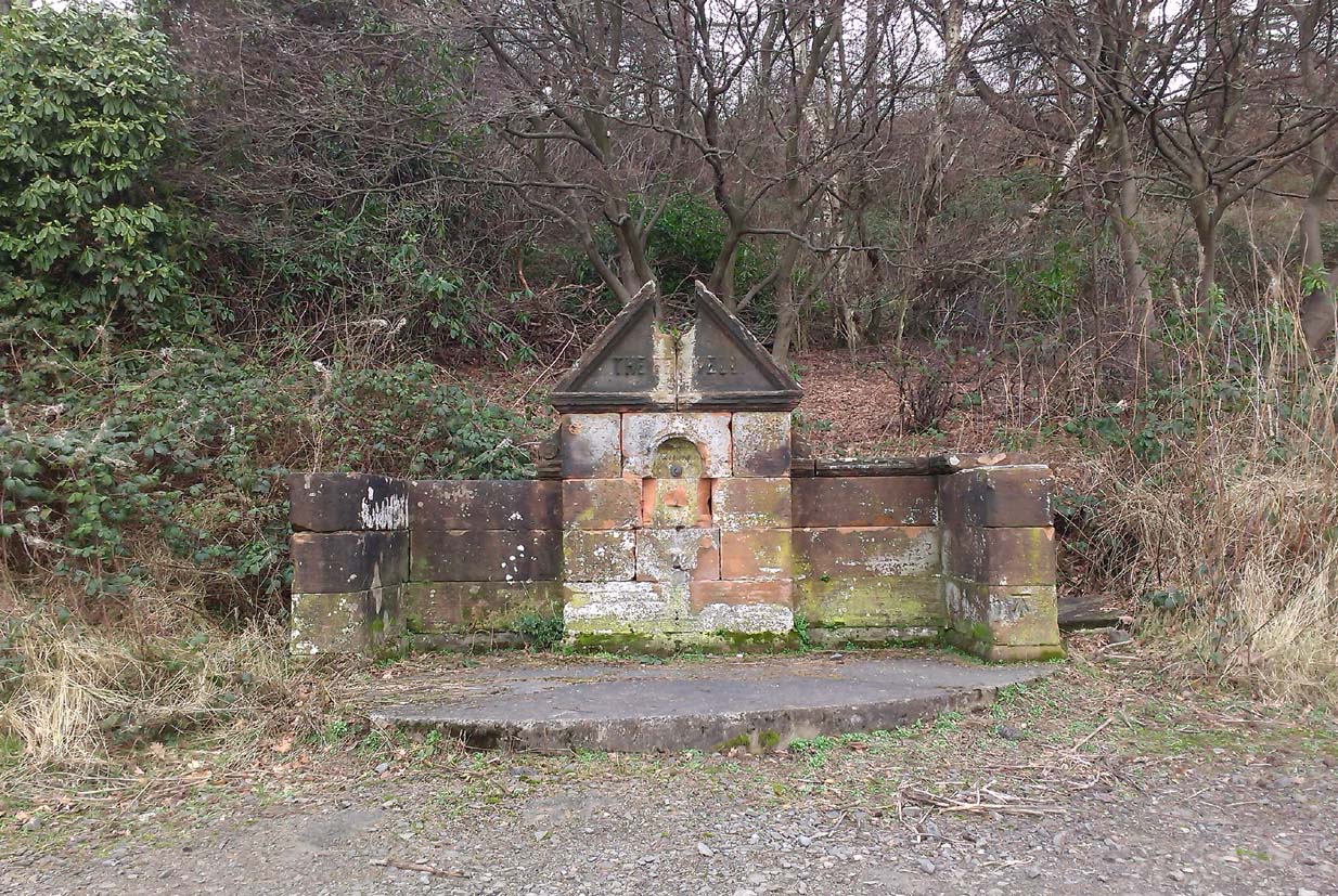
The iron-clad door is locked, as the visitor will see. Please enquire at the hotel regarding it being opened to look inside. Upon our visit here in June 2017, the waters, as in J.R. Walker’s (1883) day, were still bubbling up and were quite high, but it looked as if the inside needed cleaning. For a change, we didn’t drink the water…..
Folklore
Although various writers have posited that the oily waters are probably due related to the nearby coalfields, legend tells otherwise:
“It owes its origin, it is said, to a miracle in this manner: St. Katherine had a commission from St. Margaret, consort of Malcolm Canmore, to bring a quantity of oil from Mount Sinai. In this very place, she happened, by some accident or other, to lose a few drops of it, and, on her earnest supplication, the well appeared as just now described.” (Thomas Whyte 1792)
References:
Banks, M. MacLeod, British Calendar Customs: Scotland – volume 1, Folklore Society: London 1937.
Begg, James, “Parish of Liberton“, in New Statistical Account of Scotland – volume 1: Edinburgh, William Blackwood: Edinburgh 1845.
Muir, Thomas S., Characteristics of Old Church Architecture,in the Mainland and Western Isles of Scotland, Edmonston & Douglas: Edinburgh 1861.
Royal Commission on the Ancient & Historical Monuments of Scotland, Inventory of Monuments and Constructions in the Counties of Midlothianand West Lothian, HMSO: Edinburgh 1929.
Walker, J. Russel, “Holy Wells’ in Scotland,” in Proceedings of the Society of Antiquaries of Scotland, volume 17, 1883.
Watson, W.N.B., “The Balm-Well of St Catherine, Liberton,” in Book of the Old Edinburgh Club, volume 33, 1972.
Whyte, Thomas, “An Account of the Parish of Liberton in Midlothian, or County of Edinburgh,” in Archaeologica Scotica, volume 1, 1792.
Wilson, Daniel, Memorials of Edinburgh in the Olden Times – 2 volumes, Edinburgh 1891.
Acknowledgements:Huge thanks for use of the Ordnance Survey map in this site profile, reproduced with the kind permission of the National Library of Scotland.
This long lost holy well used to be found somewhere on the south-side of the Water of Leith, close to Powderhall, between Warriston and Broughton. References to it are minimal. Whilst Ruth & Frank Morris’ (1981) thought it might have been an alternative name of the Bonnington Mineral Spring—aka St. Cuthbert’s Well—a half-mile to the north-east, we know from John Russel’s (1933) article that it was a quite separate site; but all he could tell us was that St. Leonard’s Well was “a now forgotten mineral well”. The clearest indicator telling of its whereabouts is in John Geddie’s (1896) lovely work on the history of the Leith watercourse, where he described this “forgotten mineral spring” as being below Powderhall “beside the Water”, i.e., the river Leith. A few miles south, a crag at Arthur’s Seat was once dedicated to St. Leonard. (the grid-reference to this site is an approximation).
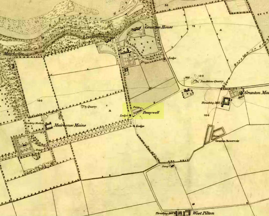
On the 1853 Ordnance Survey map of Granton we are show the house and place-name of Pennywell with a ‘pump’ adjacent to it. Sadly we don’t have as rich a history of the place as its namesake at Newington. Its earliest written appearance seems to be in 1812. A few years later, in the OrdnanceName Book of the area, it was recorded that,
“Two cottages on the property of Sir John McNeil the name appears to be derived from a well which was formerly situated at the North east end of the houses where one Penny was paid for a draught of water.”
Remembered as a watering place for horses, the old Scots word ‘penny’ may be behind this old name, in terms of it giving the animals and locals their water supply. Stuart Harris (1996) thought that this Penny Well may have been the long lost St. Columba’s Well in the parish of Cramond.
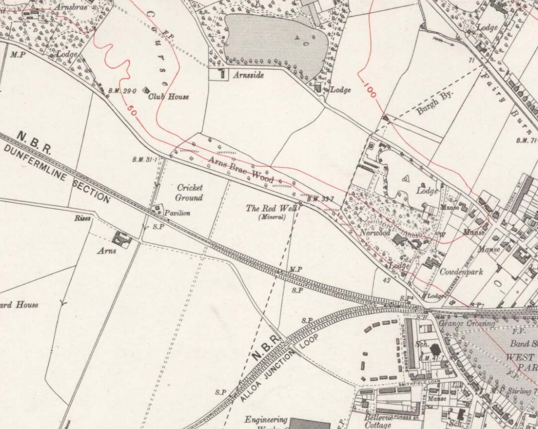
Along the A907 a mile west of Alloa and heading towards Tullibody, just before the roundabout across the road from the school fields, a small entrance takes you into the small wooded parkland. There, right in front of you as you walk in, and visible from the road, is the enclosed architectural stone walling and somewhat ruinous remains that are the Red Well, with its faded name carved on top.
Archaeology & History
Red Well on 1913 map
Although the waters no longer run for the people to drink, this old iron-bearing spring was long of repute to the old folk of eastern Alloa. So much so, it seems, that even Janet & Colin Bord (1985) included it in their national survey of sacred wells! Like other chalybeate springs, its waters were known to be good as a tonic—which makes sense as iron fortifies the blood and general immune system. The Well was highlighted on the 1913 OS-map of the area.
References:
Bord, Janet & Colin, Sacred Waters, Granada: London 1985.
Musselburgh has had an ancient fair—held upon St. James’ Day (July 25)—for many centuries. It was held along the old High Street by a more ancient Market Cross than the one seen there today. R.M. Stirling (1894) told us that, “The cross is erected over a draw-well, and in local parlance is known as the Cross Well.”
On the 1853 township map, a water ‘pump’ is shown at the very spot, with the ‘cross’ and water trough shown on subsequent maps. The Well isn’t mentioned in John Small’s (1900) description of the cross and its authenticity as a ‘holy’ well is questionable.
Take the A836 road between Tongue and Bettyhill, turning down at Borgie Bridge for 1.8 miles (2.87km) until you reach the little information sign at the roadside. Walk downhill and cross the little bridge and wander onto the west side of the beach. You’re likely to end up daydreaming… so once you’ve re-focused, head into the middle of the beach and walk up the steep-ish sand-banks to your right (south). Once at the top, you’ll see a gigantic rock—the Ringstone—bigger than a house. Walk up the hill above this until your reach the rocky plateau where things roughly level out. Look around!
Archaeology & History
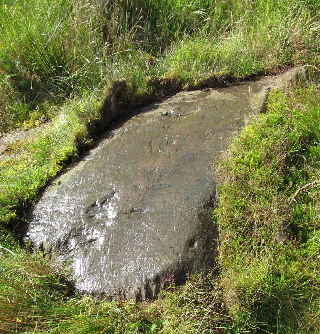
This previously unrecognised carving on the edge of the rocky promontory that drops down to the stunning Torrisdale Bay—above the gigantic and legendary Ringstone boulder—is very much like the curious ‘C’-shaped motif on the Fyfield Down petroglyph, a couple of miles east of Avebury, literally 499 miles (803km) to the south. Indeed, that’s all I kept thinking about when I found it!
Ringstone carving, looking S
The carving’s nowt special—apart from the fact that it’s seemingly isolated and has no apparent companions nearby. It’s an incomplete circle, perhaps more like a bell-shape than a circle, about six inches across and seems to have no inner cup-mark. Its general appearance on the rock surface seems to indicate it was carved by a metal tool, instead of being ‘pecked’—but it’s still very old. Initially, I wondered whether it was an ichnological fossil or stromatolite—but it isn’t.
(Note that the OS-grid-ref is just a 6-figure one. I was ambling about and didn’t make an exact note of the place, but it won’t take much finding on the rocky levels above the giant Ringstone if you zigzag about. Apologies for the poor photos too, but She was cloudy most of the day.)
Acknowledgments: Huge thanks to Donna Murray, for putting me up in this part of Paradise. Cheers Donna.

 This is the first detailed guide ever written on the holy wells and healing springs in and around the ancient city of Edinburgh, Scotland. Written in a simple A-Z gazetteer style, nearly 70 individual sites are described, each with their grid-reference location, history, folklore and medicinal properties where known. Although a number them have long since fallen prey to the expanse of Industrialism, many sites can still be visited by the modern historian, pilgrim, christian, pagan or tourist.