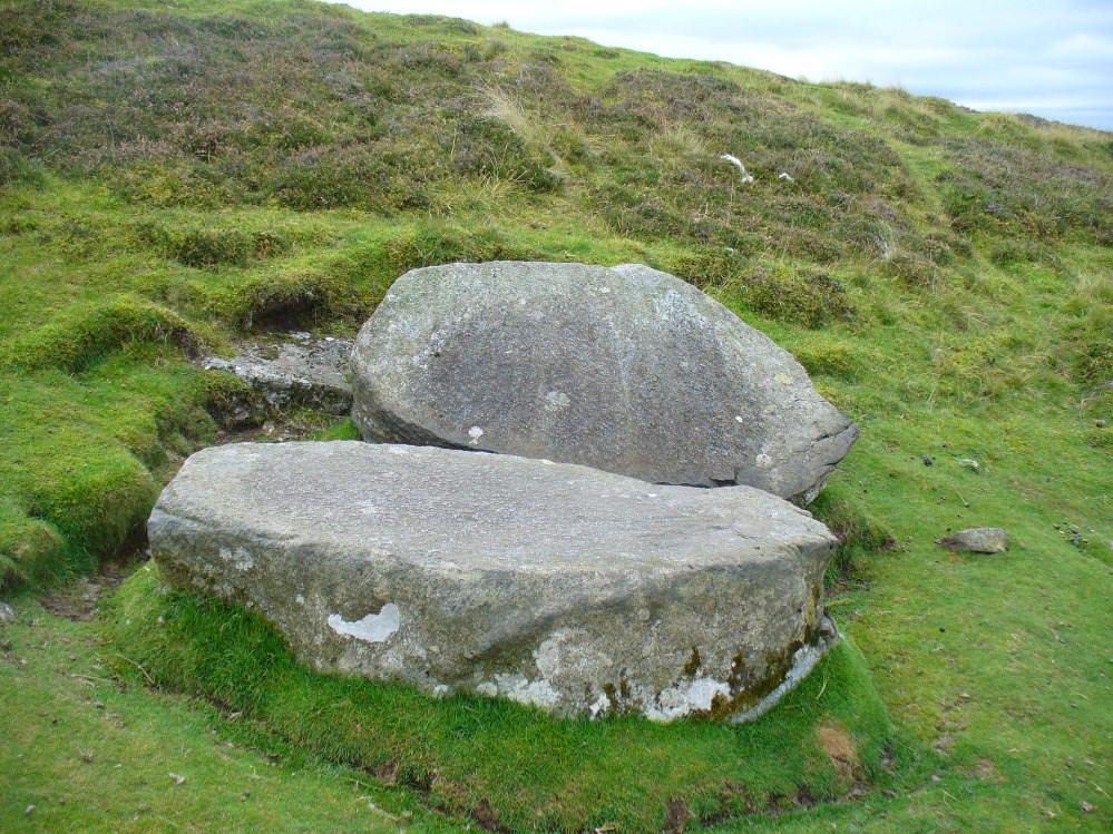
The best way to find this site, in the middle of the large woods up the slopes, is to follow the circular mile-long tourist path that runs through it. Take the B846 road out of Aberfeldy over the bridge towards Dull and Weem. As you go through Weem, watch closely for the signpost directing you into the trees of Weem Rock and Woods on the right. Follow this tiny road up until you reach the parking circle in the edge of the trees. Follow the directed footpath up into the woods & keep to the winding track, up, zigzagging, and up again, until it levels out a bit and runs below the large long crags. Tis beneath here you need to be!
Archaeology & History
The pool of St David’s Well
Not far from the curious Weem Wood carvings, hidden beneath one section of the long high crags in remains of the ancient forest, is this trickle of fresh water which collects into a small stone-lined pool. (a small round plaque which reads ‘St. David’s Well’ on the cliff-face above the waters is helpful) It’s in a truly lovely setting, with a small ‘cave’ about 50 yards west along the same footpath and a modern carved ‘cross’ in front of it.
The well was formerly known as St. Cuthbert’s Well (date: 20 March) who, so legend tells, lived nearby—probably at the christian-druid college at Dull, a mile west of here. It was he who collected the waters from the rock face into the small pool we see today. This used to be known as St. Cuthbert’s Bath. But several centuries after the saint’s death, the local laird, Sir David Menzies, came and restored the well and gained a reputation for spending much time living hereby, sometimes in the small cave along the edge of the cliffs. It was to him that the New Statistical Account wrongly dedicated the waters to in the 19th century—but the title has stuck!
Described in several old local history works, the site was included in the giant folklore tome on Scottish waters by MacKinlay (1893), who wrote the following:
“In the wood clothing the steep hill of Weem, in Perthshire, is St. David’s Well, said to be named after a former laird who turned hermit. The spring has a considerable local fame, and many have been the wishes silently breathed over its water. Part of an ancient stone cross lies at its margin, and on it the visitor kneels while framing his or her wish.”
Nothing of this ‘cross’ can now be seen, but it is said that its remnants are housed at Weem church in the village below. Also in the 19th century, occasional christian gatherings were held here and as many as fifty people came “for religious services.” Thomas Hunter (1886) reported that “a collection of human bones” were found near the well in front of the crags. There is also what looks like a newly cut large cup-marking with two carved lines reaching out from it, heading towards the well, on a small ledge of stone close to the pool.
Folklore
Folklore tells that once, long ago, dragons lived in these old woods—overcome no doubt by the incoming christians who stole and denigrated the olde peasant ways of our ancestors. In bygone times, locals used the waters here for their health-giving properties. As Ruth and Frank Morris (1982) told,
“it was an ancient wishing well which was still visited in 1954, when such objects as pins and buttons and an occasional penny was thrown in.”
References:
Ferguson, Malcolm, Rambles in Breadalbane, Thomas Murray: Glasgow 1891.
Take the B846 road out of Aberfeldy over the bridge towards Dull and Weem. As you go through Weem, watch closely for the signpost directing you into the trees of Weem Rock and Woods on the right. Follow this tiny road up until you reach the parking circle in the edge of the trees. Follow the directed footpath up into the woods & keep to the winding track, keeping your eyes peeled for the first large rocky crag above you, with a huge tree growing out of the edge. Once you get to the top of the steps and onto these crags, look right in front of you!
Archaeology & History
The nearest ‘officially recognised’ cup and ring carvings to the one we’re gonna see here, are those described by Kaledon Naddair (1990) in his brief descriptions of the Glassie Farm carvings a short distance northeast in the same woods. Other than that, I can find no account of the carvings I’m about to describe – other than a couple of short local history walking guides, which tell that one of the carvings here is “modern.” And that much is plainly evident.
Close-up of one section of the main design
There are at least seven carved stones here – all very close to each other on the top of an impressive crag with a large old tree growing out of the edge of the cliff. But the carvings are located on the flat ground above the cliffs and, it would seem, may well be modern. But I thought that since there are no accounts of the site on-line and no remarks in the Canmore registers, they should be mentioned as future students may mistake them as ancient. There is the possibility (unless someone can show us otherwise) that one or two of them are prehistoric, but I think it’s best we surmise that they are all recent additions in the landscape for the time being. And damn good designs they are too!
The triangular rock designs
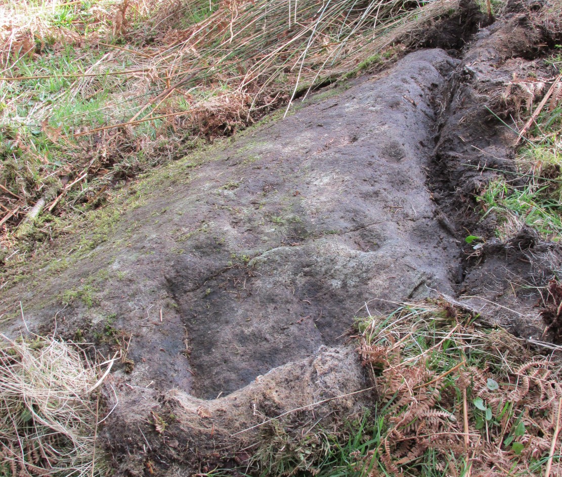
The first and most notable of the group of seven (at least), is on the large earthfast triangular flat rock, pointing out to the cliff’s edge and the hills across the valley. This is where the greatest cluster of multiple cup-and-rings can be seen. Double- and triple rings surround several of the central cup-markings, with the traditional lines running out from the central cup. There are a great number of single cups scattering the surface; and we also find a typical ‘rosette’ element, comprised of a central cup surrounded by eight singular cups, which some students have interpreted as solar and lunar symbols (amongst other things) when found on other carvings (there is a prehistoric Rosette Stone is known on Ilkley Moor; but similar examples are known in Ireland, Northumberland and elsewhere).
Below this triangular rock (perhaps attached beneath the) is another long piece of earthfast stone, with more carvings on. But when Lindsey Campbell and I came here yesterday, it was obvious that some elements along this section of stone were carved in recent years. Two double-cup-and-rings are at the bottom-left of this section of rock, with a scattering of other cup-marks reaching across its surface. Several of these are obviously quite new.
Another multiple cup-and-ring
The third notable example is to the top-right of the triangular rock. This stone is mainly of quartzite rock, apart from near the top-end, where another multiple cup-and-ring (four, with a possible fifth broken ring fading away) stand out very blatantly. This carving also seems to be not that olde…
From this third quartz carving, look 10 yards (if that!) back towards the trees and there’s a large boulder. On the surface of this is another multiple cup-and-ring that was very obviously new, and several other cup-markings, also quite new. I presume that the other sections carved onto this stone have also been etched by the same modern artists.
Another boulder with new carvings
As I looked back to the main triangular carved stone, I noticed other small pieces of stone peeking up from the ground and, upon closer inspection, found one small rounded triangular piece with another multiple cup-and-ring that just fit onto the rock. And close by this was another long piece of stone which, when I rolled the turf gently back, found three simple cup-markings along the surface.
A seventh carving was found on one of the rocks that is falling slightly down the slope, close to the fourth ‘new’ carving that I described. This was heavily covered in moss and autumn’s fallen leaves, and I wasn’t about to take the moss away just for the sake of my curiosity. But it was obvious that other cup-markings were on the sloping face of this large stone.
We’ll have to venture back here soon and get some better photos and, with any luck, find some old locals who can tell us when the carvings first appeared. It’s quite a superb spot for a bimble, with the healing waters of St. David’s Well and his cave close by—and the woods were, so local legends tell, inhabited by dragons and good heathen creatures in centuries past. But the proximity of the Druid school—formed by the Ionian druids no less—around the 6-7th century, may have thankfully preserved these old tales and relate to some of the many other monuments found in this area. Although some of these carvings (possibly all) are of recent years, this is a gorgeous spot well worth exploring… And if anyone knows precisely when they were done – please let us know!
From the main road running through lovely Comrie, take the south B827 road over the old river bridge. Go dead straight for several hundred yards until the road bends right; but take the left turn here. 100 yards or so along note the trees on your right, and the road begins to swerve round here. Just round the corner in the trees, the stones are in the clearing right by the roadside. You can’t miss them! (if you hit the graveyard, you’ve gone past them)
Archaeology & History
This is a truly lovely, almost warming enclosed megalithic site—albeit damaged by the ruin of centuries; but on the occasions I’ve been here it feels quite nurturing and elicits a quite natural meditative state. Whether or not this is due to the surround of trees, or the natural electromagnetic field, or just me, I dunno….
Dunmoid Circle, looking SEDunmoid from the North (Coles 1911)
The ‘circle’ is constructed upon a flat rounded section of ground, surrounded by a ditch on two-thirds of its edges, very reminiscent of a typical henge monument—but there is no mention of this in modern surveys. One of the earliest accounts of Dunmoid was written by John MacPherson (1896) who gave us as much of the known history of the site as is still known by any modern academic. He wrote:
“At the west side of the new cemetery, close to the public road, there is a curious round knoll, which at one time must have been used as a place for the burial of the dead. The attention of the writer of this was drawn to it about twenty years ago. There were three large slabs of stone lying upon the ground, which apparently had been at some former period placed erect by some loving hands to mark the last resting-place of some departed friend or hero. By the aid of some of the Comrie masons the stones were placed in a standing position. Curious to know what lay beneath the surface, we dug up the earth in front of the largest slab, and came upon a stone cist placed north and south, 7 inches long, 1 foot 8 inches broad, and 1 foot 3 inches deep. The only remains discovered was a thigh-bone, but whether it at one time formed a part of the leg of a Celt, a Roman, or a Saxon we could not tell. An old man who then lived in the village of Comrie told us that in his young days the same mound was dug up, when an urn filled with ashes was discovered. This, perhaps, would indicate that it formed a place of burial for Romans rather than for Caledonians. The spot is called Dunmoid, or ‘hill of judgment.'”
Fred Coles 1991 planDunmoid from SE (Coles 1911)
The circle gained the attention of the prolific Fred Coles (1911) in his Perthshire surveys, whose drawings and measurements are still repeated in the modern textbooks more than a century later. When he visited the site, two of the stones were still upright, but today only one still stands. In Aubrey Burl’s (1988) survey on ‘four-poster’ stone circles, he reiterated Coles’ words, telling:
“Originally four stone stood at the corners of a rectangle on a mound some 75ft (23m) across and 2ft (60cm) high. Coles’ plan showed the NW stone standing 5ft 4ins (1.6m) high and the SE, opposite, 5ft 2ins (1.6m), with the thick NW stone prostrate, 4ft 6ins (1.4m) long, with the more slender SW pillar also supine and 4ft (1.2m) long. The longer SE and NW sides of the oblong were roughly 9ft 6ins (2.9m) long and the others 9ft (2.7m) in length. The circle on which the stones had been placed had a diameter 13ft 2ins (4m), of which the Megalithic Yard is not an integer.”
The circle is included in Andrew Finlayson’s (2010) modern survey of the region.
References:
Burl, Aubrey, Four Posters: Bronze Age Stone Circles of Western Europe, BAR 195: Oxford 1988.
Finlayson, Andrew, The Stones of Strathearn, One Tree Island: Comrie 2010.
Hunter, John (Ed.), Chronicles of Strathearn, David Philips: Crieff 1896.
Hutchison, A.F., “The Standing Stones of Stirling District,” in The Stirling Antiquary, volume 1, 1893.
MacPherson, John, “At the Head of Strathearn,” in Chronicles of Strathearn, Crieff 1896.
Along the A822 road past Crieff and then Gilmerton, shortly past here is a small road to Monzie and the Glenturret Distillery or Famous Grouse Experience. Go on this road and after a just a coupla hundred yards you’ll see the large old gatehouse for Monzie Castle on the left. Ask at the gatehouse and they’ll point you to the stone—in the field about 300 yards past the Monzie stone circle, 200 yards past the gatehouse itself. You can’t really miss it!
Archaeology & History
The southern flat face of the Witches Stone
This is a fascinating stone for a variety of reasons—not least of which it enabled us to identify an otherwise curious geological anomaly as an unerected standing stone some 16 miles SSW…but that’s a story for later! The stone here leans at an angle in the field, as shown in the photo, but it still rises 5 feet tall and is a thick chunky fella, with one face very flat and smoothed indeed from top to bottom. This side of the stone was obviously cut and dressed this way when first erected. As Paul Hornby then noted, its western face is also quite flat and smoothed aswell, with the edge between the two sides almost squared at right-angles. The eastern and southern sides of the stone are undressed, as the phrase goes. These physical characteristics have just been found at a newly found pair of un-erected standing stones on the western edges of the Ochils, just below a newly found cairn circle.
Fred Coles 1911 drawingWitches Stone, looking NE past Milquhanzie Hill fort
There were several early descriptions of this stone, two of which talked about an avenue or road along which the stone seemed to stand within. This ‘avenue’ was in fact the very edge of what is probably an earlier prehistoric enclosure—but you can’t really see this anymore unless you’re in the air (check Google Earth, which shows it reasonably well).
In J. Romilly Allen’s (1882) account, he mentions the stone only in passing, telling it to be “a single standing stone measuring 4 feet by 3 feet and 5 feet high (with) no markings on it.” It was later described in Fred Coles’ (1911) survey of the region where he told:
“This monolith is the westerly of the two prehistoric sites grouped on the O.M. as Standing Stones. It stands a few yards to the south of the avenue, almost half a mile from the East Lodge. The Stone has a slight lean towards the north. Its southern side is remarkably broad and smooth, measuring 4 feet across the base on that side, in girth 13 feet 1 inch and in vertical height 4 feet 9 inches.”
Alignment to Monzie stone circle, just visible in field
In Alexander Thom’s edited magnum opus (1980) he found that this standing stone—800 feet northwest of the superb Monzie cup-and-ring stone and associated megalithic ring—marks the midsummer sunset from the stone circle. We noted on our visit here, that this alignment runs to the distant cairn on the far northwest horizon, many miles away.
Folklore
In Joyce Miller’s (2010) excellent work on Scottish heathenism, she told the folowing tale of this stone:
“The standing stone is said to mark the site of Kate McNiven or MacNieven’s, sometimes known as the witch of Monzie, execution. The story goes that she was put in a barrel and rolled down what is now known as Kate MacNieven’s Craig on the north side of the Knock of Crieff before being burnt. Kate had been the nurse to the Grahams of Inchbrackie, and was accused of witchcraft, including turning herself into a bee. Graham of Inchbrackie tried to save her but to no avail, but as she was about to die it is said that she spat a bead from her necklace into his hand. The bead – a blue sapphire – was turned into a ring and it was believed that the ring would keep the family and lands secure. She did, however, curse the laird of Monzie, although whether this worked or not is not known. MacNiven or Nic Niven was also believed to be the name of the Queen of Fairies. Indeed it is not clear whether Kate MacNiven was a real person or is a conflation of stories. There do not appear to be any contemporary records of her execution at or near Crieff, and dates for her unpleasant death are variously given as 1563, 1615 and 1715.”
From Bridge of Allan go down the main A9 road towards the University, but turn left up the Sheriffmuir road, 100 yards up turning right to keep you on track up the steep narrow dark lane, turning left at the next split in the road. Follow this for a mile or two all the way to the very end where the tell-tale signs of the unwelcoming english incomers of ‘Private’ now adorns the Pendreich farm buildings. There’s a dirt-track veering uphill diagonally right from here. Go up here and as it bends slightly left, look into the open copse of trees to the highest point here less than 100 yards to you right. That’s it!
Archaeology & History
Lisa gives an idea of scale
The remains of this prehistoric tomb sits right on the very crown of the hill round the back of Pendreich, covered on its western edges by old gorse bushes. Its eye speaks with the nearby sites of the Fairy Knowe to the south, the fallen standing stone of Pendreich Muir to the northeast, the associated cairns to the east, and the Pictish fortress of Dumyat behind them. When I came up here for the first time last week with local archaeologist Lisa Samson, we found that the land upon which the cairn now lives is fertile with a variety of edible (Boletus, Amanita, etc) and sacred mushrooms (Panaeolina, Psilocybes, etc). And, despite being told by locals and the archaeology record as a place where very little can be seen, I have to beg to differ.
Fallen stone at the cairn edge
The crowning cairn is of course much overgrown and has been dug into in earlier years, but just beneath the grassy surface you can feel and see much of the stone that constitutes this buried site. The cairn itself rises a couple of feet beneath the grass and is clearly visible as you walk towards it. At its edges there seems to be the fallen remains of a surrounding ring of stones. Inside of this ring we can see and feel the overgrown rocky mass and open cists sleeping quietly, awaiting a more modern analysis to tell us of its ancient past. When the site was visited by the Royal Commission lads in the 1960s, they went on to tell us the following about the place:
“This cairn is situated on the summit of a low knoll within a felled wood, 170 yards ENE of Pendreich farmhouse at a height of 600ft OD. It consists of a low, grass-covered mound which measures 40ft in diameter and stands to a maximum height of 1ft 6in. The surface is disfigured by pits caused in 1926 when the cairn was opened and three cists were uncovered. Two of these contained no relics; in the third there were fragments of bones and a broken beaker, some sherds of which are preserved in the Smith Institute, Stirling.”
Although we find the scattered remains of old farm equipment lying round the edge of this tomb, it’s still a good site to visit and, I’d say, worthy of further archaeological attention.
References:
Royal Commission on the Ancient & Historical Monuments Scotland, Stirling – 2 volumes, HMSO: Edinburgh 1963.
Royal Commission on the Ancient & Historical Monuments of Scotland, Archaeological Sites and Monuments of Stirling District, Central Region, Society of Antiquaries of Scotland 1979.
Watson, Angus, The Ochils – Placenames, History, Tradition, Perth & Kinross District Libraries 1995.
Head out of Doune village and take the A84 to Stirling. Just a few hundred yards along, over the old river bridge, take the first right along the B8032 (don’t head into Deanston). Barely 500 yards along on the left-hand side, between the farmhouse and a small group of houses, note the large tree-lined mound in the middle, just over the fence. It’s quite a big fella – you can’t really miss it.
Archaeology & History
The mound and its trees
This is an almost archetypal fairy mound of a monument—and a mighty one at that!—living quietly in the field with its olde trees for company. Despite its size, it has brought little by way of archaeological attention and has, to my knowledge, never been excavated. Probably a Bronze Age burial mound, the tomb stands more than 15 feet high and is some 30 yards across east-west and 35 yards north-south. The Royal Commission (1979) listing of the mound says simply that “this large cairn measures 34m in diameter and up to 5m high.”
References:
Royal Commission on the Ancient & Historical Monuments of Scotland, Archaeological Sites and Monuments of Stirling District, Central Region, Society of Antiquaries of Scotland 1979.
A few hundred yards below the legendary old Wizard’s Stone, we find there’s a real cluster of witch-lore in the small area to the north of Dollar which, to be honest, is deserving of wider analysis from competent researchers and historians. Not only is there the legendary Lochy Launds of the Black Goddess hereby, but we also find this curious rock, described by one ‘J.C.’ in an early edition of the Scottish Journal (1848), which told:
“On the confines of the parish of Dollar, not far from Hillfoot, the seat of John McArthur Moir, Esq., lies a glen, called Burngrens, watered by a small stream and planted with numerous large trees. A great number of these, however, have fallen, during the last few years, beneath the unsparing axe; but strong, healthy saplings are rising rapidly to supply their place.
“In this glen there is a large stone, of peculiar formation, in every way like a cradle. It is currently believed by the superstitious in the vicinity, that the stone, every Hallowe’en night, is raised from its place, and suspended in the air by some unseen agency, while “Old Sandy,” snugly seated upon it, is swung backwards and forwards by his adherents, the witches, until daylight warns them to decamp.
The following rather curious affair is told in connection with the “Cradle:”
“One Hallowe’en night a young man, who had partaken somewhat freely of the intoxicating cup, boasted before a few of his companions that he would, unaccompanied, visit the stone. Providing himself with a bottle, to keep his courage up, he accordingly set out. The distance not being great, he soon reached his destination. After a lusty pull at the bottle, he sat down upon the “Cradle,” boldly determined to dispute the right of possession, should his Satanic majesty appear to claim his seat. Every rustle of a leaf, as the wind moaned through the glen, seemed to our hero as announcing the approach of the enemy, and occasioned another application to fortifying “bauld John Barleycorn.” Overpowered at last by repeated potations, our hero, dreaming of “Auld Nick,” and his cohort of “rigwuddie hags,” fell sound asleep upon the stone.
“His companions, who had followed him, now came forward. With much shouting and noise, they laid hold of him, one by the head and another by the feet, and carrying him, half-awake, to the burn, dipped him repeatedly, accompanying each immersion with terrific yells. The poor fellow, thinking a whole legion of devils were about him, was almost frightened to death, and roared for mercy so piteously that his tormentors thought proper to desist. No sooner had our hero gained his feet than he rushed up the glen, and ran home, resolving never to drink more, or attempt such a feat again. For many a long day he was ignorant who his tormentors really were.
“We stood upon the stone about a week ago. Ivy and moss are slowly mantling over it, a proof that it is some considerable time since the Devil has been rocked on it.”
Historian Angus Watson (1995) told the place to be “south of Wizard’s Stone…near Kelty Burn,” and also that,
“it is said to be where witches rock Satan to sleep on Halloween.”
Above here, the tree-topped rounded hill to the north was one of the meeting places of the witches of Fife, Perthshire and Clackmannan. Something of sincere pre-christian ritual importance was undoubtedly enacted in this region, as we also find sites of the Maiden a short distance due north. Does anyone know more about this fascinating sounding place?
References:
‘J.C.,’ “The Deil’s Cradle”, in The Scottish Journal, February 5, T.G. Stevenson: Edinburgh 1848.
Simpkins, John Ewart, County Folklore – volume VII: Examples of Printed Folk-Lore Concerning Fife, with some Notes on Clackmannan and Kinross-Shires, Folk-Lore Society: London 1914.
Watson, Angus, The Ochils: Placenames, History, Tradition, PKDC: Perth 1995.
A prehistoric tomb of unknown size was opened and robbed of its contents shortly before its total destruction sometime in the middle of the 19th century. There were no remains seen of the site when Ordnance Survey came here in 1854, and it is unlikely to have been confused with the large Thorn Knowe tumulus a half-mile to the northwest. A certain Prof. Duns (1876) described in an early article that the only remaining artefact from this tomb was an elaborate early Bronze Age spear-head, found in 1855, which he described at some length in the PSAS journal of the time. Neither he nor any other colleagues told us anything further about the tumulus.
Royal Commission on the Ancient & Historical Monuments, Scotland, Inventory of Monuments and Constructions in the Counties of Fife, Kinross and Clackmannan, HMSO: Edinburgh 1933.
Take the A822 straight road south out of Crieff and as you pass the garden centre on your right and the fields and trees begin either side of the road, you need to watch out in the field on your left-hand side. Just a couple of hundred yards after passing beyond the garden centre, stop. Look in the field there and you’ll see the object in question. You can’t really miss him!
Archaeology & History
As you approach or leave Crieff along the A822 you can easily pass this stone by. Which would be a pity, as it’s quite a giant standing alone just above the slight ridge in the field. And in times gone by, not only were there other standing stones here as companions, but a cluster of other prehistoric pits, enclosures and linear markings were all around this very spot. Some of them are visible as faint crop-marks even today, but they remain unexcavated and we are left (presently) in the dark as to their nature.
Dargill stone, looking NWOld drawing by Fred Coles
The standing stone itself is a real beauty! A huge fat fella, standing nearly eight feet tall, looking proudly across the field in all directions and gazing into the northern hills, where the wanderer’s eye naturally falls… In earlier years, the great megalithic explorer Fred Coles told of two other stones standing hereby—although they are not noted on the earliest OS-map of the area. Nevertheless he wrote the following:
“This place-name deserves brief notice. It is pronounced by persons in the locality as if it were spelt like the Irish name Dargle, having the stress on the first syllable. The site is in a field between the main road from Crieff to Auchterarder and Dargill Island on the river Earn, at the height of 121 feet above sea-level… There is here an indistinct mound, not now easily traceable, nor of any considerable height; but it is significant to have to report that up to 1909, when a new tenant entered the farm, two other great Stones were standing. These were removed by the newcomer, much to the surprise and indignation (I was told) of the neighbours. The remaining monolith is an unusually square and massive oblong block of schist, girthing over 16 feet, and standing clear of the ground 7 feet 8 inches in height. Its eastern edge is rough and riven into long vertical hollows; but the other sides are, on the whole, smooth. I append a view from the south-east.”
More recently the Dargill stone was described in Andy Finlayson’s (2010) excellent photo-history guide to the megaliths of the region.
Folklore
In recent years this great stone has received the attention of local ley hunter David Cowan, who dowsed here and found ‘earth energies.’ These are in fact water-lines: the primary dowsing response and not related to leys.
From the hamlet of Eskdalemuir, take the B709 road over the river bridge and keep going for about a mile, past the Hartmanor Hotel. Keep your eyes peeled for the small parking spot on the left-hand side of the road soon after the hotel. Once here, cross the road and walk down the footpath towards the river, following the line of the fence, pass the superb apple trees. You’ll walk straight to it!
Archaeology & History
The Loupin Stanes, looking SW
A long distance from anywhere out here in the hills, my short foray here with fellow antiquarian Paul Hornby told that there was once much more here than presently meets the eye. Aubrey Burl (1979) hinted at the same, as did our mathematical megalithic magus Alexander Thom. (1980) There are curious stones near and not-so-near the circle you’re about to meet, many of them speaking of relationships just hiding beneath their historical surface. Sadly we only spent a short time here at the Loupin Stanes. A full day or two would have been much better!
Despite this circle (and its nearby companion the Girdle Stanes) hiding miles away from anywhere out here, the legendary compilers of the 18th century Statistical Account of Scotland still managed to find it, telling us simply,
“On the farm of Coatt there are two circles of erect stones, the one entire measuring about 90 feet (i.e., in girth), and the other, having a part of it worn away by the Esk, measuring about 340 feet.”
The ‘entrance stones’Loupin Stanes, looking WNW
Another century was to pass by before anyone else came and wrote about these hidden stones, sitting upon a level man-made platform built by neolithic or Bronze Age ancestors. In Dave Christison’s (1897) lengthy article for the Scottish Society of Antiquaries, he gave a pretty lengthy description of the Loupin Stanes, which is still as accurate today as when he wrote it 120 years ago. He told:
“The site of the smaller circle is at Hartmanor, retired about 80 yards from the river, in a gently undulating field, and it has been banked up nearly all round from a foot to 18 inches, perhaps with the object of making the interior level. The circle consists of thirteen stones…not reckoning one which seems too small to be included, but from the inequality of the intervals it is likely that a number have been carried off, and this seems proved by one hollow…left in all probability by the removal of a stone, and – by another within the circle opposite a blank in it, probably caused by digging to uproot a second stone. The developed view…shows this irregularity of the spacing. But it also shows that two neighbouring stones greatly exceed the others in size, and alone can be considered truly standing, as they are pillar-like and set on end, whereas the smaller ones are so shaped that it does not much matter on which end they are placed. The two large stones are about 5 feet 4 inches high, and are flat-topped. One is a massive rectangular block, about twice the bulk of the other. Few of the smaller stones stand a foot above ground, and the two highest do not exceed a couple of feet. The large stones (in this ring) are known as ‘the loupin’ stanes…
“…In its present state the ‘circle’ is slightly oval, the cross diameters, measured from the inner faces of the stones, being about 35 and 31 feet. The entrance, if we may call it so, between the two pillar-stones, looks out about E.S.E.”
Of course, Christison meant WSW, not ESE. Probably the best description of the Loupin Stanes (and the nearby Girdle Stanes) was done, not surprisingly, by a local historian. In the superb work on the Langholm district, the brothers Hyslop (1912) gave commendable descriptions—including ingredients which, I’m pleased to say, the likes of Mr Hornby and myself wondered over in our short visit here. Burl and Thom thankfully noted the very same elements.
Loupin Stanes & stone avenue to the Girdle Stanes
The casual visitor here cannot fail to note the curious scatter of other stones close to this megalithic ring. Before you actually reach the circle there is a scatter of small stones which have more of a ‘feel’ to them being related to the actual circle than proof has yet afforded. Both Thom and Burl postulate this scatter of stones as the remains of another damaged stone circle. One of these stones has three cup-marks upon it. But there are other stones reaching away up the slope of the field to the south. Our impression here was that these had some relevance to the circle when it was first built, probably 4000 years ago. Paul suggested the idea of an ‘avenue’ perhaps linking it with the Girdle Stanes circle about 600 yards away. He wasn’t the first to do so. John and Robert Hyslop (1912) talk of the likely relationship these two stone circles had with each, and much more:
“Though now forming separate circles 600 yards apart, that they were at one time, though possibly not originally, parts of one scheme is clearly indicated by their relative positions and especially by the irregular line of large stones stretching from one to the other. Only two of the stones of the first Circle are now standing. One stands 4 feet 9 inches above ground and measures 19 feet 5 inches in girth. The other is also 4 feet 9 inches high but is only 7 feet 8 inches in girth. It is quite possible that some of the other stones composing the Circle are in their original positions, though they are now greatly weathered and broken… This…Circle when built appears to have consisted of nine* large stones, and was nearly 36 feet in diameter, or some 113 feet in circumference by inside measurement.
“A little to the south-east of the Loupin’ Stanes there is what, to the casual observer, appears to have been, and probably was, another Circle also of nine stones, with a centre stone. Some of these stones have been displaced, and the contour of the Circle is consequently broken. Nearer the Esk, and almost touching the Loupin’ Stanes, are four single stones whose relation to the other members of the group it is very difficult even to guess. Fancy or guesswork might weave a simple theory which could neither be proved nor absolutely refuted — but it is wiser not to guess in questions like this! Reference has already been made to the “avenue,” or line of single stones stretching from the Loupin’ Stanes to the Girdle Stanes. Though the line is not a straight one, and is broken, it seems to afford fairly conclusive proof that all these stones at the Cote are parts of what must once have been a prehistoric monument of considerable importance, and, needless to add, of great antiquity.”
The ‘avenue’ between the two circles was later described with a bit more detail and the suggestion of an astronomical function arose. Again, the Hyslop’s (1912) told that the avenue was,
“a course of 11 stones placed at intervals between the two Circles, rudely joining them, but not in a straight line. The last four of these (nearest the Loupin’ Stanes) form very nearly a straight line in a direction S. 16 34′ E., but no satisfactory significance has been found for this line.
“…Whether there was a single or double line of stones in the “avenue” between these two Circles cannot be said until a careful survey has been made. The theodolite and the link-chain have a curious habit of settling these disputed points and spoiling many a charming theory — without regrets or apologies! But this much may safely be said: if an “avenue” existed between the Loupin’ Stanes and the Girdle Stanes, as appearances suggest, it was probably for ceremonial rather than for astronomical purposes.”
Remains of possible avenue, from the Esk to the StanesHyslop’s old drawing of the Loupin Stanes
Very true indeed. But whether this alignment of weaving stones has actual relevance to the megalithic arena, only detailed excavations will tell for sure. Yet on the western side of the Loupin Stanes, we see at least four stones (possibly six) which run down to the River Esk. This also may be remains of an old avenue, taking us to an important water source.
No ‘avenues’ were mentioned in the survey by the Royal Commission (1920) lads, written several years after their visit here in July 1912. They described the site as follows:
“The stone circle known as the Loupin Stanes…is situated at an elevation of 600 feet above sea-level, on an undulating meadow some 80 yards from the left bank of the White Esk and 600 yards north-east “of the Girdle Stanescircle…. It consists of twelve stones placed at irregular intervals, of which, on the west side, only two, standing 8 feet apart (A and B on plan, fig. 64), are true pillars, all the others being simply boulders.
“The setting does not form a true circle but is flattened on the western arc; it measures some 38 feet in diameter from north to south and 31 feet from east to west. The pillar stones, which are flat-topped, measure about 5 feet 4 inches in height, and the two highest of the smaller stones do not exceed 2 feet, while few of them reach 1 foot. The site has been banked up nearly all round from 1 foot to 1 foot 6 inches, perhaps with the object of making the interior level. There are numerous large stones adjacent, some of which may be the remains of other circles, but others are probably merely boulders naturally deposited or outcrop of rock. The field was in a hay crop at the date of visit, and the fallen stones were not easily seen.”
1920 Loupin Stanes plan (after RCAHMS )
When Alexander Thom (1980) came here and measured the site, he thought there was a ‘possible’ midsummer sunrise from the stones—but even he didn’t seem convinced. Described as a Type A Flattened Circle, he did find units of his ‘megalithic yard’ in the construction of the site.
Folklore
In David Christison’s essay (1897) on this and its companion site—the Girdle Stanes—he told:
“The large stones are known as ‘the loupin’ stanes,’ because it is said that lads, and even a lass, were in the habit of jumping from the top of one to the other; but as the distance is 8 feet, the people of the district must be uncommonly good ‘loupers’ to accomplish the feat without breaking their legs. However it may be with their limbs, so little are the powers of observation of the natives cultivated that, although all know ‘the loupin’ stanes,’ they generally deny the existence of a circle.”
This narrative was repeated in the Hyslop’s (1912) work. Though it should be noted here that Mr Christison’s final remark about the local people denying the existence of any such circle is something I’ve encountered a few times, despite them knowing otherwise. But for good reason, it has to be said.
…to be continued…
References:
Burl, Aubrey, Rings of Stone, Frances Lincoln: London 1979.
Burl, Aubrey, A Guide to the Stone Circles of Britain, Ireland and Brittany, New Haven & London 1995.
Burl, Aubrey, The Stone Circles of Britain, Ireland and Brittany, Yale University Press 2000.
Christison, David, “‘The Girdlestanes’ and a neighbouring stone circle, in the parish of Eskdalemuir, Dumfriesshire”, in Proceedings of the Society of Antiquaries, Scotland, volume 31, 1897.
Hyslop, John & Robert, Langholm As it Was, Hills & Company: Sunderland 1912.
Macauley, Anne, Megalithic Measures and Rhythms, Floris: Edinburgh 2006.
Royal Commission on the Ancient & Historical Monuments, Scotland, Inventory of Monuments and Constructions in the County of Dumfries, HMSO: Edinburgh 1920.
Thom, Alexander, Megalithic Sites in Britain, Oxford University Press 1967.
Thom, A., Thom, A.S. & Burl, H.A.W., Megalithic Rings, BAR: Oxford 1980.