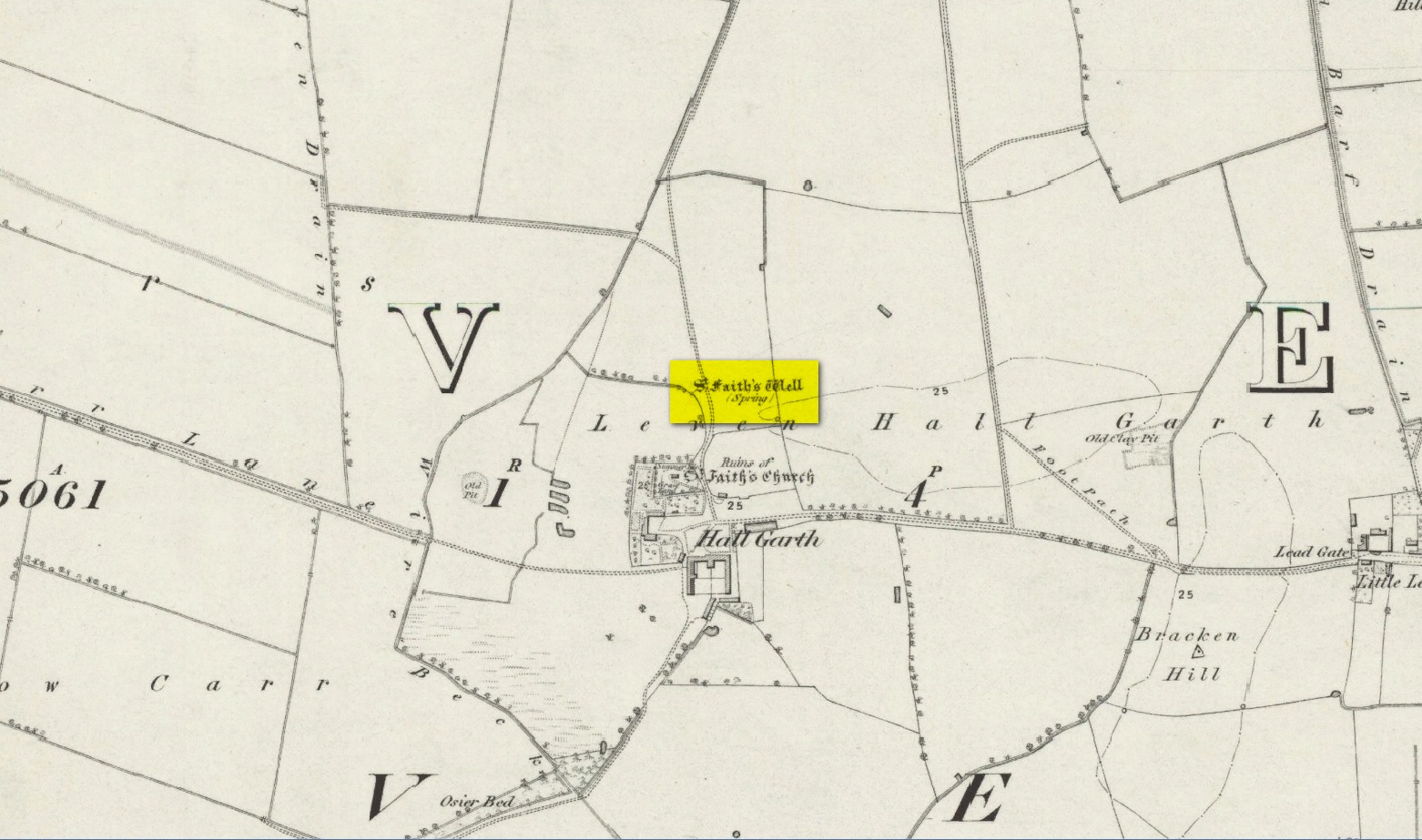
The site of the well is on the Carrs to the west of Leven village, immediately north of the old cemetery adjoining Hall Garth house. Reverend William Smith, writing in 1923, told us:
St Faiths Well on 1855 map
“St Faith’s Well lay on the left of the road known as St Faith’s Lane, which leads to the old churchyard to which the spring was near. St Faith belonged to France, and when quite a young maiden, was martyred because of her christianity. She lived and died in the third century….
“St Faith’s Well was filled in about a hundred years ago and the site lost. This, however, has lately been approximately fixed by the aid of water divining. A Leven man, who can wield the hazel wand, went over the ground near to which the well was thought to have been, and the wand indicated a spot under which, on digging to the depth of about three feet, “the water fairly bubbled up”, and it was judged this was the place where the well lay. St Faith’s Well is said to have given water both pure and abundant, and to have been in the old days the only supply of drinking water to the people of the Carrs.”
St Faith’s Saint’s day is the 6th October and she was a saint whose patronage was invoked by pilgrims, prisoners and soldiers. From this, is it perhaps reasonable to infer that St Faith’s Well may have been a station for pilgrims to the local shrines of St John of Beverley and St Philip Ingleberd at Keyingham? Also a stopping point for fugitives seeking sanctuary at Beverley?
There was another holy well dedicated to St Faith at Hexton in north Hertfordshire.
References:
Cox, J.Charles, The Sanctuaries & Sanctuary Seekers of Mediæval England, George Allen: London 1911.
Farmer, David H., Oxford Dictionary of Saints, Oxford University Press: Oxford 1987.
Smith, Rev. William, Ancient Springs & Streams of the East Riding of Yorkshire, A. Brown: Hull 1923.
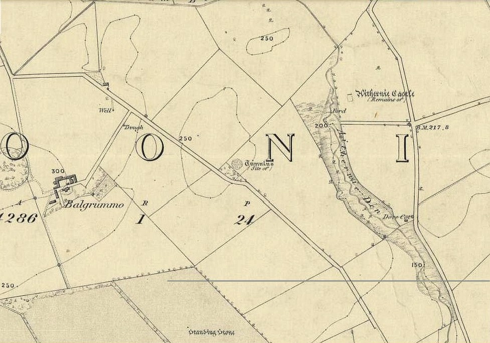
A mile or so WNW of the fantastic standing stones of Lundin, and just a coupla hundred yards above where the lesser standing stone of Balgrummo lives, we could once see an impressive prehistoric burial mound on the small hilltop of Aithernie. Sadly, like oh too many prehistoric sites in our landscape, it was vandalised and destroyed in the 19th century by the prevailing stupidity of the period. Thankfully we have a couple of accounts describing the place.
The site had already passed into memory when the Ordnance Survey fellas got up here in 1854, but an account of it was made in the ‘Object Name Book’ of the parish a decade earlier. Thankfully the story of the site was known locally and, along with the New Statistical Account describing the olde mound, A.S. Cunningham (1906) told the story of when it was “opened” and then of its subsequent demise. He wrote how,
“…in 1821 a much more interesting relic of antiquity…was opened in a field on the estate of Aithernie. When digging moulding sand for Leven Foundry, the workmen struck right into the heart of an ancient tumulus. This cemetery of prehistoric times contained as many as twenty rude stone cists. These cists were typical of the prehistoric burial places found throughout the country. They were constructed of slabs placed on edge, with a covering stone, and cemented with clay puddling. Above the coffins was a covering of stones, the stones having hundreds of years before been so firmly cemented together with clay and sand that the workmen required the aid of picks to enable them to “rifle the tombs.” Small urns were found in two of the coffins, and five of them contained larger urns, 14 inches in diameter and 24 inches in depth, and in another cist quantities of charred wood beads were discovered. All the coffins, except the five in which were the large urns, contained human bones, and innumerable bones were found outwith the mouths of the cists.”
When the Royal Commission (1933) lads visited the place in 1925, they reported “no existing indication of a tumulus” remained. Gone!
Royal Commission on the Ancient & Historical Monuments, Scotland, Inventory of Monuments and Constructions in the Counties of Fife, Kinross and Clackmannan, HMSO: Edinburgh 1933.