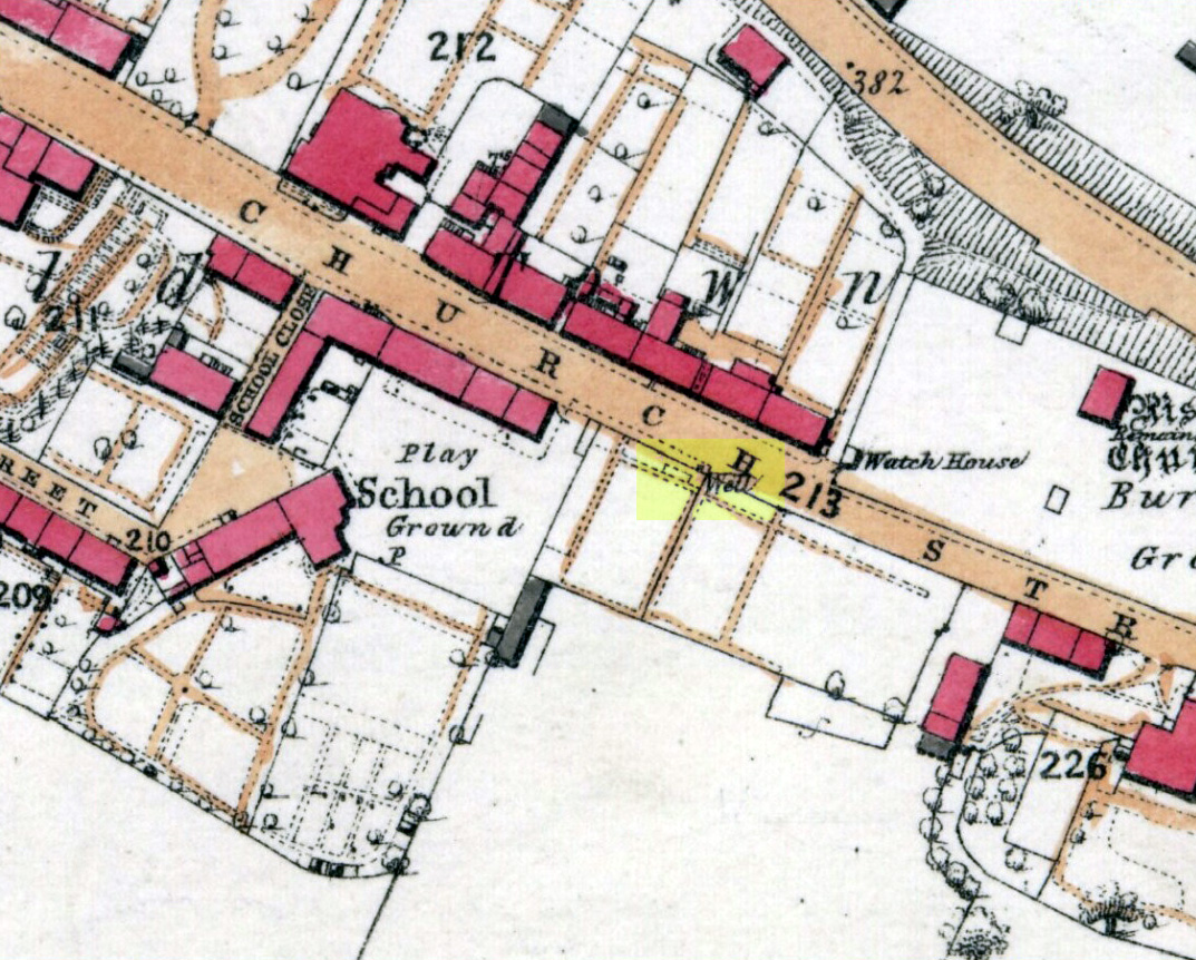
Get into the small town of Alloa, where the buses stand at Shillinghill. From here walk southwest down Mill Street, which runs into Bank Street. Keep your eyes peeled on your right-hand side, where outside one of the old municipal buildings you’ll see it standing upright.
Archaeology & History
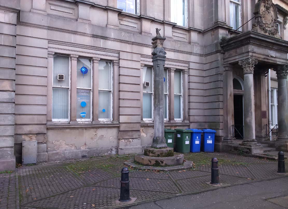
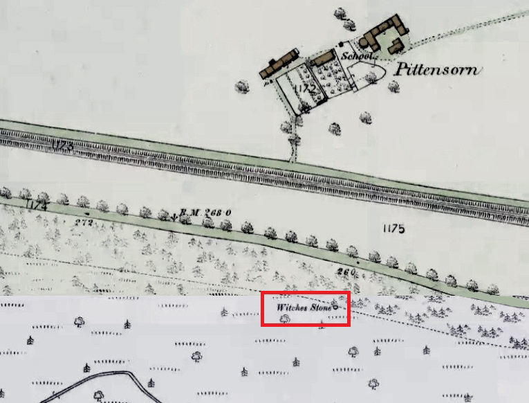
Although now standing against the old buildings halfway down Bank Street, Alloa’s Mercat or Burgh Cross was initially set up at the crossroads 162 yards (148m) away, where Mar Street meets Mill Street and Bank Street. It was moved to its present position sometime in the 1880s and knowledge of its early history is scant.
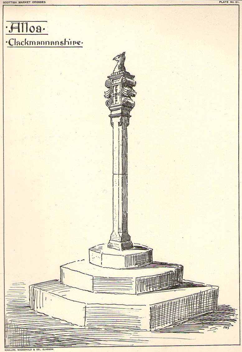
Standing some ten feet high, the monument was described in John Small’s (1900) rare magnum opus, in which he detailed the architectural features of the monument, telling us that,
John Small’s sketch
“The shaft, which rests on a base and three steps, is of the usual square section, with splayed angles, stoped at top and bottom, the top stop being rather peculiar.
The head of the Cross is composed of an oblong stone set upright, characteristic of the late type seen in Keikleour and Kinrossie. The oblong is ornamented at the sides with debased volutes and acanthus leaves, the whole crowned by a wreath from which rises a griffin’s head, part of the supporters of the Arms of the Lords of the Manor, Lord Mar and Kellie.”
References:
Anonymous, The Alloa Illustrated Family Almanac, MacGregor & Steedman: Alloa 1887.
Mair, Craig, Mercat Cross and Tolbooth, John Donald: Edinburgh 1988.
Royal Commission on the Ancient & Historical Monuments, Scotland, Inventory of Monuments and Constructions in the Counties of Fife, Kinross and Clackmannan, HMSO: Edinburgh 1933.
Small, John W., Scottish Market Crosses, Eneas Mackay: Stirling 1900.
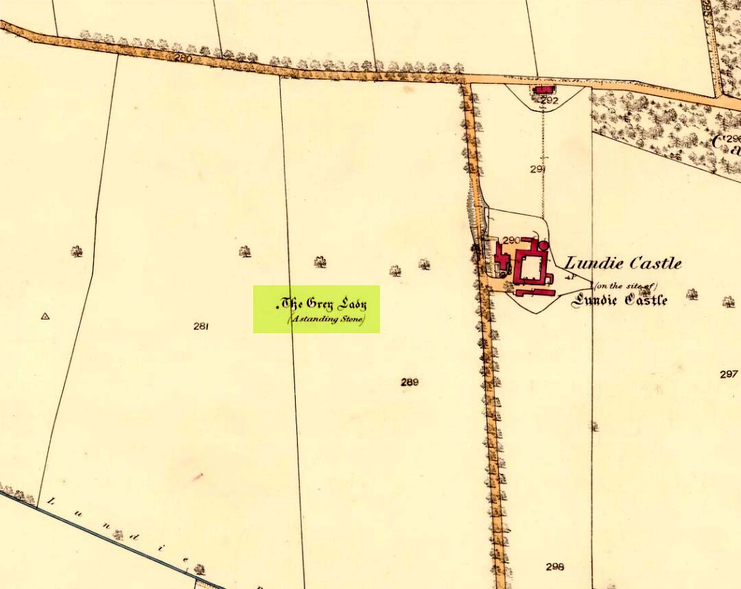
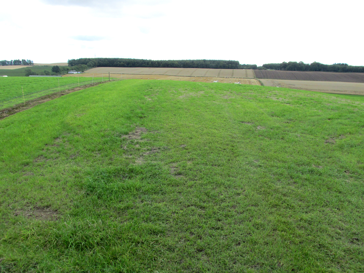
The site of the stone is on the top of a ridge due west of Lundie Castle and is best approached from the minor road between Lundie and Denhead, but at the time of my site visit a steel gate had been erected across the field just before the site of the stone together with a large festoon of electric fencing, which I did not cross.
Archaeology & History
The Grey Lady stood on the near grassy horizon
The Ordnance Survey name book describes the stone, the informants being Mr. Pattullo junior and Mr. Bett of Pitermo:
“This name is applied to a Standing Stone a little to the west of Lundie Castle. It is about 4 feet high, between two & three broad & rather a Kidney Shape. …Some think of druidical origin, but young Pattullo intends to blast it shortly“.
The rough grass probably marks where she stood.
And indeed it seems the feckless youth did have his wicked way with The Grey Lady, who had been a landmark for millennia, for she sadly no longer exists. In view of the folklore attaching to the stone, it may be worth speculating whether the kidney shape denoted a lunar symbolism for the stone.
Folklore
The OS name book states:
“The ladies of Lundie Castle have romance connected with it – that a white lady is to be seen walking round it on a certain night of every new moon.”
Reference:
Ordnance Survey Name Book; Forfarshire (Angus) volume 66 (1857-61)
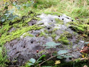
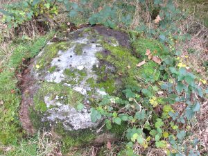
Park up at Murthly village, follow the farm road west, opposite the Kinclaven junction up to the cross roads, and turn right and go past Douglasfield Farm, following the road as it bends to the left; then through the metal gates and walk on until you come to an earth bridge over the ditch to your left. Cross the bridge and the low-lying Witches Stone is about 30 yards on to your left by the drainage ditch.
Archaeology & History
Not recorded on the Canmore online database, the Witches Stone is a low-lying, domed, earthfast rock bearing at least 12 cup marks. One cup mark has been drilled at some time in the past. Did the land owner do this as a preliminary to blowing it up with gunpowder? There is an interesting story relating to the origin of the cup marks, and it seems the name of the rock and its folklore may point to its ritual significance having passed down through oral tradition from the Bronze Age to historical times.
Folklore
The mid-nineteenth century Ordnance Survey Name Book has the following record, attested by Sir W.D. Stewart, Mr. T. Cameron & Mr. J. Cameron:-
Close-up of cupsBlackberries in cupmarks
“A small rock nearly level with the ordinary ground surface, underneath which it is traditionally held that a large sum of money is buried. In order to test the truth of this tradition, it is said that some years ago a man commenced to excavate the soil around the rock in order, if possible, to secure the hidden treasure, while so employed, a small dog suddenly appeared on the top of the rock and desired the man to desist, assuring him at the same time that the reputed treasure was really there, but it was never intended that the eye of mortal should behold it. There are some marks on the rock which the superstitious tell you are the prints of this very sagacious dog’s paws.”
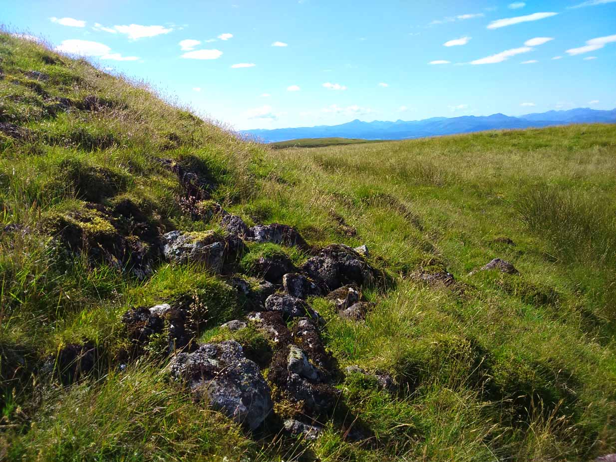
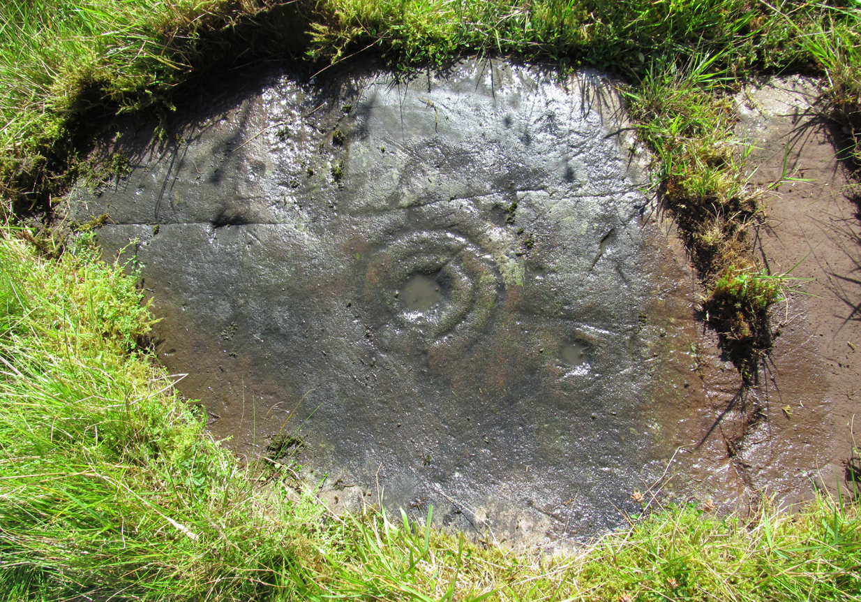
Along the A81 road from Port of Menteith to Aberfoyle, watch out for the small road in the trees running at an angle sharply uphill, nearly opposite Portend, up to Coldon and higher. Keep going, bearing right past Mondowie and stopping at the dirt-track 100 yards or so further up on the left. Walk up this dirt-track for ⅔ mile, and just before reaching the planted forestry, turn right along another dirt-track. Less than 200 yards along there’s a large sycamore tree, and about 20 yards below it (south) are several open flat rock surfaces. This is the most westerly of them.
Archaeology & History
…and again
On this small smooth rock surface we find an almost archetypal cup-and-ring stone, whose design consists of a double cup-and-ring and a faint cup-and-ring. The double-ring has several seemingly natural small fissures in the rock running at various angles into the central cup from the outside; and there are two faint ones running from the double-rings outwards to the cup-mark in the single-ring, framing the central cupmark in the middle. It may have been that these scratches on the rock gave rise to the position of the cupmark in this petroglyph. It’s difficult to see whether or not the single cup-and-ring was ever completed.
Canmore’s description of this petroglyph tells simply: “The larger of the two is 180mm in diameter and has two rings around a cup that is 70mm in diameter and 15mm deep. The smaller has one ring around a cup.”
Once you’ve seen this, have a look at the Over Glenny (6) carving, about 10 yards east of here.
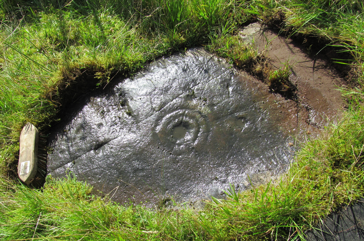
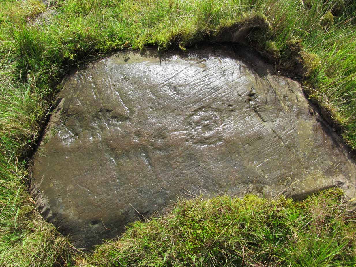
Along the A81 road from Port of Menteith to Aberfoyle, watch out for the small road in the trees running at an angle sharply uphill, nearly opposite Portend, up to Coldon and higher. Keep going, bearing right past Mondowie and stopping at the dirt-track 100 yards or so further up on the left (and ignore the english fuckers up here who might say “you’re not allowed to park here”, as Scottish government regulation allows you to do so unless you block the road). Walk up this dirt-track for ⅔ mile, and just before reaching the planted forestry, turn right along another dirt-track. Less than 200 yards along there’s a large sycamore tree, and about 20 yards below it (south) is the carving you’re looking for.
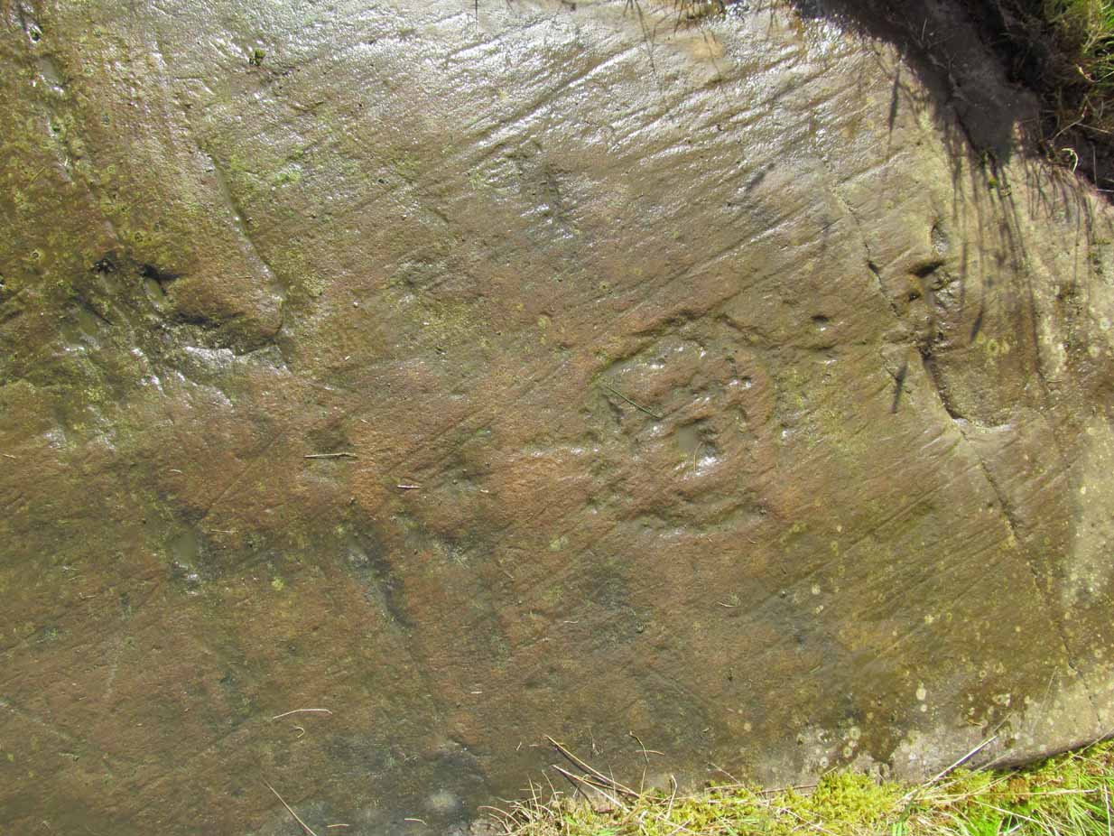
Archaeology & History
It’s difficult keeping up with the carvings in this region to the north of the Lake of Menteith, as we find new unrecorded ones on every visit, maintaining the tradition of fellow rock art students Maarten van Hoek, Kaledon Naddair, George Currie, Jan Broewer and the rest—and we know that there’s more of them hidden away. This one doesn’t seem to be in the Canmore listings, but I put that down to the fact that they’ve got a grid-reference wrong somewhere, as it’s pretty plain to see. Although, to be honest, in the rather vague descriptions of other adjacent carvings (Over Glenny 5 and 7), this carving is in-between them, so you’d expect it to be listed. Anyway, that aside…
Looking down at the ringsClose-up of faint rings
This long flat exposed rock surface has two primary cup-and-rings upon it: one cup with a double-ring, and the other standard cup-and-ring; there are also two single cup-markings on the stone: one near the middle of the rock and the other on its lower-right side. The main element is the double-cup-and-ring, which appears to be incomplete—not only in terms of its design, but also, as you can see in the photos, seems unfinished. From the central double-ring, a faint carved line runs out from the centre and into the other faint, incomplete, single cup-and-ring.
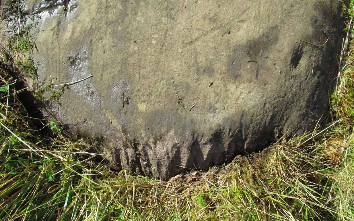
Series of metal-sharpening groovesArty-farty sketch of the design
At the bottom of the stone (as with several others hereby) a curious set of deep scars have been cut into the edge of the rock. They’re unmistakable when you see them. They have probably been created by metal artifacts being sharpened along the bottom of the rock—many many times by the look of it. These deep cuts reminded me of the more famous Polisher Stone, down Avebury-way. They may be explained by the fact that, several centuries ago, a battle occurred here and some of the men gathered in the area before the attack. It would seem as if this and the other cup-and-ring stones were used to sharpen their blades before going into battle. Whether this was done because of some local lore which imbued these stones with some sort of magick, we do not know. Folklore here seems curiously scarce (english incomers destroyed local traditions, as writers were telling us in the 19th century), apart from the well-known one of the area being rife with fairies: Robert Kirk’s famous The Secret Commonwealth of Elves, Fauns and Faeries (1691) was written three miles west of here, at Aberfoyle.
This is the first detailed guide ever written on the holy wells and healing springs in and around the ancient city of Edinburgh, Scotland. Written in a simple A-Z gazetteer style, nearly 70 individual sites are described, each with their grid-reference location, history, folklore and medicinal properties where known. Although a number them have long since fallen prey to the expanse of Industrialism, many sites can still be visited by the modern historian, pilgrim, christian, pagan or tourist.
The book opens with two introductory chapters: the first explores the origin and nature of holy wells and what they meant to local people in earlier centuries; and the next is a comparative overview of water cults worldwide. It is an invaluable guide for any student or tourist who wants to look beneath the modern history of the city and get a taste of the more archaic customs that once belonged here…
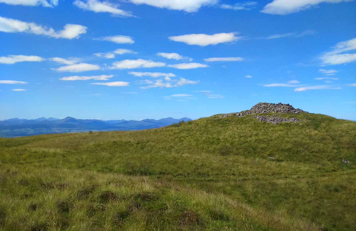
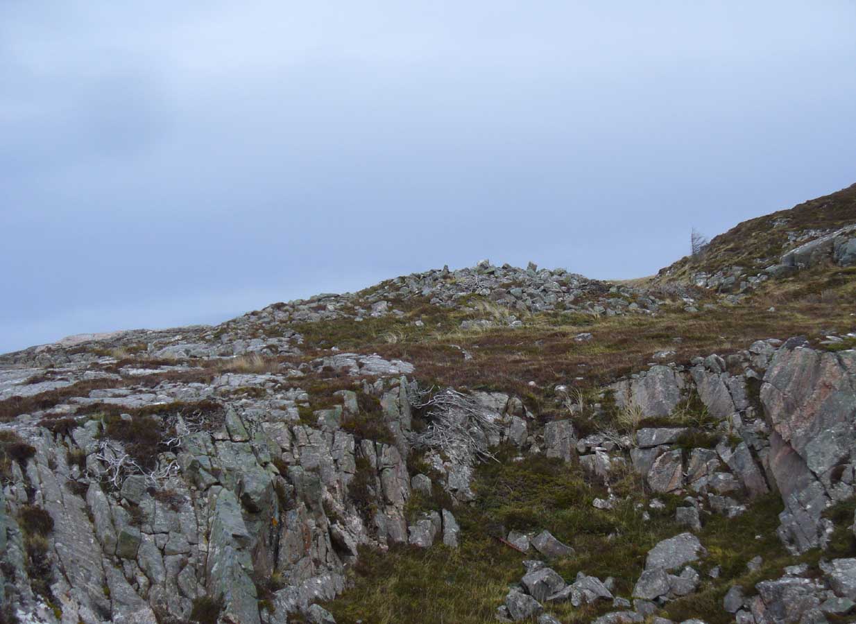
The quickest way here is still a long one. From Gargunnock village, take the road west towards the A811, turning left just before the bend down to the main road, and up through what looks like private estate gates. Walk all the way along this road as if you’re visiting the Leckie broch and its carvings, but keep going, until it becomes a track. Continue into the woods, uphill and out the other side until you have the Gargunnock cliffs rising a few hundred yards ahead of you. On your right a few yards up is a long straight length of walling running to the first set of cliffs. Go up it and up the next rise and the next. When you’re on top of the moors, look for the highest spot close by. You can’t miss it!
Archaeology & History
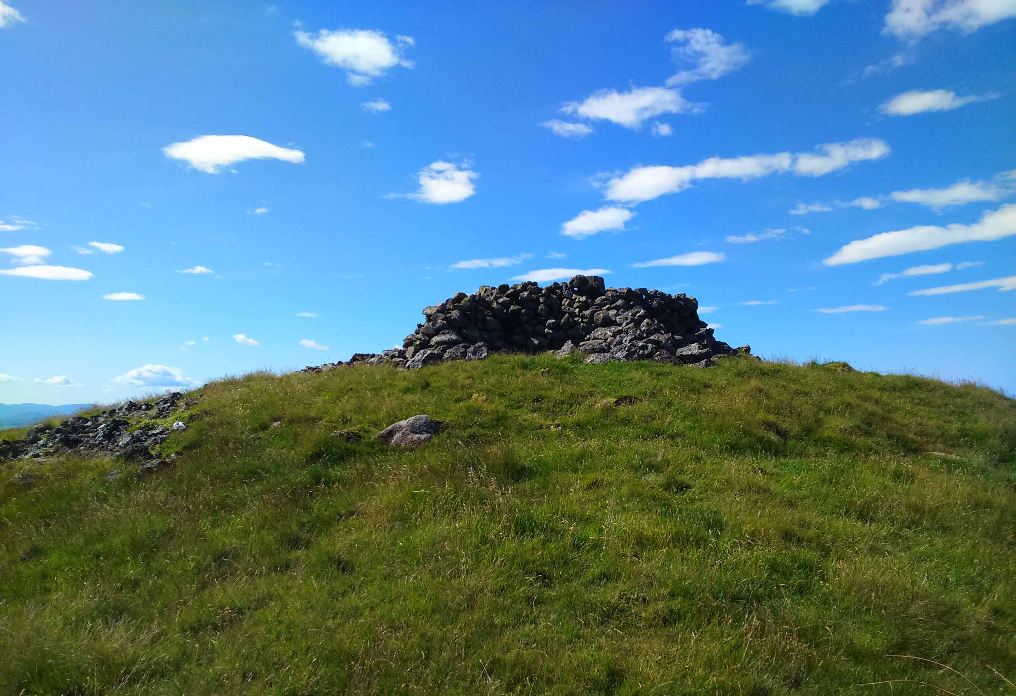
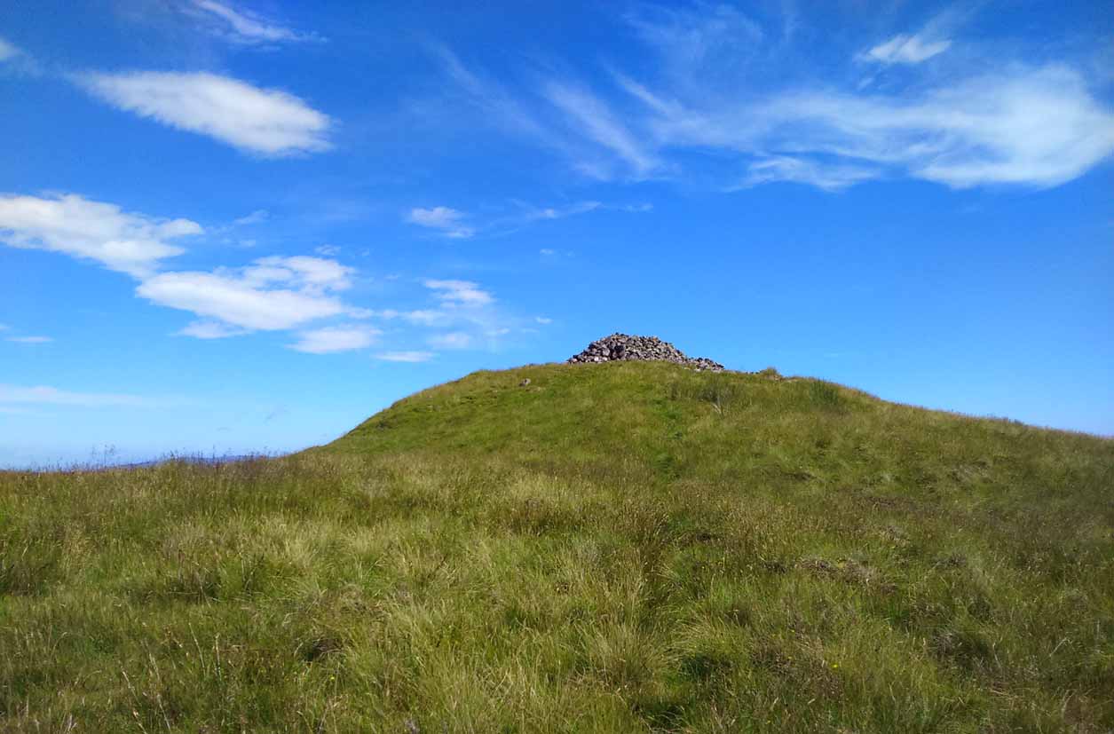
Cairn-edge, looking NW
Nearly 1600 feet above sea level, this seemingly isolated giant cairn sits on the highest point of the Gargunnock Hills, giving a truly fantastic 360º view, looking across a diameter of perhaps 100 miles on a clear day—which is what I was greeted with when I visited. Giant cairns scatter hilltops all across the British Isles, many of them peopled with creation myths of giants, devils and thoroughly animistic creatures! But I can find no such tales here… Equal lackings are in the archaeological texts which, it seems, only catalogued the site in recent years.
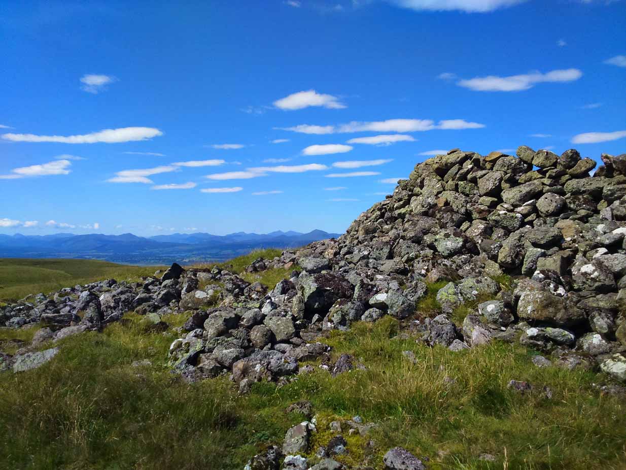
Caerlatheron, looking SE
The name of the site is intriguing. The element caer is a fort, but no such ‘fort’ seems to be here. But we’ll come back to that shortly. The element latheron and its variants apparently relates to a mire or swamp (Watson 1926), whose existence to the immediate south and west is considerable (a small loch was once hereby, but its size has decreased over the last 150 years), and it is very boggy across the tops here. When I visited, it was a scorching day (I was fucked by the time I got here!), but in many places the ground was very dangerous to walk over. It was superb! So it seems that the place-name indicates Caerlatheron was ‘the fort by the swamp’. It works perfectly, except that this is listed as a cairn – and it’s a large one at that!
Note the overgrown raised embankment (lower centre)
The cairn sites on top of a large mound. This mound seems to be artificial and is between 10-12 feet high. The cairn and mass of rocks on top of the mound (within which is a triangulation pillar) is itself 4-5 feet high—although much of this relates to Ordnance Survey and walkers piling up many of the loose stones to create an enclosure or wind-break to protect any traveller up here in stormy weather. The cairn-pile is 20 yards across at the top, and as you walk around it you become aware that this appears to be slightly raised on top of its parent mound with an evident ’embankment’, particularly on the eastern side. As you follow this round, you lose sight of it completely on the southern edges, which is covered by the extended cairn-mass; but some of it seems in evidence on the northwest and northern side. A number of stones marking this out would seeeem to be in evidence. A few larger flat stones on the south and western top of the cairn might suggest that it was once a chambered cairn – but this is highly speculative. The late great Audrey Henshall never got here; and I don’t know whether the great local archaeologist, Miss Christian MacLagan, ever got her fingers here either, so we don’t have their expertise to help us out.
Caerlatheron, looking ECairn-mass of the huge mound
The mound upon which the ‘cairn’ sits is also intriguing. When walking round and around the bottom of it, you note the unmistakable substantial mass of overgrown rocks, particularly around from the northwest, to north, to northeast, both on the slopes and at the bottom, seeming to imply that the entire mound is artificial. I kept walking up and down and around it, to see if these had simply fallen from the top, but wasn’t 100% sure and wished there was a geologist at hand to tell me, one way or the other. In truth, the shape of the mound from the bottom, from most angles, reminded me of an overgrown broch and not a cairn. And there are a few brochs nearby—the closest of which is just at the bottom of the hill from here: the Leckie broch (I aint done the site profile for it yet, soz….). It was only when I got home and looked for the meaning of Caerlatheron that the ‘broch’ idea came back to me with a little more fortitude, perhaps making sense of it as a ‘fortified structure by the bogs and swamps’. Perhaps… Without an excavation, we may never know for sure.
Singular cairn, 350yd NNW
About 350 yards northwest, across truly dodgy swampy ground (walk up here at night and it’ll probably be the last thing you ever do!) is another small singular cairn, made up of quite large rocks, with a few smaller ones filling it up. It looks to be either a shepherd’s cairn, or one for his sheepdog perhaps, a few centuries old. I can find nothing about it in any local history or record-books.
The place is well worth visiting—but it’s a full day out and you’ll be knackered when you get back. However, from here Nature grants us a stunning view of these tiny parts of Her body. It’s well worth the effort!
References:
Watson, W.J., Celtic Placenames of Scotland, William Blackwood 1926.
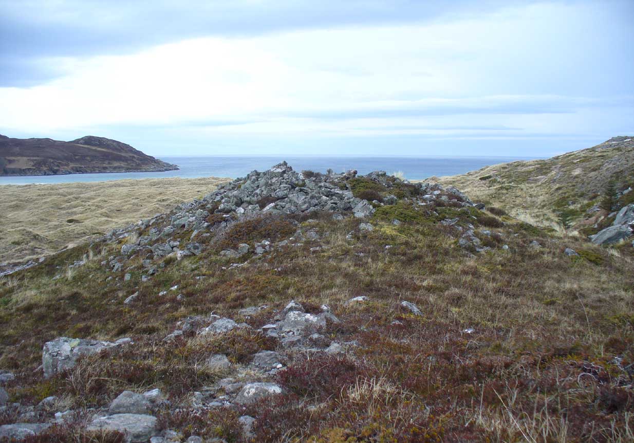
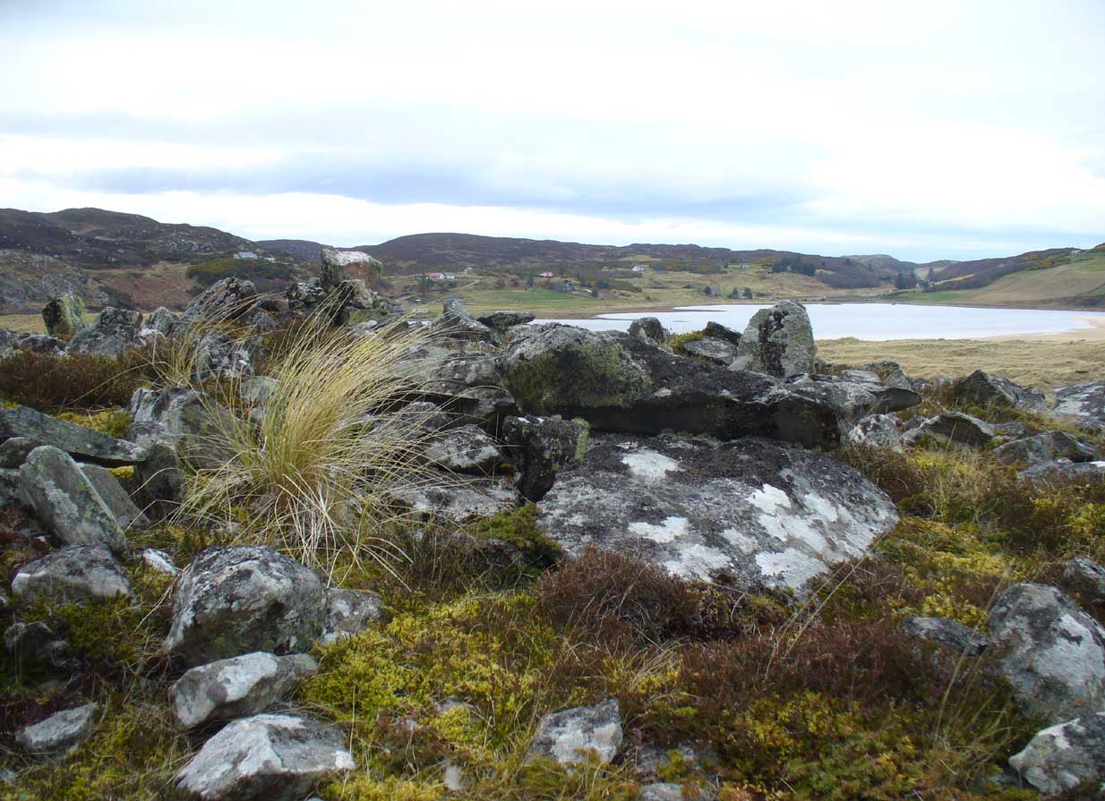
Along the A836 road between Bettyhill and Tongue, keep your eyes peeled for the turning down to Borgie and Skerray. Go along here for 1.8 miles (2.9km) until, just past a tiny road on your left, a small parking spot with a tourist board is by the roadside. Walk down hill and over the River Borgie below and follow the footpath round until your reach the edge of Torrisdale Beach. From here, walk right, uphill, across overgrown sand-dunes to the stone escarpment 400 yards or so to the east. A large scattered mass of rocks on top of one of the first rocky knolls is what you’re looking for. You can’t really miss it.
Archaeology & History
Dun Riaskidh, looking north
This is worth the journey for the scenery of Torrisdale Bay alone: one of the most beautiful places in all Scotland. …Not far from the legendary Ringstone and the carving above, this collapsed mass of scattered rocks was said, in local lore, to have been the remains of an old broch—or that’s what Hew Morrison told the Royal Commission (1911) lads about it when they surveyed the area more than a century back. Their description was short:
“About ½-mile E of the footbridge across the River Borgie, near Torrisdail, and on the W. side of Druim a’ Chleibh, are the remains of a broch. No outlines of walls are visible. The site is indicated by a structureless heap of stones.”
It seems at first to be in an unusual position for a chambered cairn: built onto solid rock instead of soil. Yet we find this geocentric structuralism echoed at the Borgie chambered tomb 1½ miles to the southeast. When you reach the place, a large mass of stones—hundreds of them piled-up several feet high—is strewn across the rocky surface and reaching onto more typical moorland ground. On top are a number of large stones, some laid down, some half-upright appearing, perhaps, to have played some part in an internal cist or chamber. On the eastern side the rocky mass falls down a natural steep slope, with many of the fallen stones covered by centuries of vegetation. As you walk around it, cairn-scatter seems to extend southwards towards another natural rocky knoll 20 yards to the south, giving the impression of a second cairn (much like the Fiscary 1 and 2 cairns 2.8 miles to the east), but this is improbable.
The first detailed archaeological account of the site was by Audrey Henshall (1972), who told us:
“…The cairn is about 4ft high, consisting of a mass of angular stones. On the S side the edge can be traced, and the indications are that the diameter was about 57ft. The edge on the N side is rather vague and may have been flattened in plan. On the E and W sides, where there are steep drops, the stones have evidently spread downhill, though on the E side parts of a roughly built edging can be seen.
“Many large slabs lie about the site, probably mainly displaced corbels and roofing stones. Much of the chamber structure probably exists, and a few visible orthostats are probably in situ. The entrance has probably been from the N or seaward side. A slab towards the S side, aligned E-W, projects 1ft 6in, and is likely to be the back-slab. The E side of the chamber is represented by a slab 4ft 6in to the N, aligned N-S, which is just visible. On the W side of the chamber there are a number of large slabs, one over the other wide their E edges aligned vertically, and laid declining to the W, which appear to be corbel stones only slightly displaced. To the N of them, a stone set transversely to the axis of the chamber, 10ft 3in N of the back-slab, might be a portal stone. Another upright stone seemingly firmly set but obstructing the probable position of the entry into the chamber, is presumably displaced.”
More than twenty years later however, Miss Henshall (1995) revisited Dun Riaskidh and altered her initial diagnosis of it as a chambered cairn, suggesting it to be something completely different, telling:
“The cairn-like structure…has an overall spread of about 17m including stone displaced downhill, and a height of 1.6m on the S side. On the summit a group of upright slabs protrudes up to 0.35m, and forms a rough oval 5.5m E to W, by 4.5m N to S. They seem to be on the inner side of a ring of stony material about 2.5m thick. In the interior is a disorganised mass of lintel slabs and three earthfast upright slabs. The structure appears to be a house with spaced uprights in the inner face of the wall, and with a series of uprights which helped to support a partly lintelled roof. A hollow on the N or seaward side probably indicates the position of the entrance.”
Top of the cairn, looking W
Now woe am I to go against the words of a giant like Miss Henshall, but having slept in numerous derelict houses and seen countless numbers of them in the hills, this structure does not seem to have such properties. The category that is continued by Canmore and Ordnance Survey re Dun Riaskidh is still a “chambered cairn”; but, perhaps, if Miss Henshall is correct in saying that it is not a cairn, then maybe the words of local tradition may have been right all along (again!) and this is a collapsed broch? Who knows for sure…?
Whatever its original nature and function, this vestige of antiquity is enveloped within another one of Nature’s incredible domains…
References:
Henshall, Audrey S., The Chambered Tombs of Scotland – volume 2, Edinburgh University Press 1972.
Henshall, Audrey S. & Ritchie, J.N.G., The Chambered Cairns of Sutherland, Edinburgh University Press 1995.
Mercer, R.J. & Howell, J.M., Archaeological Field Survey in Northern Scotland – volume 2, University of Edinburgh 1981.
Royal Commission on Ancient & Historical Monuments, Scotland, Inventory of Monuments and Constructions in the County of Sutherland. HMSO: Edinburgh 1911.
Acknowledgments: Huge thanks to Donna Murray, for putting me up in this part of Paradise. Cheers Donna.
A singular reference to this site appears in James Horsburgh’s (1870) early article on the prehistoric remains of Sutherland. It seems he was on an early road-trip (or dirt-track-trip as it would have been in those days, as there were no real ‘roads’) and as his journey took him along the remote tracks in the far North, visiting places that are still intact and mentioning those which, oral tradition told, had passed into memory, local folk told him about a couple of brochs that had recently met their demise. This was one of them. He wrote:
“Between Farr and Tongue, after crossing the Naver Ferry… some miles on, near Borgie-farm house, there was a Pictish tower, now demolished, and on the side of the old road to Tongue, another.”
In asking the lady who lives here if she knew anything about the broch, she told that although she didn’t, she’d ask some old locals to see if they knew of any folk remnants about the place. It would have stood a short distance above the little-known Borgie souterrain. If we receive any additional info, the site-profile will be updated. (the grid-reference for this broch is an approximation)
Healing Well (destroyed): OS Grid Reference – NT 49384 35696
Archaeology & History
Probable site of the Well
An all-but-forgotten well that was said to be named after a local forester and ranger in the 18th century—called Willie Bold, obviously. It was located a few steps away from the main hunting lodge in the village, known locally as the Hunter’s Ha’ (also long since gone), from which an ancient pathway ran up to the local Toothill. The Well was described in Robert Hall’s (1898) definitive history of Galashiels, albeit in the past tense, even in his day:
“Willie Bold’s well was about ten yards distant from the east end of the peel, the road which led to it being about four feet wide and fenced on both sides with a high stone wall. The well was circular and about three feet deep, but in order to reach the water, it was necessary to go down two steps. Here the village children of a past generation quenched their thirst, lifting the water with a “tinnie,” which was always returned to Willie’s house, where it remained till again required.”
In 1863, the first OS-map of the area highlights a ‘Well’ very close to the position cited by Mr Hall, which we presume must be the Well in question. .


 This is the first detailed guide ever written on the holy wells and healing springs in and around the ancient city of Edinburgh, Scotland. Written in a simple A-Z gazetteer style, nearly 70 individual sites are described, each with their grid-reference location, history, folklore and medicinal properties where known. Although a number them have long since fallen prey to the expanse of Industrialism, many sites can still be visited by the modern historian, pilgrim, christian, pagan or tourist.