Whin Well, Stirling, Stirlingshire

Healing Well (lost):  OS Grid Reference – NS 7934 9412

Whin Well on 1858 map

Archaeology & History

Shown on the 1858 map of the city, this ‘Well of the Gorse’ (from the old folk-name ‘whin’, or Ulex Europareus) on the northern side of the old town, about 300 yards east of Stirling Castle, has long since gone.  An old cottage of the same name was once to be found at the end of the appropriately named Whinwell Road, which also preserves its memory.  Although the folklore of the site has seemingly been forgotten, it may be that the waters here had medicinal qualities akin to those given by the plant – i.e., jaundice, intestinal problems and to strengthen the heart. (see Mrs Grieve’s Modern Herbal)

© Paul BennettThe Northern Antiquarian


Salachary Stones, Kilmartin, Argyll

Standing Stones:  OS Grid Reference – NM 8405 0403

Also Known as:

  1. Canmore ID 22831

Getting Here

Two of the Salachary stones

Roughly halfway between the staggering standing stone at Kintraw and the farmhouse of Salachary a coupla miles east along the A816 road to Kilmartin, a small overgrown car park nearly hides on the south-side of the road, just below the forestry.  50 yards west of this, a small track winds uphill.  650 yards (0.6km) up here, once it levels out, a hairpin in the track veers NW; ignore it, instead walking into the marshy grass in front of you (south) for 50-60 yards up and round the small rocky crag.  Once you get round the edge of this, immediately east, you’ll see one of the tall monoliths 50 yards ahead of you.

Archaeology & History

Rediscovered in recent times by Marion Campbell (1962), this damaged row of three tall standing stones is cited in Swarbrick’s (2012) poorly-arranged survey as being “difficult to find in broken ground”; although patience brings the stones clearly into sight for any explorer.   They’re big too!  Sadly only one of them still remains fully upright—but that one’s nearly 9 feet tall!

In Miss Campbell’s initial description of the site, following their rediscovery, she told how,

“A chance sighting led to the discovery of a group of three monoliths, one erect, one sloping and one prostrate, on the West side of a wide glen leading S from the upper part of the Bealach Mor; the site commands a fine view into the northern hills. The spot is about 550ft above sea level and this is therefore the highest group of standing stones so far recorded in the area.

“The erect stone is 8ft 4in x 2ft x 1 ft, lozenge-shaped in section, with a pointed top. The leaning stone, also lozenge-shaped, is 10ft x 1ft 8in x 1ft, and pointed. The fallen stone is over 11ft x 2ft wide, too deeply buried in turf for the thickness to he measured. The stones appear to have stood in line, the nearest points of the first and third stones 9ft apart and the line joining them running north and south.  Along a ridge running S behind the stones are a number of small ruins, oval and rectangular, in old cultivations. No surviving placename has been recovered for the site so far.”

Section of the fallen stone
Looking west

Indeed, no subsequent investigation has led to either an early name nor any traditions about the site, and the stones cannot be found on any early maps of the area.  A pity, as they’re quite impressive stones and would have had some old stories known of them in ages gone by.

Twenty years after Miss Campbell’s discovery, in May 1982, the stones were visited and surveyed by the Royal Commission lads.  Their description very much tallied with Miss Campbell’s, but it’s worth citing anyway.  They told us that:

“On a terrace on the W side of an unnamed valley to the S of Bealach Mor and about 850m SW of Salachary, there is a setting of three large standing stones which is aligned from N to S.  Only the N stone is still upright; it measures 0.7m by 0.72m at the base and rises with straight sides to a pointed top at a height of 2.75m.  The central stone is of similar proportions, but it now leans to the NE at an angle of about 15° to the horizontal.  The S stone, which measures 3.4m by 0.65m has fallen with its top to the SE.”

Royal Commission plan
Alexander Thom’s plan

Around the same time, Clive Ruggles (1984) assessed the Salachary stones for any potential astronomical alignments and found—as Alexander Thom & Aubrey Burl did in their own survey (1990)—that as they pointed virtually north-south they stood beyond any solar or lunar functions.  Thom found the stones align almost perfectly north-south, with a notch in the southern horizon at 178°, and on the northern horizon the hilltop of Meall Reamhar at 2° west of north.  This northern line may relate to the airt of death, although no other immediate archaeological remains have been found to fortify this idea (however, other unrecorded standing stones are close by and their relationship with Salachary has yet to be adequately assessed).

Aubrey Burl’s first description of this stone row told us:

“There are three stones in a N-S row situated on a terrace on the W side of a glen.  The N stone, with a pointed top, stands 8ft 4 (2.5m) high.  The central stone leans dramatically at 20°.  It is 10ft (3m) in length.  The S stone is prostrate and half-buried.  It is 11ft (3.4m) long.  The row is about 13ft (4m) long.  From the site there is a fine view of the northern hills.”

Looking north

In truth, the main north-south axis relates to the more open geological avenue of the landscape.  Both the east and west are all but blocked by crags and hills, and the stones seem to have been positioned to echo the hollowed section of the landscape.  The land runs in curious geological folds and has a distinct genius loci which I enjoyed in differing (usually wet) conditions when I used to live nearby.  The site is well worth a walkabout if you’re in the area – and there are more unrecorded stones still hiding in Nature’s rocky folds nearby.

References:

  1. Burl, Aubrey, From Carnac to Callanish, Yale University Press 1993.
  2. Campbell, M. & Sandeman, M., “Mid Argyll: An Archaeological Survey,” in Proceedings Society Antiquaries Scotland, volume 95, 1964.
  3. Campbell, Marian, Salachary, Kintraw’, in Discovery & Excavation Scotland, 1962.
  4. Ferguson, Lesley, “A Catalogue of the Alexander Thom Archive Held in the National Monuments Record of Scotland,” in Records in Stone (ed. C. Ruggles), Cambridge University Press 1988.
  5. Royal Commission on the Ancient & Historical Monuments of Scotland, Argyll – volume 6: Mid-Argyll and Cowal, HMSO: Edinburgh 1988.
  6. Ruggles, Clive L.N., Megalithic Astronomy, BAR: Oxford 1984.
  7. Ruggles, Clive L.N., “The Stone Alignments of Argyll,” in Records in Stone (ed. C. Ruggles), Cambridge University Press 1988.
  8. Swarbrick, Olaf, A Gazetteer of Prehistoric Standing Stones in Great Britain, BAR: Oxford 2012.
  9. Thom, A., Thom, A.S. & Burl, Aubrey, Stone Rows and Standing Stones – volume 1, BAR: Oxford 1990.
  10. Weston, Garth, Monuments and Mountains, Ashridge: Bakewell 2007.

Acknowledgements:  This site profile could not have been written without the help and of Nina Harris, Paul Hornby, Frank Mercer and Belinda Sales.

© Paul BennettThe Northern Antiquarian


Murrayshall, Scone, Perthshire

Standing Stone:  OS Grid Reference – NO 15200 26263

Also Known as:

  1. Balgarvie (Swarbrick)
  2. Canmore ID 28135
  3. Mill of Bonhard

Getting Here

Murrayshall standing stone

On the main road (A94) through Scone, go east along either Murrayshall Road or Bonhard Road for a short distance until you go out of the town and into the countryside. About ⅓-mile (0.5km) along the country lane, go left at the road junction; and just another ¼-mile on, notice the field-gate on your left.  As you’ll see, the standing stone is just over 100 yards away in that field.

Archaeology & History

Murrayshall on 1867 map

In a region littered with megaliths, this fine upright single stone stands, quite deliberately, at a point in the field where you have excellent 360° views, which to the north looks way into the orgasm of the Scottish mountains.  History and tradition seem to tell it has always been a loner, without companions, but no archaeological excavation has taken place here to my knowledge; and the apparent proximity of some type of prehistoric ring-ditch 30 yards away may be related to the stone.  But we don’t for sure…

Close-up of cupmark

North-face with cupmark

Despite being shown on the first OS-map of the region in 1867 and despite being a large monolith more than 6 feet tall, very little seems to have been said of it.  It was included in Swarbrick’s (2012) poorly arranged survey; and the Royal Commission (1994) merely listed it, without comment, other than to say “it bears no markings.”  Yet when Paul Hornby and I visited the place recently, a large single cup-mark is plain to see on the north-face of the stone.

Although the stone is alone in this field, once you start exploring the hills a short distance to the south and the farmed fields heading north and east, masses of prehistoric sites begin to appear.  It’s well worth checking out!

References:

  1. Royal Commission on the Ancient & Historical Monuments of Scotland, South-East Perth: An Archaeological Landscape, HMSO: Edinburgh 1994.
  2. Swarbrick, Olaf, A Gazetteer of Prehistoric Standing Stones in Great Britain, BAR: Oxford 2012.

Acknowledgements:  Huge thanks as always to Paul Hornby for getting us to this site.  Plus, accreditation of early OS-map usage is reproduced with the permission of the National Library of Scotland.

© Paul BennettThe Northern Antiquarian


Montalt, Dunning, Perthshire

Cup-Marked Stone:  OS Grid Reference – NO 06 13

Also Known as:

  1. Canmore ID 26675
  2. Mount Alt Farm

Archaeology & History

Montalt’s curious cup-marked stone

This is a curious stone and may not be the type of ‘cup-marked’ rock we’re used to.  Maybe… It is presently housed in Stirling’s Smith Art Gallery & Museum, where a small note tells that is was originally found “on the top of the Ochils, near Mount Alt Farm, Path of Condie in 1893.”  The stone was found at the same time, and adjacent to, a prehistoric collared urn—which implies it had an association with a cairn or cist, or burial site of some sort (which isn’t uncommon).  However, the exact location of its original whereabouts has been forgotten.

Broken off from a larger piece of stone, the remaining piece of rock has six cup-markings cut into it, between one and three inches across.  The smallest cup is what we might call a ‘normal’ size, but the rest of them get increasingly large and may have been more functional than purely mythic in nature.  In a small note attached to the stone in the Museum, they add the interesting note that,

“There are…indications that in some places they may be related to transhumance: the practice of moving sheep, cattle and goats to higher pastures in the summer, where they may have been used to mark routes or sources of water.”

They may indeed – amongst a variety of other things too.  But the suggested relationship with cattle occurs in stones found near Haworth, West Yorkshire, where large man-affected carved ‘cups’ such as the ones here, were known to be filled with milk at specific times of Nature’s calendrical rhythms, for the spirits of the place to give good fortune to the farmer and local people.  We know of one instance where this practice still occurs and goes back generations in the same family.  Examples of this animistic practice have also been found in the Scottish Highlands.

© Paul BennettThe Northern Antiquarian


Meikle Findowie, Little Dunkeld, Perthshire

Standing Stone:  OS Grid Reference – NN 96105 39143

Also Known as:

  1. Canmore ID 86434

Getting Here

Meikle Findowie stone

Along the A822 road between Dunkeld and Milton, 4.7 miles (7.6km) west of the A9, turn left down the track signposted ‘Meikle Findowie’.  About 700 yards along the track you’ll reach a modernised farmhouse and here, on your left, a track takes you eastwards (left).  Go along here for about 100 yards until, just before the modernised house on your right (it was just a pile of ruins when we came here), you’ll see the standing stone in front of it.

Archaeology & History

Looking westwards

Beside the old trackway that runs east-west past Meikle Findowie, above the ancient flood-plain of the breathing River Braan, a solitary stone lives by the more modern shadow of old sheep-folds.  Tis a quiet little fella, less than 5 feet tall, that you could almost pass as a forgotten gatepost if you chattered when walking by. But it’s much more ancient than any old gate…

It nestles below the old hill of Airlich, with its beautiful stone circle and huge ancient enclosures higher up: a chunky old stone with no carvings or other human marks upon it.   Tis a site site worth visiting before heading uphill, to the megalithic ring of enchantment.

Acknowledgements:  Huge thanks as always to Paul Hornby for getting us to this site.

© Paul BennettThe Northern Antiquarian


Drumend, Easter Rattray, Perthshire

Stone Circle (ruins):  OS Grid Reference – NO 20175 45825

Also Known as:

  1. Canmore ID 30760
  2. Old Rattray

Getting Here

The stone from the south

Just less than a mile east of Blairgowrie, the site is situated about 200 yards along a farm track that runs north from the A926 Rattray – Alyth Road.  This road is narrow with a lot of bends and very busy, with no safe parking places.  It is best to walk from Rattray, the stone will be seen in the field just east of Drumend Farm.

Archaeology & History

There is one stone here that survives from a megalithic ring that was progressively destroyed some time between the publication of the 1792 Old Statistical Account and the publication of the 1867 OS map.  Reverend James Smith, writing in the 1792 Statistical Account, told us:

“Above the river, SE from the village, in a beautiful situation, is a Druidical temple, much defaced, and many of the stones carried off. The farm upon which it has been built, is called Standing Stones.”

Reverend William Herdman wrote patronisingly in the 1845 New Statistical Account:

“If large graystones be entitled to the appellation of antiquities, or are any indication of the religious worship of our ancestors, a few of these appear in a field, thence called Standing Stanes, which are supposed to be the ruins of a Druidical Temple.”

Many years later, in the first few years of the 20th century, the great northern antiquarian and megalith writer, Fred Coles, visited the site and gave this description in 1909:

“Standing Stone on the Farm of Standing Stone, Old Rattray.  [A] monolith attracts our notice, in a field on the north of the main road, one mile and a quarter east of the middle of Old Rattray village. The height above sea-level is 270 feet. This monolith …[has a] mineralogical composition …more analogous to the quartziferous schists so frequently found in the vicinity.

The top is smooth, with an inclination towards the south-east, and the whole mass is squarish and pillar-like. It is set up with the longer axis N.E. 50° and S.W. 50°. The highest point is 5 feet 1 inch above ground, the basal girth 8 feet, but rather more than mid-way up it increases to 10 feet 4 inches.

In this lower-lying district, comprising an area of about 35 square miles, the megalithic remains are extremely sparse. Agricultural operations, doubtless, have swept away some monoliths, and possibly also whole circles of stones; but at any rate it is somewhat significant that only four Standing Stones are now left, and that there is no record on the maps of any other variety of sepulchral structure.”

This brave survivor has a commanding position over the valley of the River Ericht, and again we can only lament the loss of its companions, but be thankful it too didn’t fall prey to ‘agricultural improvements’ or religious bigotry.

References:

  1. Smith, Rev.James, Old Statistical Account, Perthshire, Parish of Rattray, 1792. #
  2. Herdman, Rev. William, New Statistical Account, Perthshire, Parish of Rattray, 1845.
  3. Coles F.R., ‘Report on stone circles surveyed in Perthshire (South-East District), with measured plans and drawings; obtained under the Gunning Fellowship’, Proc. Soc. Antiq. Scot., vol. 43, 1908-9.

© Paul T. Hornby, 2019


Pitcur Souterrain (3) – Carving 2, Kettins, Perthshire

Cup-and-Ring Stone:  OS Grid Reference – NO 25290 37378 
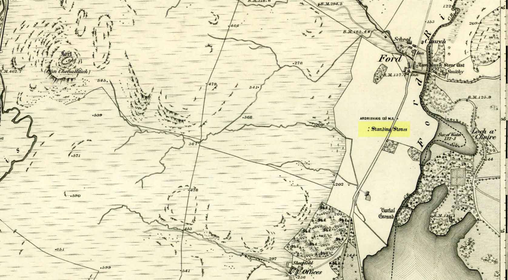
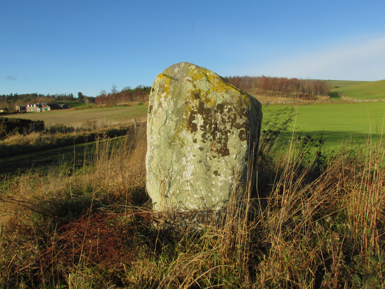
Getting Here

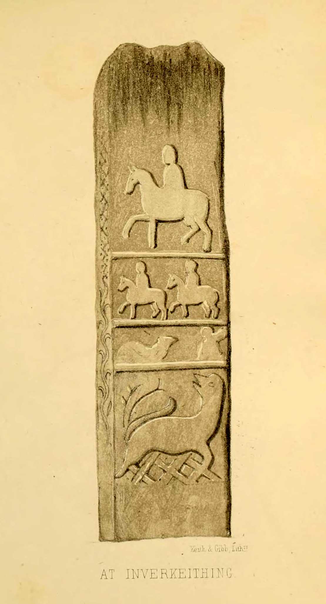
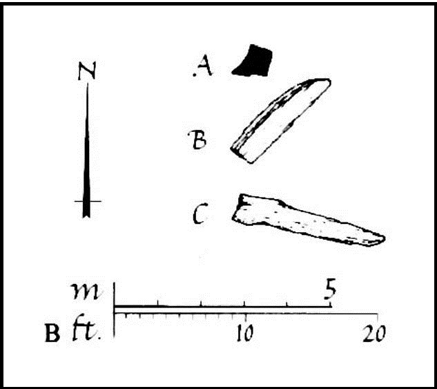
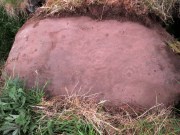
MacRitchie’s 1900 groundplan

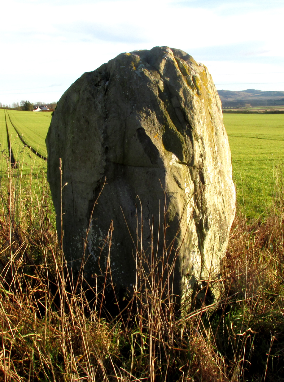
Follow the same directions as if you’re visiting the Pitcur (3) souterrain.  Once here, you’re standing at the southernmost uncovered section of the monument, where one uncovered passageway bends round and meets up with another open section (“m” on MacRitchie’s plan, right).  From here, just to your right, a single large roofing stone joins one side of the open passageway with the other, enabling you to walk across it—and the stone you’d walk across has these very faint carvings on it.

Archaeology & History

Shortly before darkfall a few weeks ago, Nina Harris, Frank Mercer, Paul Hornby and I were just about ready to pack-up and leave the brilliant Pitcur souterrain with its underground chambers and various petroglyphs when, as I walked along one of the open passages beneath one of the monument’s many large capstones, my fingers gently stroked the rock above me, almost unconsciously.

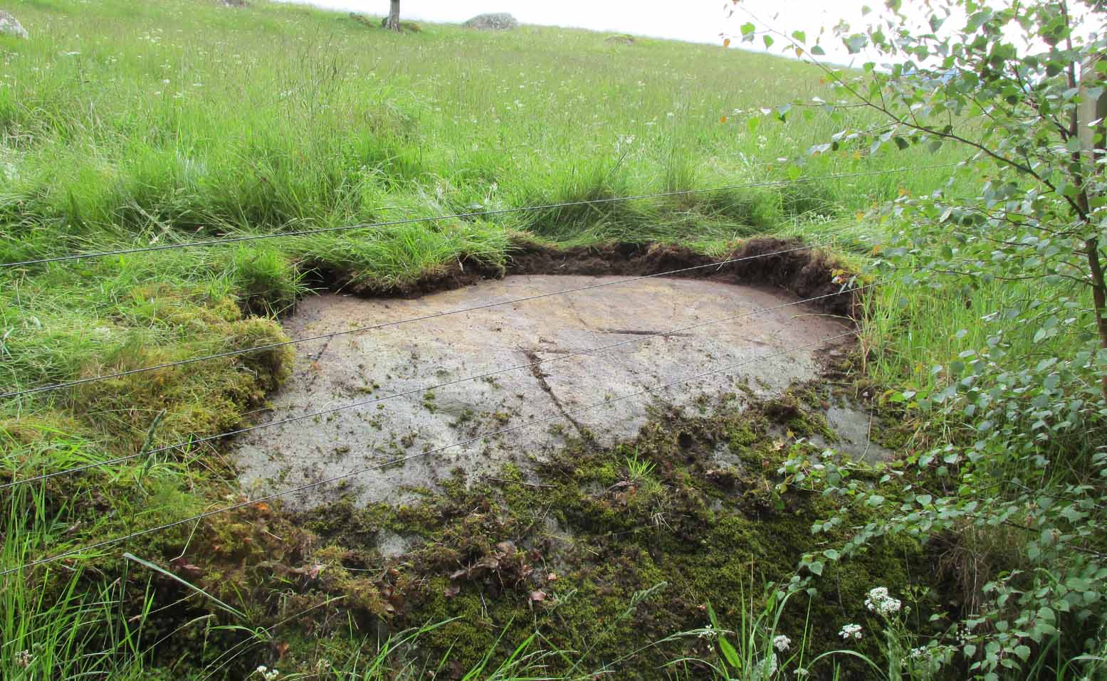
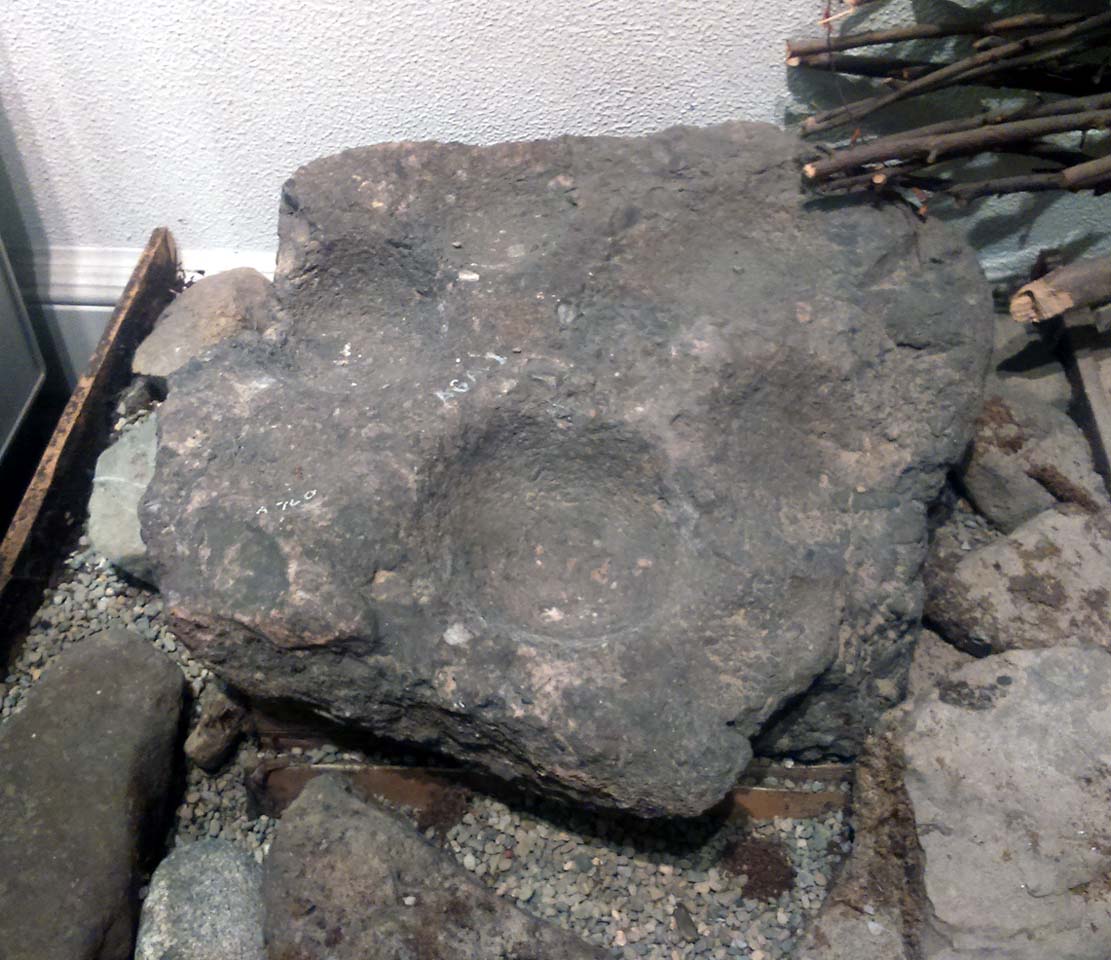
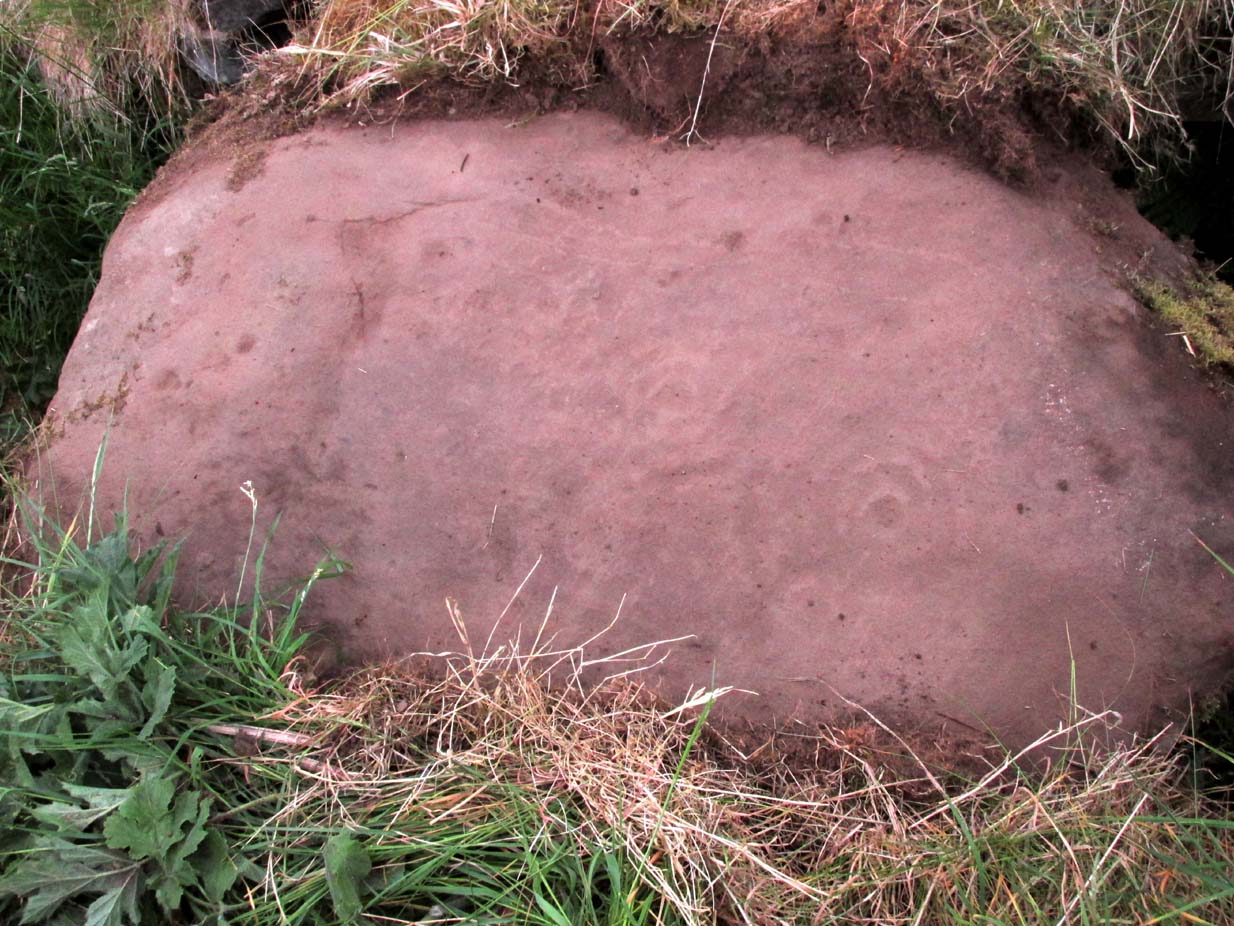
First photo of the carving (by Paul Hornby)

“Was that a faint cup-mark?” I asked myself, fondling gently the smooth stone once more.

Standing eight-feet above me in the long grasses, Mr Hornby was gazing around in his usual way.

“Paul – can you see from up there if this is a cup-marking I’m feeling here?”

Walking onto the edge of the rock itself, he proclaimed, “it looks like it!”

It was indeed!  And during the remaining 30 minutes of daylight we found that the single cup-mark had a number of companions on the same stone.  With multiple rings!  Twas another good day out.

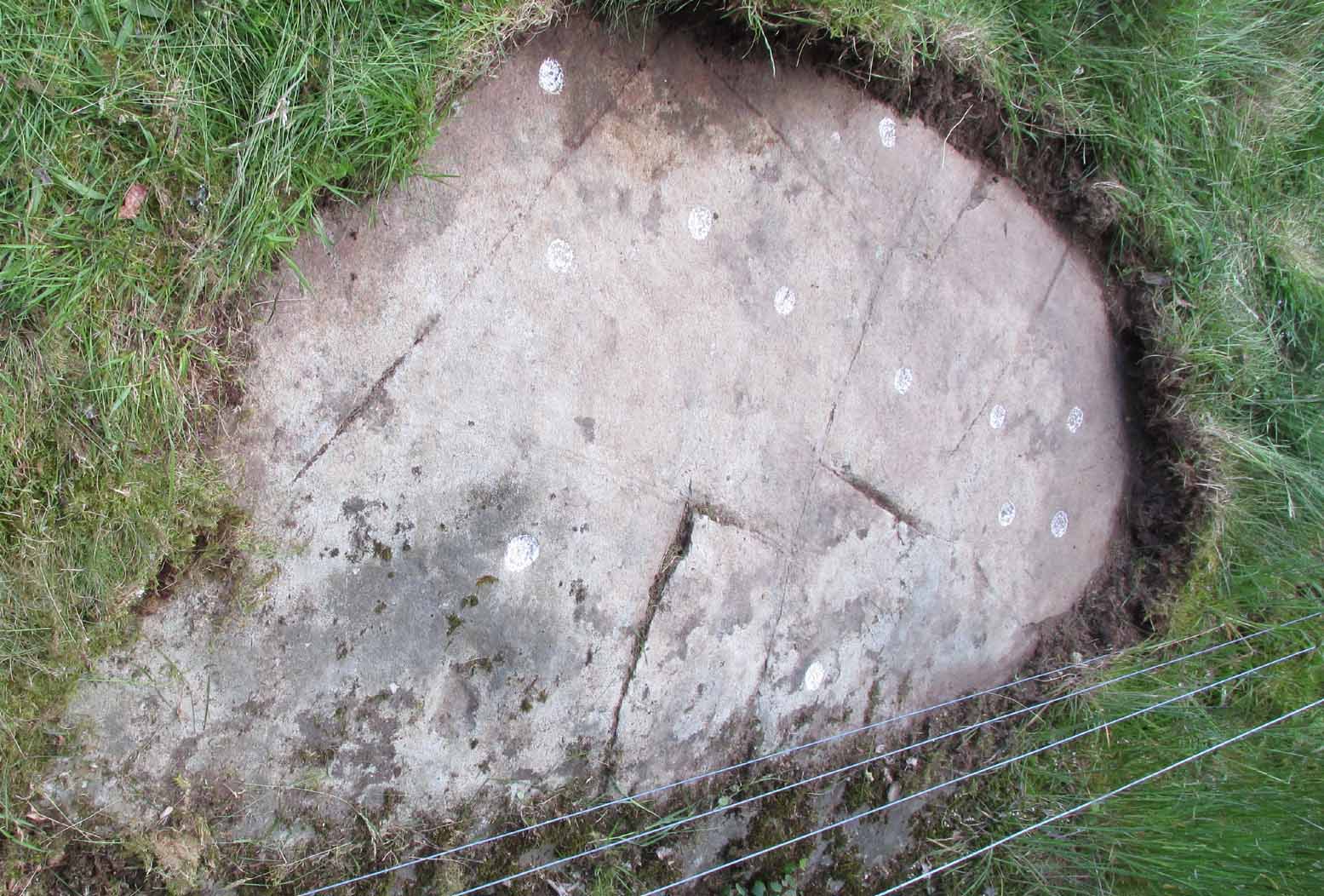
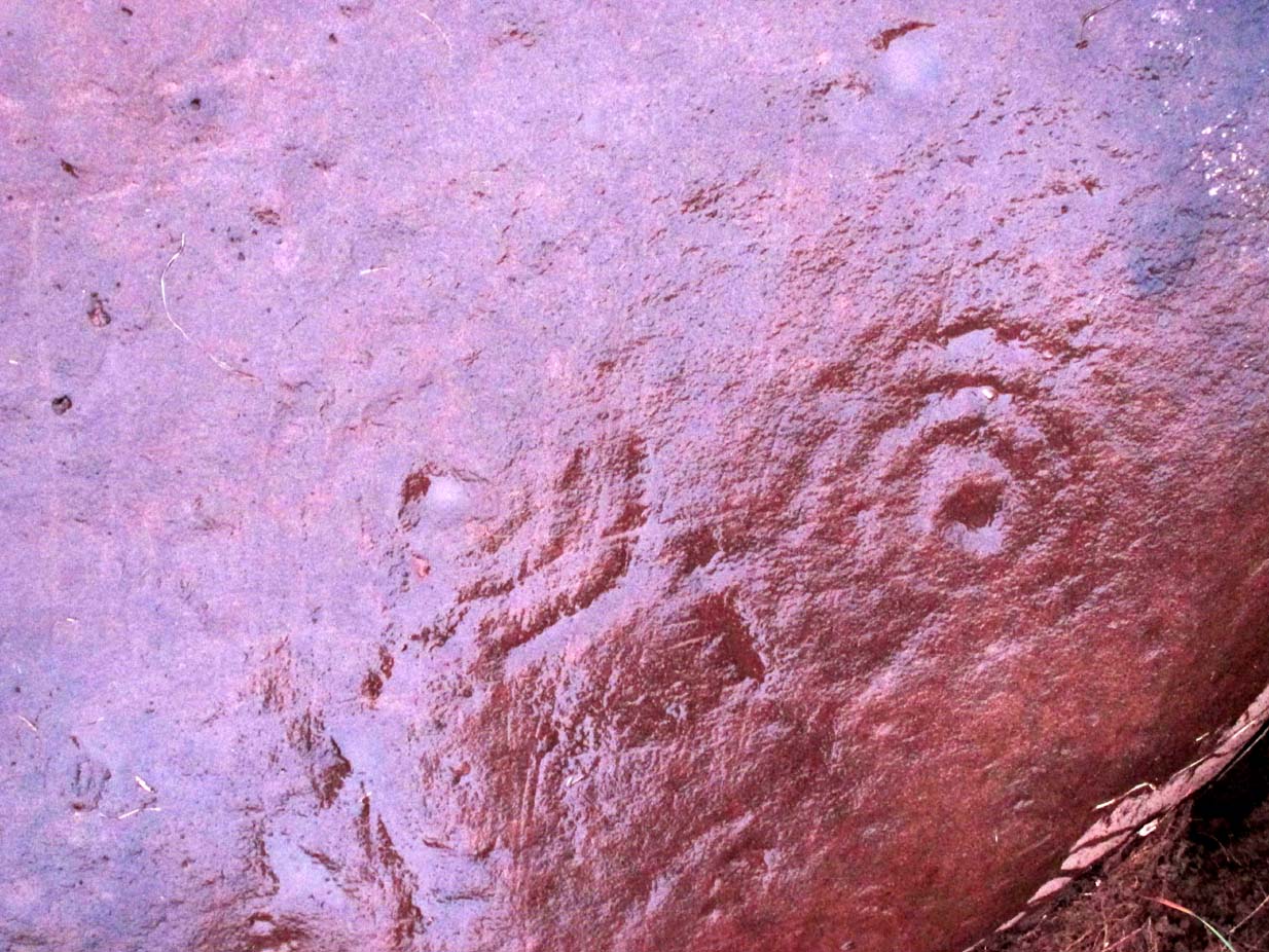
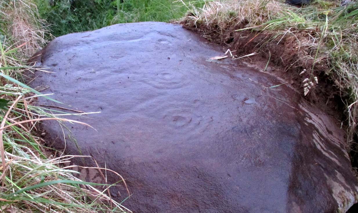
Carving when wet (photo, Frank Mercer)

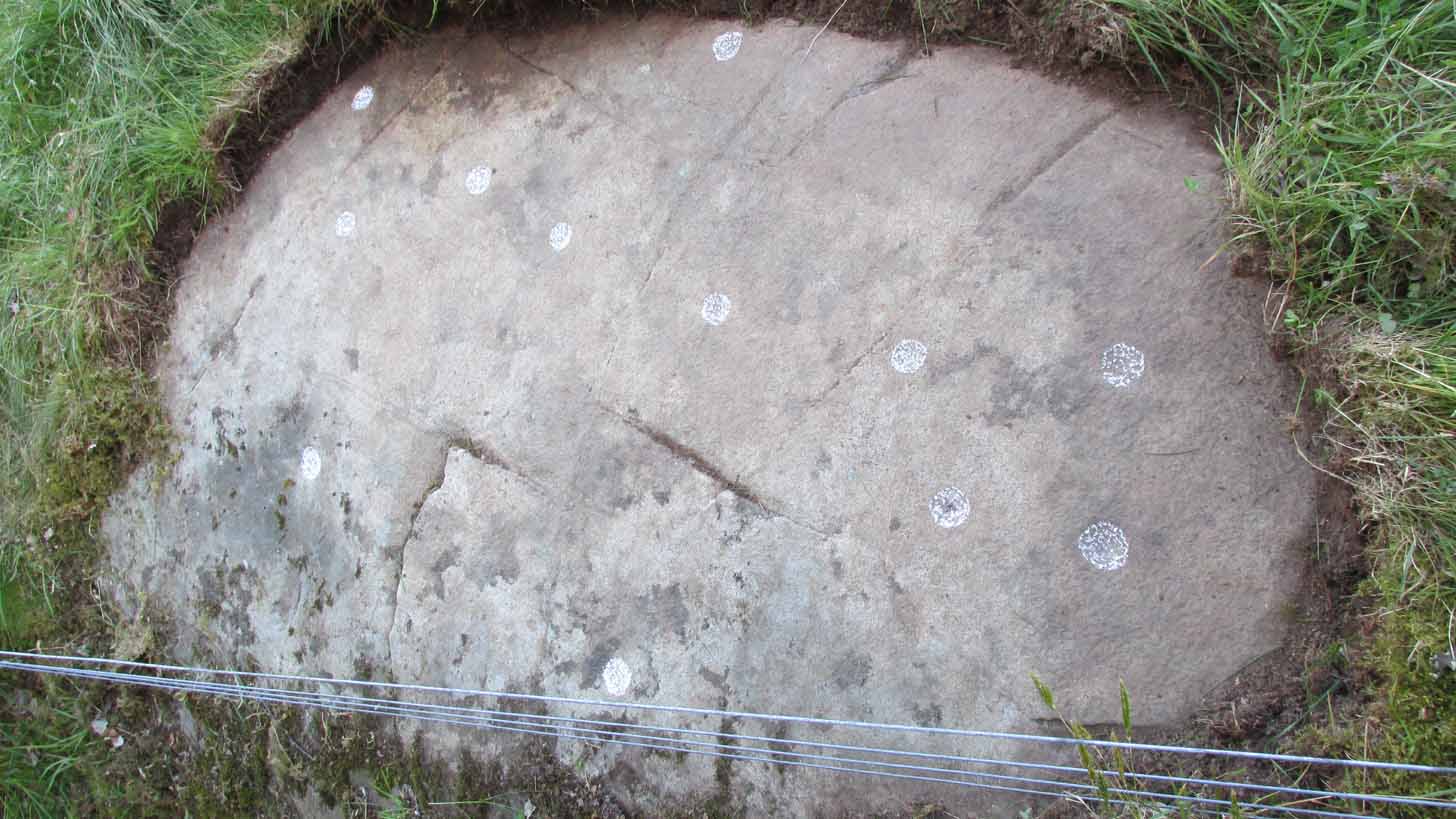
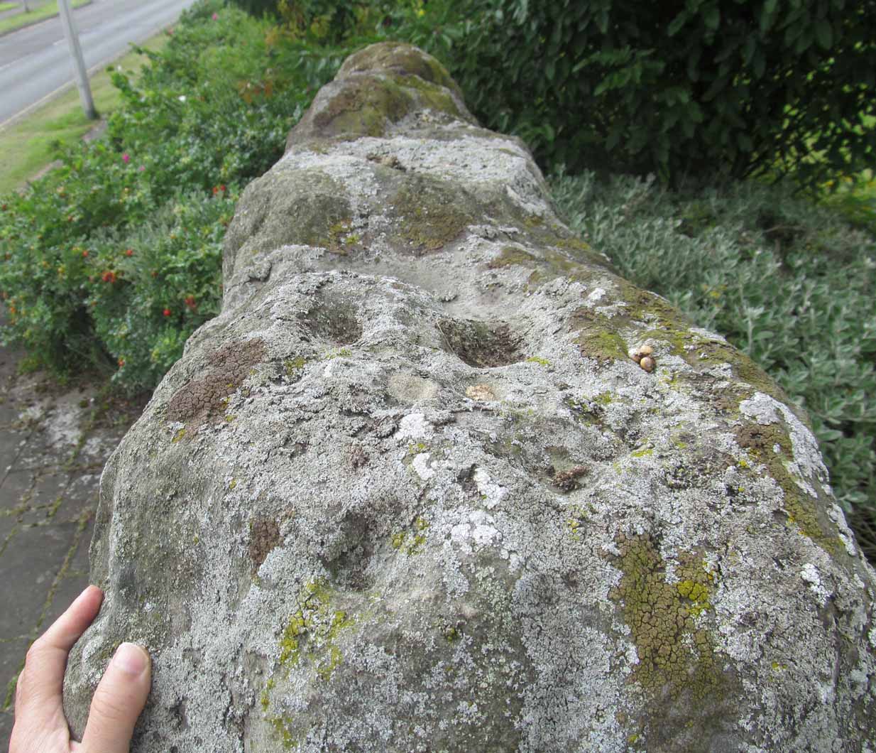
Looking straight down

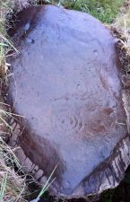
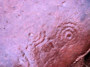
Previously unrecorded, this large rounded stone just about covers the space across from one side of the souterrain passage to the other, measuring roughly 6 feet by 4 feet, with its longer axis positioned roughly east-west.  It was on the westernmost edge of the stone where I located the first single cup-mark, close to the edge, but there are perhaps 12  others: three of which, as the photos show, are in a straight line from near the west-side of the stone to the upper-middle.  On its far eastern edge, another cup-mark is clearly evident; whilst on its southernmost edge is another.  It’s the middle and eastern section of the rock that grabs most of the attention.  Here we found the very faint rings becoming clearer and clearer as the dust of ages was carefully swept away, eventually giving us vision of carvings that were, in all likelihood, first pecked into the rock in the neolithic period, 4-6000 years ago.

Close-up of the 2 triple-rings

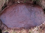
Cup-and-rings at an angle

As we can see, two faint triple-rings exist, each with lines running in/out of them.  The eastern concentric system is just about complete and has a small cup-mark on the NW edge of the outer ring.  A line that runs out from the central cup meets another carved line which, from some angles, appears to look almost like a bowl beneath the triple rings—but this is unclear.  The other triple cup-and-ring, slightly closer to the middle of the stone, has an incomplete outer ring, with evidence of another line running outwards from its central cup. There seems to be a slightly-pecked outline of a single cup-and-ring on the north side of the stone, but this is also unclear.

In truth we need to revisit the site soon, when the lighting gives us a clear idea of what we actually found, because our visit here was cut short by encroaching night and a grey cloudy evening—which are not the best conditions for isolating new petroglyphs!

At least six other petroglyphs exist within the Pitcur Souterrain (3), with the one closest to this (Pitcur 3:3) also used as a roofing stone, covering the deep trench from one side to the other.  However, it would appear the petroglyphs on that stone were on its underside, as the erosion on it is negligible, away from the elements—unlike this one! Another capstone that was also turned over (Pitcur 3:4) was found to possess more cup-and-rings, again on the underside of the stone.

This carving was probably executed 2-3000 years before the souterrain came into existence, and as a result of this we’re unsure as to the original location of the stone—but it was probably close by.  It might have originally been a carved standing stone, re-used here; or been part of a lost prehistoric tomb; or even a loose earthfast rock (though this is the least likely of the three).  Why it was used, and whether it retained any sense of the original meaning when it was re-positioned into the present construction, is a relevant question.  In all likelihood some of the original mythic element—or a morphed development of its original animistic narrative–was probably a functional ingredient of importance to the souterrain builders, 2-3000 years after the carving had been made.

A superb site!

References:

  1. Wainwright, F T., The Souterrains of Southern Pictland, RKP: London 1963.

Acknowledgements:  This site profile would not have been made possible were it not for the huge help of Nina Harris, Frank Mercer & Paul Hornby.  Huge thanks to you all, both for the excursion and use of your photos in this site profile. 🙂

© Paul BennettThe Northern Antiquarian


Netherfoodie Cottage, Dairsie, Fife

Standing Stones (destroyed):  OS Grid Reference — NO 4128 1769

Also Known as:

  1. Dairsie Stones

Archaeology & History 


View of the field where the stones stood (Paul Hornby)

Recent archaeological investigations at the site which has become known as the Dairsie Hoard—where many pieces of broken Roman silverware were seemingly deposited in one spot, adjacent to a dried bog “which may arise from a former spring” of water—brought about the discovery of much earlier megalithic remains.  The position of two previously unrecorded standing stones were found during the archaeological dig here.  In the most recent edition of Current Archaeology, Fraser Hunter (2018) described the position of the Roman silverware close to some ancient pits or sockets in the ground. This “group of features was…intriguing”, he told,

“for two of them contained stumps of standing stones, one in association with probably Bronze Age pottery. This hoard had been buried in a memorable, perhaps even a sacred site, between an intriguing wet spot on one side and, on the other, two standing stones, which were already ancient by the time the silver was buried.  Such burial of valuables in association with prehistoric monuments can be readily paralleled elsewhere.  It suggests this silver was placed under the care of the gods, probably as a sacrifice rather than a burial for safekeeping.”

Two thousand years before the Roman silver deposit had been deposited, megaliths here stood.  Sadly they’re long gone, leaving more questions than answers as usual…

References:

  1. Hunter, Fraser, “Solving a Silver Jigsaw,” in Current Archaeology, 335, February 2018.

Acknowledgments:  Many thanks to Paul Hornby for use of his photo in this site profile.

© Paul Bennett, The Northern Antiquarian


Moonzie, Cupar, Fife

Cup-Marked Stone:  OS Grid Reference – NO 34 18

Archaeology & History

There are no previous literary references to this small portable cup-marked rock, relocated recently by Paul Hornby during one of his various antiquarian meanderings.  Found in association with a much later architectural structure, it position in the landscape (near the top of a hill) would suggest that is was most probably located in a prehistoric cairn in earlier days—all traces of which have vanished.  But we cannot be sure of this and I’m merely speculating.

Moonzie cup-marked stone

Site of carving

The thin, fairly flat stone is about 18 inches across, by a foot wide, and consists of what seems to be 10 cup-marks (no rings, sadly), of which six of them are the real deal.  No other carvings officially exist anywhere near it and its isolation is an enigma… such as it is with petroglyphs…

Due to the fact that the stone can literally be picked up and moved by anyone, we’re hoping that it can be seen by local archaeologists and perhaps placed into a museum for safe-keeping.

© Paul BennettThe Northern Antiquarian 


Samson’s Stone, Waltonhill Farm, Craigrothie, Fife

Legendary Stone: OS Grid Reference – NO 36312 09667

Getting Here

Light-coloured Samson Stones visible from road south of farm

Travelling South along the A916 just past Craigrothie, turn right down to Chance Inn, and turn left at the T junction. and follow the road on to just past the left hand bend when Waltonhill Farm will be seen on the right. The Stones form part of the structure of a dwelling house and are not accessible to the public, but are visible from the public highway further down the road as the light coloured irregular shaped stones at ground level either side of the door of the south-facing house.

Archaeology & History

According to a piece published in the Fife Herald & Journal in 1905:-

“Once upon a time, so runs the legend, Samson challenged the devil to match him at boulder throwing. As challenger, Samson stood on the West Lomond; Satan stood on the East. The signal was given; two mighty rocks whistled through the air. ‘The De’ils Stane‘ fell where it now lies, on the road-side about a quarter of a mile west from Waltonhill Farm. Samson, though handicapped by three miles greater distance, flung his stone fully four hundred yards beyond that of Satan, and with such force that it split into three parts; which parts are now built into Waltonhill barn.”

The light-coloured, irregularly-shaped stones at ground level are the likely remains

This is of course a variant of a creation myth that is to be found throughout Britain, of an Age of Giants who strode the land quarrelling with each other and the mortal humans. The original names of the Giants have been lost in the aeons of oral transmission of the legend from pre-history, and replaced by that of a probably equally legendary Middle Eastern strong man from the Christian’s Bible, in combat with the Christian’s Naughty Man. And to prove the point of Christianity’s superiority over the old animistic cults of the land, the De’il has to be demonstrably the Loser.

Another view of the Stones

The house owner told me that what is now the farmhouse bearing the stones, was originally the barn, that they rebuilt after 40 years of dereliction, and interestingly she had heard something about some Samson’s Stones, but not about the nearby De’il’s Stane, which shows that these ancient legends are still being orally transmitted.

The Stone was thrown over 10 miles from West Lomond (right). No wonder it split!

There are five ‘odd’ stones either side of the doorway, along the base of the wall facing the Lomond Hills, of irregular shape and lighter colour than the rest of the building’s walls. These are the likely candidates for the Samson’s Stones (unless anyone can come up with more convincing evidence). While the legend speaks of three stones, it is quite feasible that the masons dressed these when they built the original barn, making five stones out of the three. They look like they may be successive horizontal slices of a larger square to triangular sectioned stone. Pure speculation on the writer’s part, but are these the remains of a lost standing stone(s) that had to be demolished in order for the barn to be built, pieces of which were incorporated into the building to give the original stone’s magical protection to the farmer’s animals and crops?

References:

  1. Fife Herald & Journal, 1st November 1905, quoted in John Ewart Simpkins’ County Folklore – Volume VII: Fife, with some notes concerning Clackmannan and Kinross-shires, Folk-Lore Society by Sidgwick& Jackson: London 1914.

© Paul T Hornby, The Northern Antiquarian 2018