Stone Circle (ruins): OS Grid Reference – NO 20175 45825
Also Known as:
- Canmore ID 30760
- Old Rattray
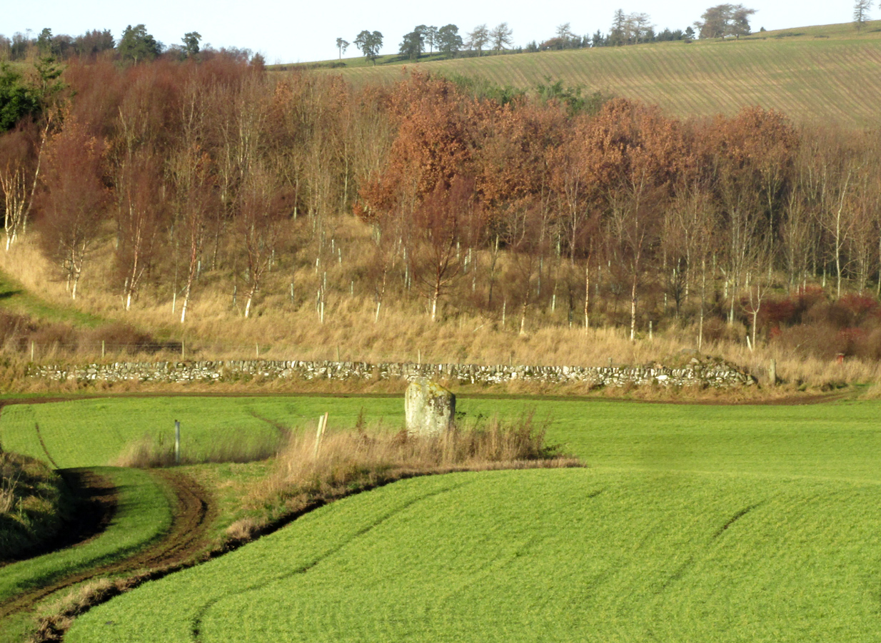
Just less than a mile east of Blairgowrie, the site is situated about 200 yards along a farm track that runs north from the A926 Rattray – Alyth Road. This road is narrow with a lot of bends and very busy, with no safe parking places. It is best to walk from Rattray, the stone will be seen in the field just east of Drumend Farm.
Archaeology & History
There is one stone here that survives from a megalithic ring that was progressively destroyed some time between the publication of the 1792 Old Statistical Account and the publication of the 1867 OS map. Reverend James Smith, writing in the 1792 Statistical Account, told us:
“Above the river, SE from the village, in a beautiful situation, is a Druidical temple, much defaced, and many of the stones carried off. The farm upon which it has been built, is called Standing Stones.”
Reverend William Herdman wrote patronisingly in the 1845 New Statistical Account:
“If large graystones be entitled to the appellation of antiquities, or are any indication of the religious worship of our ancestors, a few of these appear in a field, thence called Standing Stanes, which are supposed to be the ruins of a Druidical Temple.”
Many years later, in the first few years of the 20th century, the great northern antiquarian and megalith writer, Fred Coles, visited the site and gave this description in 1909:
“Standing Stone on the Farm of Standing Stone, Old Rattray. [A] monolith attracts our notice, in a field on the north of the main road, one mile and a quarter east of the middle of Old Rattray village. The height above sea-level is 270 feet. This monolith …[has a] mineralogical composition …more analogous to the quartziferous schists so frequently found in the vicinity.
The top is smooth, with an inclination towards the south-east, and the whole mass is squarish and pillar-like. It is set up with the longer axis N.E. 50° and S.W. 50°. The highest point is 5 feet 1 inch above ground, the basal girth 8 feet, but rather more than mid-way up it increases to 10 feet 4 inches.
In this lower-lying district, comprising an area of about 35 square miles, the megalithic remains are extremely sparse. Agricultural operations, doubtless, have swept away some monoliths, and possibly also whole circles of stones; but at any rate it is somewhat significant that only four Standing Stones are now left, and that there is no record on the maps of any other variety of sepulchral structure.”
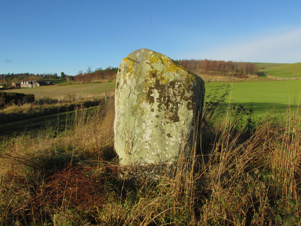
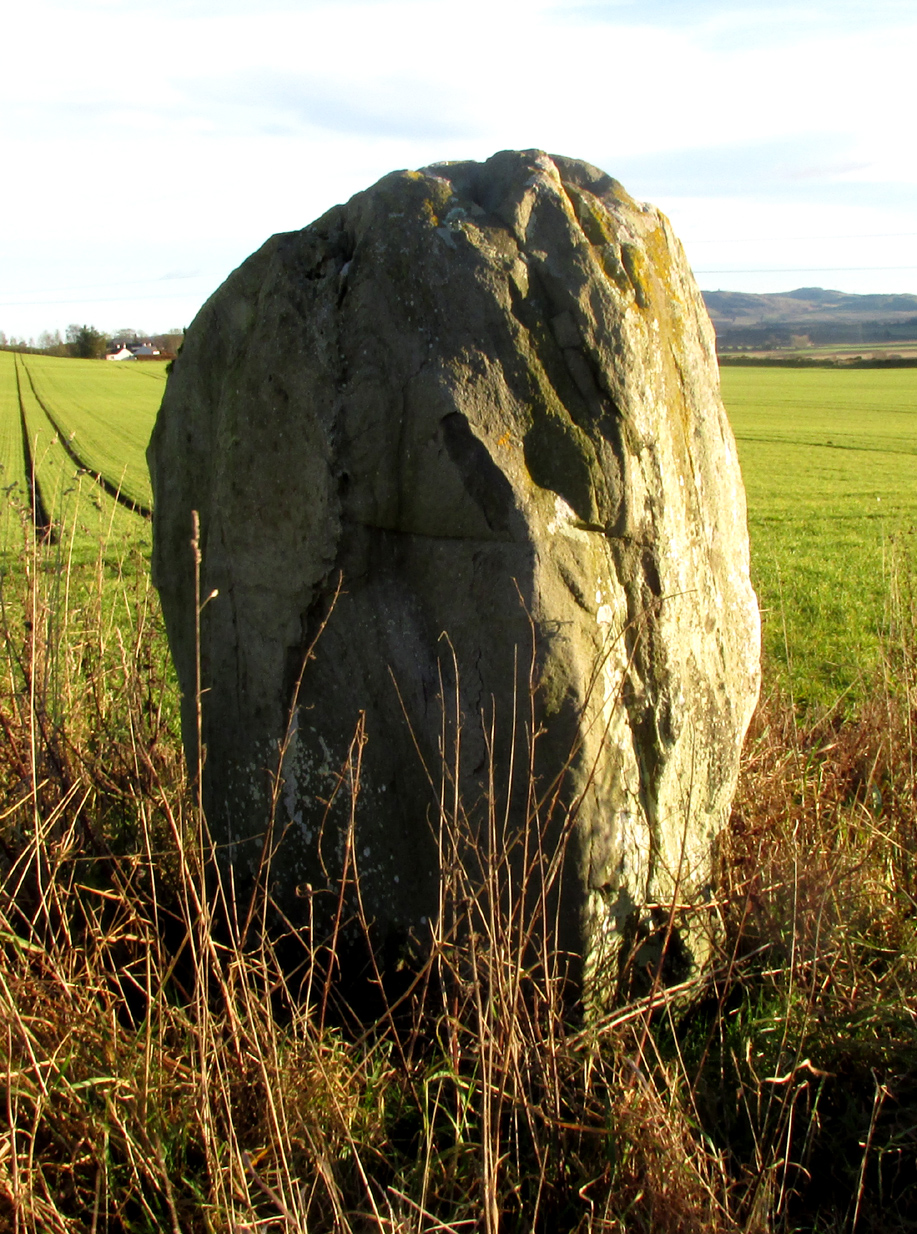
This brave survivor has a commanding position over the valley of the River Ericht, and again we can only lament the loss of its companions, but be thankful it too didn’t fall prey to ‘agricultural improvements’ or religious bigotry.
References:
- Smith, Rev.James, Old Statistical Account, Perthshire, Parish of Rattray, 1792. #
- Herdman, Rev. William, New Statistical Account, Perthshire, Parish of Rattray, 1845.
- Coles F.R., ‘Report on stone circles surveyed in Perthshire (South-East District), with measured plans and drawings; obtained under the Gunning Fellowship’, Proc. Soc. Antiq. Scot., vol. 43, 1908-9.
© Paul T. Hornby, 2019