Holy Well (destroyed?): OS Grid Reference – SO 9609 8284
Archaeology & History
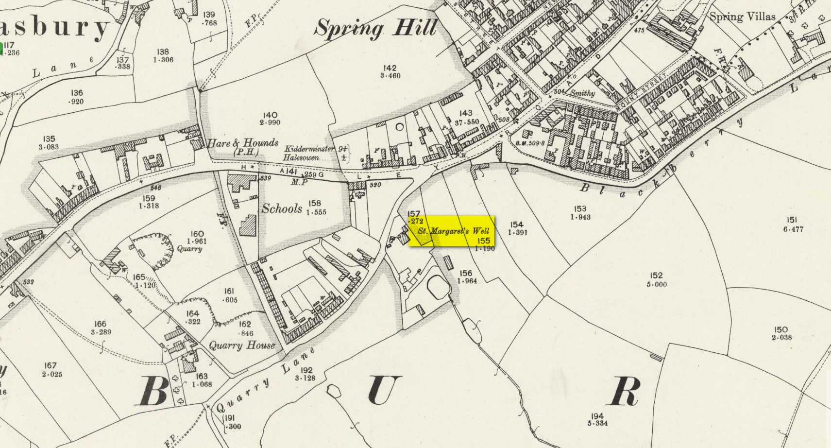
The site on the 1904 map
Shown on the 1904 OS-map, beneath the aptly-named St Margaret’s Hill on its northern side, we can see where the holy well of St Margaret used to be, not too long ago. Although it seems to have fallen pray to industrial destruction, there are a number of old references to the site, mainly gathered together in Jeremy Harte’s (2008) magnum opus on the subject. It was also mentioned in a survey by the British Geological Society (Richardson 1930) where we were told that it was,
“in the private grounds of a house recently erected, and is a spring issuing from the Halesowen Sandstone at the junction of two faults (shown west of the ‘H’ of Hasbury on the new series Geological Map, Sheet 168) about 100 yds SW of the point where Blackberry Lane joins Hagley Road. It is referred to, as a well of good cold unmineralised water, by T. Nash in 1781.”
And it was Mr Nash who gave us the earliest description of the place, saying:
“In the hamlet or township of Hasbury is an ancient holy well, called St Margaret’s Well, which formerly had much good stonework about it; but that was wholly removed in the year 1747. One of these stones contained some curious sculpture, the figure of a man in a posture of hasty walking, and in the next compartment that of another man leaning on crutches… This place is called Margaret’s Hill and the water of the well supplies a small brook, which runs below the Grange, and falls into a piece of water at the end of the town, called Cornbow Pool.”
It’s more than probable that the old carvings he described—of one man on crutches and the other of a figure walking speedily—represents one of the main curative allegations that these waters possessed. Cases of people walking on crutches to sacred wells, drinking the waters, then walking away without them (and in many cases leaving their crutches at the well-side as testament to its properties) are commonplace. And, aptly enough, the curative elements of this ancient site has been maintained in modern times with the medical centre of St Margaret’s Well Surgery being built by this very spot!
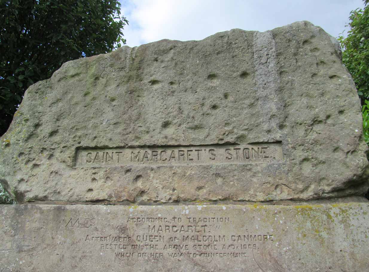
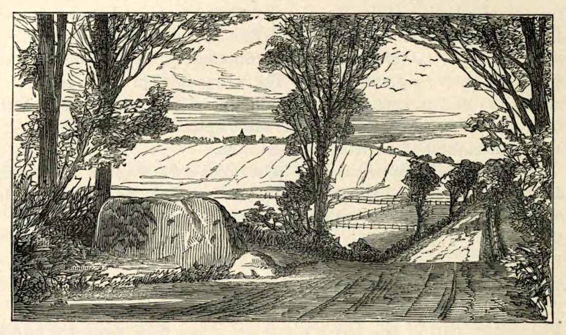
Take the A823 road out of Dunfermline south towards Rosyth. A half-mile before you hit the motorway roundabout, at the roundabout where Carnegie Avenue takes you east, turn west and park up along the road where the modern business park lives. 30-40 yards from the roundabout, set back on the pavement, you can’t really miss the huge flat slab of stone, covered in cup-markings, resting on a stone plinth with ‘St Margaret’s Stone’ stamped on it!
Archaeology & History
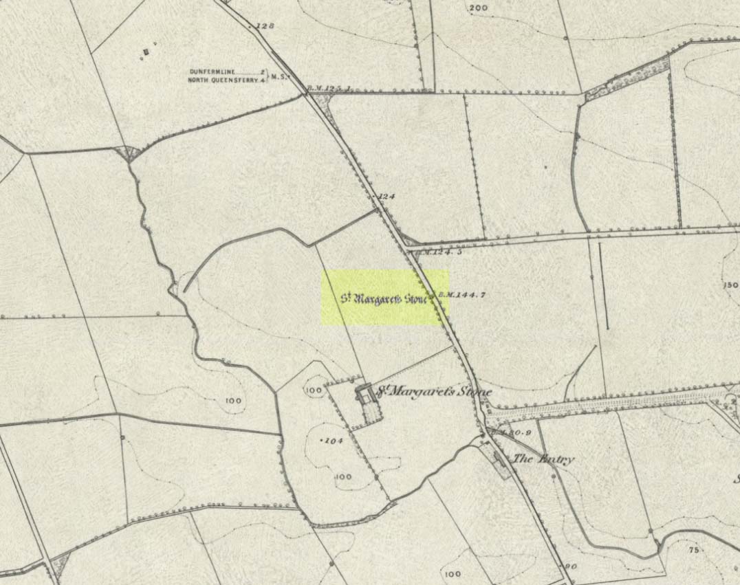
On the 1856 OS-map of this area, St Margaret’s Stone is shown at the roadside just above a farm of the same name, a short distance away from its present location. In October 1879, Alexander Stewart (1889) told us that funds were raised and steps taken to properly fix and preserve this ancient ‘resting-place’ of Queen Margaret on the Queensferry Road. It was quite a few years later before it was moved the few hundred yards further to its present location.
Cups on stone’s edge
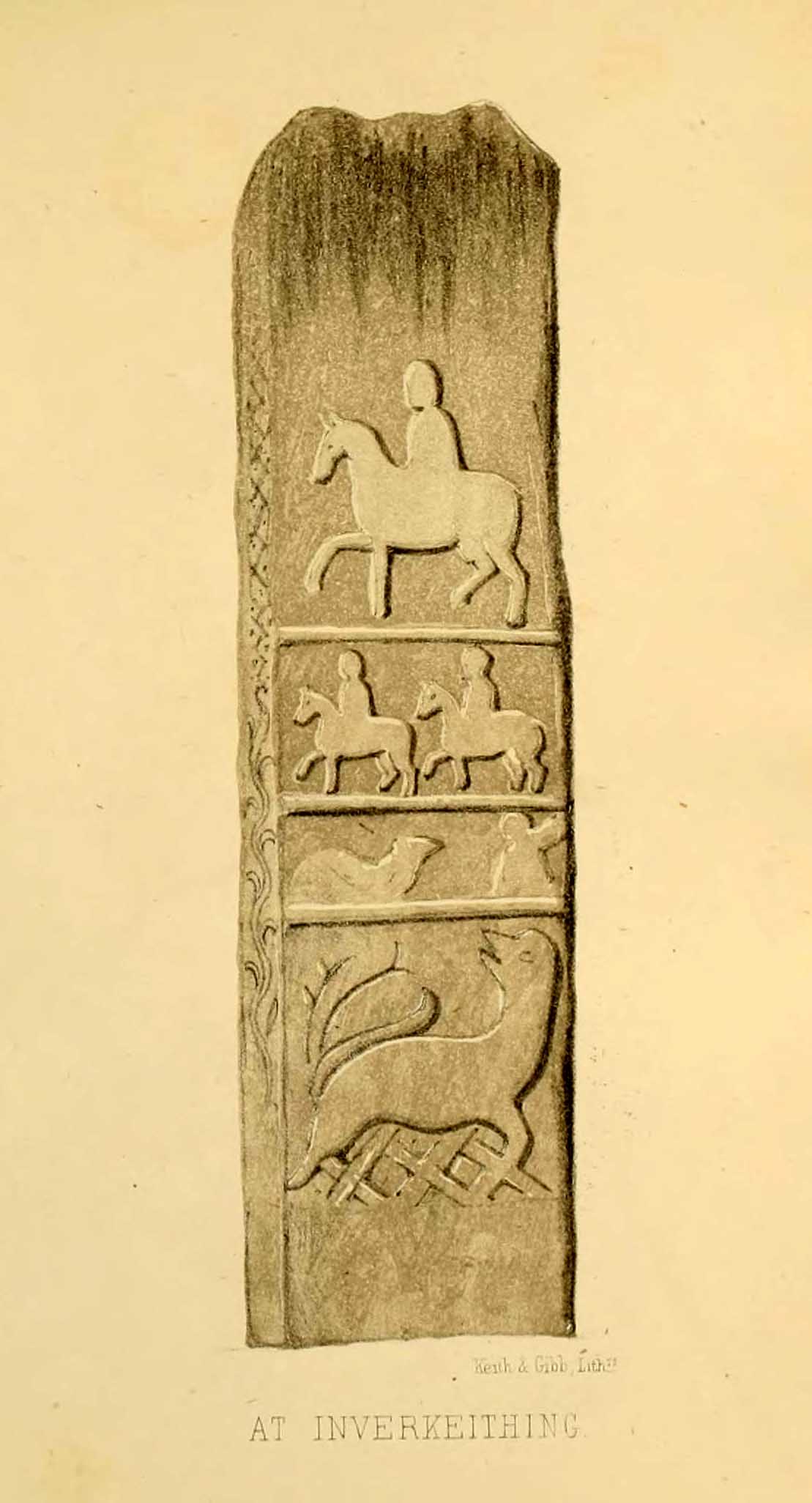
Early writers tell us that originally its position in the landscape was on the crest of one of the rises in the land between Dunfermline and the sea, making it visible for some considerable distance. This would seem to have been a deliberate placement. In my mind, and in accordance with the placement of many a prehistoric tomb, St Margaret’s Stone may originally have been part of a neolithic or Bronze age cairn, long since gone. The size and shape of the rock implies it too, with similarities here of the impressive cist or gravestone found inside the Netherlargie North cairn at Kilmartin. However, this wasn’t the thought of the prodigious Scottish historian, William Skene. He thought that St Margaret’s Stone originally stood upright, being a Pictish-style standing stone that was mentioned in the first Statistical Account of the area. The brilliant Scottish antiquarian, John Stuart (1856)—who gave us an illustration of the ‘standing stone’ in question—told us:
“It has been supposed by some that “St. Margaret’s Stone,” a block now lying on the side of the highway leading from Inverkeithing to Dunfermline, and about midway between these places, can be identified with the standing stone referred to in the Statistical Account. Mr Skene has noted below a sketch of St. Margaret’s Stone:- “The sculpture upon this stone has been lately chipped off in mere wantonness, so as to leave few traces of the subject recorded upon it.” He farther states that it formerly stood erect, and was called “The Standing Stone.” According to Mr. Skene’s measurement, St. Margaret’s stone is about nine feet and a half in length, one foot in thickness, and four feet broad at the widest end, and broken off to a narrow point at the other.”
The missing ‘standing stone’
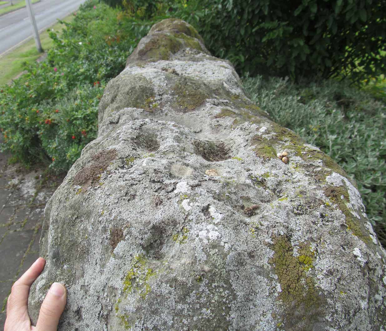
In this instance, Skene was confusing St Margaret’s Stone with the lost Pictish monolith (left) that used to exist nearby, which had carved horse figures and other memorial designs upon it and which he thought had faded away. Whereas the large slab we are looking at here, and which Skene visited and measured, is covered on one side by a gathering of prehistoric cup-markings—much earlier than any Pictish or early christian carvings. At first glance, it seems that some of these cups may well be natural, but it has to be said that some of them are distinctly man-made. And if we were to believe the archaeo-accounts of the stone, the cupmarks are only to found on one side of the stone. This is incorrect. As we can see here, a number of cupmarks run along the edge of the stone. We cannot say for sure whether all of them are artificial, but they certainly look like it! Also, on the other side of the flat surface, one or two single cups are visible. It would be good if we could get an artist to give us a detailed impression of the prehistoric carvings without the modern engraving of St Margaret’s Stone etching on the main face. (is there anybody out there!?)
The Royal Commission (1933) lads visited the stone in 1925 and, several years later in their write-up, told us simply:
“This stone…stands with its main axis due north and south and measures 8 feet 6 inches, by 4 feet 7 inches, by 1 foot 6 inches. On one side the entire surface is cup-marked, the markings varying in size from 1¼ inches to 3¼ inches and having an average depth of from ½ to ¾ inch.”
When the Scottish petroglyph writer and explorer, Ron Morris (1968) came to the site, he gave it an equally brief description, merely telling us:
“On standing stone (8 1/2 feet high, 4 1/2 feet wide), built in to roadside fence, over 80 cups, up to 4in in diam, 3/4in deep, some run together as rough dumbells.”
It’s well worth checking out!
Folklore
St Margarets Stone in 1825
When the Saxon Queen Margaret landed on the shores just west of Queensferry at Rosyth Castle (NT 1087 8200), legend reputes that she and her entourage made Her way north towards Dunfermline. Halfway along the ancient track She rested at this large stone which, thereafter, gained the name by which we know it today. It was said that Queen Margaret subsequently visited the stone on a regular basis for periods of solitude. The tale probably has some germ of true in it. Additional ingredients also told that,
“The large stone here is associated with St Margaret and was visited by women who hoped to conceive or sought a successful birth. The eight-foot high stone is said to mark the resting place of St Margaret when she journeyed between Queensferry and Dunfermline. Margaret had eight successful pregnancies and probably needed to rest quite a few times on her travels!”
The fertility aspects of the rock were not the only pre-christian virtues attached to it. We also find that oft-cited motif of rocks moving of their own accord: in this case, as J.B. MacKie (1905) told us, local people had always
“been told that the stone rose from its bed and whirled thrice round in the air every time it heard the cock at the adjoining farm crow.”
Cocks crowing are symbolic of sunrise, obviously, and this lore may simply represent a folk memory of the spirit in/of the stone being animated at that time of day. It’s a motif found at ancient sites all over the place!
Royal Commission Ancient & Historical Monuments of Scotland, Inventory of Monuments and Constructions in the Counties of Fife, Kinross, and Clackmannan. HMSO: Edinburgh 1933.
Rupert-Jone, John A., Rosyth, A. Romanes: Dunfermline 1917.
Stewart, Alexander, Reminiscences of Dunfermline and Neighbourhood, Scott Ferguson: Edinburgh 1889.
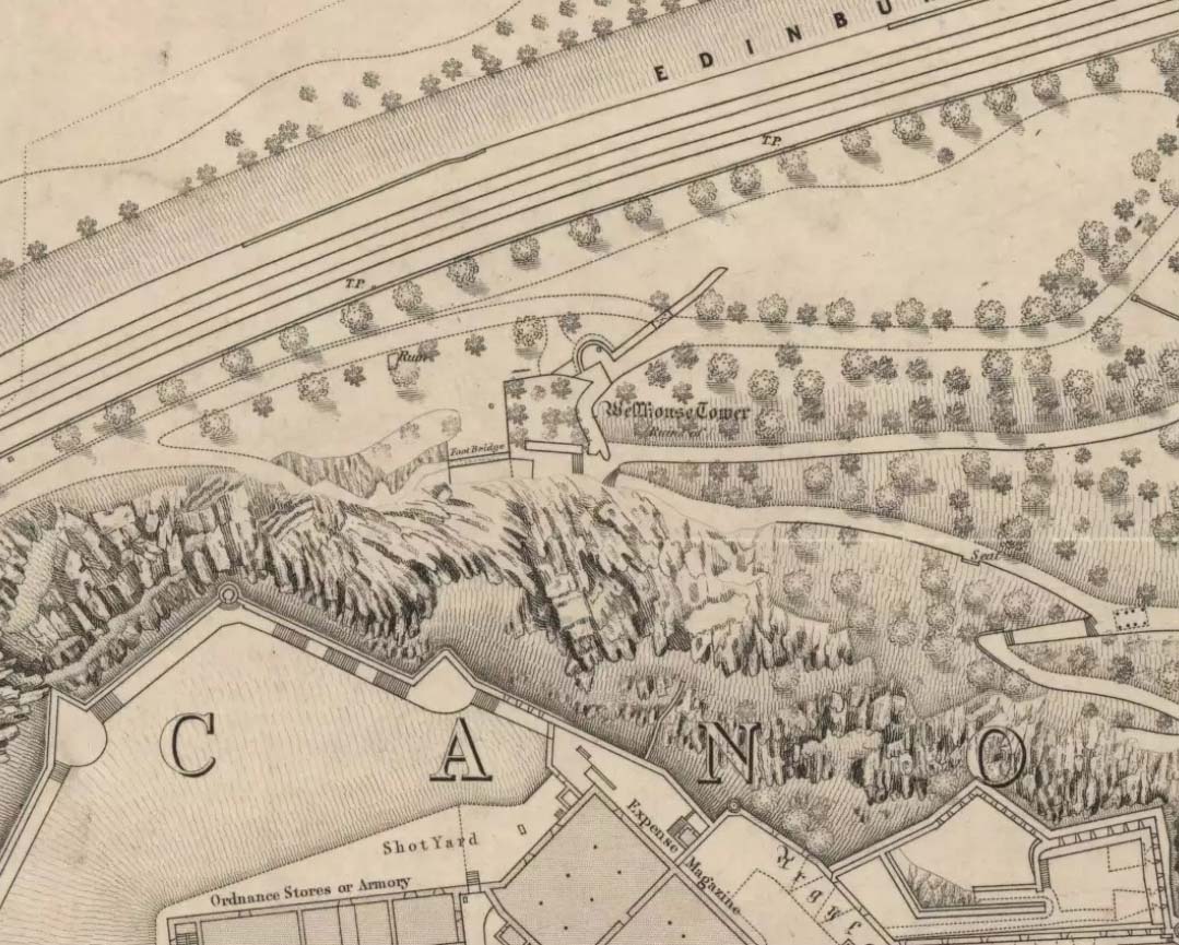
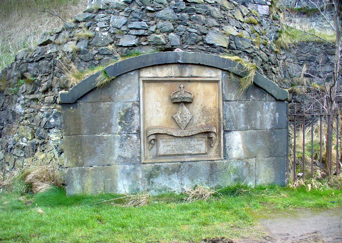
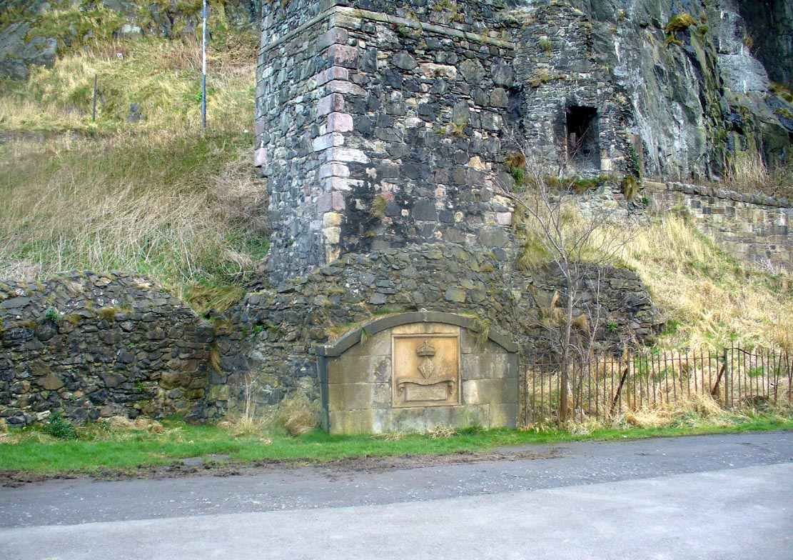
Along the more western end of Princes Street, looking up at the castle, wander into the park below and walk towards the railway line. There’s a foot-bridge over it. Once on the other side, turn right and walk along the path for just over 100 yards until you’re just about beneath the cliffs. There, in front of you, a ruinous stone building and carved faded plaque reads “St Margaret’s Well.”
Archaeology & History
The bedraggled architectural remnants we see of St. Margaret’s Well today, is not where the waters originally emerged. We must travel 2-300 hundred yards west of the present edifice, along old Kings Stables Road near St Cuthbert’s Church, for its original position. Long since gone of course…
Close-up of plaqueSt Margarets, by the old ruins
The history of this holy well tends to be found scattered in a number of sources—but none give us a decent narrative of its medicinal or traditional lore. Perhaps the best was conferred in W.M. Bryce’s (1912) lengthy essay on St. Margaret’s chapel where he told:
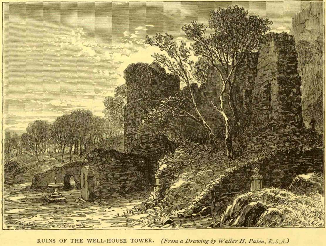
“Of the fountain in West Princes Street Gardens, also known as St. Margaret’s, and for the protection of which the Well-house Tower was erected in 1362, no legend of a similar nature seems to have survived. It was a little flowing stream of pure water, and down to the year 1821 was utilised for drinking purposes for the supply of the garrison, in supplement of the ancient draw-well of the Castle. The earliest notice of this fountain appears in a charter by David I in favour of the Church of St. Cuthbert, dated circa 1127, in which he conveys the land under the Castle from the fountain which rises close to the corner of the King’s Garden, and along the road leading to the church. It was here, in this royal garden, beside the pellucid waters of the well which was afterwards to bear her name, that Queen Margaret, in the company of her husband and children, spent many a sunny afternoon under the shade of the rugged old Castle rock.”
St Margarets Well in 1870s
The carved plaque in front of the old tumbled-down well-house sadly hides no water anymore; merely some trash and heroin-addicts needles at the back. Best avoided.
Folklore
This Scottish Queen and consort of King Malcolm Canmore, ‘St Margaret’, had several days in the calendar on which she was commemorated. Mrs Banks (1941) told how, traditionally, her day is June 10:
“This day was appointed for her festival by papal decree, but in Scotland her day is that of her death, November 16. The festival of her translation was commemorated on June 19th.”
W.M. Bryce (1912) cited St Margaret’s Day to be generally accepted as June 19, which is closer to Midsummer and could easily be accommodated into local heathen traditions.
References:
Banks, M. MacLeod, British Calendar Customs: Scotland – volume 3, Folk-lore Society: London 1941.
Royal Commission on the Ancient & Historical Monuments, Scotland, Inventory of the Ancient & Historical Monuments of the City of Edinburgh, HMSO: Edinburgh 1951.
Described in Hope & Telford’s (1813) rare work, this little-known holy well has escaped the attention of all surveyors since then. It was one of four sacred and healing sites in the village and “the most copious” of them all, they said.
Located a little to the east of the old churchyard, chemical analysis showed its water to contain carbonates and sulphates of lime, “muriate of soda and a magnesium salt in very minute proportion, and carbonate of iron in a still smaller” amount.
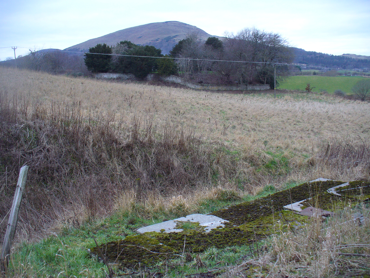
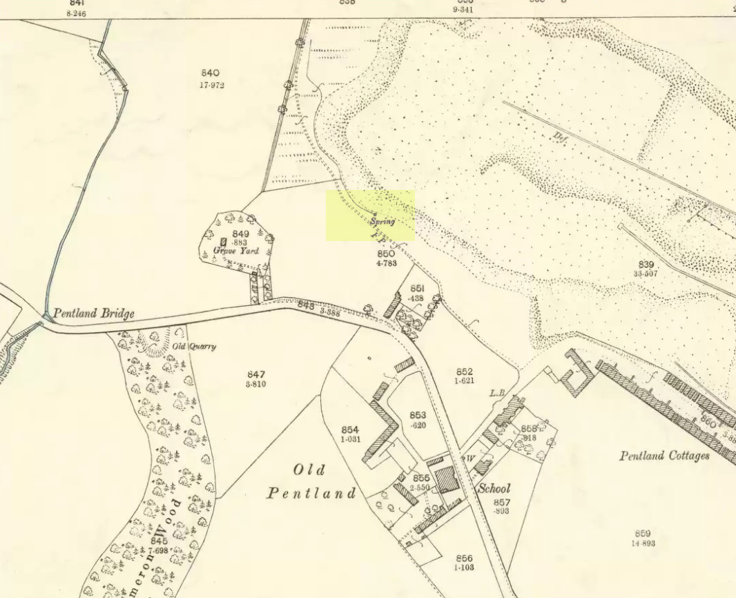
Covering slabs on the wellThe ‘Spring’ on 1894 map
Until recently, the waters of St. Margaret could still be seen in the small copse of trees, just off the footpath, but they have now been covered in large stone slabs. Underneath them, you can clearly hear the sound of the rushing water still pouring out of the ground, quite copiously, as Hope & Telford said! A little further down the slope—into which the waters have cut a tiny glen—the ground is very boggy and marshy due to the outflow from the well. However, the waters here seem very dodgy indeed and it isn’t recommended that you try to drink them! (in the adjacent trees is a large dump site)
It is likely that the St. Margaret dedication here relates to the 11th century Scottish Queen, who was believed to have landed at nearby North Queensferry, known as St. Margaret’s Hope. Literary history tells that she became a Roman Catholic.
A sacred water source that is thought to have taken its name from the adjacent church of St. Margaret (makes sense!). The site was described at some length in the fine work of Robert Charles Hope (1893), where he quoted extensively from earlier works:
“At the west end of this chappel, about three yards distant, is the well or spring, antiently and to this day called St. Margaret’s Well, being the very same that she by her prayers at the building of the chapple opened. Of which heare a certaine old English poet, who in the life of St. Frideswyde in the legend of English saints, speaking of her various fortunes and of her passage from Bampton to this place, saith thus:
Ther fer with her [fellows.] she be laft ther
And to serve Jhesu Christ . a chapel leet [raise.]
Ther as is yit a fayr cort . and a cherche fayr and swete
Arerid in the honour . of her and Seynte Margrete
As this mayde [lived.] ther . in holy lyf and clene
The maydenes that were with her . gone hem ofte be [bemoan.]
That water was sum del to fer . hem ofte for smale dede
And cride on Seynt Friswid . that she schold hem therof [rid]
This mayde Seynt Friswid . bad our lordis sonde
That he water thorw his gras . hem sente ner honde
So sprong ther up a welle . cler [enough] and clene
That fond hem water inowf . tho dorst hem nought be mene
That beside the cherche is [it] . in the west syde
That mony a mon hath bote do . and that men seggeth wide.
Over St. Margaret’s Well was a covering of stone, and thereon on the front the picture of St. Margaret (or perhaps St. Frideswyde), pulled down by Alderman Sayre, of Oxon, a little before the late war, 1639.
To this well also and her image and certaine reliques in the chapple did the people come on pilgrimage with as great devotion to ease their burdened soules and obtaine resolutions of their doubts, as they would to an oracle.
And here, also, when those maimed and unsound folke had bin cured either by bathing in, or drinking of; this water, hang up their crutches as a speciall memorandum of their cured griefs. For which end and purpose there were severall preists that inhabited here appointed by the Prior of St. Frideswide’s purposely to confess and absolve those pilgrims.
Near to this place it was that the Lady Edyne, of Wynton, the widdow of Sir William Lancelot, knight, had a vision. (See Twyne, xxi., 199.)
The well wee find almost to the last frequented by superstitious people, and especially about a hundred years before the dissolution. Soe much, that they were forced to enclose it–as in old time before, they had defended it–with a little house of stone over it with a lock and a dore to it. But all decaying and going much to ruine, at the suppression of St. Frideswyde’s Priory, was at last –I meane the little house–about twenty-five years agoe, pulled downe and quite taken away. Soe that now being overgrowne with nettles and other weeds, and harbouring frogs, snails, and vermin, scarce owneth the name of a well; noe more than the old and small building joyning to the north side of the chapple doth–as formally it did–a court.
The well is now in better condition. When I visited it on 25th October, 1887, the churchyard was tidily fenced and very neatly kept. At the well a descent of some five steps brought one to an arched vault, beneath which, in the centre of the flooring, was a round basin containing the water of the well, the surface of the water being about six feet below the level of the ground. On the wall above the arch was this inscription:
“S. MARGARET’S WELL.
S. Margaretae fontem, precibus S. Frideswidæ (ut fertur) concessum, nquinatum diu obrutumque in usum revocavit T. J. Prout, Aed. Xti alumnus, Vicarius, A. S. MDCCCLXXIV.
At the time of the restoration of this well, an Oxford wit, having regard to its proximity to the church, suggested for an inscription:
Ariston men hydor
When you open your pew-door,
This may comfort supply
Should the sermon be dry.
(Ibid., pp. 323-328, et seq.)
Denham Tracts, p. 151: The well of St. Margaret or St. Frideswide, in Binsey churchyard, scarce two miles from Oxford, is supposed to have sprung from the prayers of St. Frideswide, and many in olden times consulted it as an oracle on the state of their burdened souls; maimed and sick persons drank and bathed in the waters, and were cured by them. The stone edifice was in the last century destroyed, but has been restored.“
References:
Hope, R.C., The Legendary Lore of the Holy Wells of England, Elliot Stock: London 1893.