Cragganester (9), Kenmore, Perthshire

Cup-Marked Stone:  OS Grid Reference – NN 65596 38828

Getting Here
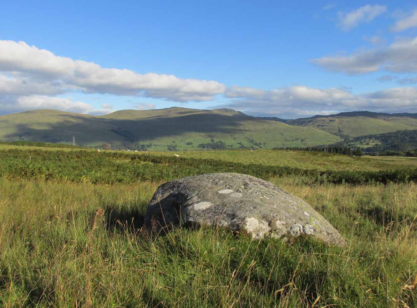
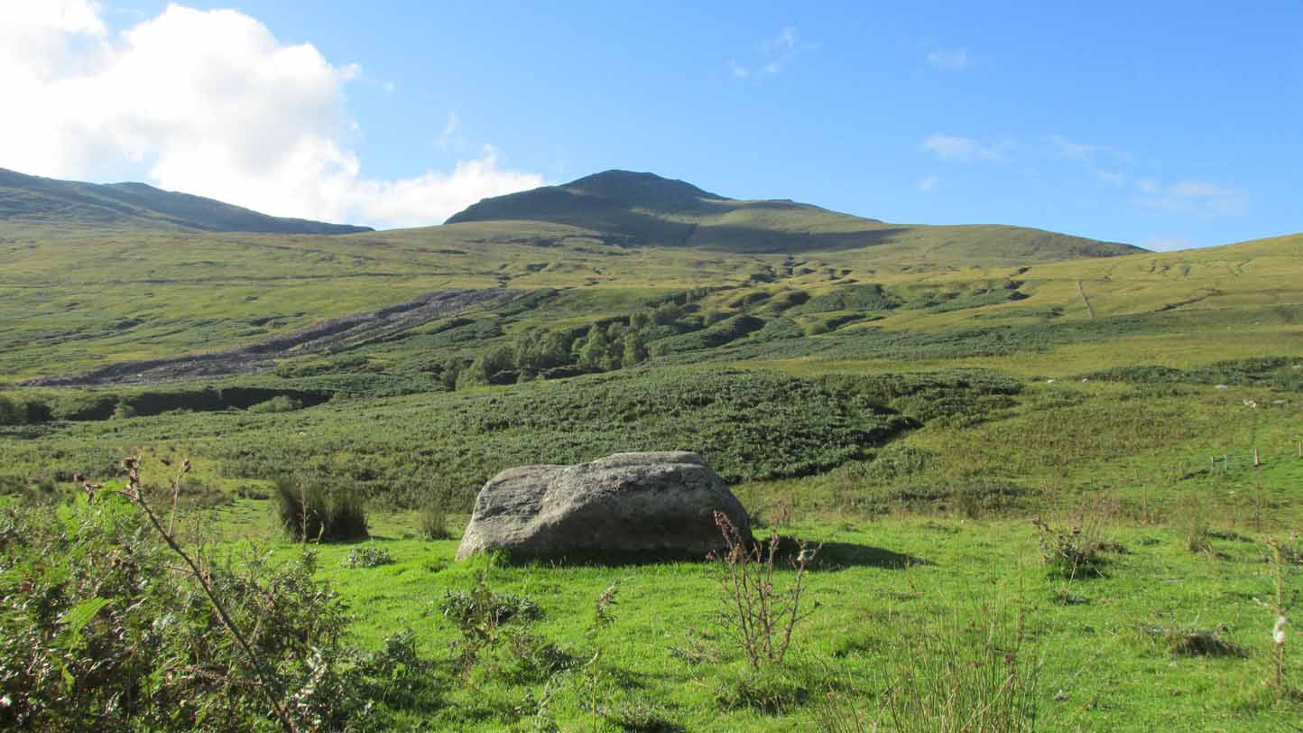
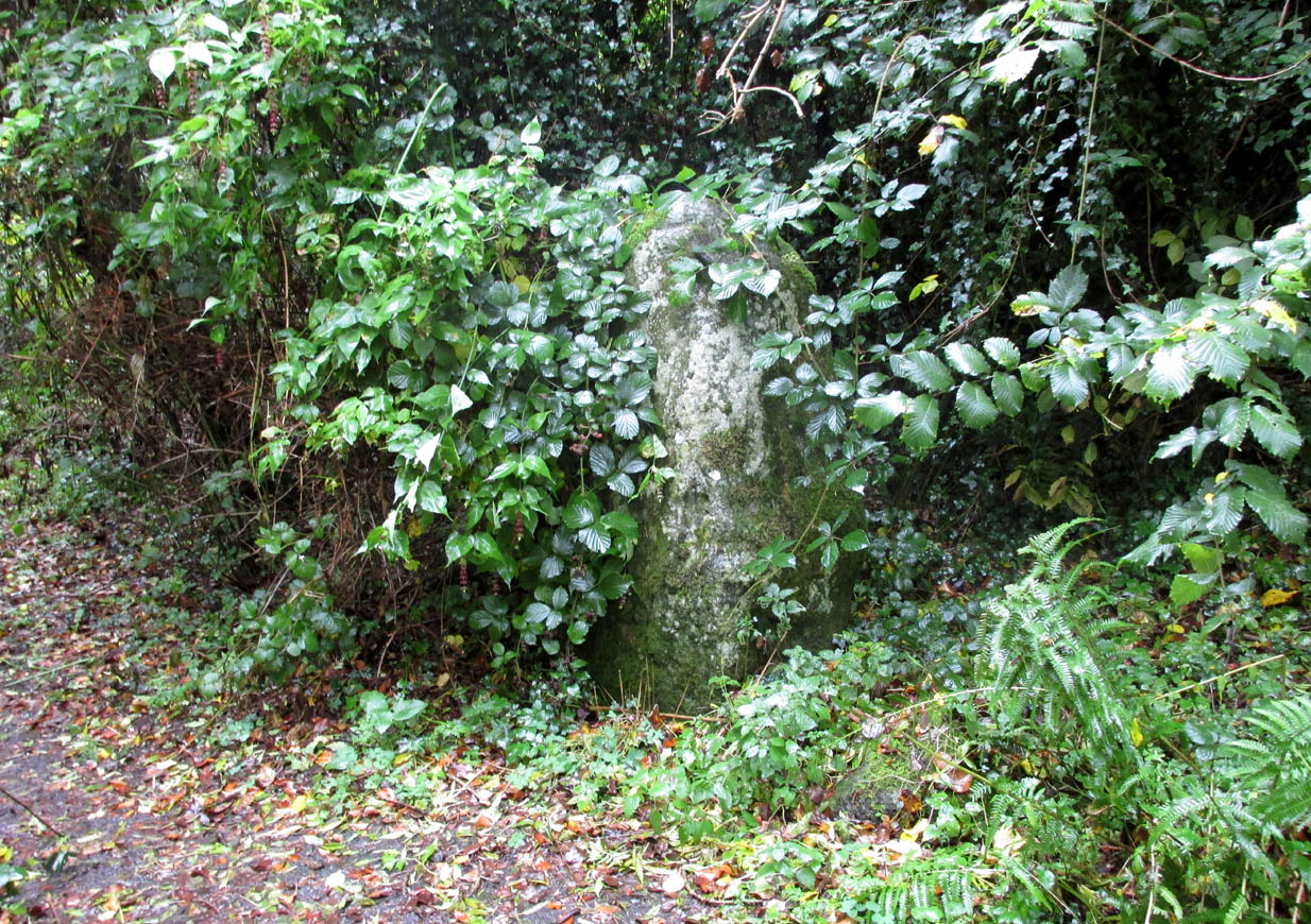
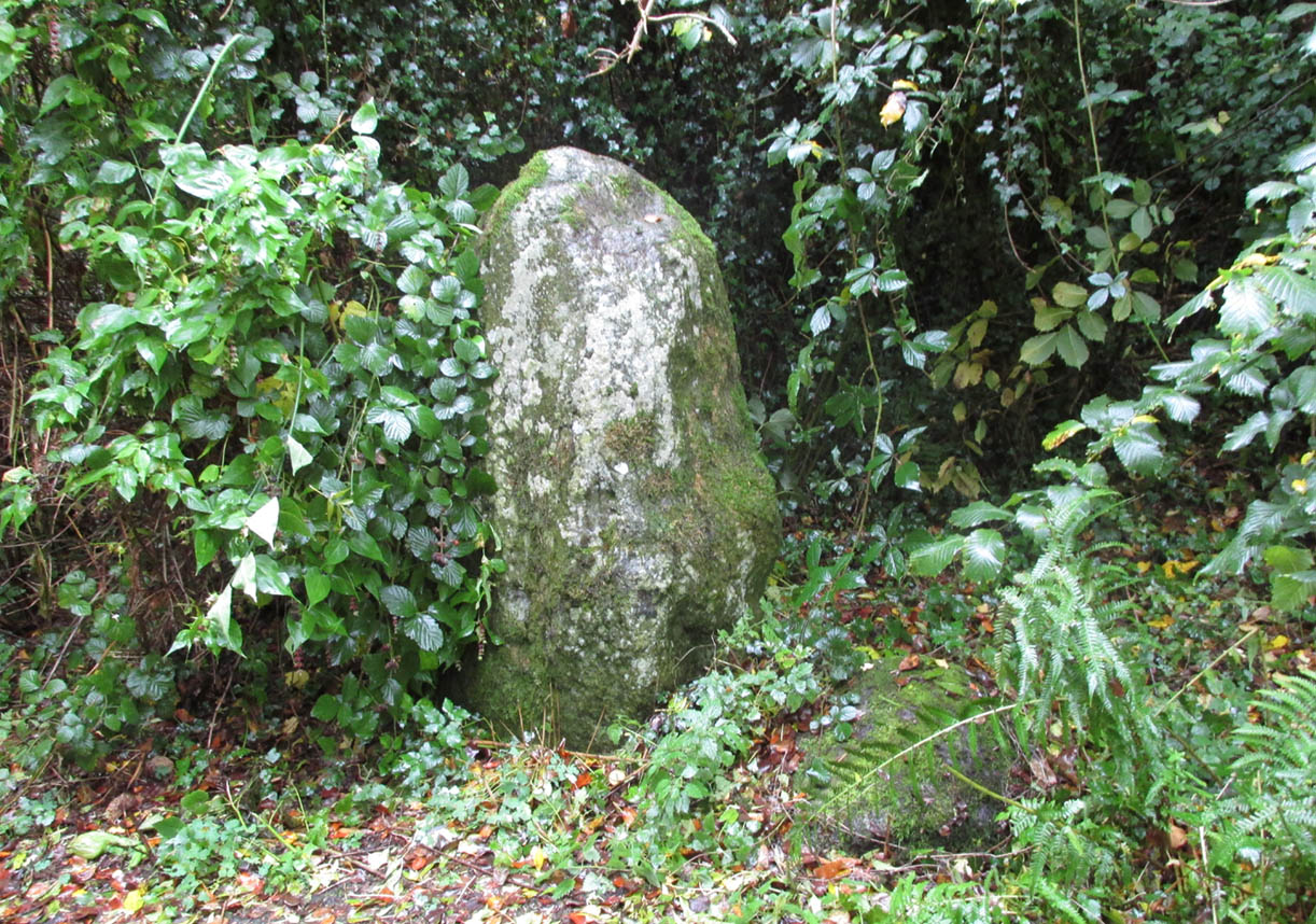
The stone in its setting

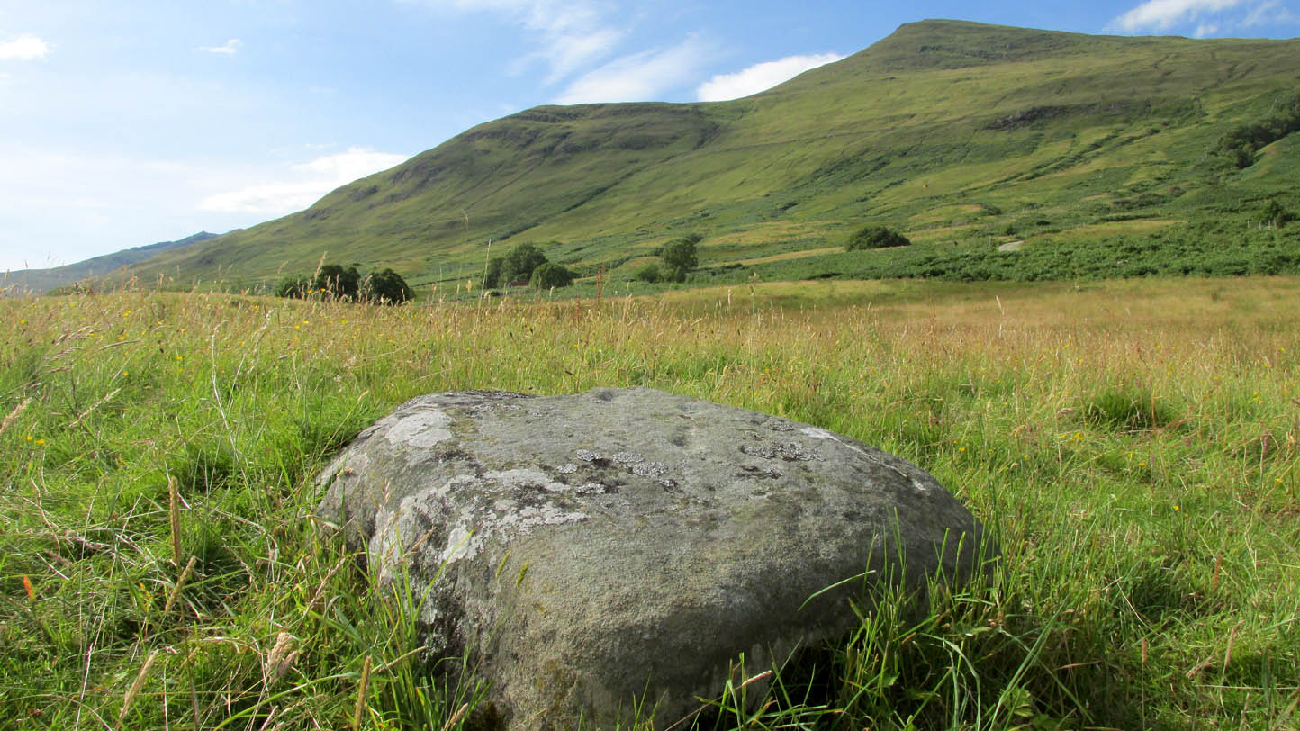
From Killin, take the A827 road to Kenmore. 6 miles along, on your right, is the track down to the Big Shed at Tombreck.  Keep on the A827 for exactly ⅓-mile (0.53km), and opposite the driveway to Craggantoul is a small parking spot.  A few yards on the road, over the burn, go thru the gate on your left.  Follow the straight line of walling up for 800 yards where the walling hits the burn, then follow the water up until you cross a fence.  Once over this, 50- yards to your right you’ll see a large rounded rock and companion.  It’s the rounded rock.

Archaeology & History

As with most the carvings along here, it is the setting that captivates more than the petroglyph.  This is another one mainly for the purists amongst you, but there’s a distinct feel of other carvings hiding very close by that remain hidden.  Anyhoo…
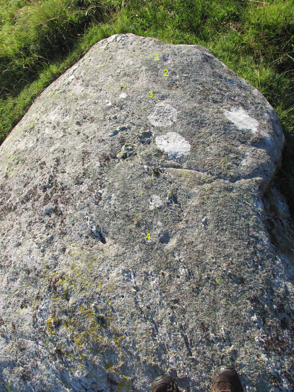
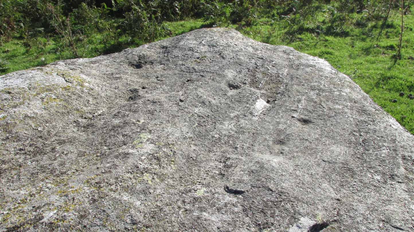
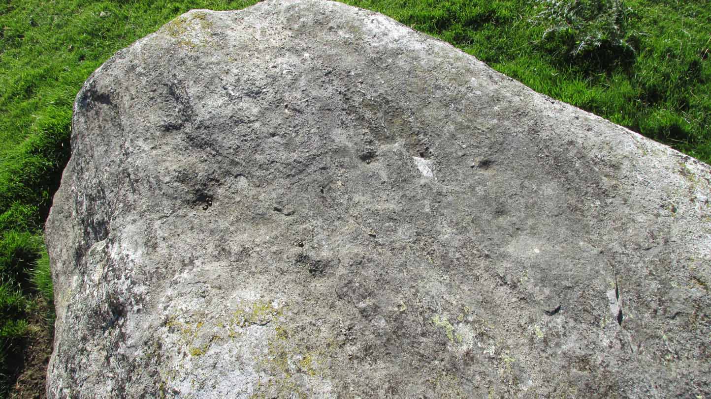
4 of the cups numerated
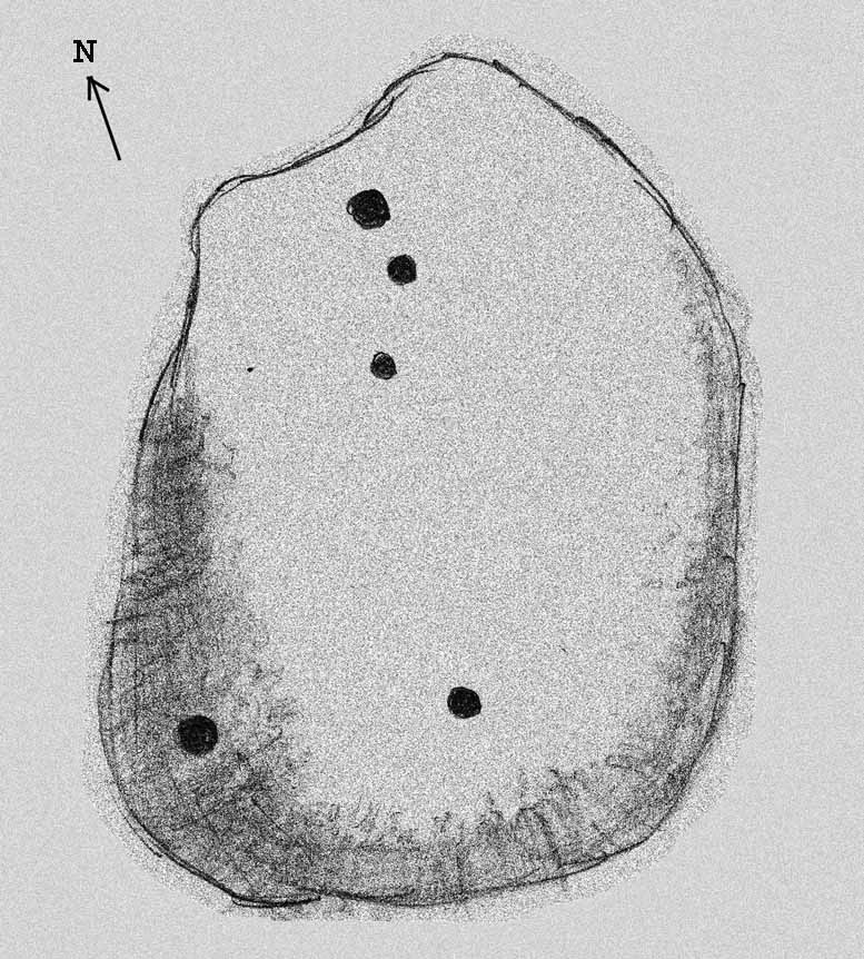
Rough sketch of design

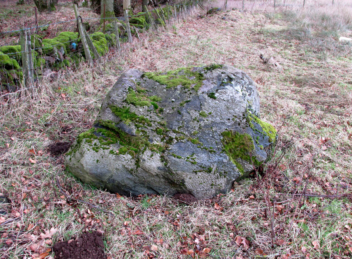
This reasonably large, rounded, female stone has the usual scatter of quartz in its veins, along with at least four cup-marks on its upper sloping surface.  Three of them are seen in a slight arc on the more northern slope of the stone with one of them particularly faint; but the most notable of the lot on the very crown of the stone. (see the numerated image, right)  A fifth cup-mark is clearly visible on the western face of the boulder, shortly below where the rock begins to level out.  You’ll see it.  Some 200 yards west of this carving, the prominent rock hosting the Cragganester 10 carving is visible on top of its rounded knoll.

© Paul BennettThe Northern Antiquarian


Cragganester (10), Kenmore, Perthshire

Cup-Marked Stone:  OS Grid Reference – NN 65796 38799

Getting Here

The stone on its knoll

From Killin, take the A827 road to Kenmore. 6 miles along, on your right, is the track down to the Big Shed at Tombreck.  Keep on the A827 for exactly ⅓-mile (0.53km), and opposite the driveway to Craggantoul is a small parking spot.  A few yards on the road, over the burn, go thru the gate on your left.  Follow the straight line of walling up for 7-800 yards and then walk to your right, into the field.  About 300 yards into the overgrown meadowland you’ll see a rounded knoll with a very notable boulder on its crown. Y’ can’t really miss it!

Archaeology & History

It’s the setting of this carving that captures you way more than the carving itself—which is probably somewhat of a disappointment to most folk, unless you’re a petroglyph fanatic like myself.

The five cup-marks
…and from another angle

Found relatively close to other carvings, this reasonably large boulder has, upon its roughly smooth top, just five simple cup-marks with varying degrees of weathering, from the very noticeable to the somewhat faint—hinting at the unlikely possibility that it might have been carved at different times.  A possible sixth cup can be seen in certain daylight conditions on the southwest section of the stone.  That’s it!

© Paul BennettThe Northern Antiquarian


Abernethy Den, Abernethy, Perthshire

Standing Stone:  OS Grid Reference – NO 1883 1610

Also Known as:

  1. Canmore ID 185835

Getting Here

Hidden by creeping ivy

Along the main A913 Perth Road that runs round the northern edge of Abernethy village, as you approach the village from the western side, go right at the mini-roundabout up the Main Street into the village.  However, just where this roundabout is, there’s a footpath into the trees known as the Castlelaw.  Walk up here, keeping to the left-side of the burn (don’t cross over onto the right-hand side!) and after about 200 yards or so, keep your eyes peeled for a large upright stone, almost overgrown in dark vegetation on your left.

Archaeology & History

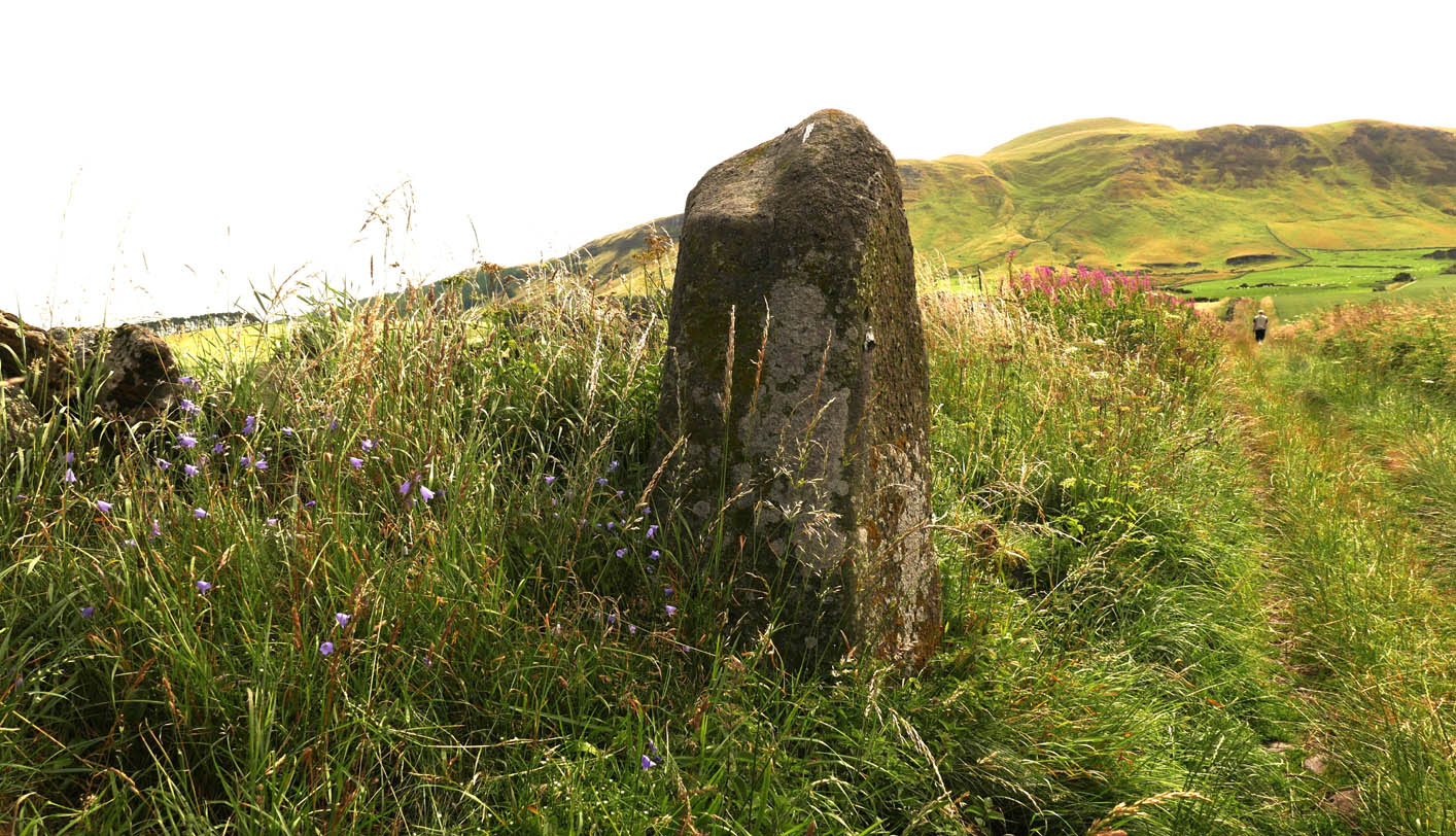
An intriguing standing stone in a most unusual position: a small wooded glen with a steep slope on its immediate eastern side, very enclosed.  It’s quite a big thing too, standing some six-feet high with the usual worn rounded crown, typical of olde stones.

The olde stone, unmasked

In the very brief account of this site by Hallyburton & Brown (2000) they describe this “previously unrecorded /lost standing stone and possible ruinous stone circle.”  This is also echoed in Canmore’s description.  A standing stone we certainly have, but in several visits here there was no evidence of any stone circle either side of the burn.  It was suggested that the “circle” may once have been atop of the slope immediately above this stone, but again there is no evidence at all to suggest this and old maps show nothing.  I’m extremely doubtful of any megalithic ring here (I’d love to be wrong though).

References:

  1. Hallyburton, I. & Brown, R., “Abernethy Den (Abernethy Parish),” in Discovery & Excavation Scotland, New Series – volume 1, 2000.

© Paul BennettThe Northern Antiquarian

Clach an Eolas, St Kilda, Outer Hebrides

Legendary Stone:  OS Grid Reference – NF 101 996?

Also Known as:

  1. Stone of Knowledge

Archaeology & History

This stone has very similar qualities to the one found upon Mullach-geal, ⅔ of a mile to the west, as a place where ritual magick was performed.  And, just like the Mullach-geal stone, we only have an approximate position of its whereabouts: “behind the village”, as Mr Sands (1878) said.  The same words were used by other St Kildan writers when it came to describing the whereabouts of Tobar Childe, so we must assume it to be reasonably close to the old well.

Folklore

Mr Sands seems to be the first person to write about it, telling us,

“At the back of the village is a stone, which does not differ in external appearance from the numerous stones scattered around, but which was supposed to possess magical properties.  It is called Clach an Eolas, or Stone of Knowledge.  If any one stood on it on the first day of the quarter, he became endowed with the second sight — could “look into the seeds of Time,” and foretell all that was to happen during the rest of the quarter.  Such an institution must have been of great value in Hirta, where news are so scanty.  To test its powers I stood on it on the first day of Spring (old style) in the present year, but must acknowledge that I saw nothing, except two or three women laden with peats, who were smiling at my credulity.”

Charles MacLean (1977) mentioned the stone a hundred years later, but seems to have just copied this earlier description.  Does anyone up there know its whereabouts?

References:

  1. MacLean, Charles, Island on the Edge of the World, Canongate: Edinburgh 1977.
  2. Sands, J., Out of the World; or Life in St. Kilda, Maclachlan & Stewart: Edinburgh 1878.

© Paul BennettThe Northern Antiquarian

Mullach-Geal Stone, St Kilda, Outer Hebrides

Legendary Rock:  OS Grid Reference – NF 092 996

Archaeology & History

This is a most intriguing site, whose exact location seems to have been forgotten.  It was first mentioned in Macaulay’s History of St Kilda (1764) as being one of four stone altars that the islanders used for worship.  Three of them were related to the early christian figure of St. Brendan, whose well and chapel remains are on the south-side of the island.  However, this fourth stone altar possessed a purely magickal and heathen function.  Macaulay initially gives the location as being “on top of a hill to the southwest” of St. Brendan’s chapel; but subsequently tells us it was upon “Mulach-geall” which is a mile NNW.  It was an important place to the people of Hirta and its exact position needs to be found and, hopefully, the altar still exists.

Folklore

Despite Macaulay’s conflicting directions of how to get here (a common feature of early writers), he wrote:

“I have already made mention of one St. Kilda altar, that in Brendans Chapel.  There are no less than four more in the island, of which three lie at considerable distances from the holy places.  There is one particularly on the top of a hill to the south-weft (sic), dedicated according to tradition to the God who presides over Seasons; The God of thunder, lightning, tempests and fair weather.  To avert the terrible judgments inflicted by this mighty Divinity, the ancient St. Kildians offered propitiatory sacrifices on this altar, sacrifices of different forts, much like the old Pagans, who offered a black sheep to Winter, or the Tempest, and a white one to the Spring…  The place where the people of this island, offered their victims to Taranis, is called Mulach-geall, that is to say, the White eminence or hill…”

More than a hundred years later, Seton (1878) made mention of it, but added no further details.

The invocation to Nature’s elements is something we find echoed at some sites further east, such as the Well of the North Wind on Iona and its compatriot Well of the South Wind.  At both these places, so-called ‘pagan’ rituals were used to both placate and invoke the gods and spirits of the wind.  This one on St Kilda possessed additional magickal prowess.  But where is it?  Have we lost it, or is it sleeping somewhere on the edge of Mullach-Geal…?

References:

  1. Macaulay, Kenneth, The History of St. Kilda; Containing a Description of This Remarkable Island; the Manners and Customs of the Inhabitants; the Religious and Pagan Antiquities There Found, T. Becket: London 1764.
  2. Seton, Gordon, St. Kilda – Past and Present, William Blackwood: Edinburgh 1878.

© Paul BennettThe Northern Antiquarian

Giant’s Stones, Arnbathie, Perthshire.

Legendary Stones: OS Reference – NO 16695 26086

Getting Here

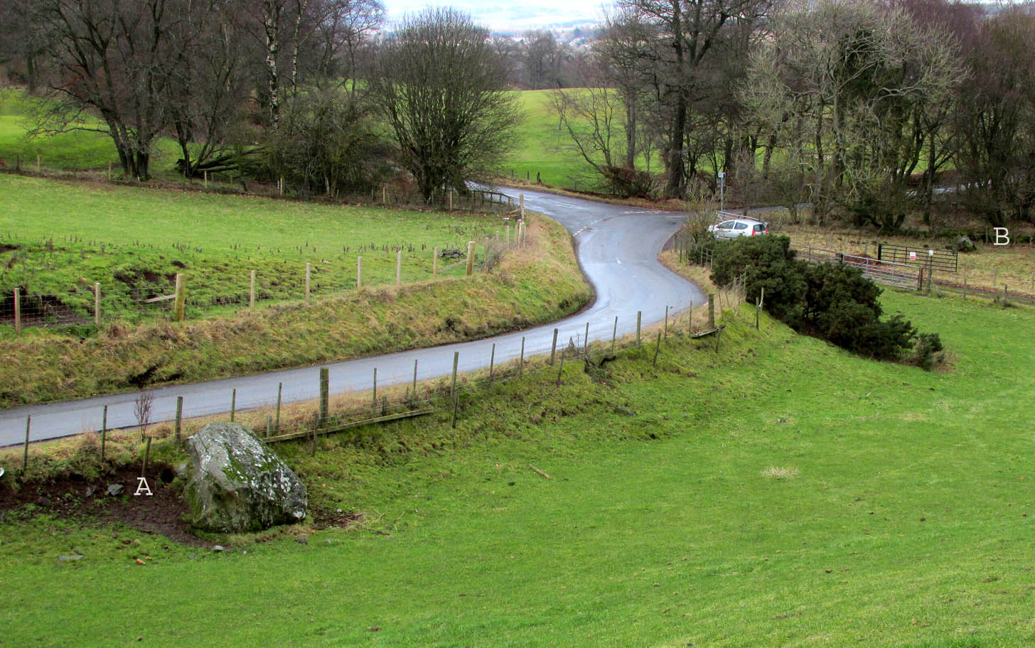
The two stones in relation to each other

Travelling north from Perth on the A94, take the right turning for Murrayshall just before entering Scone, then take the first right and continue up to the road junction, and park up at the trackway opposite.  You’ll see the big stone in the field to the right, up against the road embankment; and the small stone is in the paddock to the left of the trackway at the edge of the trees.

Archaeology & History

Two large glacial erratics which have acquired mythic status and picked up a Christian triumphalist message on the way.

Folklore

In Lawrence Melville’s (1939) excellent local history work, he thankfully put to pen an all-but-forgotten tale of oral tradition:

“Where the road from the Muir of Durdie leaves Kilspindie parish, a grass grown road leads north to Boglebee….. A few yards from the highway lie two large stones, said to have been flung from the Giant’s Hill in Collace parish – the flat topped eminence lying due north from the stones, about two or three miles away, better known as “Macbeth’s Hill”, or “Dunsinane Hill”.

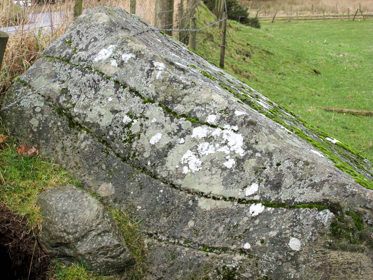
The ‘string’ marks of legend
The smaller stone with its ‘string’ marks

“When the church dedicated to St John in Perth was being built and its tower began to appear, a witch living in Collace was enraged to see this proof of the approach of Christianity and determined to destroy it. She had a son, a giant (after whom the hill receives one of its names), whom she sent to the top of the hill, giving him two huge stones with which to destroy the rising church.

“By her incantations she had supernatural power and knew that when Christianity came her power would be destroyed. She gave him her mutch from her head to be used as sling and in it the giant put the two huge stones. Whirling it around his head, he aimed them in a line with the tower, but, just as he let them fly, the string of his mother’s cap broke and the stones only went the length of Boglebee. The marks on the stones are said to be the marks of the witch’s mutch strings.”

Another view of the larger stone

A familiar folkloric message is remembered the length of Britain:  a giant, a devil or other supernatural being throwing stones that either spill out of an apron or otherwise miss their mark.  And in this case an unsubtle message to anyone trying to take on the might of the church.  But what was the original story of these stones as told by the old time oral storytellers before Christian missionaries stalked the land?

If the string hadn’t broken and the stones had followed their original trajectory they would have fallen south of St John’s Kirk, but it was the thought that counted….

Reference:

  1. Melville, Lawrence, The Fair Land of Gowrie, William Culross: Coupar Angus, 1939.

©Paul T. Hornby 2020, The Northern Antiquarian


Giant’s Leap & Rock, Black Hill, Abernyte, Perthshire.

Legendary Rock: OS Reference – NO 21559 31659

Getting Here

Giant’s Rock in ravine overlooked by the Leap

The Rock and Leap may be seen from the B953 Bandirran to Abernyte road.  Approach across the fields.

Archaeology & History

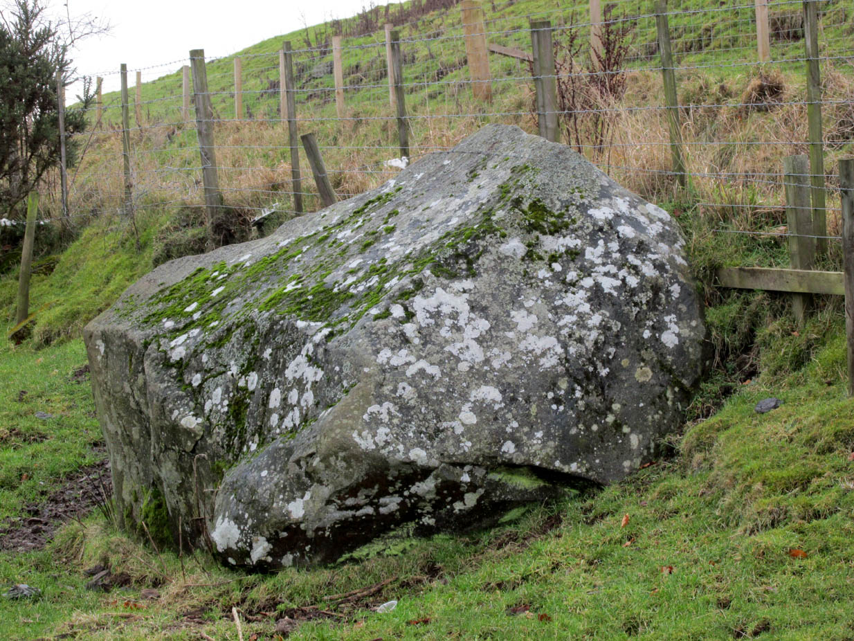
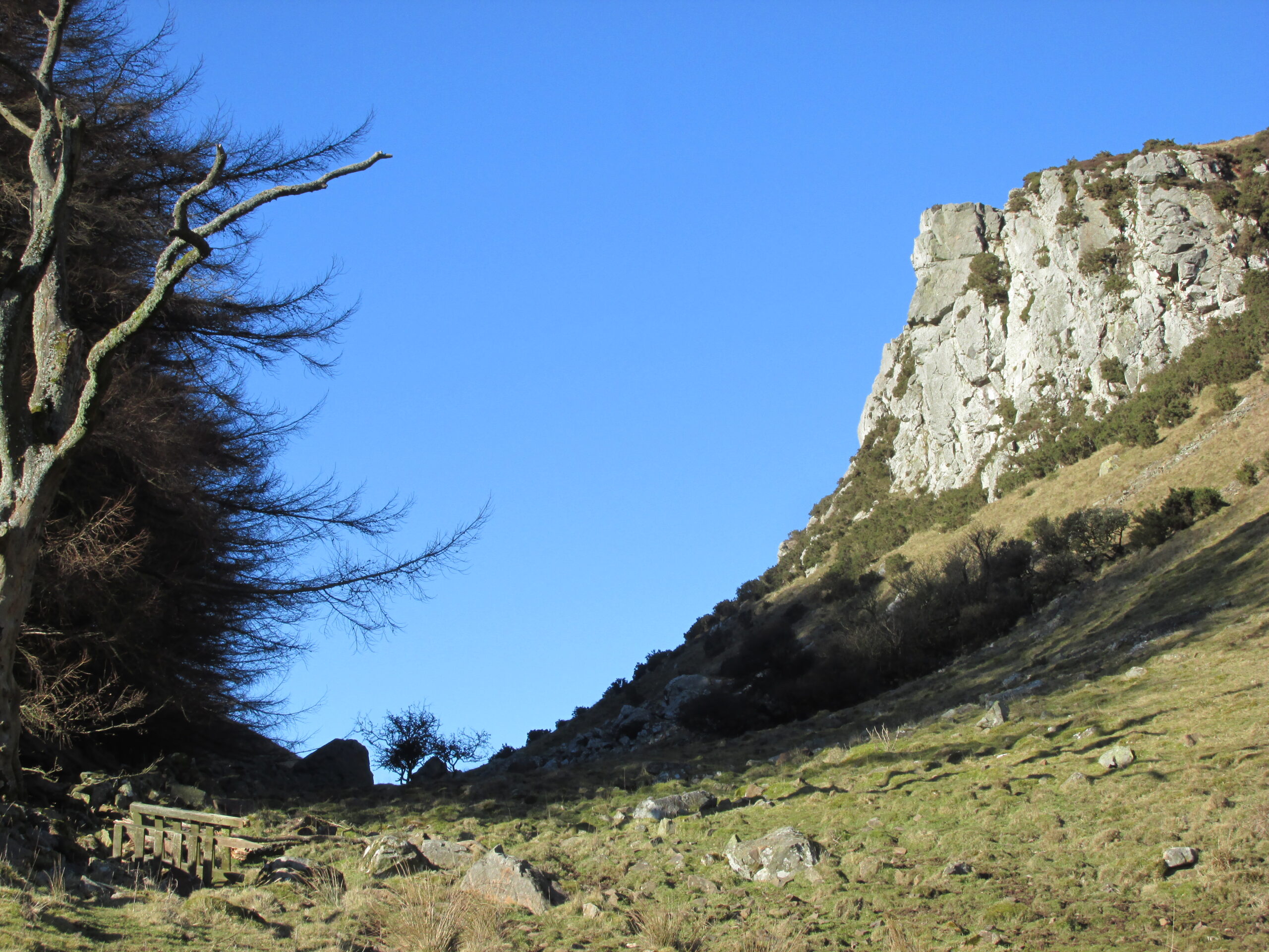
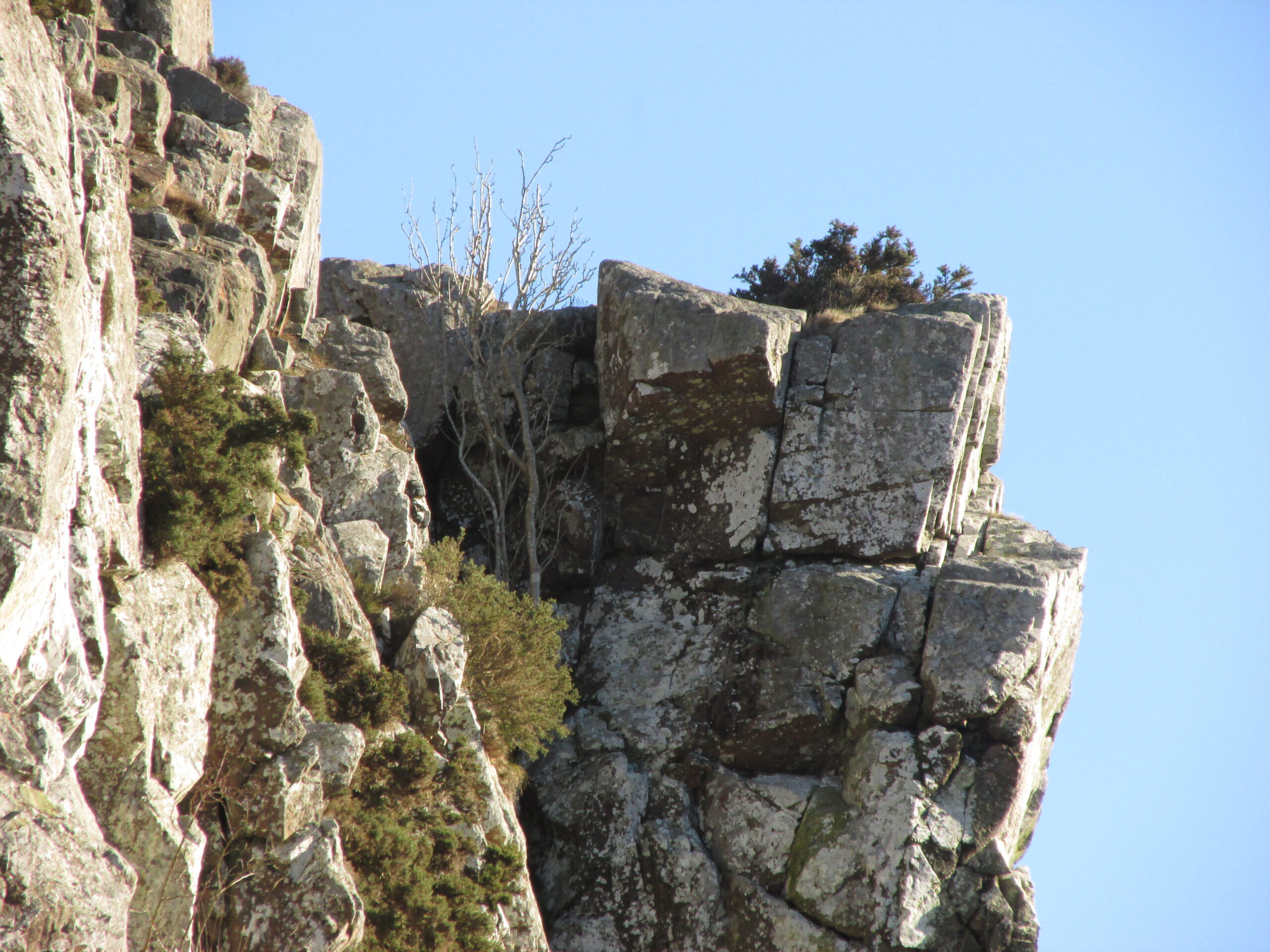
A large boulder perhaps 40 tons in weight lies in a ravine between Dunsinane and Black Hill. The ‘Leap’ is a flat topped ledge jutting out from the west side of Black Hill facing Dunsinane.

Folklore

Melville (1939) in his The Fair Land of Gowrie writes of the simple pleasures of the giant:

“From the farther side of the ravine [between Dunsinane and Black Hill], a precipitous rock juts out, which is called the “Giant’s Leap”. According to the lore of the Sidlaws, a giant, who once lived in these parts, leaped from this rock right on to the top of Dunsinane Hill.  The giant also amused himself by tossing about a huge boulder which can be seen lying at the bottom of the ravine.”

And adds:

The Big Fellow’s toy
Giant’s Leap from the north

“Fairies haunted the hills here and on summer nights they descended to the meadows, where they danced at a spot called “Fairygreen”. The Black Hill gets its name from the dark heath which covers it. Weird and bleak looking for most of the year, the lower slopes are brightened by glowing patches of purple flowers in late summer.”

Fairygreen Farm lies a mile almost due north of Dunsinane.

Reference:

  1. Melville, Lawrence, The Fair Land of Gowrie, William Culross & Son, Coupar Angus, 1939.

© Paul T Hornby 2020, The Northern Antiquarian


Wester Nether Urquhart Stane, Gateside, Fife

Standing Stone:  OS Grid Reference – NO 1862 0799

Getting Here

Wester Nether Urquhart Stane

To find this stone take the A91 to Gateside and turn into Station Road.  Follow to the end, then turn right.  200 yards on there is a parking spot for the Bunnet Stane, and a track to follow.  As you go up this track towards the Bunnet, approximately 280 yards on is this beauty.

Archaeology & History

At over 6ft high, this previously unrecorded standing stone has quite a presence on this slight incline.  It’s hard to tell the true height as he is set in a grassy bank with a drystane wall behind.  It has obviously been used as a gatepost at some time in the past, but there’s no hint of being moved for that purpose.  There are many ancient relics in this area and there used to be a stone circle across the road and behind Nether Urquhart Farm, along with several burial cairns.  I reckon there is a lot more to be found, and we fully intend to go back there.

© Maggie Overett, The Northern Antiquarian
Tombreck (15), Kenmore, Perthshire

Cup-Marked Stone:  OS Grid Reference – NN 64894 38308

Getting Here

Tombreck (15) carving

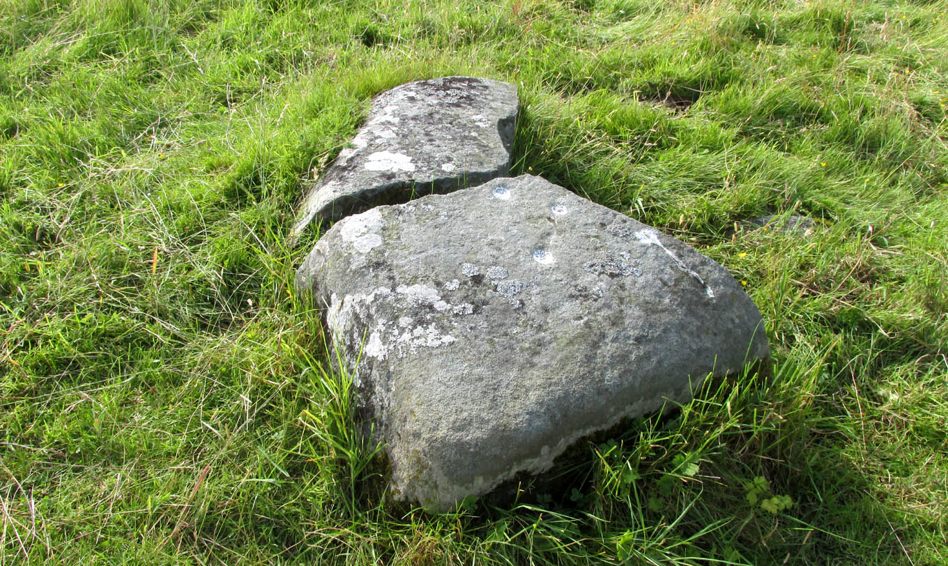
Along the A827 Loch Tay road between Morenish and Lawers, take the track uphill where Carie farmhouse and Tombreck are either side of the road. Walk up this track 2-300 yards till you go through the gate just past the sheep-folds on your left.  Ahead of you is a small grassy hillock on your right upon which you’ll find the unimpressive Tombreck-1 carving.  Walk down the grassy-slope to the boggy stream and then up the rounded knoll on the other side, where you’ll find a stone that’s been split in two.  You’re here!

Archaeology & History

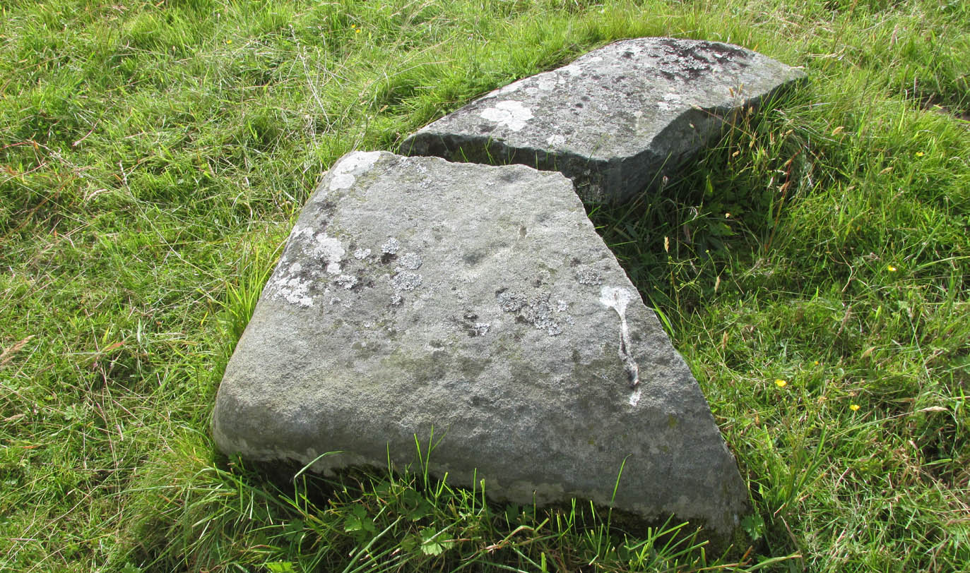
This is another unrecorded carving, found amidst this already large petroglyphic cluster on August 9, 2020.  Carved on a stone that’s been spilt in half, three simple cup-marks can be seen on the larger easternmost section, with the lowest of them having a possible short line running towards the cup on the right.  It seems that the right-hand (north) side of the stone has also been cut, but there is no trace of this part of the stone on the ground.  Additionally, there is the possibility that this stone once stood upright, as evidenced by its very worn rounded top and the larger bottom end of the stone being distinctly lower compared to the ground all round it. But this is speculative.

The 3 cups, highlighted
3 cups on the lower stone

Although the rock is close to being on the top of a rounded knoll, giving good visibility both east and west for a few miles along the extensive grassy ridge (where many other petroglyphs exist), the grandeur of Loch Tay  in the glen below is not and could never have been visible from this, or indeed many other carvings on this ridge.  I mention this due to the fact that some students are positing that the existence of so many carvings along here may relate to some sort of deification of Loch Tay.  But here and at many others along this ridge, the idea simply aint valid, unfortunately.

© Paul BennettThe Northern Antiquarian
Stews, South Ronaldsay, Orkney

Standing Stone: OS Reference – ND 46558 88998

Also Known as:

  1. Canmore ID 9516
  2. Stowse

Getting Here

A wind blown stone

Take the third left road off the A961 past St Mary’s Hope, travelling south, taking the right fork at Lythes, and continue down to the end of the metalled road. From there, walk up the slope to your right (south) and follow the fence on your left into the next field and the stone will be seen in a fenced enclosure.

Archaeology & History

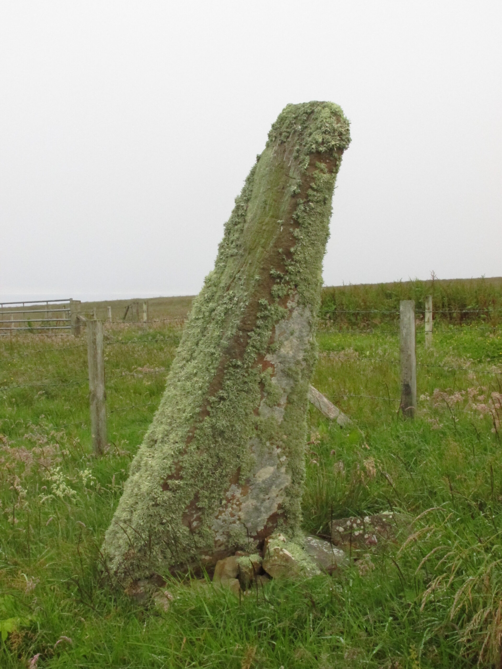
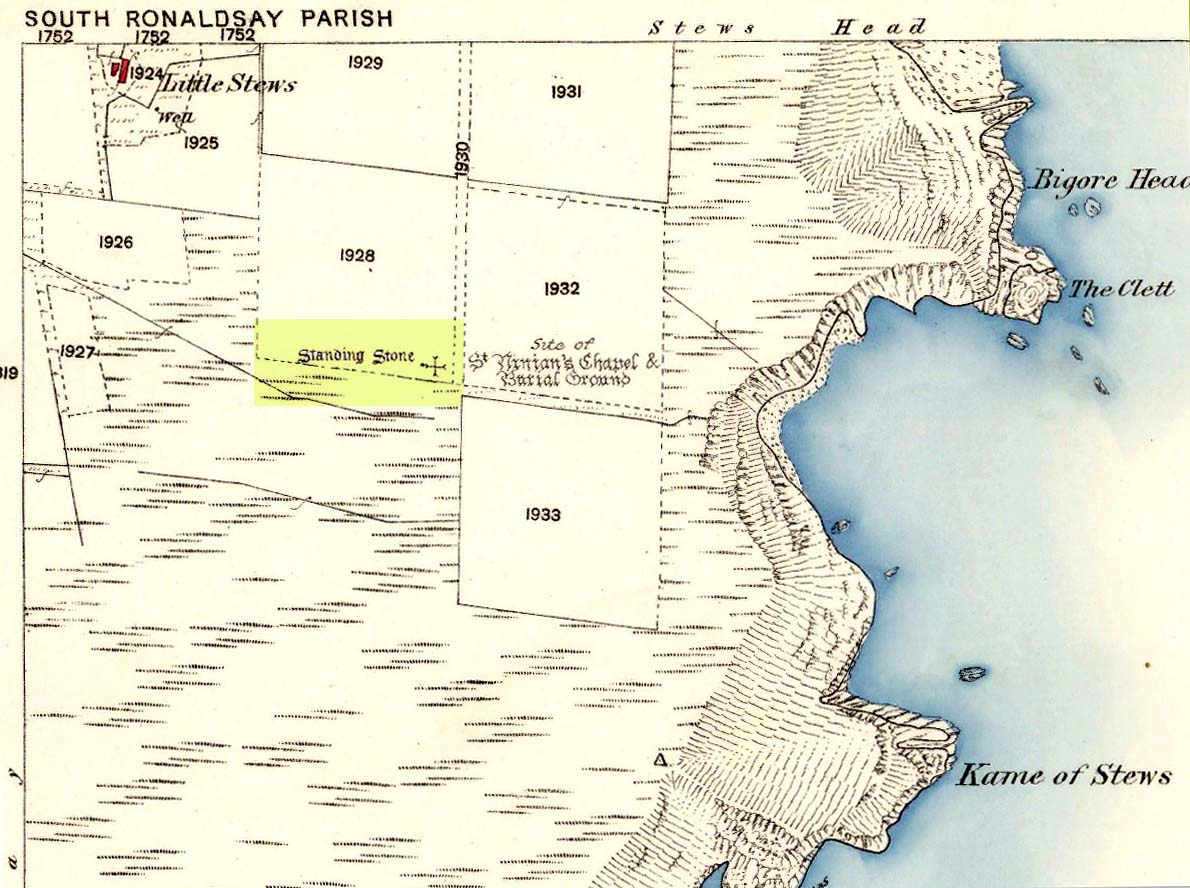
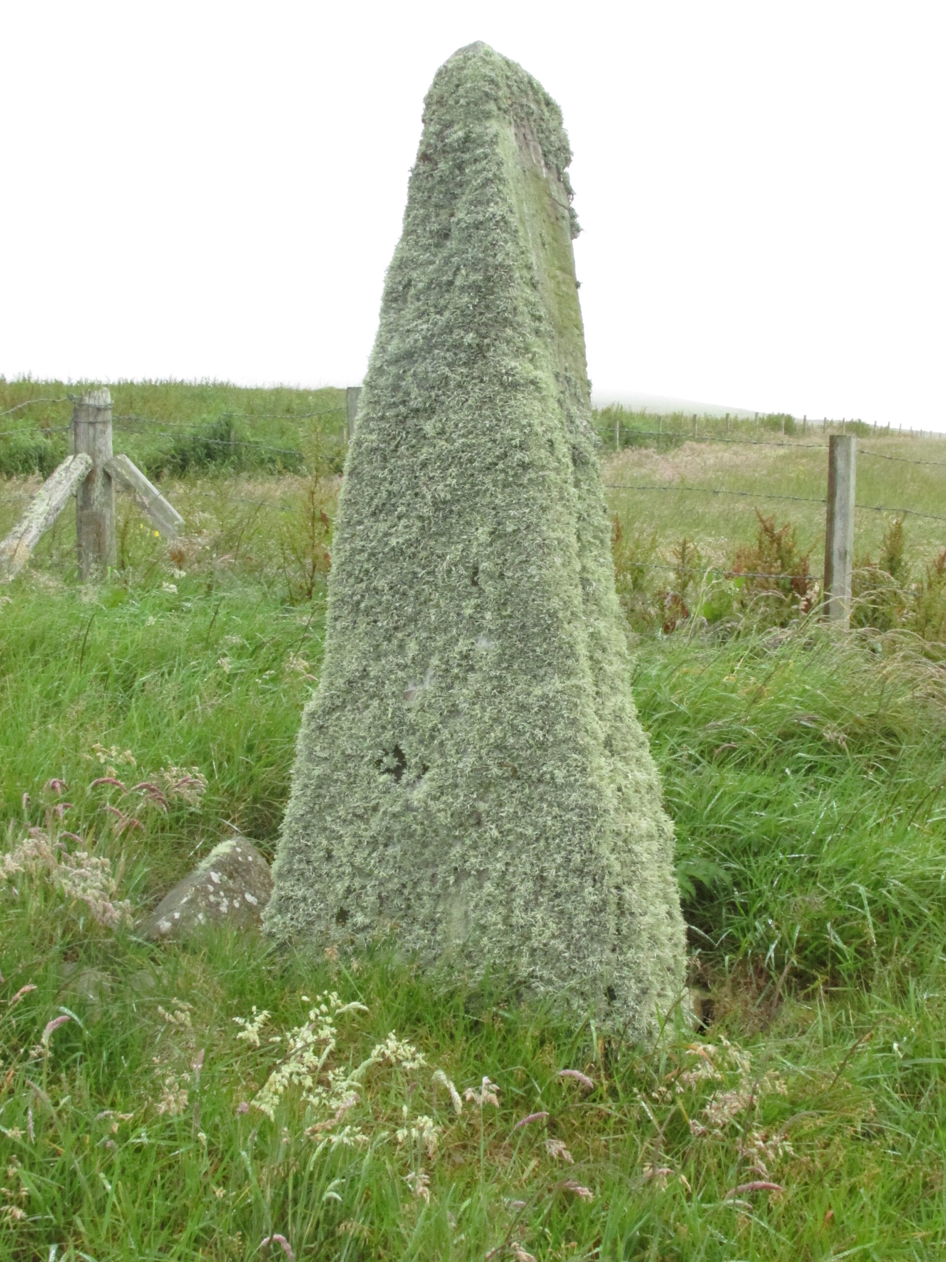
Two things strike you when you first see this stone, the triangular shape of the east facing side, and the lichen which covers this face and much of the rest of the stone giving it the distinct illusion of having a green velvet coat! From another angle it has a distinct lean and there are quite a few packing stones around its base. The Royal Commission inventory (1946) describes it thus:

Stone on 1881 map

“On a ridge barely a quarter of a mile S of the farmhouse of Stews is a triangular block of red sandstone nearly 6 ft high, set with a packing of small stones at the base and with its axis N-S.  At the bottom where it is widest it measures 2 ft. 6 in. across and is from 12-13 in. thick.  As it rises it tapers gradually to a pointed top, which is slightly inclined towards the W.”

George Low on his 1774 tour wrote:

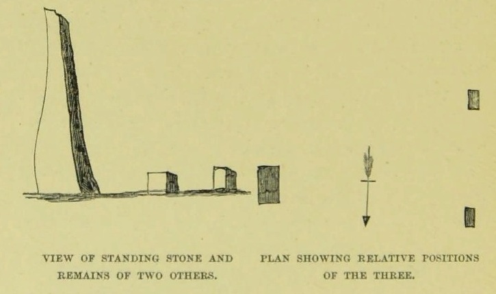
“Left this spot, and May 12th, proceeded southward by Stowse head; observed on the hill the remains of a tri-angular monument, but very much defaced, and two of the stones broke to the stumps. Tradition is there none as to the reason &c. of its erection.  The figure with a plan follows…”

George Low’s 1774 sketch
A coat of lichen

There is now no trace on the surface of the other two stones of this group so we are fortunate to have Mr Low on the spot sketch to record them. The stones would have been visible to the seafarers of times past who may have used them as navigation landmarks in pre-literate times, this being one of a number of surviving coastal stones on the Orkneys but whether they were erected for this purpose cannot be known.  If you’ve been to see the Sorquoy stone up the coast, the surviving Stews stone is worth the journey if only for its ‘velvet’ coat.

References:

  1. RCAHMS, Twelfth report with an inventory of the ancient monuments of Orkney and Shetland, 3v. Edinburgh. 1946
  2. Low, George, A Tour Through the Islands of Orkney and Schetland…collected in 1774, William Peace & Son: Kirkwall 1879.

Acknowledgements:  Big thanks for use of the 1st edition OS-map for this site profile, Reproduced with the kind permission of the National Library of Scotland

© Paul Hornby 2020, The Northern Antiquarian