Stone Row: OS Grid Reference – SE 83016 98119 (SSW) to SE 83031 98142 (NNE)
Getting Here
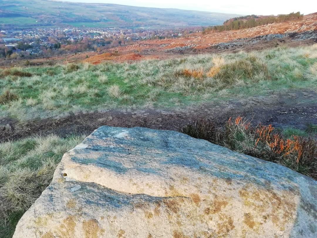
From Pickering take the moor road towards Whitby (A169) for approx. 12 miles. After passing the Fylingdales Early Warning radar on the right (you can’t miss it), the road dips down to cross Eller Beck as a dog leg. After a half mile turn off left (west) towards Goathland (signposted). Follow the road under the North Yorks Moor railway bridge and after a third-of-a-mile the road turns slightly left. Park in the little layby and follow the track onto the moors. Cross the small stream and walk along the narrow track through gorgeous heather for a mile and a half. Ahead you will see Simon Howe prominent on a ridge, with a stone row leading to it.
Archaeology & History
Not included in either of the giant megalithic alignments surveys of Burl or Thom, it seems that the first archaeological reference to this site was made by Raymond Hayes (1988). He visited the site in 1947, shortly after a moorland fire had cleared away all the vegetation, allowing for a clearer view of the stones and, after his brief description of the adjacent Simon Howe tomb, he told that,
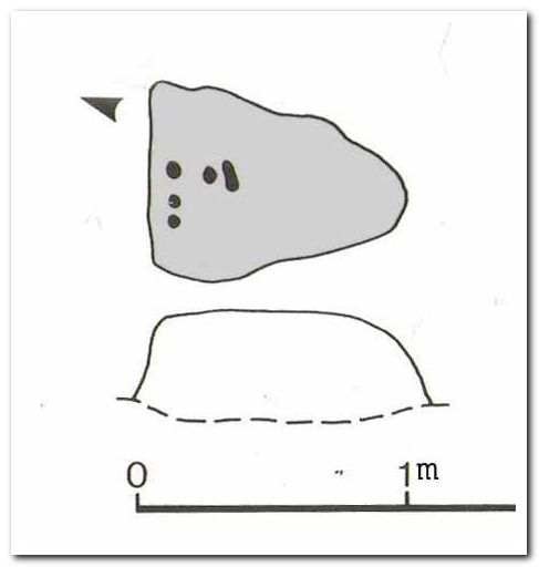
“The ridge is also the site of what is an unusual feature for the moors: a stone alignment consisting of three, formerly five upright stones that lead to a low eroded cairn c.65m to the south(west). A moor fire in 1947 revealed the fourth, fallen stone, and I was able to locate the socket of a fifth.”
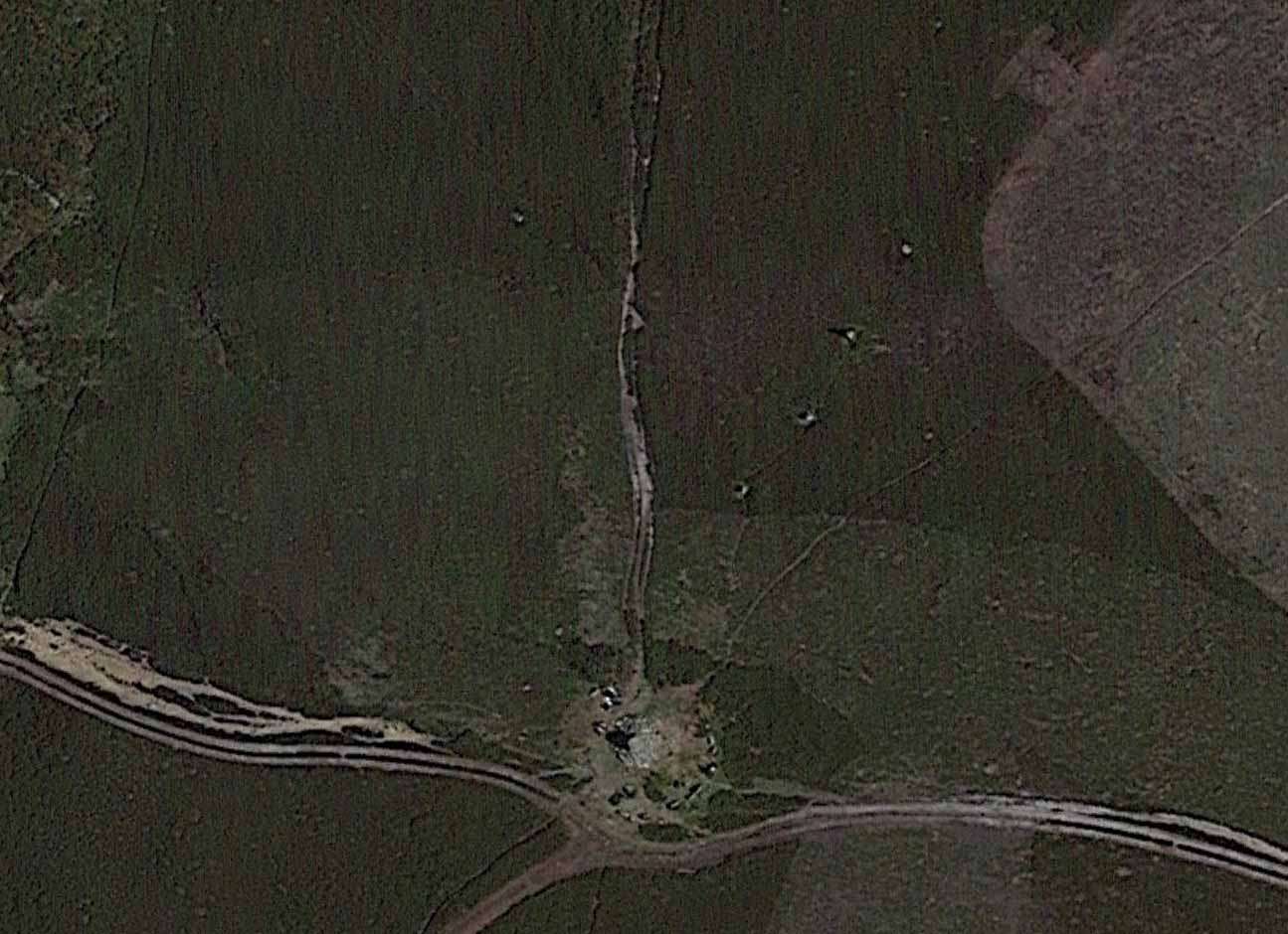
From hereon, Hayes seemed to more interested in seeking out and describing a large number of flints that he found scattered on the ground around Simon Howe and its associated monoliths than the stones themselves. Very sad… The exact position of the missing fifth stone seems to be shown on Hayes’ plan as being closest to the cairn, about 10-15 yards away, but no trace of this remains. However, of the remaining monoliths, they are all clearly visible from the air on Google Earth!
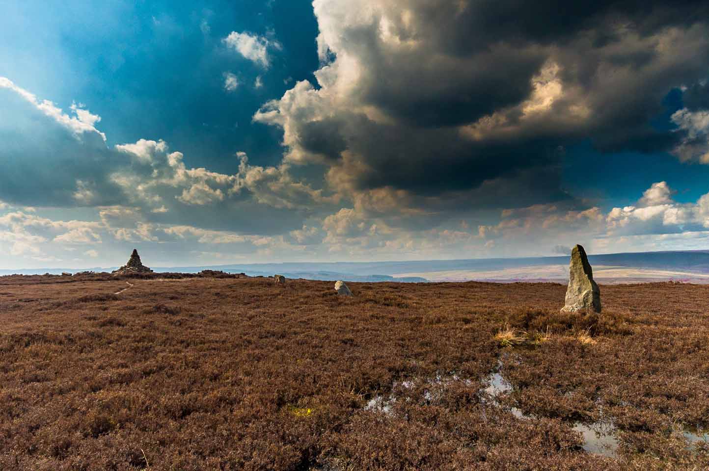
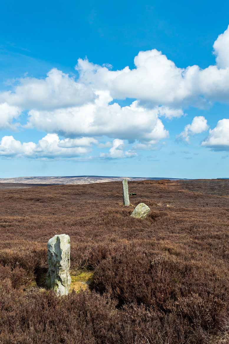
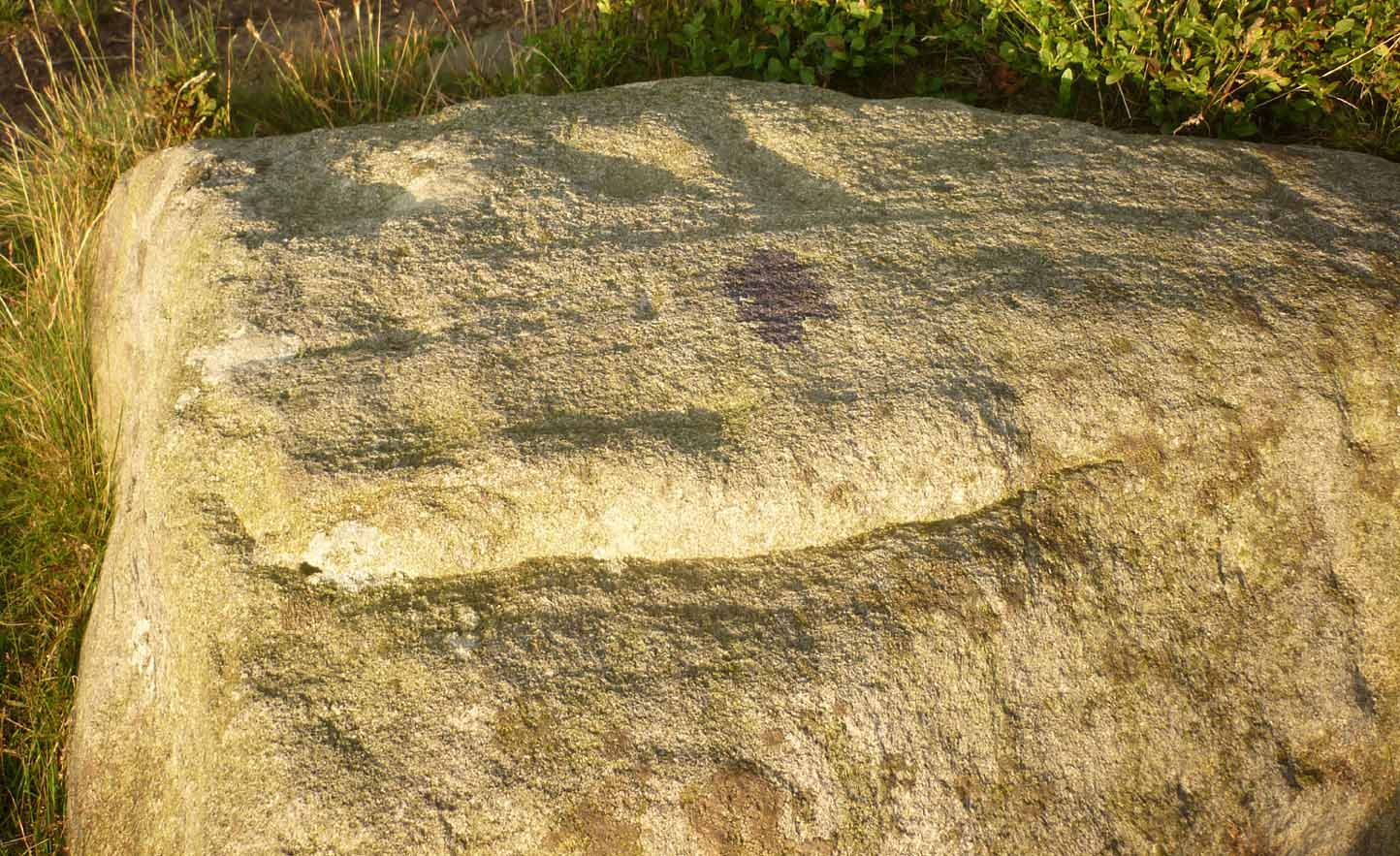
The most southerly of the four stones (SE 83016 98119) stands just over 3 feet tall and the second upright, leaning at an angle, is just slightly taller, with the tallest of the three uprights at the northeastern end, being some 6 feet tall. The fourth fallen stone (SE 83031 98142) lies just beyond this in the heather and which, if resurrected, would stand some 4 feet in height. The length of the row, stone-to-stone, is just over 29 yards (26.6m). I’m not aware if this site has ever been assessed as having an astronomical function, but its angle to the northeast might suggest a lunar rising. Perhaps more pertinent would be another prehistoric cairn that can be seen less than 100 yards away past the northern end of the stone row: as North is the cardinal direction symbolizing Death in traditional lore…
References:
- Hayes, Raymond H., North-East Yorkshire Studies: Archaeological Papers, YAS: Leeds 1988.
- White, Stanhope, Standing Stones and Earthworks on the North Yorkshire Moors, privately printed: Scarborough 1987.
- Windle, Bertram C.A., Remains of the Prehistoric Age in England, Methuen: London 1909.
Links:
- Simon Howe Stone Row on Stone Rows of Great Britain
Acknowledgements: A huge thanks to James Elkington for use of his excellent photos in this site profile, as well as telling us about Getting Here. 🙂
© Paul Bennett, The Northern Antiquarian