Legendary Rock (destroyed): OS Grid Reference – NH 792 651
Archaeology & History
In the ruins St Bennet’s Chapel, along with his accompanying holy well (NH 7923 6502), could once be seen a curiously shaped rock which, according to tradition has been destroyed. In Mr Innes’ (1855) major history work he mentioned this Fairies Cradle in passing. Not far from here and close to the coast, is a curiously-shaped boulder with several natural cupmarks (at NH 9150 6497).
Folklore
In Hugh Miller’s (1878) definitive local history work, Scenes and Legends, we have our main description of this once important site. It existed,
“near the chapel itself, which was perched like an eyry on a steep solitary ridge that overlooks the Moray Firth, there was a stone trough, famous, about eighty years before, for virtues derived also from the saint, like those of the well. For if a child was carried away by the fairies, and some mischievous unthriving imp left in its place, the parents had only to lay the changeling in this trough, and, by some invisible process, their child would be immediately restored to them. It was termed the fairies’ cradle; and was destroyed shortly before the rebellion of 1745, by Mr. Gordon, the minister of the parish, and two of his elders.”
The story of children here being carried away by littlepeople and then restored by an impish offering, is a play on the site being a healing stone. There are numerous other “curing stones” found elsewhere in Scotland, but with their own respective traditions—like the Measles Stone at Fearnan, the Whooping Cough Stone near Killin, and many others.
If anyone knows anything more about this lost “curing stone”, please let us know.
From Killin, take the A827 road to Kenmore. 6 miles along, on your right, is the track down to the Big Shed at Tombreck. Keep on the A827 for exactly ⅓-mile (0.53km), and opposite the driveway to Craggantoul is a small parking spot. A few yards on the road, over the burn, go thru the gate on your left and walk up the path for less than 100 yards. The stone is just a coupla yards on your right (if you reach the derelict tractor, you’ve gone about 10 yards past the stone).
Archaeology & History
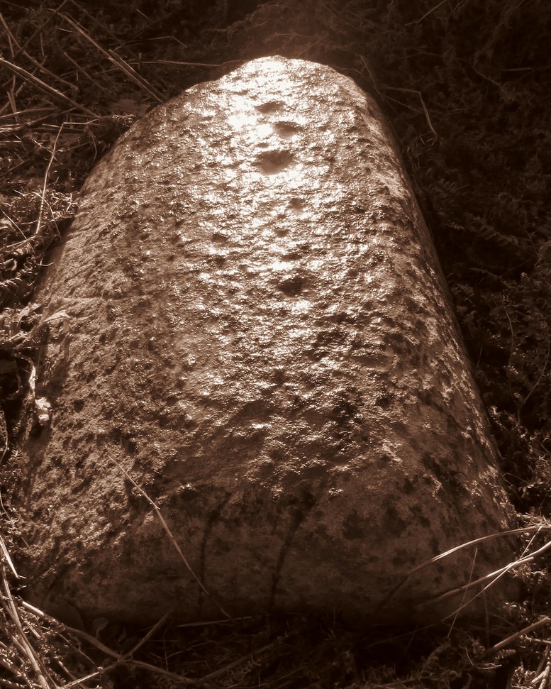
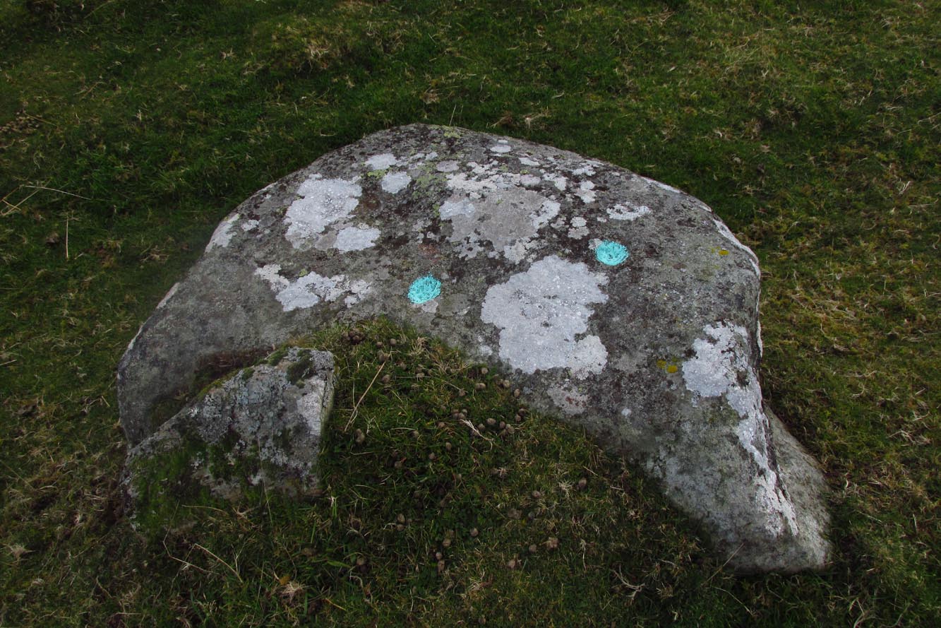
Cupmarks along the top
This is another one of the many simple cup-marked petroglyphs scattering the Cragganester and Tombreck regions beneath the slope of Ben Lawers. It’s an elongated, smoothly-shaped ‘female’ stone, aligned north-south, possessing four distinct cups along its crown: three in a small line at the south-end of the stone and a single one close to the north end. However between these is what may be another, shallow fifth cupmark—but this is uncertain.
One notable feature here is that the rock is encrusted with small garnets. This geological ingredient isn’t uncommon in this area, and we’ve found that quite a proportion of the petroglyphs hereby possess this feature. It was probably of some importance to the people who carved them.
Acknowledgements: Thanks to Paul Hornby for use of his photograph.
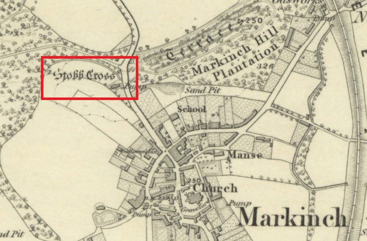
The cross is located on a bluff of land overlooking the west side of Stob Cross Road on the northern edge of Markinch.
Archaeology & History
In 1933, following a visit in 1925, the county archaeological inventory described it thus:-
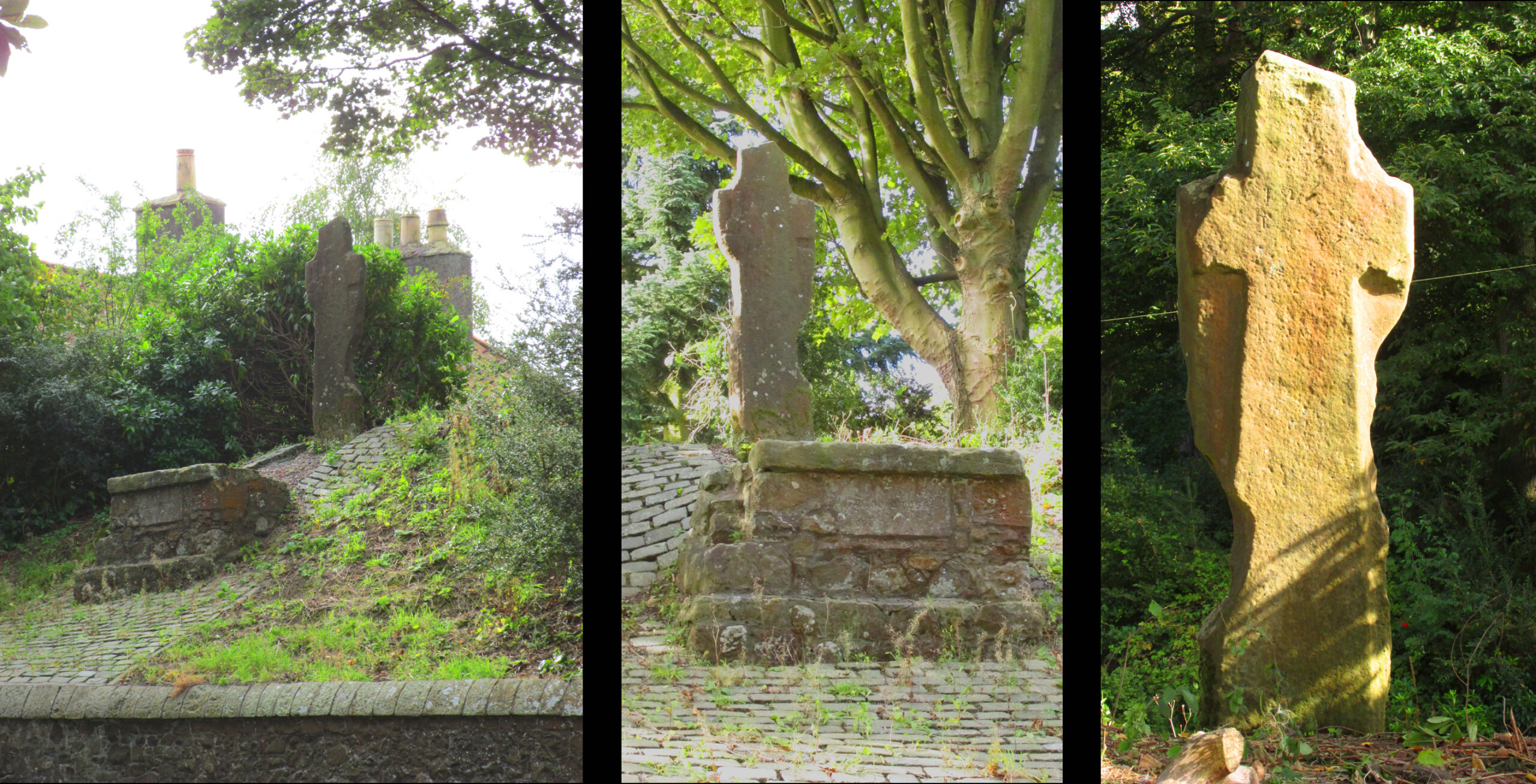
Close beside the East Lodge of Balbirnie House, on a knoll 200 feet above sea-level, stands a stone known, from the nature of its sculpturings, as the “Stob Cross.” It is a somewhat mutilated rectangular slab, 7 feet 5 ½ inches in height, 2 feet broad at the base and 6 inches thick, having a plain cross carved in relief on the east and on the west face. The cross on the east is now very much damaged but sufficient remains to indicate that the arms have been 1 foot wide and that the shaft has measured 1 foot 5 inches across at the intersection. On the west face the design stands out in relief from 1 to 1 ¼ inches. The arms of the cross measure 11 ½ inches in width, and the upper limb, which tapers slightly to its extremity, is 12 ½ inches across at the point of intersection. The shaft measures 1 foot 2 inches across below the arms and widens gradually downwards to 1 foot 8 inches at the base. In 1790, when the cross was in danger of falling, the Earl of Leven had the position faced up with masonry, and the monument now stands, with its major axis north and south, on a two-stepped base of modern construction.
Roadside views l. & centre – Rear view r.
It’s certainly had a hard life, and its official designation as ‘early medieval’ leads us to suspect that it may have been a decorated Pictish cross that has had its ornamentation obliterated by Reformation iconoclasts. Those same iconoclasts may have concocted the ‘history’ recounted by Rev John Thomson (1794) in the Old Statistical Account of 1794 of what he describes as a ‘very coarse piece of work’:-
‘Vulgar tradition says, that it was erected to the memory of a gentleman, who fell on this spot, in a mortal encounter with one of his neighbours.’
Writing of Markinch, nineteenth century historian Aeneas Mackay (1896) has this to say:-
‘A cell of the Culdees was established there by one of the last Celtic bishops, and the ancient cross near Balgonie [sic] may mark its site.’
Modern place-name research ascribes Markinch as a place where horses were grazed while their owners were attending the early mediaeval courts and assemblies at Dalginch a quarter of a mile to the east, so the cross may at that time have been a waymarker. A roadside plaque describes the Cross as possibly marking the limit of an ancient sanctuary enclosure related to the church of St Drostan (known locally as St. Modrustus) in the centre of Markinch. Additionally, it was on the ancient (and recently revived) Fife Pilgrim Way from Culross to St Andrews, so would have been a wayside station for the pilgrims. which if it was a Pictish cross would have made it a target for desecration by iconoclasts. We are lucky that it has survived at all, and with the revival of the Pilgrim Way as a long distance path it will attract many new admirers.
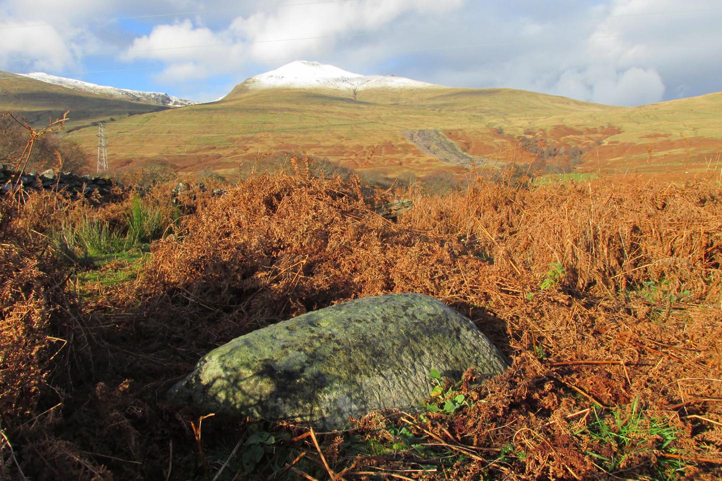
Although you could just as well follow the directions to reach the Cragganester 22 carving (exactly 100 yards away), it’s probably easier to get there from where the track leads down to Balnasuim, but there’s nowhere to park any vehicle here—unless you’re on a bike! Across the road from the Balnasuim track is a gate. Go thru this and then follow the fence immediately on your left, running parallel with the road for roughly 250 yards (218m), until you reach a denuded wall that runs onto the hillside above you. Follow this up for roughly 200 yards (96m) until you reach a grass-lined track. Walk to your left and keep your eyes peeled for a reasonably large rounded boulder next to the track 40 yards on. That’s it!
Archaeology & History
2 cupmarks highlighted
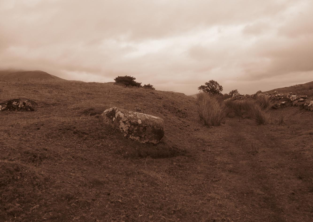
This is one of the many simplistic petroglyphs in the Cragganester complex, probably only of interest to the fanatics amongst you! There are two distinct cup-marks on this nice rounded ‘female’ stone, one near the top and one near the middle, amidst the olde lichen growth. Loch Tay stretches along the glen below here, but only a portion of it is visible nowadays. In times gone by, tree growth probably prevented any vision of the waters below…
It’s a bittova pain-in-the-arse to reach this and its associated carvings, as there’s little place to park along here. The easiest is to park 600 yards east of Tombreck at the spot just by the small bridge at Craggantoul. Keep your eyes truly peeled! From here, walk along the road for ⅔-mile where you’ll hit a gate taking you onto the boggy hillside. Go diagonally up here for 150 yards where you’ll hit an overgrown track and small disused quarry. Some 50 yards along you’ll see a small rock outcrop on your left (as if you’re going back to the road). That’s the spot!
Archaeology & History
Close-up of cupmark
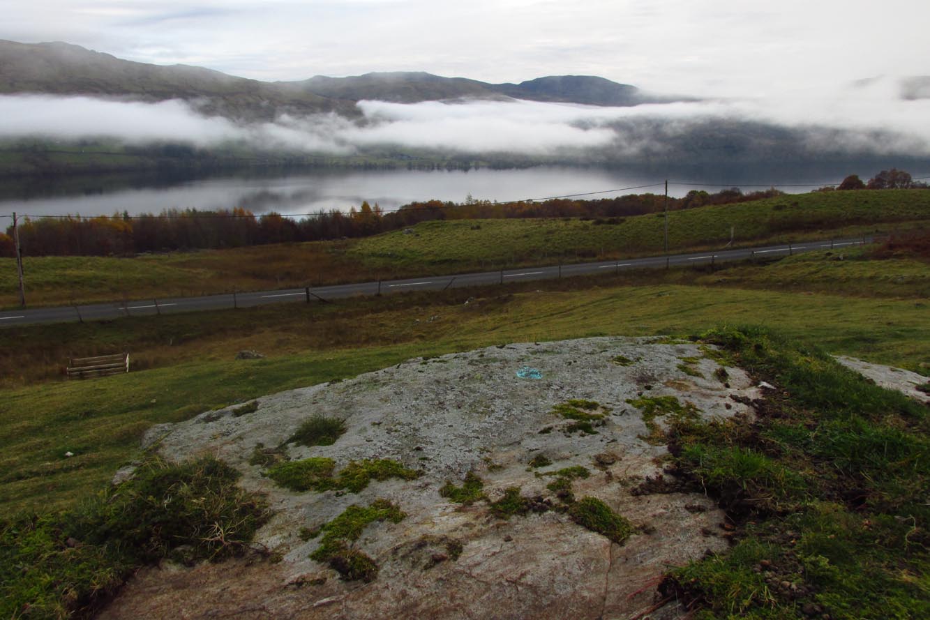
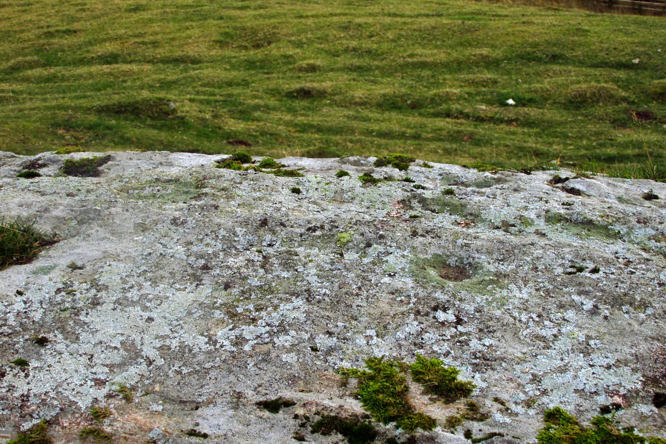
Not previously recorded, this simple petroglyph on a small rock outcrop—barely 50 yards above the A827 Killin-Kenmore road—comprises of one clear cup-mark prominently etched near the middle of the upper surface; and another possible cup on the left (eastern) section of the rock. Cragganester carvings 19 and 20 are respectively about 100 yards NE and NW of here but, like other carvings nearby, is only gonna be of interest to the fanatic nutters out there!
An entry in George Benson’s huge work on the history (mainly) of York, describes the holy well of St Dunstan “near the Glass Works”, which used to be at the south-side of the city on Fishergate. I can find no other reference to this site and it’s not on the early OS-maps, so we must presume it is long gone.
Other wells in his name can be found in Kent, Somerset, Sussex and Tottenham.
Folklore
The fable relating Dunstan to wells was his ability to make springs miraculously appear. Tradition relates him to have been born in Wessex in the 10th century. His festival date is May 19.
References:
Benson, George, An Account of the City and County of York – volume 3, Cooper & Swans: Micklegate 1925.
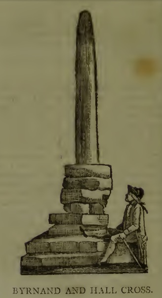
This long lost Cross could once be seen close to the Tudor era Byrnand Hall, which stood on the north side of the High Street. The Hall was demolished around 1780, and replaced by the present building, which is now a political club. The Cross was taken down around the same time, so we’re very fortunate to have a contemporary sketch.
Harry Speight (1906), the Great Yorkshire antiquarian, described the Cross when he was writing of the ‘big houses’ of Knaresborough, saying:
“Another notable old mansion was Byrnand Hall, which stood at the top of the High Street facing Gracious Street, and was rebuilt about a century ago. It was the property and seat for many generations of one of the leading families of Knaresborough, named Byrnand, one of its members being recorder of York in 1573. Opposite the house stood a very ancient stone cross, consisting of a plain upright column, without date or inscription, supported by several rudely-formed stones placed on three tiers or steps. It appears that one Richard Byrnand paid a fine and was permitted to enclose a cross standing on a piece of waste land then lately belonging to Robert Nessfield. The cross may be conjectured to have been either a memorial or boundary-stone. In those days ” it was not enough,” says the old antiquary, Hearne, ” to have the figure of the cross both on and in churches, chapels, and oratories, but it was put also in church-yards, and in every house, nay, many towns and villages were built in shape of it, and it was very common to fix it in the very streets and highways.
“This ancient relic, the site of which is now marked by a brass cross sunk in the causeway, was in after times called the Byrnand Hall Cross, from its proximity to the house of the same name. It stands on the road equidistant between York and Leeds, being eighteen miles from either place.”
At the end of the eighteenth century, E. Hargrove wrote:
“The (Byrnand) family mansion was situated at the end of the High-street, leading towards York. Near it formerly stood an ancient Cross, which being placed on the outside of the Rampart, and opposite to the entrance into the borough, seems to have been similar in situation, and probably may have been used for the same purpose, as that mentioned by Mr. Pennant, in his History of London, which stood without the city, opposite to Chester Inn; and here, according to the simplicity of the age, in the year 1294, and at other times, the magistrates sat to administer justice. Byrnand-Hall hath been lately rebuilt, by Mr. William Manby, who took down the remains of the old Cross, and left a cruciform stone in the pavement, which will mark the place to future times.”
Abbot J.I. Cummins, writing in the 1920s about the Catholic history of Knaresborough, told:
“Of the Byrnand Cross beyond the old town ditch the site is now marked in York Place by a brass cross let into the pavement for Christians to trample on.”
The Cross occupied an important position in the Knaresborough of old, at one of the highest points of the town by the junction of the modern High Street and Gracious Street, this latter being the road down the hill to the riverside and the troglodytic shrines of St Robert of Knaresborough and Our Lady.
Assuming the eighteenth century drawing is an accurate representation of the Cross, it does give the impression of considerable antiquity, and looks to have been 15-16 feet (4.75m.) high. From its appearance it looks like either a prehistoric monolith or an Anglo-Saxon ‘stapol‘ or column, and if it was the latter, it may have been erected to replace an earlier heathen wooden column or sacred tree following the replacement of the old beliefs by Christianity. If so, there may be no reason to deny Hargrove’s speculation that Byrnand Hall Cross once had a similar juridical function to the Chester Inn Cross in London.
References:
Bintley, Michael D.J., Trees in the Religions of Early Medieval England, Woodbridge, Suffolk, Boydell Press 2015.
Cummins, J.I., “Knaresborough,” in The Ampleforth Journal, Vol XXIV, No II, Spring 1929.
Hargrove, E., The History of the Castle, Town and Forest of Knaresborough, 5th Edition, Knaresborough 1790.
Speight, H., Nidderdale, from Nun Monkton to Whernside, London, Elliot Stock, 1906.
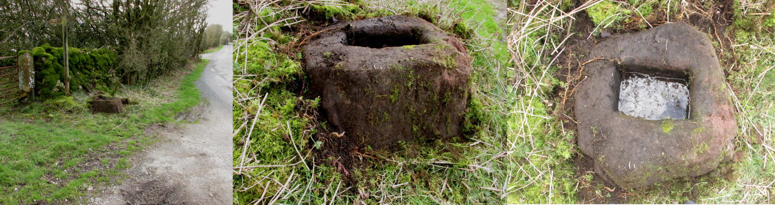
Take the Town End Road out of Slaidburn, and turn right along Wood House Lane at the Gold Hill junction, continue past the entrance to Myttons Farm on the right, and the cross base will be seen on the right next to the gateway just before the sharp left hand bend.
Archaeology & History
Only the socketed red sandstone base of this mediaeval wayside cross survives. It is unusual in that it has carved decorative fluted corners. It has an OS bench mark carved on its north face and has suffered recent damage to one of the corners, probably from a grass cutter. It is beside the old salt road over Salter Fell from Bowland into Lancashire and the Lune Valley.
There is one surviving complete cross and a cross base at the other end of the salt road, south of Hornby. Wood House Lane was known as Cross Lane when the 1850 6″ OS map was printed. It is a Grade II listed building and is described in the citation as:
“Base of cross, probably medieval, sandstone. Of irregular shape with a rectangular socket in the top.”
Three views of the Cross base
Folklore
The farmer of the adjoining land told me that a local elder had told him that the smashed remains of the Cross had been built into an adjoining dry stone wall, which, if this is correct, may indicate
destruction of the Cross at a comparatively late date.
Note: the monument is in the historic county of the West Riding of Yorkshire.
Standing Stone (lost): OS Grid Reference – SU 161 432
Archaeology & History
In William Stukeley’s Stonehenge, he described a number of monoliths outlying Salisbury Plain that also possessed a prehistoric pedigree. Most of them have been recorded, but this one seems to have been forgotten about — perhaps by virtue of it having fallen into the River Avon! Edgar Barclay (1895) described it in his fine survey, saying:
“In the bend of the river below the village, is a large submerged stone; only during drought is any portion of it visible above water; it can, however, in ordinary times, be dimly seen from the bank, which is of chalk, here very steep and overgrown. The country people assert that a metal ring, “turning always,” is let into its upper end. Legend relates that when the Devil brought the rocks of Stonehenge from Ireland, tied together with withes, this stone escaped from the bundle and fell into the river. Its position forbids the belief that it got fixed in the bed of the stream when its passage to Stonehenge was being attempted, for it lies immediately beneath the crest of a very steep bank, and at its most inaccessible point; as the stream sweeps against this, the water must always have been deep at this spot, the open valley would everywhere offer more favourable points for such an operation, especially would this be the case before the Avon was dyked. A boundary stone would have been placed on the brow of the hill; if the stone be a grey-wether, as report says, and as is probable, it may originally have stood on the bank, and “once upon a time”, a ring having been fixed in it, it may have been dragged into the stream to moor a ferry-boat. It lies closely midway between the stone on Bulford Down and that in Durrington fields.”
One wonders if any local people might know more about this…
References:
Barclay, Edgar, Stonehenge and its Earth-works, D. Nutt: London 1895.
Cross (destroyed): OS Grid reference – TA 0424 2064
Archaeology & History
This long lost wayside cross was described in various local records from 1621 upwards. In the definitive place-name survey of this area, Kenneth Cameron (1991) told us that this was,
“A medieval cross dedicated to St James, situated at the point where the Thornton and Burnham roads meet… Mr R. Newton comments, “said to have replaced a wayside shrine. The foundations of the shrine were exposed when the Home Guard dug a defensive trench there at the beginning of the last war. Foundations destroyed by a bomb.””
References:
Cameron, Kenneth, The Place-Names of Lincolnshire – volume 2, EPNS: Nottingham 1991.