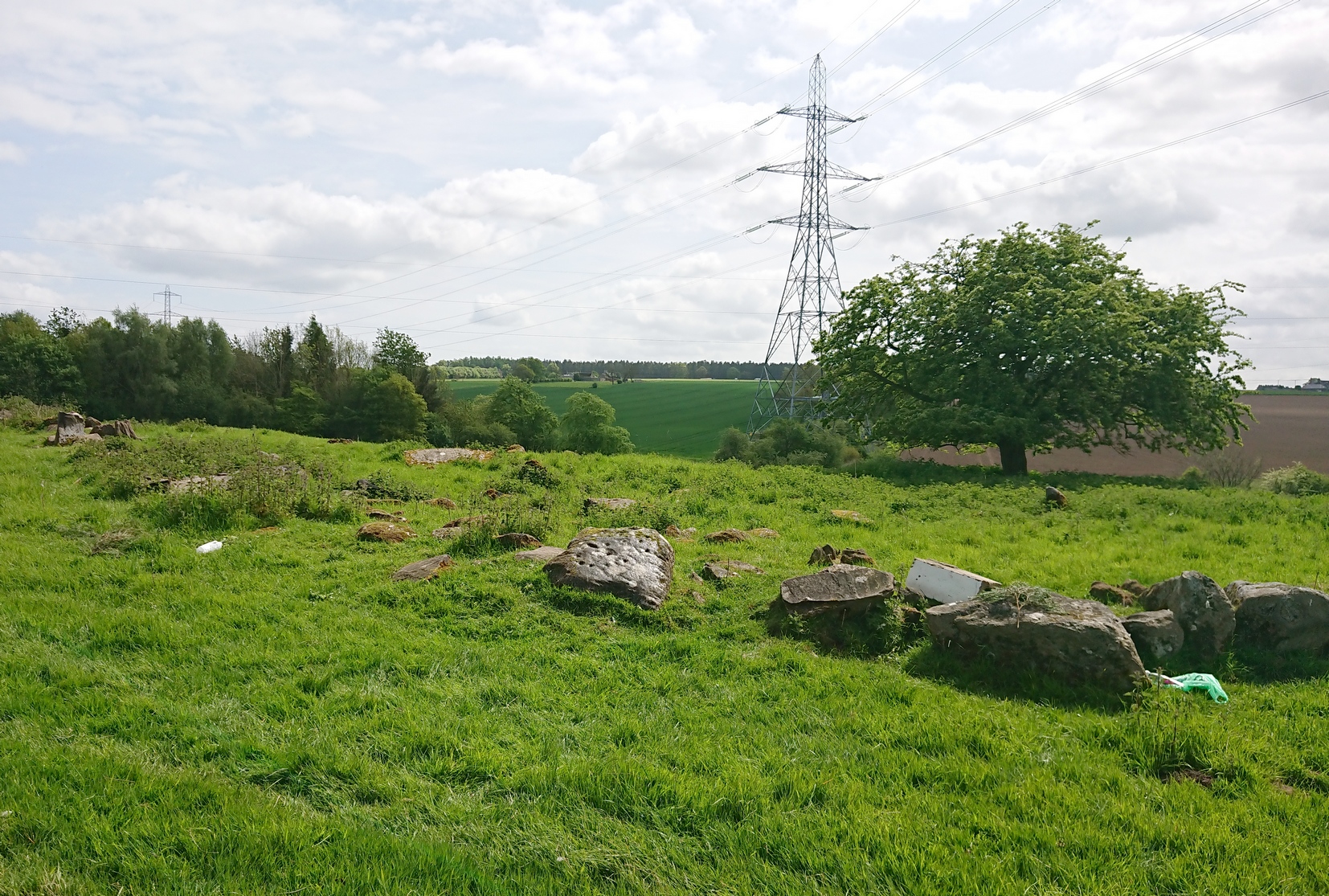
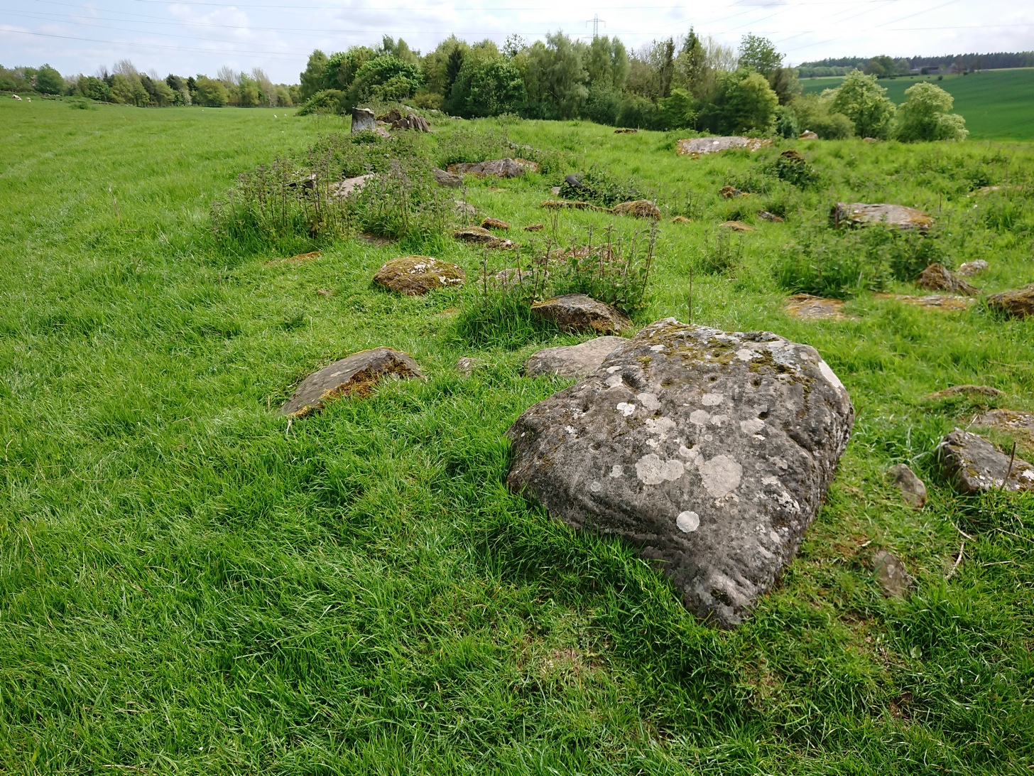
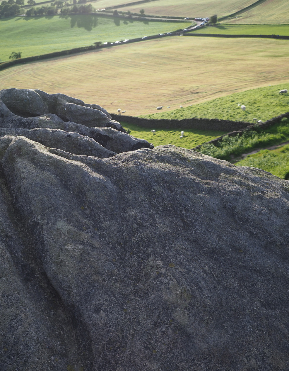
Go west out of Perth city centre, along Longcauseway which runs straight into Jeanfield Road, then (keep your eyes peeled) turn left and go along Burghmuir Road to the end where, at the roundabout, go straight across. 100 yards along, a dead straight path starts on the left-side of the road. Walk 400 yards along here, cross the road, keep straight on the path (called Old Gallows Road) into the trees and a half-mile on you reach a large pylon on your right; but walk to your immediate left here and after 25 yards go through the gate on your left. In this field, 100 yards to the south you’ll see a tree inside a large low stone enclosure. You need to find the stone that’s the most northerly one in this enclosure walling.
Archaeology & History
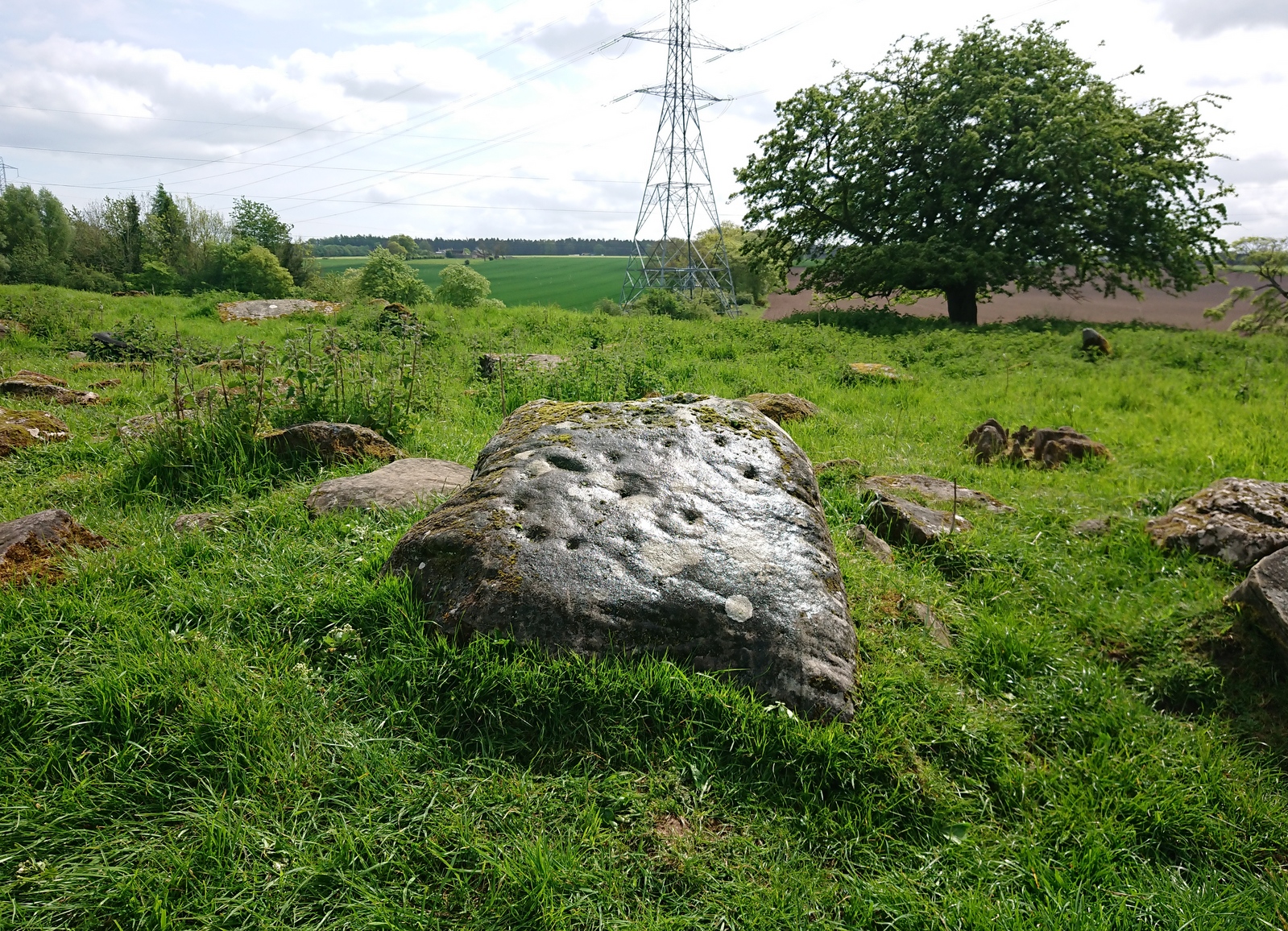
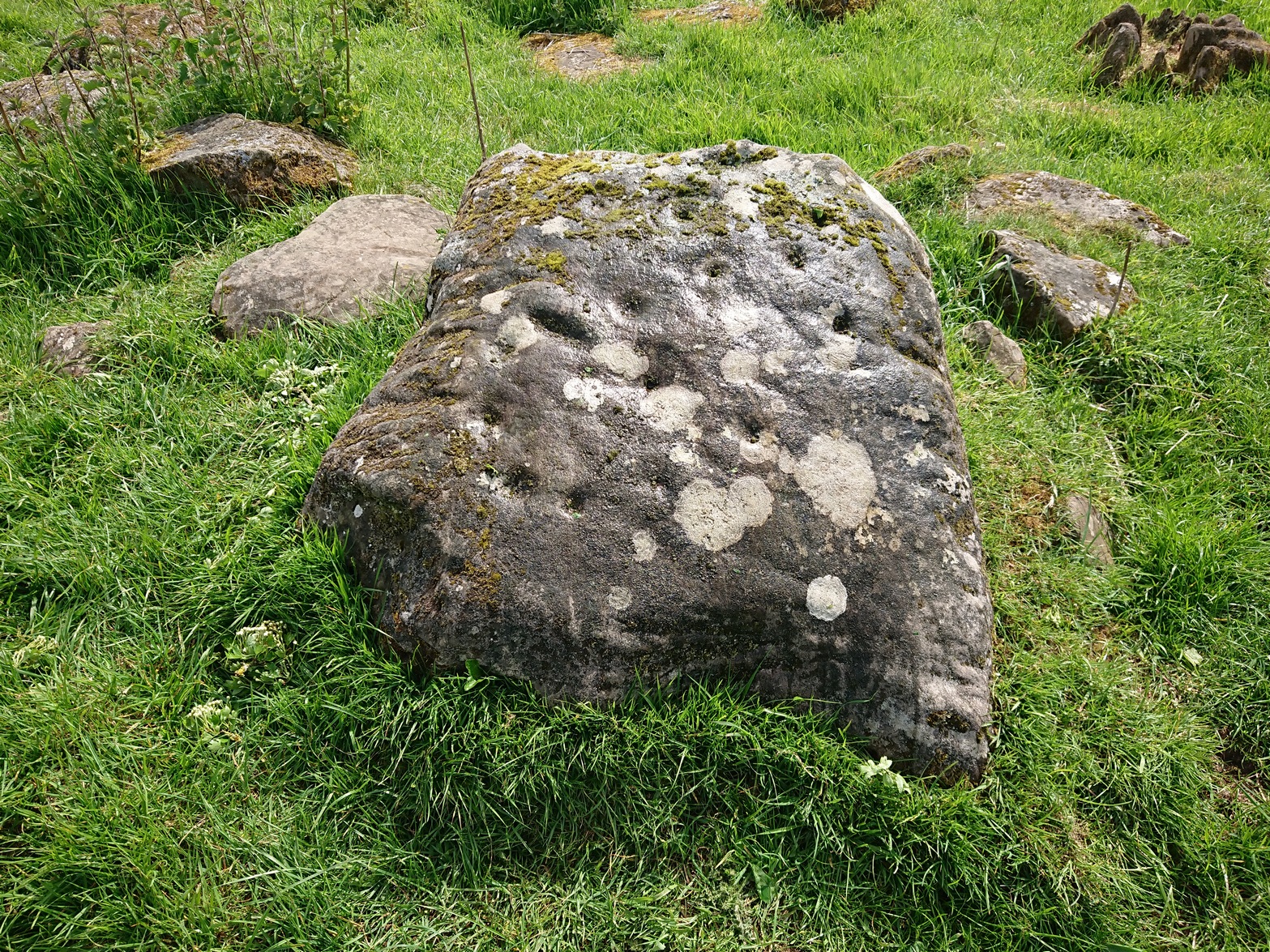
It’s debatable as to whether or not this carving is in its original position as it’s located within the outer walling of an enclosure, deemed by Fred Coles (1903) to have been a large garden, yet which has all the hallmarks of being much earlier structure, possibly even Iron Age. Either way, the cup-and-ring that we see today on the northernmost edge of this old walling, would seem to have been moved into the position it presently occupies.
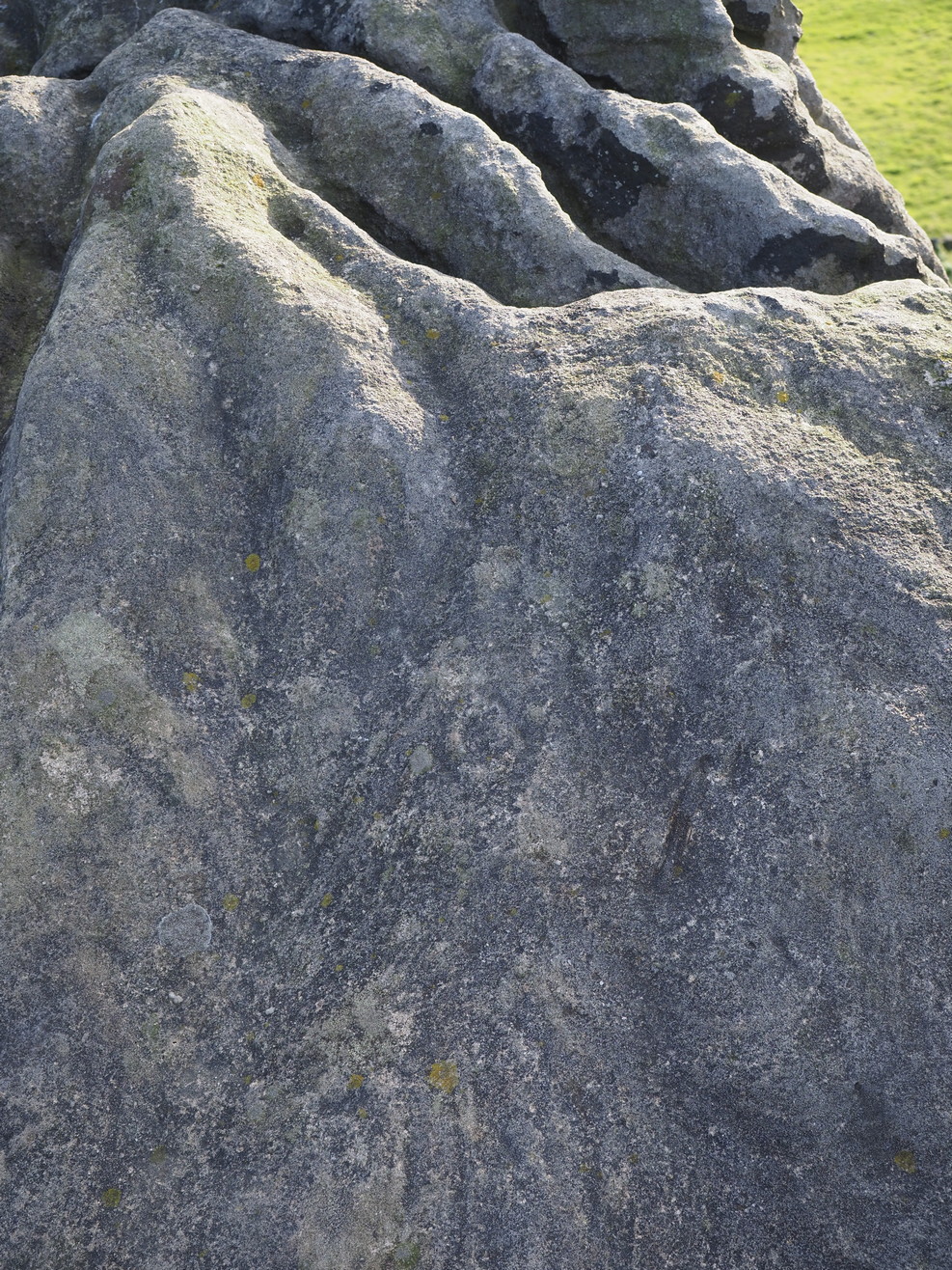
Close-up of the carvingPosition in line of walling
There’s another oddity about it too, as one (or more) of the cup-markings have been incised and worked upon in much more recent centuries, as evidenced by a small thin almost pencil-like cut into the centre of one of them, perhaps with the intention of smashing the stone to pieces. A geologist or stonemason could perhaps look at this and let us know what they think. Thankfully the stone and the carved design remains intact!
It was described by the great Fred Coles (1903) in a summary essay of numerous antiquities both here and further afield. He told us:
Coles (1903) sketchClose-up of the design
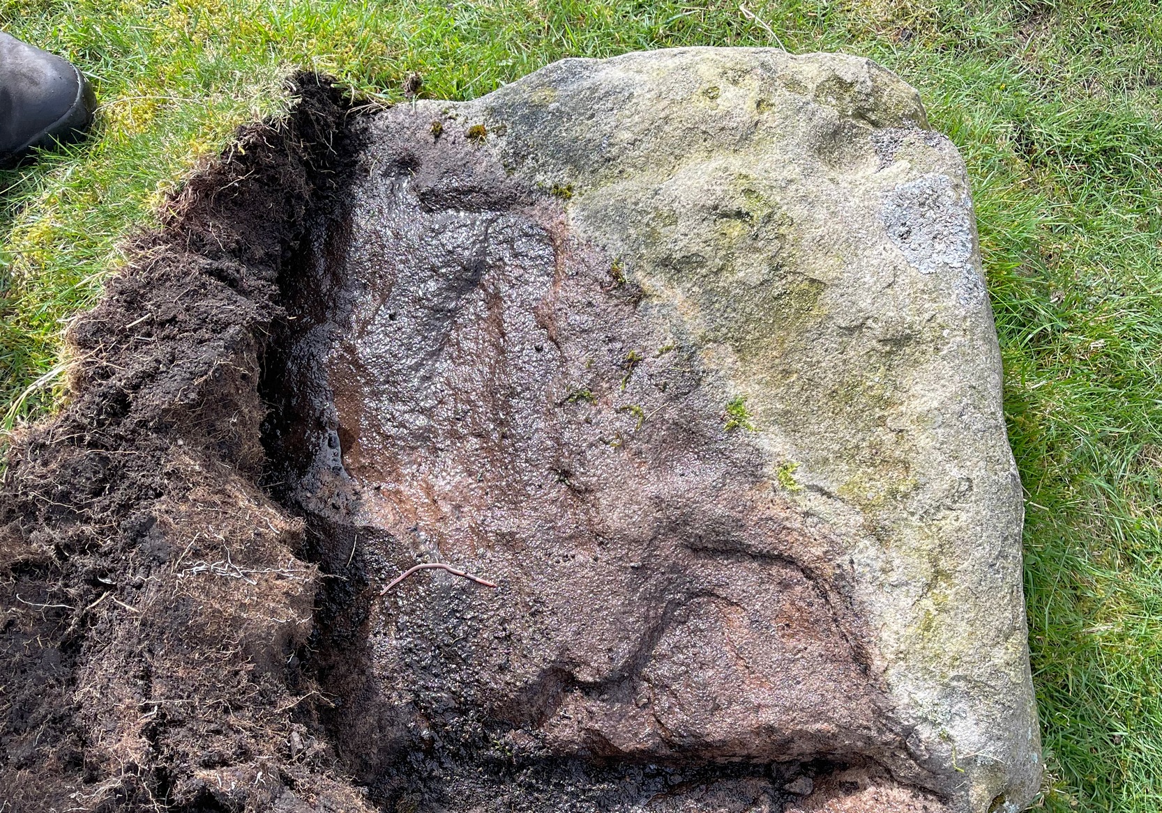
“The cup-and ring-marked stone here was first brought to my notice by Mr David Smith in the summer of 1900. He then reported that the stone appeared to be one of a large number forming a rough circle in a plantation on the west of this farm. On reaching the house, I was fortunate in meeting Mr Douglas the tenant, who at once conducted me to the westmost field and showed me the stone. It is a squarish and not very thick block of ‘bastard whinstone,’ uneven, weathered, and moss-grown. It measures 2 feet 10 inches by 2 feet 8 inches. As far as examination in the gloom of the clump of trees allowed, I believe I am correct in recording…the seven single cups and the two surrounded by rings as all the definitely artificial marks now visible on this stone. The stone at present lies prone upon the curved alignment of many stones which have been set on edge, enclosing an area roughly oval, and measuring in round numbers about 210 feet nearly east and west by 90 or 100 feet north and south.”
There are in fact a few more cups with rings than what Coles described, but they’re difficult to make out. At least five have rings, possibly six of them. If you happen to visit this carving when the daylight is being nice, see if you can catch us a good photo or two and stick ’em on our Facebook group.
References:
Coles, Fred, “Notices of…some Hitherto Undescribed Cup-and-ring-marked Stones,” in Proceedings Society Antiquaries Scotland, volume 37, 1903.
Acknowledgements:Many thanks for use of the Ordnance Survey map in this site profile, reproduced with the kind permission of the National Library of Scotland.
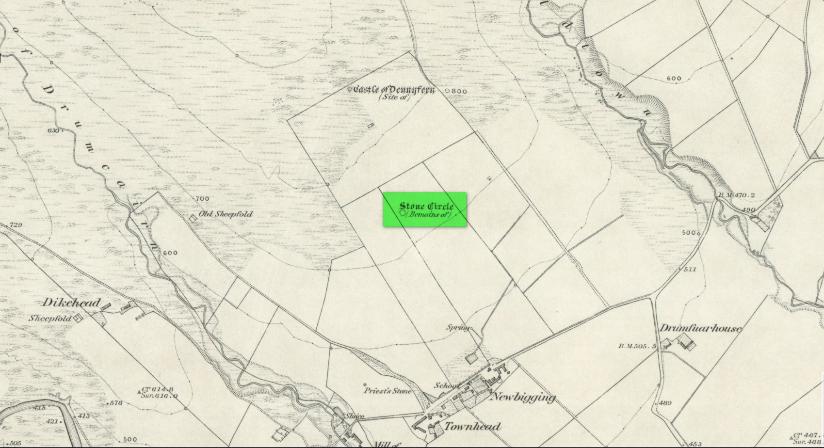
Stone Circle (destroyed): OS Grid Reference – NO 5414 6935
Archaeology & History
Site location in 1863
Entered in Aubrey Burl’s (2000) magnum opus as a stone circle, the site has also been reclassified as a ring cairn or cairn circle, for obvious reasons. We can haggle about definitions if we wanna get a bit anal about it, but even from what little we know, this was an impressive looking site to say the least! Burl (1976) originally suggested that it may have been a recumbent stone circle: an Aberdeenshire outlier, so to speak—and he may have been right. Sadly the place has been destroyed, like so many megalithic rings in this neck o’ the woods.
It was first mentioned, albeit briefly, by Alexander Gardner in his 1843 summary of the parish in the New Statistical Account where he told that, “there are the remains of a Druidical Temple at Newbigging near the remains of an ancient Castle or Tower called Dennyfern.” Our main source of information comes via the early Ordnance Survey lads after they’d visited the place in 1861. They wrote:
“Though nothing now remains of this Circle but one very large upright stone, measuring 5 feet 4 inches high, 9 feet in circumference at the base, and 6 feet 3 inches at the top, yet its site is plainly traceable, and is slightly raised from the ground around it. It was an immense Cairn, 40 feet in diameter according to the farmer of Newbigging, containing 400 cartloads of stones which he removed …The one Stone standing is so large that this may be considered to be the remains of a “Stone Circle” of which the large quantity of small stones formed the raised plateau, the ring of which is still visible.”
The great regional historian Andrew Jervise (1853) culled a few extra snippets of information about the place, telling us:
“Some fifty years ago, a good specimen of concentric circles stood on the farm of Newbigging, about half-a-mile north of the house, on an elevated part of the mountain; but, of the twenty or thirty large stones that enclosed an area of from fifty to sixty feet in diameter, only one remains, the rest having been carried away for various utilitarian purposes. This boulder, which is about eight feet high, is sometimes called the Druidical, but more commonly the “Stannin’ Stane of Newbiggin’,” and many flint arrow-heads have been found in its vicinity. When demolished, the middle of the area of the inner circle was found to be filled with small stones to the depth of about three feet, under which lay a quantity of black clammy earth, mixed with pieces of charcoal, while a track about two feet broad, composed of loose red sandstone, laid to the depth of a few inches, ran directly through the clammy earth and pebbles, from side to side of the outer circle.”
Alex Warden (1884) mentioned the remaining Stannin’ Stane of Newbiggin’ in his survey of the area, and the monolith was still in place when Cruikshank (1899), the local minister, wrote his detailed history book, but he added little more by way of Jervise’s description, merely telling that the stone circle
“on Newbigging must have been in its original state interesting and remarkable. It was composed of upright stones of great size, as we can see by the only one now remaining, which is known as “the Stannin’ Stane of Newbiggin’.” The blasted massive remains of the other stones form the foundation of the field dyke close by.”
It’s obvious that Burl’s idea that this circle was a recumbent one is based on Jervise’s description of it being “a good specimen of concentric circles” with the internal cairn structure giving it additional archaeomythic clout. Its complete destruction prevents us knowing anything more.
References:
Barnatt, John, Stone Circles of Britain– volume 2, BAR: Oxford 1989.
Burl, Aubrey, The Stone Circles of the Britain Isles, Yale University Press 1976.
Burl, Aubrey, The Stone Circles of Britain, Ireland and Brittany, Yale University Press 2000.
Cruikshank, F., Navar and Lethnot: The History of a Glen Parish in the North-east of Forfarshire, Black & Johnston: Brechin 1899.
Jervise, Andrew, The History and Traditions of the Land of the Lindsays in Angus and Mearns, Sutherland and Knox: Edinburgh 1853.
Royal Commission on the Ancient and Historical Monuments of Scotland, The Archaeological Sites & Monuments of Central Angus, Angus District, Tayside Region, HMSO: Edinburgh 1983.
Warden, Alex J., Angus or Forfarshire: The Land and People – Descriptive and Historical – volume 4, Charles Alexander: Dundee 1884.
Acknowledgements:Huge thanks for use of the Ordnance Survey map in this site profile, reproduced with the kind permission of the National Library of Scotland.
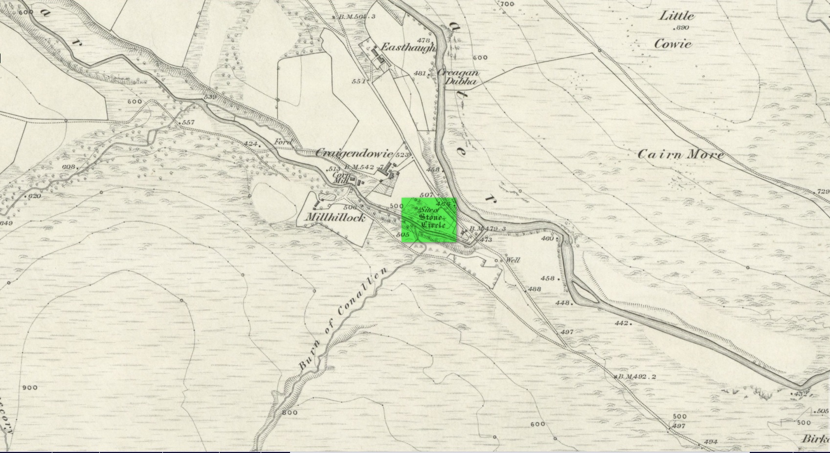
Stone Circle (destroyed): OS Grid Reference – NO 5225 6924
Archaeology & History
Site shown on 1865 map
All remains of this stone circle have long since bitten the dust. It was already described in the past tense when Alexander Gardner wrote his summary of the parish in the New Statistical Account in 1843 where he told that, “there are the remains of two or three small Druidical temples, one at Newbigging, one at Blairno, and one said to have been at Craigendowie, but now demolished.”
A few years later Andrew Jervise (1853), in his classic tome on the Mearns, gave us the best description of the place, based either on his own personal visit here, or one given to him by a local when he was surveying the history of the area. He wrote:
“In the vicinity of Craigendowie … among the mass of artificial-looking cairns (which are said to be the graves of warriors), there was a small circle, composed of a quantity of stones about the same size, and ranged in the same manner, as those at Fernybank…. Unlike the latter, this circle was never thoroughly explored, even at the time of its removal more than forty years ago, and if as old as prehistoric times, it cannot now be said in how far it may have been a place of sepulture. Craigendowie has, perhaps, its true etymon in the Gaelic Craigandubh, or “the black rock,” for the craig is an immense black rock close by the river-side; but, according to a truer etymology, as well as popular story, it implies the “rock of the funeral cairn,” or perhaps the “craig of battle or mischief;” and, if any reliance can be placed on the tales regarding the malicious actions of the kelpie in the dark pool beside it, or in the story of warriors having fallen in the neighbourhood, the latter rendering may not be altogether inept!”
When the Ordnance Survey lads wrote about it their Name Book (1861) they told simply of its memory, saying,
“There is now nothing remaining to mark the site except a portion of the ground being still uncultivated, nor is there any person who recollects seeing any remains. It is supposed to have been demolished in making an old road through it, the track of which is still plain.”
And, later still in Cruikshank’s (1899) major work on Lethnot township he added little extra information other than saying that “it was situated in the field in front of the farmhouse (but) is entirely destroyed.”
References:
Cruikshank, F., Navar and Lethnot: The History of a Glen Parish in the North-east of Forfarshire, Black & Johnston: Brechin 1899.
Jervise, Andrew, The History and Traditions of the Land of the Lindsays in Angus and Mearns, Sutherland and Knox: Edinburgh 1853.
Royal Commission on the Ancient and Historical Monuments of Scotland, The Archaeological Sites & Monuments of Central Angus, Angus District, Tayside Region, HMSO: Edinburgh 1983.
Warden, Alex J., Angus or Forfarshire: The Land and People – Descriptive and Historical – volume 4, Charles Alexander: Dundee 1884.
Acknowledgements: Huge thanks for use of the Ordnance Survey map in this site profile, reproduced with the kind permission of the National Library of Scotland.
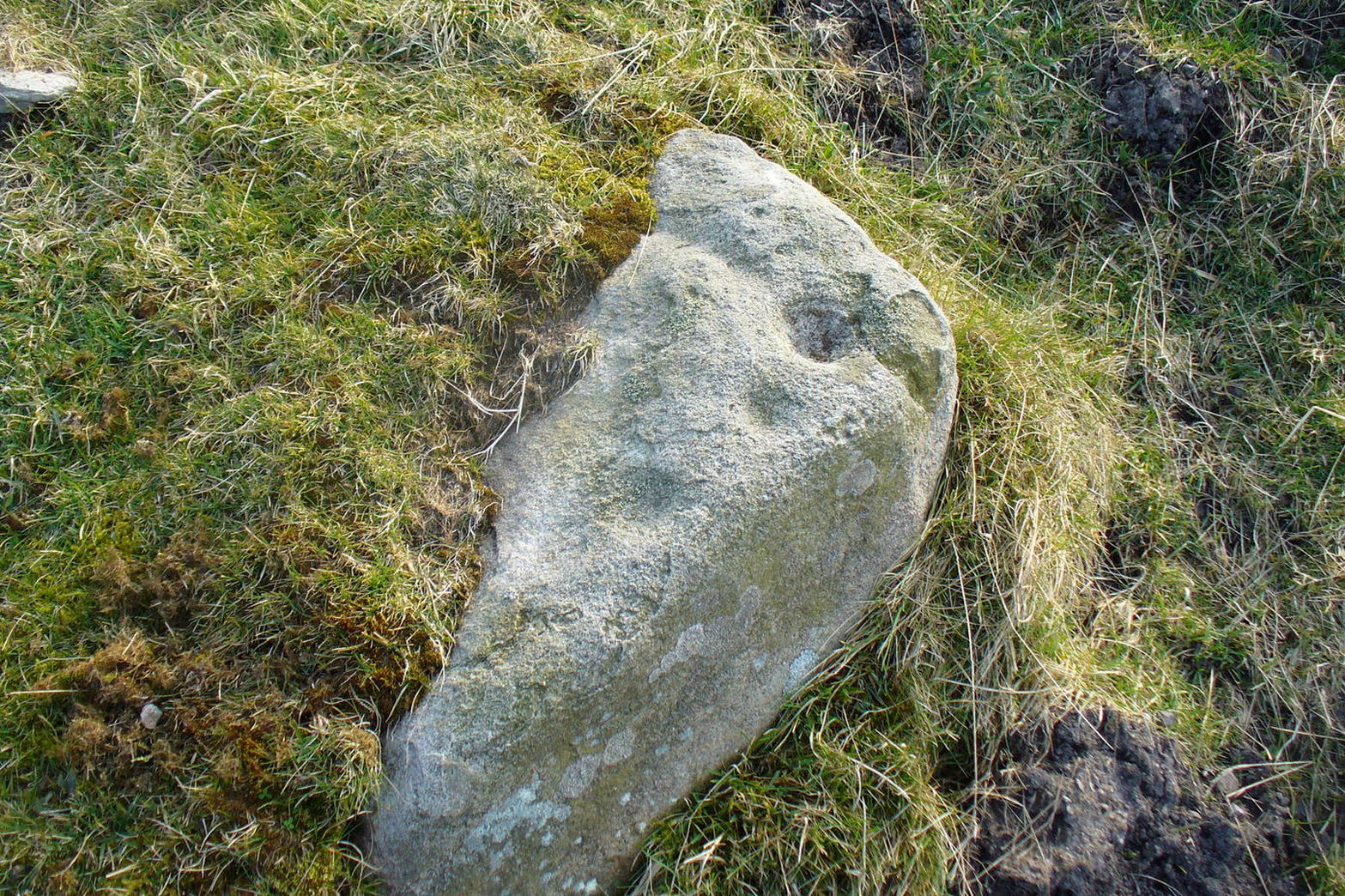
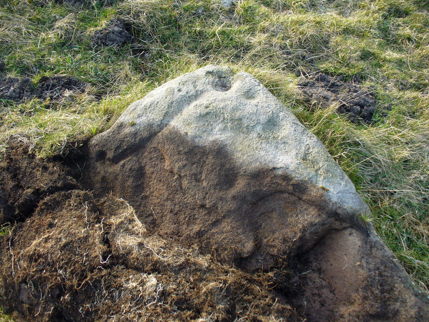
Cup-Marked Stone (removed): OS Grid Reference – NT 128 709
Archaeology & History
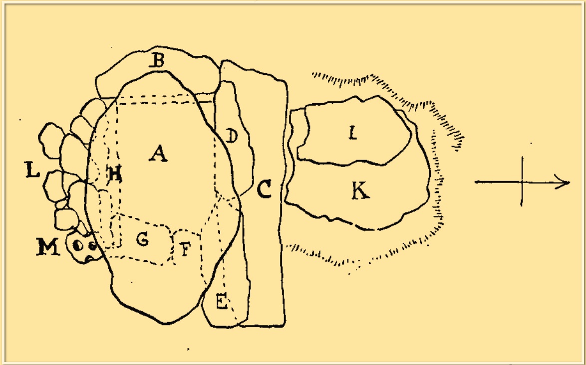
“M” marks the cupmark
A simple cup-marked stone was located inside a prehistoric burial cist that was discovered by quarry workmen in November 1897. The cist was subsequently excavated by Fred Coles (1898) who found therein (amongst other things) a simple cup-marked stone whose present locale is a box somewhere in Edinburgh’s National Museum (could someone send us a photo please?). The carving comprises simply of two complete cups and portion of a third, all close to each other on a small stone that was located on the south-side of the cist (see ‘M’ in the attached diagram). Coles described the carving thus:
“During the removal of (some) small stones, one, when the damp soil was rubbed of, showed two cup-marks, about 1½ inch wide each and ½ inch apart. The stone itself measures 5 inches by 4¾, and appears to be but a fragment of a larger one, one edge showing part of a third cup. The cups all show the tool-marks usually noticed on these mysterious sculpturings.”
Cup-Marked Stone (lost): OS Grid Reference – NN 4808 0140
Archaeology & History
On the south-side of Loch Ard, just a few yards from the entrance to Rob Roy’s Cave (one of several), right by the water’s edge are the natural upstanding pillars known locally as Gog and Magog. In Peter Joynson’s (1996) work on Aberfoyle, this site is listed as one in a number of unrecorded cup-and-ring stones in the area. Discovered by a local lady—”the late Mrs Maitland”—here we have,
“two huge stones about 30ft high known as Gog and Magog situated at the mouth of Blan Ross Bay. They have numerous cup marks, but sadly have disappeared from view as they have been covered by forestry planting.”
This is an increasingly annoying problem that many rock art students are having to contend with! When we visited the site, the tops of these huge stones were, indeed, covered in depths of mosses and pine needles and the carving is hidden from sight. When the trees are felled, let’s hope someone can find it!
Folklore
These natural rocks were said to have been two giants that were turned to stone, the story of which seems to have been forgotten…
References:
Joynson, Peter, Local Past, privately printed: Aberfoyle 1996.
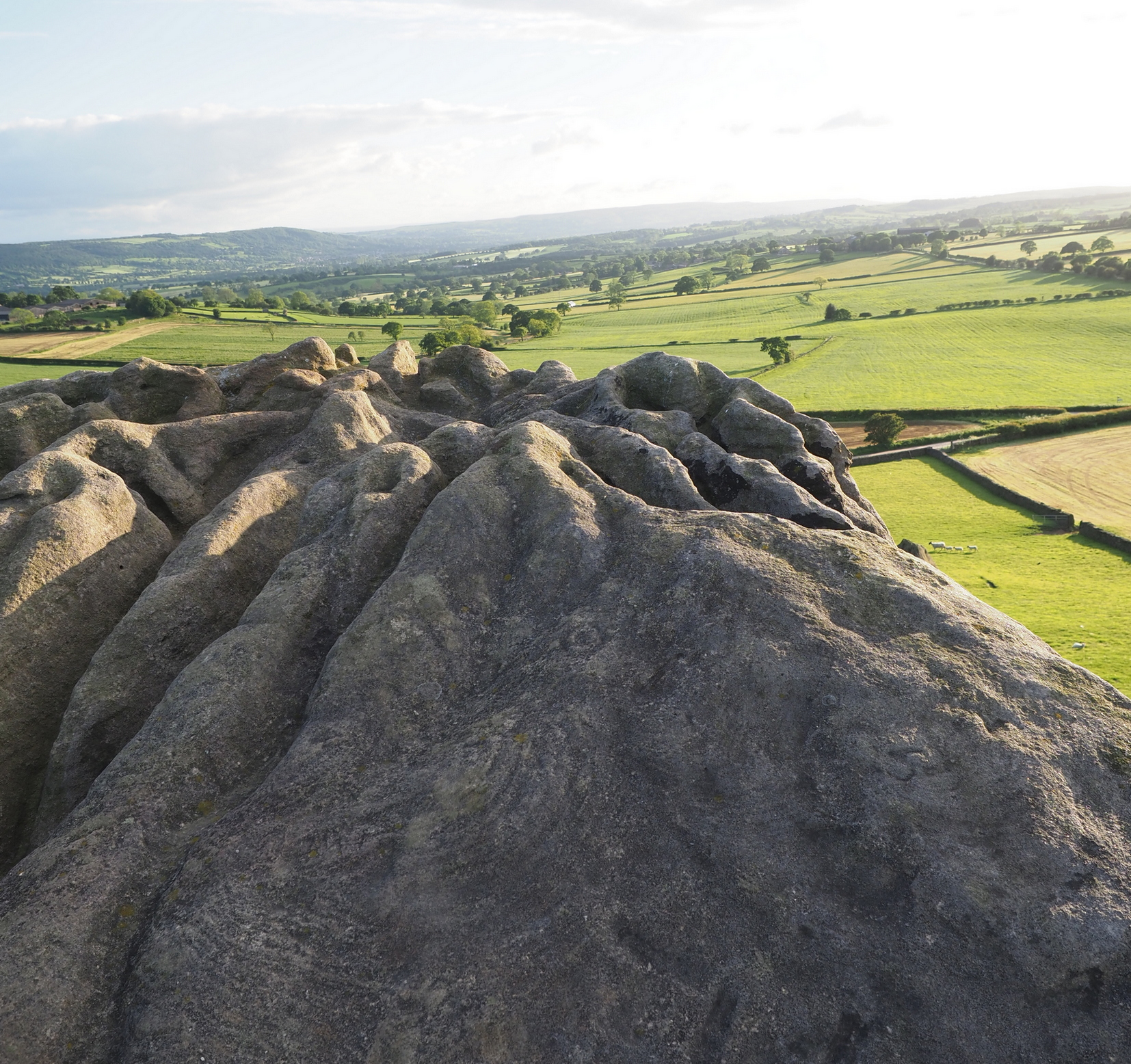
This is an outstanding site visible for miles around in just about every direction – so getting here is easy! If you’re coming from Harrogate, south down the A658, turn right and go thru North Rigton. Ask a local. If you’re coming north up the A658 from the Leeds or Bradford area, do exactly the same! (either way, you’ll see the crags rising up from some distance away) As you walk to the main crags, instead of going to the huge central mass, you need to follow the line of walling down (south) to the extended cluster of much lower sloping rocks. Look around and you’ll find it!
Archaeology & History
On the evening of May 27, 2024, I received a phone call from a Mr James Elkington of Otley. He was up Almscliffe Crags and the wind was howling away in the background, taking his words away half the time, breaking the sentences into piecemeal fragments. But through it all came a simple clarity: as the sun was setting and the low light cut across the rocky surface, a previously unrecorded cup-and-ring design emerged from the stone and was brought to the attention of he and his compatriot Mackenzie Erichs. All previous explorations for rock art here over the last 150 years had proved fruitless—until now!
Looking northwestCentral cup-&-ring
On the east-facing slope of the stone, just below the curvaceous wind-and-rain hewn shapes at the very top of the boulder, is a singular archetypal cup-and-ring. It’s faint, as the photos show, but it’s definitely there. What might be another cup-and-ring is visible slightly higher up the sloping face, but the site needs looking at again when lighting conditions are just right! (you can just about make it out in one of the photos) But, at long last, this giant legend-infested mass of Almscliffe has its prehistoric animistic fingerprint, bearing fruit and giving watch to the countless heathen activities going back centuries. Rombald’s wife Herself might have been the mythic artist of this very carving! (if you want to read about the many legends attached to the major Almscliffe rock outcrop, check out the main entry for Almscliffe Crags)
Stone Circle (destroyed): OS Grid Reference – NX 693 709
Archaeology & History
In March 1844, Rev. W.G. Crosbie in his survey of the parish of Parton, mentioned the mediaeval earthworks, or motte, above the west side of the Borland Glen:
“At a short distance from this,” he wrote, “are the remains of a small Druidical circle.”
This “Druidical circle” was subsequently described in Fred Coles’ (1895) megalithic survey of Kirkcudbrightshire, where he added that the circle was “some two hundred yards distant” from the motte—but it had already been destroyed when he wrote about it and its exact location seems to have been forgotten. Logic suggests that the circle would have been on the lands immediately west of the motte, where the land is relatively level and possesses several small hillocks, which would be perfect for megalithic siting. (the grid-reference cited above is an approximation)
References:
Burl, Aubrey, The Stone Circles of Britain, Ireland and Brittany, Yale University Press 2000.
Coles, Fred, “The Stone Circles of the Stewartry of Kirkcudbright”, in Proceedings Society Antiquaries, Scotland, volume 29, 1895.
Crosbie, W.G., “Parish of Parton,” in New Statistical Account of Scotland – volume 4, William Blackwood: Edinburgh 1845.
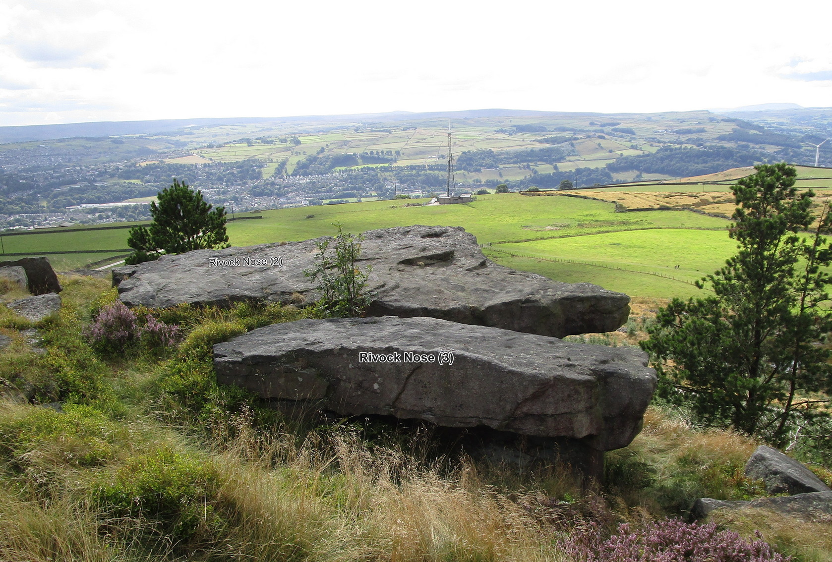
Follow the directions as if you’re visiting the fascinating Wondjina Stone and its companion. From here look at the large rocks on the edge of the drop a few yards away (west) and you’re looking for the flattest rectangular rock jutting out over the edge of the slope, about 15 yards from the walling. The carvings of Rivock (2) and (3) are on the adjacent rocks.
Archaeology & History
The southernmost of (at least) three cup-marked rocks on the edge of this outcrop, it isn’t a carving I’d necessarily include in my own surveys nowadays. It’s a dubious one to say the least. Nonetheless, earlier surveyors added it in their catalogues.
Lichen-covered “cups”
First mentioned in John Hedges’ (1986) survey, this large and roughly flat rectangular boulder possesses three or four questionable cups close to the edge of the stone. Boughey & Vickerman (2003) subsequently included it in their own work—copying Hedges’ notes—and told it to be a “large rock. About three cups on NW side.” Have a look at it when you visit the other more impressive Rivock carvings nearby and see what you think…
References:
Boughey, Keith & Vickerman, E.A., Prehistoric Rock Art of the West Riding, WYAS 2003.
Hedges, John (ed.), The Carved Rocks on Rombald’s Moor, WYMCC: Wakefield 1986.
Morris, Ronald W.B., “The Prehistoric Rock Art of Great Britain: A Survey of All Sites Bearing Motifs more Complex than Simple Cup-marks,” in Proceedings of the Prehistoric Society, volume 55, 1989.
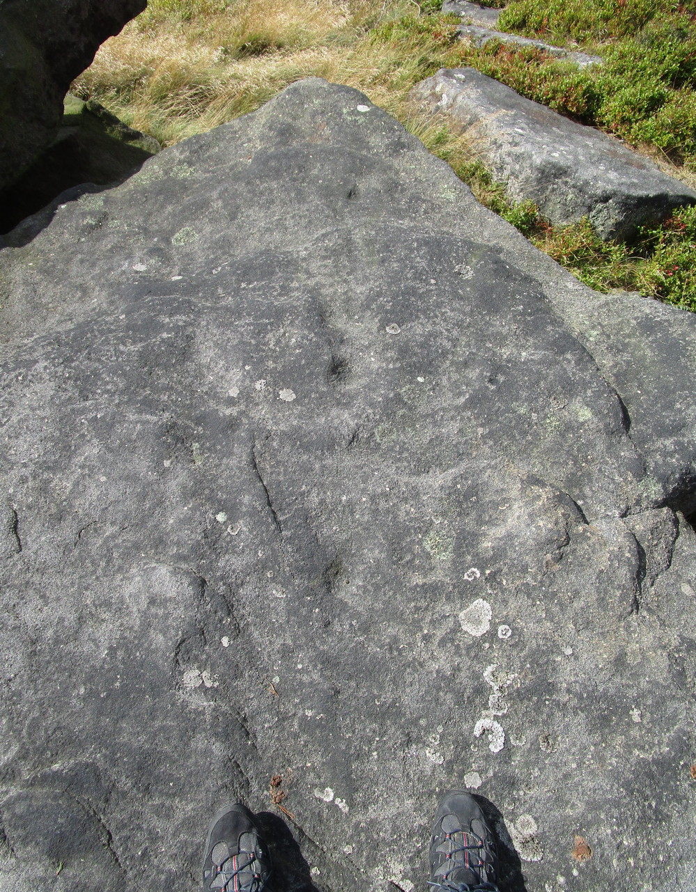
Take the same directions as if you’re visiting the fascinating Wondjina Stone and its companion. From here, just a few yards to the west, are the large rocks overhanging the steep hill, several of which have cup-markings on them (including the carvings Rivock Nose [1] and [2]). This particular carving is the one closest to the wall. You can’t really miss it!
Archaeology & History
Line of 3 cups
A simplistic design that’ll only be of interest to the real geeks amongst you; but you might as well give it your attention when you’re looking at the adjacent Wondjina Stone. On its large surface, the most notable ingredients are the three large cups that run (roughly) in a straight line from the middle of the stone to its outer pointy edge. You can see them pretty clearly in the photo. Several other cup-marks can be seen on the more northwesterly side of the stone.
It was first described in John Hedges (1986) survey, whose notes were simply copied in the subsequent survey of Boughey & Vickerman (2003) where, in their traditional way, gave a very basic description, saying, “Large gritstone outcrop: 3m x 2m. Five cups towards NW edge.”
References:
Boughey, Keith & Vickerman, E.A., Prehistoric Rock Art of the West Riding, WYAS 2003.
Hedges, John (ed.), The Carved Rocks on Rombald’s Moor, WYMCC: Wakefield 1986.
Morris, Ronald W.B., “The Prehistoric Rock Art of Great Britain: A Survey of All Sites Bearing Motifs more Complex than Simple Cup-marks,” in Proceedings of the Prehistoric Society, volume 55, 1989.
On the moorland road from Dick Hudson’s pub, head east along the Otley Road for more than 1½ miles, past the T-junction right-turn at Intake Gate (to Hawksworth) and just a quarter-mile further on park-up at the roadside (opposite Reva Reservoir). Walk (north) thru the gate into the field and after 300 yards through another gate into the next field. From this gate, walk straight north to the Fraggle Rock cup-and-ring stone, then go down the slope NNW for nearly 50 yards and just above the old track you’ll see the edge of this stone peeking out!
Archaeology & History
One of a number of previously unrecorded carvings in these fields, this is a pretty simplistic but unique design. The first thing you’ll notice is at the top-corner of the stone where, like many rocks on these moors, a nicely-worn cup stands out. Erosion obviously…. or so it first seems. This cup-mark has another two by its side, along the top edge of the stone which, again, initially suggested them to be little more than natural. But in rolling back the turf this assumption turns out to be wrong; for, along the west-side of the rock you’ll see a notable pecked groove running down to another cup-mark about twelve inches below, kinking slightly just before it reaches that cup. You can see this in the photo. Now, if we return to the prominent cup-mark at the top corner of the stone, in certain light there seems to be a very faint incomplete ring around it – but we can’t say for certain and it needs to be looked at again in better light.
Cups & line clearly visibleMain carved section
The name given to this carving (thanks to Collette Walsh) comes from the wavy lines that go into the middle of the stone from the long pecked line. These wavy lines are natural, although one portion of them might have been artificially enhanced. It’s difficult to tell one way or the other and we’ll have to wait for the computer boys to assess this particular ingredient. Just above these “waves” is a single eroded cup-mark nearly 2-inch across. And that’s that!