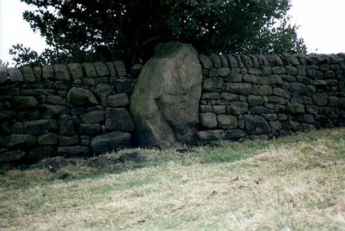
Slack Bottom Stone, Heptonstall, West Yorkshire

Standing Stone:  OS Grid Reference – SD 98374 28800

Also Known as:

  1. Dawson City Field Stone

Getting Here

Go all the way up and through Heptonstall village until you reach the hamlet of Slack, by the road junction.  From here walk down the road as if you’re going back into Hebden for less than 200 yards, then take the footpath on the left downhill and walk along. After a couple of stiles, keep a keen eye on the walling where the holly trees are, above the tree-line of Hardcastle Crags.  You’ll see it soon enough!

Archaeology & History

Slack Bottom stone

Arguably the best-named standing stone in Britain, it was first discovered by Absalom Voist in the late 1990s (and first described in my Old Stones of Elmet), hiding away in the more modern walling, beneath a holly tree.  But the stone itself is very nicely eroded and seems of good age, aswell as being a good near-six-foot tall specimen of a standing stone, just above the tree-line south of Hebden Dale.  The stone gets its name from the fact that it’s at the bottom end of Slack village (which is actually called ‘Slack Bottom’ – with a house-sign there above the door to prove it!).  It may be part of what was originally some original Iron Age walling instead of an authentic standing stone — tis hard to say really — but it’s a nice stone nonetheless.  David Shepherd (2003) named this stone as ‘Dawson City Field’ in his later survey of megaliths in upper Calderdale.

Not far from here, along the edge of the woodland, is the little-known remains of an old cross-base which I think has eluded all previous surveys.  Next time I’m up here, I’ll try remember to get some photos of the place!

References:

  1. Bennett, Paul, The Old Stones of Elmet, Capall Bann: Milverton 2001.
  2. Shepherd, David, ‘Prehistoric Activity in the Central South Pennines,’ in Proc. Halifax Ant. Soc., 2003.

© Paul BennettThe Northern Antiquarian


Halo Stone (318), Ilkley Moor, West Yorkshire

Cup-and-Ring Stone:  OS Grid Reference – SE 13223 46505

Also Known as:

  1. Carving no.154 (Hedges)
  2. Carving no.318 (Boughey & Vickerman)

Getting Here

Looking straight down at it

Looking straight down at it

From Ilkley train station, head up Cow Pasture Road and get to the Cow & Calf Hotel (if needs be, ask a local).  From its car-park, cross the road and go along the straight-ish footpath onto the moor.  Less than 200 yards on, you’ll hit a main track (and a faint cup-marked stone).  OK – walk down this track (left) for 30-40 yards, then walk left again into the heather for about 10 yards.  You’re looking for a small rounded stone and you’re damn close!

Archaeology & History

...and from another angle

…and from another angle

Just over 40 yards east of the very basic Brown Law cup-marked stone, we find this slightly more exotic petroglyph, keeping low in the undergrowth.  Difficult to see unless the daylight is just right, preferably as the sun is rising or setting (as with many neolithic carvings), on this small slightly rounded stone we see a central cup-mark surrounded by a double-ring (unfinished, perhaps on its northern edge)—although an outer cup seems to touch the edge of this second ring.  As the faint images here show, there are other cups and shallow lines also etched onto the stone, but these are gradually fading as the years go by.  It was originally found close to a small cairn that has seemingly been destroyed in recent years.

CR318drThe carving can be troublesome to find when the heather and bracken gets growing, so it’s best explored in the Winter and early Spring—unless of course you want me to show you it, along with the hundreds of others on these moors!  If so, gimme a shout. 😉

References:

  1. Boughey, Keith & Vickerman, E.A., Prehistoric Rock Art of the West Riding, WYAS: Wakefield 2003.
  2. Cowling, E.T., Rombald’s Way: A Prehistory of Mid-Wharfedale, William Walker: Otley 1946.
  3. Hedges, John (ed.), The Carved Rocks on Rombalds Moor, WYMCC: Wakefield 1986.

© Paul BennettThe Northern Antiquarian


Baildon Moor Carving (130), West Yorkshire

Cup-Marked Stone:  OS Grid Reference – SE 13077 40097

Also Known as:

  1. Carving no.11 (Hedges)
  2. Central Design Stone

Getting Here

Baildon Moor carving

Baildon Moor carving

Take the directions to find the Glovershaw Quarry carving,or the Baildon Moor 126 carving and the newly-found Toad Stones circle, and zigzag about in the bracken when it’s down at the end of Winter (forget it from summertime onwards!).  You’re damn close.

Archaeology & History

A carving that I first visited when I was a child – but one which, curiously, caught my attention.  The small arc of four cup-marks that you can see on the stone was an integral feature of other carvings in this particular region—though not all, of course.  It seemed to me at the time that it had symbolic significance, as the arc occurred in a number of other Baildon petroglyphs.  Astronomy was my fetish at that time and so I saw the arc as solar or stellar movements across the sky, represented by the cup-markings.  It was one of many fascinating Rorschach’s that I encountered, just as rock art students across the world do when looking at these ancient carvings. However, the simple symbolism of this and similar nearby carvings has stuck and plays under my skin somewhat: one of those curious non-egoic tickles, constantly nudging away, as if there’s something in it, but being looked at from the wrong angle…

CR130dr

John Hedges 1986 sketch

Looking down at the cups

Looking down at the cups

Anyway… All we have here is a primary design of four cup-marks reaching across a small earthfast stone.  Other simple carvings are found close by and there are the remains of several prehistoric cairns circles within a few hundred yards.  Beneath the deep bracken-mass, it is highly probable that other ancient remains remain hidden.

The carving was first recognised in one of Sidney Jackson’s (1958) archaeology bimbles in the 1950s with his bunch of northern antiquarians from Cartwright Hall, Bradford. It later found its way into the survey of John Hedges (1986) where he described it, simply:

“Small, lozenge-shaped, smooth grit rock, sloping NW-SE into grass and bracken, four symmetrical cups in slight curve.”

References:

  1. Baildon, W. Paley, Baildon and the Baildons – parts 1-15, Adelphi: London 1913-1926.
  2. Bennett, Paul, Of Cups and Rings and Things, unpublished: Shipley 1981.
  3. Bennett, Paul, Megalithic Ramblings between Ilkley and Baildon, unpublished: Shipley 1982.
  4. Boughey, Keith & Vickerman, E.A., Prehistoric Rock Art of the West Riding, WYAS: Leeds 2003.
  5. Cowling, Eric T., Rombald’s Way, William Walker: Otley 1946.
  6. Hedges, John, The Carved Rocks on Rombald’s Moor, WYMCC: Wakefield 1986.
  7. Jackson, Sidney, “Cup-Marked Boulders, Baildon Moor,” in Cartwright Hall Archaeology Group Bulletin, 3:2, 1958.

© Paul BennettThe Northern Antiquarian


Sunrise Stone (605), Snowden Crags, Askwith, North Yorkshire

Cup-and-Ring Stone:  OS Grid Reference – SE 18066 51251

Also Known as:

  1. Carving 605
  2. Northern Earth Mysteries Stone

Getting Here

Sunrise Stone, Snowden Carr

Sunrise Stone, Snowden Carr

Take the same directions as if you’re going to visit the Naked Jogger Carving (stone 612), not far from the well-known Tree of Life Stone.  From the Naked Jogger carving, walk up the small outcrop of rocks that bends above you.  Barely 100 yards up when you reach the top, you’ll notice a single large sloping stone barely 50 yards ahead of you in the same field.  That’s the spot!

Archaeology & History

This is a little-known beauty of a carving just off the edge of the quiet moors that are littered with prehistoric remains.  It was only rediscovered a few years ago — by myself if you believe the writings of rock art student Keith Boughey (2010) in his essay on the validity of so-called “amateurs”who research and discover petroglyphs (Boughey’s essay is scattered with mistakes).  But I’d never even visited this carving until two years ago!  The stone was in fact found during a field-walk by early members of the Northern Earth Mysteries group in August 1989 (Wilson 1990) and subsequently described and illustrated for the first time by Phil Reeder (1990).

Close-up of main cluster

Close-up of main cluster

As can be seen in the photos accompanying this site profile, the rock on which the carving has been done has, at some point in the past, been cut into and its edges have been hacked away and destroyed, literally cutting into the overall design.  We have no idea what the original size of the stone was, obviously, but this petroglyph was once larger than the design that we see at present.  Such is the price of ‘progress’, as some folk call it.

Anyway – a few months after the carving was rediscovered, Phil Reeder (1990) wrote:

“After a visit to the Tree of Life stone…a cursory inspection by the NEM Group was made on nearby rock outcrops, part of which showed evidence of recent exposure due to soil erosion.

“One stone in particular stood out as five shallow cups and associated rings could be discerned.  When cleaned, it became apparent that further carvings extended beneath a thin eroding soil layer.  When this layer was cleared, a complex set of carvings were revealed.

“Only preliminary work at the site has been carried out to date, but it appears that the carvings comprise of at least 28 cups, 13 of which have associated rings; several of the cups are linked by gutters forming an intricate design, one gutter part enclosing 11 cups.  The carvings on the lower edge of the stone have weathered badly and are difficult to interpret.”

Reeder’s so-called “amateur” description is a good one. Certainly more accurate than the subsequent one by Boughey (“I’m a professional”) & Vickerman (2003):

“Large rock of coarse grit whose surface slopes with the hill. About forty cups, some large, many with single rings, and many curving grooves, the whole forming a remarkable, complex design.”

Phil Reeder's 1990 drawing

Phil Reeder’s 1990 drawing

Boughey & Vickerman's sketch

Boughey & Vickerman’s sketch

We can see in the respective drawings by both Reeder (left) and Boughey & Vickerman (right) that some elements which should have been included in the ‘official’ drawing were missed, yet had been accurately included in the earlier ‘preliminary’ drawing, as Mr Reeder put it.  I hope that readers will forgive me pointing out these seemingly minor elements; but I do it to illustrate the ineffectiveness of more recent rock art students who are gaining the title of ‘experts’ in this field.  It’s important to recognise that, in this field of study, “experts” are few and far between indeed… I’ve certainly yet to meet any!

Northern end of carving

Northern end of carving

Southern side of carving

Southern side of carving

The carving is mentioned briefly in Beckensall’s (1999) introductory study, with little comment.  But of note here is not only the curious linear feature running between two cup-and-rings, but the position of the stone in the landscape.  For if you sit either upon or next to this carving, you are looking east straight across the gorgeous Fewston valley directly at the prominent wooded hill of Sword Point.  As it slopes down into the present-day greenery of fields and scattered woods, the Wharfe Valley spreads out to the distant east and, as the sun rises and scatters its rays onto the wet morning stone here, the design on the rock awakens with much greater visual lucidity than that which our daytime eyes bestow to us.  In all likelihood, sunrise was an important element in whatever mythic function underscored this curious carving, with its human-like figure rising on its southern side, emerging from the edge of the rock, personifying perhaps the rising solar disc and the living landscape as the daylight breath awoke Earth’s creatures; or maybe it signifies a symbolic group of people gathered together watching the sunrise…

Of course, I’m dreaming… (how very amateur of me! 🙂 )

References:

  1. Barnett, T. & Sharpe, K. (eds.), Carving a Future for British Rock Art, Oxbow: Oxford 2010.
  2. Beckensall, Stan, British Prehistoric Rock Art, Tempus: Stroud 1999.
  3. Boughey, Keith, “The Role of the Amateur in the Study of UK Prehistoric Cup-and-Ring Art,” in Barnett & Sharpe, Oxford 2010.
  4. Boughey, Keith & Vickerman, E.A., Prehistoric Rock Art of the West Riding, WYAS: Leeds 2003.
  5. Chappell, Graeme, “North Yorkshire Rock Art – New Discoveries,” in Northern Earth, no.62, 1995.
  6. Michell, John, The Earth Spirit, Thames & Hudson: London 1975.
  7. Reeder, Phil, “Snowden Carr Rock Carvings,” in Northern Earth Mysteries, no.40, 1990.
  8. Wilson, Rob, “Pateley Bridge Gathering,” in Northern Earth Mysteries, 40, 1990.

© Paul Bennett, The Northern Antiquarian

Skyreholme Carving (406), Appletreewick, North Yorkshire

Cup-marked Stone:  OS Grid Reference – SE 0740 6254

Getting Here

Skyreholme 406

Skyreholme 406 carving

Along the B6265 Pateley Bridge-Grassington road, roughly halfway between Stump Cross Caverns and the turn to Skyeholme and Applecross (New Lane) is a dirt-track on your right-hand side called Black Hill Road. Walk down here for a few hundred yards till y’ reach the gate on the right. A track goes downhill to the psilocybin-rich pastures of Nussey Green. Several hundred yards down, to the right-hand side of the track, we find this and its several companions. Look around!

Archaeology & History

Skyreholme-406 carving

Sketch showing cups

Just a few yards away from the Skyrehome Carving-404, this very basic petroglyph was rediscovered by Stuart Feather (1969) during one his many forays in this area.  Although the stone has what initially seems to be a number cup-marks on it, it seems only two of them are man-made. The rock art students Boughey & Vickerman (2003) think there may be up to four of them.

References:

  1. Boughey, Keith & Vickerman, E.A., Prehistoric Rock Art of the West Riding, WYAS 2003.
  2. Feather, Stuart, “Appletreewick, W.R.: Black Hill,” in Yorkshire Archaeological Journal, volume 42, part 167, 1969.

© Paul BennettThe Northern Antiquarian


Skyreholme Carving (405), Appletreewick, North Yorkshire

Cup-Marked Stone:  OS Grid Reference – SE 07395 62382

Getting Here

Skyreholme 405 Carving

Skyreholme 405 Carving

Going down (south) off the B6265 Black Hill Road towards Skyreholme, turn right and go all round the hill ahead of you, but instead of looking to the right (where other carvings, described elsewhere, are found), turn left where the collapsed entrance to a mine-shaft is visible about 50 yards up the hill on the left. Walk up here, keeping to the right side of the collapsed mine, till you reach this rock.

Archaeology & History

Only for the purist petroglyph fanatics amongst you, the rock art students Boughey & Vickerman (2003) allege there to be four cup-markings here—and debatable ones at that—but we could really only make out the topmost cup, shown in the picture and an elongated one (which they think may have been two cups merged into one).  A faint “X” is also carved on the stone, possibly from the mining days.

References:

  1. Boughey, Keith & Vickerman, E.A., Prehistoric Rock Art of the West Riding, WYAS: Wakefield 2003.

© Paul BennettThe Northern Antiquarian 


Cratcliff West Enclosure, Harthill, Derbyshire

Enclosure:  OS Grid Reference – SK 2259 6238

Getting Here

Site of Cratcliff West enclosure

Site of Cratcliff West enclosure

Taking the roughly north-south road betwixt the village of Elton and the town of Youlgreave, rising up to see the great rock outcrop of Robin Hood’s Stride, park-up by the roadside and walk down the path towards the impressive rocky rise of Robin Hood’s Stride.  Keep to the fields below the Rise on its north side and head for the next wooded rise 2-300 yards west.  In the field you’ll cross (field number 202 in on the map, right) before this wooded crag [Cratcliffe Rocks], the outline of the enclosure is beneath your very feet.

Archaeology & History

Aerial image of the Ninestone Ring enclosure

Aerial image of the Ninestone Ring enclosure

This blatantly obvious oval-shaped enclosure or settlement ring has had very little said of it in archaeological circles as far as I can tell. (please correct me if it has!)  I found it quite fortuitously during aerial surveys of the nearby Nine Stones circle.  It’s certainly quite large.  With a general circumference of roughly 285 yards (260.5m), the relative diameters of this enclosure are—from north to south—91 yards (83m) and—east to west—80 yards (73.25m).  The ditch alone is quite wide all the way around, almost giving it a ‘henge’ quality.  Its southern section is nearly 10 yards across at one point!

The northwest section of the enclosure has been built into, or upon a small natural outcrop of rocks.  But also at this point—as seen clearly in the aerial photo—on the other side of the wall just past the raised natural outcrop, is a long straight parallel linear feature, very probably man-made, running away to the northwest for at least 174 yards (159m).  It too is quite large, averaging  more than 13 yards (12m) across all along the length of this “trackway”: twice as wide as the nearest road and similar in form to the smaller cursus monuments that scattered neolithic Britain.

The site seems to be typical in form and structure to general Iron Age, or perhaps late Bronze Age settlements – but without a proper ground appraisal, this is a purely speculative appraisal.  Any further information or images of this site to enable a clearer picture of its nature would be most welcome.

Acknowledgements:  With thanks in various way to Pete Woolf, Dave Williams, Geoff Watson & Martin Burroughs.

© Paul BennettThe Northern Antiquarian 


Panorama Woods (228), Ilkley, West Yorkshire

Cup-and-Ring Stone:  OS Grid Reference – SE 11468 47288

Also Known as:

  1. Carving no.100 (Hedges)
  2. Carving no.228 (Boughey & Vickerman)

Getting Here

Panorama Stone 228, with cups highlighted (after James Elkington)

Come out of Ilkley/bus train station and turn right for less than 50 yards, turning left up towards White Wells.  Go up here for less than 100 yards, taking your first right and walk 300 yards up Queens Road until you reach the St. Margaret’s church on the left-hand side.  On the other side of the road, as well as a bench to sit on, surrounded by trees is a small enclosed bit with spiky railings with Panorama Stones 227, 228 and 229 all therein: the one in the centre being the one we’re dealing with here.

Archaeology & History

Originally located ¾-miles (1.2km) WSW of its present position in Panorama Woods (at roughly SE 10272 46995), along with its petroglyphic compatriots in this cage, the carving was moved here in 1890 when a Dr. Little—medical officer at Ben Rhydding Hydro—bought the stones for £10 from the owner of the land at Panorama Rocks, as the area in which the stones lived was due to be vandalized and destroyed. Thankfully the said Dr Little was thoughtful and as a result of his payment he had some of the stones saved and moved into their present position.  However, this carving is but a fragment of its former self.

John Hedges 1986 sketch
Close-up of cups (James Elkington)

It was originally to be seen within a large prehistoric enclosure—which was completely destroyed when rich houses were built hereby, without any evaluation of the site ever being made.  But particularly impressive is the fact that this now enclosed sedated stone carving was originally the large rocky base for a small rocking stone, which also had cup-markings on it and a faint cup-and-ring.  This is very unusual indeed – and perhaps unique in Britain?  Thankfully, several Victorian antiquarians visited and made notes and a sketch of the site before it was uprooted and a large section of it destroyed.  In J. Romilly Allen’s article (1879) he told that, just a couple of yards from the more famous and ornate Panorama Stone (229), a

“second stone is of irregular shape, measuring 15ft by 12ft, and supporting a smaller stone of triangular shape 6ft long by 4ft broad.  Both upper and under stone are covered with cups and rings, but the sculptures have suffered much from exposure.  The superimposed rock has eleven cups, two of which are surrounded by rings.  The under stone has 42 cups, nine of which have rings.  Amongst these are two unusually fine examples, one has an oval cup 5in by 4in, surrounded by two rings, the diameter of the outer ring being 1ft 3in.  Another has a circular cup 3in diameter, and five concentric rings, the outer ring being 1ft 5in across.”

J.T Dales 1878 sketch, with CR227 on top of it
Original location of stone

In a sketch of the site by J. Thornton Dale done about the same time as Allen’s visit, and reproduced here (apologies for the poor quality), the “five concentric rings” that Mr Allen mentioned are not shown, but clearly a spiral design had been seen by Mr Dale’s eyes.  Fascinating…. The large mass of carvings immediately left of the spiral is in fact the smaller upper stone known by modern archaeologists as carving 227.

Today, all we can see of this petroglyph are two cup-and-rings, and one faint double-cup-and-ring; several incomplete rings or arcs, and at least another 30 single cup-marks, some of which have short limes running to or from them.  The rest of original stone base with its other multiple rings or spiral design were obviously destroyed.

As with many of the Ilkley carvings, Boughey & Vickerman’s (2003) description barely does the stone justice.  They described it simply:

“Large rock, now set in concrete base, the surface rapidly deteriorating.  Over forty cups, three with single rings, one showing traces of a second, grooves.”

The mightily impressive Panorama 229 carving sits next to this one and is truly worth checking out!

References:

  1. Allen, J. Romilly, “The Prehistoric Rock Sculptures of Ilkley,” in Journal of British Archaeological Association, volume 35, 1879.
  2. Bennett, Paul, The Panorama Stones, Ilkley, TNA: Yorkshire 2012.
  3. Bennett, Paul, Aboriginal Rock Carvings of Ilkley and District, forthcoming.
  4. Boughey, Keith & Vickerman, E.A., Prehistoric Rock Art of the West Riding, WYAS: Leeds 2003.
  5. Cowling, Eric T., Rombald’s Way, William Walker: Otley 1946.
  6. Downer, A.C., “Yorkshire Archaeological and Topographical Association,” in Leeds Mercury, August 28, 1884.
  7. Hadingham, Evan, Ancient Carvings in Britain, Souvenir Press: London 1974.
  8. Hedges, John, The Carved Rocks on Rombald’s Moor, WYMCC: Wakefield 1986.
  9. Heywood, Nathan, “The Cup and Ring Stones of the Panorama Rocks”, in Transactions Lancashire & Cheshire Antiquarian Society, Manchester 1889.
  10. Speight, Harry, Upper Wharfedale, Elliott Stock: London 1900.

Acknowledgements With huge thanks to both Dr Stefan Maeder for help in cleaning up the stones; and to James Elkington for taking the photos and allowing ’em for use them in this site profile.

© Paul Bennett, The Northern Antiquarian

Abbey Craig, Stirling, Stirlingshire

Hillfort:  OS Grid Reference – NS 8094 9566

Also Known as:

  1. Canmore ID 47113
  2. Wallace Monument Fort

Getting Here

Abbey Craig on 1866 map

Most folk visiting here are coming from Stirling city.  There are various buses to get here, which head out over Stirling Bridge along Causewayhead Road (the A9) for half-a-mile where, at the roundabout and the William Wallace pub, go straight across up the minor road, zigzagging back on itself, until you reach the signs for the Wallace Monument.  Follow the well-defined footpath and, once on top of the hill, walk round the back of the mightily impressive tower.

Archaeology & History

Located right where the impressive Wallace Monument proudly stands, this prehistoric precursor to Sir William Wallace’s memory was where Scotland’s legendary hero and his men cast a clear and easy view over Bannockburn, where the halfwit english came for a fight—and deservedly lost!   The structures that used to be inside the now denuded hillfort would, no doubt, have been used by Wallace’s men; but much of those prehistoric remains have now been destroyed.  The visible remains of the fort can be seen round the back of the Wallace Monument: elongated rises of overgrown walling that run almost all the way round, getting slightly higher as you approach the more northern edges, like a semi-circular enclosure.

Royal Commission plan
Abbey Craig – and the great Wallace Monument

The site was described very briefly in William Nimmo’s (1880) early survey of the area, where he told that in 1784, “eleven brazen spears were found on the Abbey Craig, by a Mr Harley”, which he thought came from the time when the earlier ‘castle’ stood here.  He was probably right.  Many years later, the prehistoric remains were included in the county survey of archaeological sites by the Royal Commission lads (1963), who told that, near the north end of the summit of Abbey Craig,

“there is a fort which has been damaged by the construction within it of the Wallace Monument.  All that remains is a substantial turf-covered bank, cresentic on plan and 260ft in length, the ends of which lie close to the brink of the precipice that forms the west face of the hill.  The bank stands to a maximum height of 5ft above the level of the interior and presumably represents a ruined timber-laced wall, since numerous pieces of vitrified stone have been found on the slopes immediately below it.

The entrance to the fort presumably lay between one end of the bank and the lip of the precipice, but both the areas concerned have been disturbed by the construction of the modern approaches.  The interior of the fort measures about 175ft from north to south, by about 125ft transversely and the interior is featureless.”

The fort was probably built sometime in the early Iron Age; so the next time you visit this fine spot, check the remains out round the back of the tower—and remember that our ancestors were living up here 2500 years ago!

References:

  1. Aitchison, N.B., “Abbey Craig Rampart’, in Discovery & Excavation, Scotland, 1981.
  2. Feacham, Richard W., Guide to Prehistoric Scotland, Batsford: London 1977.
  3. Hogg, A.H.A., British Hill-Forts: An Index, BAR: Oxford 1979.
  4. Nimmo, William, The History of Stirlingshire – volume 1 (3rd edition), T.D. Morison: London 1880.
  5. Royal Commission on the Ancient & Historical Monuments Scotland, Stirling –  volume 1, HMSO: Edinburgh 1963.
  6. Royal Commission on the Ancient & Historical Monuments of Scotland, Archaeological Sites and Monuments of Stirling District, Central Region, Society of Antiquaries of Scotland 1979.

© Paul Bennett, The Northern Antiquarian

Lochay Woods, Killin, Perthshire

Cup-and-Ring Stone:  OS Grid Reference – NN 54125 35388

Also Known as:

  1. Canmore ID 274203

Getting Here

The stone in question

Going out of Killin towards Kenmore on the A827 road, immediately past the Bridge of Lochay Hotel, turn left.  Go down here for just over 2 miles and park-up where a small track turns up to the right, close to the riverside and opposite a flat green piece of land—right by The Green cup-marked rock-face.  Walk up the small bendy track for about ⅔-mile (1km) and eventually, high above the tree-line, the road splits.  Right here, go through the gate and walk downhill, over the boggy land, cross the burn, then the overgrown wall, and a second overgrown wall.  Very close hereby is a small rise in the land amidst the mass of bracken, upon which is the stone in question!

Archaeology & History

Close-up of some cups

This large long, undulating, quartz-rich stretch of rock has two main petroglyphic sections to it, with curious visual sections of natural geological forms accompanying the cup-markings, found either side of the stone on its north and south sides.  Its northern face has at least 20 cup-marks, of differing sizes, measuring between one and two inches across and up to half-an-inch deep.  Their visual nature is markedly different to those on the more southern side of the stone, where they are generally smaller and much more shallow, perhaps meaning they were carved much earlier than their northern counterparts. One of the cups on this section has a very faint incomplete ring around it.

Running near the middle of the rock is a large long line of quartz and a deep cleft in which I found a curious worked piece of quartz shaped like a large spear-head, and another that looks like it’s been deliberately smoothed all round the edges.  Both these pieces fit nicely in my hand.  All around the edges of the stone, many tiny pieces of quartz were scattered, as if they had been struck onto the stone—either to try carving the cups (damn problematic!), or for some visual/magickal reason.

© Paul Bennett, The Northern Antiquarian