Make a day out for this one! You could, of course, go barely half-a-mile straight up the hill (southwest) from Ossian’s Stone in the Sma’ Glen below – but it’s steep as fuck and I know that most of you wouldn’t do it. So, park-up and take the gradual 3 mile walk into the mountains. Coming via Crieff, along the A85 road east, turn left up the A822 Dunkeld road at Gilmerton. 2½ miles on, you reach the Foulford golf course on the right-hand side of the road, whilst directly across the road a dirt-track leads you into the fields, past the large Foulford cup-and-ring stone. Keep along this track, bearing right just before Connochan Lodge and follow this dirt-track uphill on and on for another 2 miles where you’ll eventually see the cairn-peak in the distance. Another shallow track leads uphill after about 2 miles: we walked up to where the ground levels out, walked across the dodgy swamp-land and up again to the tomb. It’s well worth it!
Archaeology & History
Visible for many miles round here from the surrounding hills, this somewhat mutilated giant cairn, highlighted on the earliest Ordnance Survey map of the area in 1867, hasn’t fared well in archaeology tomes. Apart from a passing note in Margaret Stewart’s (1966) summary article on prehistoric remains in central Perthshire—where she erroneously told it to be 400 feet lower down that it actually is—almost nothing has been said of this place. Most odd.
Cairn spoil, looking SENew cairn atop of the old
Despite it being ransacked over the centuries, it was obviously of some considerable size in its early days. Today, surmounting it, is a very large walker’s cairn which, no doubt, has accrued some of its own foundations from the prehistoric tomb on which it sits. To the side of this recent cairn, another one is growing, thanks to stones brought from near and not-too-far. But the original creation can still be seen in outline and mass all around. Indeed, as you walk all round the modern cairn, you’re walking over much of the early collapsed stonework sleeping gently beneath the moorland vegetation, and once you walk away and below the cairn mass itself, looking back up at it you’ll notice the very ancient raised plinth of stone on which our modern one now lives.
Low walling on NW side
Its amorphous shape is somewhat amoeboid, measuring more than 22 yards across east-west, by 15 yards north-south, with a curious arc of low walling, very old indeed, on its northwestern side. Whether this walling outlines the original edge of the tomb, only an excavation will tell. The most notable remaining mass of ancient cairn material reaches out on its south-east to eastern edges, where some of it is beginning to fall away down the edge of the mountain slope.
Folklore
Local tradition assigns this cairn to be where the bones of the great hero-figure Ossian was removed to, when they were disturbed by the unruly mob of General Wade and his cohorts in the middle of the 18th century. Notes of the event were written at the time by one of Wade’s mob, a Captain Edward Burt, who told,
“the Highlanders, they assembled from distant parts, and having formed themselves into a body, they carefully gathered up the relics, and marched with them, in solemn procession, to a new place of burial, and there discharged their fire-arms over the grave, as supposing the deceased had been a military officer.”
This was essential, said Burt, as
Site shown on 1867 mapNew cairn on old, looking W
“they (the Highlanders) firmly believe that if a dead body should be known to lie above ground, or be disinterred by malice, or the accidents of torrents of water, &c. and care was not immediately taken to perform to it the proper rites, then there would arise such storms and tempests as would destroy their corn, blow away their huts, and all sorts of other mis-fortunes would follow till that duty was performed. You may here recollect what I told you so long ago, of the great regard the Highlanders have for the remains of their dead…”
Oral tradition tells us that this cairn, high above Ossian’s Stone, is where the rites occurred. It makes sense too.
References:
Finlayson, Andrew, The Stones of Strathearn, One Tree Island: Comrie 2010.
Acknowledgements:Huge thanks for use of the Ordnance Survey map in this site profile, reproduced with the kind permission of the National Library of Scotland.
Cup-and-Ring Stone (lost): OS Grid Reference – NU 013 264
Also Known as:
Cairnfold Field
Archaeology & History
In James Hardy’s (1889) essay describing new archaeological finds from the Lilburn area, he told of seeing a triple-ringed petroglyph that seems to have been cast up from one of the cairns in the adjacent field. I can find no other reference to this. He wrote:
“On a wall top, near a gate not far from the Cairn-fauld’s field, lies a detached stone, supposed to have come from a cairn, with three circles and a hollow central cup incised on it, which no one seems to care for.”
Does anyone know what has become of it? Mr Hardy also described a series of other carvings a few fields away to the east, some with quite ornate cup-and-ring designs. These have never subsequently been seen and remain hidden.
References:
Hardy, James, “Further Discoveries of Pre-Historic Graves, Urns and other Antiquities, on Lilburn Hill Farm,” in Archaeoogia Aeliana, volume 13, 1889.
Acknowledgements:Huge thanks for use of the Ordnance Survey map in this site profile, reproduced with the kind permission of the National Library of Scotland.
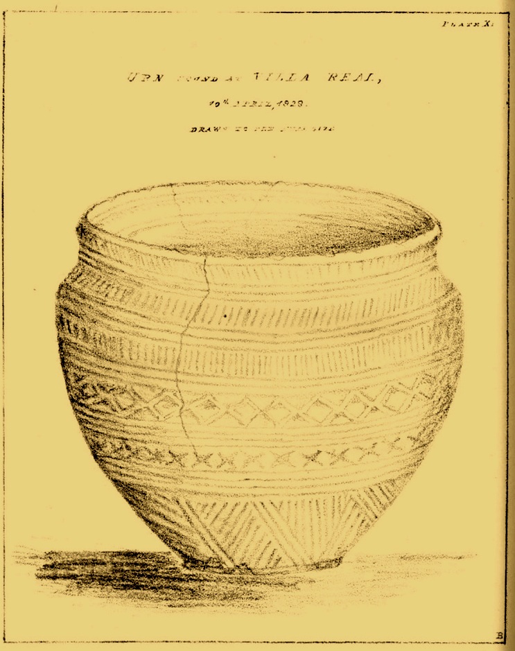
All remains of this prehistoric burial site have obviously long since fallen into only the vaguest of memory, but its incidence deserves reviving for those who may live nearby and seek for a place where our truly ancient ancestors once faired. Here, beneath the modern buildings of homo-profanus, less than a mile north-east of Newcastle city centre, a small prehistoric burial chamber, or cist, was uncovered quite accidentally by a Mr Russell Blackbird (1832) in the first-half of the 19th century. In a letter to the newly-formed (as it was back then) Society of Antiquaries of Newcastle in April of that year he told,
“In trenching some ground for planting, this morning, we discovered a stone vault, 4 feet long by 2 feet wide, and 20 inches deep, deposited in a dry hard marl below the soil, which we were taking out for making the walks in the garden. It contained the bones of a man, the head, in particular, quite perfect, with all the teeth in it. Also a small urn (was found)… There was some red-coloured earth in the urn which the labourers threw out.”
Mr Blackbird sent the antiquarian society a sketch of the urn that he and his colleagues discovered, reproduced here.
References:
Blackbird, Russell, “Account of the Discovery of a Stone Vault and Urn, at Villa Real, Jesmond,” in Archaeologia Aeliana, volume 2, 1832.
Acknowledgements:Huge thanks for use of the Ordnance Survey map in this site profile, reproduced with the kind permission of the National Library of Scotland.
Naathen… I’d give you the directions of how to find this stone, but I’m not sure of its precise location. Just get to the top of Reva Hill, on its more westerly side, and it’s somewhere on its upper slopes. I was up here again recently and hoped to find it, but the grasses might have grown back over it. If one of you petroglyph fans manages to locate it, please can you send me its exact grid-reference, so I can update the site profile.
Carving when wetFaint Reva Hill carvingCarving when wet
Archaeology & History
This was one in a cluster of carvings that were rediscovered in 2011 and which I’ve not managed to re-locate (bad boy). It’s very plain and simple, as you can see. Indeed, I was lucky to even notice it, as the central photograph above shows how faint and eroded the cup-marks are in normal light. Thankfully with a bit of water, what I initially thought may have been two cup-marks, turned into three or four of them. So the next time you’re having a look at the Fraggle Rock carving and its companions, remember that this little fella is hiding somewhere close by…
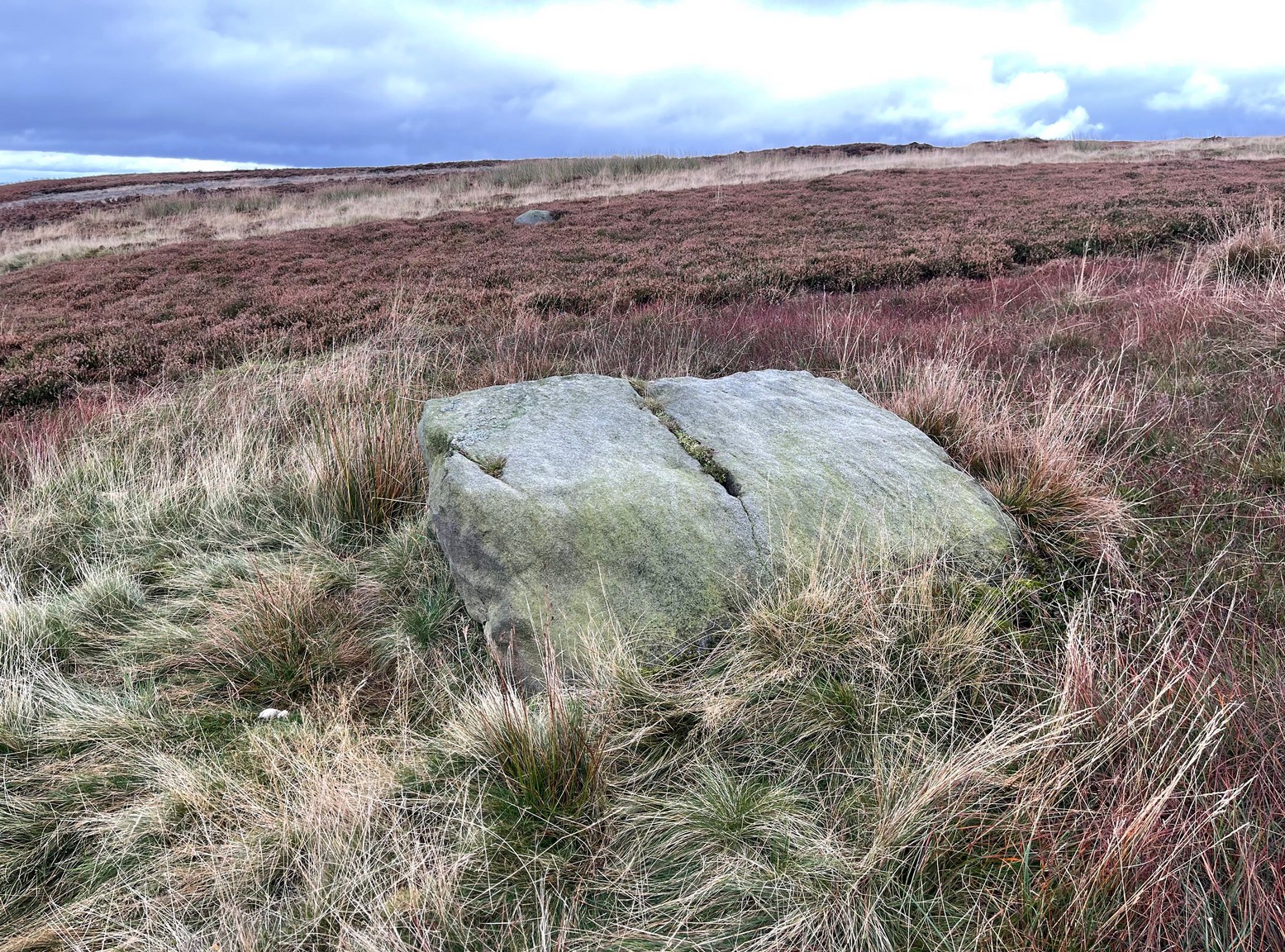
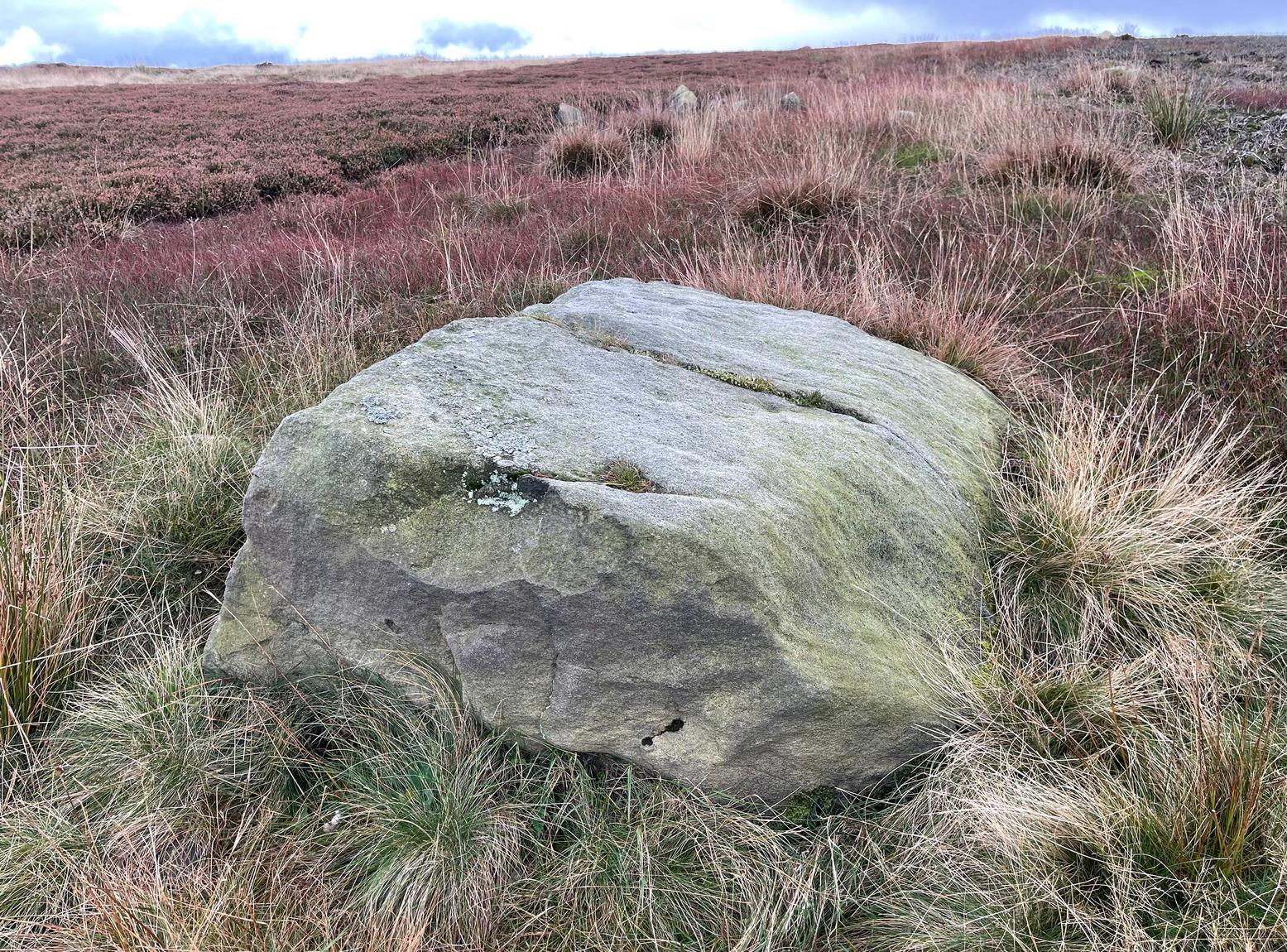
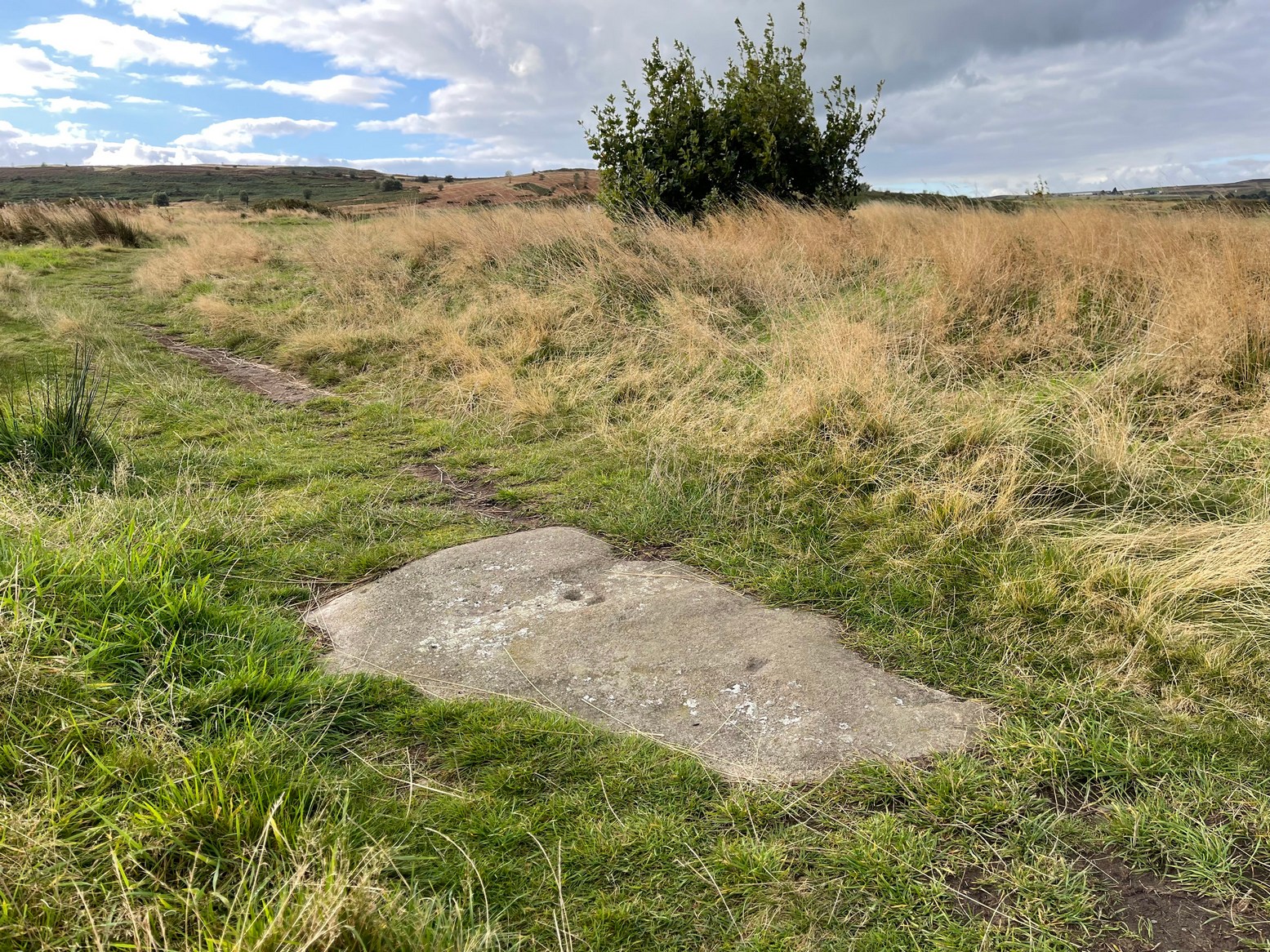
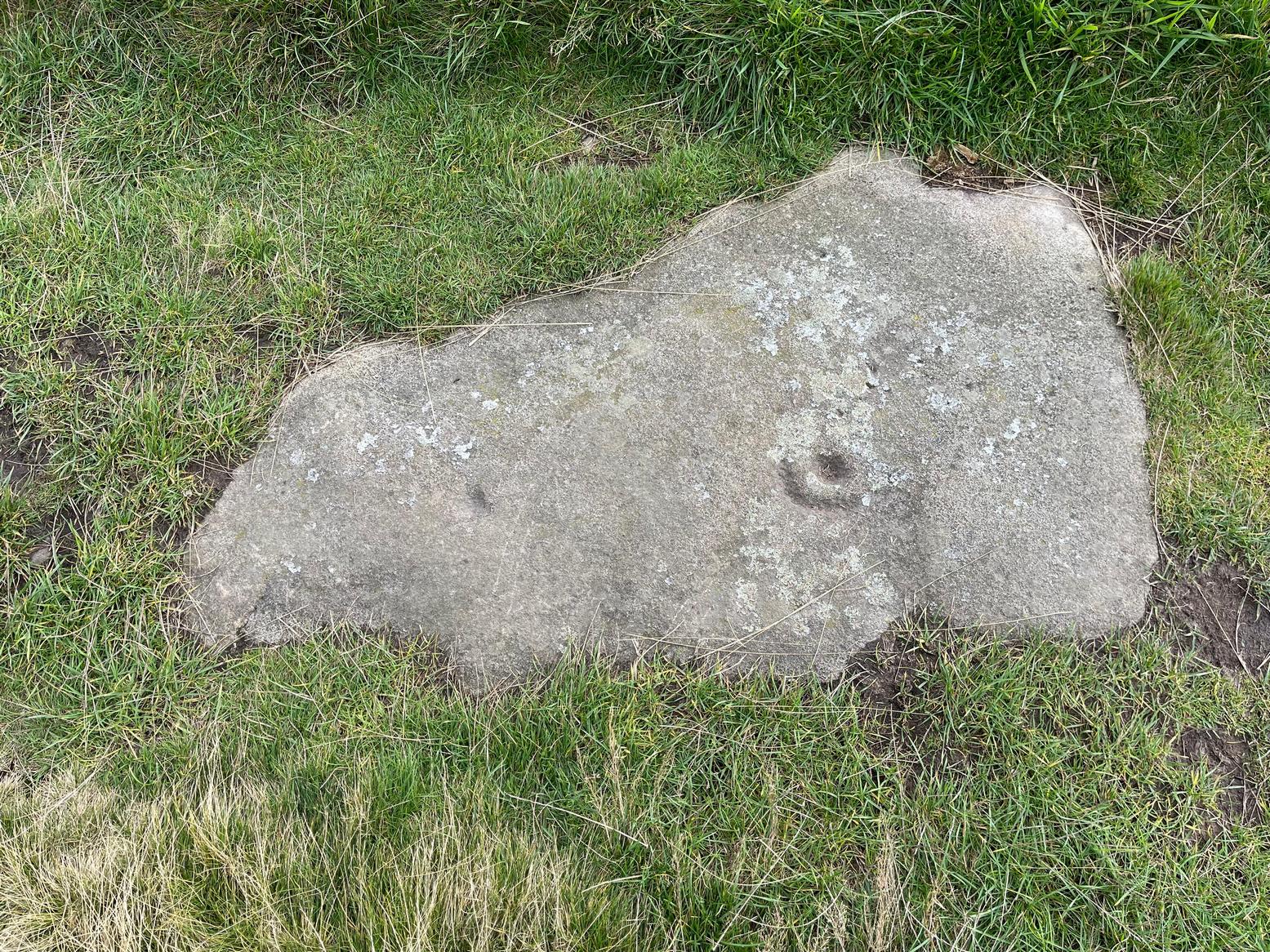
From Cow & Calf Rocks, walk up the steep footpath and turn left (southeast) when it levels out on the edge of the moor. Walk 250 yards along and, where the main path veers down to the road, just keep walking along in the same direction along the footpath that runs gradually uphill until, after 650 yards (595m) you’ll eventually meet up with the footpath that runs along the moorland proper. Where these two paths meet-up, then head upwards (south) into the heather for 55 yards (50m) until you see a good-size sloping block of stone with a crack roughly down the middle. If you hit the Little Haystack Rock (a big conspicuous stone) you’ve gon too far!
Archaeology & History
Shallow cupmarks visible
This is one of the many basic cup-marked stones you’ll find scattered all over these moors possessing (as it does) only two distinct cup-marks on its more northern half, although a possible faint third one needs looking at in better light. When we were kids exploring this and other areas, single and double cup-marked stones like this seemed ten-a-penny and we’d flippantly pass them by after quick perusal, looking for more impressive designs.
The carving here seems to have been missed in the surveys of Hedges (1986) and Boughey & Vickerman (2003), despite the rock standing out quite distinctly. I can only assume that they checked it out when the skies were grey and dull, making the cup-marks difficult to see. A number of other prehistoric remains can be found close to this carving, including cairns and sections of enclosure walling.
Folklore
Tradition tells that the indigenous Britons had a battle with the Romans on the plain where this carving is found.
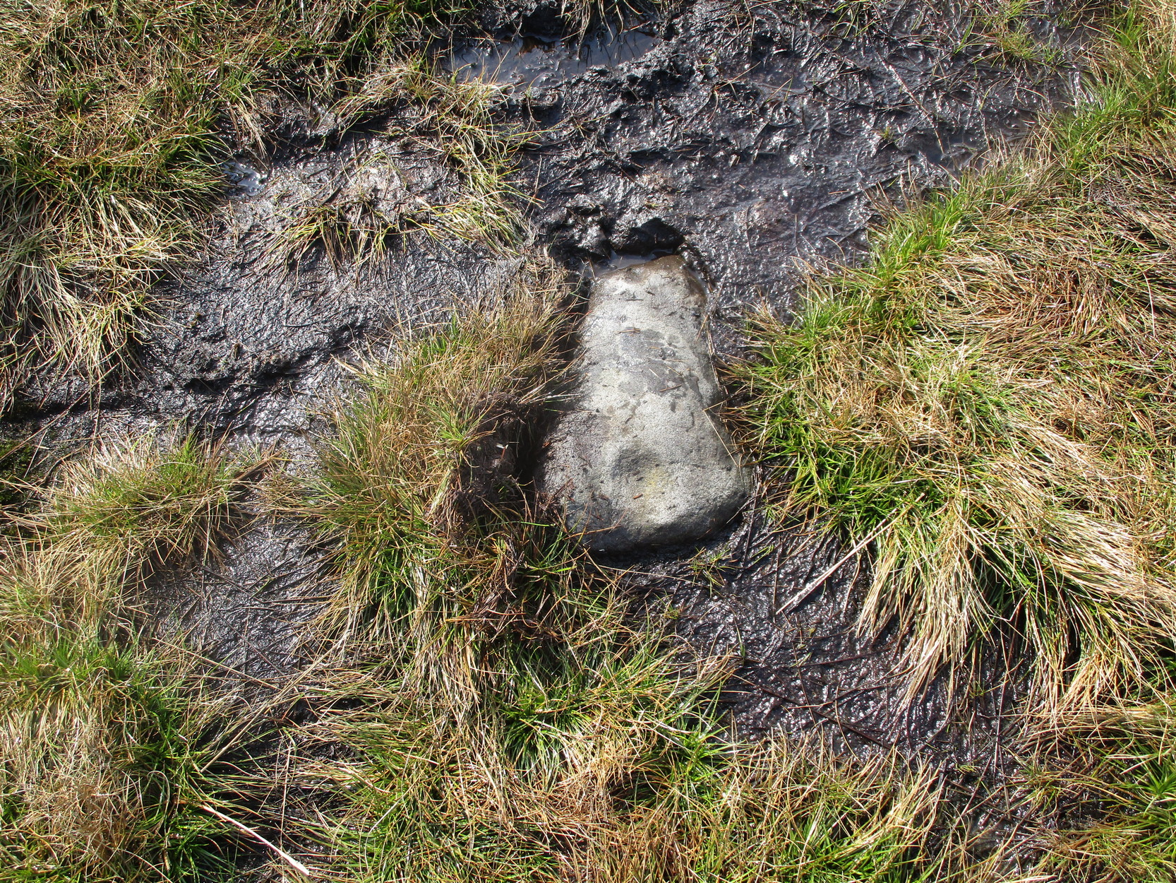
During a walk I did with a small group of people in the Spring of 2024, after a series of heavy rainfalls we ended up having to veer on and off the footpath to ensure we didn’t get swallowed in one of the bogs! In doing so, one of the group, Sarah Walker, noticed a small, almost portable-sized stone sticking up out of the edge of a peat-bog with a very distinct single cup-marking on it. (it may have been on its way as an offering stone to the Little Skirtful cairn) Sarah twizzzled it round a few times in the mud so we could get some good photos of it before we went on our way to the circle at Horncliffe. We didn’t get an exact position for the stone, but it can be found somewhere roughly over halfway between Roms Law and Horncliffe, not far off the path. Good luck!
Acknowledgements: Big thanks to Sarah Walker for stumbling across and uncovering this cup-marking, deep in the moorland mud.
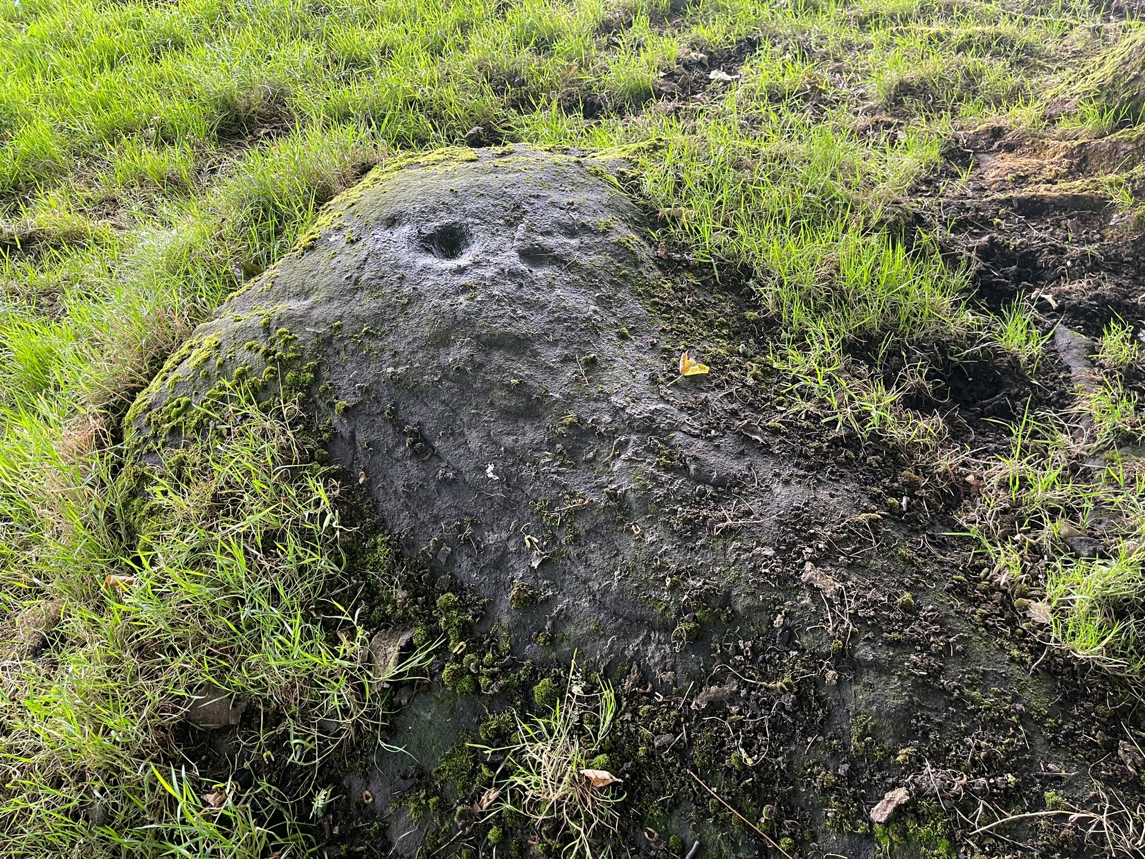
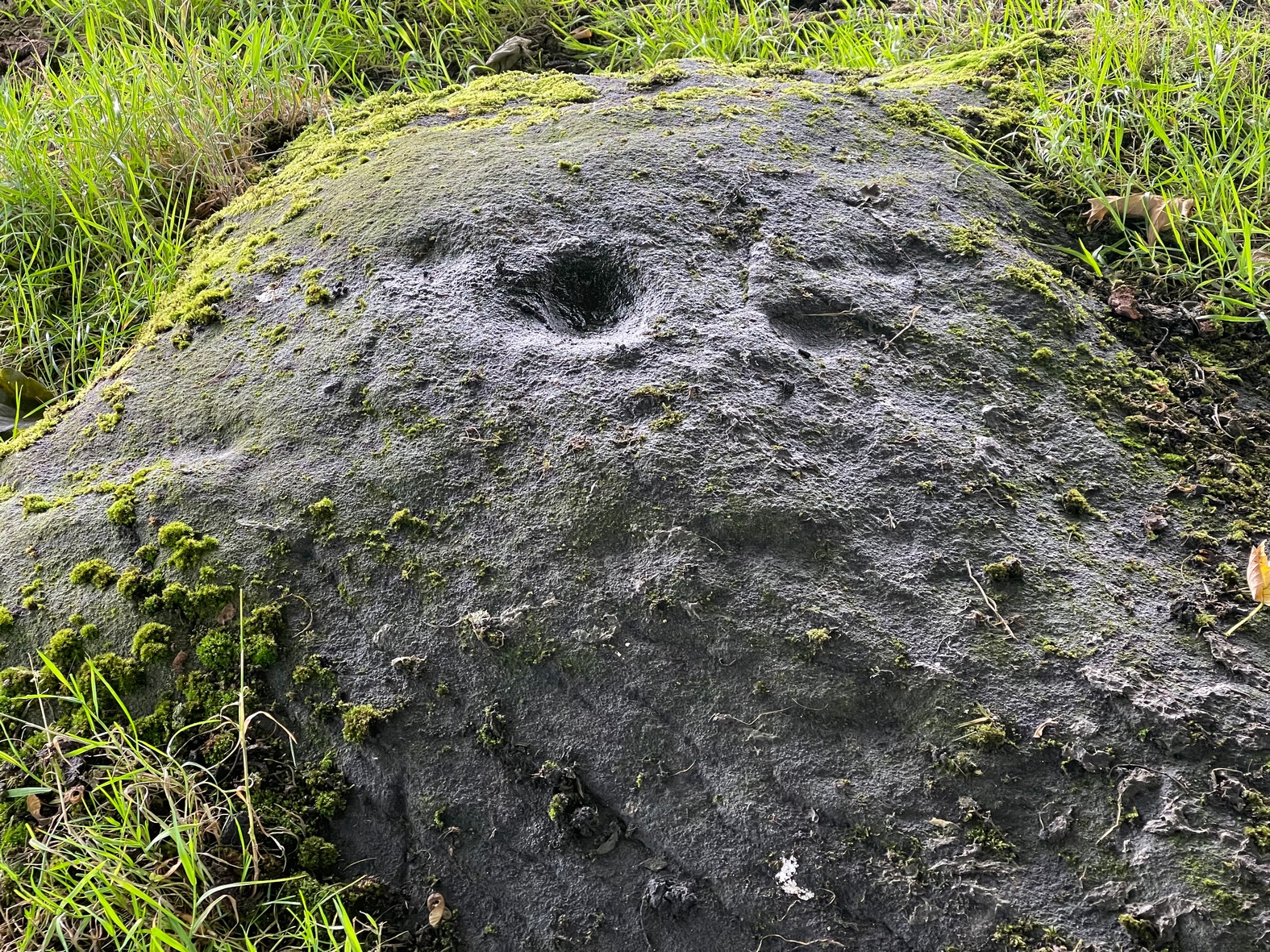
Take the road up through Baildon village, across at the roundabout up Northgate and up onto the moor, then after a few hundred yards turn left on the Bingley Road. About five hundred yards along, keep your eyes peeled for where the ruined reservoirs are to the left-side of the road. Straight across the road from here (north) you’ll see the small cliffs of Eaves Crag. Walk along the footpath that runs above the cliffs and, about 80 yards past them, keep your eyes peeled on the ground right in the middle of the path. You can’t really miss it!
Archaeology & History
Basic cup-and half-ring
First mentioned in passing in the magnum opus of W. Paley Baildon (1913) and subsequently in one of Sidney Jackson’s (1955) series of profiles on the Baildon Moor carvings, this all but insignificant carving comprises of a simple cup-and-half-ring and another singular cup-mark a little further along the stone. John Hedges (1986) described this carving as being a “well marked cup surrounded by horseshoe groove – also well marked. Possible small cup and incomplete ring.” Whilst the minimalists Boughey & Vickerman (2003) told it to be simply, “two cups, one with incomplete ring.” A peculiarity with this design is that it might have been cut by a metal implement, perhaps in the Bronze Age, perhaps even in the Iron Age. We might never know…
References:
Baildon, W. Paley, Baildon and the Baildons – volume 1, St. Catherines: Adelphi 1913.
Boughey, Keith & Vickerman, E.A., Prehistoric Rock Art of the West Riding, WYAS: Wakefield 2003.
Hedges, John (ed.), The Carved Rocks of Rombald’s Moor, WYMCC: Wakefield 1986.
Jackson, Sidney, ‘Cup and Ring Boulders of Baildon Moor,’ in Bradford’s Cartwright Hall Archaeology Group Bulletin, 1:10, 1955.
Acknowledgements:Huge thanks for use of the Ordnance Survey map in this site profile, reproduced with the kind permission of the National Library of Scotland.
From Steeton village, go up Mill Lane, turning right and then bending up the steep Barrows Lane for a half-mile or so, where in turns into Redcar Lane. There’s a row of old cottages on your left with a green lane track running into the fields at the back of them. Four fields along you’ll reach a long straight line of walling running uphill. Up here, above and past the long geological stretch of quarried rocks, the land levels out and two trees sit next to each other by walling. The carving’s beneath them.
Archaeology & History
Close-up of carving
Rediscovered in the summer of 2024 by Thomas Cleland, a deeply worn cup-mark is the primary feature of this petroglyph on the topmost section of the stone, with the remains of a faint incomplete ring around one side of it. Three or four other smaller cup-marks can be seen close to the main one. There may be another cup-marked stone on an adjacent rock, with a lines running away from it, but we need to see that in better light or have one of the computer-tech doods to give it their attention to know for sure.
Cup-Marked Stone (destroyed): OS Grid Reference – SE 152 393
Also Known as:
Carving no.195
Archaeology & History
A basic cup-marked stone could once be seen up near the top of the slope behind the Bay Horse pub as you’re heading up to Baildon village. The site would seem to have been destroyed following the demolition of buildings thereby. A photograph of the carving was taken and it was described, albeit briefly, by Sidney Jackson (1961), who told:
“A small boulder with two cups in it was found at the junction of a narrow bye road leading to 30 Lane Ends, Baildon, with the road which runs behind the Bay Horse Inn, on 12 April (1961), by Mr Alan E. Rowe, 10 Beaufort Grove, Bolton, Bradford and a photograph of it was taken for the Museum Reference Collection.”
Years back I contacted the Bradford Museum about this photo and they were about as helpful as a zionist in Palestine! – i.e., I never got to see it. It would be good if someone could locate the image.
References:
Boughey, Keith & Vickerman, E.A., Prehistoric Rock Art of the West Riding, WYAS: Wakefield 2003.
Jackson, Sidney, “Cup-marked Boulders, Baildon Finds,” in Cartwright Hall Archaeology Group Bulletin, volume 6, no. 6, 1961.
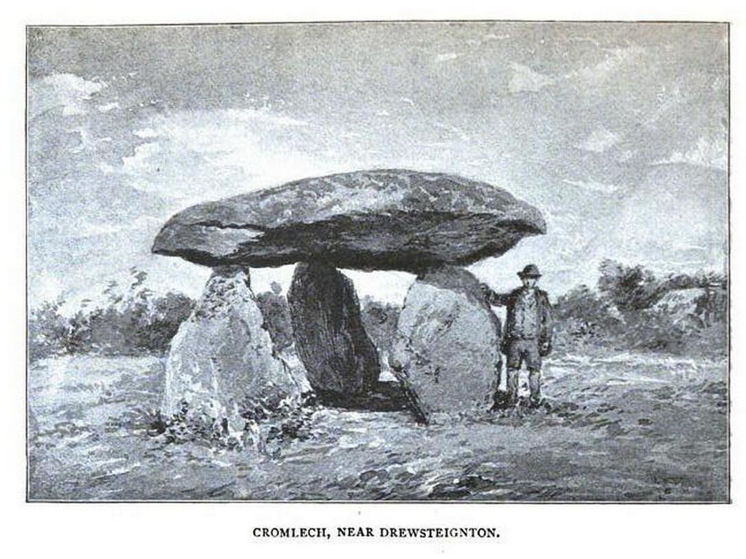
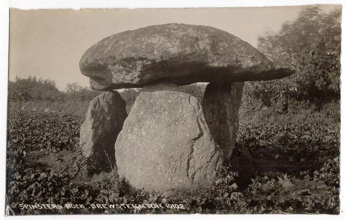
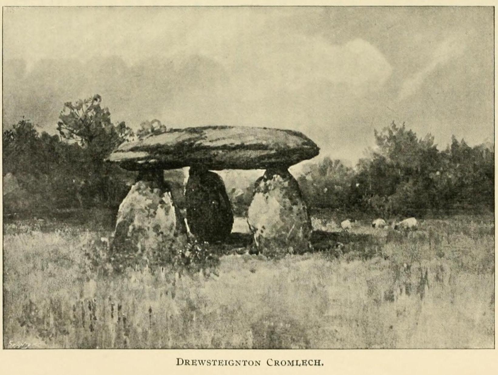
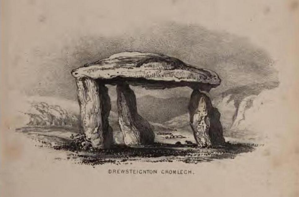
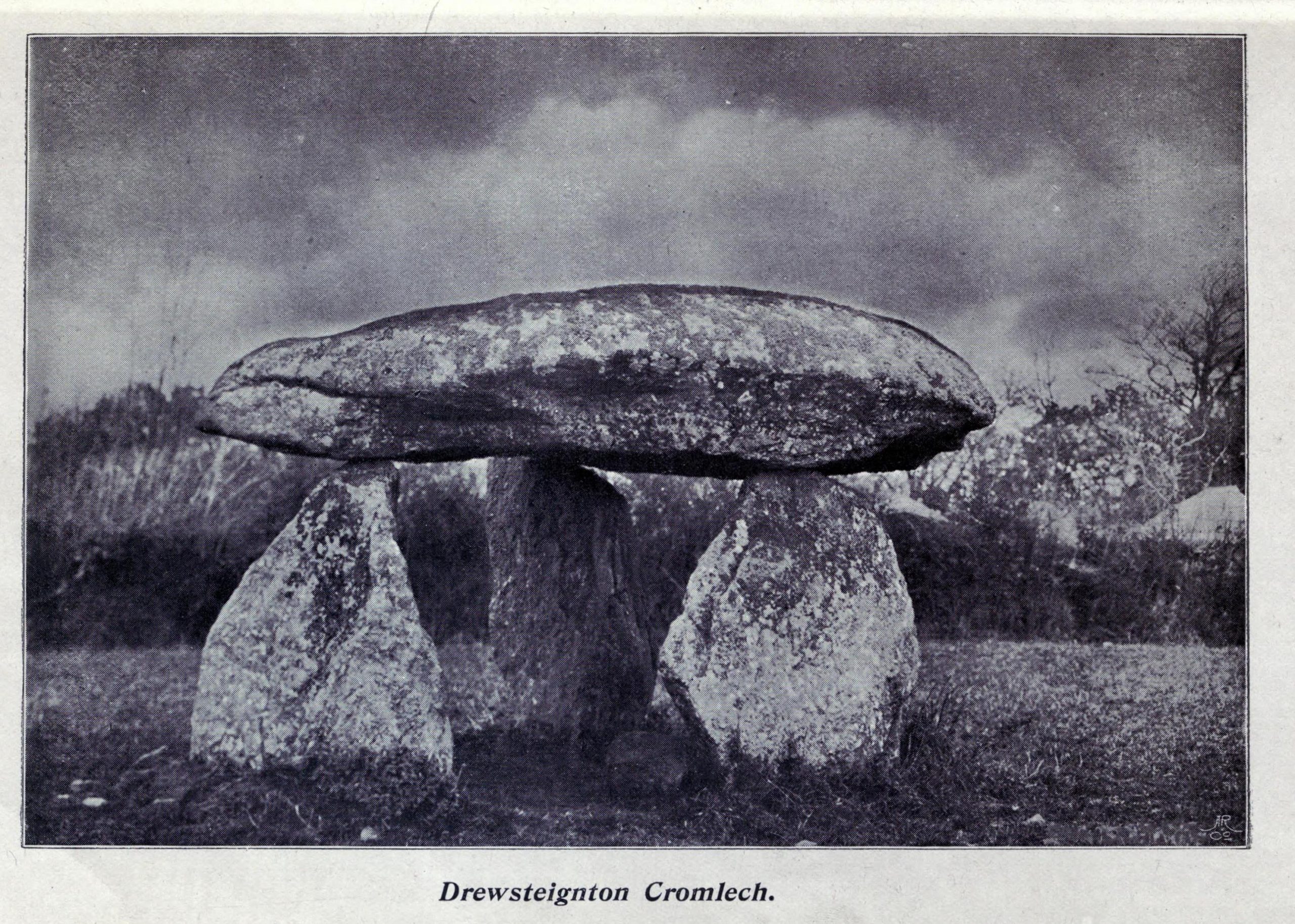
Highlighted on Benjamin Donn’s map of Devon in 1765, this impressive neolithic dolmen consists of three large granite support stones between 5 ft 7 in and 7 ft 7 in tall, surmounted by a large capstone measuring 15 feet by 10 feet. It collapsed in 1862 but was restored later the same year.
Folklore
In Murray’s (1851) Handbook for Travellers he told the following tale of the site:
This interesting old monument derives its name from a whimsical tradition that three spinsters (who were spinners) erected it one morning before breakfast; but “may we not,”* says Mr. Rowe (Peramb. of Dartmoor), “detect in this legend of the three fabulous spinners the terrible Valkyriur of the dark mythology of our Northern ancesters – the Fatal Sisters, the choosers of the slain, whose dread office was to ‘weave the warp and weave the woof of destiny.'”
Polwhele informs us that the legend varies, in that for the three spinsters some have substituted three young men and their father, who brought the stones from the highest part of Dartmoor; and in this phase of the legend has been traced an obscured tradition of Noah and his three sons.
.. The hill on which it stands commands an excellent view of Cawsand Beacon. About 100 yds. beyond the cromlech on the other (N.) side of the lane, is a pond of water, of about 3 acres, called Bradmere Pool, prettily situated in a wood. It is said to be unfathomable, and to remain full to the brim during the driest seasons, and some regard it as artificially formed and of high antiquity – in short a Druidical pool of lustration connected with the adjacent cromlech..
.. The country-people have a legend of a passage formed of large stones leading underground from Bradmere to the Teign, near the logan stone..
References:
Baring-Gould, Sabine, A Book of Dartmoor, London 1900.
Crossing, William, Gems in a Granite Setting, Western Morning News: Plymouth 1905.
Falcon, T.A., Dartmoor Illustrated, James G. Comin: Exeter 1900.
Murray, John, A Hand-book for Travellers in Devon & Cornwall, John Murray: London 1851.
Ormerod, G. Waring, Notes on Rude Stone Remains Situate on the Easterly Side of Dartmoor, privately printed 1873.
Page, John Lloyd Warden, An Exploration of Dartmoor and its Antiquities, Seeley: London 1892.
Worth, R. Hansford, Worth’s Dartmoor, David & Charles: Newton Abbot 1967.
Acknowledgements:Huge thanks for use of the Ordnance Survey map in this site profile, reproduced with the kind permission of the National Library of Scotland.