In Miss Maitland’s (1935) article on the Ledard Stone carving, she also made a brief mention of “another cup-marked stone (that) lies on the edge of the burn, beyond the one described, above Loch Ard.” She gave no further information about this second stone. It remains lost and sounds to be only a short distance further uphill and on the west-side of the burn. If any local explorers are able to find this carving please let us know and, if possible, add some info and photos of it on our Facebook page. (the grid-reference for this site profile is an approximation)
References:
Maitland, Mrs, “Cup Marked Stones”, in The Scottish Country Woman, 1935.
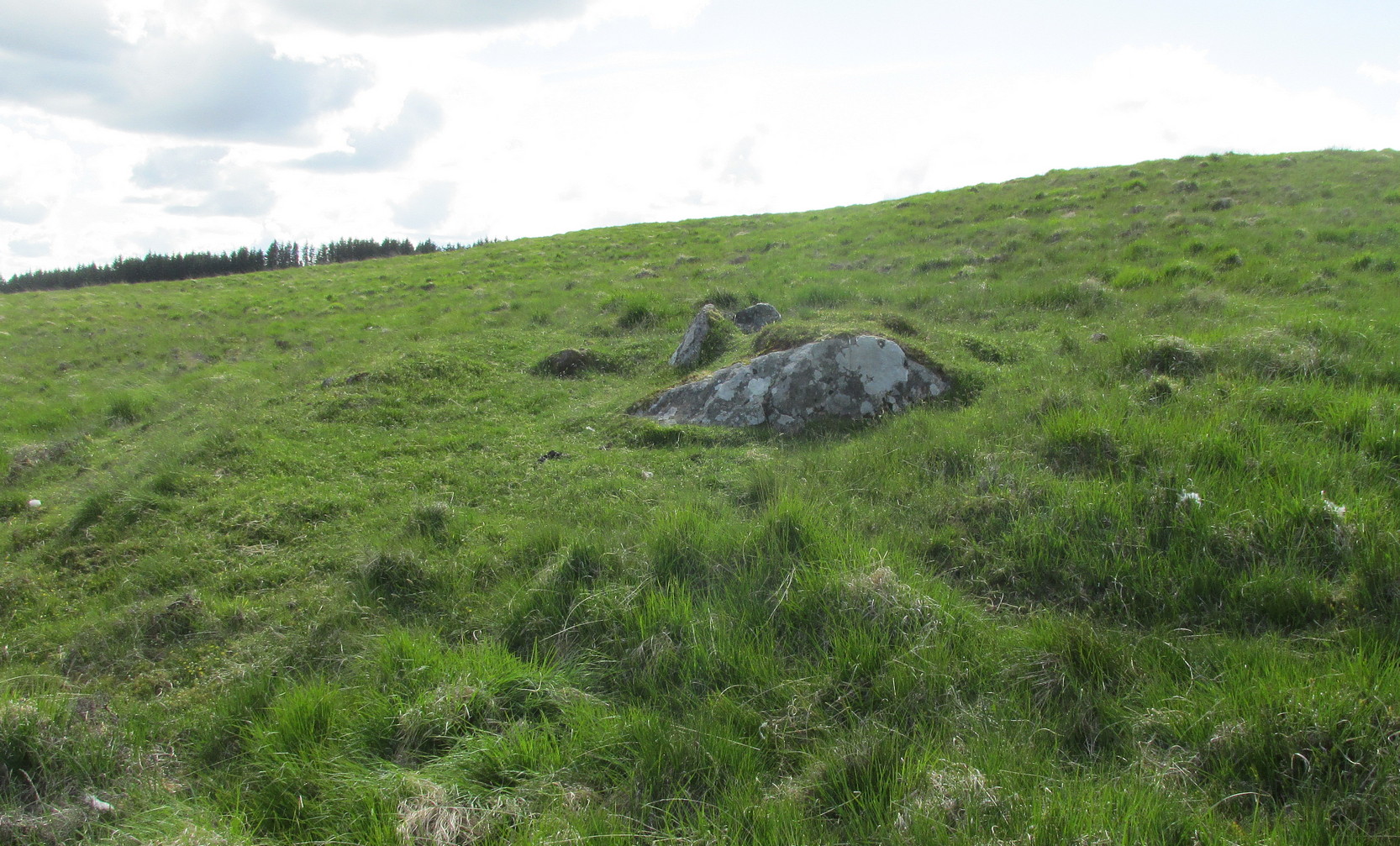
This carving hasn’t seen the light of day, seemingly, since it was first reported by a local lady, a Miss Maitland in the 1930s—and who, it transpires, uncovered a number of petroglyphs in this neck of the woods. She found it on one of her many forays in the mountains hereby and took some old photos of it—although they’ve not reproduced too well for the sake of the site profile. (apologies)
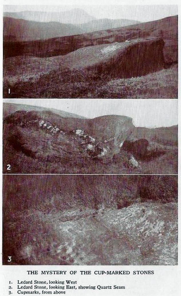
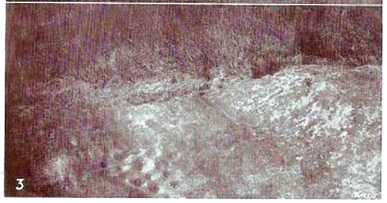
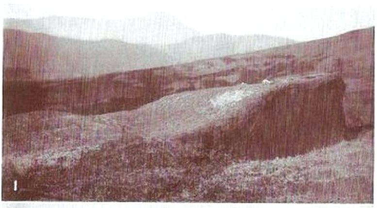
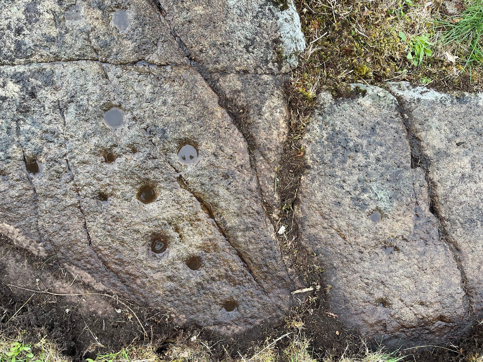
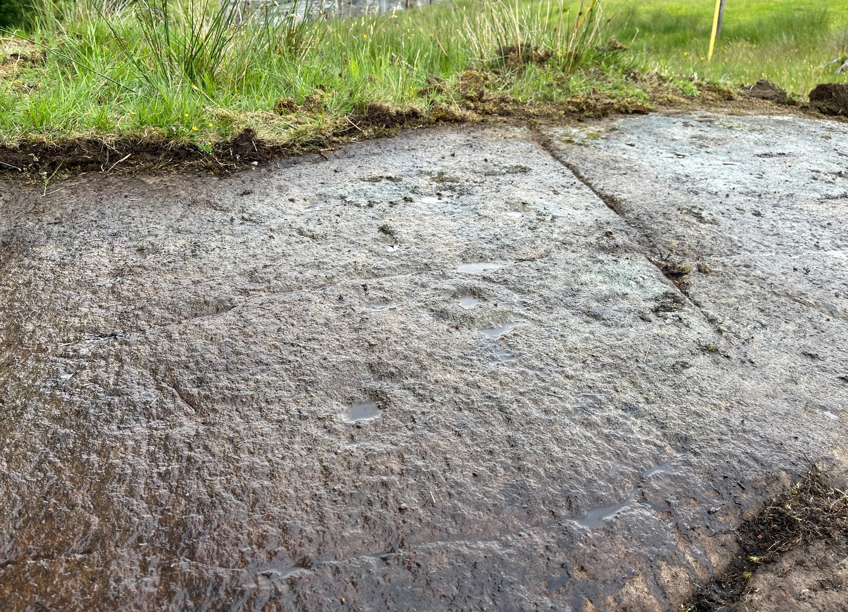
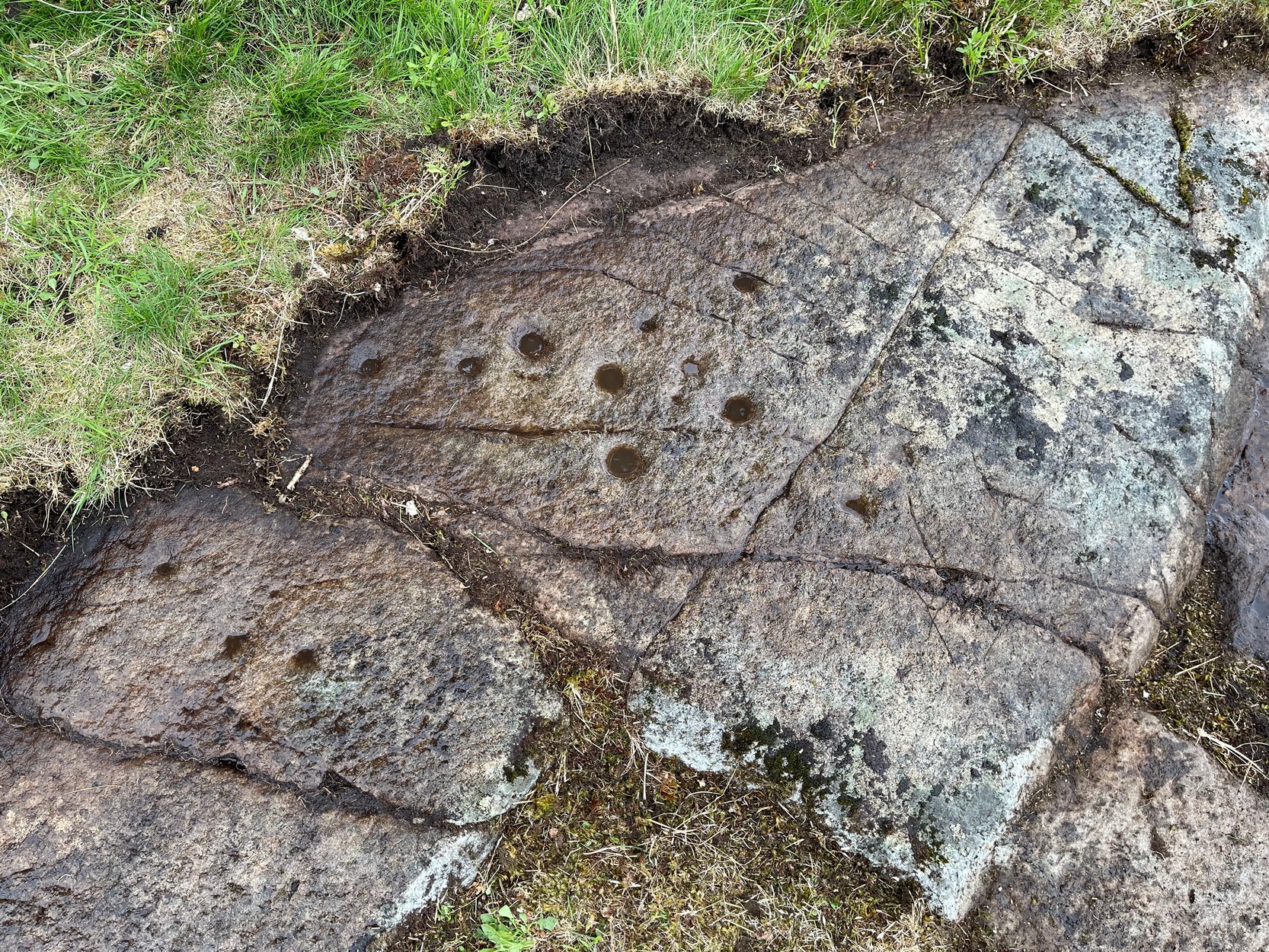
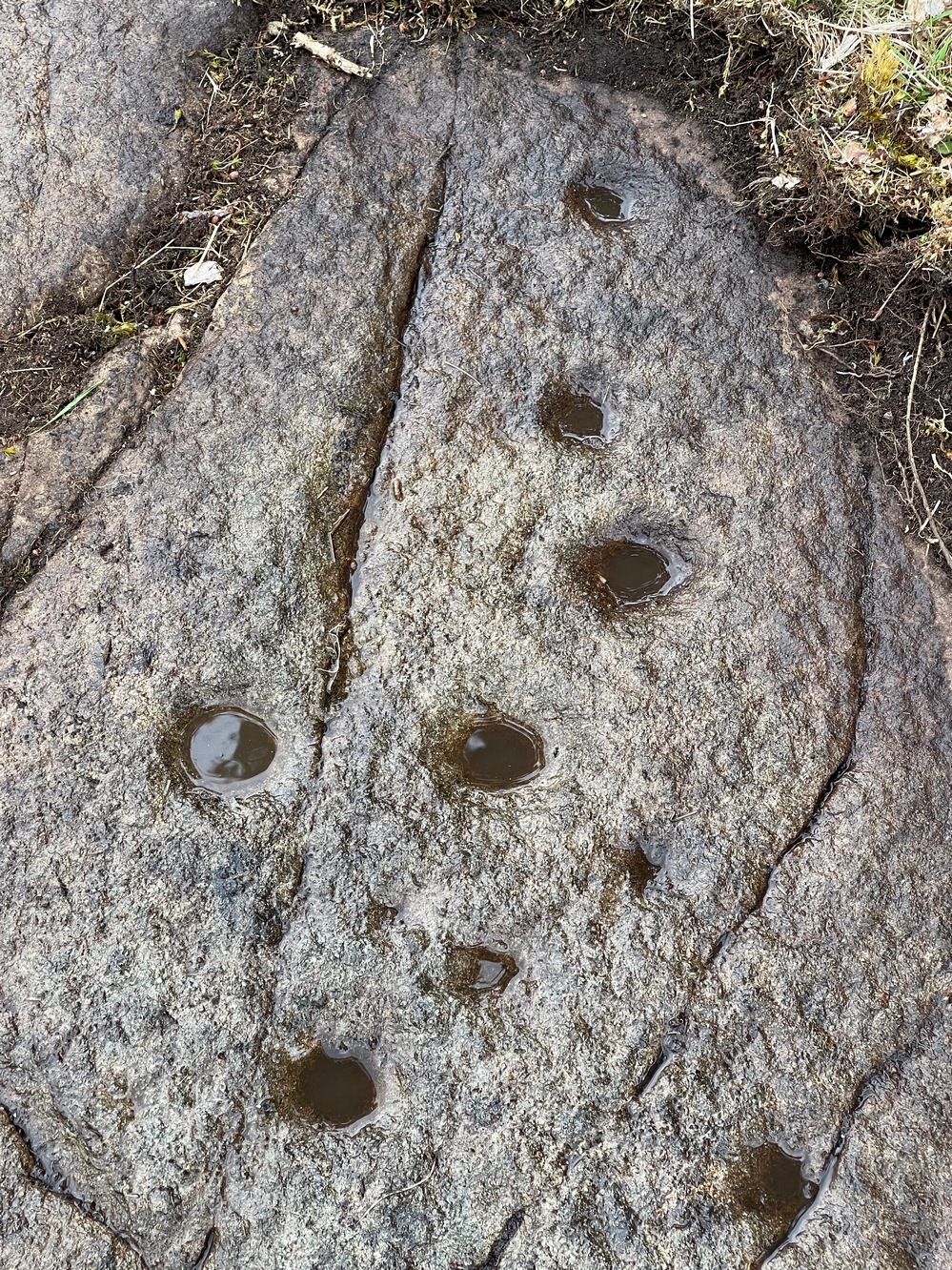
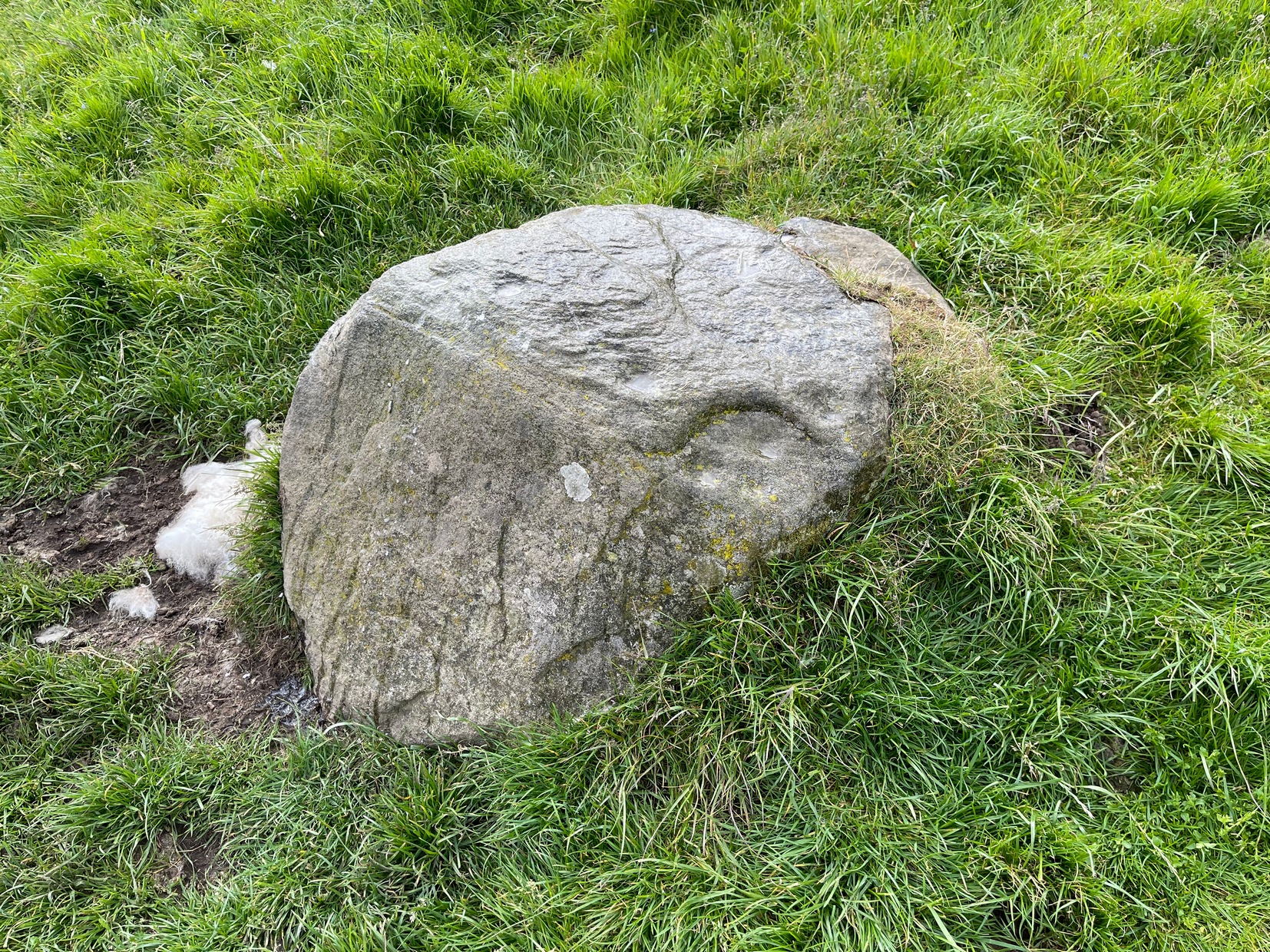
Since Miss Maitland’s days, the hillside has been covered in forestry plantation, making it extremely difficult to locate the carving. However, due to the reasonably large size of the stone, it should still be there (smaller cup-and-ring stones have been damaged and destroyed by forestry over the years); and as we can see in the middle photo, a long thick vein of quartz runs roughly along the middle of the stone—an ingredient which may have been significant for the people who carved the stone. In her article in the Scottish Country Woman magazine, Miss Maitland told:
cup-marks, bottom leftLedard Stone
“On the hill directly behind Ledard, on the north side of Loch Ard, a little to the west of the burn and a little to the east of the first grouse-butt, exactly 700 feet above sea level, lies a large boulder. Ice has smoothed and fashioned it and on the worn surface may be seen twenty-one, or so, small round hollows, varying in size and depth. The pattern made is roughly diamond-shaped, pointing directly east and west. I saw them for the first time as the sun was setting on New Year’s Eve, 1932. It was a solemn moment, for as far as I know no one else had looked upon them with such joy, and even awe, for perhaps a thousand years!”
She may have been right. And by the sound of her words, she’d certainly caught the petroglyph bug!
Anyhow, the carving doesn’t appear to have been seen since then. A “cup-marked boulder” was noted in the Royal Commission’s (1979) listings, but with no further details. We assume it must be the same carving, although they never visited it. It’s also possible that they were referring to another lost cup-marked stone a short distance further up the hill from here. If any local explorers are able to re-locate the carving, please let us know, and maybe add some info and photos of it on our Facebook page.
References:
Maitland, Mrs, “Cup Marked Stones”, in The Scottish Country Woman, 1935.
Royal Commission Ancient & Historical Monuments of Scotland, Archaeological Sites and Monuments of Stirling District, Central Region, Society of Antiquaries of Scotland 1979.
Along the A84 road as you’re heading into Callander, just 300 yards before you reach the the Keltie Bridge caravan park, take the tiny road on your left (north) and barely 100 yards along where a small crossroads can be said to exist, go straight forward up the tiny single-track road ahead of you. Keep all the way up for a mile until you reach Bracklinn Farm (when you meet a split in the road, keep left – and make sure you have parked way further down track of here). Walk up the track past Bracklinn Farm for just over a mile (1.85km), until where the track and the large burn runs roughly alongside each other (past the small Eas Uilleam cairn up to your right) and go through the gate. From here, go immediately left (SW) and walk alongside the dead straight fence for just over 300 yards, then slowly zigzag up the sloping hill. If you reach the derelict walling, you’ve gone too far.
Archaeology & History
West Bracklinn from below
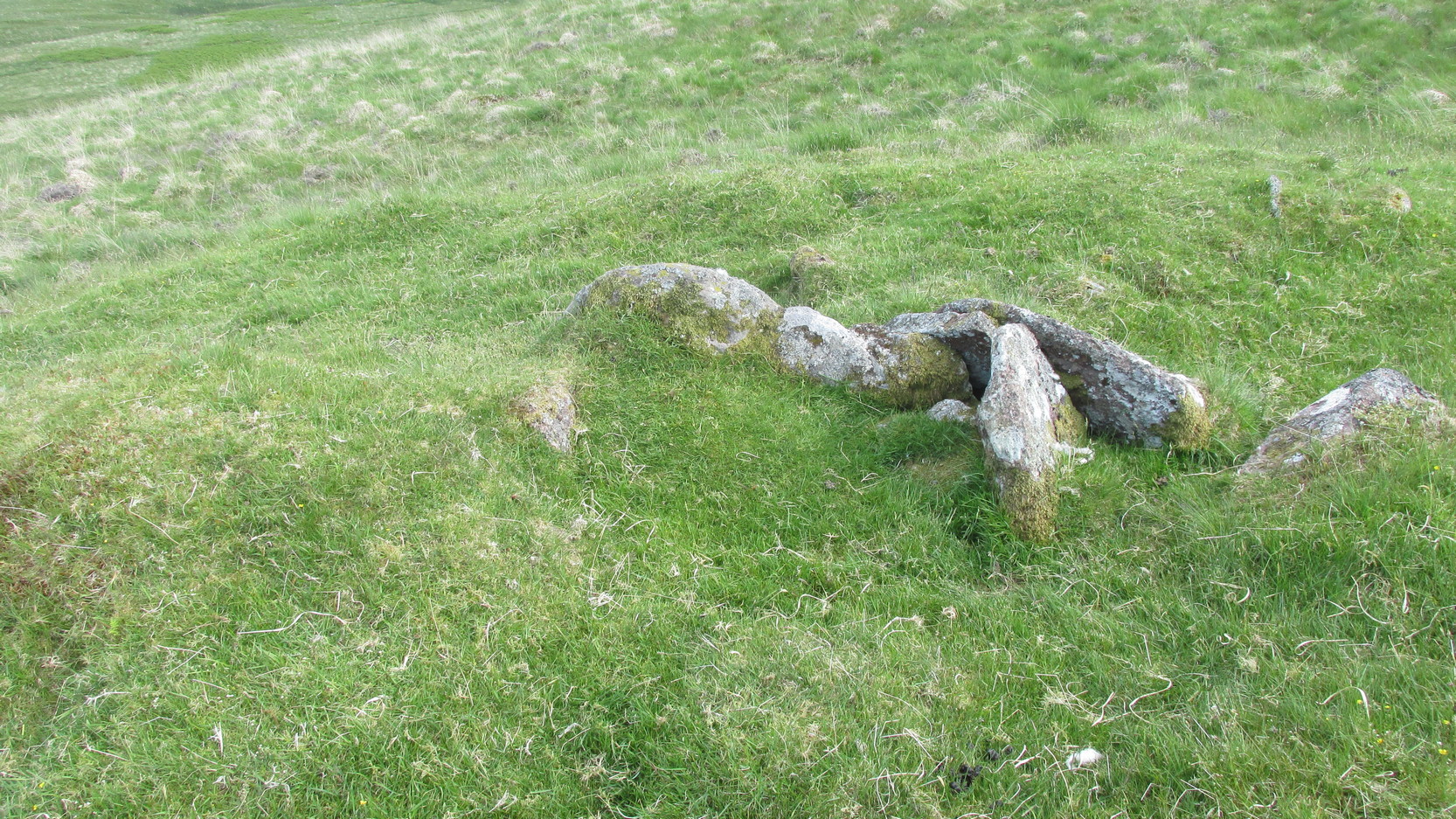
For a site marked as ‘Chambered Cairn’ on the OS-maps, you might be expecting a little bit more when you get here. Sadly, it’s not what it once was. Much of the covering stones from the cairn have been severely robbed and obviously used in the old and curiously-named ruin of Bothan na Plaighe below, and the large sheep-fold structures barely 50 yards to the north. All that’s really left to see here is the internal chamber, aligned roughly east-west, which seems to have originally been split into two sections. The remaining overgrown edges of the monument, barely two feet high at the most, measures roughly 8 yards by 9 yards, but is much denuded and can really only be noticed when you’re almost stood on top of it!
The landscape reaching out from here takes the eyes way way into the distance along the fading horizon, from north-east to south-east. This expansive view, this reaching landscape, may have been an important element in the placement of the tomb – and it’s certainly something to behold on a good day. It might be a bit of a walk to get here, but if you want some good countryside, scenery and a bit of ancient history, this is one helluva good place to go!
References:
Royal Commission Ancient & Historical Monuments of Scotland, Braes of Doune: An Archaeological Survey, RCAHMS: Edinburgh 1994.
Acknowledgements:Huge thanks for use of the Ordnance Survey map in this site profile, reproduced with the kind permission of the National Library of Scotland.
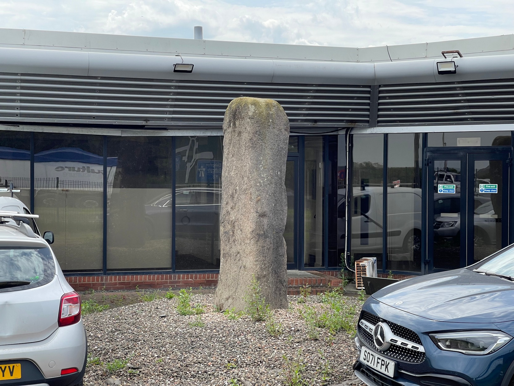
Coming out of Edinburgh along the main A8 Glasgow road, literally yards before you join the M9 near Ratho Station, on the left-side of the road where the last building stands (a company called Element), you need to look through their high metal fence. Just in front of the large windows, you’ll see this tall standing stone (if you’re coming here via public transport, there’s a bus-stop less than 100 yards away on both sides of the dual carriageway). Y’ can’t really miss it!
Archaeology & History
A prehistoric site which, today, has lost all value in terms of its original ambience. The traffic and aircraft noise here is non-stop and prevents all forms of quietude and refection. Added to this is the fact that it’s behind the high fencing of the warehouse, stopping you getting close to it. But, I suppose, at least it’s still standing after all these centuries. In many other parts of Britain, it would have been destroyed long ago…
It seems to have been mentioned for the first time, albeit briefly in John Smith’s (1862) early survey of the local prehistoric sites. He told it to be a,
“large standing stone…of coarse greenstone,” which “bears no inscription or sculpturing of any kind, and measures about 10 feet in height from the surface of the ground.”
Old stone, new home
Many years later when the Royal Commission (1929) this way ventured, they weren’t much more descriptive, but postulated, not unreasonably I might say, that it functioned as a deliberate outlier from the impressive Newbridge megalithic complex 350 yards to the west. They may be right. “In shape it is an irregular four-sided prism,” they wrote, “measuring 9 feet 3 inches in height and 10 feet 6 inches in girth.” The local megalith surveyor Adam MacLean (1977) pointed out that, relative to the prehistoric complex 350 yards away, “it is in the right position to act as an equinox sunrise marker.”
References:
MacLean, Adam, The Standing Stones of the Lothians, Megalithic Research Publications: Edinburgh 1977.
Royal Commission Ancient & Historical Monuments of Scotland, Inventory of Monuments and Constructions in the Counties of Midlothian and West Lothian, HMSO: Edinburgh 1929.
Swarbrick, Olaf, A Gazetteer of Prehistoric Standing Stones in Great Britain, BAR: Oxford 2012.
Acknowledgements:Huge thanks for use of the Ordnance Survey map in this site profile, reproduced with the kind permission of the National Library of Scotland.
Take the same directions as if you’re visiting the Tormain (1) carving (the best one of the bunch here), but about five yards before reaching it, to your immediate left, just at the edge of where the hill drops down slightly, you’ll see a small flat rock poking out of the ground that may have been cut and quarried at some time in the past. That’s the one!
Archaeology & History
This small compact design looks like a typical cup-marked stone with the usual scatter of cups in no seeming order—until, that is, you walk around it and look at it from different angles, whereupon you’ll notice that a couple of distinct deep carved lines have been cut in a cross formation, with cup-marks at the ends of the crucifix. My view of this is that cup-marks were done first, probably in the standard Bronze Age period, and the ‘cross’ was cut into the stone at a much later date, probably during the early christian era. The depth of the lines which create the ‘cross’ is deep and thin at the bottom, suggesting a metal tool, which seems to have been cut into an natural crack. Visitors here will notice a small drill-hole near the edge of the stone which seems to have been done by local quarrymen, probably in the 19th century.
It was first described in Romilly Allen’s (1882) article on the Tormain stones. He called it ‘Stone E’ and told that it
Location of Tormain 5Cups, lines & cross form
“is situated about half-way between stones A and D, and is furthest to the east. It measures 1 foot 4 inches by 1 foot 9 inches, and projects 1 foot above the turf. Its upper surface is flat, and on it are carved eight cups varying in diameter from 1 to 2½ inches. There are two connecting grooves between three of the cups, forming a rude cross. Another cup has a channel leading over the edge of the stone.”
In November 1927, the Royal Commission dudes visited the carving (and its companions), but they had to roll back the turf to see it clearly. On the stone they saw that “at least nine or ten cup-markings, in some cases with connecting gutters, are still more or less clearly outlined.”
Carving highlighted (Morris ’82)Ron Morris’s old photo
When Ron Morris (1981) visited here, he highlighted the carving in chalk to get a decent impression of the design, as the attached photo here shows. Many traditional cultures ritually paint their carvings at set times of the year, in traditions that go back many centuries—perhaps even millenia. In all probability the same thing was done at some of the British petroglyphs, although there are no remaining traditions. Anyhow, Morris described it succinctly as:
“½m square, ¼m high…on which are: eight cups up to 7cm (3 in) diameter and 4cm (1½ in) deep and some grooves, to of which connect some of the cups to form a well-defined Cross.”
The stone was looked at by the great rock art explorer Kaledon Naddair of Edinburgh, but sadly I’m unable to locate his report and the fine illustrations that always tended to accompany them. If you’re reading this sir, give us your valuable input!
Beckensall, Stan, Rock Carvings of Northern Britain, Shire: Princess Risborough 1986.
Beckensall, Stan, British Prehistoric Rock Art, Tempus: Stroud 1999.
Feachem, Richard, Guide to Prehistoric Scotland, Batsford 1977.
Hadingham Evan, Ancient Carvings in Britain: A Mystery, Garnstone: London 1974.
Morris, Ronald W.B., “The Cup-and-Ring and Similar Early Sculptures of Scotland; Part 2 – The Rest of Scotland except Kintyre,” in Transactions of the Ancient Monuments Society, volume 16, 1969.
Morris, Ronald W.B., The Prehistoric Rock Art of Southern Scotland, BAR: Oxford 1981.
Royal Commission Ancient & Historical Monuments of Scotland, Inventory of Monuments and Constructions in the Counties of Midlothian and West Lothian, HMSO: Edinburgh 1929.
Acknowledgements: Huge thanks to Jan Carrington for use of her photos. 🙂
Go along the minor single-track road on the south-side of Loch Earn (between Edinample and the ugly Lochearn Leisure Park) and roughly halfway along the loch, there’s rough parking near Ardvorlich House (the starting spot for walking up Ben Vorlich). Walk east past the track to Ardvorlich, staying on the lochside road, for about 400 yards and then go up the dirt-track on your right. Walk up here for about 200 yards and, before you reach the trees, notice a small gate in the walling above you on your right, about 70 yards up the slope. Go through here and bear immediately left, up to the large oak on the large dome of rock. From the oak, with your back to the wall, take about 10 steps forward. You’re here!
Archaeology & History
Deep cups & faint rings
The singular short reference to this impressive design was by George Currie (2011) who told us that it “bears at least 17 cup marks, three of which have single rings.” But there are in fact six of them with rings, possibly seven—with a few additional cup-marks scattered across the wider rock surface. It’s quite impressive, although on our visit here the daylight was gray and so the photos I have of the site do not do it justice. The sun popped out a couple of times, but only for a few minutes and we weren’t able to take advantage of it quickly enough.
The distinctive section of this petroglyph are the deep cup-marks on its northern side: fourteen of them, three of which have faded shallow rings around them—or rather, uneven oval-shaped surroundings. The cup-marks have obviously been worked and re-worked over the centuries, whereas the rings were given less repetitive attention, for whatever reason. This is a pattern found at a great number of cup-and-ring stones across the country.
Shallow cups, faint ringsAnother angle of deep cups
From this cluster of deep cups, walk two or three yards south onto the slightly lower smooth rock surface, where we find a much less pronounced scatter of several shallow cup-marks—may be five, may be six—but three of them have faint rings around them. They were difficult to see on our visit here due to the poor light. There’s what may be another incomplete cup-and-ring another two or three yards further along on the same rock face: a cup, certainly; the faint ring, perhaps. We need to revisit this in better light.
The rock surface continues for quite some distance all round here in the shape of a large dome, much of it covered in vegetation of varying depths. There are openings showing the bare rock and, at several other spots there are several other cup-marks, although none are as deep as the ones we’ve just described. On the edge of one piece, about three yards north of the deep cups, a couple of worn cup-marks are near the edge of one rise; two others are clearly notable a yard or so WNW of the deep cups; whilst there are several other single cups near and not-so-near of the main design. It all requires a lot more work before we see the entire picture.
It’s a gorgeous site: silent with the feel of winds and waters and the scree of buzzards touching the senses: elements that, at some petroglyphs, had mythic relevance…
References:
Currie, George, “Comrie: Balimeanach (BC 2), Cup-marked Rock”, in Discovery & Excavation Scotland, New series – volume 12, 2011.
Acknowledgements:Huge thanks for use of the Ordnance Survey map in this site profile, reproduced with the kind permission of the National Library of Scotland.
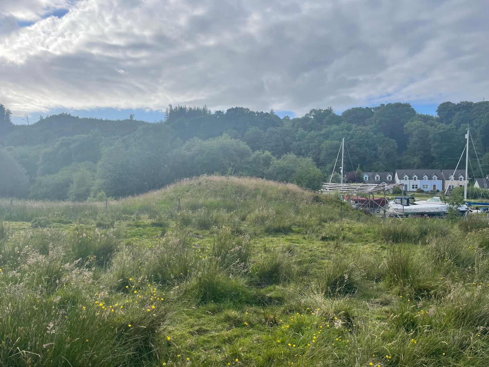
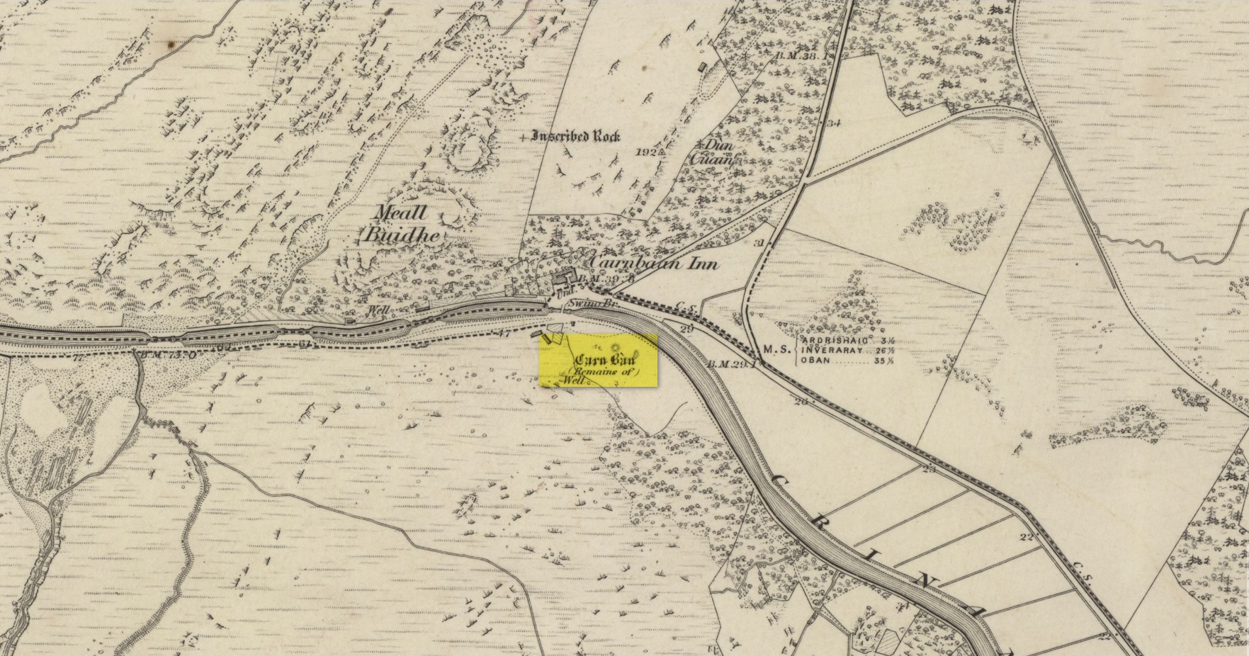
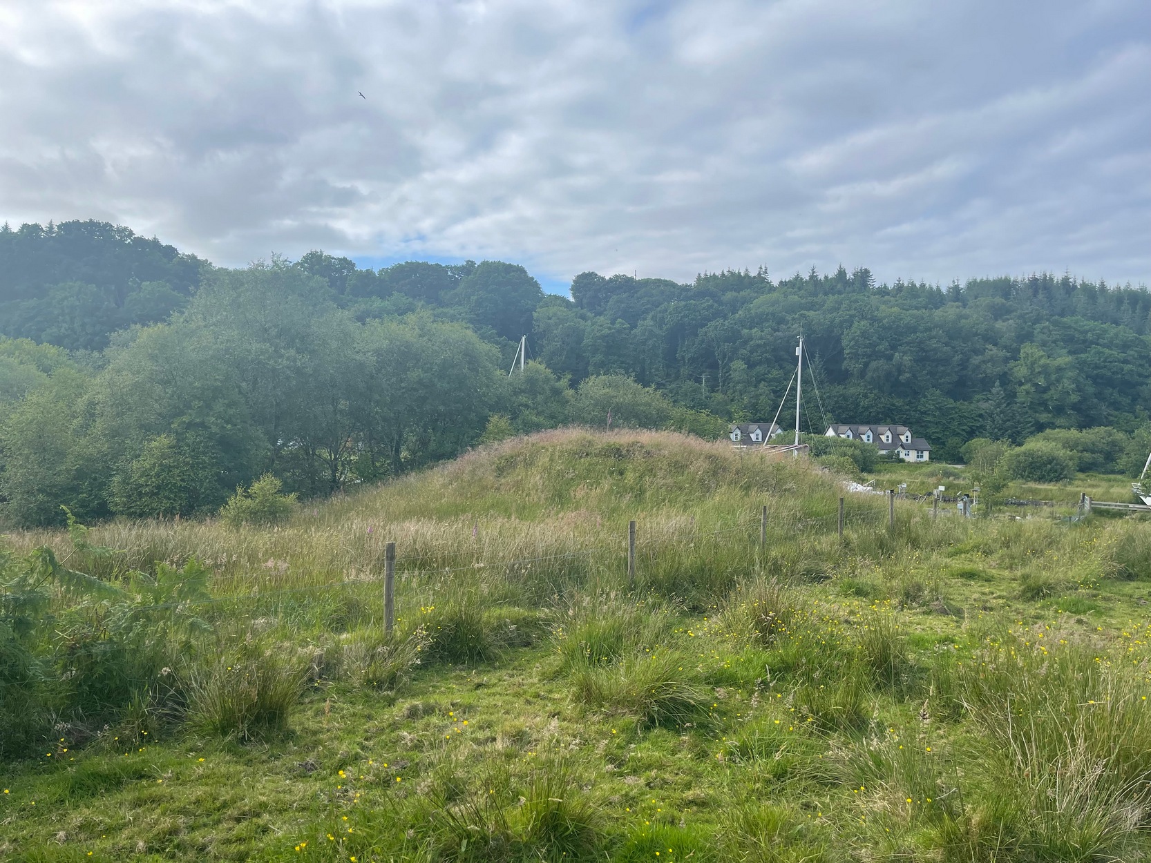
Take the A816 out of Lochgilphead and head north as if you’re going to Kilmartin. Nearly 2 miles along, take the left turn along the B841 Crinan road. A few hundred yards along, go over the canal bridge and about 70 yards along there’s a left turn onto the track into the Knapdale Forest. Go along here (there’s a parking spot) for 200 yards until your reach the grasslands on your left. If you walk into this bit of scrubland, you’ll see the rounded fairy-mound over the fence in the adjacent field, almost overlooking the canal. Y’ can’t really miss it.
Archaeology & History
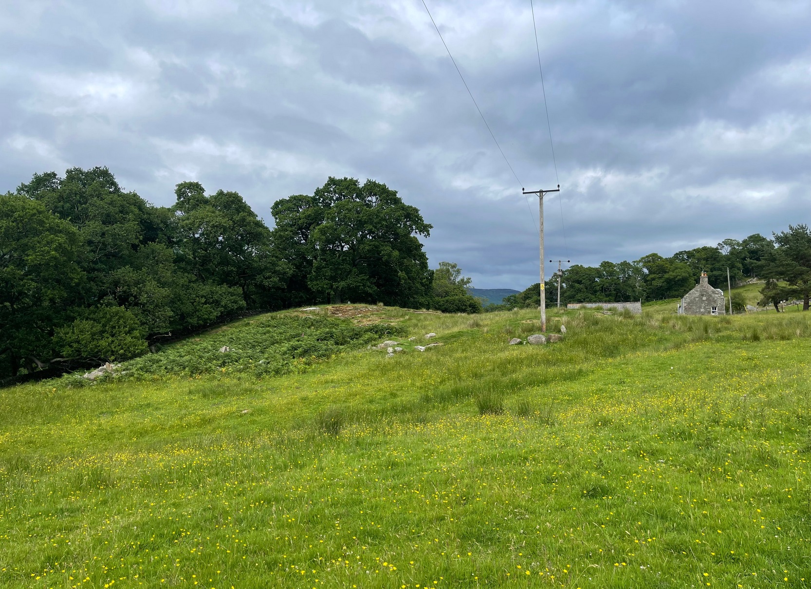
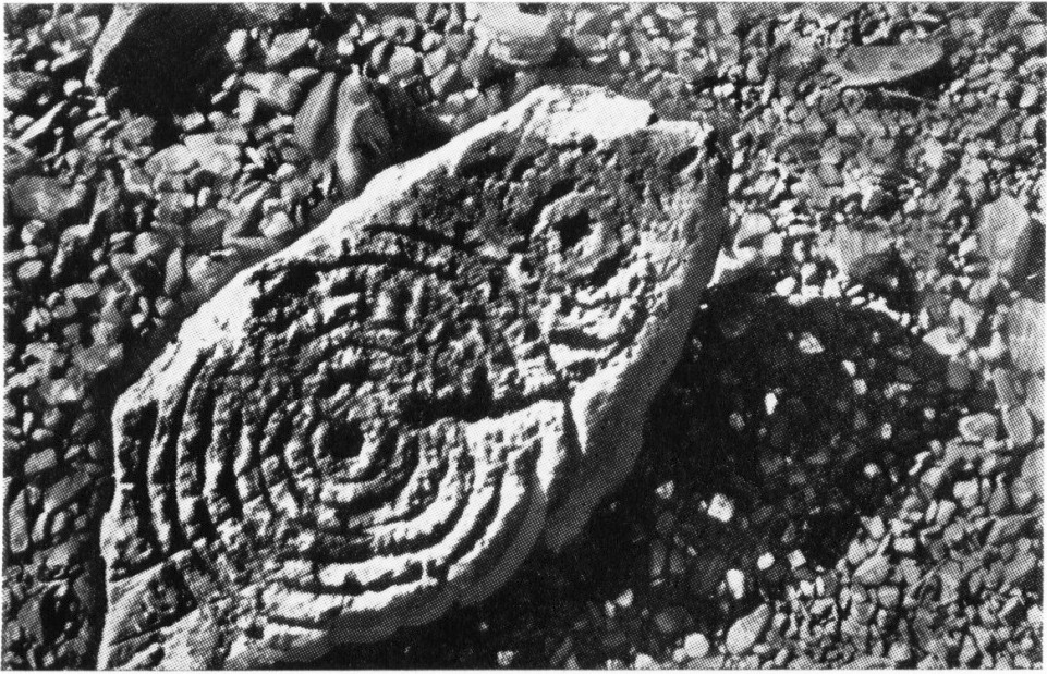
Carn ban, or the White Cairn, from which the hamlet of Cairnbaan gets its name, is a good-sized round cairn, now much overgrown in vegetation, though is still accessible and easy to see. Just above the water-line of the Crinan Canal, the mound is about ten yards across and more than six feet high and is in a good state of preservation. Originally, according to J.H. Craw (1930), the tomb was 12 feet high and 40 feet across!
Carn Ban on 1873 map
Carn Ban, looking NE
In the 1850s, the site was examined by a Dr Hunter of Lochgilphead, and Mr Richardson Smith of Achnaba, and a cist that had been built straight on top of the bare rock was uncovered near the centre of the cairn, nearly four feet long and aligned northeast to southwest. Inside it a thin slab of stone—“2 feet long, 17 inches broad, and 2½ inches thick”—had been slid up against the western end of the chamber and on it was a curious petroglyph design comprising “several incised diamond-shaped figures, one within the other”—five altogether, and the commencement of a sixth—similar to ones found at Newgrange in Ireland. This carving was removed and given to the Scottish National Museum where it still resides. Inside the cist, Hunter and Smith found a deposit of some “yellow sand with some black charcoal and several burnt bones lying upon its bottom”, and a subsequent search unearthed some flint fragments.
The Carn Ban is a good site—but if you’re wanting something bigger, something more impressive, I suggest heading just a few miles north…
References:
Beckensall, Stan, The Prehistoric Rock Art of Kilmartin, Kilmartin Trust: Kilmartin 2005.
Simpson, James, Archaic Sculpturings of Cups, Circles, etc., Upon Stones and Rocks in Scotland, England and other Countries, Edmonston & Douglas: Edinburgh 1867.
Acknowledgements:Huge thanks for use of the Ordnance Survey map in this site profile, reproduced with the kind permission of the National Library of Scotland.
Cup-and-Ring Stone (removed): OS Grid Reference – NX 546 530
Archaeology & History
A.E. Truckell’s 1961 photo (TGDNHAS, 1961)
A small multiple-ringed archetypal design consisting of a central cup-mark with seven consecutive rings emerging from it, with a second outlying, incomplete cup-and-double-ring that nearly touches the outer edge of the seven-rings, was found by a Mr Sproat “in the bed of a shallow stream on Laggan farm” in 1960. The design, as the old photo (right) shows, is very well preserved, suggesting that it cannot have been in the stream for too long, as the erosion on the carving isn’t in anyway excessive. In all likelihood it originally came from a nearby prehistoric tomb: of which, there are several upstream from the farm.
Described by A.E. Truckell (1961) as “a particularly fine example”, the carving is on a particularly small and thin piece of stone, measuring 18 inch by 8 inch amd just 2 inches thick, with one edge of it snapped-off. It’s obviously no longer in situ and, I presume, is still resting somewhere in the Kirkcudbright museum.
References:
Morris, Ronald W.B., The Prehistoric Rock Art of Galloway and the Isle of Man, Blandford: Poole 1979.
Morris, Ronald W.B., “The Cup-and-Ring Marks and Similar Sculptures of South-West Scotland,” in Transactions of the Ancient Monuments Society, volume 14, 1967.
From Bainbridge, take the A684 road east to Aysgarth. Just out of the town, 200 yards over the bridge, take the right turn down Blean Lane. Nearly ½-mile along, take the minor road on your left and go along here for 1½ miles where, a few hundred yards before the solitary farm of Carpley Green (lucky buggers!), you can park up. (keep plenty of room for a tractor to get in the fields) Walk down the track past the farm and 250 yards along, where the first field ends, a gate leads you into the hills on your left. Go through here and then the next gate 120 yards on, then walk straight along th elong geological ridge ahead of you, veering to the top-side until it meets the walling. You’ll see the giant Stoney Raise cairn on the other side.
Archaeology & History
Stony Raise from above
The remains we find here are nigh-on immense! If giant cairns get you going (like the Great Skirtful of Stones or the denuded Devil’s Apronful near Pendle, etc), this one will blow you away! Along its widest axis, to this day it’s nearly 40 yards across and nearly 7 feet high! But in earlier times it was even bigger—much bigger! The first known description of the site was made by one Charles Fothergill, a Yorkshire-born politician and ornithologist, who wrote a diary of his walking excursions to various places in North Yorkshire at the beginning of the 19th century. (Romney 1984) His account of it was a good one for that period and thankfully he recorded information that would otherwise have been forgotten. After his visit here in September 1805, he told about this,
“wonderful tumulus called Stone raise which is a great curiosity: it is formed entirely of large stones piled up without earth or gravel, differing in that respect from any I have seen. Notwithstanding that upwards of a thousand, nay ’tis said several thousand, loads of stones have been led away from it to build walls with, it yet remains a stupendous monument of this species of antiquity: we measured the base of it as well as we could by our strides and made it 369 feet in circumference and of such an height as to be seen for a considerable distance. It has been most completely rifled…and it now presents a number of small craters formed by the investigations of the money searchers. It is situated upon a hill about half a mile south of Addlebrough. In addition to the particulars I formerly mentioned, I may say the men who first opened it about 50 years ago worked incessantly for 33 days. It stands on Thornton moor, and tho’ the Thornton men would not assist in the labour, they intended to share in the profit if there was any; but the adventurers who had all the work resolved they should not and they carried a large sword with them every day to defend the treasure in case they found any; the wise man who read ’till the stones shook and rattled was a schoolmaster at Bainbridge: the teeth they found were deposited in a hollow place in the bottom of the tumuli formed long and narrow like a coffin by a walling of stones. Tho’ the tumulus has apparantly been compleatly rifled, I do not believe the whole base has been sufficiently searched, but if it was to commemorate one great individual, which appears to have been the case, perhaps nothing more may be found.”
Fothergill’s description of “upwards of a thousand” cartloads of stone being removed from Stony Raise has been doubted by some archaeologists, but this claim should not be dismissed so lightly without evidence. There are immense tombs from northern Scotland to the unholy South that have remained untouched by the hand of industrialists that easily enter the category of such giants and this may have had equal stature.
A few years after Fothergill’s visit, Thomas Whitaker (1823) briefly described the site in his magnum opus, but added very little, simply telling that on the hills behind Addlebrough,
“there is still on that elevated spot a cairn, called Stone Raise, about 120 yards in circumference at the base, to which the usual tradition of its containing a treasure of gold having been attached, two persons were several years ago induced to make the experiment; but having penetrated to the centre, found, to their great disappointment, what an antiquary would have prepared them to expect, namely, a kist vaen of flag stones, with the remains of a human skeleton, the teeth of which were still pretty perfect.”
To this day the site remains unexcavated, so we don’t know too much about the place. It’s likely to have been constructed in neolithic times and its ancestral nature quite obviously venerated. It may have been re-used during the Bronze Age, but without excavations we may never know. A decent dig into this site is long overdue!
Folklore
This gigantic tomb is, not surprisingly, said to be haunted. Strange sounds and visions have been encountered here in bygone times. But the most well-known tale is that it was the site of a great treasure—perhaps hinted at by Fothergill. There are variations on the theme, but this is overall story:
Structured stonework
The tomb was said to be where a local giant had fallen and with him was buried a great chest of gold which he had dropped before he died. Some say that the ‘giant’ was a Brigantian chief – others a great warrior. The great treasure chest beneath the cairn is said to looked over by a fairy who lived by the giant’s tomb. It was this tale which gave the site its local name, the ‘Golden Chest on Greenber’. Several attempts made to find the treasure have all failed to uncover it.
However, by the time Edmund Bogg came to write of the place in 1908, the giant had by all accounts been found within! He told that,
The giant’s cist cover?
“this Kist-vaen was opened, many years back, and the skeleton of a chieftain of great stature was unearthed; the treasure chest of that or some other primal savage was not, and has not yet been discovered – for, take heed ye matter-of-fact money hunters, it is said the lucky one must first see the wraith of the ancient warrior to whom it belonged, who will then shew under which part of the immense Raise it is hidden! May this help any reader who is imaginative enough to find it – having seen the wraith he must keep silence – he has then but to stretch out his hand, and draw it forth.”
There are variations on this tale that have subsequently been penned by a number of Yorkshire folklorists, but this is the general lore. There was also a short rhyme told of toney Raise, that speaks of its apparent use through history by various races:
Druid, Roman, Scandinavia,
Stone Raise in Addlebro’.
References:
Bogg, Edmund, Wensleydale and the Lower Vale of the Yore, E. Bogg: Leeds 1906.
Bogg, Edmund, Richmondshire, James Miles: Leeds 1908.
Elgee, F. & H.W., The Archaeology of Yorkshire, Methuen: London 1933.
Gutch, Mrs E., Examples of Printed Folklore Concerning the North Riding of Yorkshire, David Nutt: London 1899.
Lofthouse, Jessica, Countrygoer in the Dales, Hale: London 1964.
Parkinson, Thomas, Yorkshire Legends and Traditions – volume 2, Elliot Stock: London 1889.
Pontefract, Ella, Wensleysdale, J.M. Dent: London 1936.
Romney, Paul (ed.), The Diary of Charles Fothergill, 1805, Yorkshire Archaeological Society: Leeds 1984.
Whitaker, Thomas Dunham, An History of Richmondshire – volume 1, Longman Hurst: London 1823.
White, Robert, A Landscape through Time, Great Northern: Ilkley 2002.
Along the A822 road from the Gilmerton junction on the outskirts of Crieff, heading up towards the Sma’ Glen, after literally 1¾ miles (2.8km) on the right-side of the road you need to follow the route to reach the Connachan rock art cluster by walking up the dirt-track leading up past Connachan Farm. Walk past the carving of Connachan (2) and up the track past Connachan (4), then onto the level ground and walk right to the low-lying ruined Connachan cairn. From here, look up the gentle slope to the fence. A small-ish stone protrudes out 40 yards away. Head straight for it!
Archaeology & History
Close-up of line of cups
You’ll check this out when you’re doing your tour of this petroglyph cluster and sit here to admire the view. It’s the last of the small bunch of carvings, on level ground, close to the denuded cairns. It consists of just eight cup-marks, all of which are carved close to the edge of the stone on its upper sloping surface; although this doesn’t tally with Margaret Stewart’s (1967) description of any of the carvings hereby. There’s nowt much more to be said about it to be honest; apart from saying how it’s highly likely that other carvings remain hidden, undiscovered, not far from this stone along the edge of these hills.
References:
Stewart, Margaret E.C., “Connachan, Crieff – Cup Marks and Hut Circle,” in Discovery & Excavation, Scotland, 1967.