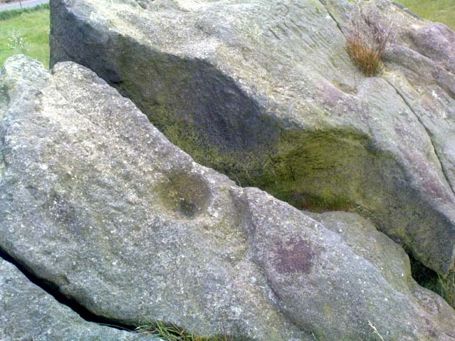
Na Clachan Bhreige, Kirkibost, Strathaird, Skye

Stone Circle:  OS Grid Reference –  NG 5432 1768

Also known as:

  1. The False Stones
  2. Na Clachan Breitheach
  3. Strathaird Circle

Getting Here

Way off from seemingly anywhere this one – on the southern foothills of the great Cuillins, by the western edge of a seemingly unnamed loch. (most unusual) Take the Elgol road (A881) south from Broadford, nearly to its end, keeping an eye out for Kirkibost a few miles from the very end of the road. Just past here, stop and walk the track west to Camasunary a half-mile along, through the small forestry-bit, then follow the line of the trees north and keep going a bit more till y’ reach the nice stream that feeds that unnamed loch. Cross the stream!

Archaeology & History
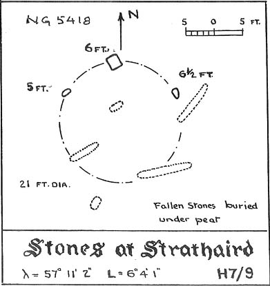
Alexander Thom's 1967 drawing
Alexander Thom’s 1967 drawing

A fascinating little site this one! Perhaps consisting of as many as eight stones at one time, only three stand visible today.  Alexander Thom (1967) reported finding other stones in this circle “being buried in the peat, but prodding revealed their position roughly” — as shown on his drawing here.  There may at one time have been as many as eight stones here, but the site itself is quite small, making a ring of stones only 21-feet across (or 8 megalithic yards as Thom had it).  The ruinous state of the site was put down to the stupidity of the Church of Scotland issuing “instructions that all stones in Skye were to be thrown down” a few centuries back.
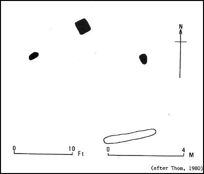
Aubrey Burl's later 'four-poster' summary
Aubrey Burl’s later ‘four-poster’ summary

Aubrey Burl reported that “there were once at least 4 stones here, the tallest being of 6ft 6ins (2m) high,” and wondered whether this was one of the many ‘four-poster’ stone circles that scatter Scotland and elsewhere.  An issue he seemed comfortable to proclaim a few years later in his survey of such sites. (Burl 1988) Of those stones still standing, the tallest is just 5 feet high; but there’s the impressive 11½-foot long monolith laying on the southeast edge of the ring!  Mr Burl also pointed out that some

“casual digging  inside the ring around 1860 uncovered a blackpolished stone about 1½ ins (4cm) long, ‘somewhat resembling a small pestle.'”

I found the proximity of the Cille Mhaire burial ground a mile west of here more than a bit intriguing (though didn’t have time to assess its geomantic relationship further).  And the reported presence of prehistoric cairns nearby imply that the Na Clachan Bhreige ‘circle’ had some relationship with death and burial.

Folklore

The folkname of ‘The False Stones’ comes from that well-known tale of the site “supposedly being the remains of three men turned into stone for deserting their wives.”  Something which Otta Swire (1964) thought was likely told by christian converts.  It would have probably replaced an earlier tale of the stones being the site where some ancestral spirits lived.  Swire also told that,

“these were once, if tradition is to be believed, Stones of Wisdom who could both foretell the future and show justice as between man and man.”

Burl (1988) also points out how,

“The name, Na Clachan Bhreige, has been variously pointed translated as ‘the judicial stones’, a place where medieval law courts were held, as in several other Scottish rings.  It has also been interpreted as ‘the stone of lies, or falsehood.'”

References:

  1. Burl, Aubrey, Four Posters: Bronze Age Stone Circles of Western Europe, BAR: Oxford 1988.
  2. Grinsell, L.V., Folklore of Prehistoric Sites in Britain, Hale: Newton Abbot 1976.
  3. Swire, Otta F., Skye: The Island and its Legends, Blackie & Sons: Glasgow 1961.
  4. Thom, Alexander, Megalithic Sites in Britain, Oxford University Press 1967.
  5. Thom, A., Thom, A.S. & Burl, Aubrey, Megalithic Rings, BAR: Oxford 1980.

© Paul Bennett, The Northern Antiquarian
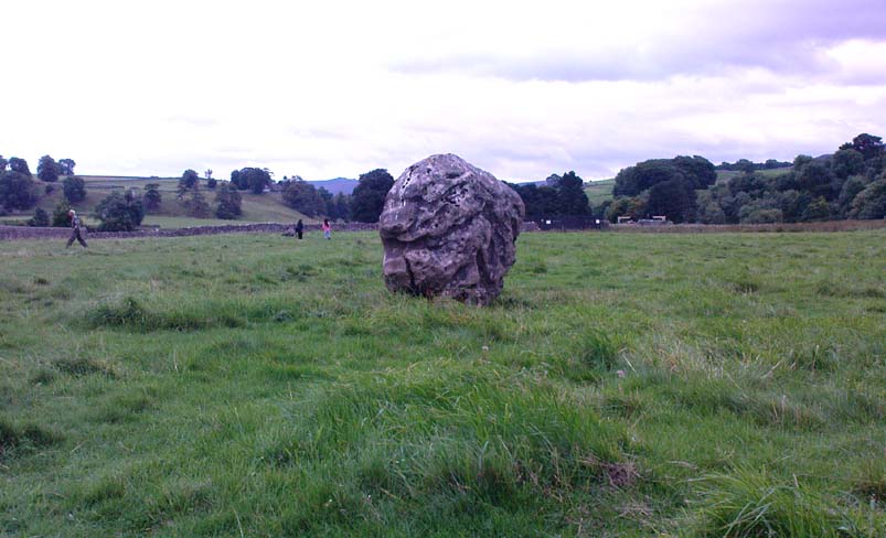
Linton Church, Grassington, North Yorkshire

‘Standing Stone’:  OS Grid Reference – SE 00426 63176

Getting Here

Pretty easy really. Get to the ancient St. Michael’s Church on the dead-end road just outside of Linton village.  As you approach it, look into the field on your right.  Y’ can’t miss it!

Archaeology & History

Linton 'Standing Stone'
Linton ‘Standing Stone’

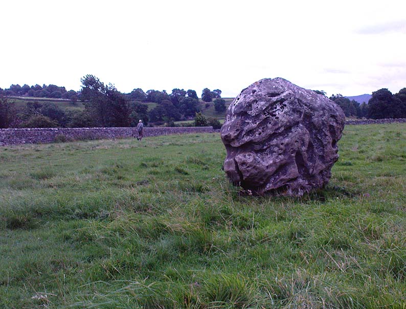
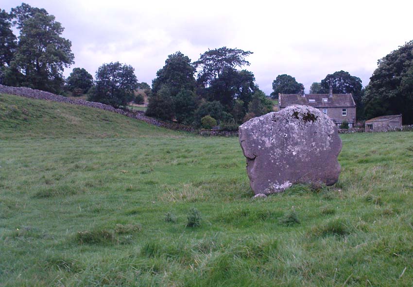
This is an oddity.  It could perhaps be little more than one of the Norber erratics found a few miles further north — but it looks more like a smaller version of one of the Avebury sarsens!  Just under six-feet tall, it was shown to me by Adrian Lord yesterday (when the heavens subsequently opened and an outstanding downpour-and-half followed), who’d come across it only a week or two earlier themselves when they visited the ancient church next door.  The stone certainly aint in any archaeology registers (no surprise there); and as one local man we spoke to yesterday told us, “there used to be several other standing stones in the same field, cos I remember ’em when I was a kid. ” The gent we spoke to seemed to know just about everything about the local archaeology and history of the area (one of those “damn good locals” you’re sometimes lucky to find!).  He told us that the other stones which used to be there had been moved by the local farmer over the years, for use in his walls.  So it seems that this is the last one standing.  What looks like several other fallen stones can be seen further down the field, just next to the church.  But this one’s pretty impressive.

Close-up of gnarled rock
Looking south-ish!
Looking south-ish!

The church of St. Michael next door was, tells the information inside, built upon some old pagan site — which gives added thought to this upright stone perhaps being the ruin of an old circle, or summat along those lines.  The church, incidentally, is built right next to the River Wharfe.

Not far from here we find an almost inexhaustible supply of prehistoric remains at Grassington and district (less than a mile north).  A huge excess of Bronze- and Iron Age remains scatter the fields all round the town.  And aswell as the Yarnbury henge close by, there is — our local man told us,  “another one which no-one knows abaat, not far away”!

Folklore

The folklore of this area is prodigious!  There is faerie-lore, underworld tales, healing wells, black-dogs, ghosts, earthlights – tons of the damn stuff.  But with such a mass of prehistoric remains, that aint too surprising.  And although there appears no direct reference to this particular stone (cos I can’t find a damn reference about it), the old Yorkshire history magus, Harry Speight (1900), wrote of something a short distance away along the lane from the church.  He told that,

“In the field-wall beside the road may be seen some huge glacial boulders, and there is one very large one standing alone in the adjoining field, which from one point of view bears a striking resemblance to a human visage; and a notion prevails among the young folk of the neighbourhood that this stone will fall on its face when it hears the cock crow.”

Just the sort of lore we find attached to some other standing stones in certain parts of the country.  And in fact, from some angles, this ‘ere stone has the simulacrum of a face upon it; so this could be the one Speight mentions (though his directions would be, unusually, a little out).

There are heathen oddities about the church aswell: distinctly pre-christian ones.  An old “posset-pot” was used for local families to drink from after the celebration of a birth, wedding or funeral here.  And at Hallowtide – the old heathen New Year’s Day,

“certain herbs possessed the power of enabling those who were inclined to see their future husbands or wives, or even recognizing who was to die in the near future.”

And in an invocation of the great heathen god (the Church called it the devil), Speight also went on to tell that:

“The practice at Linton was to walk seven times round the church when the doomed one would appear.”

In a watered down version of this, local people found guilty of minor transgressions in and around Linton (thieves, fighters, piss-heads, etc),

“was compelled to seek expiation by walking three time around Linton Church.”

Linton stone05This would allegedly cure them of their ‘sins’!  Rush-bearing ceremonies were also enacted here.  On the hill above, the faerie-folk lived.  And until recently, time itself was still being measured by the three stages of the day: sunrise, midday and sunset; avoiding the modern contrivances of the clock, and maintaining the old pre-christian tradition of time-keeping.  Much more remains hidden…

References:

  1. Speight, Harry, Upper Wharfedale, Elliott Stock: London 1900.

© Paul Bennett, The Northern Antiquarian

Slaithwaite Cross, West Yorkshire

Cross:  OS Grid Reference – SE 077 139?

Archaeology & History

The great Huddersfield historian, Philip Ahier (1948), in describing the lack of documentary evidence for several crosses in the neighbouring region, “at Deighton, Cowcliffe, Marsh and Golcar,” found out that,

“One did exist at Slaithwaite in front of the Manor House in the early past of the last century.  In March 1931, the base of this cross, commonly known as the Dial Stone, was removed to Doughlas in the Isle of Man, where it rested in the garden of Mr Harry Wood; in August 1939, it was brought back to Slaithwaite and now stands in the Recreation Park.”

However, this site differs from another two that I’ve found records for on the outskirts of this township.  Does anyone know what became of this old stone cross?  Izzit still about?  Its folk-name of the Dial Stone may make it a little easier to locate — but at the same time it does bring up the query, Why was it called that?

References:

  1. Ahier, Philip, The Story of the Three Parish Churches of St. Peter the Apostle, Huddersfield – volume 1, Advertiser Press: Huddersfield 1948.

© Paul Bennett, The Northern Antiquarian 


Druid’s Oak, Caton, Lancashire

Legendary Tree:  OS Grid Reference — SD 5297 6467

Also Known as:

  1. Caton Oak
  2. Fish Stones Oak

Getting Here

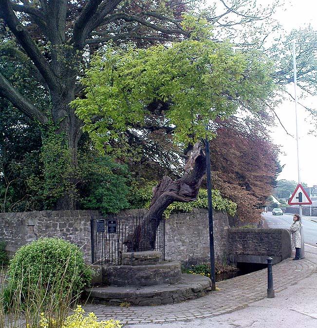
The Druid's or Caton Oak
The Druid’s or Caton Oak

Dead easy! Near the western end of Caton village, right on the edge of the main road (A683) running through the village (south-side of the road), enclosed by railings, you’ll see the remains of this ancient tree, just by the side of the stream.  Keep your eyes peeled!

Archaeology & History

The small scruffy-looking remnant of an oak standing here by the roadside in Caton village, surrounded by protective railings, is the dying remnants of the old tree, standing upon the sandstone steps which were known as the Fish Stones: a curious monument that has been listed as a protected monument by the Dept of National Heritage.  A small plaque on the side tells:

“The three semi-circular sandstone steps, shaded by the oak tree, were used in medieval times by the monks of Cockersand Abbey to display and sell fish caught from the River Lune.  The ancient oak tree, reputed to date back to the time of the druids, and the Fish Stones, have become a landmark and Symbol of Caton.”

Druid's Oak, Caton
Druid’s Oak, Caton

This was probably the local moot spot for villagers and those living in outlying farms and hills in medieval times.  No doubt a market of some sort was also once here; perhaps even an old cross, as the Fish Stones have all the appearance of some village cross steps.  I’ve found little else about this old tree, nor any folklore (but aint looked too hard if truth be had!).  There’s surely more to be said about this once sacred tree.

More sites related in folklore to druids can be found not too far away at the collapsed cairn near Bordley; the Druid’s Altar and nearby Druid’s Well on the outskirts of Bingley; the Druid’s Stone of Bungay in Suffolk and many more…

© Paul Bennett, The Northern Antiquarian 

Skyreholme Wall Stone, Appletreewick, North Yorkshire

Cup-and-Ring Stone:  OS Grid Reference – SE 0772 6231

Also Known as:

  1. Carving no.413 (Boughey & Vickerman)

Getting Here

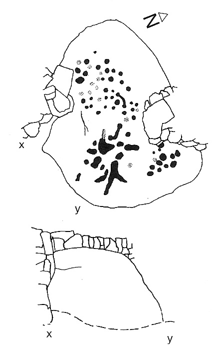
Skyreholme Wall Carving
Skyreholme Wall Carving (after Boughey & Vickerman)

Various ways here, but for the sake of newcomers I’d say it was best following directions from Burnsall.  From here, take the Appletreewick road thru the village, past the left turn a few hundred yards along, and another 500 yards or so there’s a split in the road: take the one on your right!  Follow this up, keeping right (don’t turn into Perceval Hall, tempting though it may be!) and park-up where the road turns into a track.  Walk up the track, past the haunted junction, bearing left uphill up Black Hill Road until you reach the very peak of the track where, in the walling on your left, you’ll see this big boulder.  If you can’t see it, you’re bloody close!

Archaeology & History

This is at the very peak of Black Hill Road, with excellent views of Simon’s Seat climbing to the immediate south, the prominent and rounded Nursery Knot Hill immediately north, and grand views to peaks east and west. It is very likely this position had something to do with it being deemed worthy of relevance.  The rock itself defines a point along the old boundary line.

Skyreholme Wall Boundary carving

One peculiarity on this boulder is the deep cup-mark with a strange ‘lip’ to it, which has been mentioned by others in the past.  This is surrounded by at least five others cups — not dissimilar to some of the ‘rosary-designs’ of cup-and-rings further north.

The rock art student’s Boughey & Vickerman’s (2003) drawing of this design is pretty accurate — where they call it stone 413 — though it doesn’t actually give this carving the justice it deserves.  They also erroneously tell that some of the cups here are doubtful.

Check it out for y’self.  This is an excellent stone for cup-and-ring lovers! (with plenty of other sites scattered about all round here)

References:

  1. Boughey, Keith & Vickerman, E.A., Prehistoric Rock Art of the West Riding, WYAS 2003.

© Paul Bennett, The Northern Antiquarian


Dane’s Stone, Moulin, Pitlochry, Perthshire

Standing Stone:  OS Grid Reference – NN 9425 5942

Also Known as:

  1. Pitfourie Stone

Getting Here

Dane's Stone under a brilliant sky
Dane’s Stone under a brilliant sky

Going thru Pitlochry town, turn up the A924 road for about a mile till you hit the Moulin Inn on your left-hand side.  Just past here, take the road left and continue for 2-300 yards until the stone in the field stands out on your right-hands side.  Y’ can’t really miss it!

Archaeology & History

I should mebbe have this site entered as a ‘stone circle’ and not just an old monolith, as numerous other standing stones were in close attendant not too long ago and it was said to have been a circle.   Certainly when the great Fred Coles (1908) talked about this place, he

“was informed by the tenant, Mr Reid…that many years ago, in his grandfather’s time, “there were several more stones standing”, all smaller than this monolith and that, upon the orders given by Mrs Grant Ferguson of Baledmund, some of these were saved from total demolition, and are supposed to be lying half-buried in the field to this day.”

...and here's the big man close-up
…and here’s the big man close-up

Though I imagine these remnants have now been removed.  Aerial images, when conditions are just right, might prove fruitful here.

But the solitary stone still standing here is quite a big fella.  Heavily encrusted with quartz and more than 7 feet tall, it’s a nice fat chunky thing, with its lower half being somewhat slimmer than the top.  Well worth having a look at!

Folklore

Once an old moot site, folklore also tells that an old market was once held here (there was some other folklore I had of this place, but can’t for the life of me find it at the moment!).

References:

  1. Coles, Fred R., ‘Report on Stone Circles Surveyed in Perthshire,’ in PSAS 42, 1908.
  2. Liddell, Colin, Pitlochry: Heritage of a Highland District, PKPL: Perth 1993.
  3. Reid, A., ‘Monumental Remains in Pitlochry District,’ in PSAS 46, 1912.

Links:

  1. Stravaiging Round Scotland

© Paul Bennett, The Northern Antiquarian

Pots and Pans Stone, Greenfield, Lancashire

Legendary Rocks:  OS Grid Reference – SE 01008 05072

Also Known as:

  1. Druid Stone

Getting Here

Pots & Pans on 1854 OS-map

Dead easy! From the townships of Grasscroft, Uppermill, or Greenfield, take the legendary moorland road up to Saddleworth tops (A635), keeping your eye on the modern obelisk on the hilltop to your left and you’ll see a large rock outcrop almost next to it.  That’s where you’re heading.  Once you reach near the moorland level, walk in whatever way you see fit towards the obelisk and large stones.  Enjoy…!  I s’ppose though, it’d be better for you if you started from the valley bottom at Uppermill and walked up the hill.

Folklore

Seemingly a ritual place of the sun, this fine site was known by the local folk-name of the Druid Stones, according to Jessica Lofthouse. (1976)  But more importantly in legend, this great rocky outcrop was the abode of an old giant called Alphin, who had a rival called Alder who also wandered the moors here.  Both these giants vied for the hand of a lady called Rimmon, who preferred Alphin to Alder. In good old fashioned ways they contested for her hand, throwing giant rocks across the moors at each other, but “Alphin was hit and killed, with Rimmon looking on.”  His grave lies on these moors somewhere, seemingly unfound.   …And intriguingly it seems that we’ve actually located a prehistoric tomb which may account for the legend of Alphin’s death! (Watch this space!)

A slight variation on the tale describes the Lady Rimmon to be of fairy stock, named ‘Raura Peena’ (a phonetic spelling of a local dialect name), who in one account from the Notes & Queries journal, 1850, tried luring a local man into her magickal recess of the Fairy Holes, on the slopes beneath the Pots and Pans Stone.

Local tradition also tells that the naturally-worn ‘bowls’ atop of the rocks held magical properties — water being collected from them was said to be good to cure eye problems.  This is a curative theme we find at some bullauns, cup-marked stones and old cross-bases and would strongly indicates that pre-christian practices did once take place here.

References:

  1. Lofthouse, Jessica, North Country Folklore, Robert Hale: London 1976.

© Paul Bennett, The Northern Antiquarian

Fairy Knowe, Crarae, Minard, Argyll

Cairn:  OS Grid Reference – NR 9874 9736

Also Known as:

  1. Canmore ID 40010

Archaeology & History

Fairy Knowe (Campbell 1923)

Just over 100 yards northeast of the chambered cairn in Crarae Garden we can see the denuded remains of this old mound, long ago held as the dwelling place of the little people. When it was first described in 1865, a standing stone was reported as surmounting the tomb, but this can no longer be seen.  Further excavations made by Sir George Campbell in 1923 and reported in the Oban Times, showed the cairn to have been 108 feet across and nearly 6 feet tall at the centre — beneath which a “stone coffin” was found.  It was said that two passages ran from this middle chamber: one to the southwest and the other roughly southeast.  Deposits of shells, antlers, and the bones of cattle, deer, horses and sheep were also found here.

References:

  1. Royal Commission on the Ancient & Historical Monuments, Scotland, Argyll – volume 6: Mid-Argyll and Cowal, HMSO: Edinburgh 1988:61.
  2. Scott, J.G., “Excavation of the Chambered Cairn at Crarae, Loch Fyneside,” in Proceedings of the Society of Antiquaries, Scotland, volume 94, 1961.

Links:

  1. The Fairy Knowe, Crarae – on Scotland’s Places

© Paul Bennett, The Northern Antiquarian

Torrisholme Barrow, Morecambe, Lancashire

Tumulus:  OS Grid Reference – SD 4596 6425

Getting Here

Various ways up this old hill, visible from all angles it seems.  I came up via the housing estate near where us friend lives, near Bare Lane Station, through the houses and up the footpath.  But you can just as easy (if not easier) walk up from the country lane and fields beneath its eastern side.  Much nicer!

Archaeology & History

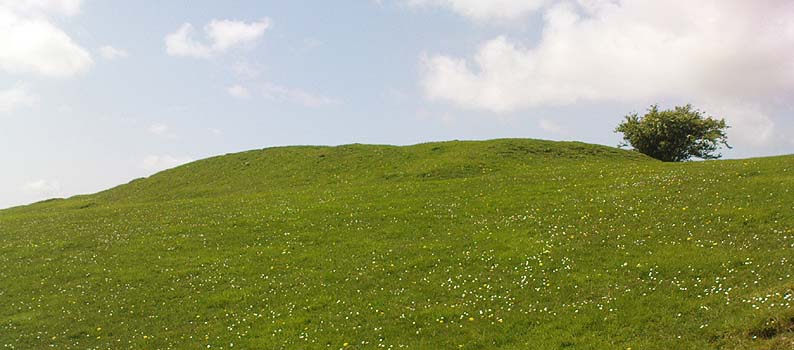
Torrisholme Barrow
Torrisholme Barrow

As many northerners will tell: gerrin information from the Lancashire archaeologists about prehistoric sites is troublesome (must be Southerners running the show!).  There’s tons of stuff in this good county, but archaeo-info is pretty poor on the ground.  This great old tomb for example, is designated as a “round barrow” on the Lancashire County Council monuments and records listing, but there’s no other info telling when it was dug, who by, the size of the tomb, what was found here, etc.  Pretty poor to be honest (c’mon chaps – get yer fingers out!).  The best info on-line comes from the more dedicated amateur enthusiasts.

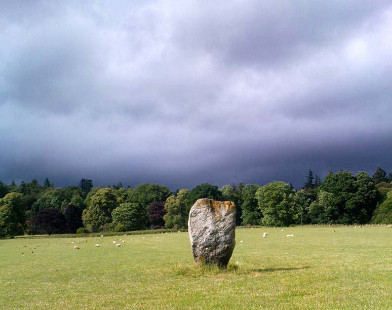
A local historian told us that there was nowt up here, but my nose told me otherwise — so up we tramped!  It was pretty obvious once we’d got to the top here, that some ancient mound had been built up.

“This has all the hallmarks of a tomb,” I said.

Torrisholme Barrow, looking SW

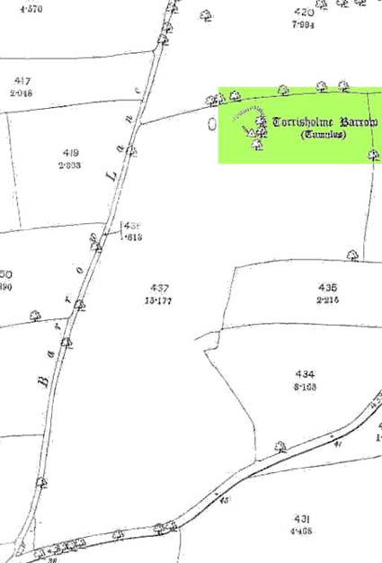
The spirit of the ancestor herein (whoever s/he was) had excellent views and flights to numerous important hills 360° all round here.  A perfect place for a tomb! And when we returned into the Darklands of our Yorkshire abodes, we found this notion to be true.  Marked on early OS-maps as a tumulus, next to the tell-tale giveaway route of Barrow Lane, there are passing mentions of it in a couple of old local history books I’ve come across, but I’ve yet to find much more about it.  It’s a fine mound and of decent size, well worth checking out if you’re in the area.  Once I get more details of the archaeological finds from here, I’ll add the data to TNA (but based on past performances and responses from Lancashire archaeo’s, I wouldn’t hold your breath…)

And for any Morecambe historians who might be able to find more: what — if anything — is known of the ‘Fartle Barrow’, now swallowed by the encroachment of the sea, just a few hundred yards west of here?

Early OS-map showing barrow

Folklore

In days of olde, this site was an old moot or meeting hill: one of the northern Law or council meeting hills.  Quite how far back this gathering tradition up here goes, aint known.  We do know however that there was a christian tradition enacted here, at Easter, of local church doods taking a cross up the top of the hill (does anyone know the story behind the old Cross Hill, half-a-mile south of here?).  There’s obviously quite a lot more pre-christian activities occurrent round here than has been previously thought.

© Paul Bennett, The Northern Antiquarian

Robin Hood’s Stone, Riddlesden, West Yorkshire

Legendary Rock:  OS Grid Reference – SE 06228 44470

Getting Here

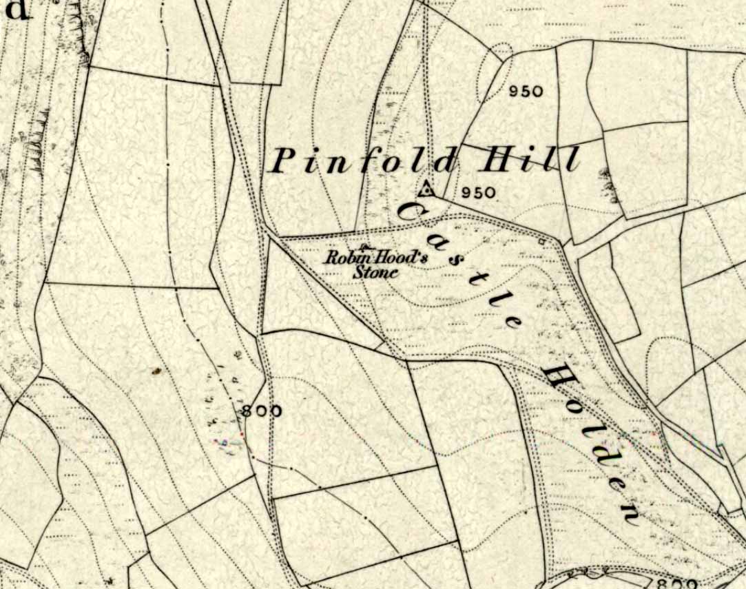
Marked on the 1853 OS-map

Dead easy!  If you come from Silsden, take the Holden Road up onto the moor edge, all the way up the wooded hill.  As you reach the top, keep your eyes peeled for the stone in the slope to your left.  Otherwise, coming from Riddlesden, take the moor road upwards (to Silsden Road) as if you’re gonna visit Peggy Mawson’s Well, the Baldwin Stone or some of the Rivock carvings.  Keep on the road to where you see the microwave tower on Pinfold Hill to your right.  It’s just below it!

Archaeology & History

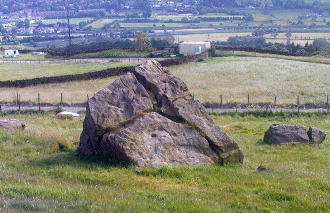
Robin Hood’s Stone from above

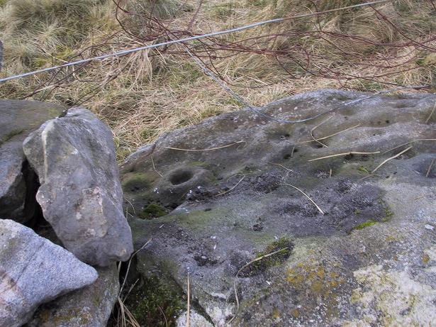
Flints have been found on the slopes above here, but records of this stone only go back — as far as I’ve found — to 1850 (this seems to typify records around the Keighley district, which only seems to record anything post-1500 AD).  In mid-Victorian times, plans were afoot to use the rock for building material, but local people objected and so the stone kept its position overlooking the valley.  There are a number of very defined ‘cups’ on the sloping face of the stone, but several (though not all) of these have all the likeness of the holes dug into the rock by climbers — though why climbers would even think to cut foot-holes into this easy rock beggars belief!

Folklore

One of several sharp well-defined 'cups' on the rock
One of several sharp well-defined ‘cups’ on the rock

Not too surprisingly, folklore tells that this stone was one of the places where our old hero Robin Hood sheltered, when being chased by god-knows-who in one of his many exploits.  We’ve no way of proving this of course, but the sparse woodland remains above here also bear the hero’s name.  What seems to be a more modern piece of industrial folklore alleges that this stone was actually put here by workers in the Victorian times!  The boulder allegedly lived near Barden, Bolton Abbey, but was blocking construction work, so was uprooted and moved all the way to where it now sits!  In bygone times the rock was a local meeting place – perhaps around Beltane, in line with Robin Hood festivities.

References:

  1. Gray, Johnnie, Through Airedale from Goole to Malham, Elliot Stock: London 1891.

© Paul Bennett, The Northern Antiquarian