Tomb: OS Grid Reference – NO 2218 3153
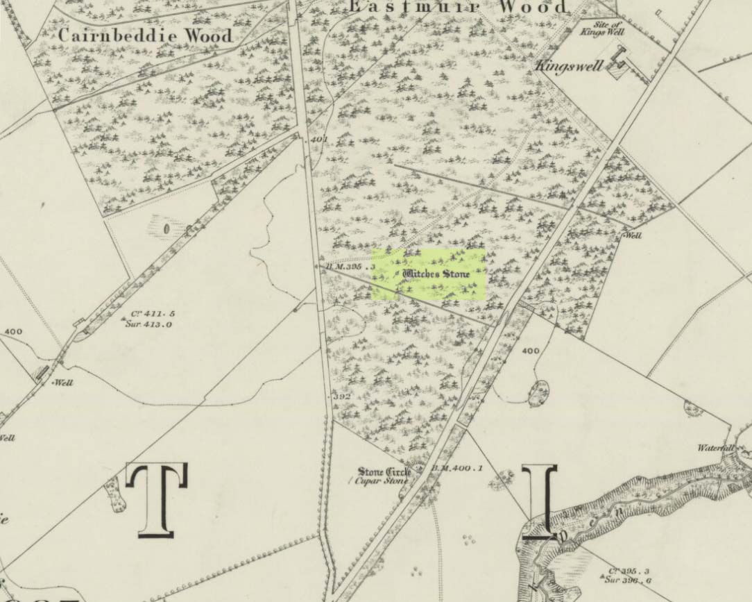
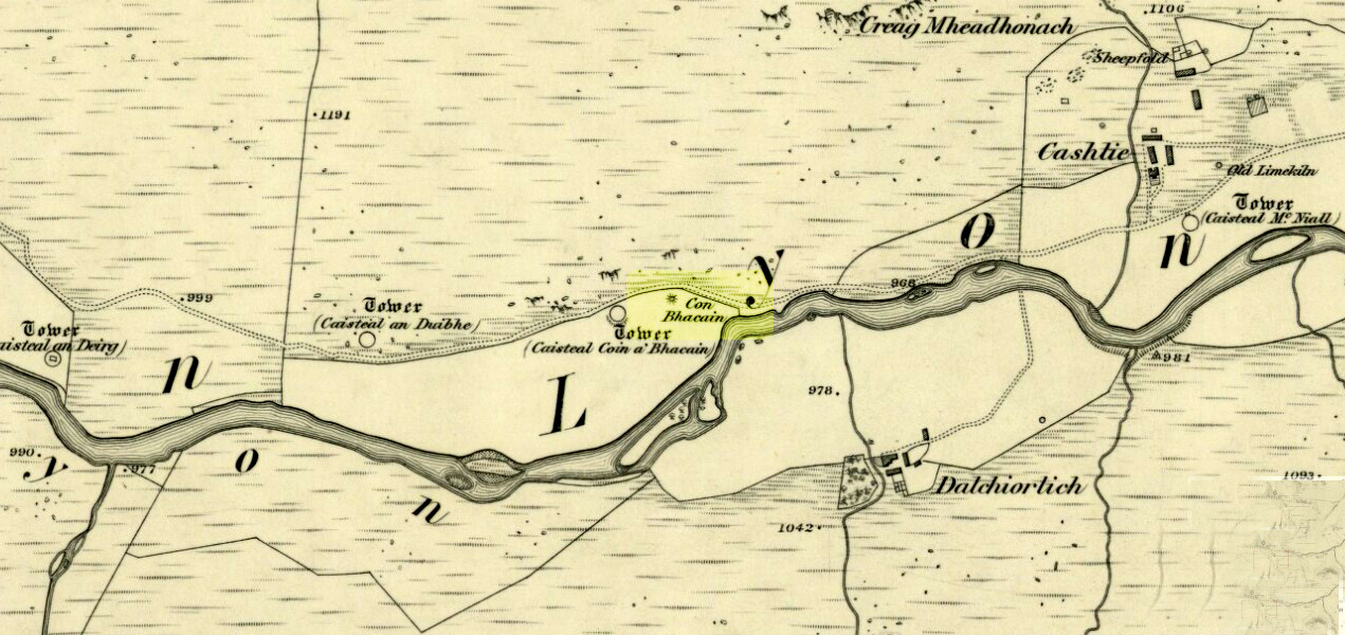
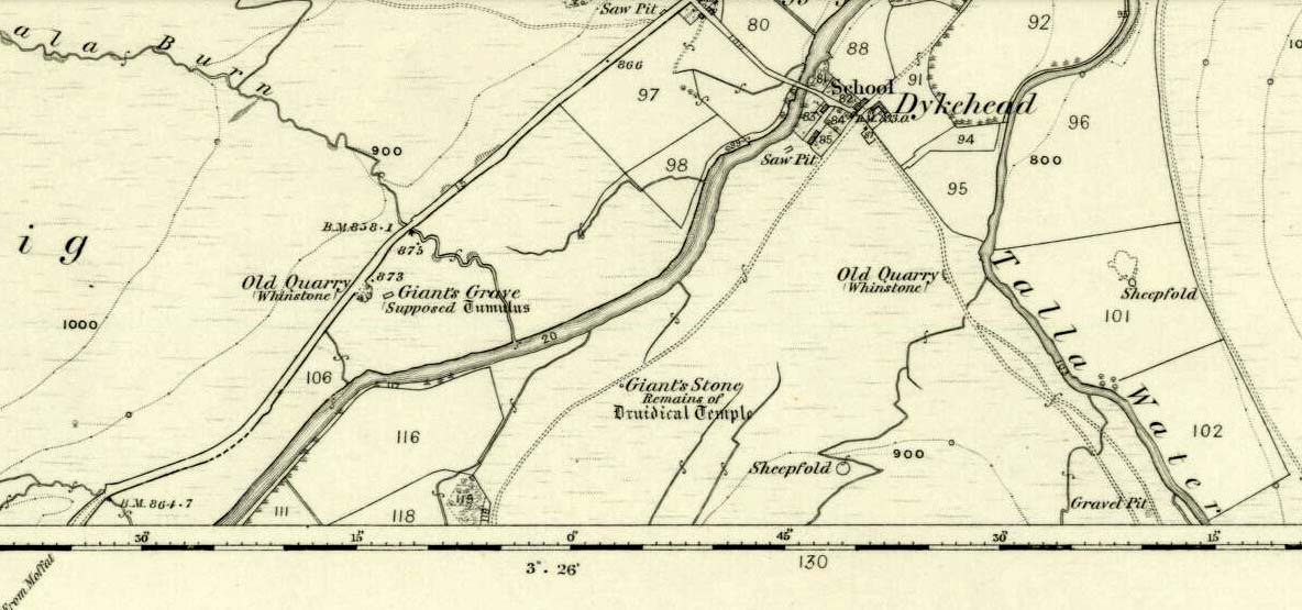
1867 OS-map of the site
Also Known as:
- Canmore ID 30663
- Hoolmyre
- The Lang Man’s Grave
- MacBeth’s Grave
Archaeology & History
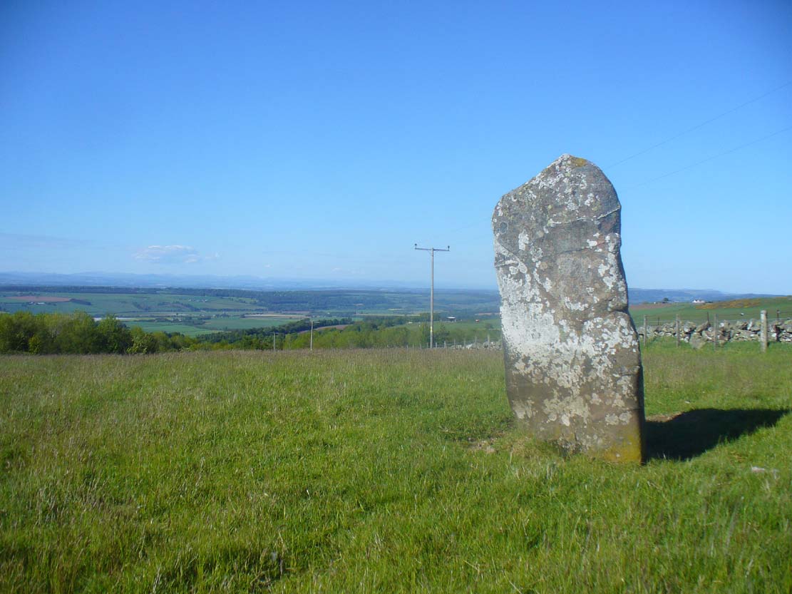
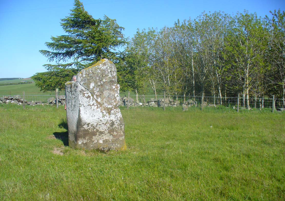
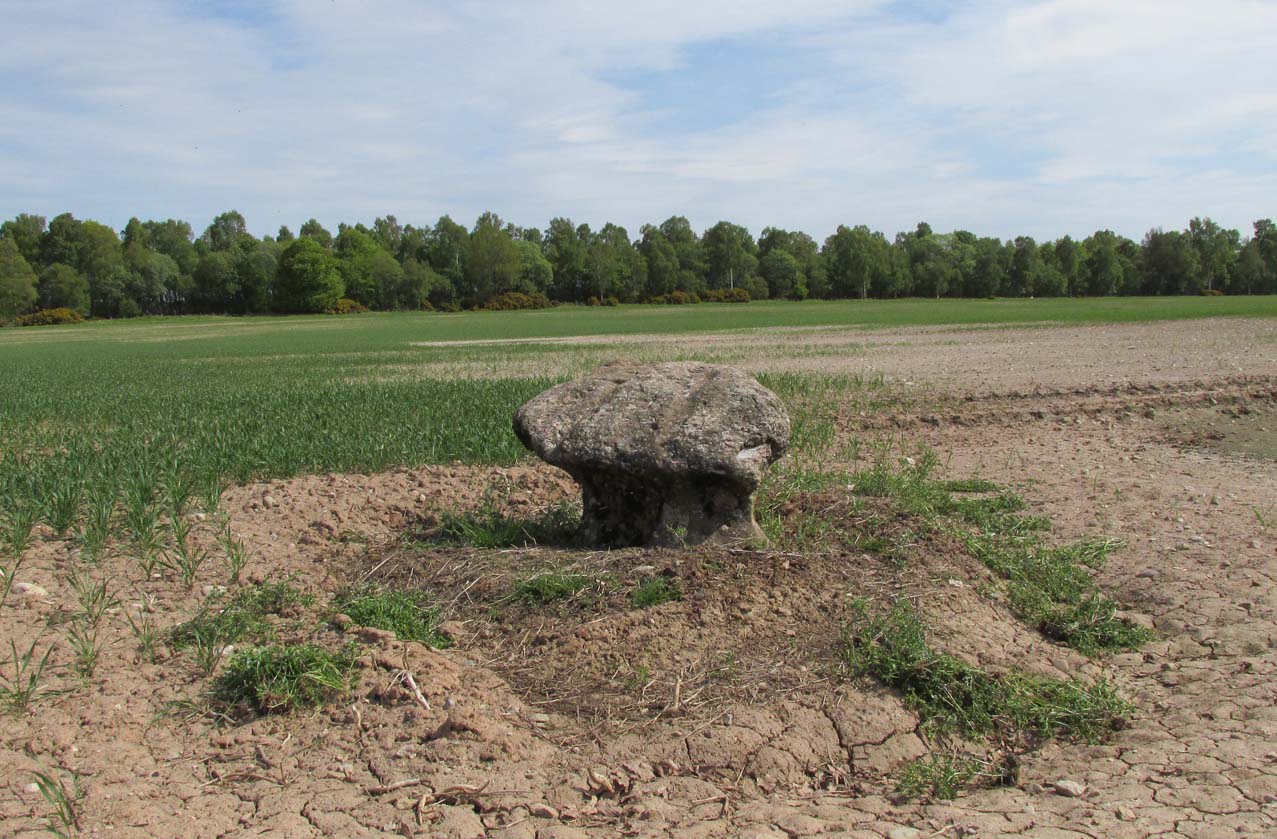
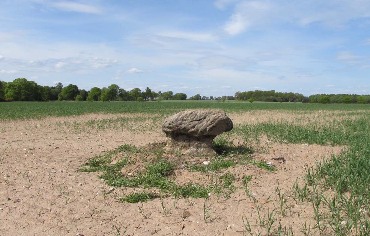
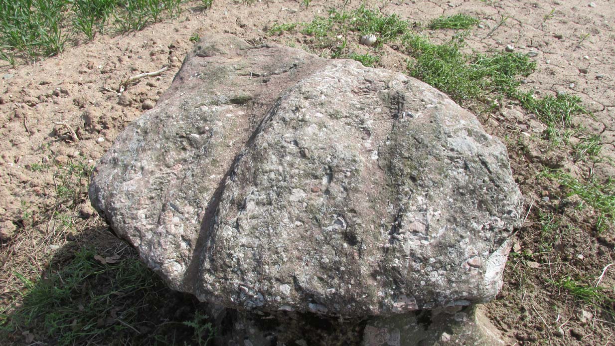
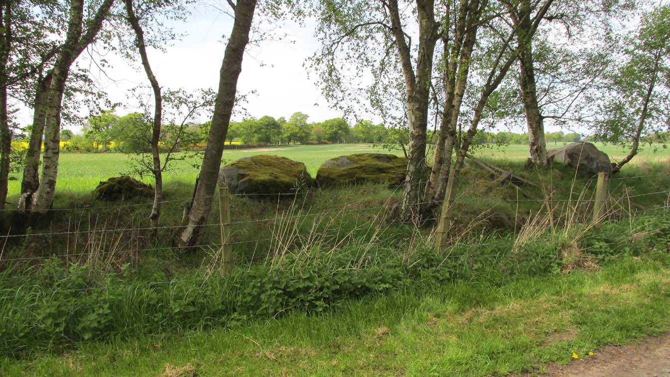
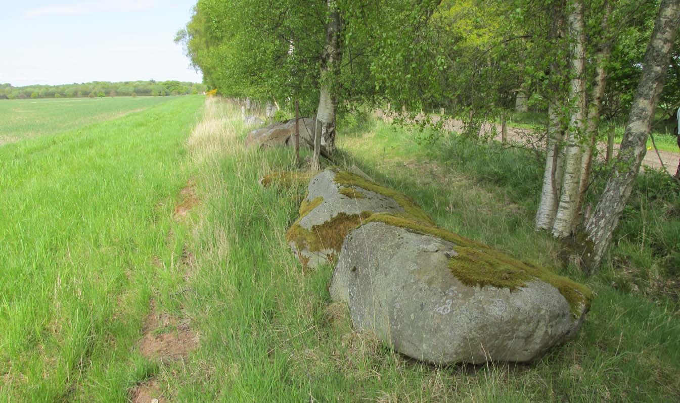
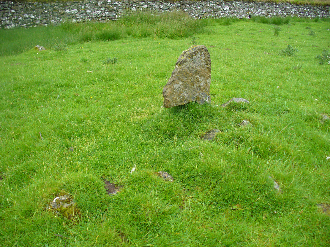
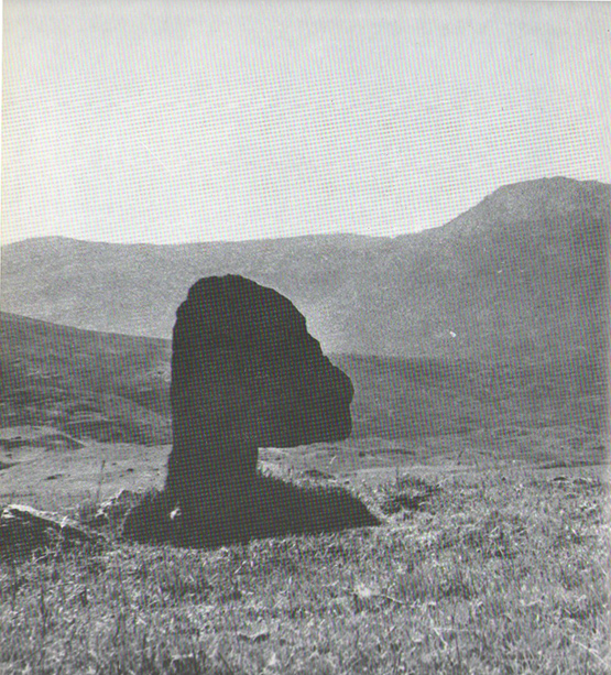
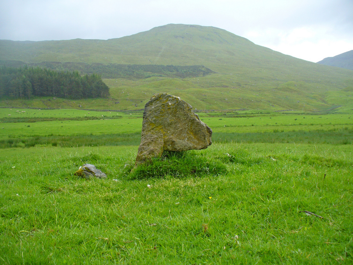
A little-known, but once important site in the mythic history of Scotland, this Long Man’s Grave was said to be the spot where MacBeth—described by Aitchison (1999) as “Scotland’s foremost King”—died. It would seem that any remains of the stone which once stood here has gone. When Robert Chambers (1827) told of the site, he said that
“At the bottom of Dunsinnan Hill, on the east side, and near the west end of a drystone wall which runs along the side of the road from Baledgarno, is a large stone about eight feet in length, beneath which MacBeth is said to have been interred. It is usually called the Lang Man’s Graff, probably from a supposition that the stone was made to suit the length of the deceased.”
More than fifty years later when the Scottish historian Thomas Hunter (1883) wrote about the site, he thought that it had probably been a prehistoric one, telling that
“The tumulus, on being examined, proved to be a druidical stone that had toppled over, and no relic was discovered that could throw light on the tradition.”
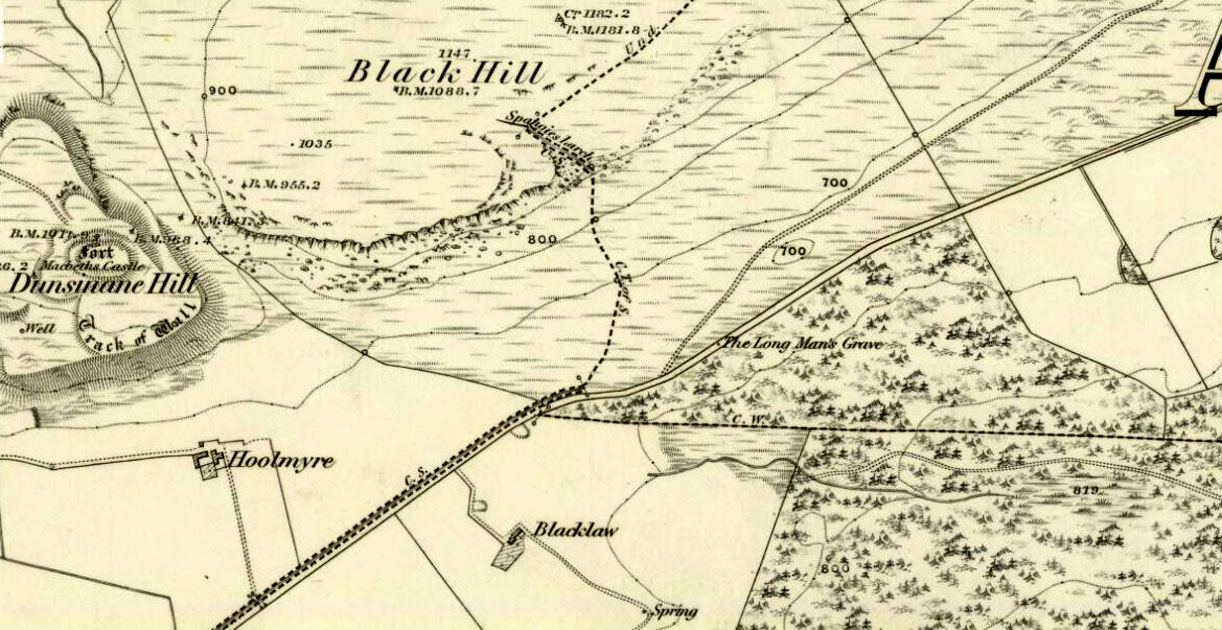
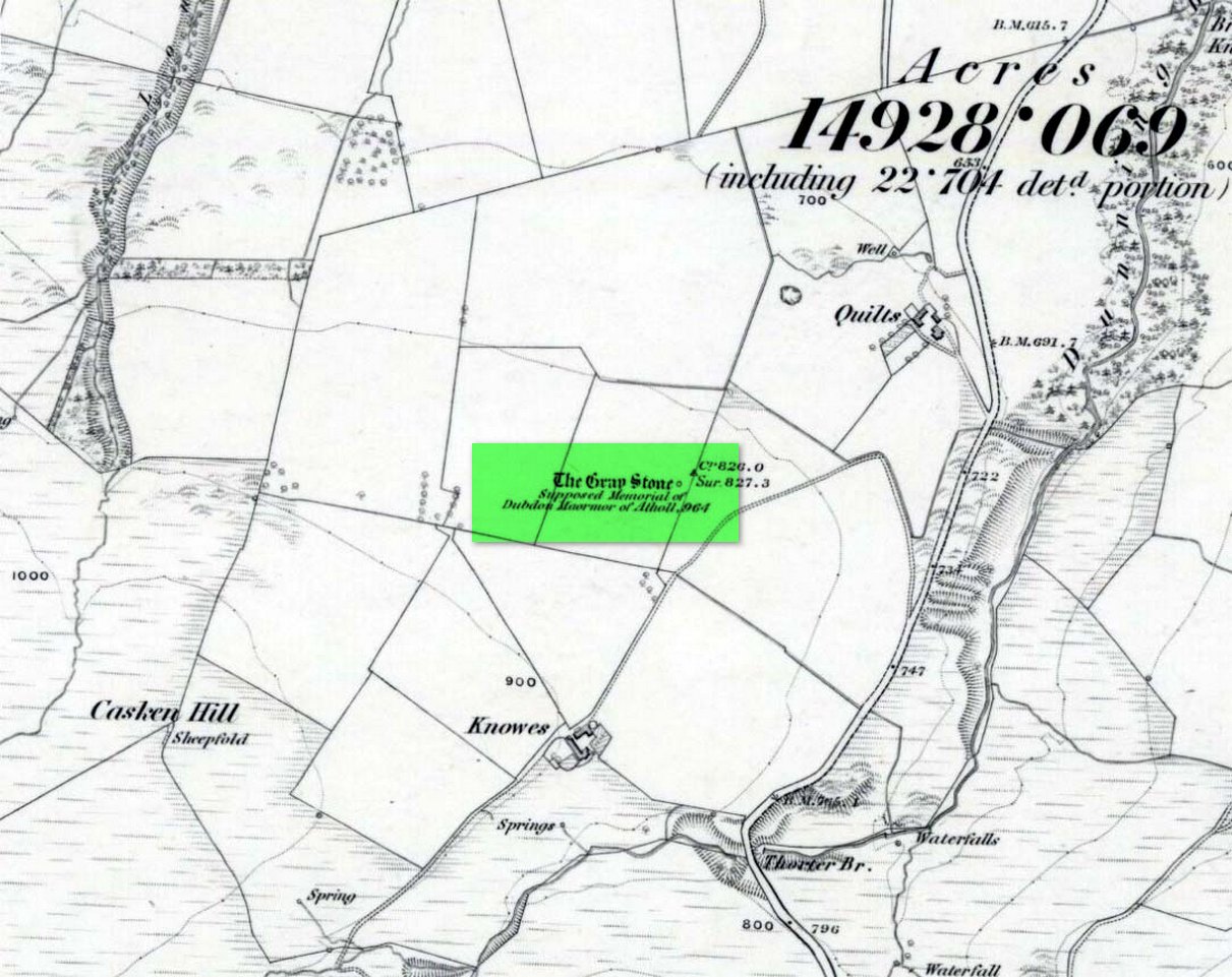
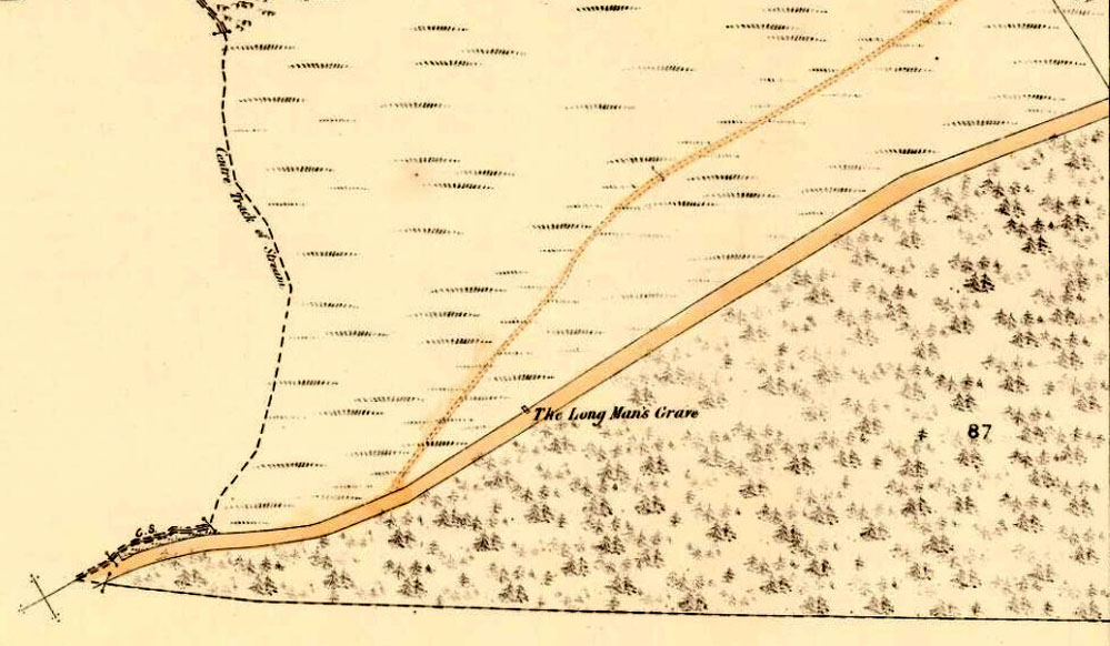
Long Man’s Grave on 1867 6-inch map
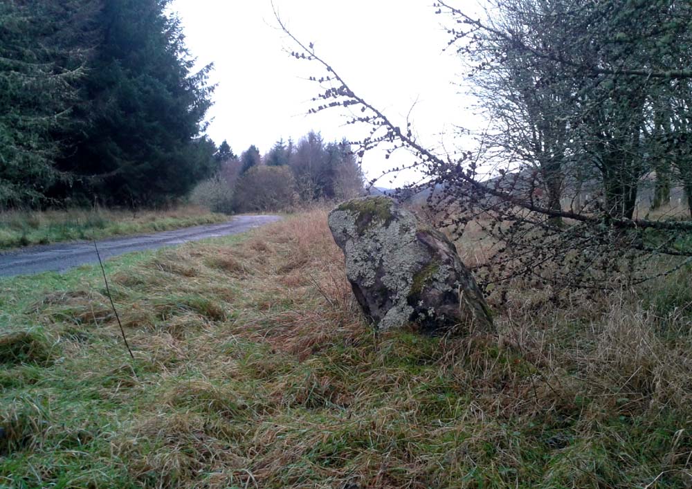
Site of the Long Mans Grave
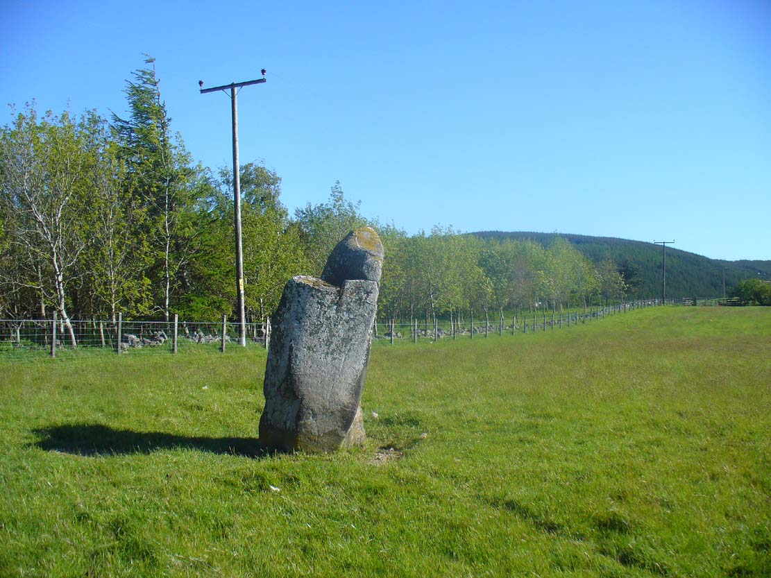
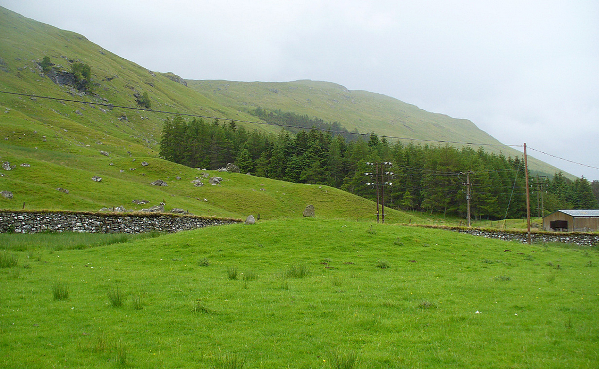
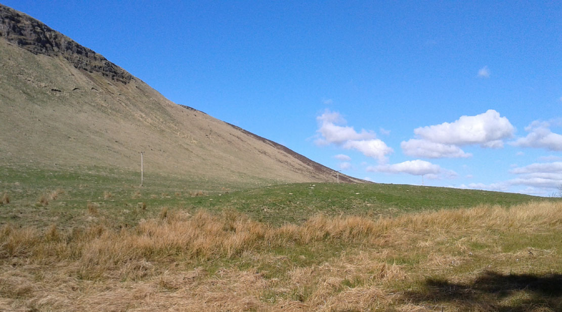
The site was shown on the earliest OS-maps of the region (as highlighted here), but we don’t know for certain about the exact nature of the site. Although a bunch of lads from the Royal Commission popped along to see the place in 1969 and proclaimed (without excavation) that the stone was “probably a ‘grave slab’ and not a “standing stone” which has toppled over”, we have to treat their words with caution. Close by are the remains of Bronze Age stone circles; above us we have the prehistoric hillfort of Dunsinane, with even older neolithic remains being found within it; and we also have neolithic rock art remains nearby; other prehistoric tombs, and plenty more besides…
Folklore
Echoing the early folklore of the site as narrated by local people, Hunter (1883) told that,
“the tradition of the district is that MacBeth, finding it impossible to escape from MacDuff, threw himself from the top of the (Dunsinane) Hill, was killed upon the rocks, and buried at the ‘Lang Man’s Grave’.”
References:
- Aitchison, Nick, MacBeth – Man and Myth, Sutton: Stroud 1999.
- Chambers, Robert, The Picture of Scotland – volume 2, William Tait: Edinburgh 1827.
- Hunter, Thomas, Woods, Forests and Estates of Perthshire, Henderson, Robertson & Hunter: Perth 1883.
- Melville, Lawrence, The Fair Land of Gowrie, W.Culross 1939.
- Pennant, Thomas, A Tour in Scotland and Voyage to the Hebrides – volume 2, London 1776.
- Royal Commission on Ancient & Historical Monuments, Scotland, South-East Perth: An Archaeological Landscape, HMSO: Edinburgh 1994.
- Sinclair, John, The Statistical Account of Scotland, 1797 – volume 11: South and East Perthshire, Kinross-shire, EP: Wakefield 1976.
© Paul Bennett, The Northern Antiquarian