Travel up the B6265 (Skipton to Grassington road) for a mile, watching on the small hills on your left (western) side, and then take the left turn up to Sandy Beck. You can’t miss the place!
Archaeology & History
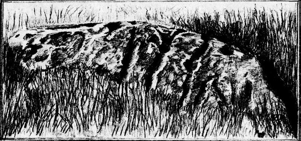
Rough Haw, looking west
My first view of this place was from the hills east of here, atop of one of the great rock outcrops on the edge of Embsay Moor. The very first impression it gave me was – “That’s a bloody hillfort!”: an obvious worked rounded hill, with ridges typical of such monuments. Subsequent investigation found that there were extensive remains of walling, more typical of the Iron Age period than the neolithic (which some modern archaeologists have proposed), clearly visible around the edges of this great hill. The structure of the site is similar in size and design to the remains at the nearby Horse Close Hill above Skipton, aswell as another (officially unknown) site closer to Keighley. A large overgrown cairn rests on the southern side of the hill, seemingly more of archaic import than a mere clearance or marker point. But I may be wrong…
Very notable at this site are the profusion of springs emerging from all round Rough Haw: the blood of seven such water sources comes from its edges on all sides and would obviously have been of some importance here.
References:
Dixon, John & Phillip, Journeys through Brigantia – volume 1: Walks in Craven, Airedale and Wharfedale, Aussteiger Publications: Barnoldswick 1990.
Along the Brighouse to Mirfield A644 road, a half-mile east of M62’s junction 25 on Wakefield Road, note the woodland on your left-hand side, above the walling. Although on allegedly private land, you can approach by hopping over the wall by the main road into the woods. Wander up the slope until it levels out and, just at the edge of the tree-line, past the brilliant overgrown folly amidst a mass of rhododendrons, you’ll see the denuded edges of this earthwork. Though you might need a bitta patience seeking it out…
Archaeology & History
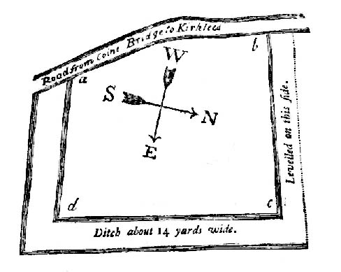
Very first sketch of this site (John Watson, 1775)
The remains of this low earthwork is found on the private land of Kirklees Hall and appointment is supposed to be made to explore, both this and the more famous Robin Hood’s Grave, a few hundred yards away. But if you can’t be bothered with that and find this little-known earthwork, you’ll see that it’s roughly squared in shape, though pretty overgrown. In Bernard Barnes’ survey (1982) he described it as a “square or five sided enclosure, 2-3 acres in size, with bank and external ditch”, wondering whether it was used to enclosure cattle and stretching its possible origin between the Iron Age to the medieval.
Although the classical Roman archaeologist Ian Richmond (1925) believed the site to be from that period, the archaeologist J.J. Keighley thought that the site was “more likely to be Iron Age than Roman.” He wrote:
“The earthwork in Kirklees Park is a square or five-sided enclosure with bank and external ditch… The site lies on Richmond’s trans-Pennine route. According to Armitage and Montgomerie, the earthwork is 0.5 hectares in area, but it is actually nearer 0.8 to 1.2 hectares. They compare its construction with the fort at Wincobank (South Yorkshire), stating that the bank on the counterscarp when excavated, revealed “a very rudely composed wall of undressed dry stone.”
Earlier local writers such as John Watson (1775) — whose early sketch of the site is reproduced above — and others also opted for the Roman date. But, unless you’re a bit of an earthwork fanatic, this site may not be too much your cuppa tea. If you are gonna check this out though, make sure you check out Robin Hood’s old tomb in the trees not far away. Very odd.
References:
Barnes, Bernard, Man and the Changing Landscape, Merseyside County Council & University of Liverpool 1982.
Keighley, J.J., “The Prehistoric Period,” in West Yorkshire: An Archaeological Survey to AD 1500 (WYMCC: Wakefield 1981).
Richmond, I.A., Huddersfield in Roman Times, Tolson Memorial Museum: Huddersfield 1925.
Watson, John, The History and Antiquities of Halifax, J. Lowndes: London 1775.
From the South Kirkby library, go west along Hague Lane and take the left turn up Homsley Lane on your left after a few hundred yards (keep your eyes peeled!). Go up here, past the housing estate, and where the trees begin on your left at the top of the Hilltop Estate, go thru them and as you emerge out the other side, the earthworks are all around you. In fact you’re just about in the middle of this hillfort-cum-settlement!
Archaeology & History
W.S. Banks (1871) gives an early description of this site, although he thought it to be Saxon in nature. He told that,
“About half-a-mile east of Ringston Hill, in a field between Quarry-road and Hornsley-road, is the site of a supposed Saxon camp, as it is called on the ordnance map — a large enclosure containing above three acres of land. It slopes to the north, and is now rough and uneven, and has been cast into ‘lands.’ The mound on the east, west and south is still very distinct. The northern side is much lower than the other and a ditch is cut across at that part…”
And in Banks’ day, as he told, “the history of it is not known.” But this site was later declared as a hillfort – a Brigantian one at that – for the first time by the director of Wakefield Museum, Mr F. Atkinson, following some excavation work here in 1949. Nothing much was found apart from,
“pieces of decayed and burnt sandstone and medieval pottery sherds,” though he still concluded the site to be Iron Age. Although little of its original form can now be seen due to extensive damage, infra-red aerial photography showed “traces of a five-sided annexe to the northwest, the line of the ploughed-out rampart to the south-southwest, and a possible defended entrance to the south.”
The same aerial survey also found another enclosure to the east of the hillfort.
…to be continued…
References:
Banks, W.S., Walks in Yorkshire: Wakefield and its Neighbourhood, Longmans Green & Co.: London 1871.
Keighley, J.J., ‘The Prehistoric Period,’ in Faull & Moorhouse’s, West Yorkshire: An Archaeological Survey, I, WYMCC: 1981.
Prehistoric petroglyphs are rare things indeed in Leicestershire! But the example that was found here — at the now destroyed prehistoric tomb which archaeologists catalogued as ‘Lockington Barrow VI’ in this small graveyard — shows that such ritual art spreads further afield than previously reported by archaeologists. Yet as with countless other cup-marked stones, it should come as no surprise to be found associated with a tumulus. Death and petroglyphs are common bedfellows – even in this part of Britain!
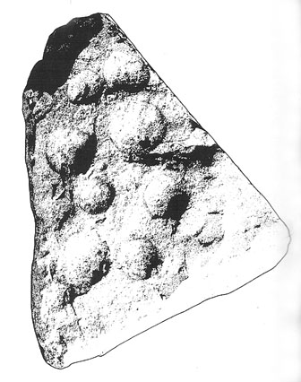
Lockington cup-marking (courtesy Gwilym Hughes)Lockington cup-marked stone
Found on the northern edge of a ring ditch surrounding this once-fine tomb, the carving was found on a small, triangular-shaped, broken piece of rock , less than 12 inches across along its longest side. The small stone has what seems to be eight cup-marks (5 seem certain) pecked onto the stone: simple, without additional ingredients, akin to the basic forms found at Baildon and other more northern climes. The stone itself didn’t seem to be local and was thought by Hughes (2000) “to be from one of the outcrops of millstone grit to the north of the site in southern Derbyshire.”
Less than 7 feet from this petroglyph, inside the barrow, was a pit containing a hoard of ancient gold and copper ware — though any likely relationship between the carving and the treasure hoard is doubtful. The carving was probably a “portable” relic, carried some distance and put here for some reason or other: perhaps as an offering; perhaps a magickal artifact — we’ll probably never know…
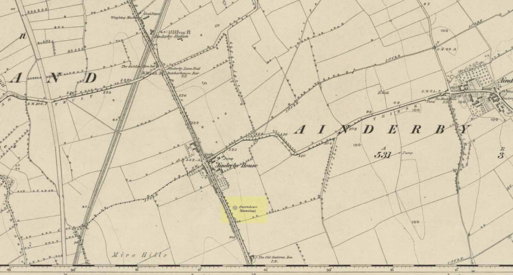
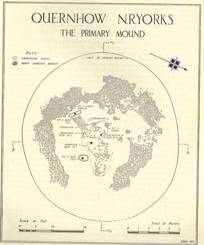
Long since destroyed by the self-righteous advance of the Industrialists, this was a pretty impressive-looking tomb according to the account of D.M. Waterman (1951). Found between the villages of Ainderby Quernhow and Kirklington, right at the side of an important prehistoric trackway—later used by the Romans and known as Leeming Street (on what is now the A1 motorway). Waterman cited it as being “of primary importance in prehistoric times” as it stood on the great plain between the three great henges of Thornborough to the north and those on Hutton Moor to the south, accompanied by a number of other tumuli nearby.
Quernhow tomb on 1856 OS mapThe excavated monument
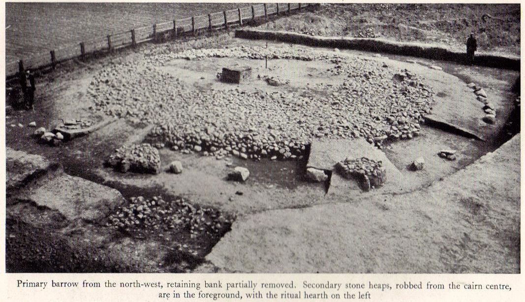
When Waterman and his team arrived here, the barrow “appeared as a low-spread mound, about 3ft in elevation, the exact limits of which were difficult to define,” due to large parts of it being covered over in mud that’d been dumped there by the local land-owner, aswell as erosion due to other farming or industrial activity. But once the archaeologists had stripped the centuries of soil from the damaged surface of the monument, a most impressive site emerged! At the heart of this great burial mound was found “an imposing stone cairn, more or less flat-topped and with a circular constructed face.” He (1951) continued:
“The material of the cairn was composed of cobbles or boulders, all of local geological origin, ranging in size from a few inches up to a foot in diameter or more. A stone considerably larger in size was occasionally encountered , the largest found measuring 23in by 20in and from 3in to 5in in thickness. The stones were heaped up without any deliberate attempt at producing a stable structure and used indiscriminately, irrespective of size or shape, although there was a tendency for the larger stones to occur towards the perimeter of the cairn. Since the cairn itself was built to a flat surface, and the underlying barrow-mound assumed a saucer-shaped profile, the cobbles perforce increased in depth towards the cairn face; at the very centre they were laid one, occasionally two deep, at the face three or four deep, although irregular size and placing precluded any consistency whatsoever in the work. The standard of the building in fact differed considerably throughout the structure. On the northeast and northwest the facing-stones were quite carefully laid, standing to a height of 22in, the work becoming increasingly shoddy towards the south where the construction had so deteriorated that whole sections of the facing had fallen bodily away from the cairn mass, slipping down the tail of the underlying mound…”
Plan of Quernhow
In the middle of the large cairn were found four small pits and a number of small cremations in and around them. There were also found the usual broken remains of pottery, human bones, charcoal, foods vessels and burnt pieces of oak and other vegetation. Near the centre of the cairn was a curious “four poster” of upright stones, “about 1.4ft long and rather less in breadth and thickness (which) suggest, from consideration of their obviously deliberate and careful placing, some significant function in burial ritual.” The four corners of these stones were close to the cardinal points: north, south, east and west.
References:
Waterman, D.M., “Quernhow: A Food Vessel Barrow in Yorkshire,” in Antiquaries Journal, volume 31, 1951.
From the Askwith Moor Road parking spot, walk up the road for about 500 yards and head to your right (east) onto the moor. Walk past the upper side of the disused quarry and through the heather for about 200 yards until the moorland slopes down and you’re on another flat moorland ridge. You should now be stood on the edge of the Snowden Crags Necropolis or cairnfield. There’s a large patch of bracken near the top of Snowden Crags in the middle of the prehistoric cemetery. That’s the spot!
Archaeology & History
Very little has been written of this site and for years several of us have wondered whether or not a stone circle was the antiquity that was being described in the only singular reference of the place, mentioned almost in passing in Mr Cowling’s (1946) fine survey of this area more than fifty years back, where he reported:
“A large circle of heavy material, some thirty feet in diameter, is isolated on the shelf above Snowden Crags to the west.”
But despite the various explorations of me and a number of other students on these moors over the last 20-30 years, Cowling’s curious singular reference (which some have taken as an error of judgement on his behalf) has remained a mystery. Until now!
South & west portion of the ring (photo credit: Geoff Watson)The complete circle, looking NW (photo credit: Geoff Watson)
Thankfully, with the help and attention of the hardworking Keighley volunteer Michala Potts on Thursday, 20 May, 2010, this large and very well-defined antiquity has been relocated — and a damn fine find it is indeed! It would appear (unless someone has notes to the contrary) that when Cowling did his extensive walkabouts on these and adjacent moors, this Snowden Crags Circle was much overgrown in heather and bracken; and I think we can safely assume this due to him making no further remarks regarding the site. Indeed, it would seem that Cowling’s consequent silence on the matter would lend us to think he never caught good sight of this “large circle” ever again. And upon these moors, that’s easily done when the heather gets deep up here! (numerous cup-and-ring stones on these and other northern moors still lay hidden amidst moorland undergrowth, awaiting rediscovery as a consequence of the deep vegetation) But thankfully now we have a good view of the place.
Wrongly ascribed by Neil Redfern of English Heritage to be a part of Scheduled Monument Record number 28065: Cairnfield, Enclosures, Boulder Walling, Hollow Way and Carved Rocks (it’s actually a short distance north of SMR 28065), the site here was relocated during one of The Northern Antiquarian exploratory walks, assessing the extensive walling, settlement pattern and prehistoric graveyard that scatters the central and northwestern section of the moors here. Michala Potts stopped and shouted for Dave Hazell and I to come and have a look at something she’d found whilst we were carefully peeling turf back from a previously unrecorded site about 100 yards away.
“What is it?” I asked; expecting just another small tomb or new cup-and-ring stone. But her tone of voice was different this time.
“I think you’d better take a look at this,” she emphasized.
As we walked through the shallow heather towards her, it became obvious she was standing in a rough circle of dead bracken, unbroken by the lack of rain over the previous months. We’d actually walked past it a couple of times the previous week and gave it no attention due to the depth of the dead vegetation covering the area. But this time it was different. I got within 50 yards of where Mikki was stood and my footsteps slowed; a couple more steps perhaps; then I stopped dead in my track. My arms lifted up and I held my head gazing at what she appeared to be stood in.
“Aww my god….” I said — transfixed at what was in front of me (I’m easily pleased aswell!).
Snowden Crags circle, looking west (photo credit: Geoff Watson)
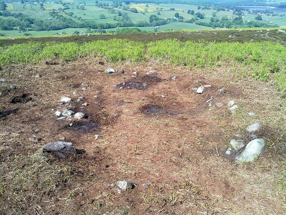
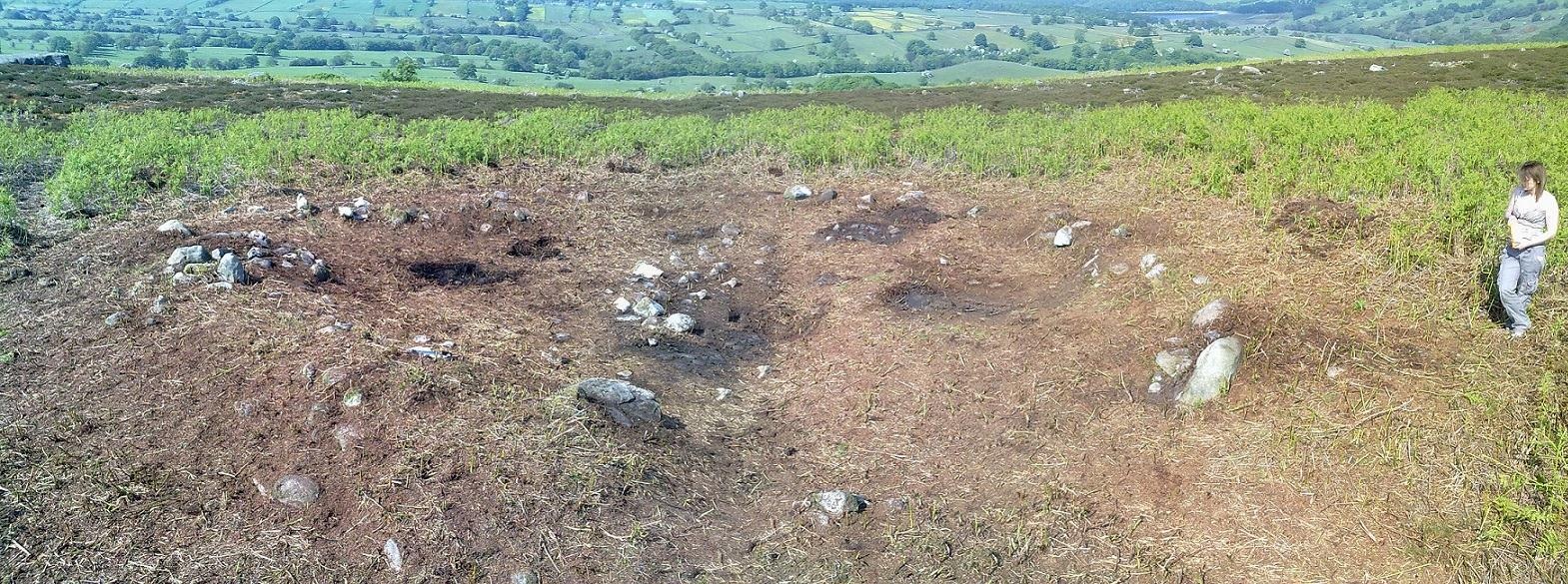
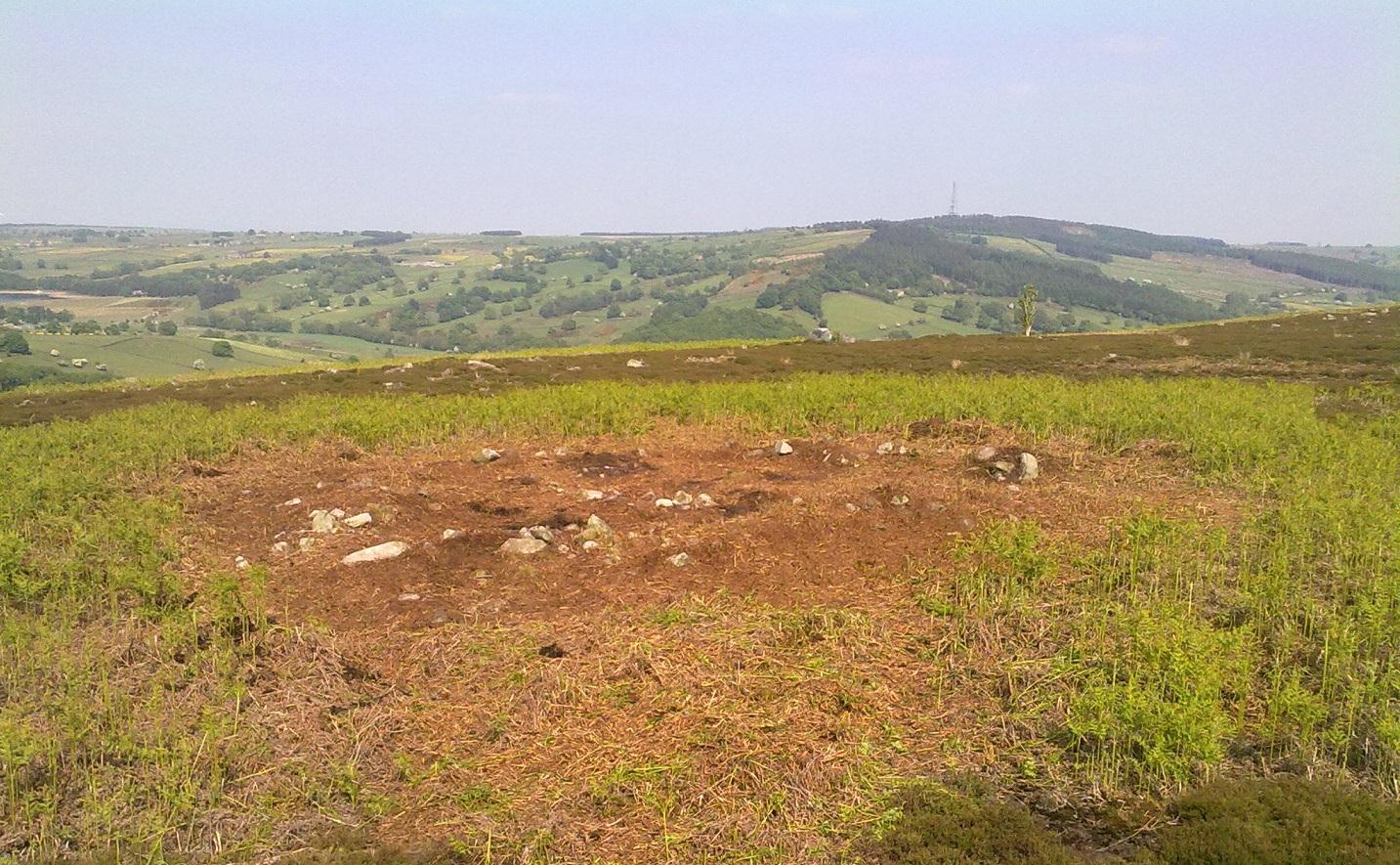
I’m not quite sure how long I stood there with my head in my hands. Ten seconds or so. I couldn’t really say. I think it was when Dave caught up to where I stood, rooted, and appeared at my side. We walked a bit closer to make sure that what we could see wasn’t just another one of those curious shapes in the landscape that you find when seeking out prehistoric sites and turn out to be bugger all — but it wasn’t. Instead, Mikki Potts had stumbled upon an average-sized ring of stones, between 1-3 feet tall, and about 13 yards across, with what seemed like an entrance on its southern side, seemingly untouched in the middle of the mass of decaying bracken! It was an exciting find — as it’s not everyday that you come across a previously unrecorded stone circle. But, once we’d calmed down and walked round and round the site to make sure that something man-made was under our feet, we decided to make our way home (we’d been on the moors all day) and get back up to have a more detailed look at the place in a few days time. On Tuesday, May 25, we went back up for a second time and had a better look at the place…
It was another lucky day. For before we even reached Askwith Moor, Mikki pointed out what looked like a small cup-marking on a stone yards from the edge of the River Wharfe. We brushed off a bit of the dusty earth and were greeted the single cup-marked stone we’ve named the Riverbank Stone. It sat there all alone and dusty and we were very tempted to look for more potential carvings along the riverbank, but the Snowden Crags site was calling for attention and so up the hill we walked.
The ring of stones was still covered in a carpet of dead bracken and also had the new shoots of Spring emerging from the Earth, so we spent the next few hours picking up much of the dead bracken and carrying it beyond the outskirts of the circle, hence enabling us to see with greater clarity the monument Mikki had found a few days previously. The hot sun shone down on us all day and it took longer than we expected to shift all the bracken; but eventually, once we’d done it, we were looking at a very distinct man-made circular monument, measuring 13 yards by 12 yards across and, at its highest point, not even three feet above the present ground level. But today’s ground level is certainly much higher than it was when these stones were first placed here — at least 12 inches higher.
Rubble bank, NE-SE section (photo credit: Geoff Watson)
When Mikki first clapped eyes on the place, only a few small upright stones were sticking up amidst the mass of compacted bracken, but once all this had been brushed off we could see the stony earthworks averaging 18 inches high around the edges; and in places this outer ring is nearly 6 feet across. The ring consists mainly of smaller packing stones (perhaps thousands of them) between a number of larger upright stones — a dozen of them — making up the perimeter; but much of this perimeter is still considerably overgrown in compacted vegetation that’s prevented us seeing the ring in its proper glory: what archaeologists in the past have called a rubble bank. On its southern side is what appears to be an entrance, i.e., in this part of the circle there are no larger stones at all and only a handful of small stones have been noticed; but we must take into account the fact that we’ve done no excavation work here and this “entrance” may in fact be illusory, as the centuries of compacted vegetation (in all probability at least 12 inches deep) could be overlaying an unseen portion of the ring. This “entrance” is about 2 yards across.
The circle has similarities in size and design to the better-known site of Roms Law on Ilkley Moor. The difference between the two however is Roms Law has been robbed, whilst the Snowden Crags circle hasn’t even been catalogued. Yet there is a distinct anomaly here.
As we walked through the southern “entrance” and into the circle, we noticed what seemed to be some form of internal walling running roughly north-to-south. This “walling” started about three yards between the southern “entrance” and the inside of the ring, but then it ran roughly through the centre and all the way to the northern perimeter. This was indicated by a distinct rise in the ground which, as you walked over and stomped your feet, proved to be a mass of numerous small stones seemingly a few inches under the ground, some of which were poking through the Earth’s surface. This ingredient alone made me stop and wonder about the nature of the site. Had we come across a cairn circle of some sort? Or were we in fact stood in the middle of a small walled enclosure, which itself sits in the middle of this prehistoric graveyard? Indeed, was this walled enclosure a potential living quarter: some sort of large hut circle with a wall through the centre splitting it in two? It was hard to say for sure. On another visit to this site a couple of weeks later, in the company of Geoff Watson, Paul Hornby and Dave Hazell, this potential internal walling was given a bit more scrutiny.
We were dying to get our hands and feet digging at the heart of this ring of stones but — as yet! — we’ve managed to restrain ourselves. Although carrying off the mass of dead bracken has dislodged a couple of the small fist-sized stones at the edge of the ring (we carefully placed ’em back into position; yet it was only as much as you’d unintentionally disturb if you walked over the place a few times), we needed to use a couple of small brushes to have a look at this apparent internal walling running through the middle of the ring. But after carefully brushing off the dry dead earth, we found this “walling” was nothing of the sort! Instead, it seemed, someone at some time in the past had beaten us to this place! The central walling was, in fact, where someone had dug into the central region of the circle — probably looking for treasure or other wealthy valuables — and in doing so had dislodged a great number of the small stones that were initially in the middle of the ring, and in doing so pushed them up into small piles of stones, away from their original central position, creating an obvious long line of rocks which, once covered with dead vegetation, gave the impression of it being a length of walling. We also found that the mass of rocks that were around the centre of the ring also spread outwards covering all of the ground inside the outer kerb of stones — probably thousands of them. Geoff called this trench in the middle, the Robber’s Trench!
This begged the question: who the hell had been here, dug out a trench in the middle of this cairn circle (possibly taking out whatever remains were in the middle) centuries before the site had even been catalogued? It didn’t seem like it could have been Mr Cowling, as the covering vegetation was much more than a mere 50 years of age; and Cowling would very likely have reported any finds that he might have made here. So it is a mystery that needs solving.* Again, an accurate archaeological excavation would be invaluable here — but I wouldn’t hold your breath. Archaeological officials don’t seem interested in helping here. I was informed by Neil Redfern of the archaeology department of English Heritage for North Yorkshire that they are unable to support any funding that might help towards any decent analysis of this important archaeological arena (probably spent all their cash on prawn sandwiches and tedious autocrats, as usual).
So what we have so far is this: a large flattened circle consisting of at least a dozen upright stones that define the edges. Between these uprights are hundreds, perhaps thousands of smaller stones, making a rubble bank of a near unbroken circle, apart from where there seems a small entrance on its southern side. Inside the circle is a scattered mass of many small stones, typical of cairn material, filling the entirety of the monument; but the central region has been dug into at some time in the past, by persons unknown. It sits on a flat plain of moorland amidst the Snowden Crags Necropolis with around 30 other small cairns. But this particular site is several times larger than all the others, probably indicating that whoever was buried/cremated here was of some considerable importance in the tribal group: a local king, queen, tribal elder or shaman. Whoever it was that this monument was made for, the landscape reaching northwards from here looks across to the giant morphic temples of Brimham Rocks and the heavenly landscape beyond and above them. It is very likely that the Lands of the Ancestors this way beckoned…
References:
Cowling, Eric T., Rombald’s Way: A Prehistory of mid-Wharfedale, William Walker: Otley 1946.
Huge thanks for the help, assistance and photographs of this newly discovered site — and others nearby — to Michala Potts, Dave Hazell, Paul Hornby and Geoff Watson.
* There is a legend that tells of gold and treasure found at a nearby pre-christian well, but this site is a mile to the north of here. Another nearby treasure legend is that of a chap called “Robinson”, who came upon tons of wealth from an unknown source, enabling him to build the eloquent Swinsty Hall a mile northwest of here (though such a chap didn’t actually build Swinsty!). Perhaps there’s some grain of truth somewhere down the line about someone finding some treasure hereby…perhaps here…perhaps not!
AN APPEAL TO SOME DECENT RICH CHAP FOR SOME MONEY TO ENABLE EXCAVATION HERE!
This site and the surrounding monuments have received no archaeological attention of any worth. If it wasn’t for the fact that us amateurs had explored these (and adjacent) moors, this cairn circle would remain unknown, many of the cup-and-rings upon these moors would remain unknown, the extensive enclosures and walling (of indeterminate age and function) would remain unknown, many prehistoric tombs would remain unknown, etc. It is clearly evident that we have quite extensive domestic and ritual remains covering this small moorland region, from the neolithic period onwards. In the event that anyone reading this with a healthy financial backing behind them could work out a financial strategy enabling us to accurately excavate this and the adjacent monuments, please get in touch. We need an archaeologist to be paid for in order that we can do the duties correctly, but there is a group of a dozen volunteers willing to put a lotta work in to do the right job in this and the surrounding sites. Is there anyone out there who has the finance to enable this? I’m serious! Or are these important sites merely going to be left alone for the elements to consume and disappear over time? Surely there are one or two rich antiquarians left in this country who, as in times of old, are willing to help in the investigation of our country’s ancient monuments? Does anyone out there know how we can get the ball rolling?
This is an intriguing find inasmuch as cup-marked stones are rare in this part of the British Isles. Antiquarians have noted examples of such carvings in the Cornish townships of Davidstow, Delabole, Portreath, but very few others are known about. But in the once-impressive Tregulland Burrow barrow that was found here on the south-side of the road a few hundred yards up from Cold Northcott, just next to the old township boundary line, as many as eighteen carved stones were unearthed!
Fig.2
They were all found inside different sections of the barrow, which was built on top of an earlier cairn structure, which appears to have been built upon an even earlier concentric ring of upright wooden poles. The cup-marked stones appear to have been introduced, or etched, around the time when the cairn structure was laid on top of the concentric ring of stake-holes. This “tradition” of adding cup-marked stones to cairns is a feature found at a number of sites in the northern lands of Yorkshire, Northumbria and across the Scottish counties, but such a celebrated event as this in the far southwest is highly unusual! (although the custom is pretty universal and is found, not only in the UK, but in many parts of the world).
Fig.3Fig.4
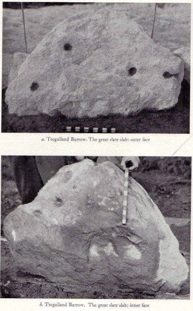
In Paul Ashbee’s (1958) excellent essay on this prehistoric tomb, he described the carvings at some considerable length — which is unusual for an archaeologist of that period — noting them as the “cup-marked and ornamented stones”. I hope that people won’t mind me repeating his lengthy notes on the relevant carved stones found in the tomb, the largest of which was on a big slab near the middle of the cairn that possessed cup-markings “and an ‘eyebrow’ motif”,* (figure 1, above) as he called it. He described the respective carvings as follows:
“From the Cairn-Ring:
1-2. A hog-backed outlined slate slab (figure 1, above). The bottom has a straight worked edge which suggests that the form was deliberate. On the inner face are four close-set cup-marks, and an ‘eyebrow’ device which has been made around a natural flaw, whilst the outer half has been formed by pecking and bashing to remove an appropriate amount of the laminated slate structure to form a depression. On the outer face there are four widely set cup-marks, one being connected by a channel to the edge of the slab…
3-4. A roughly rectangular slate slab. The upper face bears two cup-marks, one much smaller than the other, together with one abortive cup-mark, the lower a single cup-mark. Four perforations had been used to remove this slab from a parent block, the halves of these perforations gracing the upper edge. The slab was incorporated in the upper part of the cairn-ring material stacked against the largest of the sub-megalithic blocks of the cairn-ring.
5. The slab is hog-backed in outline, resembling No.1 above in general form. On the upper face, at a right-angle to the straight bottom edge, a channel had been produced by pecking, the marks of a pointed instrument being clearly discernible at the bottom of the channel. This channel extends almost from edge to edge of the slab, being narrow at the bottom and then expanding, being thus wider and then gradually tapering. Were it not asymmetrical it could be considered as a dagger representation.
6. A small block of roughly pentagonal outline, one side being irregular. The device it bears has been made by pecking an outline and removing the intervening laminated slatey rock. Found at the base of the cairn-ring on the south side.
7. A weathered pillow-like lump of a coarse sandstone-like rock. The plane face bears at least seven small ‘cup-marks.’ On other sides there are more weathered and uncertain marks which may well be natural. It was found surmounting, in a central position, the faced walling on the western side of the cairn-ring. Dr F.S. Wallis reports that: “This is evidently a sandstone rock with a large amount of quartz. This is a very generalized rock and I am afraid that it is not possible to tie it down to any particular part of Cornwall. The rock is much weathered and, judging from the print, I should say that the pits are entirely natural. Such a rock would hardly contain fossils and thus the pits could not have an organic origin.”
8. A roughly rectangular slate slab with opposing ‘cup-marks’ broken through before complete perforation. In addition there is a single cup-mark on the upper edge. (see figure 2) It was in the banked stones on the western side of the cairn-ring.
“From the soil bank:
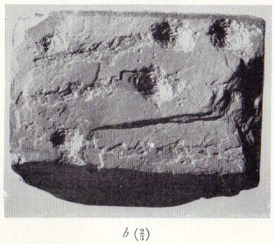
1. An even, rectangular slab bearing a group of three cup-marks in one corner, and single cup-marks in two other corners. (see figure 3) From the outer cup-marks of the group run two channels. A channel runs from one of the solitary corner cup-marks. It was found, cup-marks and channels uppermost, almost exactly above the satellite cremation trench-grave.
2. A roughly triangular slab, bearing on its upper face a single centrally set cup-mark. Found by the cairn-ring in the eastern quadrant.
3. A small slab, of pentagonal outline, bearing a single shallow cup-mark. Found by the cairn-ring in the eastern side.
4. A thin U-shaped slab which has been battered into shape by edge chipping. A concavity has been made along the upper edge.
“From the ditch infilling:
5. A tough, quartz-veined slab with a shallow battered cup-mark. From the western side of the barrow.
6. A small, tough, even, rectangular piece of slate, bearing an abortive cup-mark. From the western side of the barrow.
7. A thin piece of slate bearing a small cup-mark set at a point where laminae of slate have left the piece. From the eastern side of the barrow.
“Unstratified:
All the “unstratified” cup-marked slabs recovered from the central disturbances, both recent and earlier, may well be derived from the destruction of the central grave arrangements.
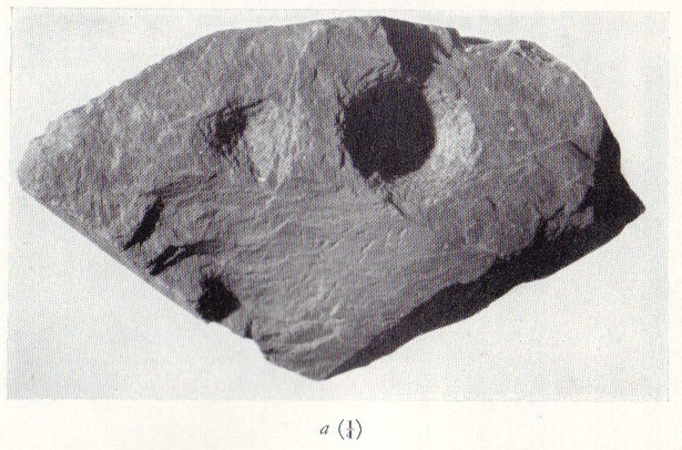
8. A thick lozenge-outlined slab bearing one large cup-mark, and one smaller set side-by-side. (figure 4, above)
9. A roughly square-outlined slab with two cup-marks of even size set across one diagonal. (figure 5, below) One cup-mark has a smaller one close by it.
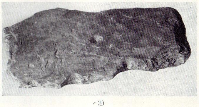
10-11. Irregular pieces of thin slate, bearing traces of perforations on their edges, one bearing cup-marks.
12. A roughly triangular slab bearing an ? unfinished cup-mark.
13. An even hexagonal slab that appears to have been, by edge trimming, worked into this form.”
Fig.5
The prolific collection of cup-marked stones in this once-impressive monument would probably indicate that the character buried here was of some significance to the local people, both to those who knew him and, evidently, in the subsequent mythologies surrounding the site (click here for the details of Tregullan Burrow barrow if you wanna know the archaeology and structure of the site). And although we find, statistically speaking, a lacking of other cup-markings in this region, it’s more than likely there are others that are hiding away amidst other old tombs and rocks…
References:
Ashbee, Paul, “The Excavation of Tregulland Burrow, Treneglos Parish, Cornwall,” in Antiquaries Journal, volume 38, 1958.
* the eyebrow motif description was used by a number of archaeo’s for sometime following publication of O.G.S. Crawford’s book, The Eye Goddess, to which the Antiquity Journal editor speculated some cup-and-rings may have owed their origin.
It is best approached from the track at the side of Weecher reservoir (site of the destroyed Weecher stone circle) on the east side of Rombalds Moor, where you should follow the natural curve of the track till you reach the tiny hamlet of Faweather where, on your right, just in the garden edge, you’ll see this faded old carving. This has only recently been incorporated into the garden (it used to sit on a small triangle of grass where three old tracks meet), but the people living here seem pleasant enough and will let you look at the carving if you ask.
Archaeology & History
Hedges 1986 drawing
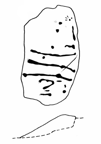
Just off the far-eastern edge of Rombald’s Moor and north of Baildon Moor, this faded cup-marked stone might only be for the real fanatics amongst you! I like it though. Described in Sidney Jackson’s rare Bradford archaeology journal, the site was added to Hedges (1986) survey, and the subsequent Boughey & Vickerman’s (2003) work, neither of whom said much about it. It’s a pretty basic carving though, consisting of several cups and lines that run over the top of the stone, some of which seems to be due to natural weathering — it’s hard to say for sure.
References:
Boughey, Keith & Vickerman, E.A., Prehistoric Rock Art of the West Riding, West Yorkshire Archaeology Service 2003.
Hedges, John (ed.), The Carved Rocks on Rombalds Moor, West Yorkshire Metropolitan County Council: Wakefield 1986.
Crowned by a clump of trees (planted in 1740), this hilltop site is one of the more impressive of a number of tombs hereby, with its nearest other neighbour being 70 yards southeast of here. One of Dorset’s early tribal meeting places (Anderson 1934), the tomb was illustrated on Isaac Taylor’s 1765 map of the region and was dug into in 1858 “on the orders of a local magnate” (Marsden 1999), damaging some substantial portion of the tomb. Of this, craniologist and antiquarian John Thurnam was most displeased; for in his description of the opening of Culliford Tree he wrote:
“A wide trench had been dug through it one side, from the summit and the rubble which had been thrown out had not been replaced… Another subject of regret was the fact that though, as we were told by the neighbouring rustics, human remains, with pottery and certain other relics, were found in the barrow, no authentic account of the exploration had, so far as we could learn, been put to print.”
Leslie Grinsell (1959) found the same trouble in his assessment of this site; and the Royal Commission (1970) lads could only describe the site thus:
“Large trench on south and top almost certainly dug in 1858 when four secondary extended inhumations, one with necklace of amber and two gold-plated beads, and cremation with incense cup in collared urn, were found.”
However, it seems that the necklace and gold-plated beads have been “lost” — i.e., someone has them in their own private collection somewhere!
Folklore
This is one of very few tombs in this part of the country where we find the tradition of fairy music. Grinsell (1959) told that:
“The Culliford Tree barrow, formerly the meeting place of the Hundred of Culllingford Tree, is also known as the Music Barrow from the belief that music could be heard beneath the mound by those who listened at the apex at midday.”
References:
Anderson, O.S., The English Hundred-Names, Lunds Universitets Arsskrift 1934.
Marsden, Barry M., The Early Barrow Diggers, Tempus: Stroud 1999.
Royal Commission on Historical Monuments, An Inventory of Historical Monuments in the County of Dorset – Volume 2: South-East, Part 3, HMSO: London 1970.
Warne, Charles, Celtic Tumuli of Dorset: An Account of Personal and other Researches in the Sepulchral Mounds of the Durotriges, Smith: London 1866.
This once impressive tumulus a half-mile east of the village was first mentioned in the Bardney Cartulary in the early 13th century, where is was written as Spelhou. Suggested by Olof Anderson (1934) to have been an early moot site — “the meeting place of the Torbar Hundred” — this appears to be confirmed in Smith’s (1937) etymological analysis where he ascribes Spell Howe to be literally, “‘Speech mound’, from OE spell, speech and haugr” (burial mound). Rising about four-feet above ground level, this is a traditional ’round barrow’ type of tumulus. In recent years, reports tell that it has been built onto with some fencing. Hopefully the present land-owners now look after the place!
References:
Anderson, O.S., The English Hundred-Names, Lunds Universitets Arsskrift 1934.
Mortimer, J.R., Forty Years Researches in British and Saxon Burial Mounds of East Yorkshire, Brown & Sons: Hull 1905.
Smith, A.H., The Place-Names of the East Riding of Yorkshire and York, Cambridge University Press 1937.