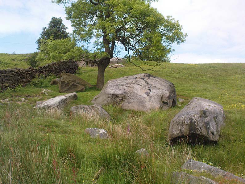
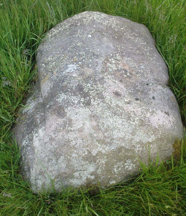
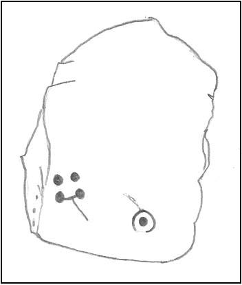
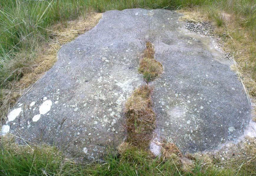
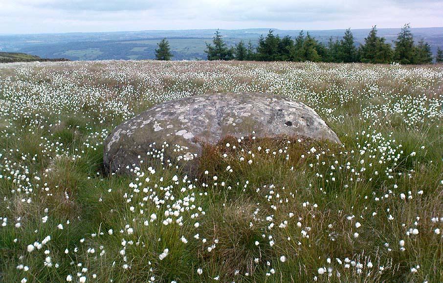
Nice n’ easy. Get to the Haystack Rock and walk on the path west (past the Three Cups Stone) and where the path swings round following the edge of the small Backstone valley, keep going for 150 yards or so. Keep your eyes out for the remains of walling in the Green Crag Settlement on your left. This flat stone is amidst the heather in and amongst the enclosure (hence the name). If you walk back and forth hereabouts for a short period, checking for flat stones amidst the heather about 20 yards off the path, you’ll find it!
Archaeology & History
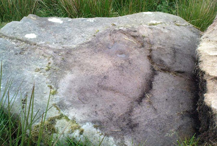
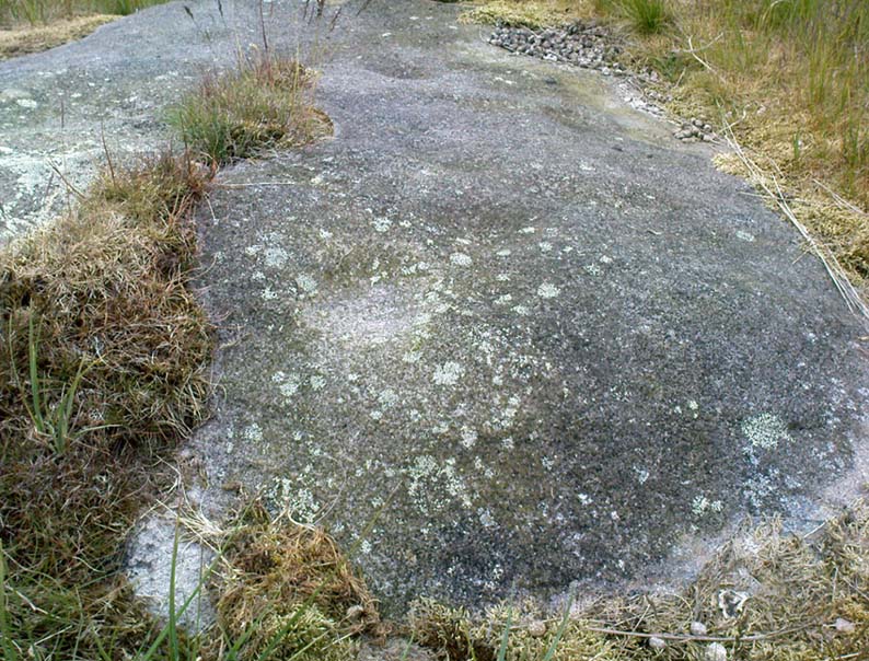
Top-left section of CR-288
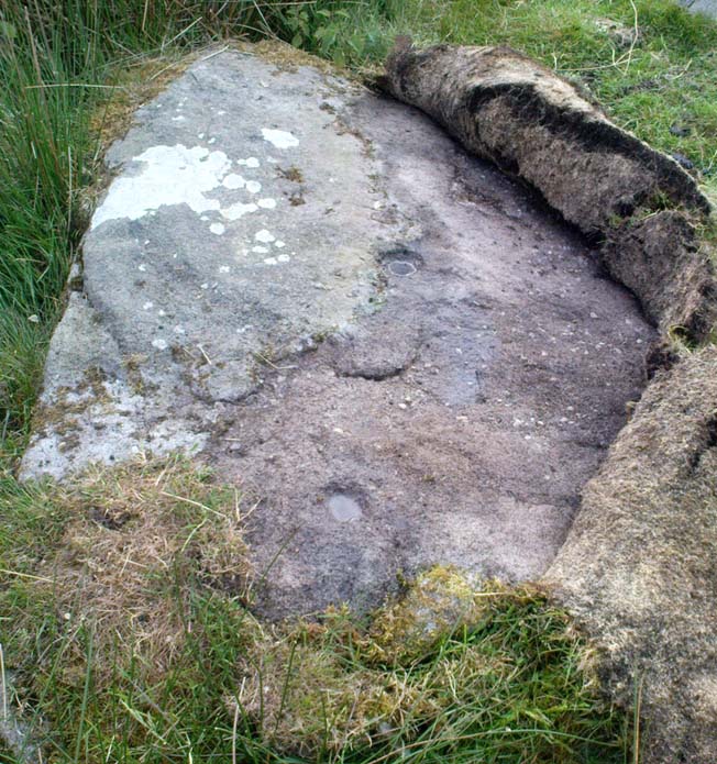
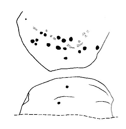
This is another one of those carvings which had been seen by a number of people, bimbling about across this part of the moor, before it saw the literary light of day in Hedges Carved Rocks book (1986). It’s a nicely-preserved design, usually covered over by much heather growth, but is worth the exploration if you like your cup&rings. The drawing of this stone however (in both Hedges and Boughey & Vickerman) does not convey the actuality of the carving, as we can see here. But that’s the case with many cup-and-rings: linear precision and the artisty of the carving are two very different things. As we can see here, one section of the stone has a defined ‘enclosure’ of cups etched upon the rock surface: something that is clearly missed in the archaeologist’s drawing. Check it out y’self and see what you think!
References:
Boughey, Keith & Vickerman, E.A., Prehistoric Rock Art of the West Riding, WYAS 2003.
Hedges, John (ed.), The Carved Rocks on Rombalds Moor, WYMCC: Wakefield 1986.
Very close to the edge of the M9, this old water source is thankfully still visible, though not in its original state. At the bottom of the ridge, loosely enclosed in the grounds of St. Thomas Well House, we find that the original well has been submerged into the pond which covers it.
Folklore
I’ve not yet found the mythic origins behind the dedication to this site, though St. Thomas’ Day is the winter solstice on December 21, and his mythic status was that of didymus, or twin. In Yorkshire, folk customs surrounding this figure have been found to be inextricably intertwined with death rites, Robin Hood and shamanism! But this Stirlingshire site is as yet silent. The presence of numerous prehistoric burials very close by may have something to do with its dedication, as such sites would heighten the likelihood of there being ‘heathen’ practices close by, to which the said ‘St Thomas’—or one of his emissaries—could subdue with their christian figure. But that’s pure speculation on my part…
References:
Attwater, Donald, The Penguin Dictionary of Saints, Penguin: Harmondsworth 1965.
Morris, Ruth & Frank, Scottish Healing Wells, Alethea: Sandy 1982.
Fleming, J.S., Old Nooks of Stirling, Delineated and Described, Munro & Jamieson: Stirling 1898.
Royal Commission on the Ancient & Historical Monuments, Scotland, Stirlingshire – volume 2, HMSO: Edinburgh 1963.
From the village of Midgley, high above the A646 Halifax-to-Todmorden road, travel west along the moorland road until you reach the sharp-ish bend in the road, with steep wooded waterfall to your left. From here, across the road (roughly) there’s a track onto the moor. Go up this, keeping to the line of the straight walling uphill by the stream-side (instead of following the path up the quarries) all the way to the top. Here you’ll see the boundary stone of Churn Milk Joan. Take the footpath to its side for up onto the moor 250 yards or so, taking a right turn into the deeply cut footpath and walk along for several hundred yards, keeping your eyes to the north (right). You’ll see the rocky cairn of Miller’s Grave not far away in the heather, near to the large rounded boulder known as Robin Hood’s Pennystone.
Archaeology & History
Ascribed by some as neolithic, and others as Bronze Age (the more probable), here is a curious archaeological relic: curious, inasmuch as it’s received very little attention from archaeologists. It’s quite a large monument — and perhaps the fact that it has always seemed to be in isolation from other prehistoric remains has held it back a little. But recent ventures here have brought about the discovery of more cairns (though singular small ones), neolithic walling, hut circles and other prehistoric remains that have never previously been reported.
Miller’s Grave, Midgley Moor (in VERY heavy rain!)Central stone aligning north to Nab End
It’s a decent site aswell. Mainly consisting of the usual mass of smaller stones piled up and around one main point; in the middle of this ‘tomb’ is a large split glacial erratic boulder, which may have been the original focus of the builders. Some may even ascribe a coupla cup-markings on this ‘ere central rock form — but they’d be pushing it a bit! This large central feature aligns to the high peak of Nab Hill several miles north, above Oxenhope. Whether this feature was of any significance in the cairn’s construction is debatable (though as north represents death in pre-christian peasant lore, this ingredient has to be noted).
Profile shot – looking NELooking SE, with small cairn in foreground
The cairn is a goodly size: some 4 feet tall and about 50 foot across at its greatest diameter. Some of the stones near the centre of the stones have been put there in more recent years. In previous centuries, treasure-seekers came here in the hope that they’d uncover gold or other trinkets and stripped off much of the original cover, moving many rocks to the edges. Others were also stolen from here to make some of the grouse-butts, not far from away. In a foray to the site on 5.9.10. we were lucky to find the heather had been burnt back and found, some ten yards to the north and to the southwest, the remains of small, outlying singular cairns (though these need excavating to ascertain their precise nature).
Calderdale Council’s archaeology notes on Miller’s Grave tell it to be “situated on the summit of Midgley Moor”, which is quite wrong. The summit of the moor is some distance west of here, near where an old standing stone called the Greenwood B stone (75 yards south of the Greenwood Stone) and the much denuded remains of other prehistoric sites could once be found — though I’m not sure that they, nor the regional archaeologist for Upper Calderdale has ever been aware of them.
Folklore
In F.A. Leyland’s (c.1869) extensive commentary to Watson’s History of Halifax (1775), he relates a fascinating tale which seems to account for the name of this old tomb:
“About ninety years ago,” he wrote, “that is, towards the end of the eighteenth century – one Lee, a miller, committed suicide in Mayroyd Mill near Hebden Bridge. The jury at the inquest held on the occasion returned a verdict of felo-de-se, and the body was buried at Four Lane Ends, the Rough, in Midgley. The fact, however, of the body of one who had laid violent hands upon himself, lying in unconsecrated ground at a point where the highways met, and at a spot which the inhabitants passed early and late, oppressed the people of the neighbourhood with an irresistible dread. Persons going to market and passing from village to village, feared and avoided the unhallowed spot, until the feeling increased to one of insupportable terror; and, in the night time, a multitude collected with torches to disinter the body. This was speedily effected and violence was even offered to the dead. A man named Mark Sutcliffe, and others, who attempted to prevent the exhumation, were stoned* by the mob, and the body was hurried to the cairn on Midgley Moor, where it was hastily interred. Here however, it was not allowed to rest; the isolation of the body, though buried in a lonely spot, was yet apart from the common cemetery where the dead lie together in their special domain; and this invested the surrounding district with a superstitious awe difficult to describe. The body was still too near the haunts of the living; and, to the perturbed imagination of the inhabitants, the unquiet ghost of the suicide constantly brooded over the hills. As this was not to be endured, the body was at last removed from the cairn, and finally buried in the churchyard of St. Thomas a’ Beckett’s, Heptonstall. Although the interment of Lee, at the cairn, has conferred upon the spot the name of the Miller’s Grave, it cannot be doubted that the large quantity of heavy stones which we find heaped together at this place…was piled up in distant times…”
Modern pagan folklore ascribes the name of this site to relate to Much, the Miller’s Son: acquaintance of the legendary Robin Hood, whose ‘Penny Stone’ boulder is just 100 yards west of here.
Follow the directions for getting to the great Badger Stone carving. From here, walk eastwards on the footpath for about 400 yards. Hereabouts walk off the path and down the slope just a few yards and amble back and forth, checking the various stones. Keep doing this until you find it! (luckily, this stone’s marked on the OS-map) There are several other reasonable carvings nearby on the same plain…the Green Gates Stone (or carving no.257) for one!
Archaeology & History
The Pitchfork Stone (after Hedges, 1986)
First found (or rather, recorded) by our old friend Stuart Feather and described in Bradford’s Cartwright Hall Archaeology Group’s Bulletin in 1961. It’s status was all-but-secret until Hedges edited the Ilkley Archaeology Group’s Carved Rocks work in 1986. The stone’s a simple design as the illustration shows: an urn-like vessel with a cup in the middle; but the attached groove at the bottom gave one anonymous chap (who dared to use the modern name of RombaldII!) the idea of it looking like a pitchfork – so the name sticks!
The enclosing “lines” that make up the pitchfork aspect of the carving are pretty enhanced (as we can see in the photograph here) and may, just may, be the result of a more recent petroglyphic artist.
References:
Boughey, Keith & Vickerman, E.A., Prehistoric Rock Art of the West Riding, WYAS 2003.
Feather, Stuart, ‘Mid-Wharfedale Cup-and-Ring Markings – Nos. 2 & 3, Ilkley Moor,’ in Bradford Cartwright Hall Archaeology Group Bulletin, 6, 1961.
Hedges, John (ed.), The Carved Rocks on Rombalds Moor, WYMCC: Wakefield 1986.
Travelling up (north) the A19, just as you get to Riccal village, there’s a small road to your right: take this! A mile along there’s a parking place just where the track veers into the woods. That’s where you’re heading. The remains of the tombs hereabouts can be hard to discern – but if your lucky you’ll either meet a local, or the virtue of patience will bring these overgrown tombs into focus! There are other tumuli a few hundred yards east and north of here aswell. If you wanna get a clear picture of them all, a full day would be a good bet!
Archaeology & History
Not to be confused with the other Danes Hills tombs a couple of miles northeast of here (as done on some other sites), the early Victorian geologist and explorer John Phillips (1853) was one of several early writers who described what, today, are known to be Iron Age tombs, scattered about a short distance east of Riccall village, saying:
“On Skipwith Common are many tumuli, old banks, and the slightly-marked foundations of ancient (turf or log?) houses or wigwams. These, by some error of tradition, are called ‘Danes’ Hills/ but, on opening the tumuli, no confirmation of so modern a date appeared. The tumuli are set in square fosses; the sides of the fossae range north and south and east and west (true). Similar facts appear in connexion with the tumuli on Thorganby Common adjacent. Burnt ashes and bones occur in the mounds; facts which suffice to overthrow the supposition of these hills being funeral heaps of the Danes of the llth century, for they then buried their dead. No instruments of metal, bone, or stone, or pottery were found.”
There were dozens of tombs that could be seen here in the past, but today many have been destroyed or are hidden by the cover of trees. A sketch-map (above) showing the rough location of many of the graves was made by the Yorkshire Antiquarian Club after a visit here in 1849 (Proctor 1855), who opened several of the barrows. Archaeologist Ian Stead (1961; 1979) defined these remains as being of the famous La Tene burials — though I’m unsure as to whether any of the tombs here had the great horse-chariots found in them, as found in the more famous Danes Graves tombs close to Driffield.
Folklore
The name of these small hills acquired their Danish title via a mix of real history and folklore. History tells of the old Danish King Harald Hardrada, who moored his fleet of ships a few miles away from here before going into battle against the armies of Northumbria and Mercia. “Dane’s Hill,” said Bogg (c.1895), “still marks the spot where the fight took place.” As John Burton (1758) told us:
“Ever since the aforesaid battle, it is by tradition to this day said, that the Danes were permitted to encamp here till they had buried their dead, and their ships at Riccal should be ready for their re-embarking for Norway.”
Local folk used to tell of the tradition of the local swamp — called Riccal Towdyke — being choked with the bodies of many slain in the battle hereabouts. Many pieces of red cloth were found all around in the neighbourhood of these tombs. However, despite this mix of fact and folklore, the tumuli were see marked on the modern OS-maps have been found to be Iron Age in origin.
…to be continued…
References:
Bogg, Edmund, From Eden Vale to the Plains of York, James Miles: Leeds n.d.
Burton, John, Monasticon Eboracense, N. Nickson: York 1758.
Elgee, F. & H.W., The Archaeology of Yorkshire, Methuen: London 1933.
Morrell, W. Wilberforce, The History and Antiquities of Selby, W.B. Bellerby: Selby 1867.
Phillips, John, The Rivers, Mountains and Sea-Coast of Yorkshire, John Murray: London 1853.
Proctor, W., ‘Report of the Proceedings of the Yorkshire Antiquarian Club, in the Excavation of Barrows from the Year 1849,’ in Proceedings of the Yorkshire Philosophical Society, 1855.
Stead, I.M., ‘A Distinctive Form of La Tene Barrow in Eastern Yorkshire,’ in Antiquaries Journal, volume 41, 1961.
Stead, I.M., The Arras Culture, Yorkshire Philosophical Society: York 1979.
Very close to being at the top of the island. If you do manage to get here take a gander at the legendary Gulf of Corryvreckan: one of the largest whirlpools on Earth, where the cailleach swirled her stuff when angry! This is the ‘hill where sorrel grows,’ and where George Orwell wrote 1984 – but more important for us is where the Royal Commission for Historic & Ancient Monuments of Scotland (Argyll, vol.5) designated that,
“a stony mound about 5.5m in diameter and 0.5m high, situated on the crest of the ridge east of Barnhill, appears to be a prehistoric burial cairn.”
Sadly I never managed to check this out when I was last up here as I didn’t know it was here!
References:
Royal Commission on the Ancient & Historical Monuments of Scotland, Argyll: volume 5 – Islay, Jura, Colonsay and Oronsay, HMSO: Edinburgh 1984.
Follow the same directions for getting to the Idol Stone, then walk just 30 yards further up the path and it’s the big rock on your left-hand side. Y’ can’t miss it!
Archaeology & History
Main section of cup-marks
This nice big boulder can be quite a temperamental chap, depending on how the light plays with the rock surface. I’ve got some photos of this old stone where you can see next to nowt on it; where as others show clearly aspects of the design that aren’t on the archaeo-images. But such is the nature of cup-and-rings I s’ppose!
Unlike its rather linear companion a few yards away, this great boulder has the more typical scattering of faded cups, lines and at least one cup-and-ring, etched with seemingly little purpose or structural design. But as we know, the very notion of structural design in forms consistent to modern mind-sets were anathema to the neolithic people who were etching these patterns on rocks. Indeed, even the notions of these images as ‘art’ as defined in modern times, has no relationship to the intrinsic reality of either cup-and-rings or reality per se, as experienced by our ancestors. And I think we find an explicit affirmation of this in the Cluster Stone here.
Close-up of cup-and-ring
Natural cuts in the rock have been heightened, for whatever reason, so that today the division between Nature’s marks and the mark of humans have become ambiguous as time has worn the features. The clustering of cup-marks on certain parts of the rock was surely indicative of (what we would term) separate events/forms, whose mythic relationship were, however, intrinscially related. This may be representative of a landscape map, or a series of events – but each would relate to one and other. But, of course, we truly don’t know, so think I’d best shut up!
Cluster Stone design (after Hedges 1986)
The carving itself, as we can see today, has perhaps as many as 40 cup-marks on it (Boughey & Vickerman safely vouch for 26), with five or six lines running across the surface, some of which have been modified by ancient peoples. The cup-and-ring on the stone is quite distinct. Neolithic or Bronze Age walling runs just a few yards away from here, but the precise line it takes has not been accurately assessed.
References:
Boughey, Keith & Vickerman, E.A., Prehistoric Rock Art of the West Riding, West Yorkshire Archaeology Service 2003.
Hedges, John (ed.), The Carved Rocks on Rombald’s Moor, WYMCC: Wakefield 1986.
Follow the same directions to reach the Pancake Stone. Then walk eastwards along the footpath on the moorland edge. After about 400 yards, keep your eye out to your right on the moorland proper where you’ll see this large boulder, seemingly isolated, of similar shape to the Haystack Rock, but a bit smaller. That’s it! If you end up near the stream (Rushy Beck) you’ve gone way past it.
Archaeology & History
Four of the cups on this lichen-rich surfaceLittle Haystack (after Hedges 1986)
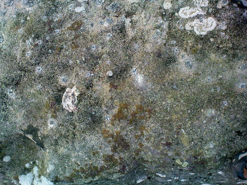
Found in the middle of the Green Crag Slack Plain, this large Haystack-Rock-shaped boulder stands out. It sits amidst a cairn-field with other neolithic remains nearby. The carving itself aint that impressive, and some parts of it seem almost dubious. But both Hedges, Boughey and Vickerman include it in their surveys, describing the cup-marks and curious lines on its northeastern surface. It’s nowt special to be honest. You’d expect a bit more from the size of this old stone; but as those folk who know their rock art well will tell you, size aint everything when it comes the splattering of cups on a rock’s surface. We have four distinct cups pretty close to each other (as the photo shows), with another possible cup-and-ring and accompanying lines nearby.
The stone’s worth looking at though. It stands out amidst the mass of single- and double-tombs scattered across the moorland plain — sitting amidst a veritable necropolis no less.
References:
Boughey, Keith & Vickerman, E.A., Prehistoric Rock Art of the West Riding, West Yorkshire Archaeology Service 2003.
Hedges, John (ed.), The Carved Rocks on Rombald’s Moor, WYMCC: Wakefield 1986.
From Threshfield, go up Skirethorns Lane for about 1/2 mile, where the lane takes a sharp right. Continue uphill for nearly 2 miles to a metal gate. Go through the gate, where you’ll see a pair of curious standing stones ahead of you, but instead walk about 250 yards along the line of the old field wall running to the west. You’ll see on the modern OS-map that a ‘cairn’ is shown: this is where you’re heading!
Archaeology & History
First highlighted on the 1852 OS-map of Bordley and district, this is a lovely site in a beautiful setting, surrounded by a veritable mass of other prehistoric remains at all quarters, including the large settlement of Hammond Close immediately south, the little-known settlement at Kealcup to the west, the Lantern Holes settlement up the hill immediately north, some standing stones due east, and much more. Although it was described in Aubrey Burl’s Four Posters (1988) as just such a type of megalithic relic (a “four-poster stone circle”), an earlier description of the site from the mighty pen of Harry Speight (1892) told of a much more complete ring of stones, with trilithon to boot. He wrote:
“This prehistoric relic consists of a round stone and earthen mound, about 150 feet in circumference and 3 feet high, and was formerly surrounded by a circle of upright stones, only three of which are now left standing. On one side was a large flat stone resting upon two others, and known as the Druid’s Altar. On the adjoining land an ancient iron spear-head was found some years ago, and fragments of rudely-fashioned pottery have also from time to time turned up in the same neighbourhood.”
Edmund Bogg’s (1904) description following his own visit a few years later described this “remains of Druidical sacrifice” as consisting of,
“a mound some four feet high, and fifty yards round the outer rim. In the centre are two upright stones about four feet in length; and others nearly buried in the mound. Numerous stones from this circle have been used in building the adjoining walls.”
Bordley Circle, looking SEBordley Hill, looking south to Pendle Hill
A decade later another writer (Lewis 1914) merely copied what Speight and Bogg had recited previously. And whatever the modern books might tell of its status, I think we can safely assert that this was originally a much more substantial monument than the humble four-poster stone circle that meets our eye nowadays. Our megalithic magus, Aubrey Burl (1988), wrote the following on Bordley’s druidical stones:
“On a circular mound 41ft (12.5m) across and 3ft (1m) high, three stones of local limestone form the corners of a rectangle 11ft 6in (3.5m) square, from which the SW stone is missing. At its corner is ‘a stump, possibly the base of a prostrate stone,’ 5ft 10in (1.8m) long, now lying near the centre. The tallest stone, 3ft 7in (1.1m) high is at the south-east. The sides of the square are close to the cardinal points. Between the SW and SE stones is a scatter of round cairnstones… Characteristically, the 4-Poster stands at the edge of a terrace from which the lands falls steeply to the west.”
Plan of the Druid’s Altar (after Burl, 1988)
The Druid’s Altar seems to have originally been a large prehistoric tomb, perhaps even a chambered cairn. Its situation in the landscape where it holds a circle of many outlying hills to attention, almost in the centre of them all, was evidently of some importance. The only geographical ‘opening’ from here is to the south, where a long open valley widens to capture the grandeur of Pendle Hill, many miles away. This would not have been insignificant.
We must also draw attention to what may be a secondary tumulus of similar size and form to the mound that the Druid’s Altar sits upon only some 25 yards to the west of the “circle”. The shape and form of this second mound is similar to that of our Druid’s Circle — though to date, it seems that no archaeologist has paid attention to this secondary feature. It measures some 21 yards (east-west) x 19 yards (north-south) in diameter and has the appearance of a tumulus or buried cairn. The mound may be of a purely geological nature, but this cannot safely be asserted until the attention of the spade has been brought here.
Druid’s Altar, Bordley (drawing by Neil Wingate, 1976)
Folklore
Although we have nothing directly associated with the circle, the surrounding hills here have long been known as the abode of faerie-folk. Threshfield — in whose parish this circle lies — is renowned for it. There have been accounts of curious light phenomena here too. Modern alignment lore tells the site to be related to the peaked tomb above Seaty Hill, equinox west of here.
References:
Bogg, Edmund, Higher Wharfeland, James Miles: Otley 1904.
Burl, Aubrey, Four Posters: Bronze Age Stone Circles of Western Europe, BAR 195: Oxford 1988.
Feather, S.W. & Manby, T.G., ‘Prehistoric Chambered Tombs of the Pennines,’ in Yorkshire Archaeological Journal, Vol 42, 1970.
Lewis, A.L., ‘Standing Stones and Stone Circles in Yorkshire,’ in Man, no.83, 1914.
Raistrick, Arthur, ‘The Bronze Age in West Yorkshire,’ in Yorkshire Archaeological Journal, Vol 29, 1929.
Speight, Harry, The Craven and Northwest Yorkshire Highlands, Elliott Stock: London 1892.
Wingate, Neil, Grassington and Wharfedale, Grassington 1977.
From Bingley, take the B6429 road up to Harden. After going up the wooded winding road for a few hundred yards, stop where it levels out. Cross onto the right-hand side of the road and walk up the slope a little, veering to your right. You’ll notice a small disused building just off the roadside, in overgrowth, with a pool of water. You need to be about 100 yards up the slope above it!
Archaeology & History
Elm Crag Well, Bell Bank Wood, Bingley
This is a beautiful old place. If you walk straight up to it from the roadside, past the derelict building, you have to struggle through the brambles and prickly slope like we did – but it’s worth it if you like your wells! However, if you try getting here in the summertime, expect to be attacked on all sides by the indigenous flora! The waters here emerge from a low dark cave, in which, a century of three ago, someone placed a large stone trough. When I first came here about 25 years ago, some halfwits had built an ugly red-brick wall into the cave which, thankfully, someone has had the sense to destroy and rip-out.
Shown on the 1852 Ordnance Survey map and highlighted as a ‘spring,’ Harry Speight (1898) gives a brief mention to this site, though refers us to an even earlier literary source when it was first mentioned. In John Richardson’s 18th century survey of the Craven area, he makes reference to an exceedingly rare fern, Trichomanes radicans, which was later included in Bolton’s classic monograph on British ferns of 1785. In it, Bolton wrote that the very first specimen of this plant was “first discovered by Dr. Richardson in a little dark cavern, under a dripping rock, below the spring of Elm Crag Well, in Bell Bank.”
Elm Crag Well
The waters from here come from two sides inside the small cave and no longer run into the lichen-encrusted trough, seemingly just dropping down to Earth and re-emerging halfway down the hillside. But the waters here taste absolutely gorgeous and are very refreshing indeed! And the old elms which gave this old well its name can still be seen, only just hanging on to the rocks above and to the side, with not much time left for the dear things.
References:
Bolton, James, Filices Britannicae: An History of the British Proper Ferns, Thomas Wright 1785.
Speight, Harry, Chronicles and Stories of Old Bingley, Elliott Stock: London 1898.