Ardtalla, Islay, Argyll

Standing Stone:  OS Grid Reference – NR 4657 5456

Also Known as:

  1. Canmore ID 38056

Getting Here

Takes a bitta getting to this one, right at the far end of the road, leading to nowhere – so those of us who like Scotland for its vast expanses of ‘middle o’ nowhere’ should like it! From Port Ellen, travel along the A846 eastwards, all the way to the where it ends in Ardbeg. But the smaller track road continues up the coast. Keep going – and keep going all the way up; past the ‘stone circle’ of Ardilistry, past the standing stone of Trudernish, right to the very end where the track leads you to the farmhouse of Ardtalla. Once here, you’ll see the stone about 20 yards west of the farm.

Archaeology & History

This old stone is only 4-foot-tall, leaning slightly, but—as I recall from many years back—”it’s cute!” (sad aren’t I?!)  All the way up here to see a small monolith!  Even the Royal Commission (1984) lads didn’t have much to say about it, merely:

“This standing stone is situated 18m NW of the SW gable of Ardtalla farmhouse.  Leaning slightly to the SSE, it measures 0.48m by 0.48m at the base and 1.25m in height.”

But if you like walking, the rest of the route up the coast is excellent. Stick yer tent in the small woodland by the fort a mile or two further north, then bring your attention to the legendary Beinn na Cailleach, if the heathen within you stirs…

References:

  1. Royal Commission on the Ancient & Historical Monuments of Scotland, Argyll – volume 5: Islay, Jura, Colonsay and Oronsay, HMSO: Edinburgh 1984.

© Paul Bennett, The Northern Antiquarian


Little Skirtful of Stones, Burley Moor, West Yorkshire

Cairn:  OS Grid Reference – SE 13829 45186

Also Known as:

  1. Little Apronful of Stones

Getting Here

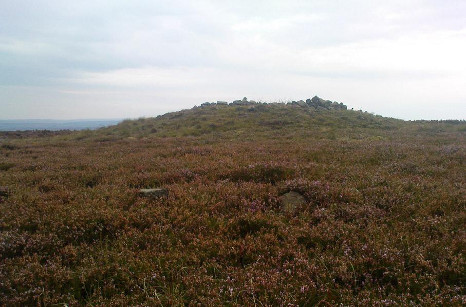
Little Skirtful of Stones, looking north

Probably the easiest way to get here is by starting on the Moor Road above Burley Woodhead, where the road crosses the Rushy Beck stream.  Looking upstream, follow the footpath up the right-hand side of the waters, nearly all the way to the top.  Where it crosses a footpath near where the moor begins to level out, look up to your right and you’ll see the raised crown of stones a coupla hundred yards off path, NNW.  That’s it!

Archaeology & History

This very large Bronze Age cairn was reported by Faull & Moorhouse (1981) to have been surrounded by a multiple stone circle, citing it to have been shown as such on an estate map of Hawksworth Common in 1734. When I contacted the Yorkshire Archaeology Society to enquire about this map, it could not be located. (This needs to be found!) No evidence of such a stone circle presently remains, though there were at least two standing stones once to be seen at the edge of this tomb, though only one of them — now laid more than five-feet long in the heather — is still evident on the western side of this giant tomb.  But anyone who might know anything about the 1734 Estate Map – pleeeeez gerrit copied or take a photo of it! Then stick it on TNA so everyone can see whether the circle surrounded this, or the Great Skirtful of Stones, 500 yards to the south.

Single cup-marked stone on outer edge of Little Skirtful

The Little Skirtful is in better condition than its big brother on the hill to the south and — unlike the Great Skirtful — there are said to be at least five cup-marked stones amidst the great mass or rocks constituting this site.  There could be more.  The carvings are just single cup-markings etched onto small portable stones, typical of sites like this.  They are found near the centre above a small cist and outwardly towards the northern edges of the cairn (for more info about them, see the main entry for the Little Skirtful Carvings).

It’s been said by Stan Beckensall (1999, 2002) that no cup-marked rocks “are known near…the really large cairns” on the moor—meaning the Little Skirtful and her allies—but this isn’t true as there are at least 4 definite carvings (a possible fifth seems likely) on the moorland immediately around the Little Skirtful.  Though to give Beckensall his due, if he got his data from the Ilkley archaeologists, his information isn’t gonna be too accurate, as they’re quite unaware of many sites on these moors!  A good number of local people have a much greater knowledge-base on such matters than those in paid offices, as this and other websites clearly shows.  The times they are a-changin’, as one dood said, not so long ago…!

Folklore

Paul Bowers & Mikki on top for scale!

The creation myth of this place tells that the giant Rombald (who gives his name to the moor) was in trouble with his wife and when he stepped over to Almscliffe Crags from here, his giant wife – who is never named – dropped a small bundle of stones she was carrying in her apron. (In traditional societies elsewhere in the world where this motif is also found, it tends to relate to the site being created by women.) Harry Speight (1900) tells us of a variation of the tale,

“which tradition says was let fall by the aforementioned giant Rumbalds, while hastening to build a bridge over the Wharfe.”

Variations on this story have said it was the devil who made the site, but this is a denigrated christian variant on the earlier, and probably healthier, creation tale. Similar tales are told of the Great Skirtful of Stones, 500 yards south.

References:

  1. Beckensall, Stan, British Prehistoric Rock Art, Tempus: Stroud 1999.
  2. Beckensall, Stan, “British Prehistoric Rock Art in the Landscape,” in G. Nash & C. Chippindale’s European Landscapes of Rock Art, Routledge: London 2002.
  3. Bennett, Paul, The Old Stones of Elmet, Capall Bann: Chieveley 2001.
  4. Boughey, Keith & Vickerman, E.A., Prehistoric Rock Art of the West Riding, WYAA 2003.
  5. Collyer, Robert & Turner, J. Horsfall, Ilkley: Ancient and Modern, William Walker: Otley 1885.
  6. Colls, J.N.M., ‘Letter upon some Early Remains Discovered in Yorkshire,’ in Archaeologia 31, 1846.
  7. Cowling, E.T., Rombald’s Way, William Walker: Otley 1946.
  8. Faull & Moorhouse, West Yorkshire: An Archaeological Survey – volume 3, WYMCC: Wakefield 1981.
  9. Hedges, John (ed.), The Carved Rocks on Rombalds Moor, WYMCC: Wakefield 1986.
  10. Speight, Harry, Upper Wharfedale, Elliott Stock: London 1900.
  11. Wood, Butler, ‘Prehistoric Antiquities of the Bradford District,’ in Bradford Antiquary, volume 2, 1901.

© Paul Bennett, The Northern Antiquarian

Cock Hill, Wadsworth Moor, West Yorkshire

Cist:  OS Grid Reference – SE 009 275

Also Known as:

  1. Mount Skip tomb

Getting Here

OK – OK – stop laughing at the title!  If you wanna check the hill out for yourselves, get to Hebden Bridge, then go up the long and very steep Birchcliffe Road.  Keep going all the way to the very top (a couple of miles uphill).  When you reach here, the building in front of you was the Mount Skip pub.  From here, walk up over the golf course and you’ll hit the disused quarries on the moor edge.

Archaeology & History

The grid reference given above is an approximation.  The tomb (long gone) was within 100 yards of the coordinate.  But don’t let that put you off having a good bimble around the moors here, cos there are several sites to see.

This long-lost burial was located in May, 1897, when quarrying operations were being undertaken behind the Mount Skip Inn, on the edge of Wadsworth Moor.  Ling Roth (1906) told that

“the first indications were the rolling down of pieces of urns which the delvers called flower pots.  Then in digging a hole to fix the leg of a crane, human bones were discovered.”

Geoffrey Watson (1952) later echoing Mr Roth’s comments wrote that,

“a grave containing a skeleton was discovered at a quarry about Mount Skip Inn.  The grave was about 6ft long, 14-18 in wide, and about 2ft deep.  The bones, which were exceedingly brittle, crumbled on handling.  Within the grave, and mainly at the ends, there appeared to be about 6 in of mixed charred wood and bones.  The larger portion of a small earthenware vessel was picked up and retained by one of the quarrymen.”

According to Mr Roth, the “earthware vessel picked up…by one of the quarrymen” was “picked up by a man named Thomas Greenwood, of Shawcroft Hill.”   What became of it, I do not know! If anyone knows, please let us know!

The description telling that “the grave was about 6ft long, 14-18 in wide, and about 2ft deep,” implies it to have been a stone cist – although this is quite long.  The nearest of any similar form would be the giant cairns at Low Bradley, 12½ miles (20km) to the north  This may have been the last remnants of a giant cairn (its landscape position would allow for this).

References:

  1. Roth, H. Ling, The Yorkshire Coiners…and Notes on Old and Prehistoric Haifax, F. King: Halifax 1906.
  2. Watson, Geoffrey G., Early Man in the Halifax District, Halifax Scientific Society 1952.

© Paul Bennett, The Northern Antiquarian


Castle Hill, Upper Cumberworth, West Yorkshire

Settlement:  OS Grid Reference – SE 2042 0697

Getting Here

Morehouse’s 1861 plan

Taking the A629 road between Shepley and Ingbirchworth, as you hit the staggered crossroads at High Flatts, take the west turn up the slightly sloping straight road of Windmill Lane.  Just where the road ‘kinks’ at a small bend, stop and look into the field on your left.

Archaeology & History

Deemed by some as a hillfort, and others as settlement remains, what little are left of the remaining earthworks here were first described by local historian Henry Morehouse in 1861.  Found about a mile west of Upper Denby, the site was described in the Victoria County History as being “on a commanding though not exactly a defensive situation on the slope of a hill.” This remark coming from the belief (and that’s all it is) that this was an Iron Age castle site.  In 1924 James Petch said of it,

“The earthwork seems originally to have been almost square, and two sides and an angle remain. The external ditch is from ten to twelve feet broad in its present state.”

While Faull & Moorhouse (1981) tell of there being “evidence for Neolithic activity” here, modern surveyors reckon it as an old prehistoric settlement — which makes sense; though little of the site remains to be seen today.

References:

  1. Faull, M.L. & Moorhouse, S.A., West Yorkshire: An Archaeological Survey, I, WYMCC: Wakefield 1981.
  2. Morehouse, Henry James, History and Antiquities of the Parish of Kirkburton and the Graveship of Holme, Roebuck: Huddersfield 1861.
  3. Petch, James A., Early Man in the District of Huddersfield, Huddersfield 1924.

© Paul Bennett, The Northern Antiquarian

Stinking Stone, Steeton, West Yorkshire

Standing Stone:  OS Grid Reference – SE 01814 42411

Getting Here

Stinking Stone on 1853 map

One of two ways to get here really.  The easiest is from Sutton-in-Craven: go through the village and up the steep hill (don’t take the right turn as you start up the hill).  Go all the way up until the hill starts to level out and on the left-side of the road you’ll notice a boundary stone stood upright (this is the Sutton Stoop).  Stop here.  Of the 2 gates, climb over the top-most one and walk down the path into the adjacent field, heading over to the gap a couple of hundred yards away where the gate to another field is.  That’s it!

Archaeology & History

Stinking Stone, Steeton

Now here’s a weird one.  With a name like this you’d expect there to be plenty of info or historical comments.  But despite all the books and journals in my huge library, aswell as visiting town libraries and exploring the resources on-line, there’s nowt written about this ‘ere spot.  Not a jot!  Even the usually satisfactory place-name fellas have a thing-or-two to say about sites with names such as this—but even their old tomes are closed-lipped.  Hmmmmm…..

I visited the place several times to try ascertain what this site was, thinking — perhaps — that it was an old boundary stone whose name had been convoluted from some older, more obvious title.*  The nearby Sutton Stoop boundary stone, right by the roadside, seemed a good indicator to such an assumption, as it was a recognised boundary marker with written history and a meeting point along the local perambulation.  But the curiously-named Stinking Stone was neither on the same line, nor ever had been according to old records, and couldn’t be located either.  There had been obvious quarrying and other industrial destruction along the hilltop where the old stone was marked and it seemed logical to assume that it had been destroyed in bygone years by that usual breed of capitalist industrial halfwits.  Until a psilocybin venture one afternoon, last season…

Twas a lovely sunny day, though windy on the tops as usual.  I was out with a couple of neophytes showing them Psilocybes and various other species, chewing them here and there and talking the way of healthy usage.  We passed by an old well, long forgotten, before heading onto Stinking Stone Hill.  Bimbling somewhat, and ruminating about the moss of colour, we decided to sit by the walling in-field and dream for a short while.  As we hit the old gate the Stinking Stone came up right before us.  Literally!

There in the old walling, blunt as you like, stood this four-and-a-half-foot tall standing stone, smoothed on one side by a short aeon of weathering, upright and proud as if it had been stood there for centuries, awaiting attention!  I exclaimed a few triumphant expletives; rubbed myself here and there over the old thing, then sat for a while behind the wind with the old upright, solidly embedded in old earth — then awaited the dream…

Twas a good day…

And then I returned home and later sought what I could on a possible etymology.  Around the hilltop a hundred yards away were small depressions and the faded remains of industrial workings, like I said; and with this in mind the awesome Mr Wright (1905) told us about the existence of ‘Stinking coals’, “an inferior kind of coal” no less.  Referring us to a work from 1818, we’re told,

“The Stinking-coal is noted for containing a great proportion of sulphuret of iron, thick seams or layers of these pyrites running in it.  In consequence of this it cannot be used for smelting purposes.”

Another account from 1868 telling us that:

“On opening the body, it contains a strong sulphureous smell, characteristic of the disease; hence it is called the stinking ill; and the stomach and bowels are prodigiously distended with air, having the same intolerable foetor.”

Worn metal scratch-marks caused when dragged here
Worn metal scratches, made when dragged here?

This old worn gatepost however, perhaps has a history that only goes back a few centuries.  It has been cleaved in half, as you’ll see if you visit it; but its western face is old and worn and it’s been embedded in the ground for a long time.  On its northern face are the curious etchings of carvings, which are more akin to wounds from some past offence (perhaps when it was split in half), cleaved by metal toolings and dragged by farmers to be fixed in into present spot.  It’s history may not be truly ancient.  Twouldst be good to know for sure though…

References:

  1. Wright, Joseph, The English Dialect Dictionary – volume 5, Henry Frowde: Oxford 1905.

* ‘Stinking’, stone-king or King Stone?  Unlikely though…

© Paul Bennett, The Northern Antiquarian 

Mini-Skirtful of Stones, Ilkley Moor, West Yorkshire

Cairn:  OS Grid Reference – SE 1346 4606

Getting Here

Follow directions to get to the Pancake Stone.  From here walk SE on the footpath that runs on the edge of the moor.  After about 200 yards you’ll hit a small footpath which heads into the moor (south).  Walk on here for about 200 yards and notice the small rise in the land to your right (if you cross the small stream where the land dips into a very small valley, you’ve gone past).  That’s it!  The Little Haystack Rock is less than 100 yards away down the slope from here.

Mini-Skirtful of Stones, looking north

Archaeology & History

Of approximately eighty prehistoric cairns that have been alleged to exist along the Green Crag Slack ridge on Ilkley Moor, this site in particular is worthy of note, due mainly to its size. As independent archaeological researcher Paul Bowers said of it when he first saw this cairn-spoil, “it seemed too big to have not been discovered in the past.”  Too right!

Mini-Skirtful, looking west

When we tracked across Green Crag Plain a few days ago, it was Michala Potts that called our attention to it.  Half-covered in full heather growth, only the eastern edge was exposed.  At first it seemed that it was loose prehistoric walling, but then I realised it was on the edge of small knoll and the stone work was deeper and wider than walling.  As we explored through the heather atop of the knoll, it was obvious that there was a more extensive gathering of stones scattered all over the top of this small rise, and it seemed that we were looking at the remains of a reasonable sized cairn. Its extent carries about ten yards down the slope from the small hillock, but only a few yards either side of it.  It seems likely that the extended loose stones have, over the centuries, simply slipped further down the slope.  However, not until a decent excavation occurs will we know anything certain.  It is possibile that this is simply the scattered remains of damaged neolithic or Bronze Age walling, but only a more detailed exploration of the site will tell us for sure.

Cowling (1946) mentioned the numerous cairns and scattered walling reaching across this part of Ilkley Moor, but gave no specific information relating to this mini-skirt full of stones! (blame Mikki for the title!)

References:

  1. Cowling, E.T., Rombald’s Way, William Walker: Otley 1946.

© Paul Bennett, The Northern Antiquarian

Eastwoods Cross Base, Summerbridge, North Yorkshire

Cross & Cup-Marked Stone:  OS Grid Reference – SE 18506 62013

Also Known as:

  1. Carving no.637 (Boughey & Vickerman)

Getting Here

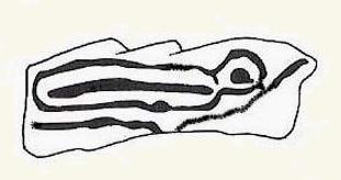
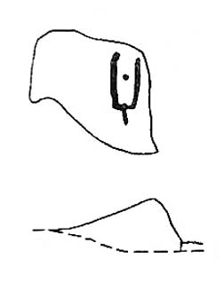
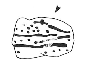
Drawing of CR 637 (after Boughey & Vickerman)

The same directions as for the Eastwoods Farm Cup: from Summerbridge, go west on the B6541 towards Dacre Banks, where there’s the signpost for the Nidderdale Way footpath.  Follow this past the disused quarry and into the meadows.  When you hit the Monk Ing road, bear right (north) and keep going till you’re 100 yards from Eastwoods Farm.  Go right, down into the field for about 30 yards or so.  Look around!

Archaeology & History

Described in Boughey & Vickerman’s (2003) survey as a “low, medium-sized, quadrant-shaped rock standing up from surroundings, with hollowed out central area.”  This hollowed-out central area is, in all likelihood, the remains of a previously unrecognized old cross-base, although investigating archaeologists have somehow missed this.  The stone’s proximity to the old Monk’s Way — a medieval trade route used by the local monastic Order — would give added weight to this assertion.  A perusal of field-name records here may prove fruitful.

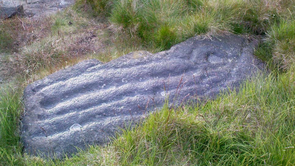
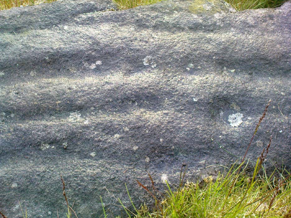
Eastwoods Farm Cross-base & Cup-Marks (courtesy Richard Stroud)
Eastwoods Farm Cross-base & Cup-Marks (© Richard Stroud)

Our authors counted “eight possible small, badly worn cups, (with) three grooves running from central basin, all possibly natural.” The grooves may well be natural, but I’d say that one or two of the cups appear to be genuine.  The large hollow in the middle of the stone may originally have been a cup-marking (or maybe even a cup-and-ring — but we’ll never know), before it became used as a site to erect a primitive cross.

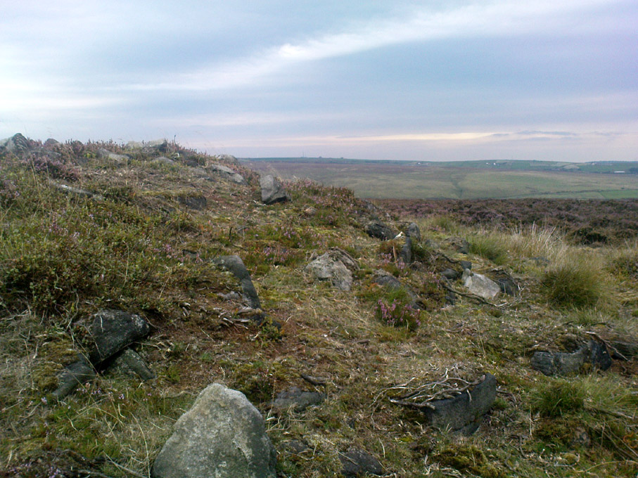
Several other cup-and-ring carvings can be found around here — the Eastwoods Farm Cup is in the same field nearby— with the great likelihood of there being others hidden amidst trees or grasses, waiting to be re-awakened!  The hugely impressive Morphing Stone and a prehistoric lightning-carving can be found in the next field, full of rocks, on the other side of the stream.

References:

  1. Boughey, Keith & Vickerman, E.A., Prehistoric Rock Art of the West Riding, West Yorkshire Archaeology Service 2003.

© Paul Bennett, The Northern Antiquarian

Eastwoods Farm Cup, Heyshaw, North Yorkshire

Cup-Marked Stone:  OS Grid Reference – SE 1852 6201

Also Known as:

  1. IAG637a (Boughey)

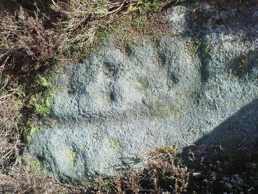
Single cup-marked stone in the field below Eastwoods Farm

Getting Here

From the large village of Summerbridge, go west along the B6541 towards Dacre Banks, where you’ll see the signpost for the Nidderdale Way footpath.  Follow this past the disused quarry and onto the meadows.  When you hit the Monk Ing road, bear right (north) and keep going till you’re 100 yards from Eastwoods Farm.  Go right, down into the fields for 50 yards or so.  Look around!

Archaeology & History

A previously unlisted single cup-marked stone which is likely to become overgrown by the grasses pretty soon.  Several other carvings are in close attendance in this field.  It’s not far from the cup-marked Eastwoods Cross Base (aka CR 637) in the same field, but a little further down.  In all probability there are other carvings yet to be found in this area.  The rock art student Keith Boughey (2007) mentioned it briefly in an article on the other carvings nearby, saying simply:

“A small area of rock (very possibly bedrock) measuring 40cm x 14cm at its greatest extent pokes up through the turf, showing one worn but clear cup-mark on its western edge (Fig 3). On its own, this marking would not be significant were it not for the fact that four other carved rocks are already recorded from this particular locality.”

The hugely impressive Morphing Stone and a prehistoric lightning-carving can be found in the next field, full of rocks, on the other side of the stream.

(NB: In a more recent visit to the site (August 2011), the carving had all but disappeared beneath ever-growing Earth.)

References:

  1. Boughey, K., “Prehistoric Rock Art: Four New Discoveries in Nidderdale,” in Prehistoric Research Section Bulletin, no.44, Yorkshire Archaeological Society 2007.

© Paul Bennett, The Northern Antiquarian

Cat Heaps, Swanston, Edinburgh, Midlothian

Cairns (destroyed):  OS Grid Reference – NT 2447 6828

Archaeology & History

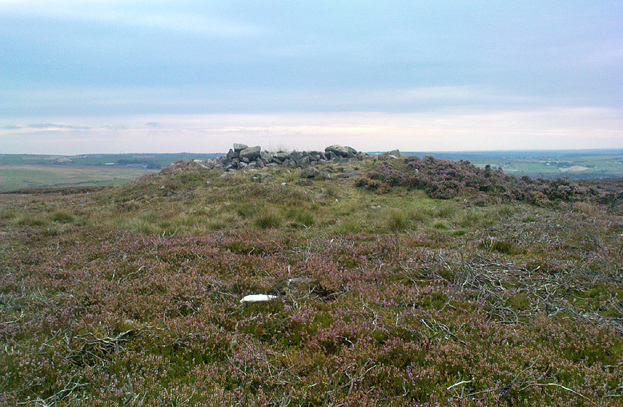
Not far from the giant cup-marked Caiy Stone, there used to be two very large prehistoric cairns, which local historian Daviid Shankie told us “were foolishly broken up by some sacriligious hand and used for road metal”!  Not good…  Remains of human bones and several fragments of old weapons were found in them.  Fred Coles (1903) told us that:

“In the neighbourhood of this [i.e. Morton Hall], but further southwest, on the grounds of Comiston, were found, in forming the public road, under large heaps of stones, various sepulchral stone enclosures, in which were deposited urns with dead men’s ashes, and divers warlike weapons.” And again, when speaking of the levelling of a part of the ground close to the old (so-called Roman) road, by Sir John Clerk of Pennycuick, the same writer adds, there ” were discovered several stone coffins with human bones.”

Folklore

According to Shankie (1902), these two great cairns were built upon lands previously known as the Templelands of Swanston and commemorated a great battle that was fought “between the ancient Picts and Scots.”

References:

  1. Coles, Fred, ‘Notice of…Cairns and Standing Stones in Midlothian and Fife,’ in PSAS 37, 1903.
  2. Harris, Stuart, The Place-Names of Edinburgh, Gordon Wright: Edinburgh 1996.
  3. Royal Commission for the Ancient & Historical Monuments of Scotland, Midlothian and West Lothian, HMSO: Edinburgh 1929.
  4. Shankie, David, The Parish of Colinton, John Wilson: Edinburgh 1902.

© Paul Bennett, The Northern Antiquarian

Three Cups Stone, Ilkley Moor, West Yorkshire

Cup-Marked Stone:  OS Grid Reference – SE 12998 46314

Also Known as:

  1. Carving no.138 (Hedges)
  2. Carving no.298 (Boughey & Vickerman)

Getting Here

Dead easy!  Follow the directions to the unmissable Haystack Rock, then look at the small upright stone about 40 yards west, just off the footpath.

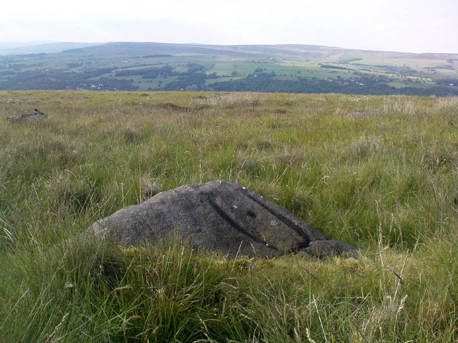
The Three Cup Stone

Archaeology & History

This is another one of the many carvings I first saw when I was a small lad, about 12 years old, in one of my countless walkabouts over these moors.  It’s thought by some to be a small cup-marked standing stone (it’s possible I s’ppose, but improbable); whether that’s the case or not, it certainly has three distinct cup-markings on its east-facing vertical face.  There are also what appears to be lines cutting through the cups and running out to near the edge of the stone which may or may not be natural.  A small, cute little thing!  Boughey and Vickerman (2003) make a note that this carving may be recent — but if so, it was done some considerable time before 1975, when I first clapped eyes on it!

References:

  1. Boughey, Keith & Vickerman, E.A., Prehistoric Rock art of the West Riding, WYAS: Wakefield 2003.
  2. Hedges, John, The Carved Rocks on Rombalds Moor, WYMCC: Wakefield 1986.

© Paul Bennett, The Northern Antiquarian