The isle of Boreray is four miles northeast of Hirta and here once lived, according to legend, a christian hermit. However in the reverend Kenneth Macaulay History of St. Kilda (1764), he told us that the character was actually a druid. Take your pick! The druid lived at Stallir House, adjacent to which, said Macaulay, was
“a large circle of huge stones fixed perpendicularly in the ground, at equal distances from one and other, with one more remarkable regular in the centre which is flat in the top and one would think sacred in a more eminent degree.”
In a later article by F.L.W. Thomas (1867) he also mentioned this ‘stone circle’, though indicated its decline. Additional information on this little known stone is sparse due to its somewhat remote position on one of the uninhabited isles of St. Kilda. I wouldn’t mind spending a month or two there, roughing it, to see what’s what!
References:
Macaulay, Kenneth, The History of St. Kilda. Containing a Description of This Remarkable Island; the Manners and Customs of the Inhabitants; the Religious and Pagan Antiquities There Found, T. Becket: London 1764.
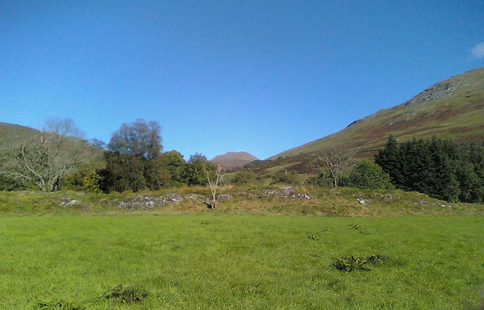
From the north side of Killin, take the minor road next to the Bridge of Lochay Hotel at Killin, past the hydroelectric station, through the wooded section until the fields open out again. The first gorgeous old house you come to is on the right-hand side of the road. Stop here! (I could really do with living here misself – tis a truly superb place!) You can ask the lady at the house where the carvings are and she’s very happy to point them out – they’re on the rocky crag near the bottom-end of the field on the other side of the road.
Archaeology & History
R.W.B. Morris sketch of the main carvings
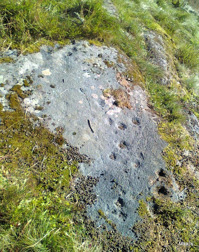
What a brilliant setting and clump of carvings we have here! As you get to the rocky hillock in the field, you see that there are numerous rocks visible along the ridge, a number of which have carvings on them – some with just cups, but most possess a number of cup-and-rings. It’s an excellent spot! Depending on the time of year when you come here will determine whether or not you get a better look at the carvings or not. I’d recommended April and May as the best time, as the vegetation is at its lowest then. Visiting the site near the end of summer doesn’t give you as good a view — but even then, if you like your rock art, you’ll still love it! The rocks here are mainly quartzite schist, with a number of the surfaces being almost pure quartz. Intriguingly, none of the pure quartz sections appear to have been carved on.
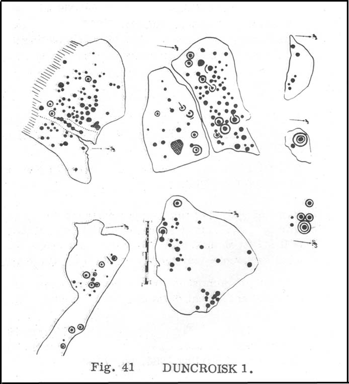
The carvings here were first mentioned in an article by D. Haggart (1895), who described them as “a very remarkable set of incised rock sculptures…discovered lately in this neighbourhood by Mr John McNaughton.” And remarkable they are indeed! In Ronald Morris’ (1981) survey of this site — which he labelled Duncroisk 1 — he counted eight separate rock surfaces that had been carved, marking them as carvings a-h, but there are at least eleven of them here; and in all honesty, if we could strip the surface of the hill of its vegetation, we’d probably find a few more hidden away!
Cup-marked stone
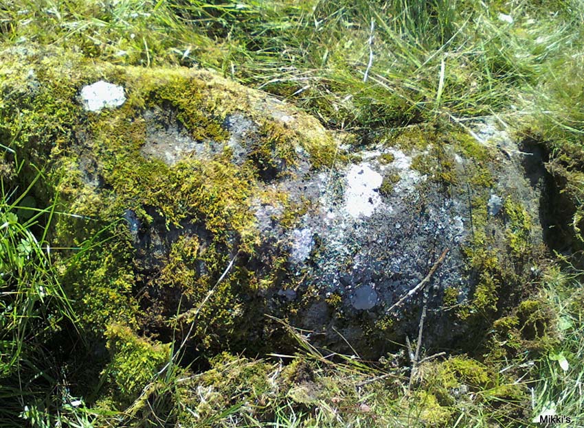
As you’ve walked across the field from the road, past the first unrecorded cup-marked stone near the start of the rocky rise, we reach Mr Morris’s ‘stone A’ near the easternmost end of the ridge, which is just a small slab of stone with “at least 6 cup-marks” on its surface. It’s easily missed in poor light, so watch out. However, if you reach ‘stone b’ (described below), just walk back ten steps and you’ll see it.
Carved Stone B
Ten yards west is ‘Stone B’, seemingly split into two sections, whereupon we find “a cup-and-two-rings and at least 12 cups-and-one-ring, up to 19cm in diameter – some rings gapped, others not, some with and some without a radial groove from the cup, and some with a “runner” or cup in a ring. There are also at least 58 cups” on this section of rock. ‘Stone C’ can also be missed, this time due to its size and the fact that the larger cup-marked surfaces are ahead of you. But assuming you don’t miss it, this carving consists of “a well-preserved cup-and-two-complete-rings 25cm in diameter, and a cup.”
Carved Stone D
‘Stone D’ is just next to ‘stone C’, but with rather more ornate designs etched upon it. This is one of the more archetypal petroglyph designs that are found in the photo-guides and textbooks. Morris (1981) told that it consisted “of a cup-and-two-complete-rings and 2 cups-and-one-complete-ring up to 20cm in diameter, also a cup-and-one-complete-ring and 2 cups.” The photo here shows it pretty clearly.
Carved Stone ECurious ‘bowl’, top-centre
‘Stone E’ is the next one along, just a foot or two away and Mr Morris (1981) told that the carving consists of “2 cups-and-one-ring up to 13cm in diameters, 1 complete, the others gapped, joined by groove to a cup, and at least 33 cups (C.G. Cash counted 42 in 1911).” Most of the carved elements on this rock are around the edges of the stone. A very large faded circular depression, man-made, is also visible on this section of the petroglyph (above left), suggestive of lunar symbolism.
Carved Stone F
‘Stone F’ is less than 10 yards further west and has the greatest number of cup-markings of the entire group here, as Morris described: “3 cups-and-one-complete-ring up to 9cm in diameter, and at least 80 cups, a few of which are widely scattered over a big area sloping steeply further south, beyond the attached diagram.” It’s perhaps the most notable of the carved rocks along the ridge here — not by virtue of its design, more its geological physique than anything else.
Carved stone G
‘Stone G’ is next along and has a curious look about it, suggestive of more modern times. At first sight it doesn’t seem to have quite the magnitude that Morris’ description affords it, but on closer inspection by rolling some of the covering turf back away from the rock, you can see what he meant. This stone has “10 cups-and-one-complete-ring, up to 10cm diameter…and also 15 cups.” One of the cup-and-rings on this section was found by Morris to have been “the smallest so far recorded by the author in Scotland.”
Then we reach ‘stone H’ at the eastern end of the carved ridge, consisting of simply 3 cup-markings. One of them has a faint arc pecked around it. Further along the rock, a complete cup-and-ring is visible close to the edge.
This entire line of petroglyphs is a fine place in a fine setting, perfect for meditative practices! Other carvings can be found close by: Duncroisk 3 is a coupla hundred yards east across the field just over the fence by the riverside; and Duncroisk 2 is on the other side of the fence down towards the River Lochay on the same side of the adjacent burn less than 100 yards away (though this is trickier to reach). Other prehistoric sites can be found not too far away…
Folklore
Local people tell of having seen curious lights flitting along the edges of the field, river Lochay and roadside close to the carved rocks hereby.
A huge linear monument that could once be found on the flats just north of the B6271 road running between the villages of Scorton and Brompton-on-Swale, east of the ancient A1 road, has long since been ruined. Although found quite a few miles north of the main Thornborough henge and cursus complex, a number of students still posit that this northern monument was part of the same “ritual landscape” arena.
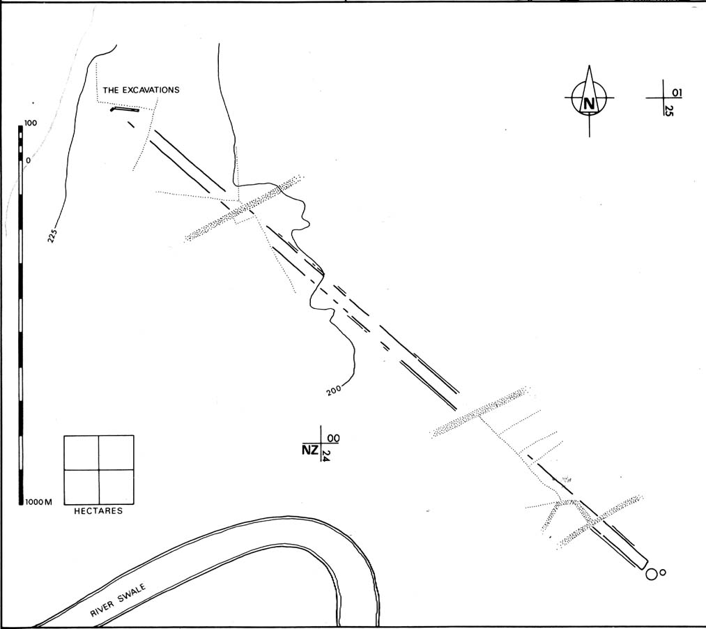
Plan of the cursus (after P.Topping, YAJ 1982)
First discovered in 1949 following aerial survey analysis by Prof. J.K. St. Joseph, this huge dead straight cursus monument ran for at least 1.3 miles (2.1km) and would have been considerably longer if the self-righteous advance of industry hadn’t quarried it away (such is “progress”!). Built along a southeast to northwest axis, the southern end of the cursus was straight and flattened (as opposed to convex, as found at some cursuses), as Peter Topping’s (1982) illustration of the monument here shows, but the northwestern end of the cursus has not been found. As Mr Topping himself wrote:
“The southwestern terminal, which shows clearly on the aerial photographs, consists of a straight transverse ditch which joins the two main ditches at right angles. Clustering around it was a series of ring-ditch cropmarks. The aerial photographs also show a series of bleach marks between the ditches at the southern end of the cursus, which may represent a series of contiguous mounds. This area of the cursus also features what appears to be smaller outer ditches…”
Topping also commented on a most “noteworthy feature” in the accuracy of the ditches that constitute the length of the monument, being so “remarkably straight considering the distance over which they extend.” Features which, in bygone days, a number of respected archaeologists denied our prehistoric ancestors the ability to execute.
Hopefully readers will forgive me citing more of Topping’s extensive notes regarding the archaeological analysis of this site, but I think they’re worthwhile. Of the ditches that make up the outline of the cursus, he told:
“The ditches of the cursus are the two most prominent features of this site on the aerial photographs. …The only evidence available for the existence of the cursus in the area to be excavated was a section exposed in the adjacent gravel quarry. This section clearly illustrated quite distinct re-cut features visible in the profiles of both ditches, and evidence of this recutting was also discovered in the excavated areas. However, one anomaly which did distinguish the excavated sections from those exposed in the quarry was the variable depth of the ditches. In the quarry-face sections the western ditch had a maximum depth of 60cms, while in the excavated area its maximum depth was 45cm; similarly, the eastern ditch had a maximum depth of 65cm in the quarry and a maximum depth of 43 cm in the excavations. This may have resulted from the actions of hillwash or ploughing reducing the height of the old land surface in this area where the ground naturally rises, or alternatively indicate no more than an uneven depth to the ditches. Their width was fairly consistent, the maximum width of the eastern ditch being 3.40m, while that of the western ditch was 3.85m.
“Recutting in both ditches was indicated by a V-shaped notch beneath the main profile of the ditch…
“Closely datable artifacts were sadly lacking in the ditches, the one possible exception being (a) flint…possibly an arrowhead, from the upper fill of the eastern ditch… The upper fill of the eastern ditch also produced (a) flint…”
But in all honesty, these flint finds were probably of little importance to the cursus itself and can be discounted as of any relevance outside of being stray hunting flints. Three other flints were discovered by the western ditch aswell, again with little significance to the monument. But the next part of the excavation work explored what Topping called the ‘Central Feature’, of which he said:
“Bleach marks on Prof. St. Joseph’s aerial photographs revealed what appeared to be a series of axially-placed contiguous mounds situated between the main ditches, and extending the whole length of the long axis of the monument as then known. The presence of this feature was confirmed in the excavated area. A low central mound was uncovered, within and respecting the lines of the ditches, which had a maximum height of 32cm above the old ground surface.”
Upon further excavation they found what one would have expected: little more than the upcast of earth and gravel dug out from the ditch that makes up the cursus, i.e., spoil-heaps made where they’d dug out the cursus lines with little other significance. This feature is obviously apparent in many cursuses. Of greater interest was the pit- or post-hole on the eastern ditch.
“This was stratigraphically related to the cursus to the extent that it was sealed by the same layer of hill-wash that had buried the cursus ditches. In addition, this feature clearly respected the limits of the eastern ditch. The dimensions of the pit/post-hole were: maximum diameter at its base, 1.12m, the maximum width at its top, 2.10m, length, 4.19m, and a maximum depth of 60cm.
“…Distinct tip-lines were evident leading in and downwards towards the centre of the feature, this central area being relatively stone-free. This could suggest that the feature originally held a post which was subsequently removed at a later date.”
I’d say this notion is highly likely! In the event that a complete excavation could have been made here, it’s probable they would have found other pit-holes into which upright wooden posts were erected around the time the cursus was constructed. When Topping and his team excavated sections of the eastern ditch-floor, they found what appeared to be the truncated base of another post-hole. He told:
“This feature was sectioned and found to be flat-bottomed and to have a depth of only 3cm and a diameter of 25cm. The fill was indistinguishable from the fill of the cursus ditch and contained no traces of organic material…although the exact function of this feature is unknown.”
Topping’s conclusion about the nature and function of this monument is a simple one:
“it can be seen as part of a concentration or complex of magico-religious structures.”
And although this is a somewhat tentative notion based on the limited archaeological evidence here, it does accord with standard views in comparative religion on the animistic relation humans had with natural and man-made monuments from this and later periods of history; as well as reflecting the findings on the origin and development of human consciousness in Jungian and other applied psychology schools. The construction of this gigantic landscape feature occurred at a period in human history when the division between the sacred and the profane had yet to emerge culturally. In all likelihood, Mr Topping’s notion is correct.
In days of olde this once proud tomb stood upright on the slopes below the more prominent Cliviger Laithe tumulus above. But, like many of the ancient ancestral tombs of this region, its days seem long gone. Although we’ve found what may be some traces of the outline of the cairn (further analysis required!), when the legendary Lancashire historian Thomas Dunham Whitaker (1872) wrote about the place, he was already writing about it in the past tense. He said briefly, that “this heap of stones was removed as materials for building a turnpike road” in 1763. The archaeologist Bernard Barnes (1982) told us that “a cist with an inhumation was found. In 1766 another tumulus was removed and an urn found. An axe-hammer is said to have been associated” here. The most lengthy description of this site can be found in Mr Booth’s (1899) short work where, in his summary of various prehistoric sites in this region, he told that,
“The first find recorded in this locality took place at Law House, near Mereclough, in the year 1763, when a mound was opened which covered a kistvaen, or stone cist, which, upon being opened, was found to contain a human skeleton. The information concerning this ancient burial is very meagre, and we have no information as to who were the discoverers of the mound. It may be noted that nearly 70 years before (in 1695) a number of Roman coins were found close to this barrow. The mound also contained a rude earthware vase filled with calcined bones.”
It’s unlikely that the earthworks by the walling hereby represent the denuded remnants of the monument in question, although the rise in the field here may be some remnant of the place, but without further excavation we might never know for sure. However, the recent discovery of what may be remnants of the cairn in an adjacent field requires further analysis. WATCH THIS SPACE – as they say!
References:
Barnes, B., Man and the Changing Landscape, University of Liverpool 1982.
Bennett, Walter, History of Burnley, volume 1, Burnley 1946.
Booth, Thomas, Ancient Grave Mounds on the Slopes of the Pennine Range, R. Chambers: Todmorden 1899.
Whitaker, T.D., History of the Original Parish of Whalley, London 1872.
Tumulus (destroyed): OS Grid Reference – SE 0095 2748
Archaeology & History
Up behind the old pub that was The Mount Skip, high on the ridge above Hebden Bridge and Mytholmroyd, overlooking the Calder Valley for many miles, was once — it would seem — a number of fine prehistoric remains, long since destroyed by the industrial advance of quarrying and such likes. Amidst what seems to have been settlement remains and, perhaps, timber circles, an ancient grave was also known here. In Mr Ling Roth’s (1906) essay on the prehistoric remains of the Halifax region, he wrote:
“In May, 1897, a grave was discovered at a quarry above Mount Skip Inn. The first indications were the rolling down of pieces of urns which the delvers called flower pots. Then in digging into a hole to fix the leg of a crane, human bones were discovered, Mr Crossley Ainsworth told me: “The grave was about 6ft (1.8m) long, from 14 to 18in (35-45.7cm) wide and about 2ft (61cm) deep…the head and feet were almost exactly north and south, with the face right towards the midday sun.” The bones were very brittle and crumbled easily in the hand. There was a lot of charcoal in the grave. In the ends of the grave which were undisturbed, “there appeared to be about 6in (15cm) thick of charred wood and bones mixed together at the bottom. Flints were also found. Also the larger half of a small earthenware vessel which had rolled down into the quarry ; this was picked up by a man named Thos. Greenwood, of Shawcroft Hill.”
The site was mentioned again nearly fifty years later in Geoffrey Watson’s (1952) survey, but with no additional details.
References:
Roth, H. Ling, The Yorkshire Coiners 1767-183; and Notes on Old and Prehistoric Halifax, F. King and Son: Halifax 1906.
Watson, Geoffrey G., Early Man in the Halifax District, Halifax Scientific Society 1952.
This little known site, long since destroyed during the construction of Keighley Railway Station, was found in a curious spot, close to the bottom of the Aire Valley. Most (known) prehistoric burials occur on the higher grounds in this area. And though we don’t appear to have the exact location of the find, it was pretty close to either side of Keighley’s old railway station (which is shown as 100 yards to the other side of the road of the present station on the 1852 OS map). This may position the site as being on the grounds opposite and below St. Anne’s Church; otherwise it was getting closer to where the River Worth runs by. In Keighley & Holmes’ early (1858) work they told that,
“Whilst excavating for the Railway within about a hundred yards of the Keighley station, one of the labourers discovered three urns containing a quantity of human bones. Two of them were unluckily broken, one being large enough to hold eight or nine quarts. The one brought away whole, and seen by the present writer, may hold about a quart; it is somewhat distastefully designed, moulded by hand out of the common clay, without glaze, and rudely ornamented on the outside by some sharp implement. The once animated contents of each urn were covered by a square flat stone.”
This final remark seems to indicate the urns were located in a cist (a small stone grave), but we don’t know whether this was found within the remains of a denuded tumulus or stone cairn. However, considering the lack of any remarks about a large pile of stones (which would have been very noticeable) covering this burial site, it would seem more probable that this site was originally an earth-covered tumulus, whose visibility and knowledge had long since diminished in this part of Airedale.
References:
Keighley, William & Homes, Robert, Keighley, Past and Present, R. Aked: Keighley 1858.
From the village of Midgley, high above the A646 Halifax-to-Todmorden road, travel west along the moorland road until you reach the sharp-ish bend in the road, with steep wooded waterfall to your left and the track up to the disused quarry of Foster Clough. Go up the Foster Clough track for 100 yards and, when you reach the gate in front of you, go over it but follow the line of the straight walling uphill by the stream-side (instead of following the path up the quarries) all the way to the top. Here you’ll see the boundary stone of Churn Milk Joan.
Archaeology & History
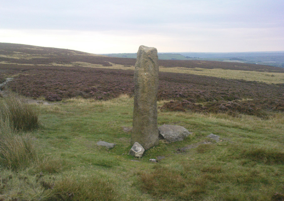
The present large standing stone you see before you isn’t prehistoric. However, the small broken piece on the ground by its side may have been its prehistoric predecessor; and there is certainly something of an archaic nature here — albeit a contentious one — as we find old cup-markings cut into its eastern face.
Two ‘cup-marks’ on eastern face
The upright is roughly squared and faces the cardinal points. It was described in Mr Heginbottom’s (1977) unpublished survey on Calderdale rock art, where he described there being a few cup-markings inscribed on its east- and south-facing edges, some of which may be prehistoric — though they would obviously have had to have been carved upon the upright stone when it still lay earth-fast. However, we must posit the the notion (unless some of you have better ideas) that the tradition of etching cup-marks onto rocks was still occurring in this part of Yorkshire until the late Middle Ages, as this stone was, as we know from boundary records, only placed upright to mark the meeting of the three boundaries of Wadsworth, Hebden Royd and Sowerby.
Churn Milk Joan’s other name, Saville’s Low, originates from the great Saville family who owned great tracts of land across the region in the fourteenth century, possibly when the Churn Milk Joan we see today was created. The word “lowe” may derive from the old word meaning, “moot or gathering place,” which this great stone probably served as due to its siting at the junction of the three townships.*
Folklore
In modern times the stone has become a focus for a number of local pagans and New Agers who visit and ‘use’ the site in their respective ways at certain times of the day, albeit estranged (ego-bound) from the original mythic nature of the site.
The name of the stone comes from an old legend about a milk-maid named Joan who, whilst carrying milk across the moors between Luddenden and Pecket Well, got caught in a blizzard and froze to death. When her body was found many days later, the stone we see here today was erected to commemorate the spot where she died. Although such a scenario is quite likely on these hills, as Andy Roberts (1992) said,
“Considering the sheer amount of sites with similar legends this explanation is unlikely to be true and we should looker deeper for the meaning behind Churn Milk Joan, to be found in its positioning in the landscape and ourindividual feelings about it.” [see profiles for the Two Lads and the Lad o’ Crow Hill sites)
The monolith’s other title, Churnmilk Peg, is the name given to an old hag who is said to be the guardian of nut thickets. How this female sprite came to find her abode upon these high hills is somewhat of an enigma, but it was first stated as such in an article by Andy Roberts (1989) in “Northern Earth Mysteries” magazine. E.M. Wright (1913) noted this supernatural creature in her work on folk dialect, describing it as a West Yorkshire elemental who, along with another one known as Melsh Dick:
“are wood-demons supposed to protect soft, unripe nuts from being gathered by naughty children, the former being wont to beguile her leisure by smoking a pipe.”
Another legend of the stone tells how it is said to spin round three times on New Year’s Eve when it hears the sound of the midnight bells at St. Michael’s church (St. Michael was a dragon-slayer) at Mytholmroyd in the valley below. Another piece of folklore tells that coins used to be left in a small hollow at the very top of the stone which, according to Haslem (1981), was “a gift to the spirit world, to bring luck” – a common folk motif. It may equally originate from the custom of it as a plague stone. This tradition of leaving coins atop of the stone is still perpetuated by some local folk.
Mr Haslem also made some interesting remarks about the nature of Churn Milk Joan standing as a boundary stone, representing something which stands not just as a physical boundary, but as a boundary point between this and the Other- or spirit world. In folklore, streams and rivers commonly carry this theme. But here on Midgley Moor, as a standing stone at the junction of three boundaries, we may be looking at the place as an omphalos: a centre point from which the manifold worlds unfold. (see Almscliffe Crags, the Ashlar Chair and the Hitching Stone)
The other motif here, of milk and snow [both white], have been speculated to represent power of the sun at midwinter, and geomantically we find the position of the stone in the landscape exemplifying this: it stands midway in the moorland scenery facing south, the direction of solar power, yet is bounded as an equinox marker from east and west. The winter tales it has nestled around it are merely complementary occult augurs of its more wholesome elements at this point in the hills.
There is however, another much more potent element that has not been conveyed about the site and its folklore—and one which has more authenticity and primary animistic quality. Regardless of ‘Joan’ or ‘Peg’ being the elemental preserved in the landscape title, the ‘churning’ in its name and the ‘spinning’ of the stone in myth at the end of one year and the start of the next at New Year, are folk memories of traditional creation myths that speak of the cyclical seasons endlessly perpetuated year after year after year, in what Mircea Eliade (1954) called the ‘myth of the eternal return.’ As season follows season in the folk myths of our ancestors, everything related to the natural world: a world inhabited (as it still is) by feelings and intuitions learned from an endless daily encounter, outdoors, with the streams, hills, gales, snow and fires. Their entire cosmology, as with aboriginal people the world over, saw the cycles of the year as integral parts of their daily lives. Here, at Churn Milk Joan with its central landscape position along an ancient boundary, the churning and turning of the year was commemorated and mythologized year after year after year; with maybe even the Milky Way being part of the ‘milk’ in its title, from which, in the shamanistic worlds that were integral to earlier society, the gods themselves emerged and came down to Earth.
References:
Bennett, Paul, The Old Stones of Elmet, Capall Bann: Milverton 2001.
Eliade, Mircea, The Myth of the Eternal Return, Bollingen 1954.
Haslem, Michael, “Churn Milk Joan: A Boundary Stone on Midgley Moor,” in Wood and Water, 1:8, 1980.
Heginbottom, J.A., “The Prehistoric Rock Art of Upper Calderdale and the Surrounding Area,” Yorkshire Archaeology Society 1977.
Ogden, J.H., “A Moorland Township: Wadsworth in Ancient Times,” Proceedings of the Halifax Antiquarian Society, 1904.
Robert, Andy, “Our Last Meeting,” in NEM 37, 1989.
Robert, Andy, Ghosts and Legends of Yorkshire, Jarrold: Sheffield 1992.
Wright, Elizabeth Mary, Rustic Speech and Folk-Lore, Oxford University Press 1913.
* The great stone at the cente of the Great Skirtful of Stones, Burley Moor, which previously stood at the centre of the Grubstones Circle, was just such a moot stone. Upon it is carved the words “This is Rumble’s Lawe”.
Cursus Monument (destroyed): OS Grid Reference – TL 735 084
Also Known as:
Springfield Barnes Cursus
Archaeology & History
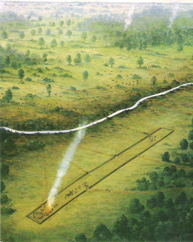
The first cursus monument discovered in Essex, archaeologists were fortunate when they came to excavate the site in 1979 as they found it almost complete. A rarity these days! Close to the Springfield Lyons causewayed enclosure monument, the cursus here was some 45 yards across and 750 yards long. Like a number of other cursuses, the Springfield one was dead straight all the way down, running northeast to southwest with squared terminii at both ends. (of the Bi category, as Loveday called them) And it appears to have had quite a long period of use.
Springfield Cursus (painting by Frank Gardiner)
The ditch that constitutes the very outline of the cursus — averaging between 3-4 feet in depth all round — was cut into the earth in the neolithic period. It had small ‘entrances’ at certain points along its longer axis, both on the east and west sides. The flat ends of the cursus were both ‘closed’, without entrances or breaks of any kind. Some depositional remains were found scattered at different spots along the course of the ditch: neolithic pottery and flints in both the northern and eastern ditches, but archaeologists were unsure whether these deposits were left at the time the monument was in use, or at a later period — though it seemed consensus opinion that the deposits were from a period when the cursus was in use. Charcoal remains were also found, but these were associated with an internal timber circle that was erected within the northeastern end of the cursus. The timber circle was found to have consisted of 14 upright wooden posts arranged in a near-complete ring, some 26 metres in diameter. It seems highly likely that this part of the monument had some ritual or ceremonial function relating to the dead (“mortuary practices” is the term used at the moment!).
Later excavation work here in 1984 found there to be various other linear and pit-like features within the confines of the monument, and what seemed to be the remains of a barrow beyond its eastern end.
Archaeologist David McOmish (2003), thought that “alignment is also significant,” saying that the “Springfield Cursus, 700 metres long, is aligned on a smaller enclosure some 300 metres away.” The alignment potential here was first suggested by Pennick & Devereux (1989), albeit pointing “to the village of Wexford just over two miles to the southwest.” McOmish also suggested there may have been some an astronomical reason for the alignment of the monument NE-SW, but I’m not aware whether this has been explored further.
The creation of these huge monuments had obvious relationships with human death rites, the spirits of trees, and celestial gods. But much more research is needed at these sites if we’re to find out more about the nature of these prehistoric giants in the landscape.
References:
Buckley, D.G., Hedges, John & Brown, N., “Excavations at a Neolithic Cursus, Springfield, Essex, 1979-85,” in Proceedings of the Prehistoric Society, volume 67, 2001.
Hedges, John D. & Buckley, D.G., Springfield Cursus and the Cursus Problem, Essex County Council 1981.
Loveday, Roy, Inscribed Across the Landscape: The Cursus Enigma, Tempus: Stroud 2006.
McOmish, David, ‘Cursus: Solving a 6000-year-old Puzzle’, in British Archaeology, 69, March 2003.
Pennick, Nigel & Devereux, Paul, Lines on the Landscape, Hale: London 1989.
Go northwest along the country lane running between High Utley (on the outskirts of Keighley) and Steeton known as Hollins Lane, which then becomes Hollins Bank Lane. You’ll see the fine castle building as you go along, known simply as The Tower arising from the top of the tree-line. As you get to the driveway leading down to the Tower, a less impressive farm building is on the other side of the road, known as Hollins Bank Farm. On the right-hand side of this house is an old overgrown road. Walk along here to the end, going into the field immediately left where a small group of stones can be seen halfway up the field by the tree. You’re here!
Archaeology & History
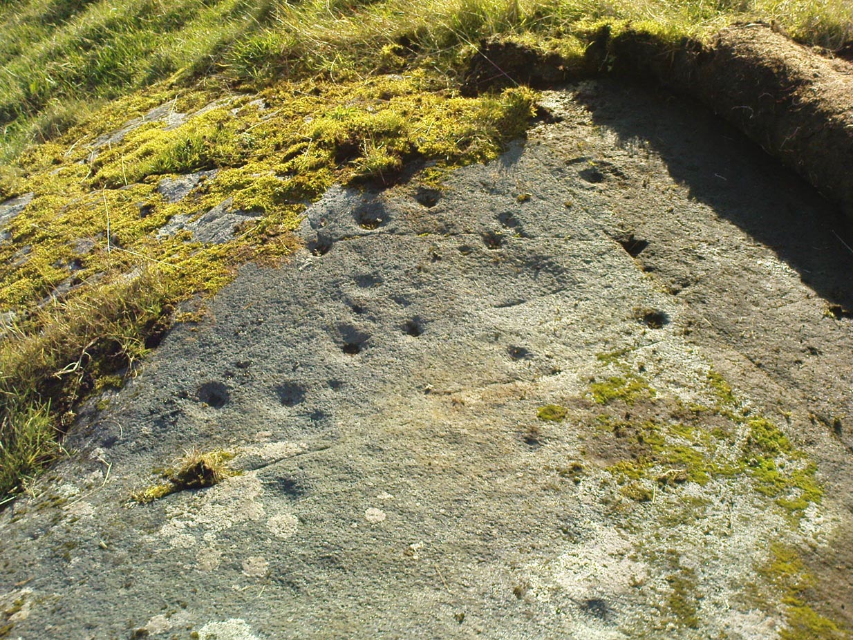
First discovered one sunny afternoon on April 7, 2010, in the company of Buddhist scholar Steve Hart, this is a really curious carving, inasmuch as it seems to have been deliberately carved around what may be curious naturally eroded cup-forms. You’ll have to visit it to see what I mean. They’re a bit odd. Almost too perfect as cups to be the ancient eroded ones we’re used to looking at. But this aside….
…and againDragon Stone, looking NW
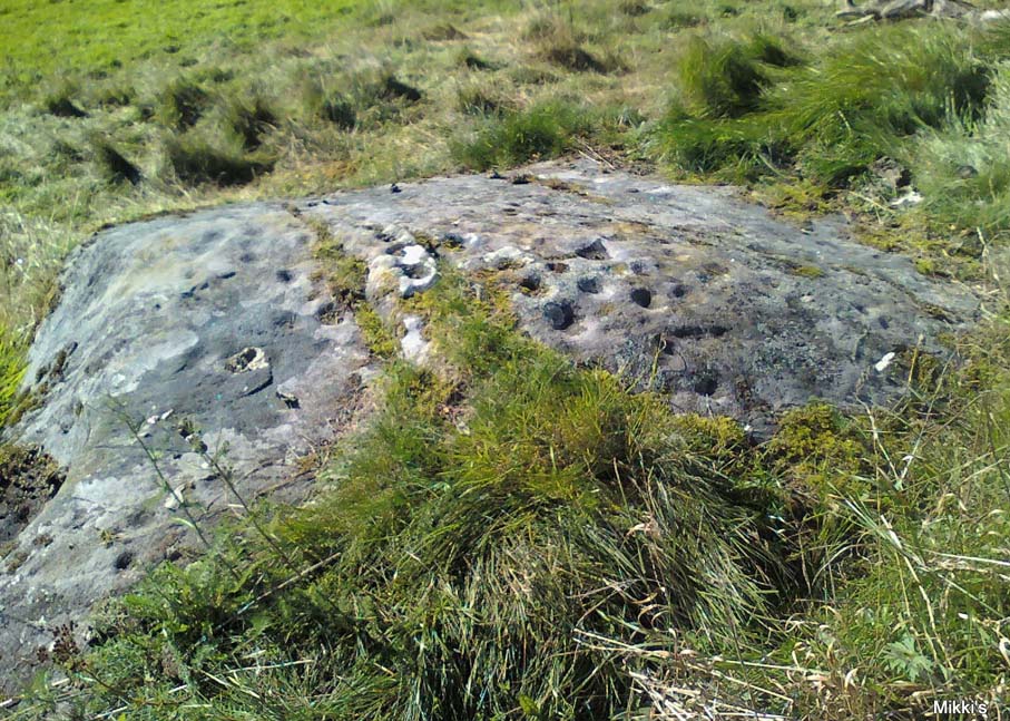
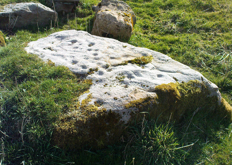
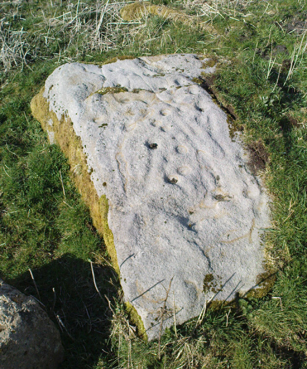
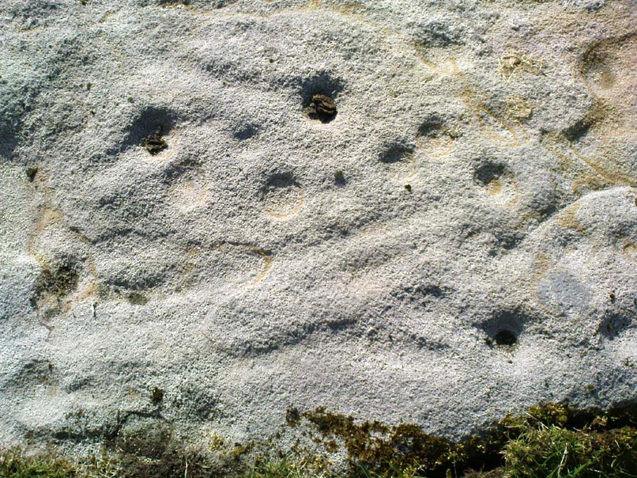
It’s a lovely flat stone, with curvaceous lines running across the middle and edges and into cup-markings. Although some of the cups give an impression of being natural, others have the authentic-looking ring to them, with at least one of them possessing a near-complete ring encircling it (as you can faintly see in the close-up photo here). There are at least 19 cup-markings on this stone, and four main ‘lines’ running roughly in north-south directions, with the cups interspersed between them. At the top (north) end of the rock, separated by a crack, the lines stop and we just have some cup-markings. The crack in the stone may have been functional here.
Although graphically different, the carving has a similar feel in design (for me at least) to that of the Wondjina Stone at Rivock Edge, on the other side of the Aire Valley a couple of miles east of here — though this newly found carving is in a better state of preservation. The small scatter of rocks around it seem to have been unearthed or moved recently by the land-owner (who aint keen on you looking on his land, so be careful) and the good state of preservation may be that they were only unearthed sometime this century. We must also keep in consideration that the lines that run across the surface of this stone are water-lines and may be more the result of Nature’s hand than humans. It’s obvious that some human intervention has occurred here, but it may be difficult to ascertain the precise degree of affectation between the two agencies.
Close-up of cups & lines
According to the archaeological record-books there are no carvings here, but another simple cup-marked stone accompanies this more extravagant serpentine design just a few yards away; a simple cup-marked stone may be seen at the top of the hill; and the faint Currer Woods carving can be found 0.68 miles (1.09km) due west of here, on the other side of the small valley. Other outcrop stones scatter the fields and slopes here, some of which still need checking to see whether or not further carvings exist.
…And for those who may bemoan my seemingly romantic title of the carving: remember! — close by in Steeton township, between the years 1562 and 1797, there was an old field-name known well to local folk, of “one parcel of arable land in town field called Drakesyke, 3 acres”, i.e., the dragon’s stream or dyke. (Gelling 1988; Smith 1956)
References:
Clough, John, History of Steeton, S. Billows: Keighley 1886.
Gelling, Margaret, Signposts to the Past, Phillimore: Chichester 1988.
Smith, A.H., English Place-Names Elements – 2 volumes, Cambridge University Press 1956.
Pretty simple this one. From Chipping Norton, head west on the A44 for a coupla miles till you hit the lovely Salford village. The church stands out, so head for it and, as you walk towards the building, watch for the small stone cross in front of you.
Archaeology & History
Salford Cross cup-markings
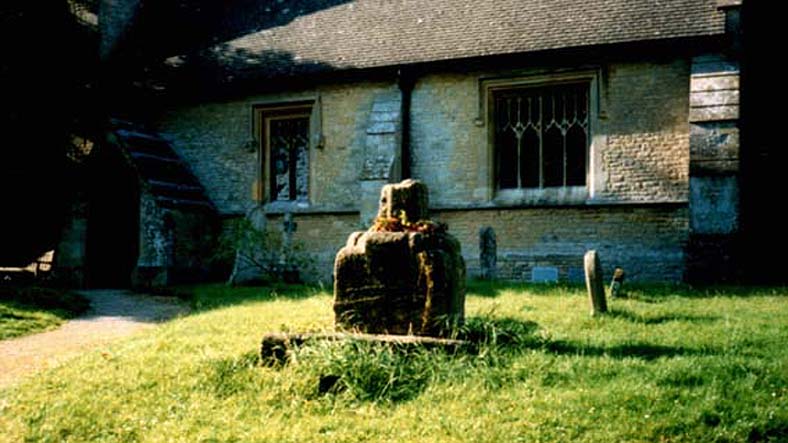
This is curious. Very curious! We might expect to find cup-markings occasionally on some of the cross-bases or other early christian monuments in northern England and Scotland, but to find them in the heart of a small Oxfordshire village where the tradition of cup-marked stones is unknown, was something of a surprise when Tom Wilson and I (1999) found it, to say the least! But this is what we’re looking at here.
Salford Cross remains
On the remains of an old medieval cross, whose broken shaft has seen better days, as the photo shows — and as a personal viewing shows even clearer — there are 3 simple cup-markings etched on one side of the cross-base in Salford churchyard. The cups certainly aint natural, but then also they don’t have the archaic looks of the prehistoric carvings from Yorkshire to Scotland. It would be good if we had a more extensive history of the cross monument itself, perhaps saying precisely where the stones which make it up came from, but local records tell us nothing it seems. If we could ascertain that parts of it were made up of some remains taken from some local prehistoric ‘pagan’ tomb (and a number of tombs have been found in and around this area), then some sense could be thrown upon its position here. But until we can ascertain more about the history of the cross, the three clear cup-markings on the cross-base remain somewhat of a mystery.
Folklore
Lovers of ley lore will be intrigued to find this carved cross-base is on a very accurate ley linking the King Stone, Rollright stone circle, Little Rollright church (where a standing stone can be found in the walling just before it), the Salford Cross and the site of another cross on the hill outside the village.
References:
Bennett, Paul & Wilson, Tom, The Old Stones of Rollright and District, Cockley: London 1999.