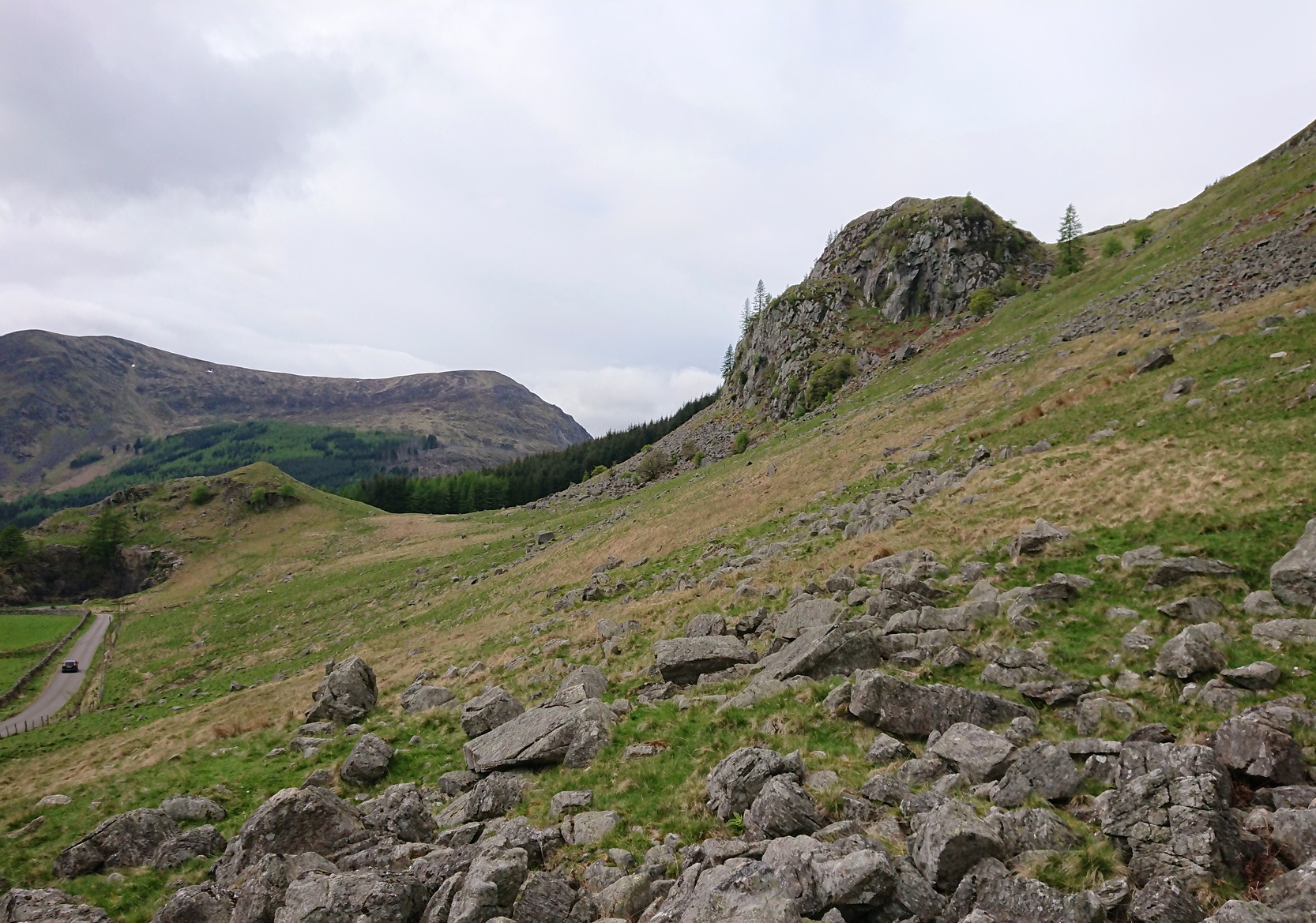
Take the B6362 high road between Lauder and Stow and, regardless of which direction you’re coming from, when you reach the top heights of the moorland road with views all around, you need to keep your eyes peeled for where a dirt-track runs south and, diagonally across the road on its north side, is a dirt-track-cum-parking-spot. Park up here and walk 10 yards or so into the heather on your left. You’re probably stood at the side of it!
Archaeology & History
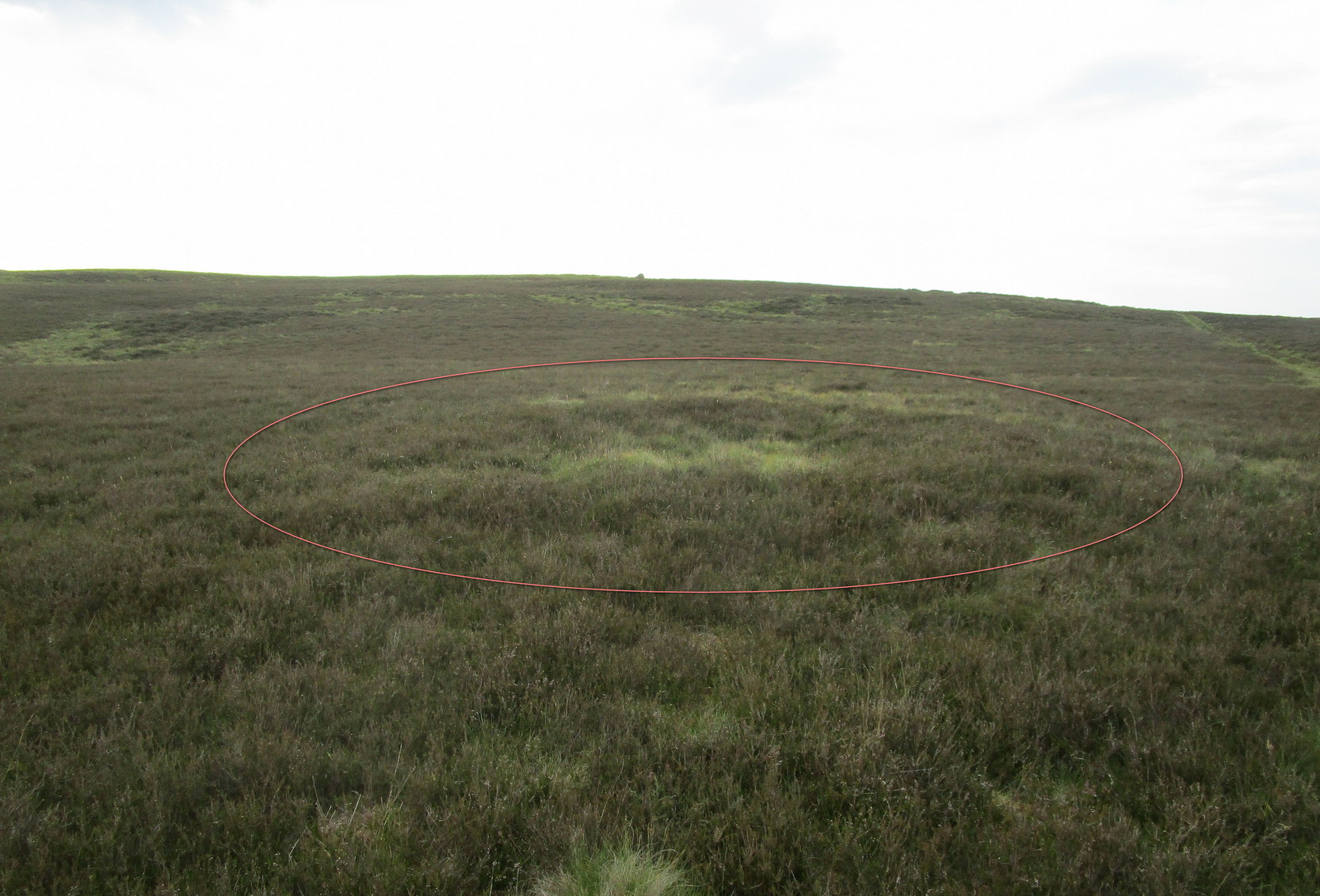
Hut circle (ringed) looking N
A very distinct, but isolated hut circle can be seen here when the heather is short. It’s most notable by seeing the slightly elevated circular rise in the ground with the rough ring of long grasses in the middle of it. To be honest, unless you’re a mad archaeo-geek into these sort of things, it’s not gonna send a rush of blood to your head.
Probably constructed in the Bronze Age, it’s a plain little thing about six yards across, making it suitable for perhaps just a couple of folk to have lived in. The overgrown walling is very low (between 12-18 inches high) and about a yard wide all the way round it. The main thing that you’ll get from this place is not only the sense of isolation, but the beautiful view…
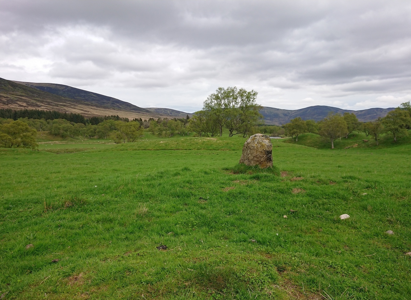
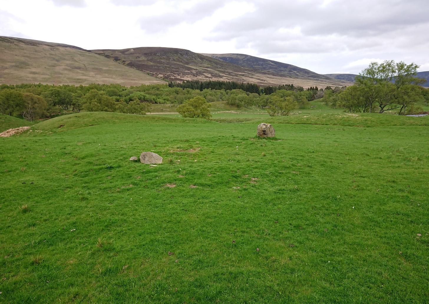
Two ways: i) up the A93 road from Blairgowrie, after 5 miles turn right at the Bridge of Cally and up Glen Shee. After another 3½ miles, keep your eyes peeled for the tiny road on the right signposted to the Drumturk Cheese farmshop. Go up this long tiny winding road for a mile up to the cheese place and keep on this road for another 2¼ miles where you can park up near the entrance to the huge wind-farm; or – (ii) from Alyth, go up the long winding tiny Bamff Road and keep to the signposts for Bridge of Cally Glen Shee until, after about 4 miles, you reach the entrance to the windfarm. Walk up the track to the windmills, bearing right at the first junction, then right again at the next one. From here, shortly before the second windmill, walk down into the moor for nearly 200 yards. It’s quite a large stone.
Archaeology & History
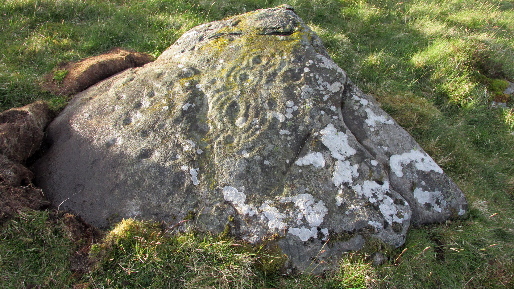
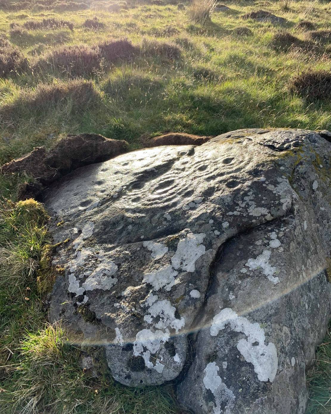
Interlocking rings close-up
This is impressive. Very impressive! Found within a huge mass of other prehistoric sites in the Forest of Alyth, its only known petroglyphic bedfellows—Drumderg (1) nearly 500 yards yards south, and Drumderg (3) 120 yards north—have nothing on this one! Where the others have basic cupmarks, this bears a series of multiple interlocking cup-and-ring designs, some with one ring, others with two, and one with four, albeit incomplete rings.
The design is etched onto the sloping face of a curved triangular ‘female’ stone. An eroded cutting all but separates the two main components of the design, but this cut has within it a distinct singular cup-and-ring almost linking each side together. On one side (which is near the middle of the stone) we have a complex series of multiple cup-and-rings that seem to be sequentially moving and (almost) growing into each other in some form of organic pattern. The bottom of this growth begins from a standard cup-and-ring and runs immediately into a vulva-like slit of a cup-mark surrounded by four incomplete rings. As the photos show, this keeps climbing upwards.
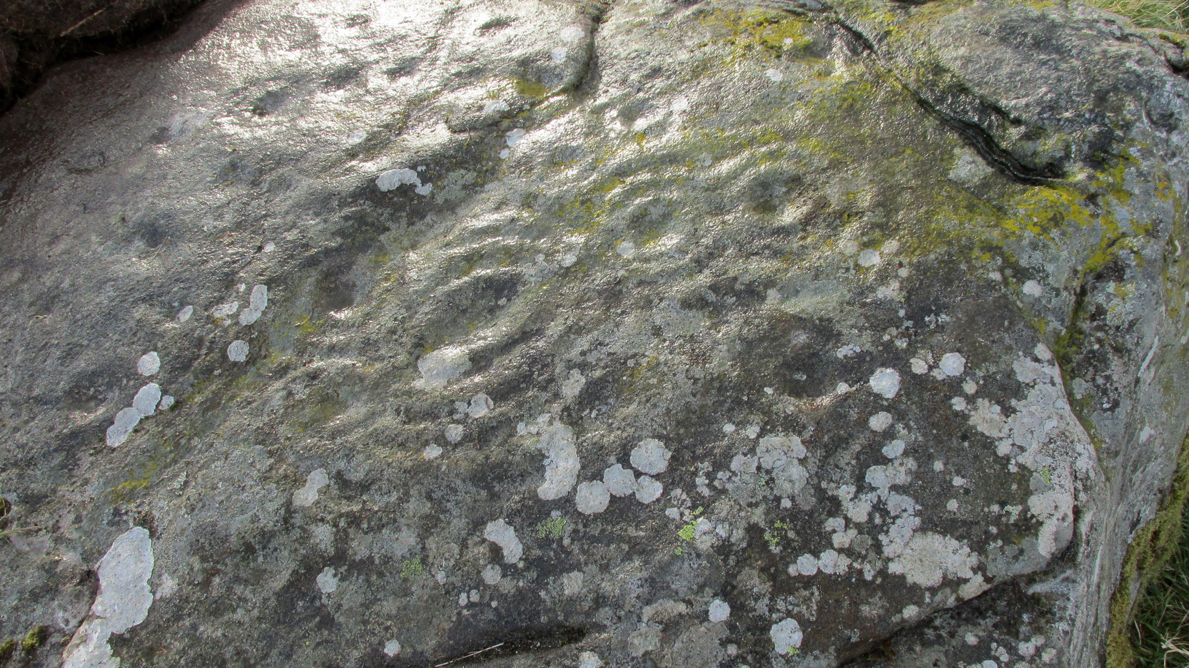
Cupmarks on its W-sideLooking into the setting sun
A more simplistic basic design has been etched onto the more western side of the stone, on the other side of the eroded cutting. Two of the cup-marks have rings around them, with one of them seeming to give birth to another upward “growth”, but this time comprising merely of a line of more cups, curving ever-so-gently towards the middle of the stone. Along with this there are also cup-marks on the top ridge of the stone; faint carved lines curve and intersect. Movement seems embedded in this fixed non-linear design. That’s my impression anyhow!
The only literary attention given to the carving seems to have been by the Scottish Royal Commission (1990) lads in one of their Perthshire inventories. It’s simple as always, telling basically,
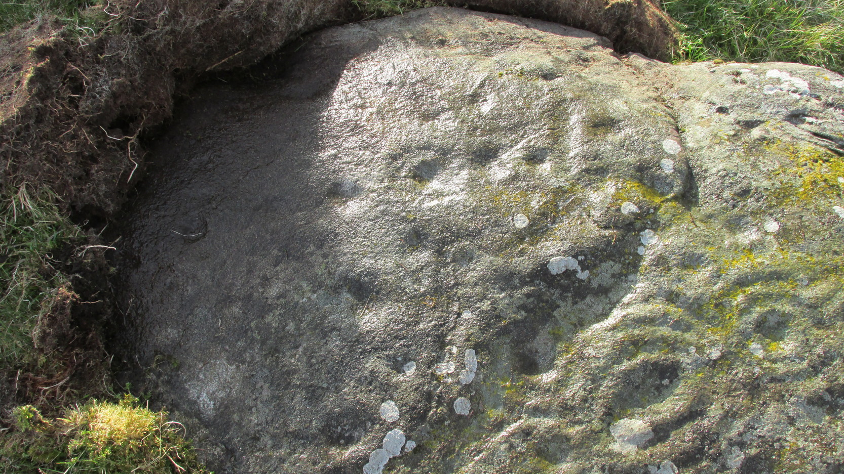
“this heavily weathered cup-and-ring marked boulder lies 150m south of the hut circles… The carvings are on the southwest face of the boulder and comprise: at least four cups surrounded by single rings; two cups surrounded by triple rings; an oval cup measuring 100mm by 70mm surrounded by four rings; and twenty-two plain cups marks, the largest 60mm in diameter.”
If there’s anything extra that we should puzzle over, it’s this: why do we have such an intricate carving here, living in near isolation in the midst of countless other prehistoric remains? The answer, most likely, is that it’s not alone. I highly suspect that others are waiting to be found up here beneath the endless ocean of heather…
References:
Royal Commission on the Ancient & Historical Monuments of Scotland, North-East Perth: An Archaeological Landscape, HMSO: Edinburgh 1990.
From Kirriemuir town centre up the B956 Kinnordy Road, turn left where it goes along the B955 road for several miles towards Cortachy. Keep going on the B955 for a few more miles into the quiet beauty of Glen Clova. A third-of-a-mile (0.5km) past Glenarm house, the road splits. Take the right-hand road, which goes down and across the river below. Keep on this road for just over a mile (1.8km) and as you approach the large farmhouse of Whitehillock—about 200 yards before it—keep your eyes very well focused in the field on your left and you’ll see a mass of large fallen stones right up against the other side of the fence. You’ve arrived.
Archaeology & History
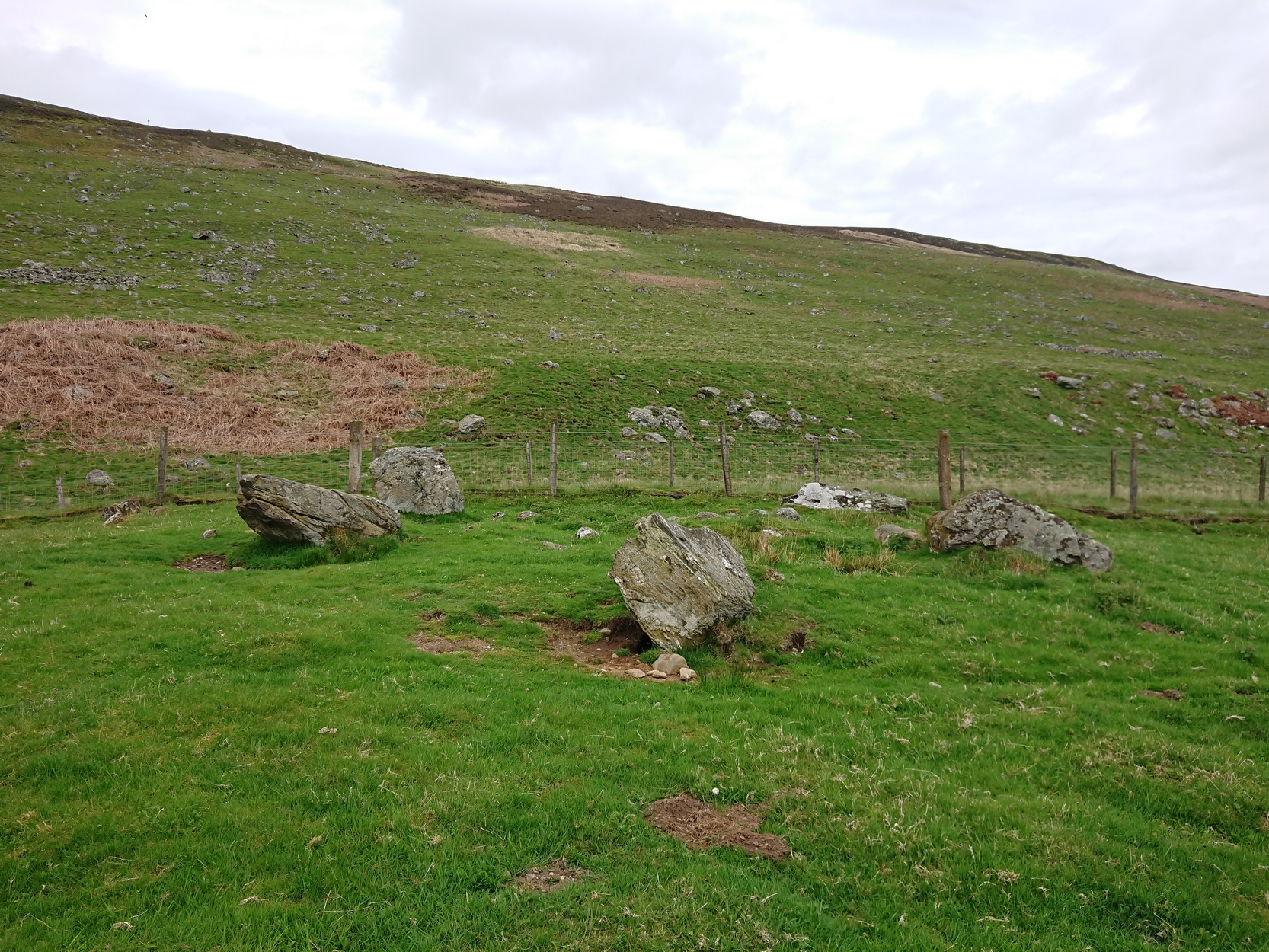
Internal “cairn”
A half-mile north of Clach na Brain, or the Stone of the Raven (a stone that was traditionally used to beat woven cloth after it had been washed), we come across this ruined stone circle, which has seen better days. Not shown on any of the early OS-maps, nor found in the standard megalithic catalogues (Barnatt 1989; Burl 2000), its existence seems to have been logged for the first time by some of the Royal Commission doods in 1999, but of late its veracity as a prehistoric site has been questioned as the local farmer alleged it to have been built by his father sometime in the 20th century. It might have been – but if he did, he made a bloody bad job of it! The site doesn’t have that “new” look about it and, unless someone told you that this was a stone circle, you wouldn’t give it a second look! That aside…
The stones have been placed around the edge of a small rise in the land, within which is a scatter of small and reasonably large stones that give the impression of a cairn at its centre. All but one of the stones (the eastern one) is still standing and measures about 3 feet in height. The rest are either laid down or near to collapse and measure between four and six feet in length. Without an excavation of the site, we cannot be certain of its age, but the official records still have it listed as a stone circle. We await further examination…
References:
Dorward, David, The Glens of Angus, Pinkfoot Press: Forfar 2001.
From Kirriemuir town centre up the B956 Kinnordy Road, turn left where it goes along the B955 road for several miles towards Cortachy. Keep going on the B955 for a few more miles into Glen Clova, past the Caddam stone and eventually, after going over the bridge into Clova village, you turn left and go up towards the mountains. Nearly 3 miles along you see the very conspicuous and impressive rising crag, like a small volcano on the right-hand side of the road, which is Dun Mor. Walk up the steep climb round to the back of it – and you’re in the middle of the old ruins…
Archaeology & History
Highlighted on the 1865 OS map of the region, Dun Mor is Gaelic for a “large or great fort” – and such it is! Those of you with a nose for these sorts o’ things will no doubt take to the remains pretty quickly. Its position in the landscape is a bit of a gem! On its north-side— invisible to anyone in the glen below—an overgrown arc of walling some 3 feet high and about 70 yards long bends towards the crag of rocks on each side, with a notable “dip” or entrance about 8 feet wide in the middle of it. The walling itself averages about 4 yards wide all along its arc.
The crag of Dun Mor
It’s quite impressive once you get a good feel of the place and envisage it as it once was. The sheltered fortress within the rise of Nature’s crags is about 100 yards across and would be ample space for several families to live in when it was first built, in those mythic times of so so long ago. It was probably constructed in the Iron Age, although several ruined rectangular stone structures inside it are thought to be mediaeval shelters; and even in those more recent times, the people here would have regularly heard the howl of the wolves, whose names are kept in the hills above as reminders of a world not too long past….
The only real way to get here is via Kirriemuir. Head north to the hamlet of Cortachy and past it, as you enter Glen Clova, where the road splits make sure you bear to the left-hand (western) side. Nearly 5½ miles along, keep your eyes peeled on your right where you can’t really miss it. The stone’s less than 100 yards into the field. …It may perhaps be a bit easier if you take the eastern road of the glen all the way to Clova village. Turn right from there, over the small river bridge and as it curves to go back down the glen, a half-mile along you pass Caddam house. Keep going for another 500 yards and you’ll notice it in the field.
Archaeology & History
Stone and its hut circle
Not to be confused with the ruined stone circle of the same name 10 miles to the south, this small standing stone—only some three feet in height—is at the eastern edge of a small overgrown hut circle measuring some 3 yards by 4 yards across. You can just make out the overgrown low walling in the second photo (right). The stone probably had some architectural relationship with the hut circle, but without an excavation we can’t know for certain what that relationship might have been. A settlement of much larger hut circles can be found on the other side of the river, near Rottal, two miles southeast of here.
Cup-Marked Stone (lost): OS Grid Reference – NO 0617 2328
Archaeology & History
Site shown on 1933 map
First highlighted on the 1933 OS-map of the area, it was located alongside the old fence-line hereby, but no subsequent description of the carving has been made since then. A small boulder and a number of other stones can be found along the line of fencing, but none seem to be possessed of petroglyphs and apart from it being shown on the old maps, I can find no reference or description of it. It may have been destroyed. Some researchers have wondered if the carving was mistakenly marked at this spot by surveyors who confused it with another one more than 500 yards to the southeast (and described by Fred Coles in 1903), but this would seem an unlikely error to have been made. Whilst this was described as a simple “cup-marked stone”, its neighbour at West Lamberkine (2) was a distinct and more complex cup-and-ring design.
References:
Coles, Fred, “Notices of …(4) of Some Hitherto Undescribed Cup-and-ring-marked Stones…” in Proceedings Society Antiquaries Scotland, volume 37, 1903.
Acknowledgements:Many thanks for use of the Ordnance Survey map in this site profile, reproduced with the kind permission of the National Library of Scotland.
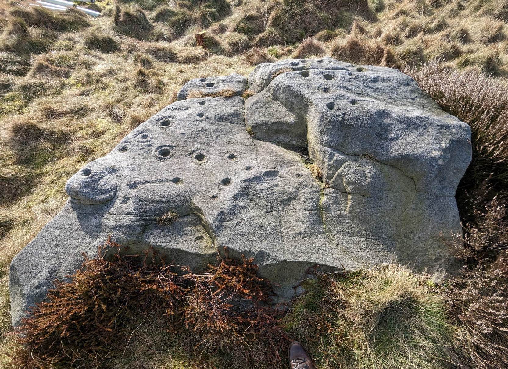
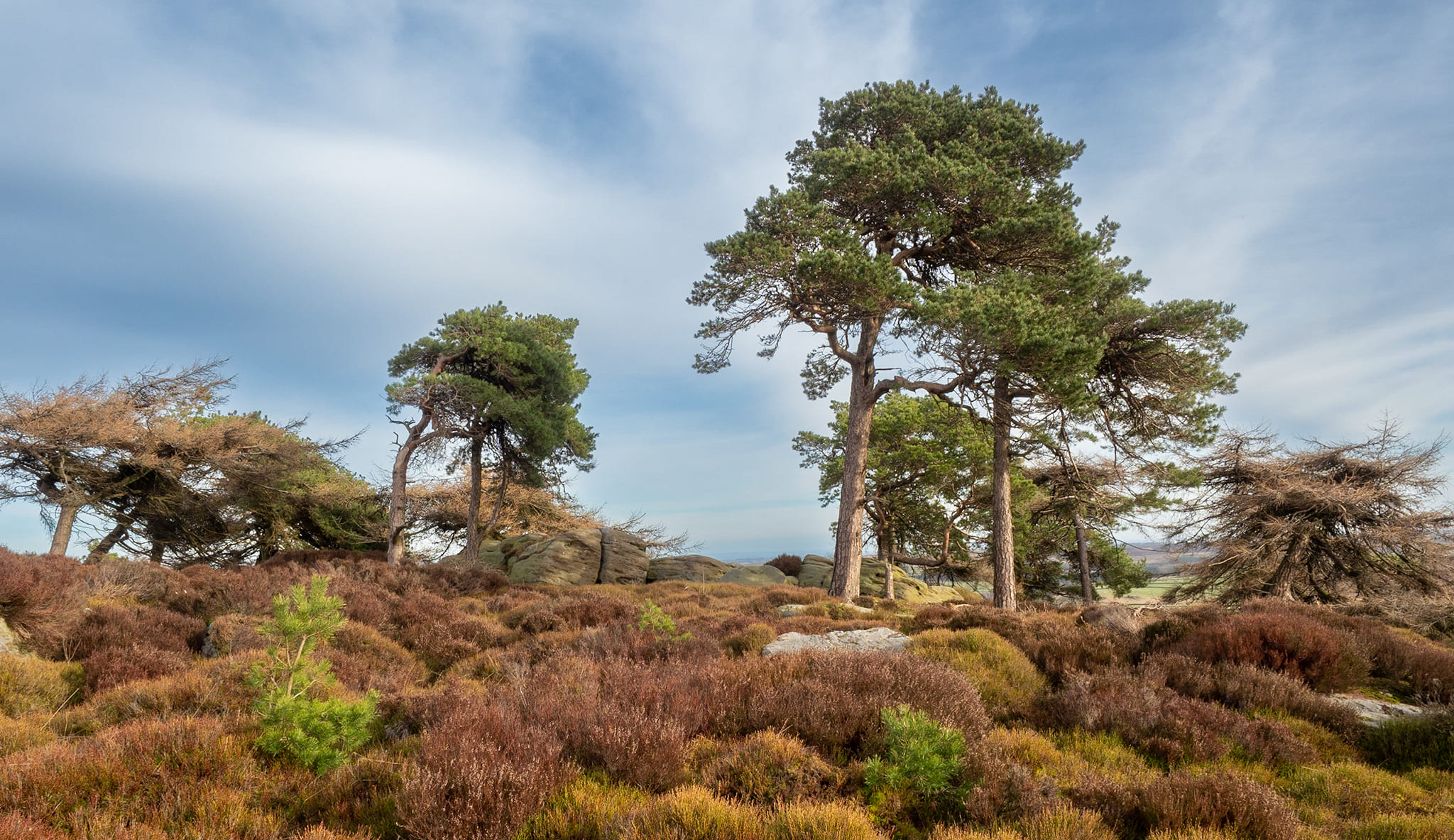
The best/easiest way to approach this and the Rivock carvings as a whole is to reach the Silsden Road that curves round the southern edge of Rombalds Moor (whether it’s via East Morton, Riddlesden, Keighley or Silsden) and keep your eyes peeled for the singular large windmill. About 200 yards east of this is a small parking spot, big enough for a half-dozen vehicles. From here walk 450 yards east along the road till you hit the dirt-track/footpath up towards the moor. Follow the track up for about 400 yards and you’ll see the crags a half-mile ahead of you. Get up there to the Wondjina Stone and follow the walling east for about 175 yards where you’ll see a track-cum-clearing in the woods. Walk along and the first large stone on your left is what you’re after.
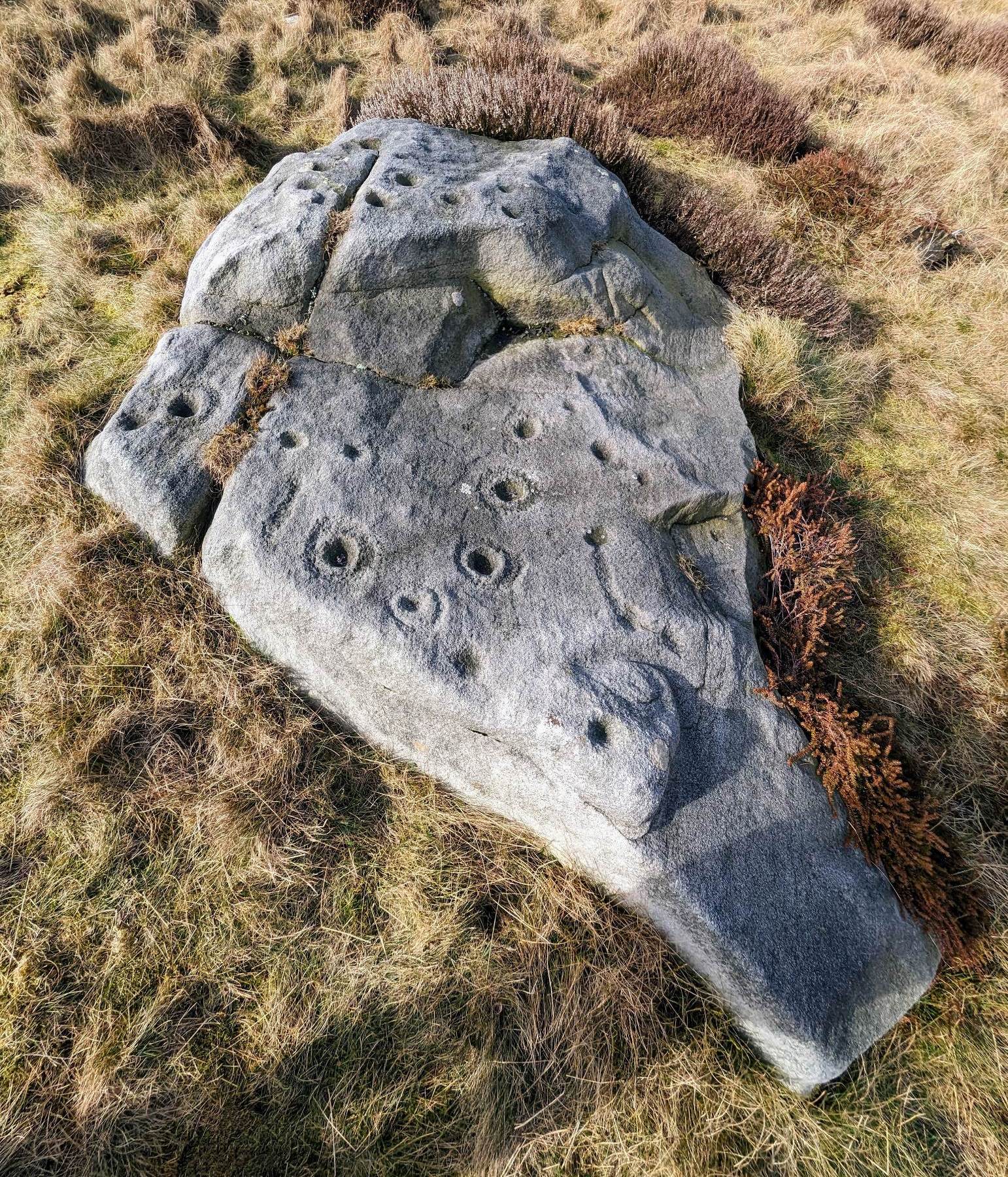
Archaeology & History
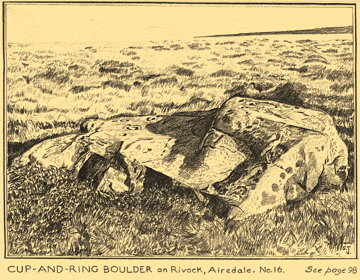
I first visited this carving in my teenage years in the 1970s, before the intrusive so-called “private” forest covered this landscape and when its petroglyphic compatriots were easier to find. Thankfully this one’s still pretty accessible and possesses a damn good clear design. It was rediscovered in the 1960s by Stuart Feather and his gang, zigzagging their way across the open moors, pulling back the heather to see what they might find. His description of it told how the stone,
“has two roughly level areas, one 18ins and the other 2 feet above ground level. Both (levels) have several well-preserved cup-and-ring markings on them. There are eight single cup-and-rings and 18 cups, two of the latter being joined by a clear channel seven inches long and 1½ inches wide. Nearly all the markings are unusually well preserved and the pocking marks are very clear.”
Note the line running down
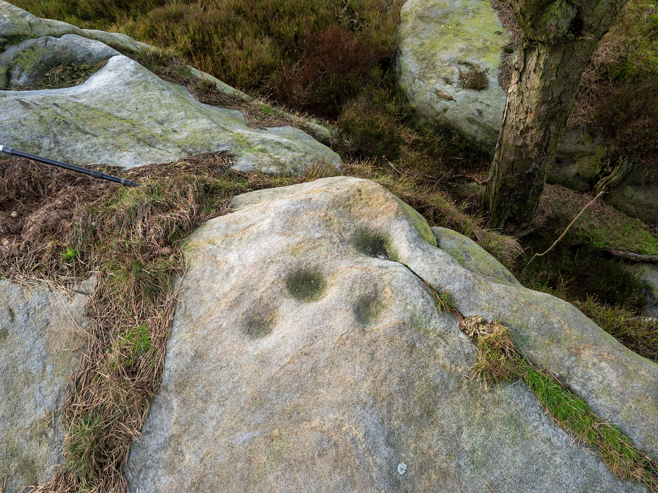
He also had “the impression that all the markings on this stone and possibly one other similar stone in the Rivock area have been carved by the same hand, as all the symbols are nearly identical in in type, size and execution.” (this other carving he’s referring to seems to be one about 170 yards to the north, where occasionally “offerings” have been found)
The design from E-W
When John Hedges (1986) and his team checked the stone out he could only make out “seven cups with single rings, twenty two other cups”; whilst the ever descriptive Boughey & Vickerman (2003) saw “twenty-nine cups, eight with single rings.” Eight cup-and-rings is what most people see when the light’s right. There’s also a long, bent carved line on the lower level of the rock, running from near the middle of the stone out to the very edge. It seems to be man-made (although I may be wrong) – and I draw attention to it as this same feature exists on at least three of the other large and very ornamental cup-and-rings hereby within 300 yards of each other – and on these other carvings the long “line” is definitely artificial. Tis an intriguing characteristic…
Stuart Feather’s old sketch
When visiting this petroglyph you’ll notice how some of the carved elements on top of the stone are more eroded than those on the lower section. This is due to the fact that the lower section was only revealed by Feather and his team in the mid-20th century, after it had been covered in soil for countless centuries. As a result you can still see the peck-marks left by the implements that were used to make the carving, perhaps 5000 years ago!
The name of the stone was inspired by a local lady who saw an astronomical function in the design (I quite like it as well). Examples of petroglyphs representing myths of heavenly bodies have been described first-hand in some tribal cultures and, nowadays, even a number of archaeologists are making allusions about potential celestial features in some carvings in the British Isles. That doesn’t mean to say that it’s correct, but the idea’s far from unreasonable…
Anyhow – check this one out when you’re next up here. You’ll like it!
References:
Bennett, Paul, “The Prehistoric Rock Art and Megalithic Remains of Rivock & District (parts 1 & 2),” in Earth, 3-4, 1986.
Boughey, Keith & Vickerman, E.A., Prehistoric Rock Art of the West Riding, WYAS 2003.
Deacon, Vivien, The Rock Art Landscapes of Rombalds Moor, West Yorkshire, ArchaeoPress: Oxford 2020.
Feather, Stuart, “Mid-Wharfedale Cup-and-Ring Markings – no.16 – Rivock,” in Cartwright Hall Archaeology Group Bulletin, volume 8, no.10, 1963.
Hedges, John (ed.), The Carved Rocks on Rombalds Moor, WYMCC: Wakefield 1986.
Morris, Ronald W.B., “The Prehistoric Rock Art of Great Britain: A Survey of All Sites Bearing Motifs more Complex than Simple Cup-marks,” in Proceedings of the Prehistoric Society, volume 55, 1989.
Acknowledgments: Huge thanks to Collette Walsh for use of her photos.
Cairn (destroyed): OS Grid Reference – NT 3071 7366
Archaeology & History
The only reference I can find of this long lost cairn is in William Baird’s (1898) massive history work of the area—but even in his day he reported that “it has long since disappeared.” He wrote:
“We have a curious reference in a charter of Kelso Abbey, granted about 1466, to a cairn of stones which stood near the south-east corner of the garden wall at Mount Lodge, Portobello. In the charter, where it is referred to as forming part of the boundary of the lands of Figgate, it is described as, ‘a certain heap of stones there deposited.'”
The cairn was likely of considerable size and, said Baird, “in all probability marked the site of an ancient place of sepulture.”
References:
Baird, William, Annals of Duddingston and Portobello, Andrew Elliot: Edinburgh 1898.
Cup-Marked Stone: OS Grid Reference – SE 1194 5810
Getting Here
The Raven stone setting
Take the A59 road from Harrogate and Skipton and at the very top of the moors keep your eyes peeled for the small Kex Ghyll Road on your left(it’s easy to miss, so be diligent!). It goes past some disused disused quarry and after a mile or so where you hit a junction, turn left, past the Outdoor Centre of West End and straight along Whit Moor Road. About a mile past the Outdoor Centre go left down to Brays Croft Farm and over the ford, then keeping to the footpath up to the right (west) and note the clump of trees on the moors above you to the west. That’s where you need to be.
Archaeology & History
Several of the cupmarks
Several natural basins that might have been worked in prehistoric times are accompanied by several distinct cup-marks near the middle-edge of the stone, in a rough triangular formation, with two others slightly more eroded a little further down the same side. Boughey and Vickerman (2003) noted several other cupmarks on the rock, some distinct, some not so.
Adjacent to this carved stone is another naturally worn stone of some size, with incredibly curvaceous ripples over the top of the rock which, in all probability, possessed some animistic property to the people who carved this and other nearby carvings. Check the place out. It’s a gorgeous setting!
References:
Armstrong, Edward A., The Folklore of Birds, Collins: London 1958.
Boughey, Keith & Vickerman, E.A., Prehistoric Rock Art of the West Riding, WYAS: Wakefield 2003.
Round Barrows (destroyed): OS Grid Reference – NZ 692 214
Archaeology & History
Tumuli shown on 1920 map
On top of the large plateau that is Warsett Hill, on the southwest side of the old trig-point, could once be seen a cluster of at least seven burial mounds or tumuli. The mounds are shown on the first OS-map of the area, but merely as mounds. It wasn’t until there’d been a subsequent investigation here by local historian J.C. Atkinson in the 19th century that they were highlighted on the 1920 map as “Tumuli.” Sadly, since then, they’ve all been destroyed.
Very brief notes were written on six out of the seven tombs here by William Hornsby (1917), with only one of them receiving any real attention. “Of the other six,” Crawford (1980) wrote,
“there is very little information; all were excavated by Atkinson prior to 1893, but his excavations revealed no finds and he stated that all of the mounds had been previously disturbed. They were later dug by Hornsby, who stated that although he found no sepulchral deposits, all the mounds contained flints.”
In medieval times this became a beacon site, where bonfires were lit. I can find no further information about this. (NB: This site should not to be confused with another Warsett Hill that exists two miles southeast of here above Skinningrove.)
References:
Crawford, G.M., Bronze Age Burial Mounds in Cleveland, Cleveland County Council 1980.
Hornsby, William & Stanton, R., “British Barrows near Brotton,” in Yorkshire Archaeological Journal, volume 24, 1917.
Acknowledgements:Huge thanks for use of the Ordnance Survey map in this site profile, reproduced with the kind permission of the National Library of Scotland.