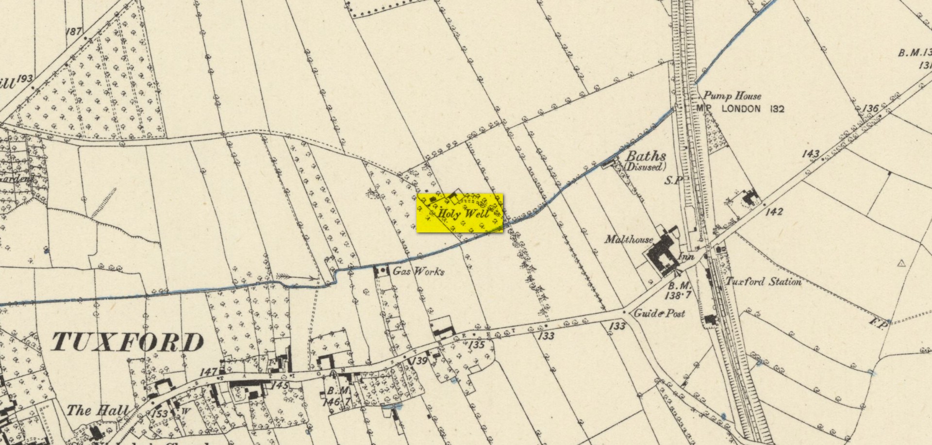
Highlighted on the early Ordnance Survey map of the region by the appropriately named ‘Holywell Farm’, this once important sacred water source would seem to be little more than a muddy patch nowadays. Not good. Its cold waters were reputedly good for curing skin diseases such as scurvy, along with aiding in the affliction of rheumatism.
Local folklore attributed the site to have once fed some Roman baths, but this idea seems to have been a diluted version of it once, historically, supplying some baths a few hundred yards east, albeit in the 19th century and not way way back in Caesar’s days! Of course, the waters of the well would have been used in ancient times, but we have no archaeology or unbroken traditions telling us such things. It was last known to be used as a local water supply in the 1920s. The fact that the spot where it used to run free is still sometimes boggy means that it could be re-animated with a bit of effort from local people.
References:
Morrell, Robert, Nottinghamshire Holy Wells and Springs, Nottingham 1988.
Acknowledgements:Huge thanks for use of the Ordnance Survey map in this site profile, reproduced with the kind permission of the National Library of Scotland.
From the Cow & Calf car-park, walk towards and past the gigantic Calf rock, swerving round the fallen mass of rocks and into the trees at the back. Walk uphill to the Hanging Stones cup and ring stones, then keep heading—down the slope then back up the next one—west, for barely 100 yards until you’re on the level ground again, following the footpath alongside the heather. Barely 50 yards along, keep your eyes peeled in the heather for a low flat rock just a few yards in. Forage around and you’ll find it.
Archaeology & History
You’ll no doubt be seeing this carving after you’ve visited the impressive Hanging Stones petroglyphs 150 yards to the east. And you’ll probably be disappointed in its lack of visual grandeur when compared to its more ornate eastern neighbour. But the petroglyph fans among you should give it your attention.
Hedges 1986 sketchLooking to the SE
When the dawn or evening daylight cuts across the rock, the design looks much better than at sun high, perhaps telling us that the message of the stone coincided with those periods of the day. The gentle folds of the stone itself morph into the carving: evening and morning light cutting subtle shadowy folds across the rock, giving it an organic texture that our aboriginal ancestors told to be a vital essence of stone itself. The two small clusters of cup-marks upon this stone become greater than their basic design when brushed with the shadows and glows of a sunset. And when our aboriginal peoples painted them in ochre and other colours, an even greater mythos emerged—but sadly it is forgotten here….
When looked at with the simplistic eyes of the archaeo-mind, this and its compatriots are little more than a number of marks on lifeless rocks. This stone for example was described in John Hedges’ (1986) survey as being just “two groups of four and five cups and grooves”—nothing more—with naught but an echo in Boughey & Vickerman’s (2003) later work. The carving has neighbours even more basic in the heather close by…
References:
Boughey, Keith & Vickerman, E.A., Prehistoric Rock Art of the West Riding, WYAS: Wakefield 2003.
Hedges, John (ed.), The Carved Rocks on Rombalds Moor, WYMCC: Wakefield 1986.
From Arncliffe village, walk past the front of the Falcon Inn village pub and along the track called the Monk’s Road. After a short distance it becomes a dirt-track where the old house lives. Less than 200 yards past the old house, a footpath takes you over the wall, then you walk 200+ yards southwest and through another wall, then up the curvaceous footpath diagonally WSW up the steep hill until you go over another wall where the land levels out. Follow the footpath along the edge of the steep drop for just over a mile where you’ll cross the fifth wall (the Clowder (1) enclosure is up above you by the rock outcrop to the left) and 100 yards along, just north of the footpath, you’ll see a large hollow defined by rocks and low walling. You’ve arrived!
Archaeology & History
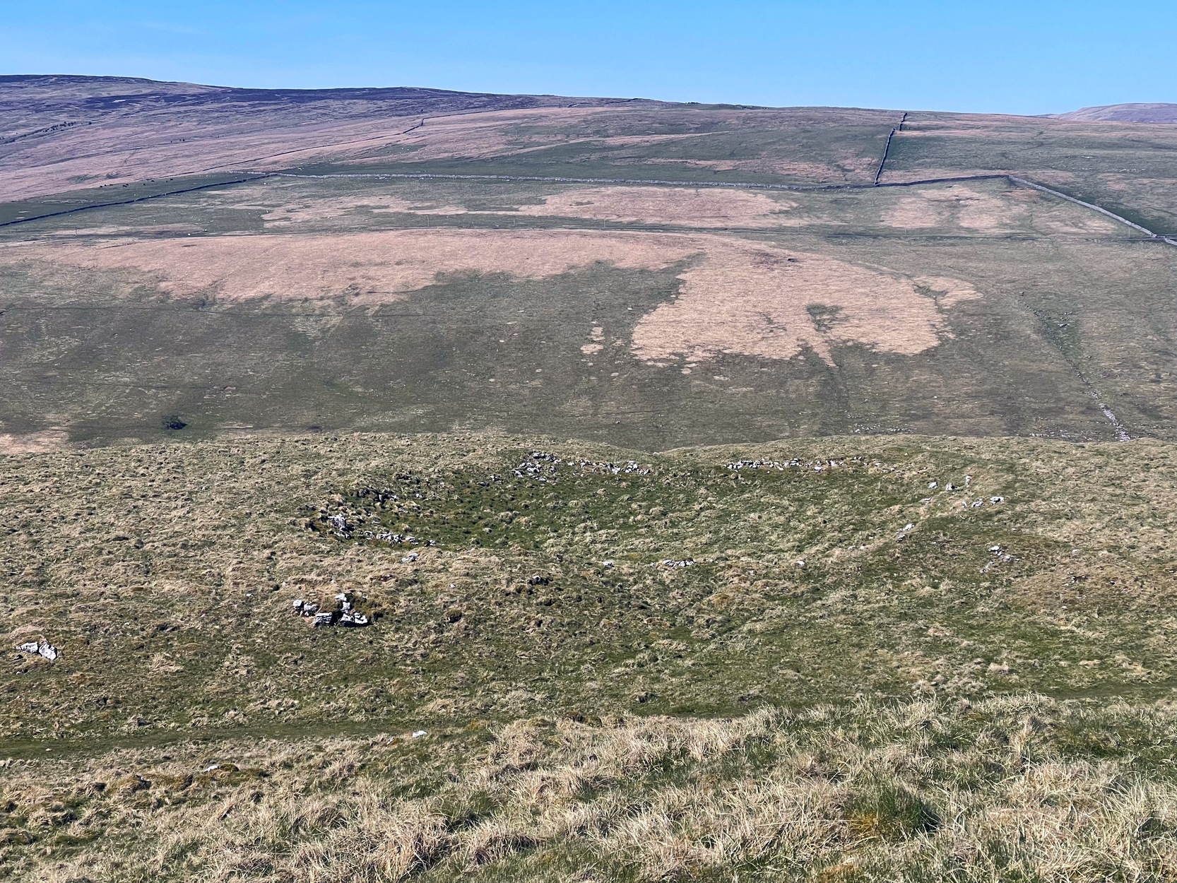
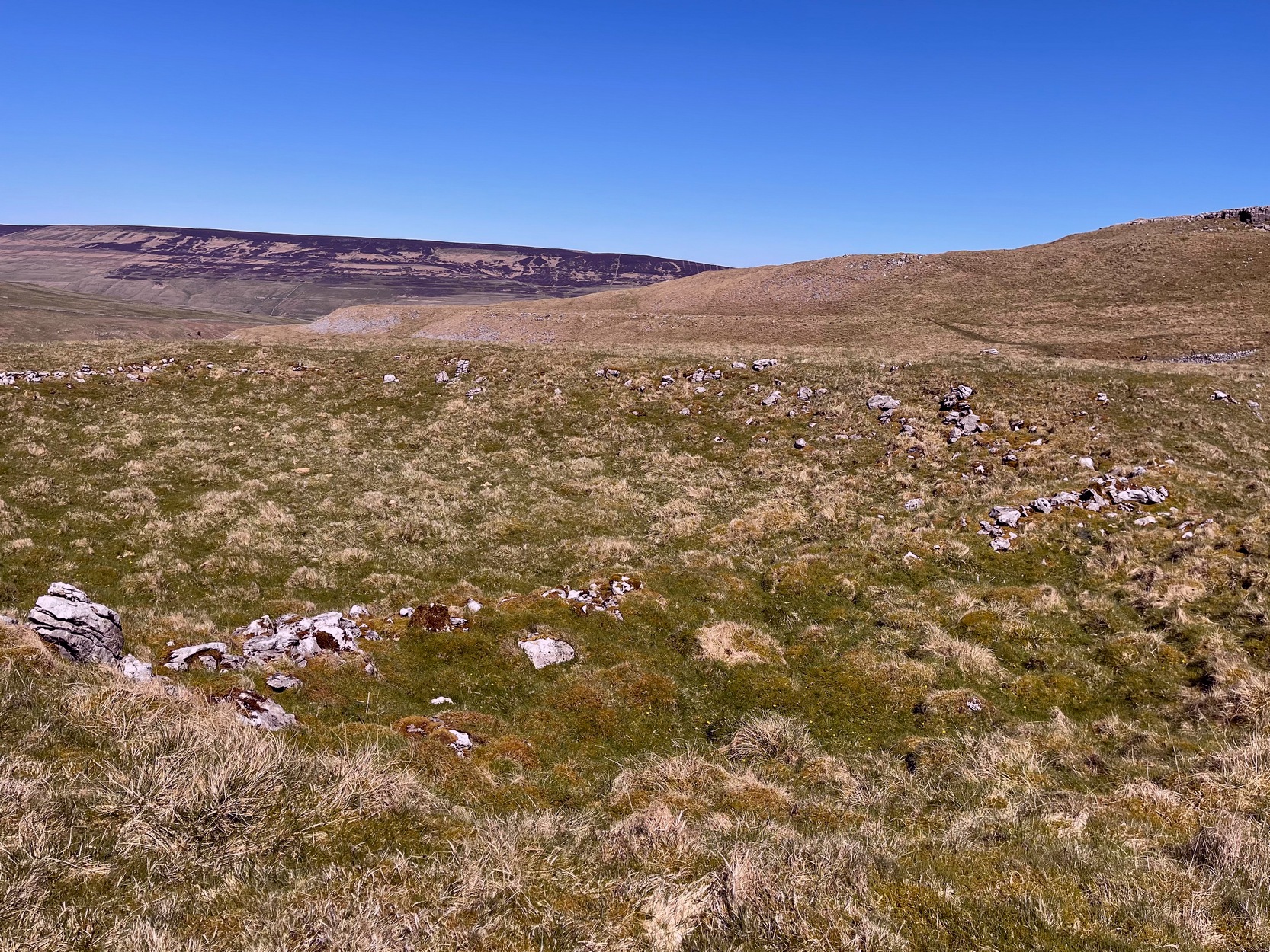
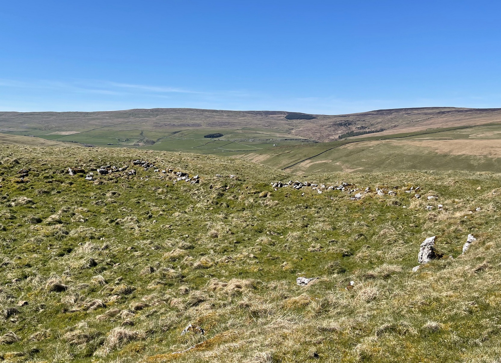
The south & eastern walls
Amidst the scattered remains of the extensive Dewbottoms settlement complex, this large hollowed walled enclosure is pretty clear to see. Measuring 40 yards north-south across its longest axis and 31 yards east-west, the structure is like an erratic rectangle in shape, with entrances in the middle of its northern wall and, perhaps, another along the southern side too. It’s quite deep too, being several feet lower than the land around it, keeping it protected from any strong winds above: an ingredient that would obviously have been taken into consideration when it was being built. The walling that defines the structure is a contrived mix of Nature’s own semi-circle of earthfast limestone rock, with intermittent gaps filled-in with thousands of small stones placed there by humans, 2-3000 years ago. It’s quite impressive when you see it in the flesh.
Northern wall & dipped entranceThe west & northern walls
The site appears to have an Iron Age to Romano-British pedigree – although I’m hedging a bet that the place was probably still in use during medieval times. The enclosure has the appearance of some sort of prehistoric village hall. There are no hut circles or any other walled structures inside the overall enclosure, meaning it may have been used, perhaps, for tribal village gatherings; or it might just have been a large enclosure for cattle. Only an excavation would tell us one way or the other.
Anyhow, if you’re coming up to see the Dewbottoms complex from Arncliffe, this is the first main thing that you’ll come across. From here, to your immediate south and west, there’s a mass of prehistory beneath your feet. Make a long day out of it as you’re gonna be somewhat overwhelmed by the magnitude of it all.
References:
Charlesworth, D., ‘Iron Age Settlements and Field Systems,’ in Proceedings of the Archaeological Journal, 125, 1968.
Dixon, John & Phillip, Journeys through Brigantia – volume 2, Aussteiger: Barnoldswick 1990.
Raistrick, Arthur & Holmes, Paul F., Archaeology of Malham Moor, Headley Brothers: London 1961.
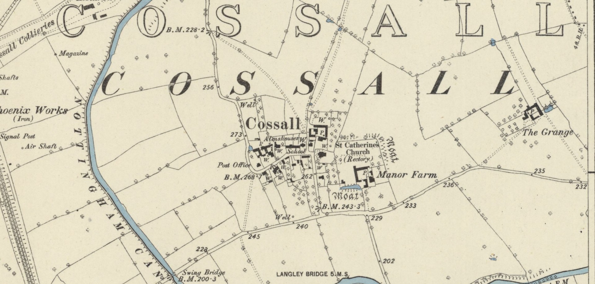
Hiding away in the Title Deeds of the Willoughby Family of Wollaton, written around 1280 CE, a somewhat lengthy entry on land ownership around the parish of Cossal, showed there once existed a little-known St. Helen’s Well: long since lost it would seem. The account, known as the “Quitclaim (of) William son of Adam le Gaoler,” cited the following information:
“Release by William, son of Adam le Gaoler of Nottingham, and Beatrice (his wife) and Agnes (heirs once of Adam de Cossale in Nottingham) to William de Barre and his wife Dionise [Denyse] of all claims to toft and croft with all its appurtenances, with 10 seliones of arable land with appurtenances in various parcels and sites in town and territory of Cossall; the toft and croft lie between land of Dionise on each side; 3 seliones lie together on Brochisale, 2 lie on Elrinstubbe between land of Robert de Marisco and William Baret, 2 lie on Smalethornchis between land of Henry and Robert son of Adam, 2 lie a square furlong ‘quarentelam’of the spring of St. Elena between land of Stacy le Greyne and Nicholas de Marisco and 1 selione lies on le Westfeld between 2 boundaries.”
A few years later in an early 14th Century Feet of Fines there is another mention of the well, which gave a slightly better description of its whereabouts. It mentions items known as ‘sellions’, which are strips of arable land. The account told of,
“two selions lying together at St Helen’s Well between the land of the church of St Katherine of Cossale on one side, and the land of the said Eustace on the other side, abutting at one end on the croft that Walter Talpe holds, and at the other end upon the north conduit…”
This indicates that the well was close to the village—perhaps even within the village itself. On the early Ordnance Survey maps of Cossall, several wells are shown, and any one of them could be the St. Helen’s Well in question. Does anyone know which one is the forgotten holy well of the village…?
Folklore
St Helen’s feast day is August 18.
References:
Gover, J.E.B., Mawer, Allen & Stenton, F.M., The Place-Names of Nottinghamshire, Cambridge University Press 1940.
Morrell, Robert, Nottinghamshire Holy Wells and Springs, Nottingham 1988.
Acknowledgements:Huge thanks for use of the Ordnance Survey map in this site profile, reproduced with the kind permission of the National Library of Scotland.
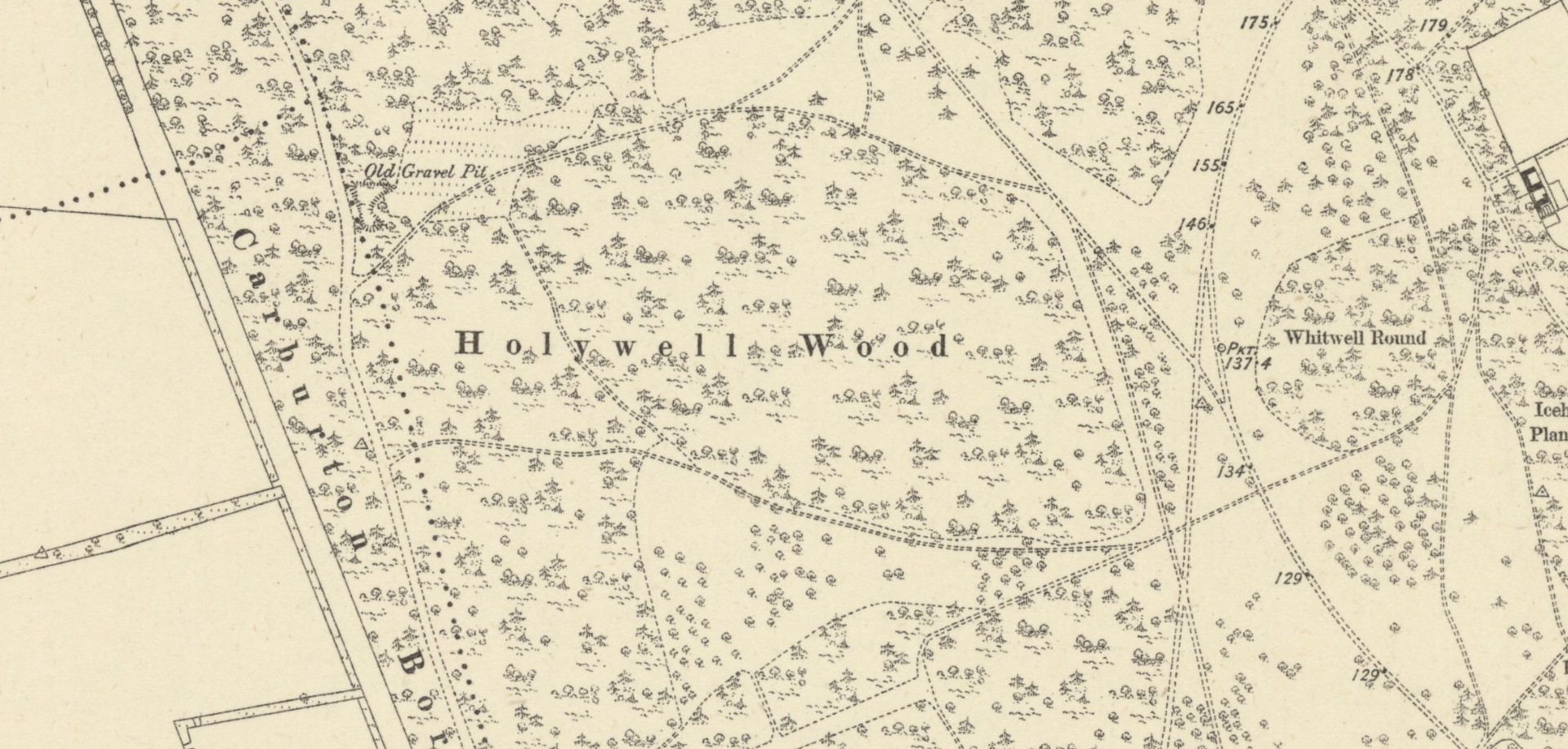
The precise whereabouts of this holy well—in the aptly-named Holywell Wood—is hard to pin down. It was first recorded in the Dukery Records of 1232 as Holywell Dale and the woodland that owes its name to the site was recorded on the 19th Century Ordnance Survey maps (right). Bob Morrell (1988) added the site to his survey of Nottinghamshire holy wells, but he was unable to locate it and its position remains elusive. One account suggested that it marked the line of an ancient boundary—which would place it on the western side of the present woodland. It’s alternative name, the Allenwell, may suggest a dedication to St. Helen. I add the site here in the hope that a local antiquarian might be able to locate it. Please let us know if you re-discover it!
References:
Gover, J.E.B., Mawer, Allen & Stenton, F.M., The Place-Names of Nottinghamshire, Cambridge University Press 1940.
Harte, Jeremy, English Holy Wells – 3 volumes, Heart of Albion press: Wymeswold 2008
Morrell, Robert, Nottinghamshire Holy Wells and Springs, Nottingham 1988.
Acknowledgements:Huge thanks for use of the Ordnance Survey map in this site profile, reproduced with the kind permission of the National Library of Scotland.
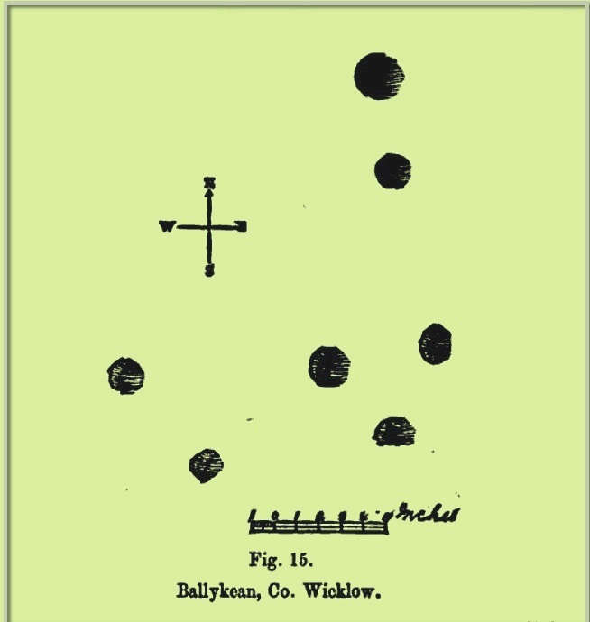
This is one of at least fourteen petroglyphs in this parish that have been either lost or destroyed since their initial description in the 19th century. It was described in George Kinihan’s (1884) survey as a “flat irregular stone, sloping slightly towards the east: the cups are seven in number”, in a design similar to that of the constellation of Cassiopeia. When the Archaeological Survey of Ireland looked for the carving in 1990 it could not be located. Corlett (2014) suggests that a collection of rocks in a hollow to the north may conceal this and some of the other carvings in this cluster.
References:
Corlett, Christiaan, Inscribing the Landscape: The Rock Art of South Leinster, Wordwell: Dublin 2014.
Kinihan, George H., “Proceedings: Cup-marked and Inscribed Stones in the Counties of Wicklow and Wexford”, in Journal Royal Society Antiquaries Ireland, (4th series) volume 6, 1884.
Cup-Marked Stone (lost): OS Grid Reference – SG 21584 42271
Also Known as:
Ballykean ‘Stone K’ (Kinihan 1884)
Archaeology & History
This is one of at least fourteen petroglyphs in this parish that have been either lost or destroyed since their initial description in the 19th century. It was described in George Kinihan’s (1884) survey as being, “a small peaked stone, having on the western side two small cups.” The carving has not been seen since then and he seems to have made no sketches of the stone. When the Archaeological Survey of Ireland looked for the carving in 1990 it could not be located.
References:
Corlett, Christiaan, Inscribing the Landscape: The Rock Art of South Leinster, Wordwell: Dublin 2014.
Kinihan, George H., “Proceedings: Cup-marked and Inscribed Stones in the Counties of Wicklow and Wexford”, in Journal Royal Society Antiquaries Ireland, (4th series) volume 6, 1884.
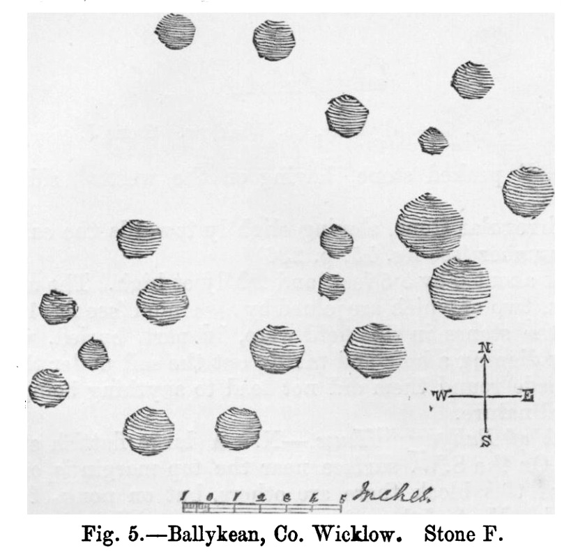
Cup-Marked Stone (lost): OS Grid Reference – SG 21537 42375
Also Known as:
Ballykean ‘Stone F’ (Kinihan 1884)
Archaeology & History
Kinihan’s 1884 rubbing of the stone
This is one of at least fourteen petroglyphs in this parish that have been either lost or destroyed since their initial description in the 19th century. It was described in George Kinihan’s (1884) survey as being, “a slightly dome-shaped stone, its surface being nearly level with that of the ground. The cups are both numerous and deep…although bits of the surface have been flaked off by fire.” He took a rubbing of the stone which showed nineteen cup-marks on its upper surface. When the Archaeological Survey of Ireland looked for the carving in 1990 it could not be located; and when Christiaan Corlett (2014) described this and the other carvings in this cluster, he thought that a group of stones dumped “in a hollow area north of the field” might possibly be where it had been moved to—although no such carvings have been identified there.
References:
Corlett, Christiaan, Inscribing the Landscape: The Rock Art of South Leinster, Wordwell: Dublin 2014.
Kinihan, George H., “Proceedings: Cup-marked and Inscribed Stones in the Counties of Wicklow and Wexford”, in Journal Royal Society Antiquaries Ireland, (4th series) volume 6, 1884.
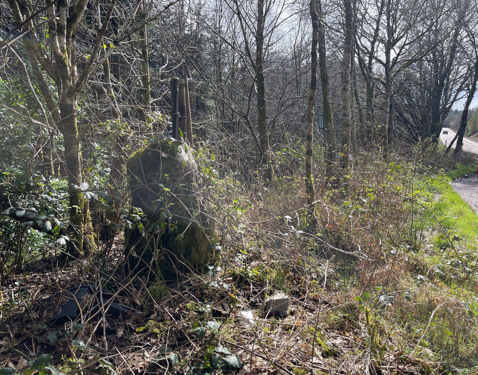
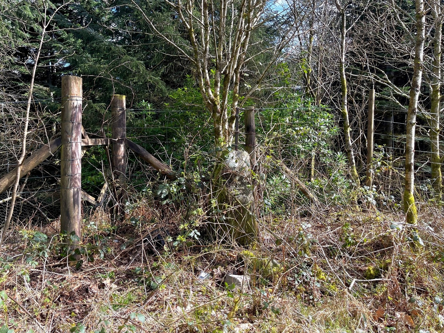
Along the A83 road, 2.6 miles (4.2km) south of Minard and/or 2.7 miles (4.4km) north of Lochgair village, an all-but-hidden parking area is on the east side of the road at the edge of the trees. Go in here and park up. Roughly halfway along where the track bends and set back against the fencing, you’ll see this obvious standing stone hiding away. If you visit this place in the summer months, it will be very hard to see. (in the event that you have the time and cutting ingredients, it’d be good to clear the stone from the undergrowth so it can be seen clearly)
Archaeology & History
Kilmichael Beg, looking E
Set back into the undergrowth of brambles and other spiney vegetation is this little-known standing stone, some four feet tall, that was converted for use as a gatepost at the end of the 19th century. It is said to have once been on the other side of the road before it was used in the line of fencing, when the metal rod coming out of the crown of the stone was inserted. The monolith is very worn and eroded on all sides, showing great age—seeming to affirm the local tradition of its antiquity. If anyone has any further information about this stone, please let us know.
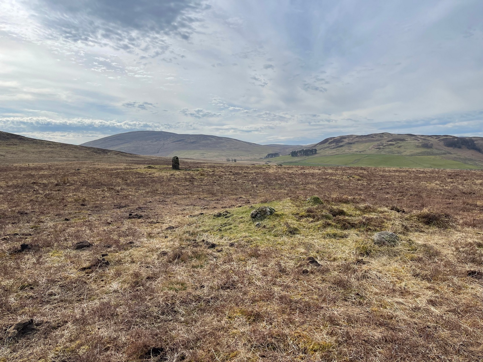
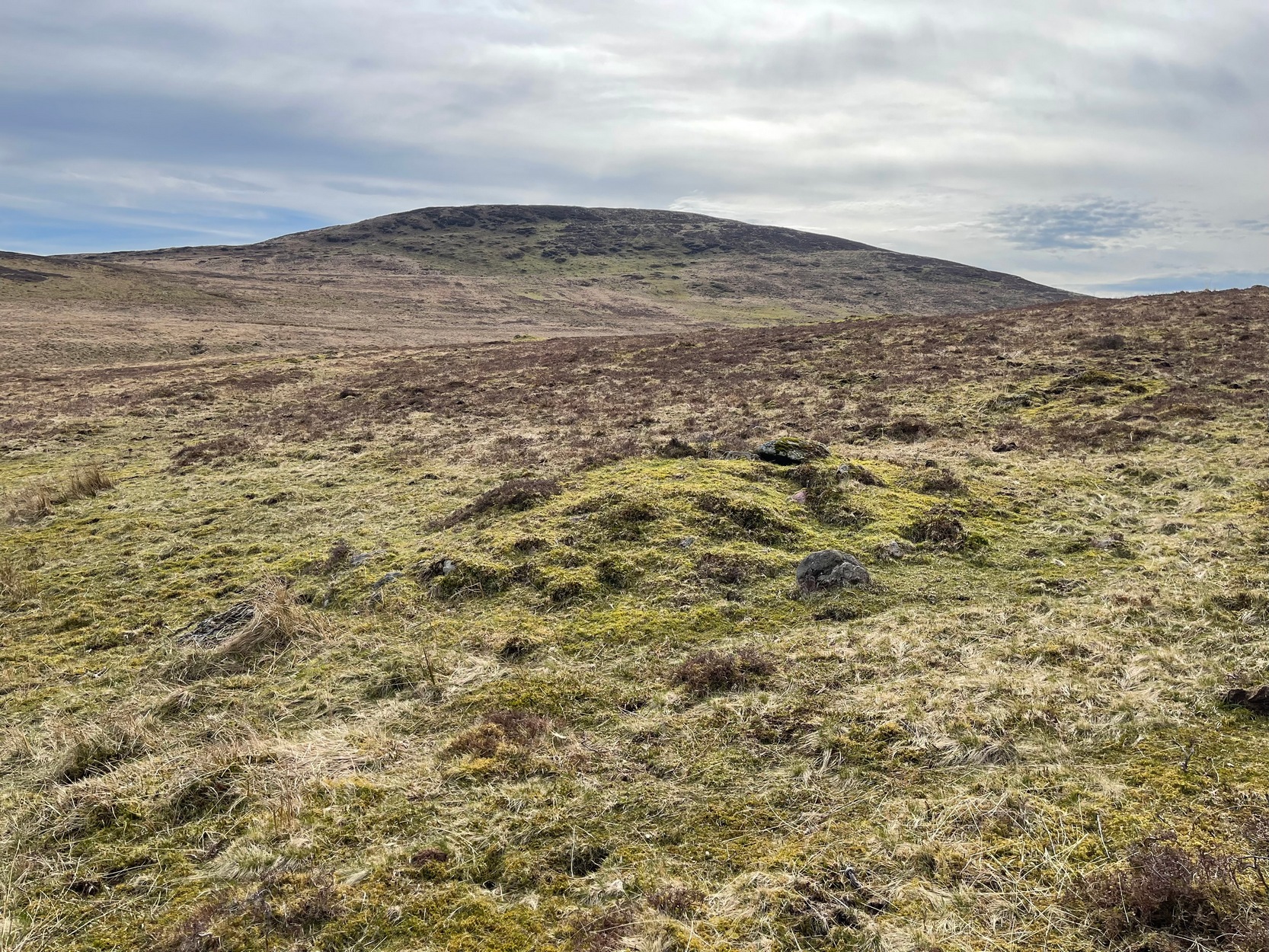
Simply follow the directions to reach the Dunruchan monoliths ‘D’ and ‘E’ and then zigzag through the heather to their immediate south—from just a few dozen yards away, to up to 300 yards west. Keep your eyes peeled for the stoney little rises in the heather as you walk back and forth and you’ll see at least some of these cairns.
Archaeology & History
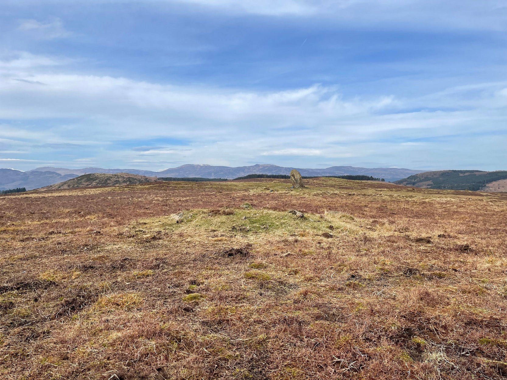
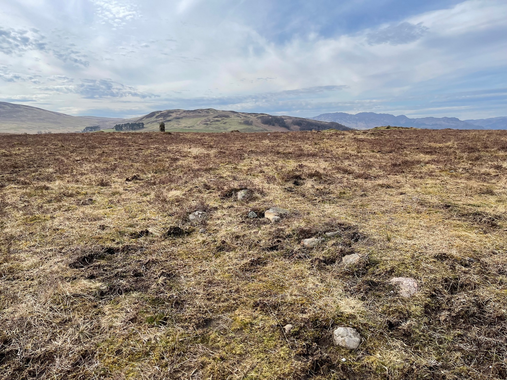
Not to be confused with the large cairn scatter on the grassy plain of Aodann Mhor a short distance north-west (whereon stands the magisterial Dunruchan A monolith), many of which which may be just field clearance cairns. This small group found a short distance east, south and west of Dunruchan stones ‘D’ and ‘E’ are more typical burial cairns. They each average between five and six yards across and none are more than three feet high. We first noticed them about ten years ago and on subsequent visits kept looking them over, but the deep heather ensured they were hard to see. But, after a recent heather-burning exercise on the moors, they are at thankfully visible—for a short time at least.
Cairn SE of Dunruchan ‘D’Cairn S of Dunruchan ‘D’
At the time of writing, probably the best one to see is found 40 yards south of Dunruchan D and 47 yards north-east of Dunruchan E and may have the astronomers amongst you running for the theodolites! It has that distinct look about it when you see it in context with the landscape and adjacent standing stones. The westernmost cairn that’s (presently) known here is 300 yards west of the Dunruchan E stone, just past the Dunruchan enclosure, at NN 7873 1676. It’s likely that there are other unrecorded prehistoric sites in this area.
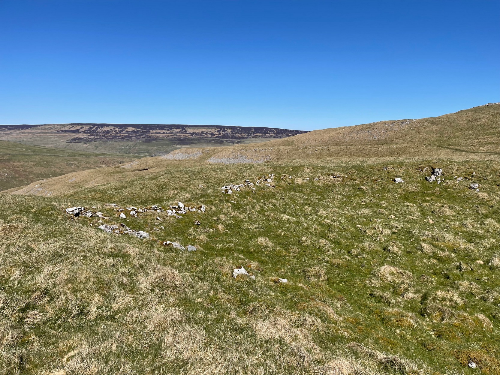
Low line of ancient walling
Amidst this section of the moors is a line of very low walling that runs a short distance east-to-west, towards the Dunruchan ‘E’ stone. A lot of old walling exists hereby, mainly visible in the fields to the east, but this particular line is much smaller and of a different age by the look of things, presumably older. It has the appearance of walling more usually associated with prehistoric hut circles, but in this case runs in a straight line towards the standing stone. Curious…
Folklore
The standing stones on this plain and the cairns here are said to be the graves of fallen Roman soldiers, slain by our tribal Scots two thousand years ago. In all honesty though, these are likely to be much older than any of those Roman savages.