Cup-and-Ring Stone (lost): OS Grid Reference – SE 0828 4507
Also Known as:
Carving no.84 (Boughey & Vickerman)
Archaeology & History
Described by Boughey & Vickerman (2003) as being located somewhere “below Dirk Hill Sike” in the Rivock woods plantation, this is (or was) a “medium, upstanding rock lying NW-SE (with) one possible heavily weathered large cup-and-ring: cup 75mm diam. and ring 200mm diam.” However, the authors give no references to this site, nor images, or notes as to who rediscovered this stone. In their survey they also included one of the Bucking Hill carvings twice, giving the impression that there was more here than had previously been reported. These errors have subsequently been repeated elsewhere on-line. In saying this, there are a number of rocks scattered in this area which may have had carvings on them, but it’s been heavily forested and, recently, the trees have been felled and so many of them will have been damaged, turned over, or simply destroyed as a result of the forestry shennanigans.
References:
Boughey, Keith & Vickerman, E.A., Prehistoric Rock Art of the West Riding, WYAS 2003.
Coming via the Keighley-Bingley (Airedale) B6265 road, go up to Riddlesden and then up the winding Banks Lane until you reach the T-junction. Turn left here and about 330 yards along, on the right-side of the road is a dirt-track. Walk up here, sticking to the track (not the footpath) towards the cliffs of Rivock ahead of you, going through the gate and into the Rivock woods area. 450 yards on from the gate, on your right you’ll pass the long straight line of walling running uphill and literally 275 yards further along the track from here, walk straight up into the trees for 20 yards where, just before the slope begins to truly veer into an “uphill” state, you’ll see the stone in question!
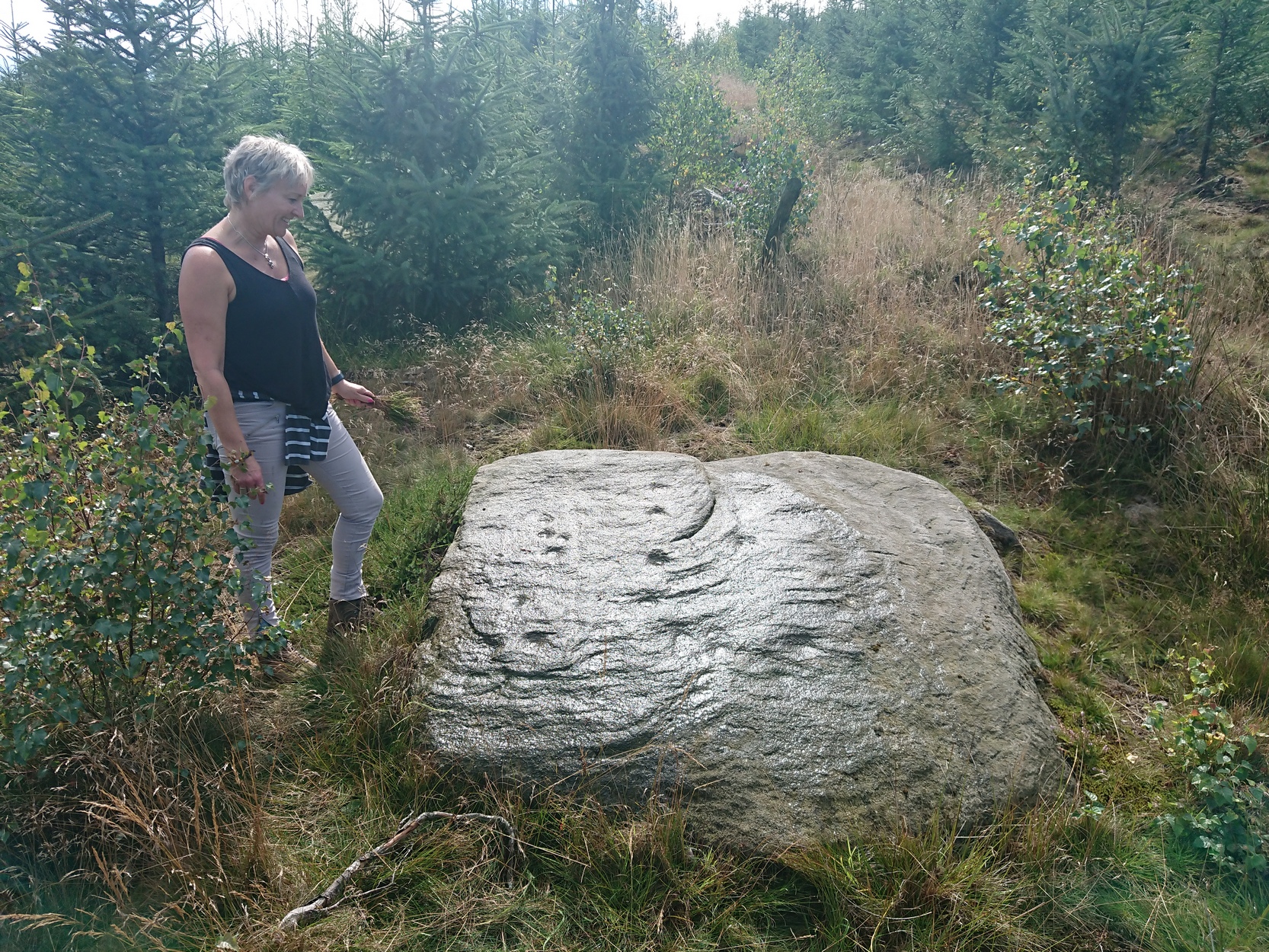
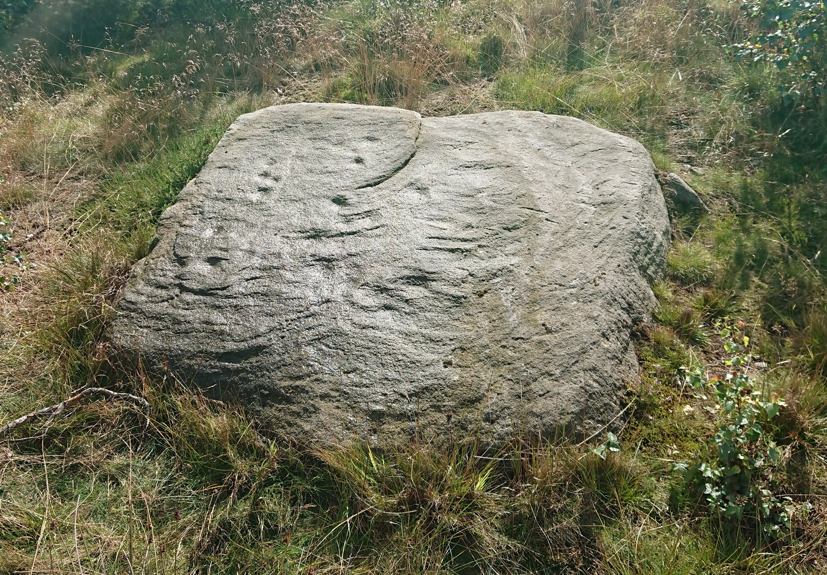
Archaeology & History
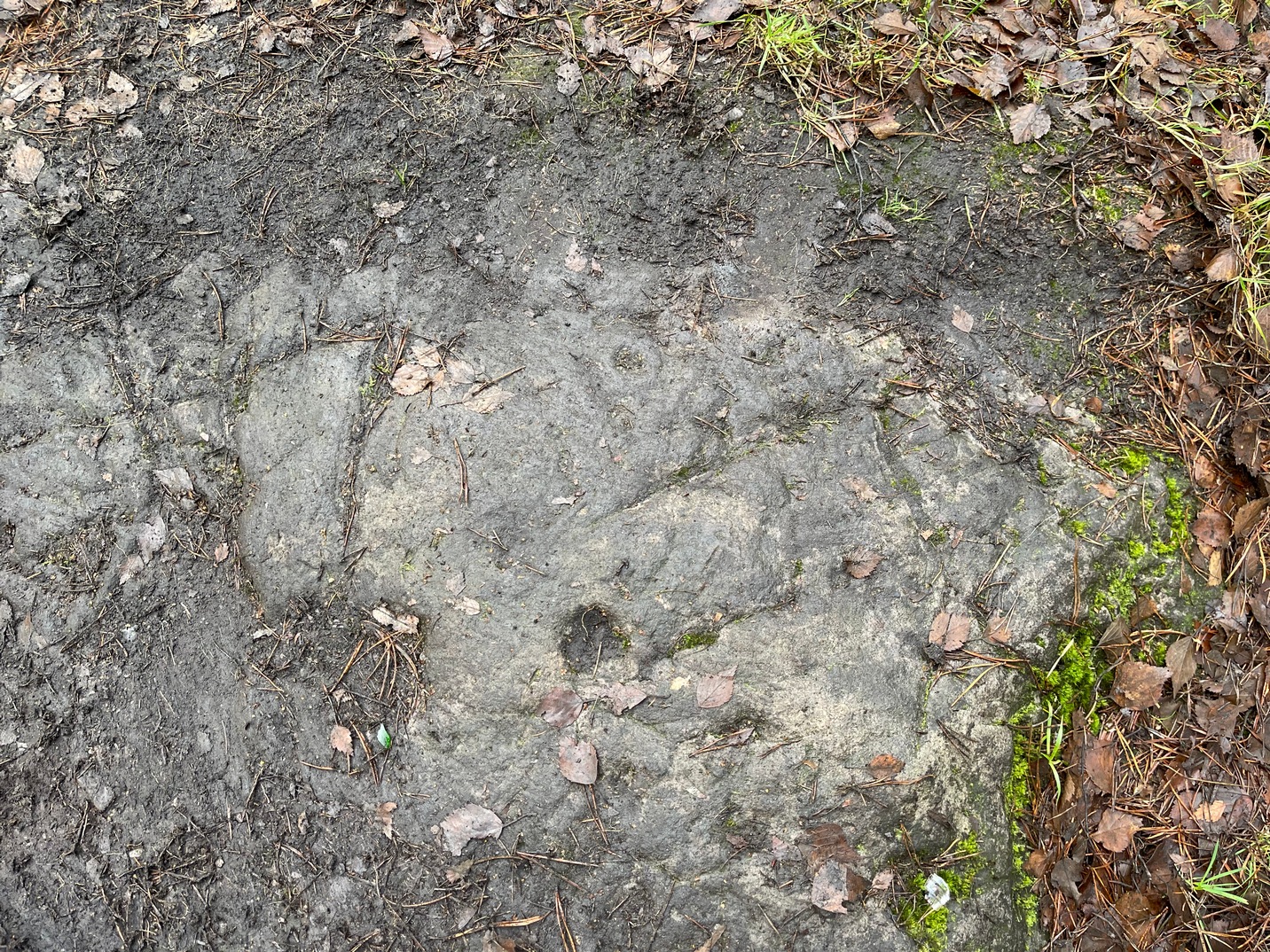
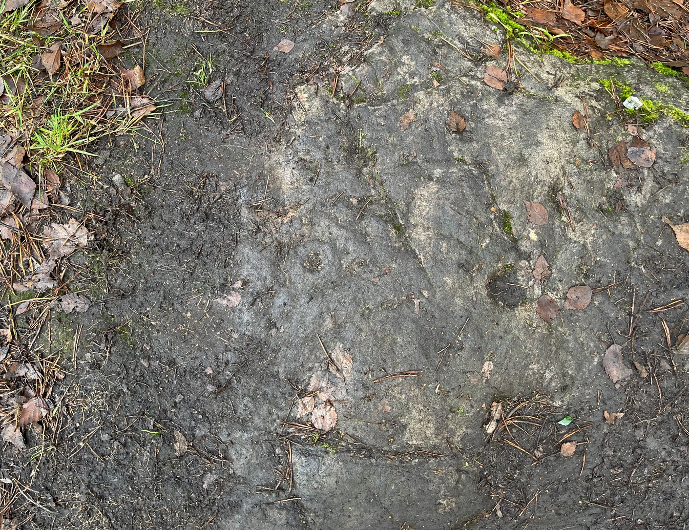
Cups on east-side of stone
In 1961 when Stuart Feather rediscovered this carving, the “rock was almost completely covered by a six-inch layer of peat and vegetation.” But, like all good rock art explorers, he slowly and carefully peeled it all back and brought back to light another one of Rivock’s olde stories. We know not what the story on the rock might tell, but it looks good nonetheless! Feather counted “several cups carved on it”, but a few more have ben discerned since then. When Boughey & Vickerman (2003) described it in their typically minimalist way, they told it be a “large square rock with surface in slope of hill. About nineteen cups.” Evocative stuff!
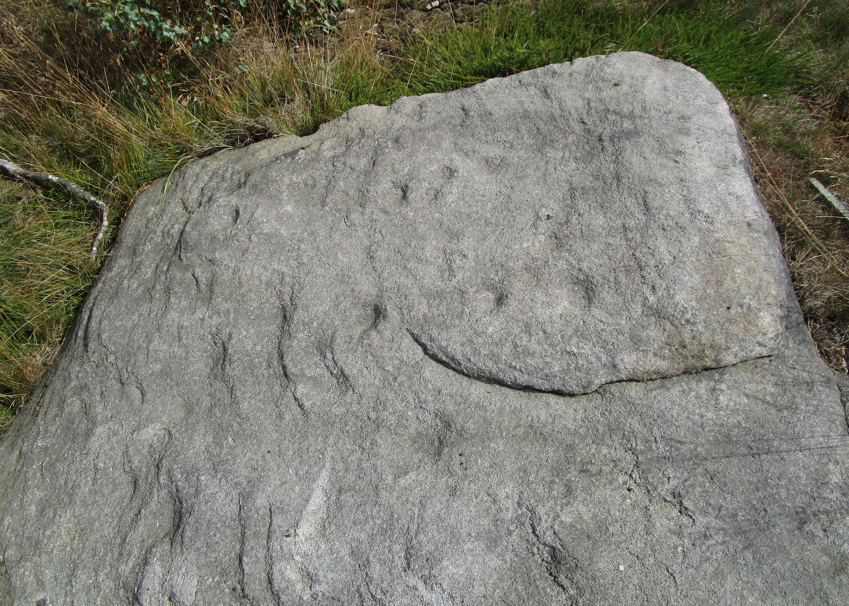
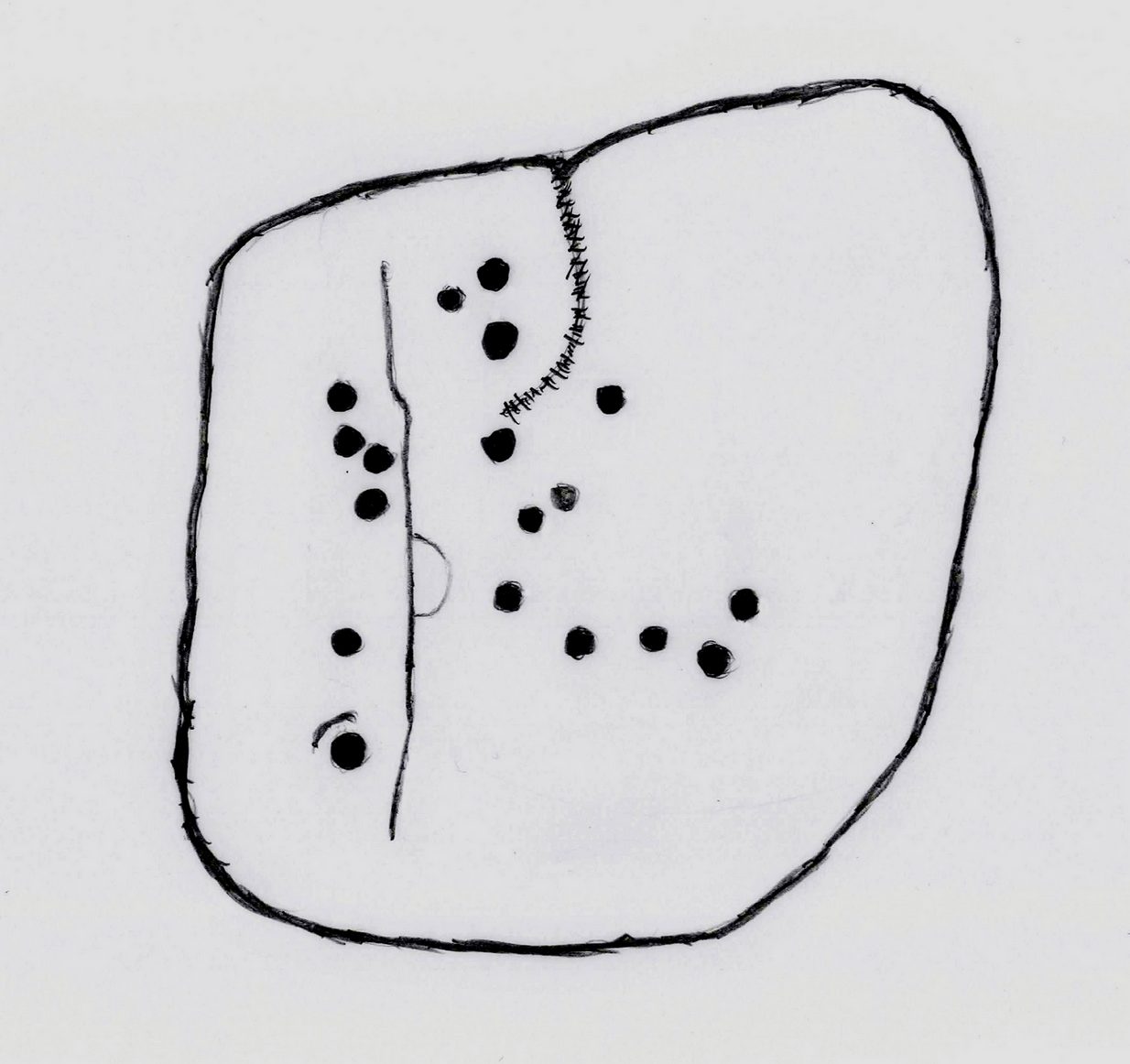
Sketch of basic designFaint line visible, left-side
When I first saw visited this carving as a young lad, the thing which stood out to me more than anything was the long but faint line that ran down one section of the stone. Added to this was an equally faint arc attached to the side of the line, like a “D” form. A few months later I did a sketch of it on my second visit, but I’ve looked and looked and seem to have lost it. (not good) The one I’ve done here is a recent one. As we can see, a series of cup-marks straddle each side of the D-line and are plainly visible, which implies that the line was carved much earlier than the cups. Of course, it’s possible that the cups were repeatedly forged over and over many times over a century or more and the D-line, for whatever reason, left untouched.
Another interesting aspect of this D-line is its repetition in the much more ornate petroglyph 35 yards to the east (presently known as Rivock 67 until we devise something more appropriate). The recently rediscovered Slinger Stone 100 yards south may also have the same feature, but this needs further surveying before we can say for sure.
References:
Bennett, Paul, ‘The Prehistoric Rock Art and Megalithic Remains of Rivock & District (2 parts),’ in Earth, 3-4, 1986.
Boughey, Keith & Vickerman, E.A., Prehistoric Rock Art of the West Riding, WYAS 2003.
Feather, Stuart, ‘Mid-Wharfedale Cup-and-Ring Markings: No. 14, Rivock,’ in Cartwright Hall Archaeology Group Bulletin, 7:1, 1962.
Hedges, John (ed.), The Carved Rocks on Rombald’s Moor, WYMCC: Wakefield 1986.
Acknowledgements: With thanks to Andy Roberts for giving this stone its modern name.
Standing Stone (destroyed): OS Grid Reference – NO 5404 6892
Archaeology & History
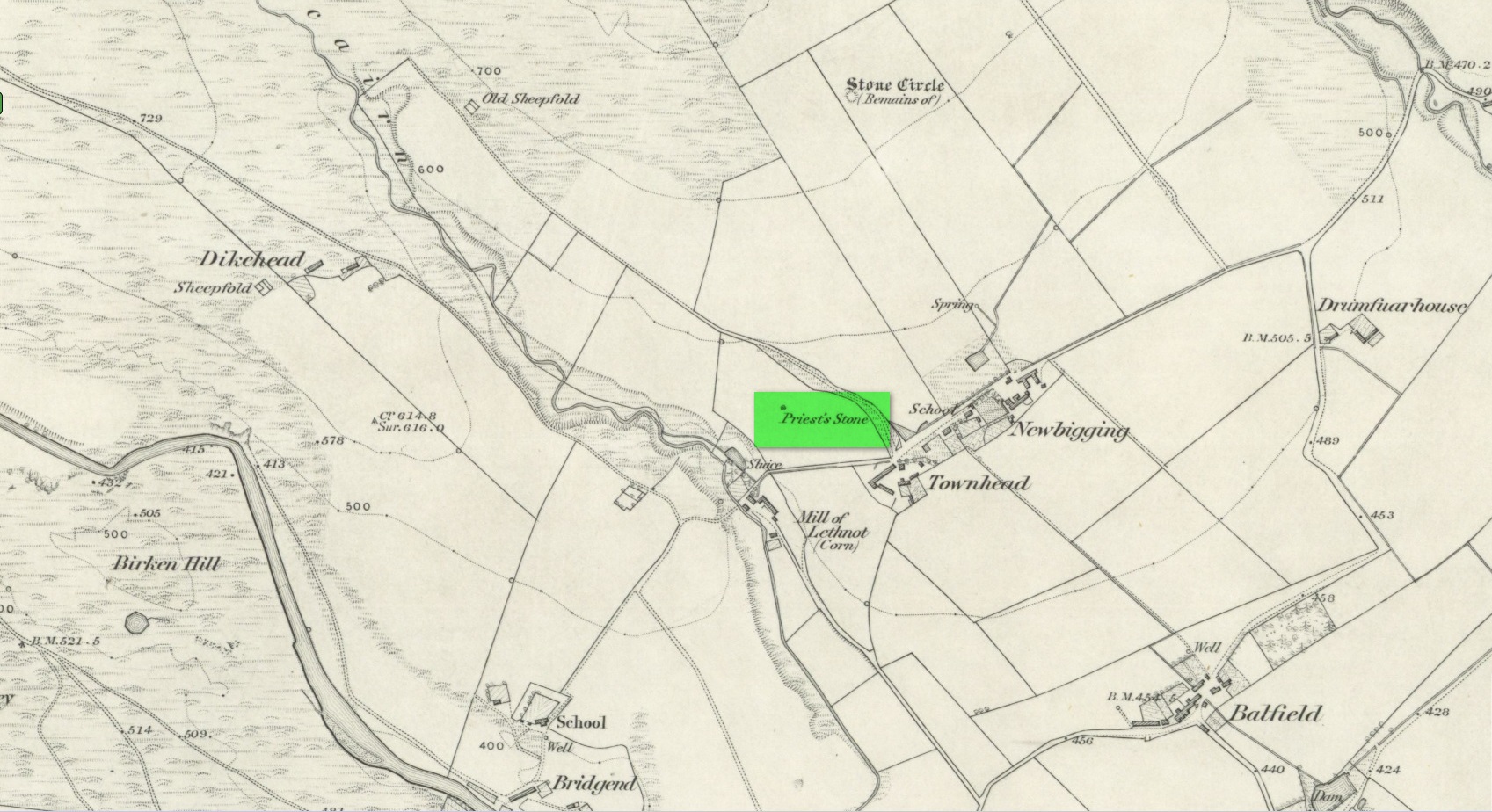
Priest’s Stone on 1865 map
Despite being shown on the early OS-maps of the area, I can find few references of this place. The Ordnance Survey lads themselves, when visiting here in 1863, merely told that this it was “a standing stone of which nothing is known except the name. It is 3 feet high, three feet in diameter at base, and a foot and a half at top.” Even in Cruikshank’s (1899) definitive survey of this township he could add little more, merely telling:
“About a quarter-of-a-mile north of Bellhill is a field known as “the Priest’s Field.” There is a large right stone in the middle of it, called “the Priest’s Stone,” and it is so given on the Ordnance Survey map. not simply because such is the local name, but also because the skilled surveyors after examining it concluded that it had been used for sacrifice. It stands just behind the site of the old farm steadying of Upper Argeith, or vulgarly, Townhead.”
Quite what he meant by saying that “it had been used for sacrifice,” god only knows! But the writer was the local minister and so would have been possessed by the usual delusions. Anyhow, the stone was uprooted and destroyed by the farmer at Newbigging, sometime prior to 1958. Idiot!
A half-mile north of this could once be seen a stunner of a site: a double-ringed giant tomb from where hundreds of cartloads of stone were taken. It too no longer exists!
References:
Cruikshank, F., Navar and Lethnot: The History of a Glen Parish in the North-east of Forfarshire, Black & Johnston: Brechin 1899.
Royal Commission on the Ancient and Historical Monuments of Scotland, The Archaeological Sites & Monuments of Central Angus, Angus District, Tayside Region, HMSO: Edinburgh 1983.
Acknowledgements:Huge thanks for use of the Ordnance Survey map in this site profile, reproduced with the kind permission of the National Library of Scotland.
Ring Cairn (destroyed): OS Grid Reference – NO 5381 7877
Archaeology & History
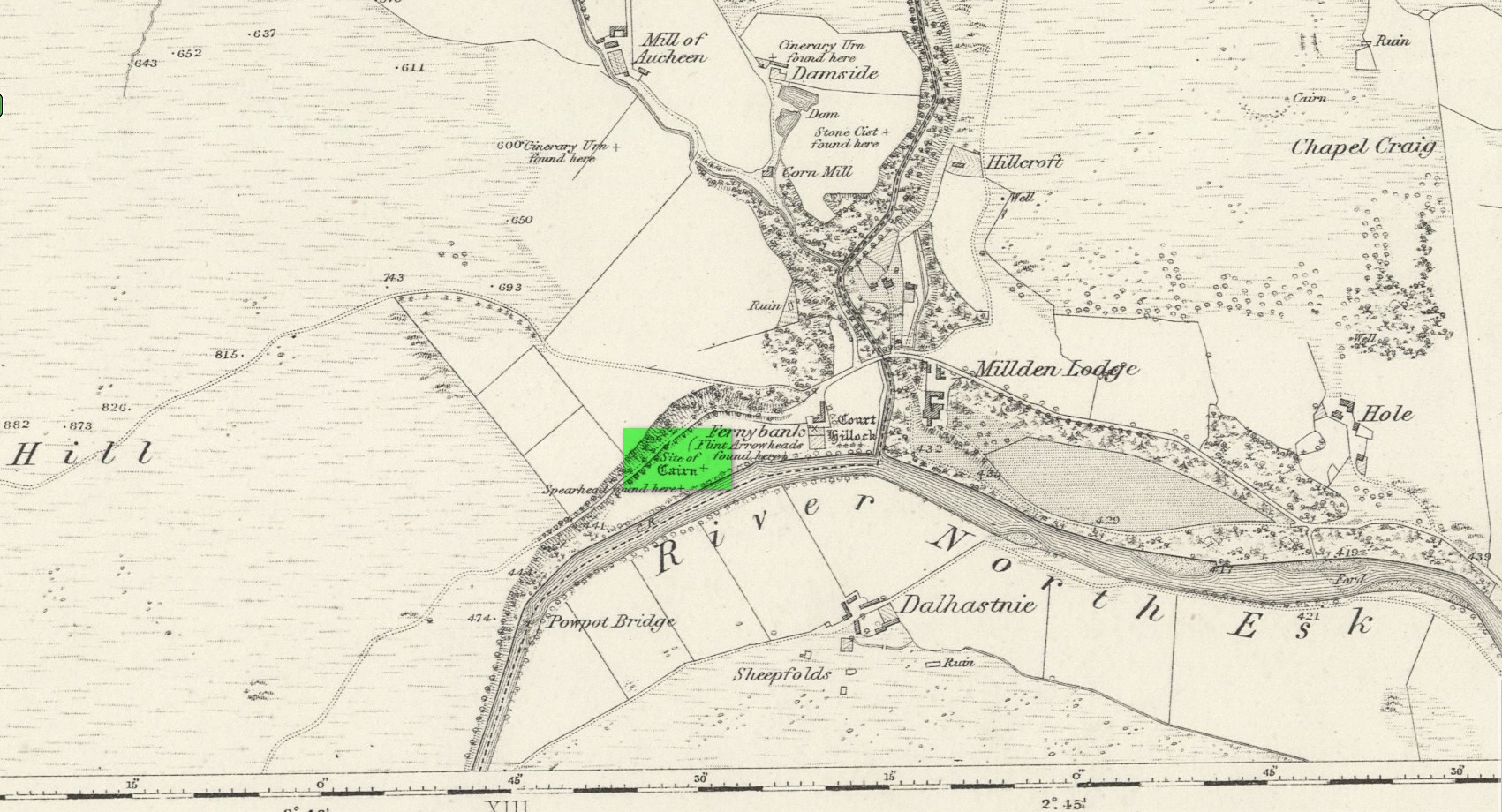
Location of site on 1864 OS-map
This is one of many sites that were thankfully recorded by the fine pen of Andrew Jervise (1853) in the middle of the 19th century, without whose diligence in antiquarian interests all knowledge would have vanished. His works remind me very much of those by the late-19th early-20th century writer Harry Speight in Yorkshire, whose veritable madness on that region’s history remains unsurpassed even to this day. But I digress…
Jervise told us that,
“About the year 1830, while the tenant of Fernybank was levelling a hillock in the haugh between the farm-house and the Powpot Bridge (about two miles north-west of Colmeallie), he removed a number of stones varying in length and breadth from eighteen to twenty-four inches. They were ranged singly, and stood upright in a circle at short distances from each other, enclosing an area of about twelve feet in diameter. On the knoll being trenched down, the encircled part (unlike the rest of the haugh, which was of a gravelly soil) was found to be composed of fine black earth; but on several cart-loads being removed, operations were obstructed by a mass of stones that occupied much the same space and form as the layer of earth. Curiosity prompted the farmer to continue his labours further, but after digging to the depth of three or four feet, and finding stones only, he abandoned the work in despair, without having discovered anything worthy of notice… Had this cairn been thoroughly searched, it is probable that some traces of sepulture might have been found in it.”
A short time after this however, Jervise reported the finding of “old warlike instruments, both in the shape of flint arrow-heads and stone hatchets, have been found in the same haugh, and so late as 1851 a spear-head made of iron, and about fifteen inches long, was also discovered; it was much corroded, but had part of the wooden hilt in it.” These were prehistoric artifacts that were subsequently moved to Edinburgh’s central museum where, I presume, they remain to this day.
About ten years later the Ordnance Survey lads came here and were fortunate to be able to meet with the same man who’d uncovered the site. They told that,
“in contradiction to (Jervise’s narrative), the tenant of Fernybank who gave the information to Mr. Jervise, states that he continued the search to the bottom of the Cairn and found a quantity of Charred wood.”
There were a number of other prehistoric sites in this neck o’ the woods, many of which were also destroyed but, again, were thankfully recorded by Mr Jervise.
References:
Jervise, Andrew, The History and Traditions of the Land of the Lindsays in Angus and Mearns, Sutherland and Knox: Edinburgh 1853.
Acknowledgements:Huge thanks for use of the Ordnance Survey map in this site profile, reproduced with the kind permission of the National Library of Scotland.
Standing Stone (destroyed): OS Grid Reference – NO 483 603(approximation)
Archaeology & History
In an area once teeming with megaliths, this is but one that lost its life in the 19th century. It would seem that the only reference of its existence—and demise—comes from the pen of the great regional historian Andrew Jervise (1853) who, in a description of the nearby holy well of St Ninian, in a field near Wellford,
“within the last half century there were two or three large rude boulders nearby, which were called Druidical stones.”
References:
Jervise, Andrew, The History and Traditions of the Land of the Lindsays in Angus and Mearns, Sutherland & Knox: Edinburgh 1853.
Cup-Marked Stone (lost): OS Grid Reference – NO 003 650
Archaeology & History
When you’ve visited the impressive cup-marked stone at Dalnavaid, this long lost carving might be worth seeking out by the real explorers among you. It’s not been seen for a hundred years and was only reported in brief by the reputable local historian Hugh Mitchell (1923). It’s located a mile north of the Dalnavaid carving, up in the hills on the other side of the road, “on the East side of Clunskea Burn, and on the West shoulder of Ben Skievie.” He described the carving as “having some 16 or 18 cups, and at present it forms part of a grouse butt.”
So if we locate the grouse-butt (they’re usually not too difficult to find), the carving will obviously follow. Mitchell gave us an extra piece of info regarding its location. He described the existence of several other seemingly prehistoric remains within a few yards of the grouse-butt, curious “pit dwellings”, three of them:
“they are of circular shape, about 9 feet in diameter and nearly 5 feet below the surface of the ground, and had evidently been roofed over at one time. The entrance to each is at the lowest level and acts as a drain, to keep the house dry. They are almost the only examples in the district of neolithic dwellings.”
Let us know if you find it!
References:
Mitchell, Hugh, Pitlochry District: Its Topography, Archaeology and History, L. Mackay: Pitlochry 1923.
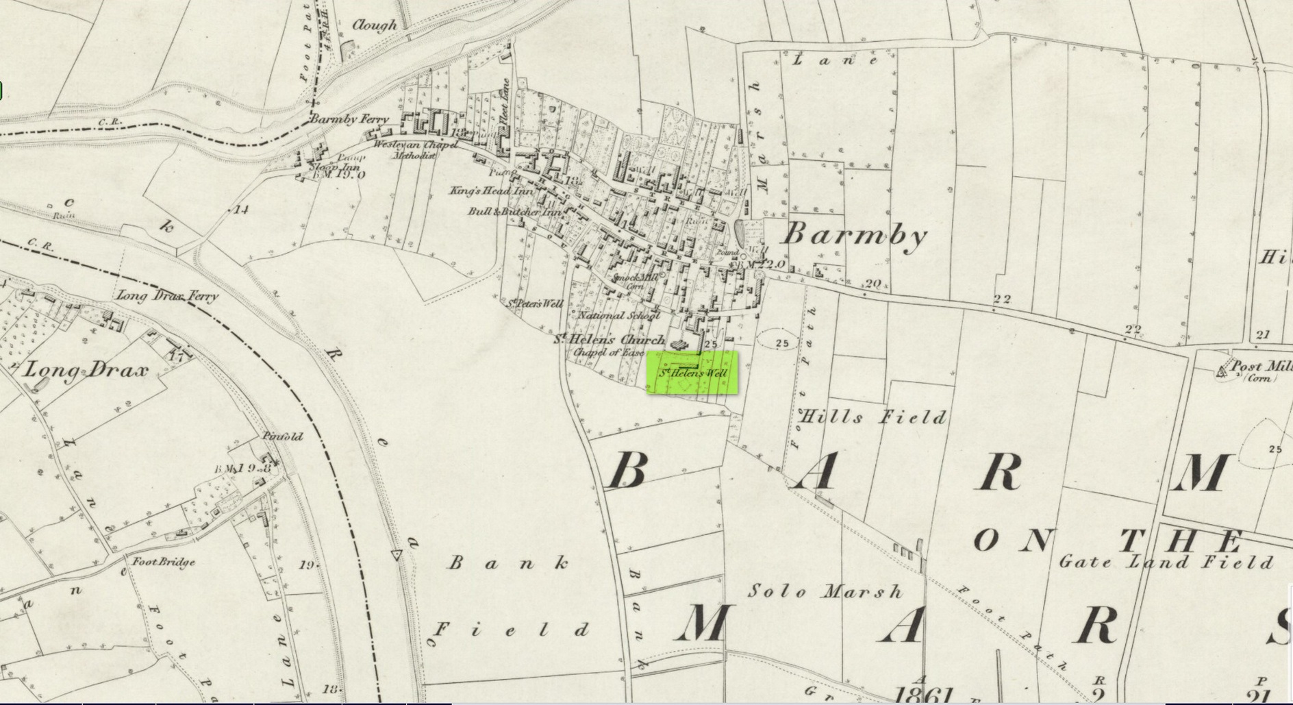
Holy Well (destroyed): OS Grid Reference – SE 6900 2841
Archaeology & History
Site shown on 1853 map
One of two holy wells in Barmby village which, like its compatriot St Peter’s Well, was destroyed sometime in the 19th century. Not good! It was located in the southwest section of the graveyard of St Helen’s Church and was apparently alive and running when the Ordnance Survey lads visited here in 1851 (as shown on their 1853 map). But when the site was revisited by them in 1905, it seems to have gone. However, as with the neighbouring St Peter’s Well, there are conflicting reports as to when it was destroyed, for although the Ordnance Survey lads spoke of it in the present tense when they went there, Thomas Allen (1831) told that “within the last six years (it has) been wantonly filled up.” Despite this, less than ten years later William White mentioned it in the present tense, also saying how it was “said to possess medicinal properties.” These healing qualities were, according to Allen, due to its iron-bearing or chalybeate nature, meaning that it would revive a weak and feeble constitution. Iron-bearing wells are damn good for such things!
As the years passed, St. Helen’s Well fell into folk memory. When William Smith (1923) surveyed the many holy wells in this part of the world he found how “old parishioners have said that as school-children they both drank of and washed in its water”, but little else.
References:
Allen, Thomas, A New and Complete History of the County of York – volume 2, I.T. Hinton: London 1831.
Gutch, E., Examples of Printed Folk-lore Concerning the East Riding of Yorkshire, Folk-Lore Society: London 1912.
Harte, Jeremy, English Holy Wells – volume 2, Heart of Albion press: Wymeswold 2008.
Smith, William, Ancient Springs and Streams of the East Riding of Yorkshire, A. Brown: Hull 1923.
White, William, History, Gazetteer and Directory of the East and North Ridings of Yorkshire, R. Leader: Sheffield 1840.
Holy Well (destroyed): OS Grid Reference – TQ 102 952
Archaeology & History
A long lost sacred site (not to be confused with the nearby Bright Well) that has given its name to the district of Holywell. It also gave its name to an early farmstead; and to the place-name of Holywellane recorded as far back 1485. It was also described as a “Holy Well” in a local vestry book in 1698. Nothing more seems to be known of the place.
References:
Gover, J.E.B., Mawer, Allen & Stenton, F.M., The Place-Names of Hertfordshire, Cambridge University Press 1938.
Harte, Jeremy, English Holy Wells – volume 2, Heart of Albion press: Wymeswold 2008.
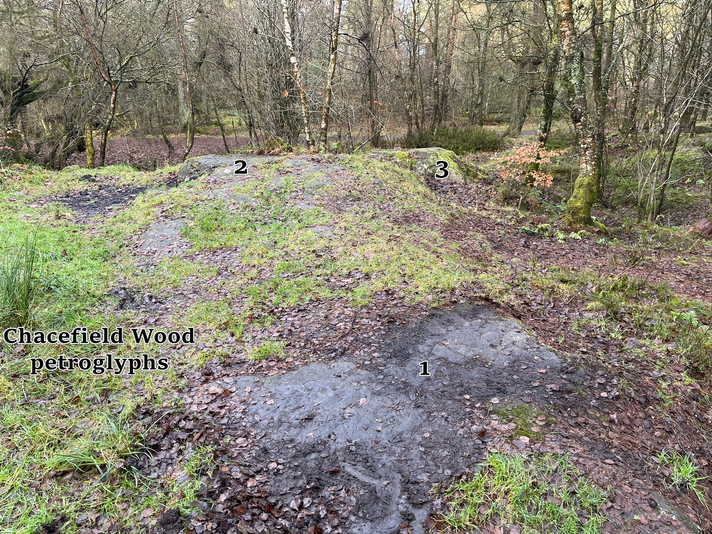
We took the A872 road on the south-side of Denny to Dennyloadhead and Longcroft, but a few hundred yards before you go under the M876, keep your eyes peeled for Drove Loan on your left. Go down here for literally ¼-mile (0.4km) where there’s a footpath into the woods on your left. Walk on the path into the trees and you’ll reach a track that heads to your right (east). Less than 200 yards on, you’ll see a pond on your right and above here is a small quarried rock outcrop. This carving’s up top, on the gently sloping rock behind carvings no.2 and no.3.
Archaeology & History
Half-covered in mud and vegetation, the first thing you’ll notice on this sloping smooth surface is what looks to be a standard cup-marking, all on its own. But it has company—albeit quiet and faint. A single incomplete cup-and-ring can be seen about 18 inch above (north-ish) this single cup-mark, which may itself be natural. You can make out the cup-and-ring pretty clearly in the photos.
When we found this, we began to clear the rest of the stone but stopped pretty quickly as a scatter of broken glass was mixed into the mud and I was lucky not to cut my hand open. Some kids have evidently been getting pissed here and have left their mess on the rock. But there may well be more symbols beneath the mulch, so if any local folk want to clean it, please make sure to wear some good gardening gloves to protect your hands! And if you find any other hidden elements, please let us know! 🙂
Holy Well (destroyed): OS Grid Reference – TL 2214 0449
Archaeology & History
An early reference by Nathaneal Salmon (1728) told that in the grounds of St. Mary’s church by the vicarage there was a well, which may or may not have been deemed as ‘holy’. He wrote:
“There is a Dale in Coppice belonging to the Manor of Potterels, from which, after a great Quantity of Rain, the Water comes through Veins of Chalk to the Vicarage Well, and is white.”
No well is shown on the early OS-maps at this place and we can only assume that it was either capped or had fallen back to Earth not too long after Salmon’s visit.
References:
Salmon, N., The History of Hertfordshire; Describing the County and its Monuments, London 1728.
Acknowledgements:Huge thanks for use of the Ordnance Survey map in this site profile, reproduced with the kind permission of the National Library of Scotland.