Legendary Tree: OS Grid Reference – NS 847 836?
Also Known as:
- Wallace’s Tree
Archaeology & History
The archaeology and traditions ascribed to this ancient tree (exact position unknown) is based on words that were first penned two hundred years ago. It was thankfully recorded with a reasonable description when William Nimmo wrote about the great Sir William Wallace in the second edition of his Stirlingshire (1817) work. Known about in oral tradition by local people, Nimmo told how:
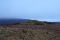
“Torwood was a place where he and his party, when engaged in any expedition in this part of the country, often held their rendezvous, and to which they retreated in the hour of danger. Here is still to be seen an aged oak, well known by the name of Wallace’s Tree; which seems to have been, even then, rotten and hollow within, and is said to have often afforded a lodging to him and a few of his trusty friends. It is supposed to have been one of the largest trees that ever grew in Scotland. It is now almost quite decayed; but, from its ruins, appears to have been of an uncommon size. The remaining stump is no less than eleven or twelve feet in diameter. It stands upon the summit of a small eminence, which is surrounded on all sides by a swamp. A rugged causeway runs from the south through the swamp, and leads up to the tree. Some other vestiges of the stonework are discernible, surrounding the tree in a circular form, and leading to the conjecture that this oak is of a very high antiquity; and that, having been much frequented by Druidical priests, amongst whom the oak was sacred, the causeway had been laid for their approach to it, and the performance, underneath its branches, of religious rites.”
Nimmo may have a point here. Not necessarily of druids (although druidic traditions and reality is known from many old tracts to have continued in many of the hidden places in Scotland), but certainly in relation to the paved track leading to a what may have been a recognised moot-hill, on top of which this great oak once stood. Great trees and ancient meeting places were held in high esteem, not only in the legends of druidism and more established animistic pantheons, but in the recognised pragmatism of local tribal gatherings, in Scotland, Wales, England and in traditional cultures all over the world. (Gomme 1880) The traces of stonework leading to the hill strongly implies an archaeological site in the paving alone; but moreso, as an important site in the traditions of the Scottish people. The fact that these stone ruins were still visible when Nimmo visited the site in the latter-half of the 18th century in the context he describes, implies it may have been the remains of a possible crannog; or a moot hill; or even, with its great oak surmounting, a sacred grove! In my mind, it was probably being used as a gathering place long before William Wallace and his men gathered here…
In 1880, a 3rd edition of Nimmo’s Stirlingshire was published and edited by R. Gillespie. Herein were additional notes about Wallace’s Oak that had been uncovered by Mr Gillespie. Although he’d visited the place,
“Not the smallest vestige…of the Wallace oak remains. Even the ” oldest inhabitant” can say nothing of it save what he has gathered from tradition. Sir Walter Scott, in his Tales of a Grandfather, speaks of having seen some of its roots eighty years ago; and recently we were shown a treasured morsel of the tree in the Chambers’ Institute at Peebles. Wallace, undoubtedly, often chose the solitude of the Torwood as a place of rest for his army, raised and roused to oppose the tyranny of Edward. Here he concealed his numbers and his designs, sallying out suddenly on the enemy’s garrisons, and retreating as suddenly when afraid of being overpowered. While his army lay in these woods, “the oak” was his head-quarters. Within it, the illustrious hero generally slept, the hollow trunk being huge enough to afford shelter both to himself and one or more of his associates.”
When John Gibson (1908) came to write about it, he told that “Wallace’s Oak, which stood on another part of Woodside (low Torwood), has…vanished.” No roots, no lingering trunk—nothing. But although the tree has long since gone, William M. Stirling pointed out in 1817 that,
“A young tree is pointed out in the neighbourhood, as having sprung from an acorn of Wallace’s Oak.”
If and when we can locate the old toll-house of Broomage at Larbert, we get much closer to identifying the exact location of this long lost oak. Then, perhaps, a commemorative plaque should surely be placed there to remind people of their great history, and included on tours of sites relating to Sir William Wallace.
References:
- Gibson, John C., Lands and Lairds of Larbert and Dunipace Parishes, Hugh Hopkins: Glasgow 1908.
- Gomme, George L., Primitive Folk-Moots, Sampson Low: London 1880.
- Nimmo, William, The History of Stirlingshire (2nd edition), John Frazer: Stirling 1817.
© Paul Bennett, The Northern Antiquarian


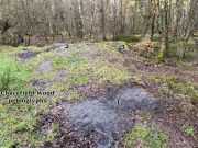
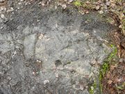
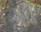
 When we found this, we began to clear the rest of the stone but stopped pretty quickly as a scatter of broken glass was mixed into the mud and I was lucky not to cut my hand open. Some kids have evidently been getting pissed here and have left their mess on the rock. But there may well be more symbols beneath the mulch, so if any local folk want to clean it, please make sure to wear some good gardening gloves to protect your hands! And if you find any other hidden elements, please let us know! 🙂
