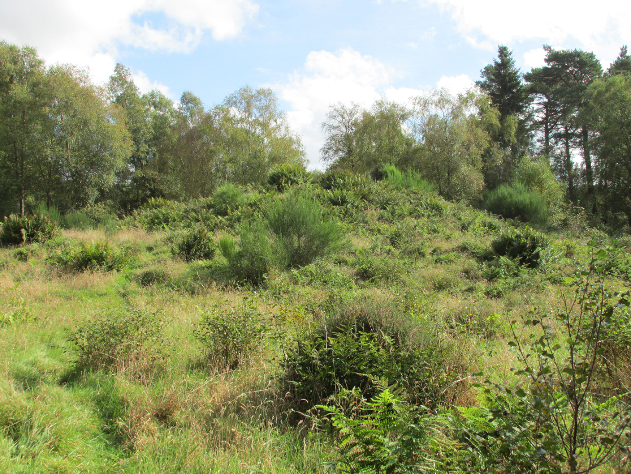
Travelling north on the Bridgemill to Fettercairn road, park at the layby just before the junction with the minor road (left) through the Forestry Commission’s Inverury Wood. Go through the gate and walk along the track to the end where it joins another track and turn right. About 300 yards along, the Hillock is in a fenced enclosure to the right, accessible over a stile.
Archaeology & History
The site was not mentioned in the Statistical Accounts, nor is the origin of the name recalled, from which it is reasonable to assume that ‘witches’ (howsoever that term was interpreted in the days of persecution by the Kirk Sessions) met there. This is reinforced by there being a plot of land due west called ‘Witchfield’. The Canmore report describes the mound as being,
“situated near the edge of a low natural escarpment..measuring about 18m. in diameter and 2m. high.”
The Ordnance Survey reported in the mid-1860s that the Hillock was,
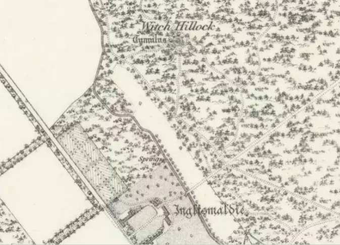
“An artificial mound….a remarkable looking object….enclosed with ornamental wire fencing, the name is well known in the district, but is not mentioned in the Statistical account nor any other document in the possession of the authorities. James Glenny, Gardener at Inglismaldie states that he assisted to open this, under directions from the Earl of Kintore, about Seven years ago, and that after clearing away the top soil there were found several stone coffins containing human bones and a clay urn containing what appeared to be calcined human bones….”
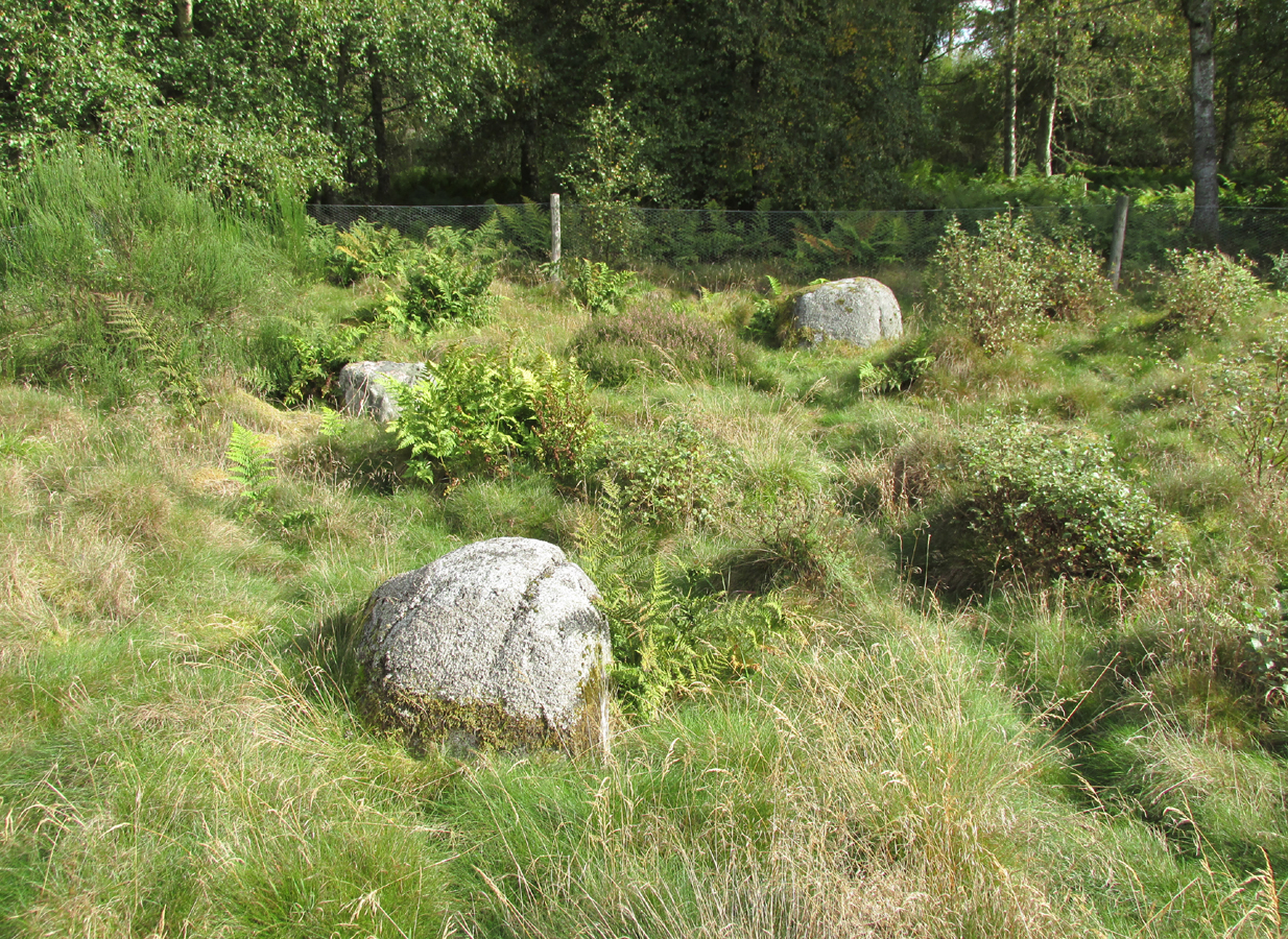
The site shown at the top of the 1865 6″ OS Map.The Hillock with 3 stones in the foreground
Another remarkable feature of the Hillock enclosure is an arc of three large earth fast boulders to the north-west of the mound. It has the appearance of being an incomplete, possibly four poster circle. The stones are not listed by Aubrey Burl (2000) as being part of a circle, and if indeed it was a circle there doesn’t seem to be any evidence of the fourth stone, which would have been positioned nearest to the Hillock. Unless the Hillock was imagined to be the ‘missing’ fourth stone.
Three stones – once part of a circle?
A ‘well’ is shown on the modern OS map in the corner of the enclosure nearest the stile, but there was no evidence of this on the day of my visit.
Despite its rather remote location, it was noticeable by the well trodden state of the long grass on the day of my visit that the site receives quite a few visitors – a venue still for witches?
References:
Burl, Aubrey, The Stone Circles of Britain, Ireland and Brittany, Yale University Press 2000.
Royal Commission on the Ancient and Historical Monuments of Scotland, The Archaeological Sites & Monuments of South Kincardine, Kincardine and Deeside District, HMSO: Edinburgh 1982.
Of all the ancient wells in the city of Glasgow, this has to be one of the most intriguing! Descriptions of it are few and far between, but it is the name of the site which is of interest, to folklorists and occult historians alike. For the word ‘Bogle’ is another term for a ‘boggart’ or goblin of some sort! The well is mentioned in Andy MacGeorge’s (1880) excellent study in his description of ancient wells in the city. Citing notes from the 17th century, amidst many sites,
“Another was Bogle’s Well, in regard to which there is a minute of the town council “that Bogillis Well should be assayed for bringing and convoying the water of the same to the Hie street according to the right the town hes thereof,” and the magistrates are recommended to arrange for having this done “by conduits of led.””
…Obviously in the days when they were clueless about lead-poisoning! The word ‘bogillis’ is the early plural form of the bogle, or bogill (Grant 1941:201). But where exactly was this old well? Are there any other records hiding away to help us locate its original position? It seems to have been one in a cluster of legendary and holy wells in a very small area scattered between Glasgow’s cathedral, down the High Street and to the northern banks of the River Clyde… (the grid-reference given for this site is an approximation)
In a less esoteric fashion, the occult historian Jan Silver suggested that the name of the Well may relate to the family name, ‘Bogle’. This could indeed be the real story behind the well’s name.
Folklore
Traditionally ascribed in the lower counties of England to be an evil malicious sprite, in more northern counties and in Scotland the creature was said by Katherine Briggs (1979) to be a more “virtuous creature”, akin to the helpful brownies or urisks of country lore. This was said to be the case in William Henderson’s (1868) Folklore of the Northern Counties. Whether this well was haunted or the home of a bogle, we do not know as the folklore of this site appears to be lost; so I appeal to any students who might be able to enlighten us further on the place. The Forteans amongst you might have a cluster of ‘hauntings’ hereby, perhaps….
Healing Well (destroyed): OS Grid Reference – NS 5974 6534
Also Known as:
Meadow Well
Archaeology & History
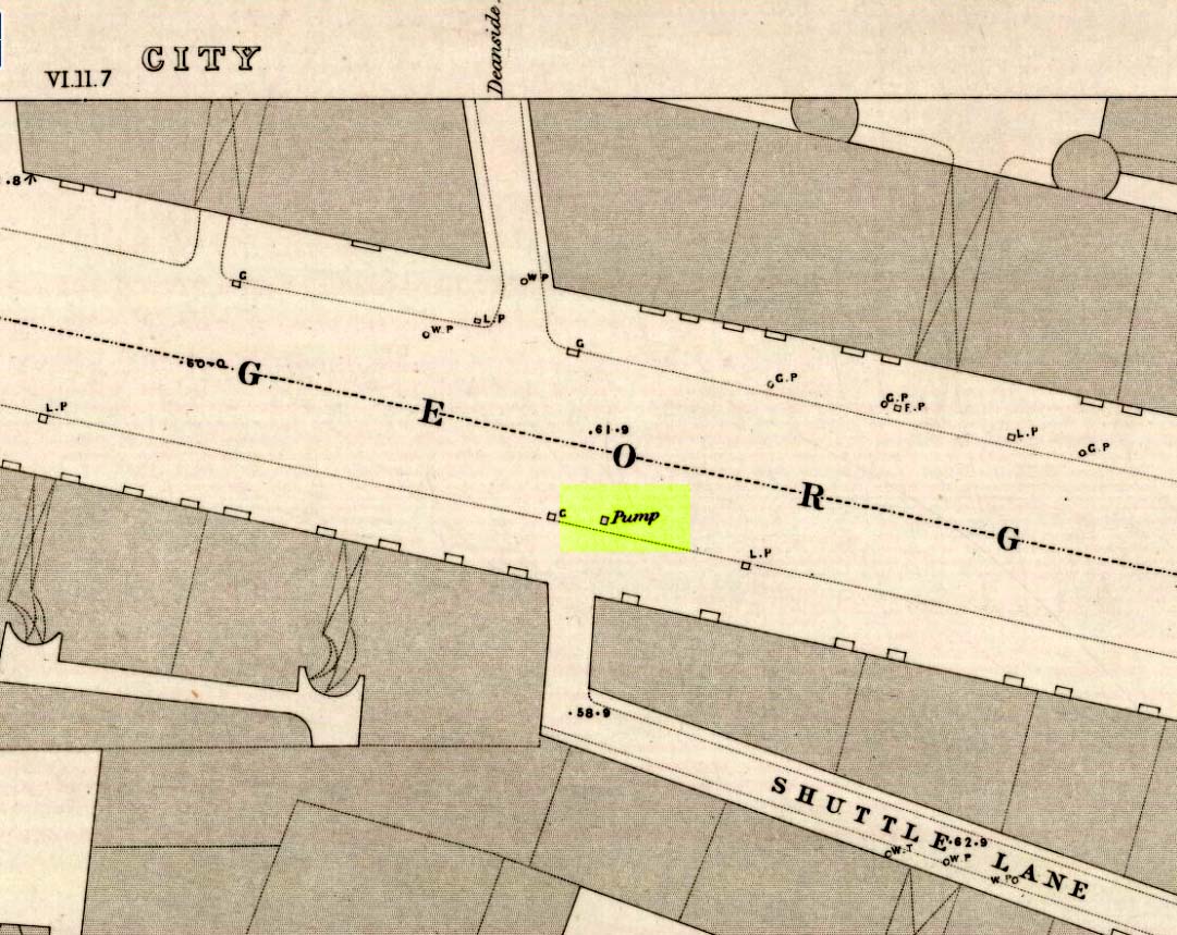
Deanside Well ‘pump’ in 1857
This little-known well—destroyed about two hundred years ago—was said to be one of the finest of all of the water supplies in the Glasgow district in pre-industrial days. The Glasgow historian Andy MacGeorge (1880) told it to be “a spring which was then, and for long afterwards, in great repute.” It was described as early as 1304 CE in a grant by Robert, bishop of Glasgow, allowing the christians to take water from the well and into their convent. The Latin transcript told:
“Noveritis Ros intuita caritatis, Dedisse fratribus Predicatoribus de Glasgu, Fontem quendam qui dicitur Meduwel in loco qui dicitur Denside scaturientem, in perpetuum conducendum in claustrum dictorum fratrum, ad usus necessarios eorundem” (Meaning, “Know ye that I Rosh, of charity, Among His brethren shared with the Preaching Friars of Glasgow, the gushing fountain called Meadow Well or Deanside as the place is called, to the cloisters is said to meet the needs” of the monks.”)
There is the possibility that the well was deemed as ‘holy’ due to it being of vital use to the bishop and monks, but I can find no record of it being ‘blessed’ as such; and the exact site of the bishop’s convent has been lost to history. In 1574 the “Deynside Well” needed cleaning due to people clogging up the waters with earth and stones; and sometime in the 18th century the spring of water was turned into a draw-well.
A northern antiquarian by the name of ‘ Senex’ (real name, Robert Reid) visited the Deanside Well at the end of the 18th century, telling of its whereabouts:
“In the year 1789 I had occasion daily to mount and descend the Deanside Brae, upon business, so that the state of the place at that date is quite familiar to me. The whole of the Deanside Brae was then vacant ground, as is shown in the old Maps of Glasgow. The Deanside or Meadow Well was situated in a meadow at the west end of Grayfriars’ (or Bun’s) Wynd, close to the footpath leading up to the Rottenrow; it is now on the street, at 88 George Street, opposite to the lane leading into Shuttle Street. The Deanside Well was then in a rural spot, the whole lands on the west, as far as Partick, being garden grounds and com fields.
“In Stuart’s Views the lonely foot passage up the Deanside Brae, to the Rottenrow, is very distinctly shown. The well stood at the south extremity of the said footpath, about the centre of the wynd.”
‘Senex’ also told that an ancient fair was held in “an enclosure” at the northwest corner of Shuttle Street, close to the Deanside Well.
Close to the ancient boundary of north Lanarkshire—if not actually on it—and looking down on the River Clyde, was once a prehistoric burial mound, probably Bronze Age in nature. Described first of all in David Ure’s (1793) early survey of Rutherglen, he told that:
“A tumulus of earth, supposed to have been originally a burying place, was lately demolished in the estate of Shawfield, a few yards from Polmadie; and the place where it stood converted into a mill-dam. None of its contents attracted the particular attention of the workmen employed in removing it.”
The site was subsequently referenced in Hugh MacDonald’s (1860) excellent work, but no remains of it now exist.
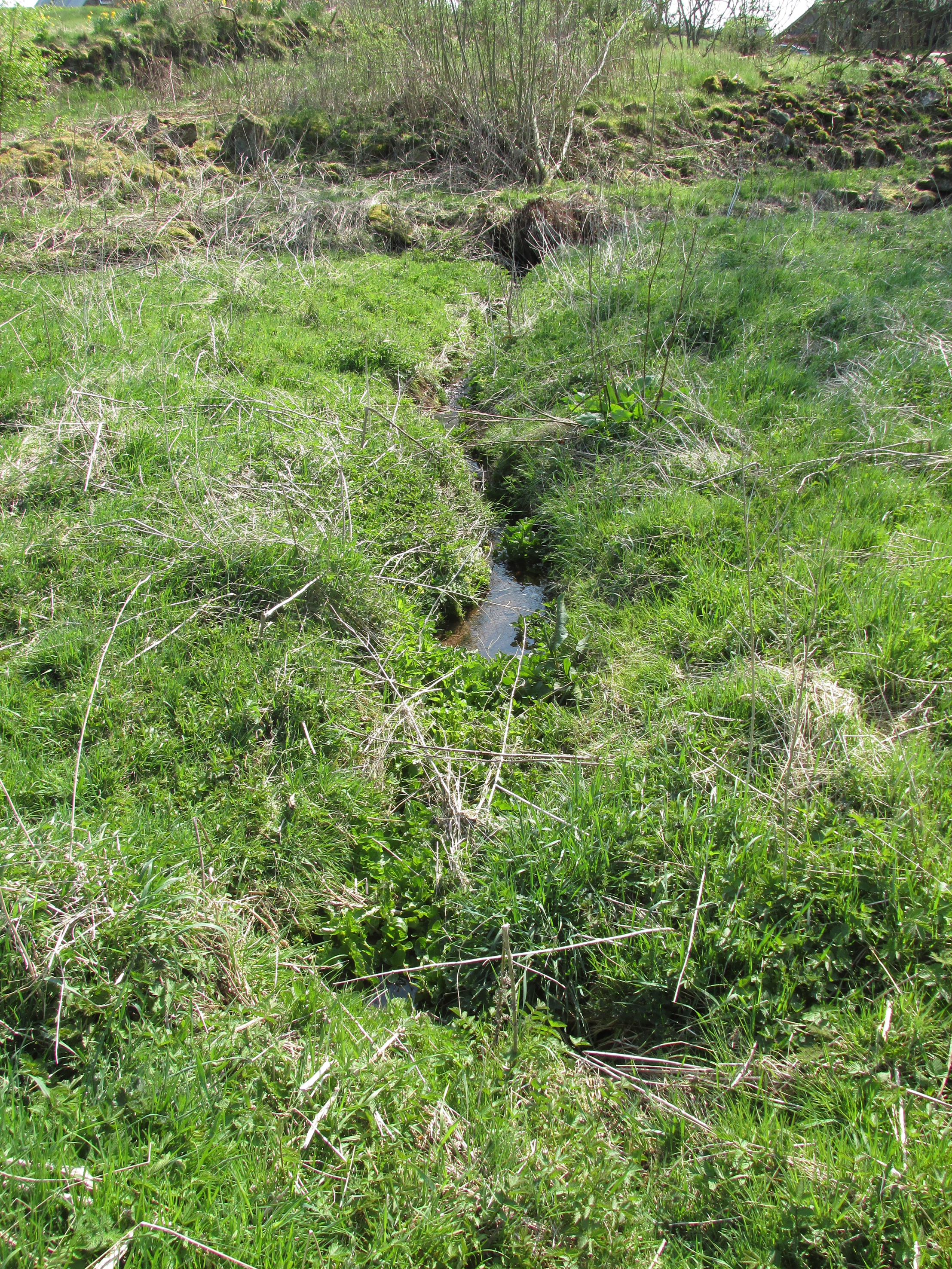
One of the present issues of St. Madden’s spring looking south.
At Kirkton of Airlie, park next to the church and walk north eastwards along the track, past the houses ‘Crabra’ and ‘Cleikheim’ and the spring that once supplied the Holy Well will be seen on the opposite side of the burn in a small fenced off enclosure. To the north east of the enclosure is a small hillock known as St Medan’s Knowe.
Archaeology & History
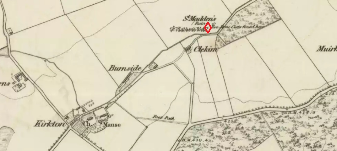
According to the Ordnance Survey Name Books, St Madden’s Well was located in a hamlet called St Maddens, which has since been almost entirely destroyed. In the mid nineteenth century a number of stone coffins and pottery were recovered from around the site, and the well was described as,
“filled up and defaced, the spring…still to be seen issuing into the mouth of a covered drain that was made some few years ago”.
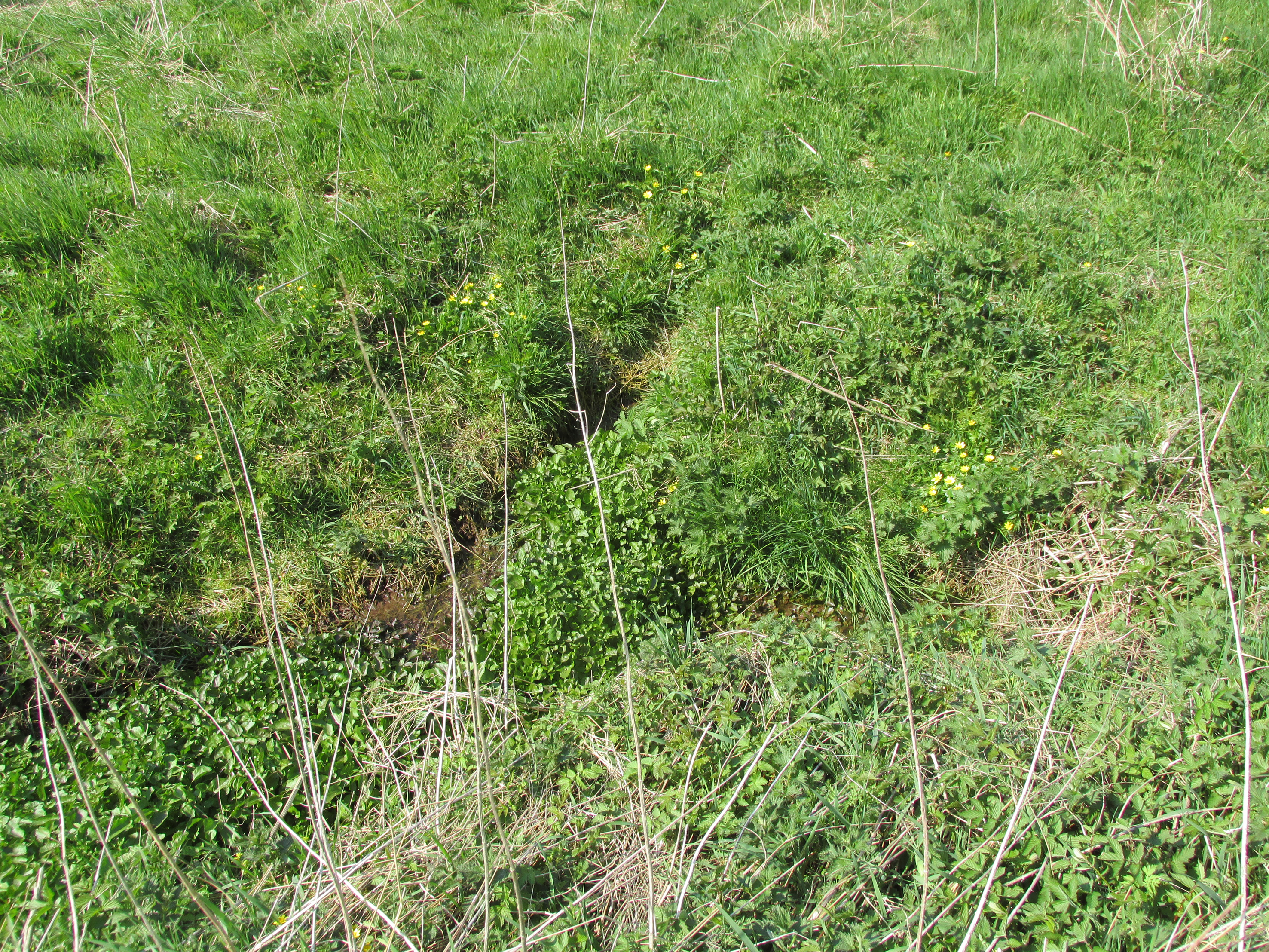
There are now two issues of water from the spring, while nothing now remains of the original well housing. An adjoining resident informed me that the local landowner had gone to some trouble to try to find any evidence of the well housing, but had found nothing.
St. Madden’s Well on 1865 Map
As is often the case with these early mediaeval Scottish saints there is some confusion as to St Madden’s identity. To some writers his Saint’s day is accepted to be April 29th, and he has been identified as Saint Middanus, abbot of the monastery of Holywood, but Bishop Alexander Forbes considers he is more likely to have been a Bishop Medanach listed in the Dunkeld Litany.
To confuse things even more, J.M. MacKinlay (1904) wrote:
“The Hamlet of St Madden’s or St Medan’s in the parish of Airlie, where are also St Medan’s Well and St Medan’s Knowe, probably retains the name of St Modan, believed to have been a contemporary of St. Ronan. Skene says: ‘Modan appears in the Scotch calendars as an abbot on the fourth February, and as a bishop on the fourteenth November; but the dedications to him are so much mixed up together that it is probable that the same Modan is meant for both'”.
Andrew Jervise provides the following quote about St Medan:
“..bishop and confessor whose feast is held on 14th November was in great favour with King Conran c.503 – Coll. for Aberdeen and Banff.”
Another issue of the spring
Whosoever St Madden was, his quadrangular bell was the subject of an extant fifteenth century deed whereby the bell with its appurtenant parcel of land was granted to the Countess of Moray as dewar (hereditary keeper of a Holy Relic with appurtenant land), together with “the infeftment being completed by (the Countess) being shut up in a house and then receiving the feudal symbols of earth and stone.” On the death and subsequent disposal of the estate of the last dewar in the nineteenth century, the bell was sold along with a load of rubbish, its true identity and value not being realised at the time.
References:
Andrew Jervise, The History and Traditions of the Land of the Lindsays, Edinburgh, Sutherland & Knox 1853.
Andrew Jervise, Epitaphs and Inscriptions from Burial Grounds and Old Buildings inthe North East of Scotland, Edinburgh, Edmonston and Douglas 1875.
James Murray MacKinlay, Influence of the Pre-Reformation church on Scottish Place-Names, Edinburgh and London, William Blackwood and Sons 1904.
Dom Michael Barrett, A Calendar of Scottish Saints, Fort Augustus 1919.
Bishop Alexander Forbes, Kalendars of Scottish Saints, Edinburgh, Edmonston and Douglas 1872.
Scotland’s Place Names
Andrew Jervise, Notice of Antiquities in the Parish of Airlie, Forfarshire, in Proceedings of the Society of Antiquaries of Scotland, June 1864
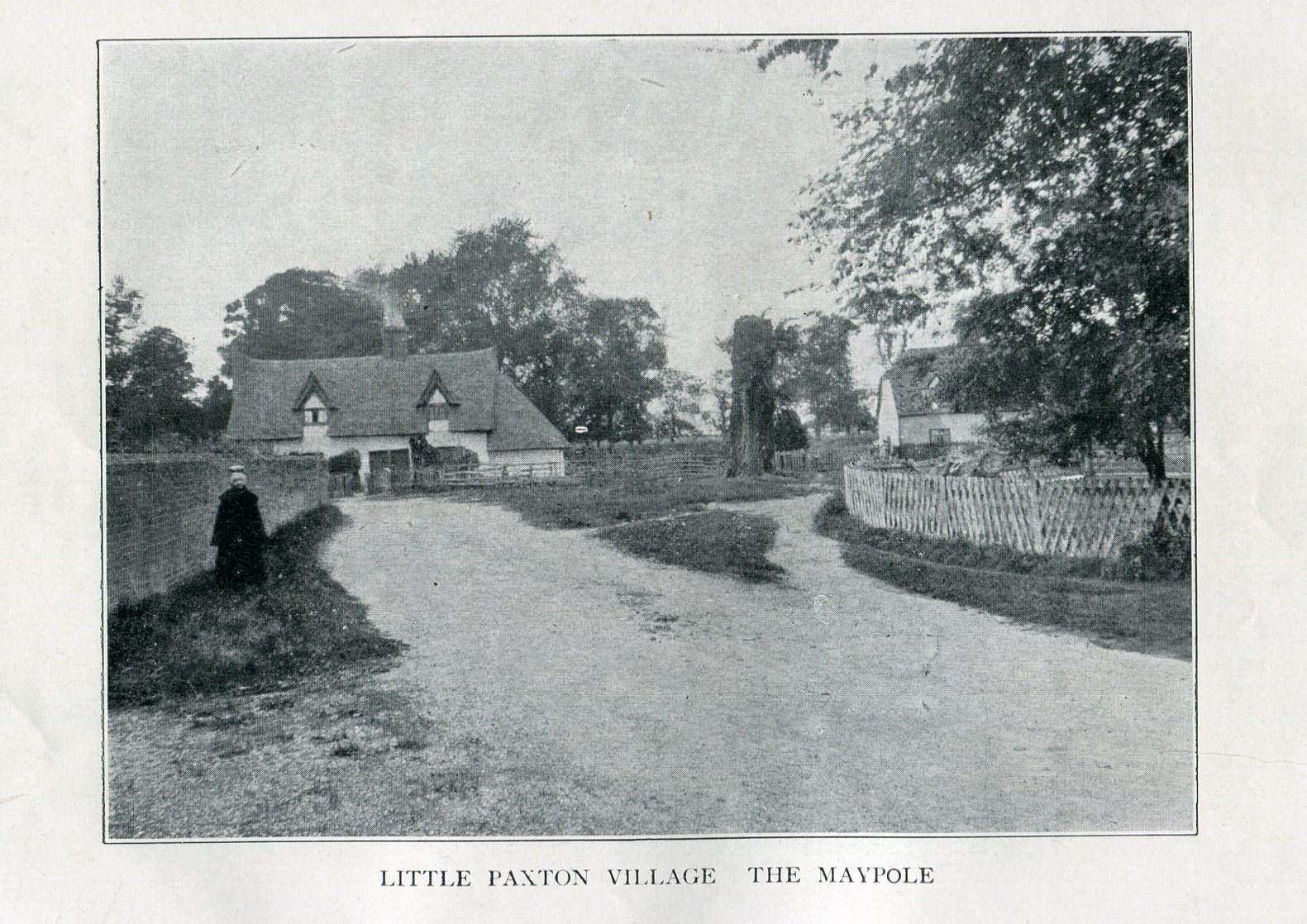
Imposing trunk of The Maypole Tree, right background
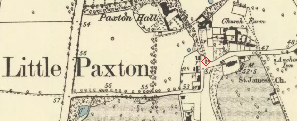
The road layout of the village has changed since the destruction of the Tree, but its approximate position was on the north side of the present High Street, at the junction with the east side of St James’ Road.
Archaeology & History
The Little Paxton Maypole Tree was a very late survival of a tradition where Mayday revellers danced around an actual tree rather than a symbolic tree in the form of a maypole. It was described as “a tall straight elm tree” that stood in front of what was then the village Post Office, and from what may be the only surviving photograph, it appears that only the very substantial trunk survived of what was clearly a very old tree.
1887 6″ OS Map, showing the Maypole Tree outlined in red
A Miss Ethel Ladds, who had been born in Little Paxton, recalled in the early 1940s:
“I remember the old tree very well, it was always called ‘the Maypole’, but I don’t know any more about it, except that they used to dance round it“.
The St Neots Advertiser recorded that the Maypole Tree was blown down in a great gale on 24th March 1895.
Folklore
While this writer has been unable to find direct folklore relating to the Little Paxton Maypole Tree, it may be worth remarking that botanically the Elm tree is a cousin of the Stinging Nettle, the Hop and Cannabis. Another Elm Tree used for May revels was the Tubney Elm, near Fyfield in Berkshire and recorded by Matthew Arnold, in his ‘Scholar Gipsy’.
References:
C.F. Tebbutt, “Huntingdonshire Folk And Their Folklore”, in Transactions of the Cambridgeshire & Huntingdonshire Archaeological Society, Volume VI, Part V, 1942
C.F. Tebbutt, “Huntingdonshire Folk And Their Folklore”, in Transactions of the Cambridgeshire & Huntingdonshire Archaeological Society, Volume VII, Part III, 1950
Gerald Wilkinson, Epitaph For The Elm, Arrow Books, London, 1979
From Kenmore, take the minor road on the south-side of Loch Tay for 1½ miles (2.4km) until you reach the hamlet of Acharn. From here take the track uphill for ½-mile past the Acharn waterfalls and follow the same route to the Acharn Burn tumulus. Walk past here along the track and, just before you reach the wooded burn, bear right and walk uphill for nearly another half-mile, roughly parallel to the Allt Mhucaidh (Remony Burn). As you reach the proper moorland, you’ll see the stones rising up!
Archaeology & History
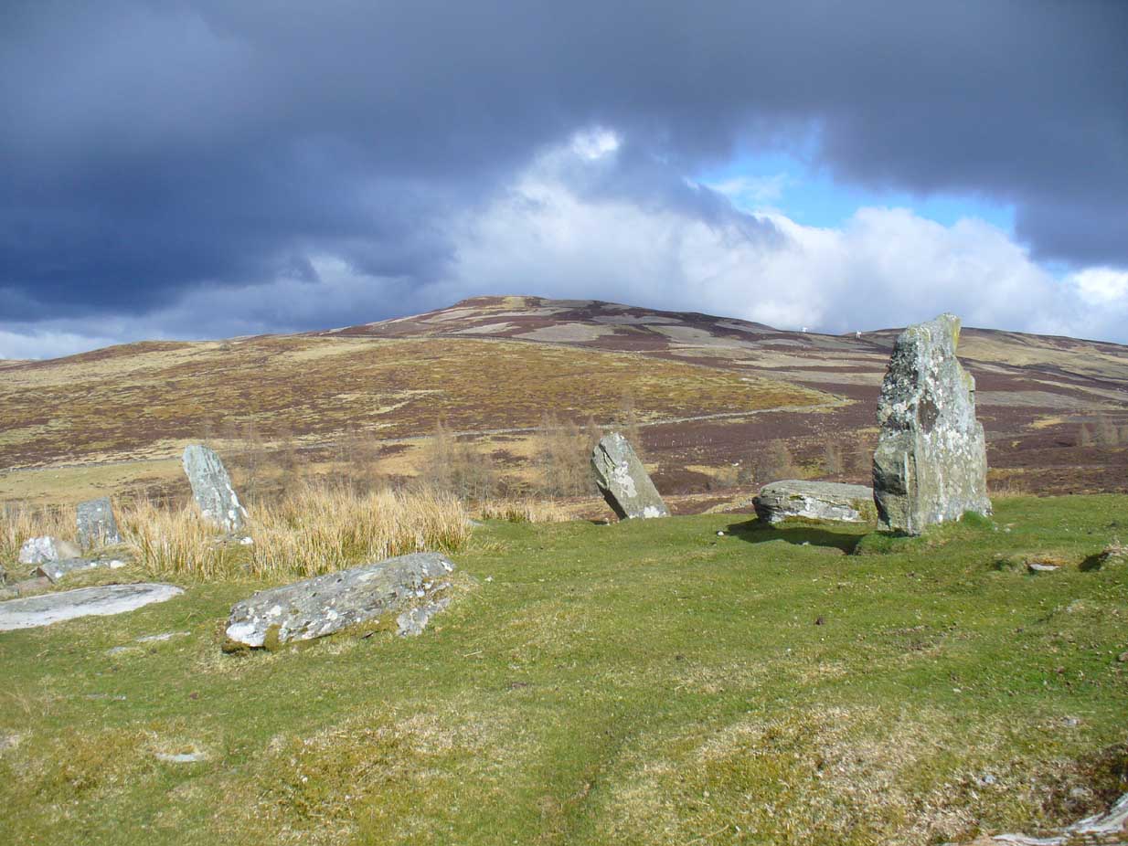
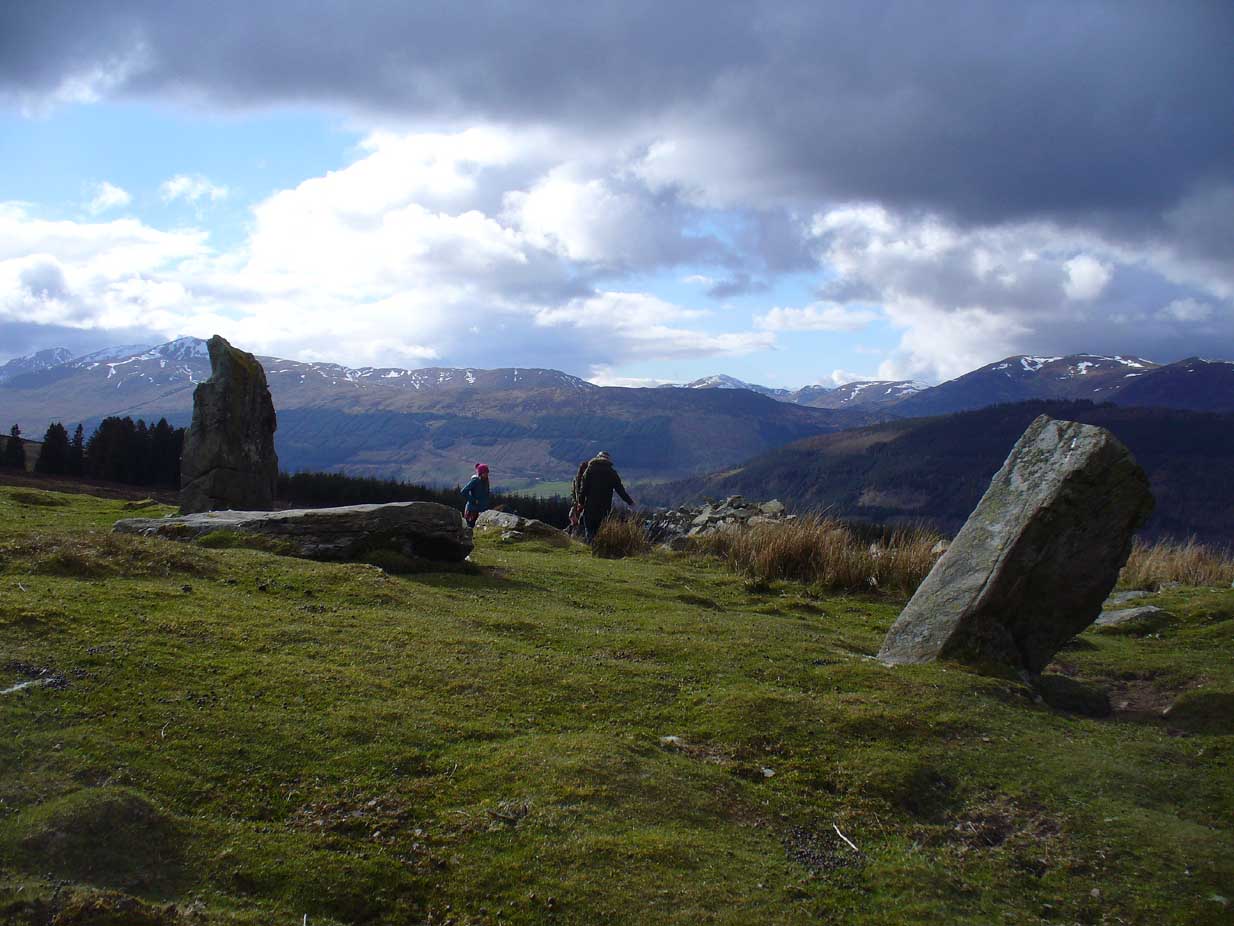
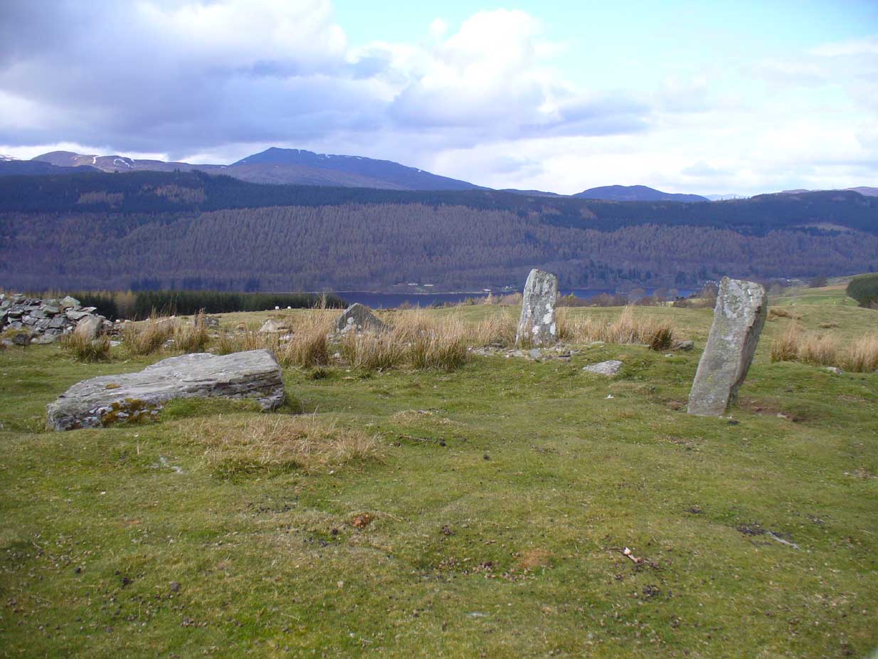
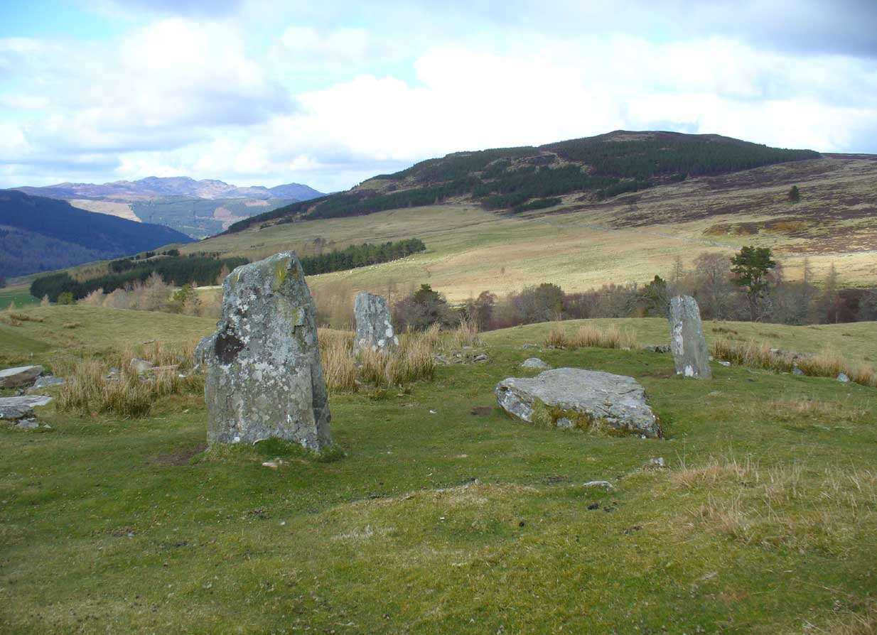
This is quite a spectacular site! Not for the size of the stones or the arrangement of the megaliths, but for the setting! It’s outstanding! When a bunch of us wandered up here a few months ago, snow was still on the peaks and Nature was giving us a real mix of Her colours and breath in a very changeable part of Her season. Twas gorgeous. Perhaps the setting was the thing which has kept the circle pretty quiet until recent years. It’s high up – and out of season the freezing winds and driving rains would keep all but the healthiest of crazy-folk away. We all only wished we’d have had more time here. But that aside…
Lara between the old stonesJ.D. MacLeod’s 1909 groundplan
Along with the changeable weather She gives up here, the literary-types have given this circle changeable names too. Nowadays known as the Acharn Falls stone circle, in truth that’s a mile away and lacks in both visual and geographical accuracy. ‘Greenland’ was the name cited when J.B. MacKenzie (1909) wrote about it more than a hundred years back, and it’s the name we find in Mr Burl’s (2000) magnum opus, despite him telling how “a local name for it is Auchliacha, ‘the field of stones'” (Burl 1995), so perhaps we should adhere to what the locals say (my preference generally).
The atmospheric ring, looking WGreenland Circle, looking N
The ring is in quite a mess, having had a drystone wall built through it in the last 100 years. No walling is shown on the early Ordnance Survey maps, so some local land-owners (an english incomer?) was probably responsible. The stones used to stand in parts of the ancient forest, which must have looked and felt quite something before they ripped the trees away. It was hiding away in the woods when J.B. MacKenzie (1909) came here, shortly after the “modern wall” as he called it, had been constructed through the circle. He wrote:
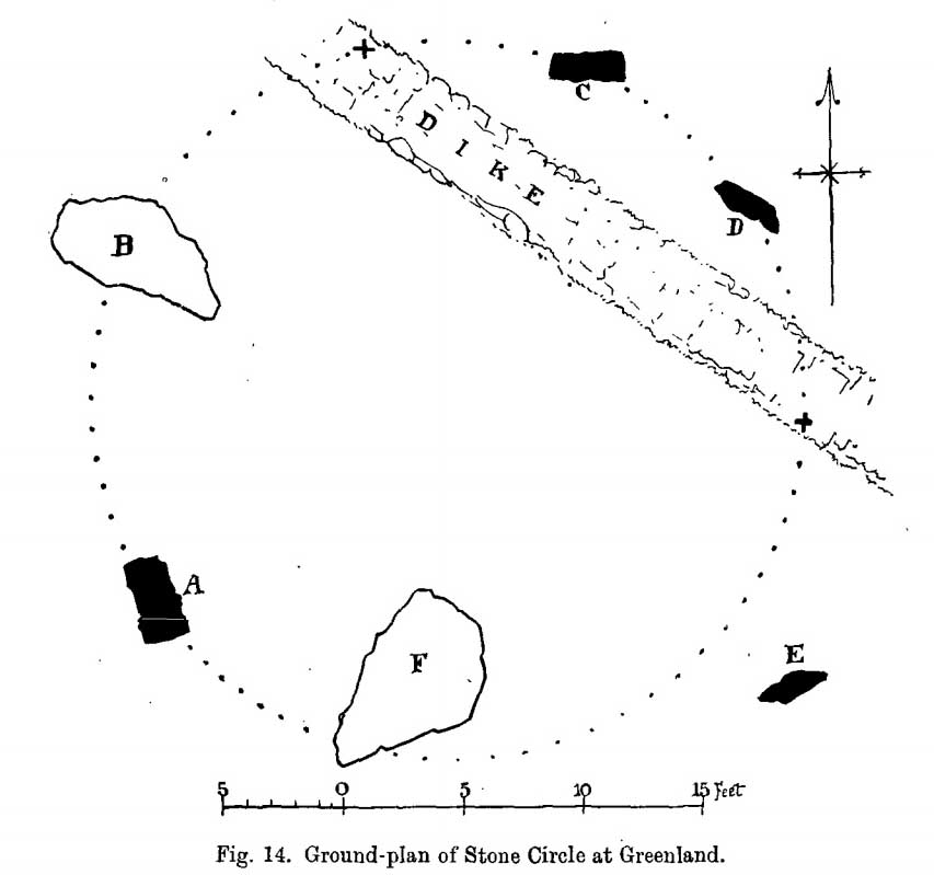
“Six stones remain on the site, of which four are still erect and in position, and two are prostrate, one of which has apparently fallen inwards and the other outwards of the line of the circle, the diameter of which, touching the inner sides of the stones still standing, is 27 feet 9 inches. Mr MacLeod has supplied the following dimensions of the several stones:
A — 6 feet 9 inches x 3 feet 6 inches, lying flat
B — 8 feet 4 inches, in circumference at ground level
——1 foot 7 inches, high above the ground level
C — 6 feet 10 inches, in circumference at ground level
——4 feet 0 inches, high above ground level
D — 6 feet 0 inches, in circumference at ground level
——4 feet 3 inches, high above ground level
E — 7 feet 8 inches x 4 feet 6 inches, lying flat
F — 9 feet 0 inches, in circumference at ground level
——5 feet 8 inches, high above ground level.”
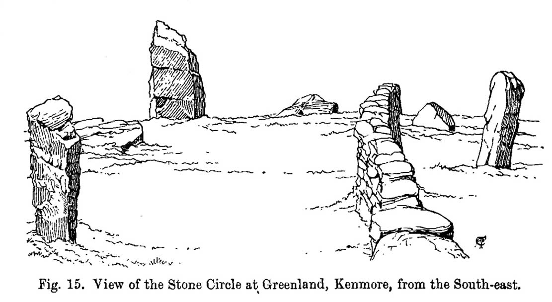
Coles’ 1910 sketch of the siteColes’ 1910 ground-plan
The year after MacKenzie’s notes, the great Fred Coles (1910) paid a visit here. Noting how high it was in the landscape compared to other megalithic rings in the region (it’s the highest known circle, at 1240 feet up), he went on to give his usual detailed appraisal, telling:
“In a little clearing amid these woods on Craggan Odhar, but disfigured by a dike which separates some of the Stones from the others, stands this Greenland Circle of which the ground-plan is given…. The Stones are six in number, of which four are erect, and they all appear to be of the quartzitic schist. Some disturbance has occurred, and it seems probable that there were at least two more Stones originally, one between B and C at the spot marked with a cross, and the other similarly marked midway between D and E. There is, however, no vestige of any Standing Stone in the sides of the dike itself.
“On the south-west is Stone A, the tallest, with pointed top, 5 feet 7 inches in height, oblong in contour, and measuring at the base 9 feet 5 inches. Having several deep horizontal fissures, this Stone…bears an odd resemblance to masonry. The next Stone, B, lies prostrate, measuring 7 feet 9 inches by 4 feet, and about 1 foot in thickness above ground. The little oblong Stone, C, on the other side of the dike, stands only 1 foot 10 inches above ground, and probably is a mere fragment—the stump of a much larger block. At D the Stone is 4 feet 3 inches in height, and is a very narrow slab-like piece; Stone E, which has a decided lean over towards the interior of the Circle, is 4 feet 2 inches high, and is in basal girth 6 feet 6 inches. Like the others, it is angular and thinnish in proportion to its breadth. Stone F measures 8 feet 2 inches by 5 feet 2 inches, and its position, with the narrow end resting almost on the circumference, suggests, as in other cases, the probability that it was this narrow end which was buried when the Stone was erected. These blocks were most likely brought from the low cliffy ledges near, for, as the name ‘Craggan Odhar’ implies, the place was, before being planted, conspicuous for its Grey Crags.”
Although no modern excavation has taken place, when the brilliant local historian William Gillies (1925) first got round to exploring the circle, he remedied that situation. In probing the ground beneath the surface when the weather conditions allowed, Mr Gillies found that there seemed to have been more standing stones in the circle than presently meets the eye. He wrote:
“I paid several visits last summer to this lonely and elevated spot, and examined the ground for stones, where the wide spaces between those indicated on the plan (see Coles’ 1910 drawing, above) suggested that others might be concealed beneath the turf. There would appear to be three stones missing, which would make the circle to consist of nine in all when it was entire. With little trouble, at a depth of only 3 inches, I located a large flat stone measuring 5 feet 6 inches by 4 feet 8 inches. It had stood on the north-western arc of the circle half-way between the fallen stone on the west and the broken standing stone on the north-north-west. It had fallen outwards. The foundation of the wall, built probably some seventy years ago to enclose the plantation, rested on the edge of the stone. The ground along the circumference of the circle between the three stones on the eastern side was carefully probed, but the rod touched only small loose stones.
“I next turned up the centre of the circle, and at a depth of 5 inches below the surface came upon a dark deposit. It extended over a space of 2 feet square and was about 5 inches in depth. It was mixed with a white limy substance consisting of calcined bones, bits of which along with a sample of the dark substance I brought to the Museum. A bit of charcoal from the deposit revealed the lines of cleavage in the wood. There is no peat at the spot, although the elevation, which is at least 1200 feet, might suggest it. The surrounding soil is of a reddish colour, and quite unlike the deposit which must have been placed there, and which was probably a burial after cremation.”
Greenland circle, looking NE
Gillies was exemplary in his exploration of sites that were on the verge of disappearing from tongue and text and we remain incredibly grateful for his later exposition on the antiquarian remains and legends of this truly stunning landscape. In Aubrey Burl’s (1995; 2000) respective summaries of this stone circle, as well as that of John Barnatt (1989), they ascribe the situation of it originally having 9 stones, as Gillies suggested.
Visit this site! If you’re into megaliths, you’ll bloody love it!
References:
Barnatt, John, Stone Circles of Britain – volume 2, BAR: Oxford 1989.
Burl, Aubrey, A Guide to the Stone Circles of Britain, Ireland and Brittany, Yale University Press 1995.
Burl, Aubrey, The Stone Circles of Britain, Ireland and Brittany, Yale University Press 2000.
Money, Bob, Scottish Rambles – Corners of Perthshire, Perth 1990.
Acknowledgements: Many thanks to the unholy bunch who helped travel, locate, photograph and take notes on the day of our visit here, including Aisha, Lara & Leo Domleo; Lisa & Fraser; Nina and Paul. Let’s do it again and check out the unrecorded stuff up there next time!
From Kenmore, take the minor road on the south-side of Loch Tay for 1½ miles (2.4km) until you reach the hamlet of Acharn. From here take the track uphill for ½-mile past the Acharn waterfalls and when you come out on the east-side of the trees, keep walking uphill parallel to the trees and burn until the land levels-out and the track heads away, east. 200 yards ahead, on the left-side of the track, you’ll see the large fairy-mound.
Archaeology & History
The tumulus looking NE
First reported in archaeological circles in the Discovery & Excavation Scotland mag in 1964, this archetypal fairy-mound or tumulus sitting on the grassy plain overlooking the eastern end of Loch Tay and district would have been known of by local people in older times, but I can find no early accounts of it, nor its traditions. When Bob Money (1990) came here, he told of the grand vista stretching into the distant mountains:
“From here the views…are superb, and the little mound, which is an ancient tumulus, or burial mound, has sat here undisturbed for several thousand years, guarding the secret of its once important occupant.”
Circular in structure and measuring 20 feet across, the mound rises nearly four-feet high and is probably Bronze Age in origin. Although mostly covered in grass, there are some loose stones visible on the side of the mound, seeming to indicate that it may be a covered cairn. No excavation have yet taken place here.
References:
Money, Bob, Scottish Rambles – Corners of Perthshire, Perth 1990.
Acknowledgements: Many thanks to the unholy bunch who helped travel, locate, photograph and take notes on the day of our visit here, including Aisha, Lara & Leo Domleo; Lisa & Fraser; Nina and Paul. Let’s do it again and check out the unrecorded stuff up there next time!
Healing Well (destroyed): OS Grid Reference – NS 5805 6728
Archaeology & History
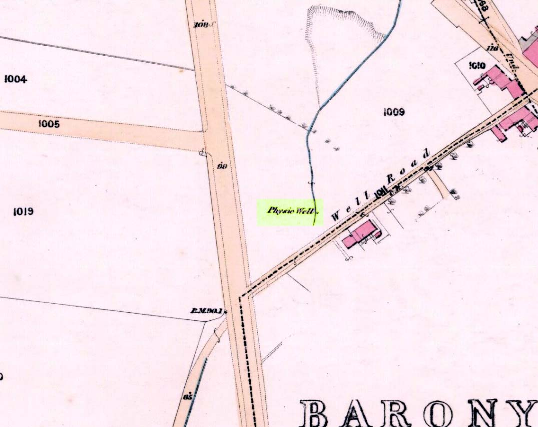
Physic Well on 1865 map
Any site named as a ‘Physic Well’ anywhere in Britain is, by definition, a spring of water renowned for its medicinal properties. Nowadays however, at this and other sites with the same name, local people aren’t even aware that such places exist. A sad state of affairs indeed… This Physic Well was once found just off Trossach Street in Maryhill—which was once called ‘Well Street’, after the medicinal spring itself—in fields just above the road. Today a small housing estate has been built on top of the site and the only sign of it ever being here appears to be marked by a birch tree in the gardens at the middle of the enclosing buildings.
Birch tree marks the spot!
The site was listed in several early 19th century municipal surveys of Glasgow, but the greater references to it seem to be from local people who described it as a place that was visited annually along the perambulation of the old Barony parish, despite it being just over the edge and into Maryhill. In an extensive footnote in Renwick’s Glasgow Memorials he gives us a fascinating insight into the gatherings at the Well, and the popular customs and social activities of the period:
“William Graham, of Lambhill, aged 69, recollected in his school days, “drinking at a well a very little to the north of the Barony glebe, which was called the Physic Well, and there was then a Royalty stone a little to the west of the glebe.” The Physic Well, perhaps all that effective drainage had left of the former loch, otherwise called ‘Plommaris Hole,’ was utilised at the periodic perambulation of marches for impressing on the memory recollection of this part of the boundary. The means taken for this end may be gathered from the evidence of John Alston, weaver, aged 54, who says that, when he was an apprentice, his master told him that it was a custom, “when the magistrates rode the marches to duck some of the last-made burgesses in the Physic Well”; and, on the same topic, James Bryce, victualler, aged 70, depones that, forty years ago, it was commonly reported in the town that at the marches-riding it was the custom “to duck the youngest town-officer in a well called the Physic Well, which is now filled up, but which was near the Barony glebe.” Janet Paterson, widow of William Paterson, labourer, aged 78, recollects of another well, called the Loanhead Well, in the Barony Glebe, from which she carried water when a young girl. ”About 57 yean ago she saw two ploughs going in the Barony Glebe on the Fast Day of the town Sacrament. In general people wrought the Physic Well Park on the town’s Fast Day, but she never saw them working on the Barony Glebe except on the occasion mentioned.” William M’Culloch, farmer, Lightbum, aged 57, says that when Mr. Hill was minister of the Barony parish, the deponent’s father was employed by him, for a good many years, to plough the Barony Glebe, and on one occasion he recollects the glebe being sown and harrowed upon a Fast Day preceding the town Sacrament. Mr. Hill told his father that the glebe was not within the town’s bounds, that the sowing and harrowing it on the Fast Day could disturb nobody, and that his father could have the sowing finished in time to go to church. Peter Ferguson, weaver, aged 5$, had resided in the neighbourhood of the Barony Glebe from his infancy. When he was a boy he heard it very frequently mentioned by old people, as a common report, that when delinquents or debtors, prosecuted before the town courts of Glasgow, were pursued by the town officers, for the purpose of being apprehended, they were in the practice of endeavouring to get across the Howgate Strand; and if they accomplished this they set the officer at defiance and pointed their fingers at them in derision, as being then without the city’s jurisdiction. Howgate Strand was a small run of water which crossed Castle Street, at the south end of the glebe, then passed through the infirmary grounds and joined the Molendinar Burn a little to the north of the High Church. Another witness, Thomas Alston, manucturer, aged 55, places the fugitives’ point of escape at the north end of the glebe. In his young days it was the practice for the town officers to apprehend boys who were playing on the streets upon the Sabbath and the Fast Days preceding town Sacraments; and he remembered well that it was a common opinion with him and his companions that they were safe from the town officers when they got beyond the Physic Well, on the Glasgowfield road, or beyond the spot marked on Mr. Fleming’s plan ‘Toll-house’, on the Kirkintilloch road, as they considered themselves to be then without the town’s jurisdiction.”
The Well was close to a series of old boundary or ‘merche’ stones, but no ancient ones seem to remain.
The medicinal potential for the water was examined in 1771 by a Dr William Irvine, who found it to be a chalybeate or iron-bearing spring, and to possess “a little muriatic acid”, giving the well both tonic and fortifying properties.
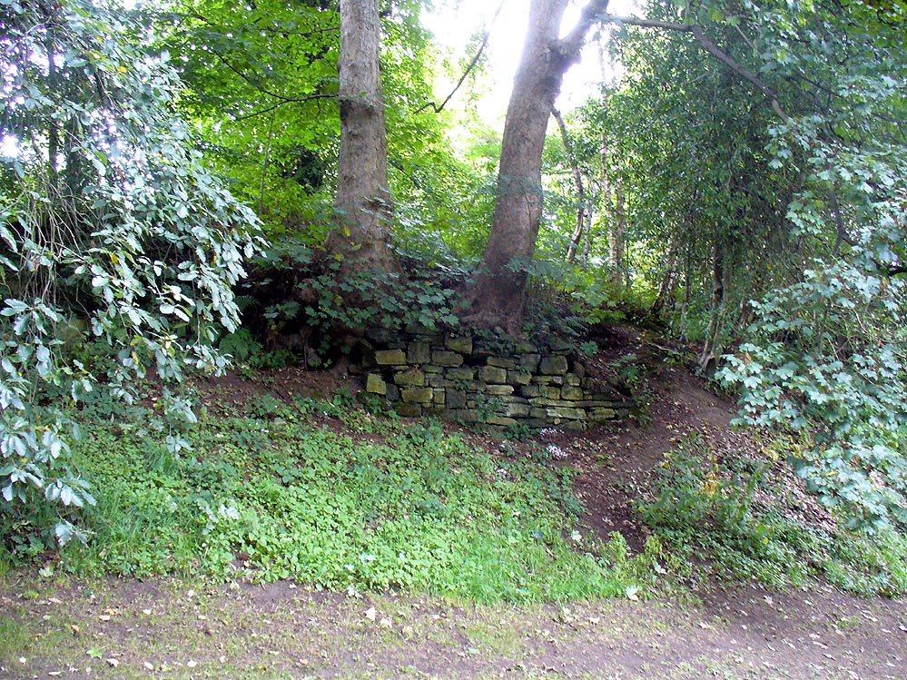
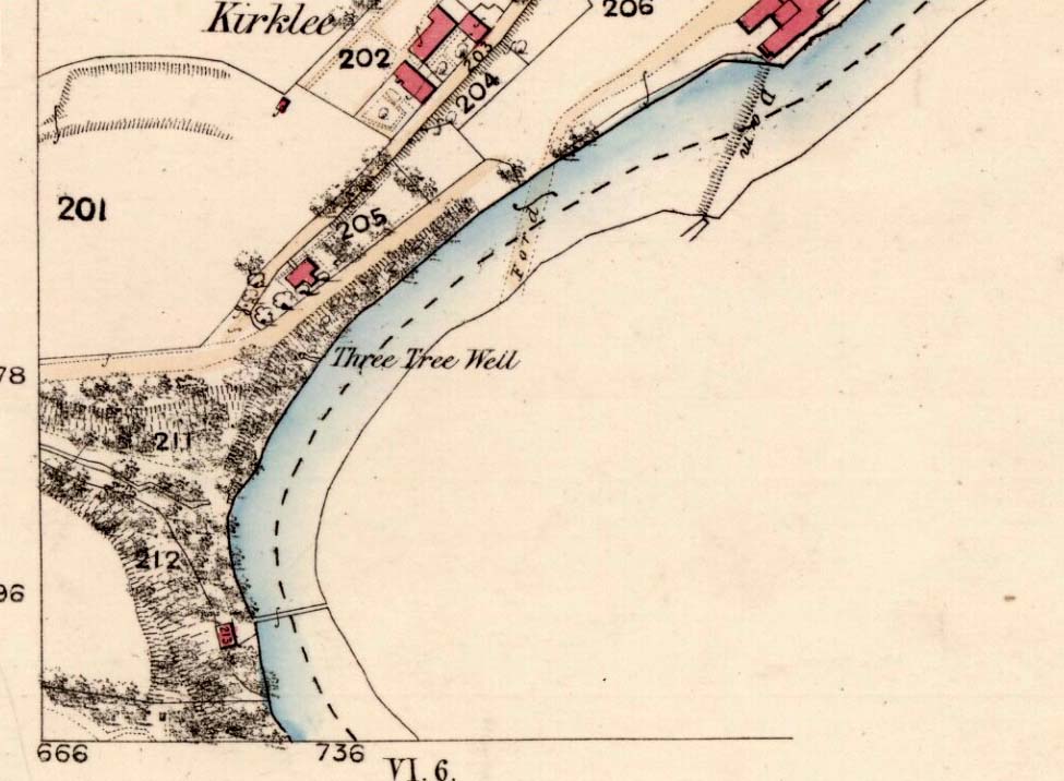
The demise of this old healing spring of water occurred a few generations ago by the look of things. Marked on the earliest Ordnance Survey maps—erroneously as the ‘Three Tree Well’, as Mr McDonald (1860) will soon explain—it was located on the west side of the River Kelvin, halfway between the Kirklee footbridge and the ancient ford, but the only remains we can see of it now appears to be the brick-walling above which a pair of sycamoretrees rise, or perhaps beneath the man-hole cover on the path lower down.
Three Tree Well on 1865 map
…But it wasn’t always this way… Known to be a chalybeate, or iron-bearing spring (which are always regarded as tonics in local lore, fortifying the blood general health), when the local writer Hugh McDonald (1860) wrote about it in his wonderful Rambles round Glasgow in the middle of the 19th century, he cast a picture of the area that few Glaswegians would recognise today—and a damn good swipe at the incomers trying to alter the names of traditional places:
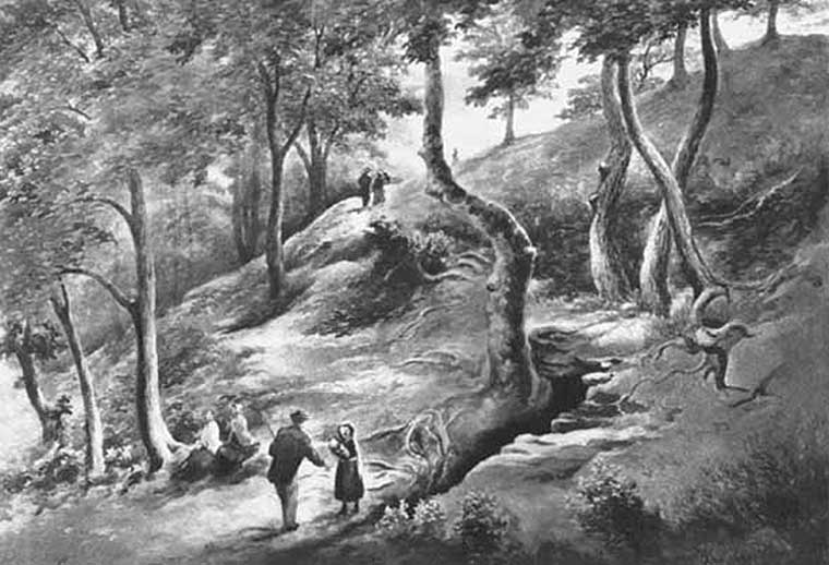
“At the western extremity of the Botanic Gardens a narrow passage, in popular parlance called “the Kyber Pass,” leads over a green knoll to the volley of the Kelvin at the famous “Pear-tree Well.” …The scenery of the Kelvin in the vicinity of the Pear-tree Well is of the most romantic and beautiful description. The banks are bold, and in many places fringed with masses of foliage to the water-lip; while the rustic bridge, the lonely cottage, and the picturesque mill, seem planted by the very hand of taste, along the meanderings of the rippled and murmuring stream, wherever they are likely to produce a telling effect… Altogether the scene and its accessories present the very choicest of those harmonious combinations of colour and form which the landscape limner loves to gaze upon, and fondly endeavours, in the pride of his skill, to transfer to the living canvas. No wonder it is that Kelvin Grove has long been the favourite haunt of our City lovers, and the favourite theme of our local poets; for Nature has, indeed, strewn its recesses with charms as fresh and beautiful as though it were situated far from the dwellings of men, instead of almost under the wing of our most dinsome and dusky of towns.
“The Pear-tree Well issues from the bottom of a steep and thickly-wooded bank, which, at this point, rises gracefully from the rocky bed of the streamlet. The crystalline and deliciously cool water is collected into a considerable cavity in the earth; immediately over which three large trees—a plane and two handsome ashes—raise on high their umbrageous heads, while their sturdy roots, in serpent-like convolutions, twine around the watery hollow beneath, as if to defend it from the intrusion of the penetrating noonday sun. Some suppose that it is from this trio of sylvan guardians that the fountain has received its name — and that the ‘Three-tree’ and not the ‘Pear-tree’ Well is its proper denomination. The advocates of the latter theory further remark, that there is no pear-tree in the vicinity, and that consequently the popular name is probably but a corruption of “Three-tree.” There is high authority for saying that names are things of slight consequence; but however that may be, we are inclined, in the present instance, to be conservative of the old name for this favourite well, and to retain it in spite of all attempts at innovation. Whether from langsyne associations or not, we shall not attempt to discover, but Pear-tree Well sounds most musically on our ear — and we should be loath to have it suppressed by the word-coinage of any crotchety theorist; and besides, who can tell what kind of trees may have formerly graced the locality? A perfect orchard of the pear tribe may, at some past period, have clothed the banks of Kelvin for anything that these violators of a time-honoured name—”these men who are given to change”—know to the contrary. No, no! Pear-tree Well it has been, and Pear-tree Well to us, at least, it must remain. We had as lief meet an old friend with a new face, as an old haunt with a new name.
“Having done our devoirs to the spirit of the fountain, by draining a bicker of the translucent water, which, by the way, is slightly impregnated with iron, we sit ourselves down on the bank above, under the ashen tree, when one of two friends with whose company we have been honoured, inspired by the half-gelid beverage, bursts suddenly out with—
“Let us haste to Kelvin Grove, bonnie lassie, O.”
“We of course join heartily in the measure, which has for many years been highly popular in the west of Scotland, and which we naturally enjoy with double zest, amid the scenery to which it refers…”
Pear Tree Well in 1896
The great historian and romantic, J.A. Hammerton (1920) even passed here, telling how sufferers of disease relied upon its curing waters to heal them. It is just such a pity that this picturesque medicinal spring and its rivulet are with us no more…
References:
Brotchie, T.C.F., Glasgow Rivers and Streams: Their Legend and Lore, John Maclehose: Glasgow 1914.