Musselburgh has had an ancient fair—held upon St. James’ Day (July 25)—for many centuries. It was held along the old High Street by a more ancient Market Cross than the one seen there today. R.M. Stirling (1894) told us that, “The cross is erected over a draw-well, and in local parlance is known as the Cross Well.”
On the 1853 township map, a water ‘pump’ is shown at the very spot, with the ‘cross’ and water trough shown on subsequent maps. The Well isn’t mentioned in John Small’s (1900) description of the cross and its authenticity as a ‘holy’ well is questionable.
Holy Well (destroyed): OS Grid-Reference – NT 3452 7264
Archaeology & History
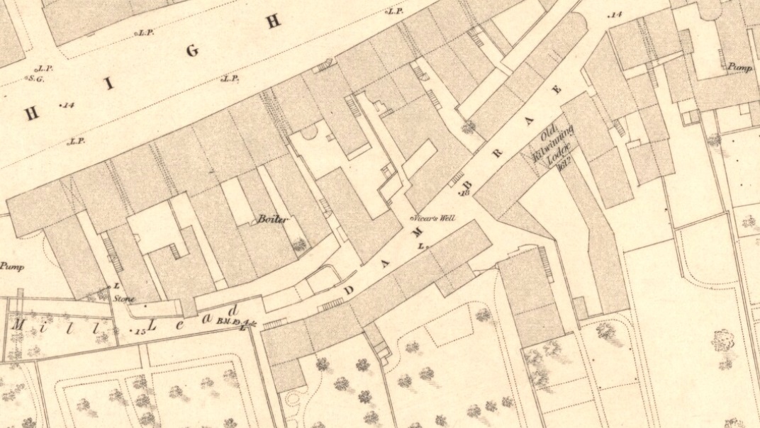
Vicars Well on 1853 map
First mentioned in the Scottish Statistical Account of 1845, its name originates from being attached to the vicarage of nearby St. Michael’s church. Highlighted on the 1853 township map of Musselburgh, this forgotten holy well was described in the middle of the 19th century by local historian James Paterson (1857). It was located near the middle of town, along a back-street south of the High Street. Mr Paterson told us that:
“At the Dam Brae there is still a well, celebrated for the excellence of its water, called ‘the vicar’s well’, from which it is believed the present manse occupies the site of the ancient vicarage. It lies to the southeast of the Brae, and the wall of the ground approaches pretty close to the mill lead, or damn, as it is called. It is well surrounded with old trees.”
When it was described by Mr Beveridge in the 1845 Statistical Account, the spring had been covered by a pump. Local lore told how the waters of this ancient Well was said by housewives to be excellent in the infusion of tea; and although its name was spoke in local dialect as the ‘Bickers Well’, Beveridge told it to mean the “Vicars Well.” There is the obvious possibility that the ‘bickers’—as in chit-chat and gossip—related to it being where local folk simply met and chatted.
When Mr Stirling (1894) wrote his account of the adjacent Inveresk parish, he told how water from the Vicar’s Well,
“was in much request till a few years ago, when its use was forbidden and its site enclosed (for) sanitary considerations.”
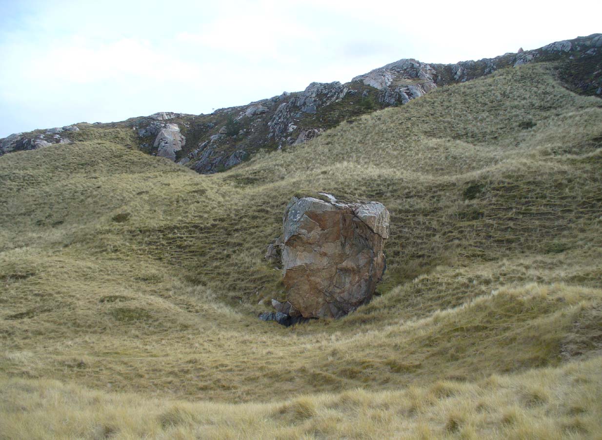
Along the A836 road between Tongue and Bettyhill, turn down towards Skerray at Borgie Bridge for 1.8 miles (2.87km) until you reach the little information sign at the roadside. Walk downhill and cross the little bridge and wander onto the west side of the beach. You’re likely to end up daydreaming… so once you’ve re-focussed, head into the middle of the beach and walk up the steep-ish sand-banks to your right (south). Once at the top, you’ll see a gigantic rock—the Ringstone—nearly as big as a house.
Folklore
This gigantic boulder is part of one of Sutherland’s archaic Creation Myths as they’re known: ancient stories recounted by archaic societies about the nature and origins of the world. Such tales tend to be peopled by giants, gods, huge supernatural creatures, borne of chaos, eggs, darkness and primal oceans. Thankfully we still find some examples of these tales in the northern and northwestern mountainous regions of Britain, as the Church and Industrialism never quite destroyed the hardcore communities—despite what they might like to tell you…
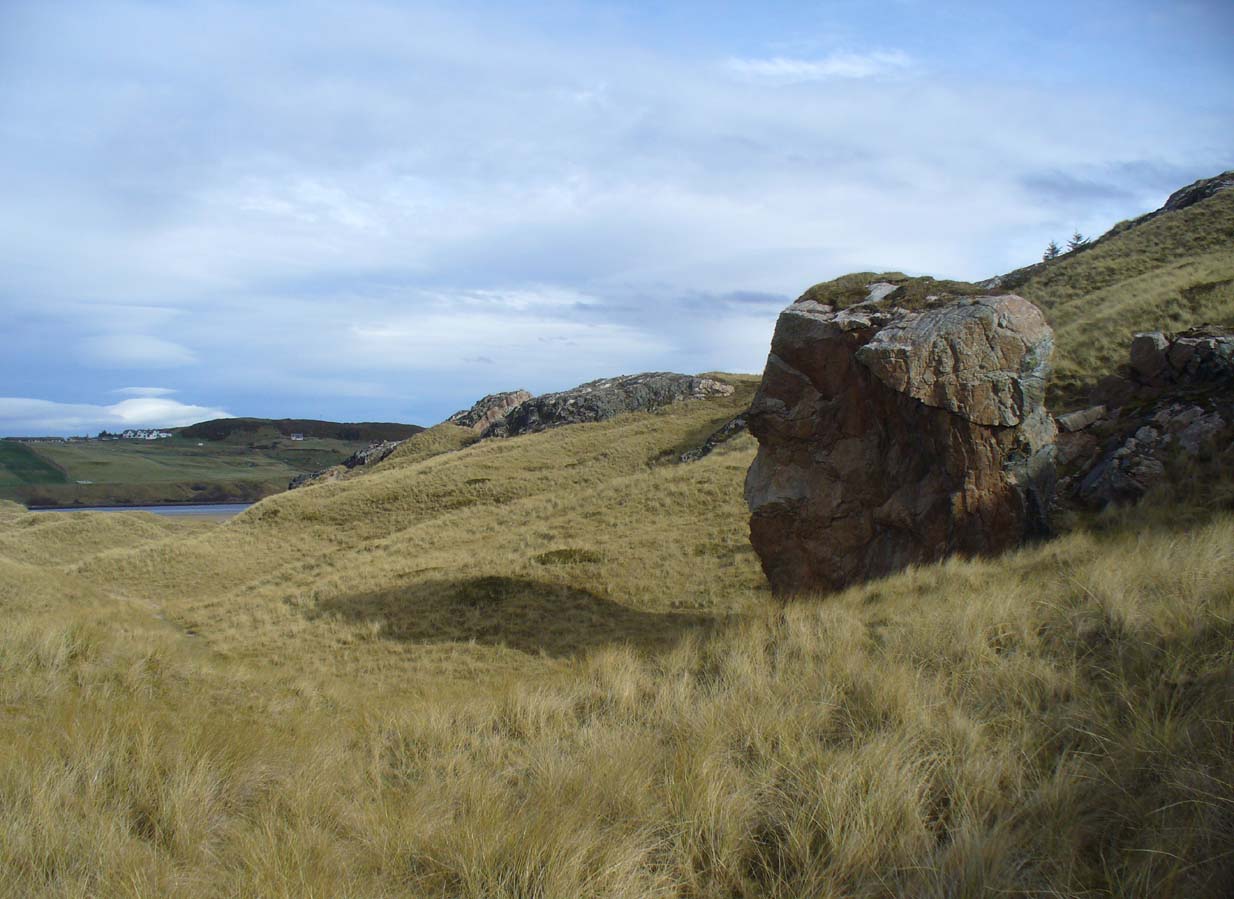
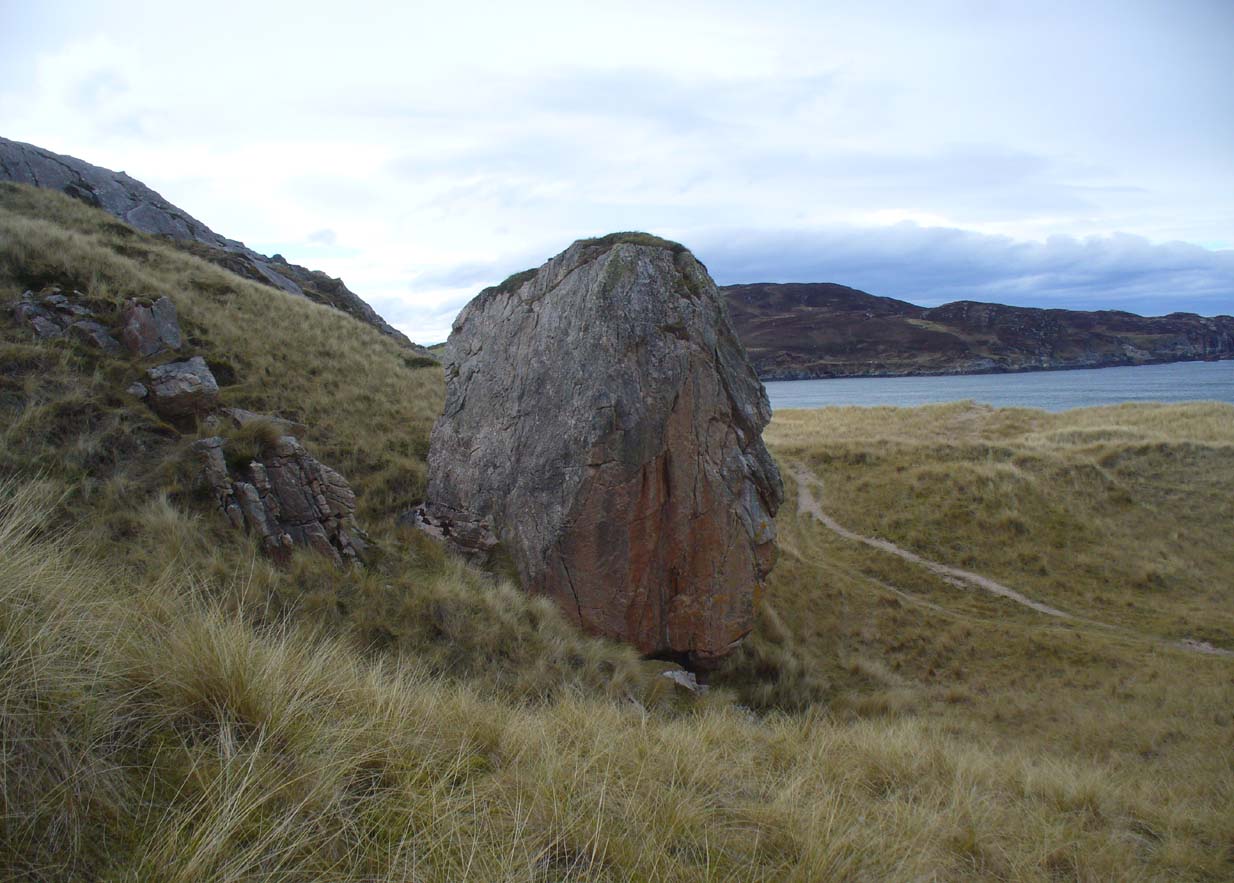
The face of the RingstoneThe Ringstone, gazing east
The following folktale was written by the local headmaster, Alan Temperley (1977), who wrote down many of the oral traditions in Scotland’s far north before they disappeared forever from the tongues of local people (as is sadly happening in these mountains) as they’re slowly, sadly, being erased by the influx of incomers with no connection nor sincere love of old tales and ways. It is typical of stories found other large geological formations from aboriginal Australia, to Skye, to everywhere on Earth where people have settled. Mr Temperley wrote:
“Many years ago there were two giants, the Naver giant from the river at Bettyhill, and the Aird giant from the hill above Skerray. Normally they got on quite well, but one afternoon they became involved in a heated argument about some sheep and cattle, and both grew very angry. The Aird giant was standing on top of the hill above Torrisdale bay with the animals grazing around him, and the Naver giant stormed across the river to the beach below.
“Those are my sheep,” he roared up the hill.
“No they’re not,” the Aird giant said. “At least not all of them.”
“You stole them. You’re a thief!”
“No I didn’t. They came up here themselves. Anyway, you owe me fifty sheep from last year.”
“You’re not only as thief, you’re a liar!” shouted the Naver giant. If you don’t send them down this minute, I’ll come up and see to it myself.”
At this the Aird giant gave a disparaging laugh and made a rude face, and picking up a great boulder flung it down the hill at his friend.
The Naver giant was speechless with fury, and picking the stone up himself, hurled it back up the hillside, making a great hole in the ground.
The Aird giant saw things had gone far enough.
“I’ll send them back if you give me that silver ring you’re always wearing,” he said.
“Never!” roared his friend, his face all red and angry.
“Suit yourself then,” said the Aird giant, and picking the stone up again he tossed it back down the hill.
For long enough the rock kept flying between them, and in time the giant from Naver grew tired, because he was throwing it uphill all the time.
“Will you give me the ring now?” said the Aird giant.
For answer the Naver giant tried one more time to throw the stone up the hill, but it only got halfway, and rolled back down to the shore.
“Come on,” said the giant from Aird, for he wanted to be friends again. “Give me the ring, and I’ll let you have it back later.”
“No!” said the Naver giant from the bottom of the hill. “I’ll never give it to you!” His eyes began to fill with tears.
“Oh, come on, please!” coaxed the Aird giant. “Just for a week.”
“Never, never, never!” shouted the giant from Naver, and pulling the ring from his finger he threw it on the ground and jammed the great boulder down on top of it. Then he sat down on top of the stone and stared out to sea. Every so often he sniffed, and his friend, looking down at his broad back, saw him lift the back of a hand to his eyes.
They never made friends again, and after a long time they both died.
The ring is still buried under the stone, and so far nobody has ever been able to shift it.”
The giant’s face, in profile
When I got back from visiting this immense rock a few weeks ago, a local lady Donna Murray asked me if I’d seen the face of the giant in the rock. I hadn’t—as I was looking to see if the name ‘Ringstone’ related to any possible cup-and-rings on its surface, which it didn’t (although I didn’t clamber onto the top). But in the many photos I took from all angles, Donna pointed out the blatant simulacra of the giant’s face when looking at it from the east.
However, on top of the slope above the Ringstone (not the Aird side), I did find a faint but distinct ‘Ringstone’ carving (without a central cupmark). Whether this ever had any mythic relationship to the tale or the stone, we might never know. The rocky terrain above Aird now needs to be looked at…
References:
Eliade, Mircea, Patterns in Comparative Religion, Sheed & Ward: London 1958.
Long, Charles H., “Cosmogony,” in Eliade, M., Encyclopedia of Religion – volume 4, MacMillan: New York 1987.
MacLagan, David, Creation Myths: Man’s Introduction to the World, Thames & Hudson: London 1977.
Temperley, Alan, Tales of the North Coast, Research Publishing Company: London 1977.
Acknowledgments: Massive thanks again to Donna Murray, for her help and for putting up with me amidst my wanderings up in Torrisdale and district.
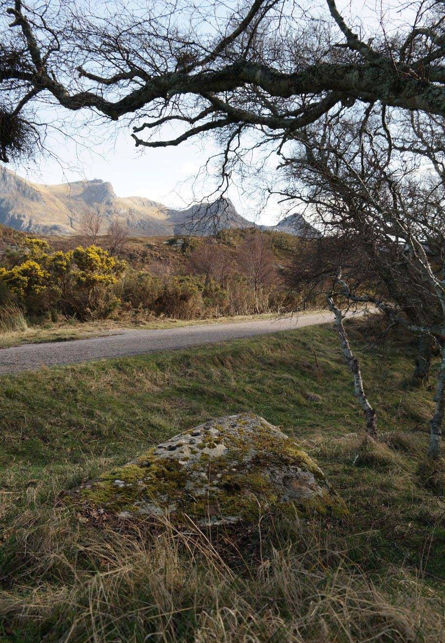
Whether you take the A836 or A838 into Tongue (through truly beautiful wilderness), make sure you go into the village itself—and then keep going, south, along the tiny country road for 3 miles. Hereby, keep your eyes peeled for Lochan na Cuilce on your right; keep going past here, into and through the old trees where you’ll then see Lochan Hakel on your left. Keep going past here until your reach the next small copse on your right. Stop here. A small pool is yards into the trees and here you’ll see a single stone between that and the roadside. You can’t really miss it!
Archaeology & History
Close-up of some cups (by Donna Murray)
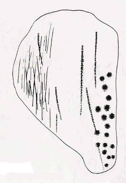
An apparently isolated cup-marked stone, some 3 feet by 5 feet, that was first described in Morrison’s (1883) meanderings amidst Sutherland’s awesome wilderness. It’s quite plain compared to Lochan Hakel 2 and many other carvings, simply consisting of 18 cups of various sizes, mainly on the eastern side of the rock. Sarah MacLean pointed out that a line running along the length of the stone seemed, in parts, to have been artificially enhanced by the hand of man, or woman. I have to agree with her.
The Royal Commission (1911) lads included this petroglyph in their superb survey of Sutherland, telling:
“On the W. side of the road to Kinloch, about ½ m. N of the bridge over the Kinloch River (Amhainn Ceann Locha), and on the N edge of a gravel pit close to the road, is a large earthfast boulder, 5′ in length as far as exposed, and 3′ 10″ in breadth, showing on its upper surface eighteen cup-marks of various depths, of which the most distinct is towards the N end of the stone, measuring about 3″ in diameter and 1″ in depth. The whole length of the stone is not visible, but the markings do not seem to extend to the portion covered…”
Carving in situ (by Donna Murray)by Kevin o’ Reilly
Simulacra lovers will love the form of this stone in relation to the background of the mountains, as its shape is echoed in that of the rising hills several miles to the south. …Of course, the depersonalizing ones amongst you lacking an understanding of animism would reject any such association due to your projection of disbelief. However—and equally—as we lack any ethnographic data on the carving we must also assume some caution…
A fascinating site – and one which is likely to have neighbours hidden in the surrounding moorlands…
References:
Gourlay, Robert, Sutherland: An Archaeological Guide, Birlinn: Edinburgh 1996.
Michell, John, Simulacra, Thames & Hudson: London 1979.
Morrison, Hew, Tourist’s Guide to Sutherland and Caithness, D.H. Edwards: Brechin 1883.
Royal Commission on Ancient & Historical Monuments, Scotland, Second report and inventory of monuments and constructions in the county of Sutherland, HMSO: Edinburgh 1911.
Acknowledgments: Huge thanks to Donna Murray for use of her photos in this site profile (aswell as for putting up with me whilst in the area); and also to Sarah MacLean for taking us to the carving in the first place. Many many thanks indeed. See y’ again soon, hopefully!
Lochan Hakel’s cup & ring (photo by Sarah MacLean)
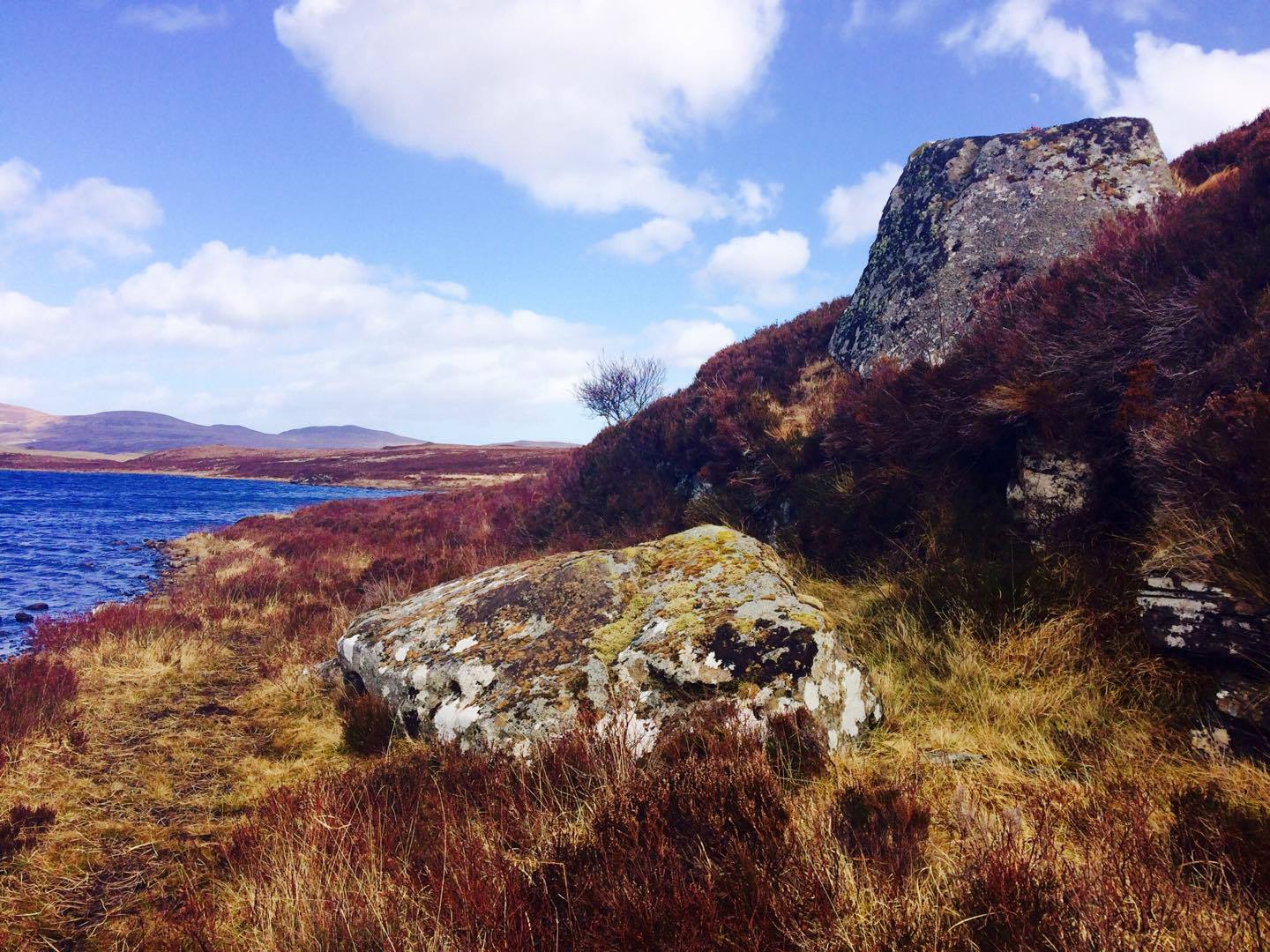
Whether you take the A836 or A838 into Tongue (through truly beautiful wilderness), make sure you go into the village itself—and then keep going, south, along the tiny country road. Nearly 2½ miles along, note the small loch of Lochan na Cuilce on your right. A few hundred yards past this, on the other side of the road (barely visible at first) is Lochan Hakel. Walk around to the south-side of the loch and, across from where the small island of Grianan lives, you’ll see this large rounded boulder by the loch-side.
Archaeology & History
Stuck in a veritably stunning middle-o’-nowhere landscape below the outstretched northern moors beneath Ben Loyal & co, there is no previous literary account of this faded petroglyph, rediscovered in early April 2017 when Sarah MacLean took us on a visit to the more renowned multiple cup-and-ringer of Lochan Hakel 2, just yards away above the moorland rise (which is unmissable from here). It’s not too special in comparison with its neighbour and many others—but try telling Sarah that!
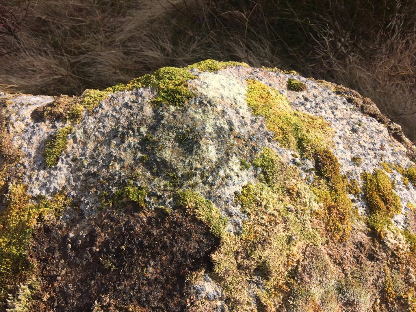
Cup & ring atop of stone (photo by Sarah MacLean)
This large rounded lichen-covered boulder has, at its height, a carved ring around a natural rise—known as a ‘boss’—at the very top of the rock. On its southern side, Sarah found a single cup-mark, along with a couple of others on the more northeasterly sloping face. At the bottom of this face is another seemingly isolated small cup-marking. There may well be other carved elements beneath the mass of ancient lichens, but we thought it best to leave them for the time being. It’s also quite likely that other unrecorded carvings exist in the area.
Acknowledgments: Huge thanks to Sarah MacLean, not only for helping to locate this carving, but for use of her photos in this site profile. Cheers Sarah! And to Donna Murray, for putting up with me whilst in the area! …Now, let’s find some more of them!
At the roadside, on the south side of Barton Lane, where it crosses the minor road joining Cross House Farm and Barton House, you’ll see the Barton Cross standing upright. You can’t miss it!.
Archaeology & History
Carved stone cut to shape
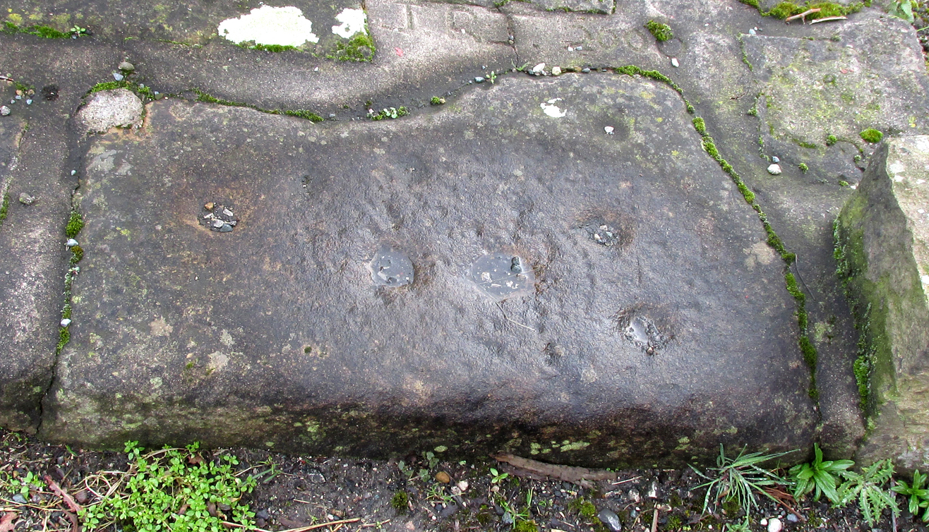
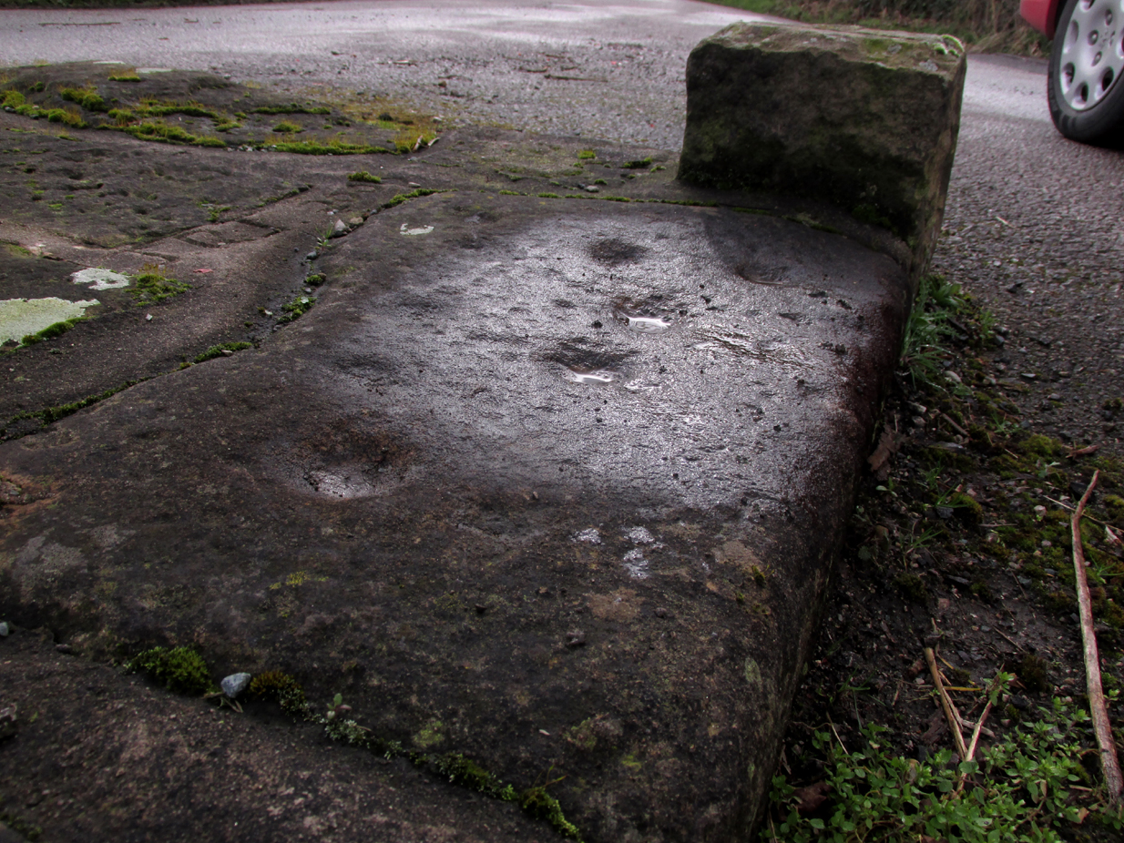
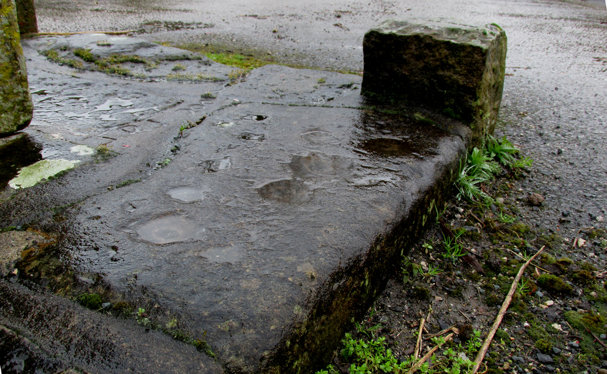
Apparently never before described, this stone has very likely been removed from another locality and cut to shape to form part of the surrounding platform base to Barton Cross, where it is at the southwest corner. It has ten cup marks.
Until or unless more such stones are located, it is a unique example of rock art in this part of Lancashire.
Nine cups visible here10th cup nr camera, after rain
Henry Taylor, in his 1906 work The Ancient Crosses and Holy Wells of Lancashire writes inter alia about the Barton Cross that it had been demolished sometime after 1848, and that the base and part of of the Cross shaft had been ‘lately restored to the old site‘. Thus the cup-marked stone may or not be in its original position as part of the Cross surround, and may have just been a conveniently available slab of stone that was used, rather than a deliberate use of a pre-existing sacred stone.
References:
Taylor, Henry, The Ancient Crosses and Holy Wells of Lancashire, Sherratt & Hughes, Manchester, 1906.
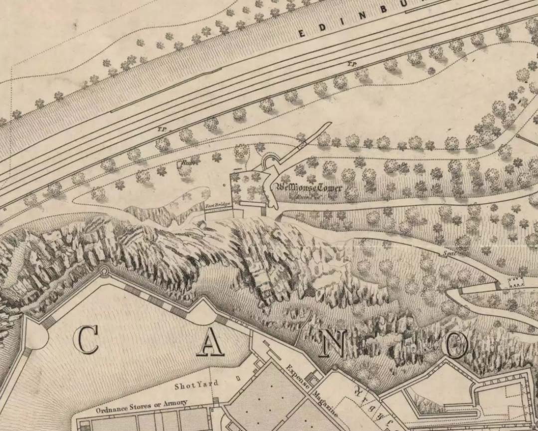
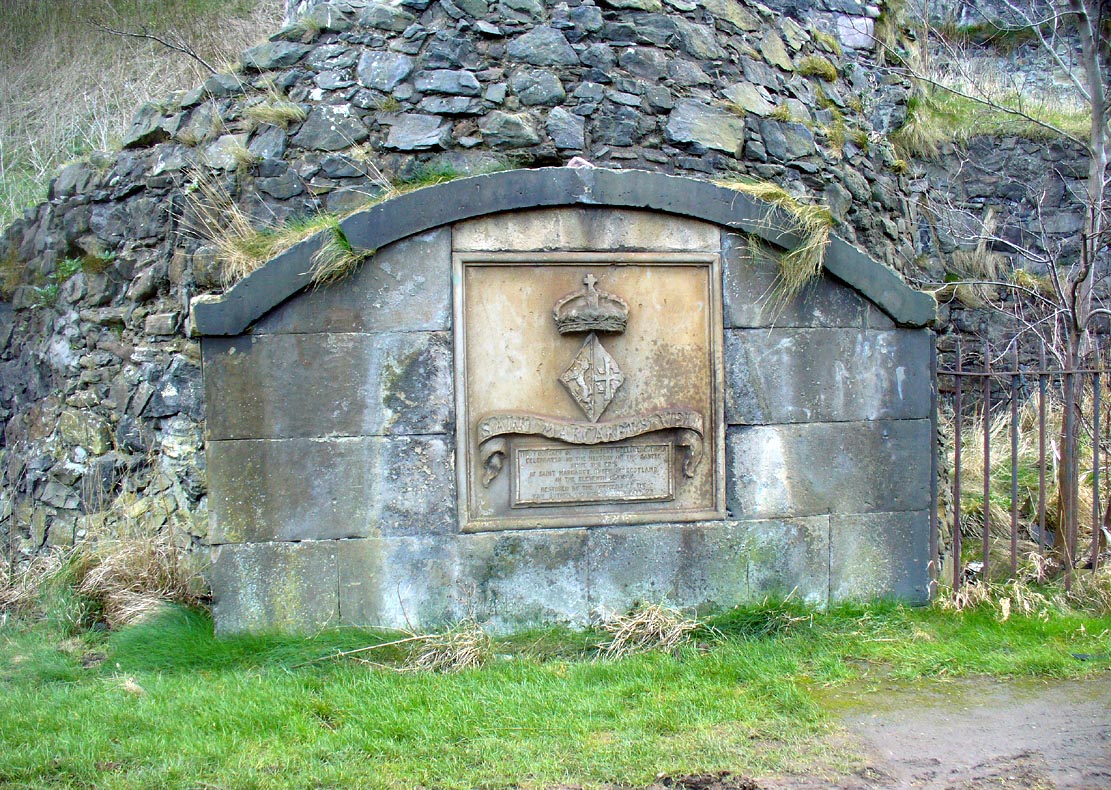
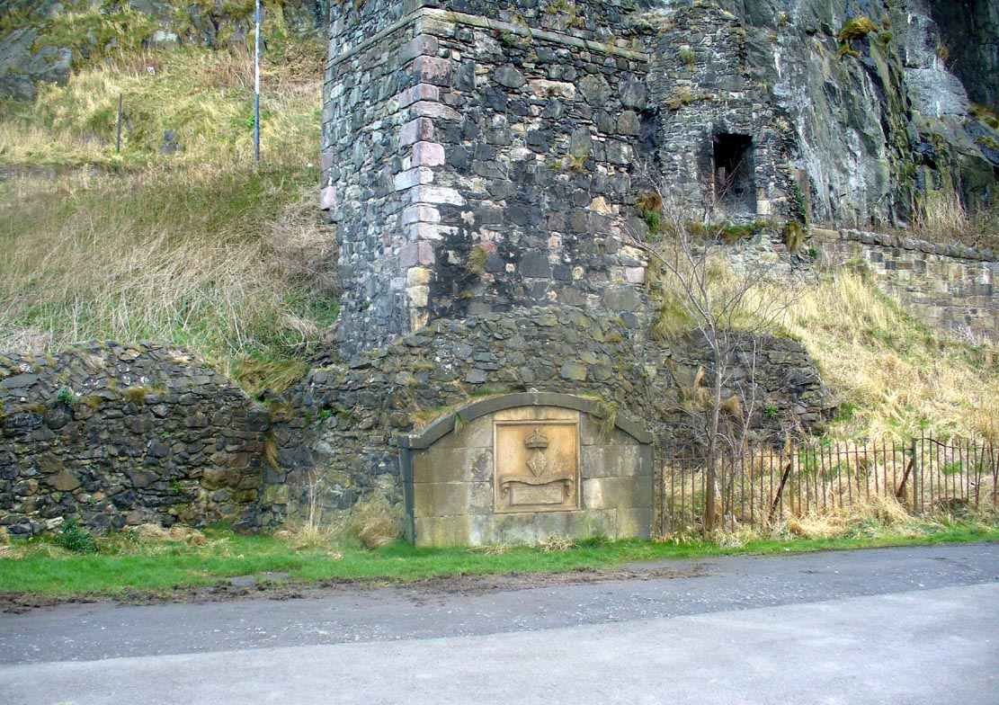
Along the more western end of Princes Street, looking up at the castle, wander into the park below and walk towards the railway line. There’s a foot-bridge over it. Once on the other side, turn right and walk along the path for just over 100 yards until you’re just about beneath the cliffs. There, in front of you, a ruinous stone building and carved faded plaque reads “St Margaret’s Well.”
Archaeology & History
The bedraggled architectural remnants we see of St. Margaret’s Well today, is not where the waters originally emerged. We must travel 2-300 hundred yards west of the present edifice, along old Kings Stables Road near St Cuthbert’s Church, for its original position. Long since gone of course…
Close-up of plaqueSt Margarets, by the old ruins
The history of this holy well tends to be found scattered in a number of sources—but none give us a decent narrative of its medicinal or traditional lore. Perhaps the best was conferred in W.M. Bryce’s (1912) lengthy essay on St. Margaret’s chapel where he told:
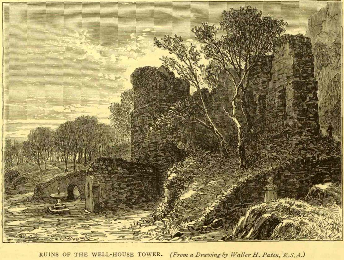
“Of the fountain in West Princes Street Gardens, also known as St. Margaret’s, and for the protection of which the Well-house Tower was erected in 1362, no legend of a similar nature seems to have survived. It was a little flowing stream of pure water, and down to the year 1821 was utilised for drinking purposes for the supply of the garrison, in supplement of the ancient draw-well of the Castle. The earliest notice of this fountain appears in a charter by David I in favour of the Church of St. Cuthbert, dated circa 1127, in which he conveys the land under the Castle from the fountain which rises close to the corner of the King’s Garden, and along the road leading to the church. It was here, in this royal garden, beside the pellucid waters of the well which was afterwards to bear her name, that Queen Margaret, in the company of her husband and children, spent many a sunny afternoon under the shade of the rugged old Castle rock.”
St Margarets Well in 1870s
The carved plaque in front of the old tumbled-down well-house sadly hides no water anymore; merely some trash and heroin-addicts needles at the back. Best avoided.
Folklore
This Scottish Queen and consort of King Malcolm Canmore, ‘St Margaret’, had several days in the calendar on which she was commemorated. Mrs Banks (1941) told how, traditionally, her day is June 10:
“This day was appointed for her festival by papal decree, but in Scotland her day is that of her death, November 16. The festival of her translation was commemorated on June 19th.”
W.M. Bryce (1912) cited St Margaret’s Day to be generally accepted as June 19, which is closer to Midsummer and could easily be accommodated into local heathen traditions.
References:
Banks, M. MacLeod, British Calendar Customs: Scotland – volume 3, Folk-lore Society: London 1941.
Royal Commission on the Ancient & Historical Monuments, Scotland, Inventory of the Ancient & Historical Monuments of the City of Edinburgh, HMSO: Edinburgh 1951.
Healing Well (destroyed): OS Grid Reference – NT 314 735
Archaeology & History
This was one of two medicinal springs that could once be found in old Portobello village. Like its companion Chalybeate Well nearly a mile northwest, in the early 19th century those entrepreneurial types tried fashioning these waters into being a Spa Well. It didn’t really work and the fad passed after just a couple of decades—and soon after the local people had completely lost their water supply here. The best historical account of it is in William Baird’s (1898) magnum opus on Portobello. He told how the well,
“was, at the beginning of the century, situated in a garden near to the main road, where there was a well with drinking cups for the accommodation of visitors, a small sum being charged from those using it. The supply here having in some way become interrupted the spring was neglected for a time. It found vent, however, lower down and nearer to the Promenade at the foot of Joppa Lane. About fifty years ago there was a pretty large open basin, in the centre of which the water bubbled up about half a foot. It was of a red brick colour. Unfortunately on the starting of a pump on the Niddrie Bum to drain the water from the Niddrie coal pits, the supply of water was again interrupted, and this excellent mineral spring, which was strongly impregnated with oxide of iron and sulphate of lime and magnesia, ceased to flow with its former fulness.”
In 1869, the Industrialists dug into the Earth to construct their promenade and, after countless centuries, the waters of this old medicinal well finally died and fell back into the deep Earth…
Along the A84 road betweeen Callander and Lochearnhead, take the small road west when you reach Balquhidder Station, towards Balquhidder village. Go along here for 1½ miles (2.5km) as if you’re gonna visit the Puidrac Stone; but 200 yards past this, go through the gate on the south-side of the road into the boggy field for about 150 yards towards the River Balvag. You’re looking for several stones, as in the photos. You’ll find ’em. (you may get soaked though!)
Archaeology & History
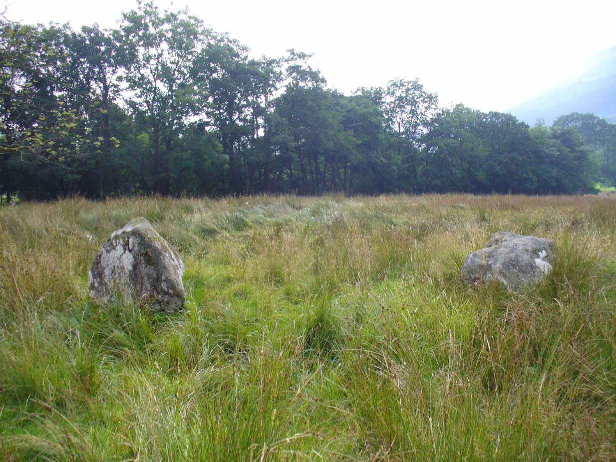
The stones, looking NW
After many thousands of years, this innocuous-looking group of small stones found in the very boggy field immediately west of the Puidrac Stone looks nothing like it once did. Some modern academics would have you think there was nothing here of prehistoric interest, but oral tradition and earlier writings tell otherwise. Although not shown on the early OS-maps, it was first described in James Gow’s (1887) articulation on the antiquities of the area, in which he told:
“A short distance east from the present (Balquhidder) parish church, in the haugh below the manse, there are seven stones remaining of a circle which appears to have been about 30 feet in diameter; only one stone is in its original upright position, but there are fragments of others lying about; as usual, they are known as “Clachan-Aoraidh,” or worshipping stones, and are not likely to be disturbed during the lease of the present tenant.”
Looking E, with Puidrac Stone just visible left of telegraph post
A few years later when Thomas Ross (1919) visited the area with a Prof Cooper and others, they reported the single standing stone still in position and the anglicized name of the Worshipping Stones was still in evidence amongst locals.
Arc of fallen stones by the trees
Nowadays the site is in ruin. Two of the stones stand out when the rushes aren’t too high, with one earthfast and its companion prostrate; but as you can see in the photo (right), there remains a sunken arc of two other stones laid down, running away from the larger ones, with a fifth overgrown and nearly covered by vegetation and the young trees. In all probability, tradition is probably right here: this is the remains of a stone circle.
Folklore
The field in which these denuded megalithic remains are found, was, wrote Thomas Ross (1919),
“the site of a long-popular market called ‘Feill Aonghais’, i.e., St Angus’ Fair. It was held, according to Mr Campbell, in May; according to Mr Gow, on “the Saint’s Day, the 6th of April.” It was quite the custom…to hold a fair after divine service on the Patronal Feast. The folks came to “kirk and market” on the same day, and mixed good fellowship and manly sport with their worship and their business.”
If you were to hold a fair there nowadays, likelihood is it would get flooded! Christian myths tell of a “St. Angus” taking over whatever the heathen traditions were in this domain, more than a thousand years back.
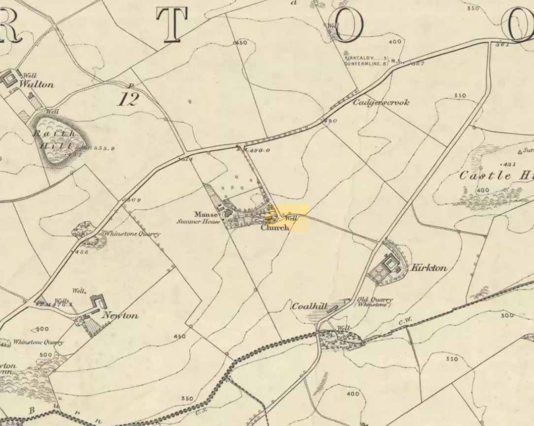
Along the B925 road between Dunfermline and Kirkcadly, ⅔ of a mile (1.07km) west of Auchtertool village, go down the small track leading down to the isolated church on the rise in some trees. Walk through the churchyard and out the other side where a small footpath runs downhill. 50-60 yards along, by the walling, this holy well is/was said to be.
Archaeology & History
Both history and tradition are pretty shallow on this all-but-forgotten site, which Penny Sinclair guided us to see in the summer of 2016. Sadly the entire area where the waters are reported to emerge were completely overgrown in nettles when we visited and, despite us trampling the Urtica down, we could find no remains of the spring. (the Church and its followers here should ensure that the well is properly maintained)
The greatest description of the site seems to be that given by William Stevenson (1908) in his rare work on the parish of Auchtertool. He wrote:
“As you approach the Kirk of Auchtertool by the old road…you come upon a well by the wayside. For many years it was the well that supplied the Manse with water, but it is now seldom used, even by the passing traveller. There is a belief that at one time this well was what is known as a holy well. Be that as it may, a friend of the late Rev. Walter Welsh, the late Dr Robert Wilson, caused a stone over the well to be inscribed with the following lines:
“Ye who the gently-winding path have trod,
To this fresh fount beside the house of God,
Taste the clear spring; and may each pilgrim know
The purer stream where living waters flow.””
The well was included in Ruth & Frank Morris’ (1982) survey, where they added that the waters from the well were “used in celebration of the mass.”