Cup-and-Ring Stone (lost): OS Grid Reference – NT 98491 28424
Archaeology & History
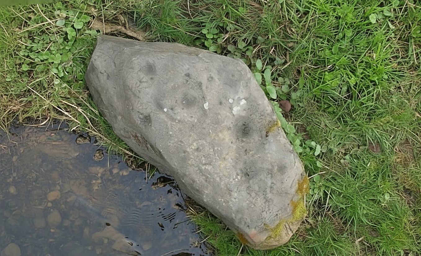
Highburn House C&R, 2015
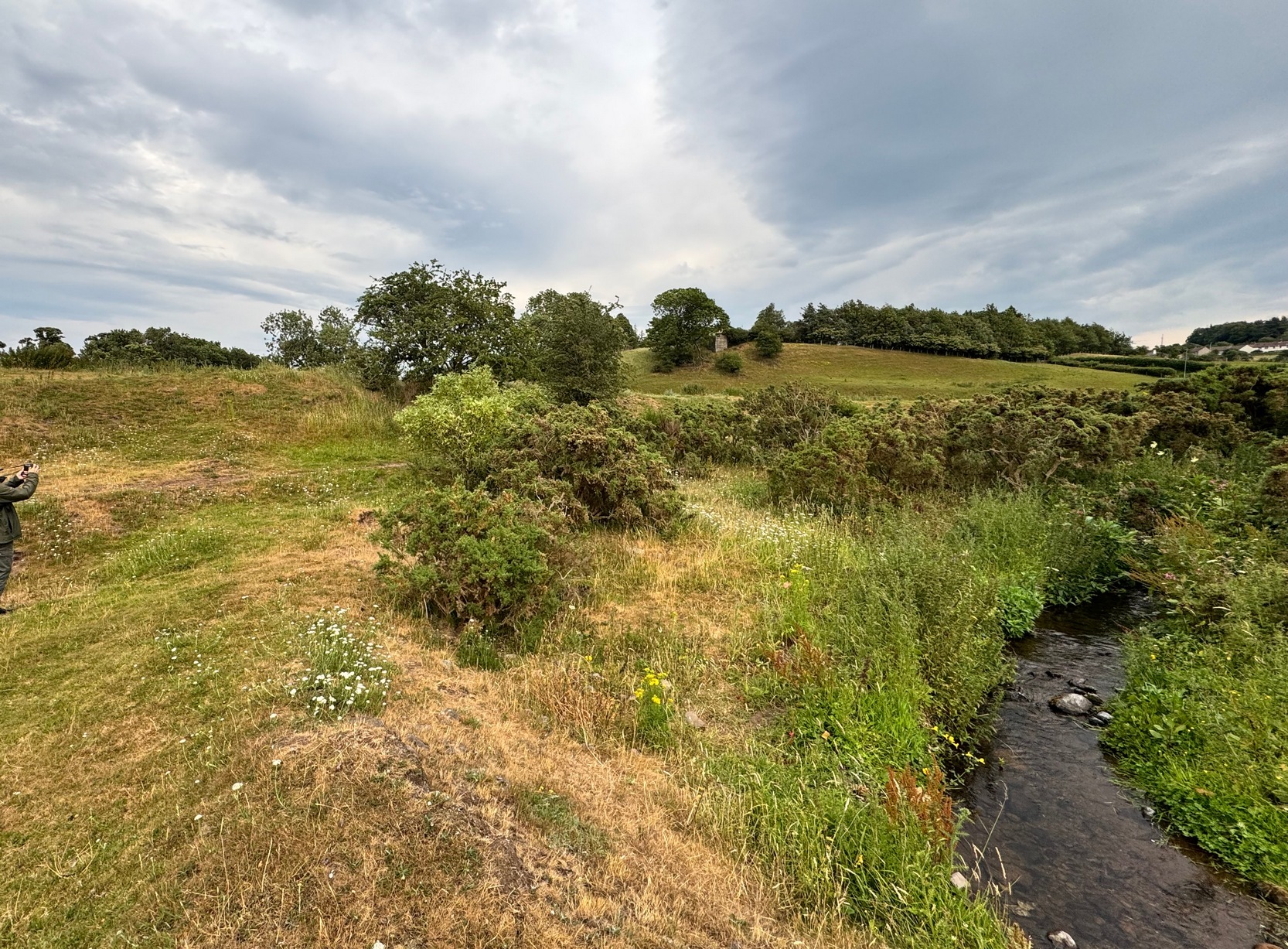
This carving was rediscovered by rock art explorer Jan Broewer in September, 2007, a few hundred yards out of Wooler on the way to Akeld and Kirknewton, in the field on the right-hand side of the road, on the embankment just a few inches above the waters of the High Burn. On a recent visit here by Tom Cleland and I, despite us rummaging amidst the gorse and other herbage all along the edge of the waters, we were unable to locate the carving and presume that it has either been destroyed or re-housed in someone’s garden, living a more comfortable life. We certainly hope it’s the latter!
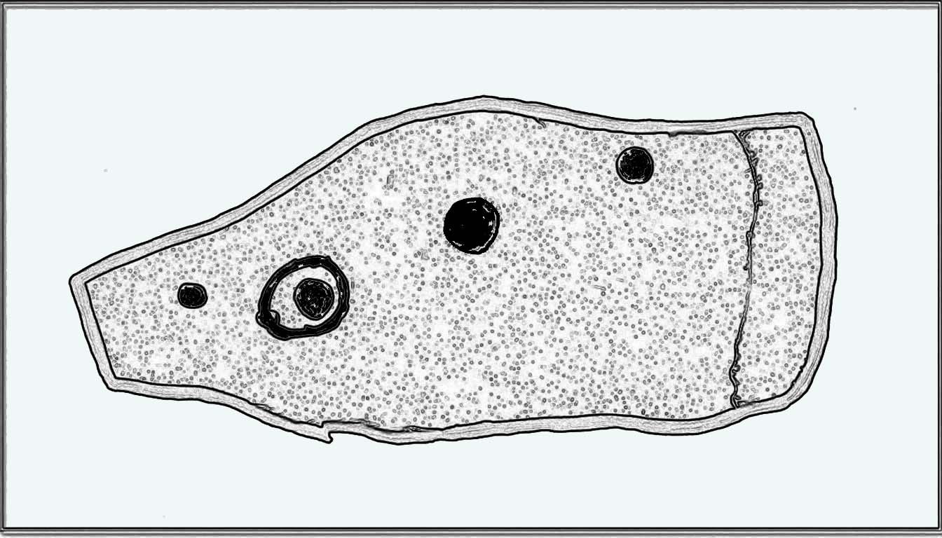
Sketch of the designHome of the lost carving
It’s design is nothing special: merely a singular, albeit scruffy cup-and-ring, with two other distinct pecked cup-marks and, possibly, a third shallow one just to the side of the cup-and-ring (but this is, in my opinion, highly suspect). The stone was obviously not in its original position when Jan first found it, and would seem to have come originally from the slope above the stream where a number of earthfast stones can be found. The numerous scratches across its surface shows that it’s been hit a few times by some (probably) metallic objects, or perhaps horses hooves, thus dislodging it from the slope above and rolling into the spot where Jan found it. Anyhow, we presently don’t know where it is or what’s become of it. Does anyone in Wooler know where it’s living?
Acknowledgements: Huge thanks to Pete Chattaway for use of his photo; and to Tom Cleland for helping the search party!
We took the B6348 road up east, from Wooler, turning left 2 miles up and crossing the small river bridge, going past Weetwood Hall where the road bends to the right and goes uphill for about a mile where, just before West Horton farm, there’s a a dirt-track on your left. 200 hards up, walk past the farm up and along the dead straight track for another 400 yards until you hit the field. Diagonally ahead of you (NW) less than 100 yards away, a small hillock rises in the field where a large metal animal feed-trough sits. Once there, the slope to your right (east) is where the stone lives. If you potter about you’ll find it.
Archaeology & History
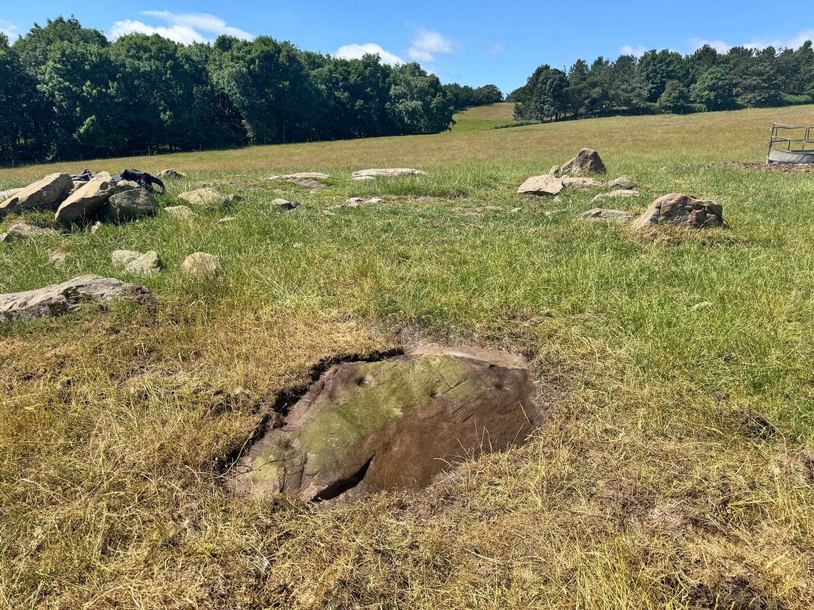
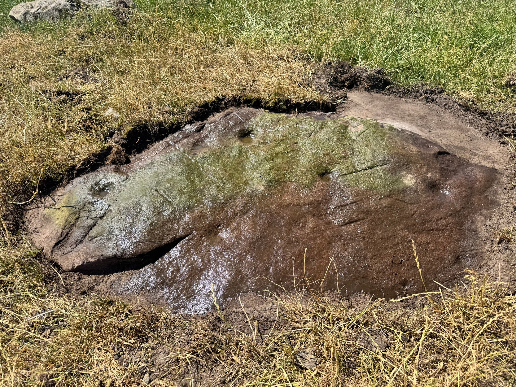
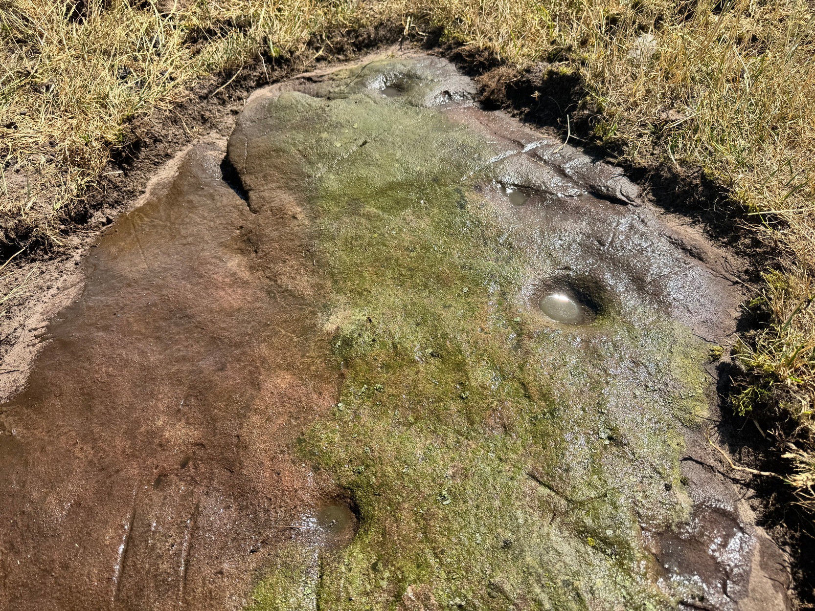
On a visit to the impressive West Horton carvings on one of the searing hot days recently, Tom Cleland and I thought to check on an otherwise unimpressive petroglyph on a rocky rise of land before heading to the beauties 250 yards northwest of here. The covering soil around a scatter of earthfast rocks on this rise in the land had been eroded by cattle and on one of them we noted what seemed to be a distinct cup-marking. And, as happens when you look closer, a more expansive design came into being.
Main design from aboveFaint ring round the cup
On the east-sloping-face of this rock are between six and seven cup-marks, most of them quite distinct. The topmost of the cups has a faint incomplete ring round it which you can just make out in a couple of the photos. It seemed that there was another even fainter ring around one of the other cups, but on the day we visited this the heat was taking its toll of me and I could only stand a short time before we had to move, so we left without getting any good images of the other ring.
More recent cup-marks
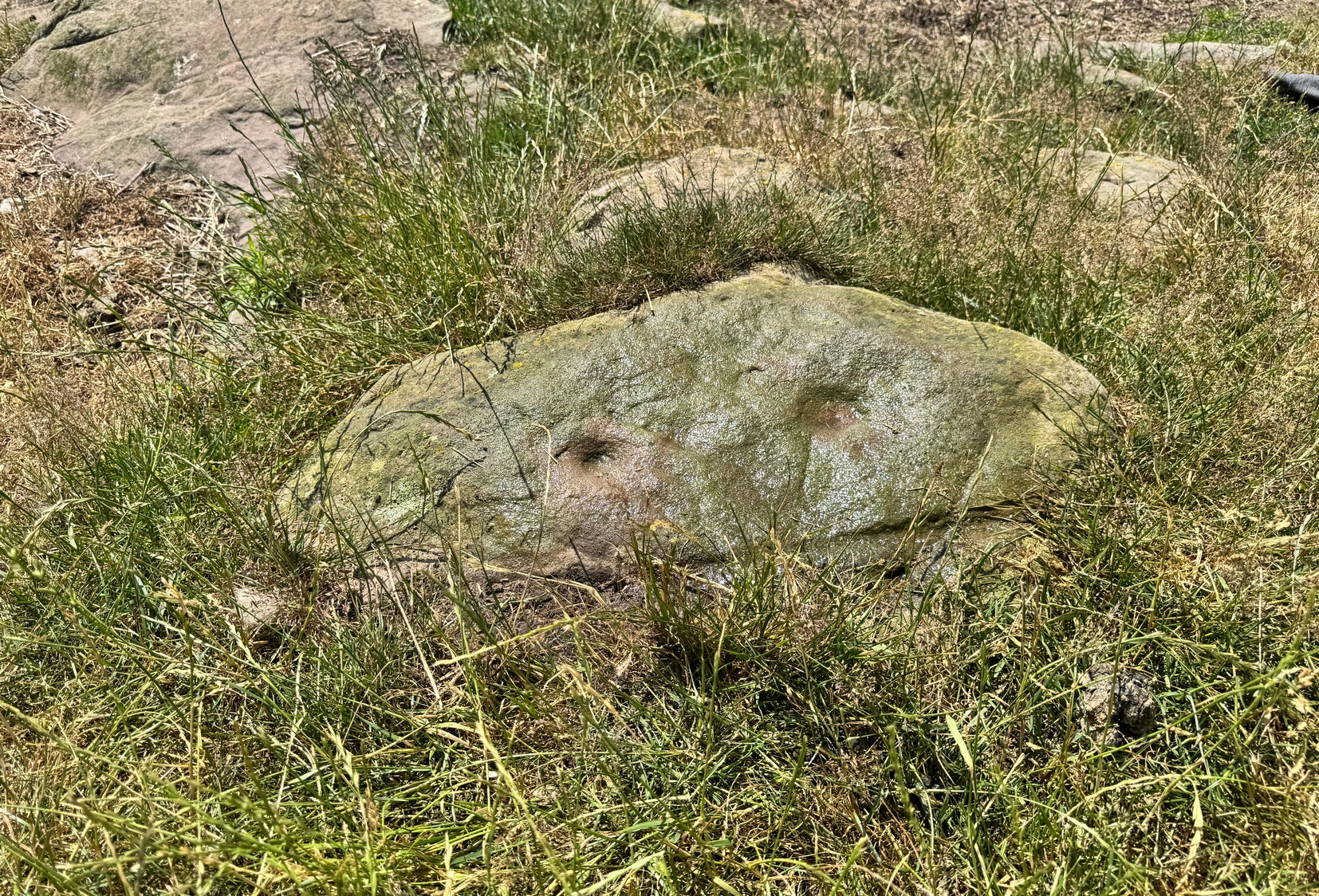
It’s more then likely that other unrecorded carvings are hiding beneath the soil which, no doubt, the cattle will slowly help uncover as the years go by. 🙂 A little further up the slope from here, approaching the West Horton (1b) carving, a small oval-shaped rock has what looks like a single cup-mark on it and another, more recent marking at its side. This impression is likely due to an incision made by the metal legs of one of the animal feeders and is unlikely to be prehistoric.
Stone Circle (destroyed): OS Grid Reference – NY 88542 74175
Archaeology & History
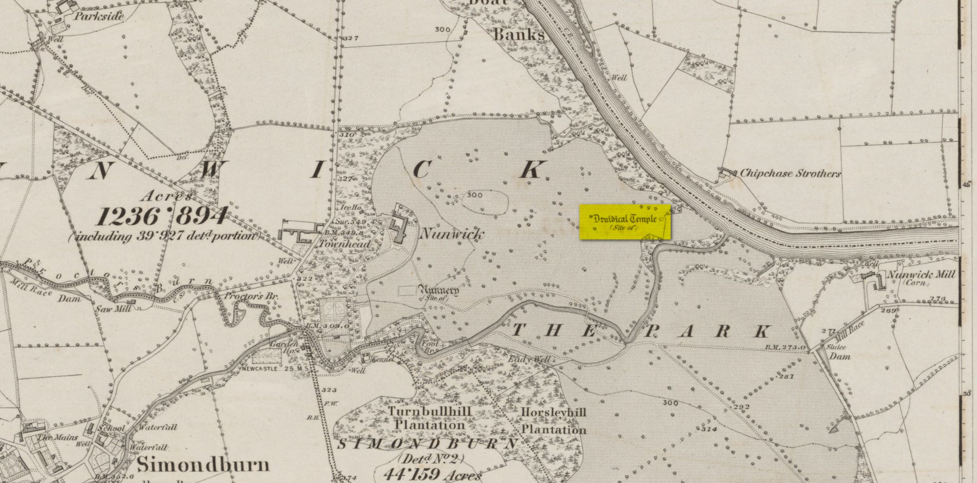
Site location on 1866 map
Highlighted, albeit in the past tense, as a “Druidical Temple” on the first Ordnance Survey map of the area in 1866, these megalithic remains were seen by earlier antiquarians, but seemingly met their demise sometime in the early 19th century. Some halfwit land-owners no doubt wanted their little garden extended to where local folk would have traditionally met at certain times each year—so in getting rid of the stones, it would help to keep the riff-raff away. (many of these elitists still think this way) It had certainly gone when the Northumbrian historian John Bates (1895) wrote about it, where he told simply:
“The fine circle at Nunwick, on North Tyne, described by Bishop Gibson, has long since disappeared.”
It was still standing in the 17th century, three or four thousand years after our ancestors put it there. We know this because the remains of the stone circle were told about in Gibson’s (1695) edition of Camden’s Britannia, where mention is made of “large stones erected at several places” in Northumberland, including this place where,
“near Ninwick in the Parish of Simondburn, four such stand still erected, and a fifth lies fall’n to the ground.”
The situation hadn’t changed when John Wallis (1769) visited Nunwick. On his trip to these megaliths he told that,
“In an adjoining field, called, Nunwick-east-field, were five upright stone-pillars, in a circular order; four of them perfect and entire in 1714, the other broken; the perfect ones eight feet high, and nine feet and an half over; the circumference of the area in which they stood, ninety feet.”
It was obvisouly a decent-sized circle! The great megalithic archaeologists Barnatt (1989) and Burl (2000) included the site in their respective catalogues, but could add no further details apart from saying there was a drawing made of the stones sometime around 1715 which, apparently, is in volume 15 of the History of Northumberland. Has anyone got a copy…? 🙂
References:
Barnatt, John, Stone Circles of Britain– volume 2, BAR: Oxford 1989.
Bates, John C., The History of Northumberland, Elliot Stock: London 1895.
Burl, Aubrey, The Stone Circles of Britain, Ireland and Brittany, Yale University Press 2000.
Dodds, M.H. (ed.), A History of Northumberland – volume 15: Simonburn, Rothbury, Alwinton, etc, Andrew Reid: Newcastle-upon-Tyne, 1935.
Gibson, Edmund (ed.), Camden’s Britannia, F. Collins: London 1695.
Wallis, John, The Natural History and Antiquities of Northumberland – volume 2, W. & W. Strahan: London 1769.
Acknowledgements: Huge thanks for use of the Ordnance Survey map in this site profile, reproduced with the kind permission of the National Library of Scotland.
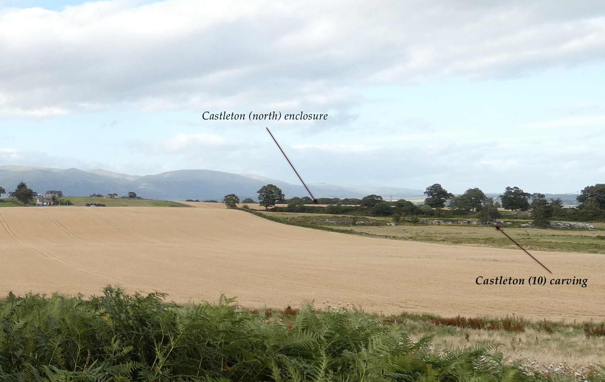
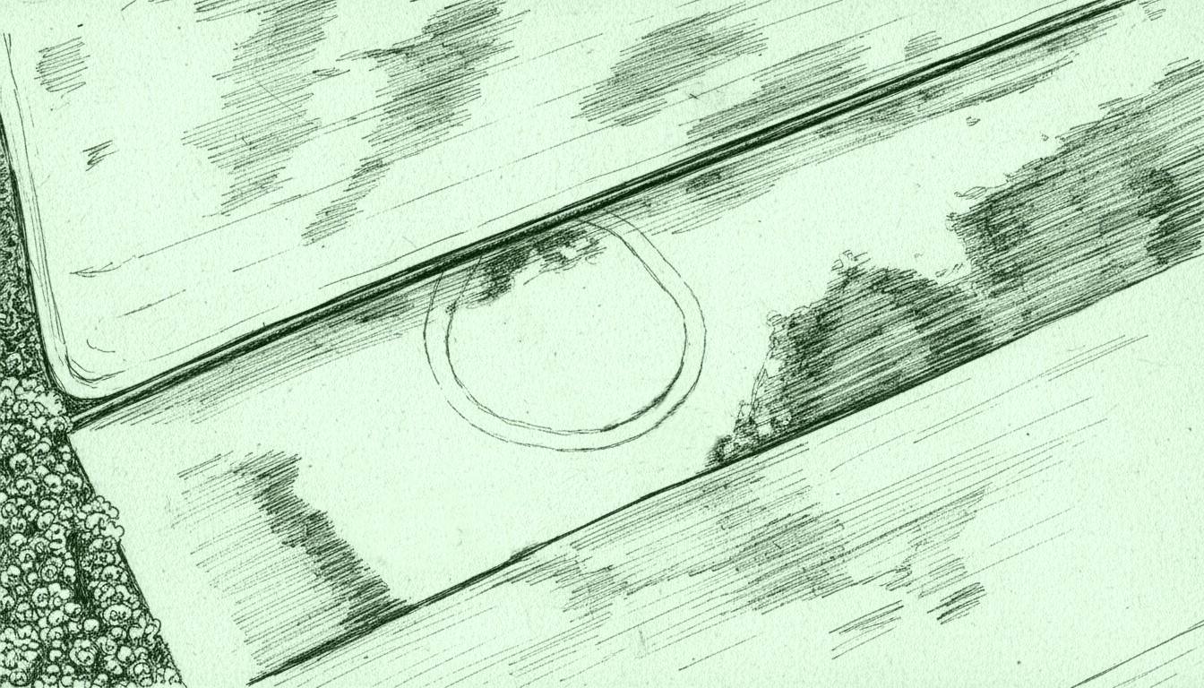
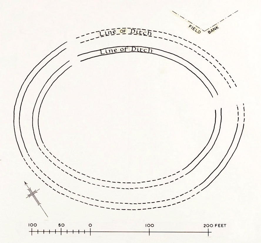
In the fields immediately above the northernmost of the Castleton petroglyphs, there was, in bygone times, a prehistoric settlement, forgotten and cast even from folk memory until very recently, when aerial photography revealed the ghostly outline of its former existence. Similar in design, but somewhat smaller than the prehistoric Gallamuir enclosure a half-mile southwest of the Castleton carvings, this double-ringed oval enclosure—thought by archaeologists to have been defined all round with large wooden stakes, or palisaded—measures, from outer edge to outer edge, 65 yards (SE to NW) across its longer axis, by 55 yards (SW to NE). The gap between the trenches that define the inner and outer wooden ‘walls’ is between five and six yards apart all round it. The entrance to the enclosure seems to have been on its southeastern side—although an excavation is needed to be sure about this. Sadly, almost nothing can be seen of the site at ground level. An archaeo-dig would be a good idea. 🙂
Rough sketch of site-plan
‘Palisade enclosures’ tend to be neolithic in origin and were in use for many centuries, sweeping into the Bronze Age. I highlight this long period in time due to the proximity of the extensive and very ornate cup-and-ring carvings that start just 300 yards southwest of the settlement on the first rock outcrop that you meet. It’s a good one too! Petroglyphs were also created mainly during the neolithic and Bronze Age periods; and as the enclosure here is on the slight rise in the land overlooking the various small rocky ridges below, many of which are decorated in ornate cup-and-rings, it’s likely that some of the people who lived here were probably the people who did them…
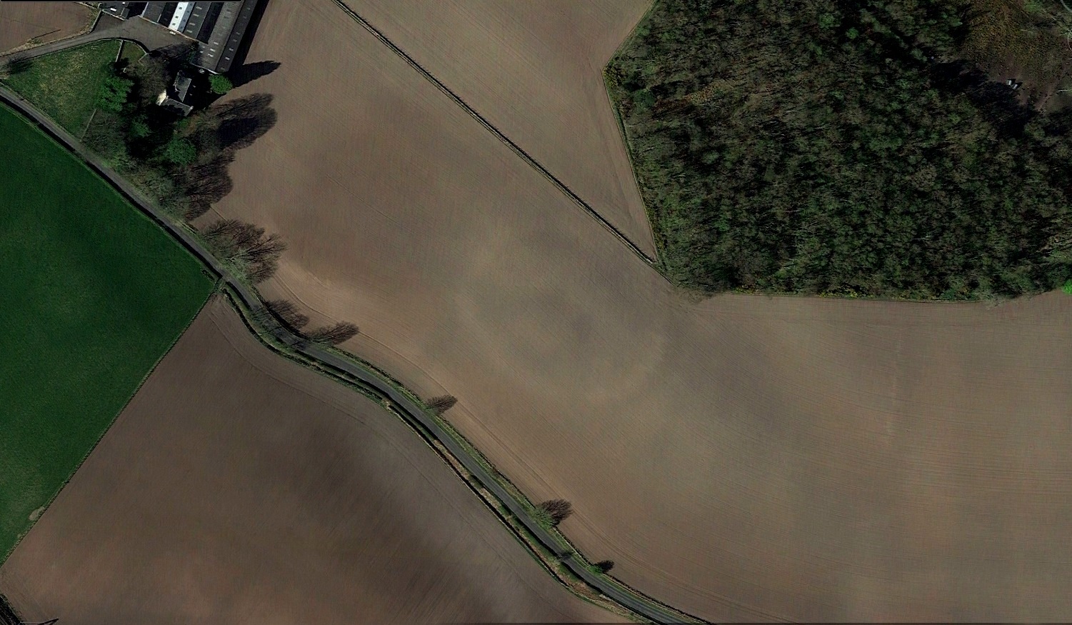
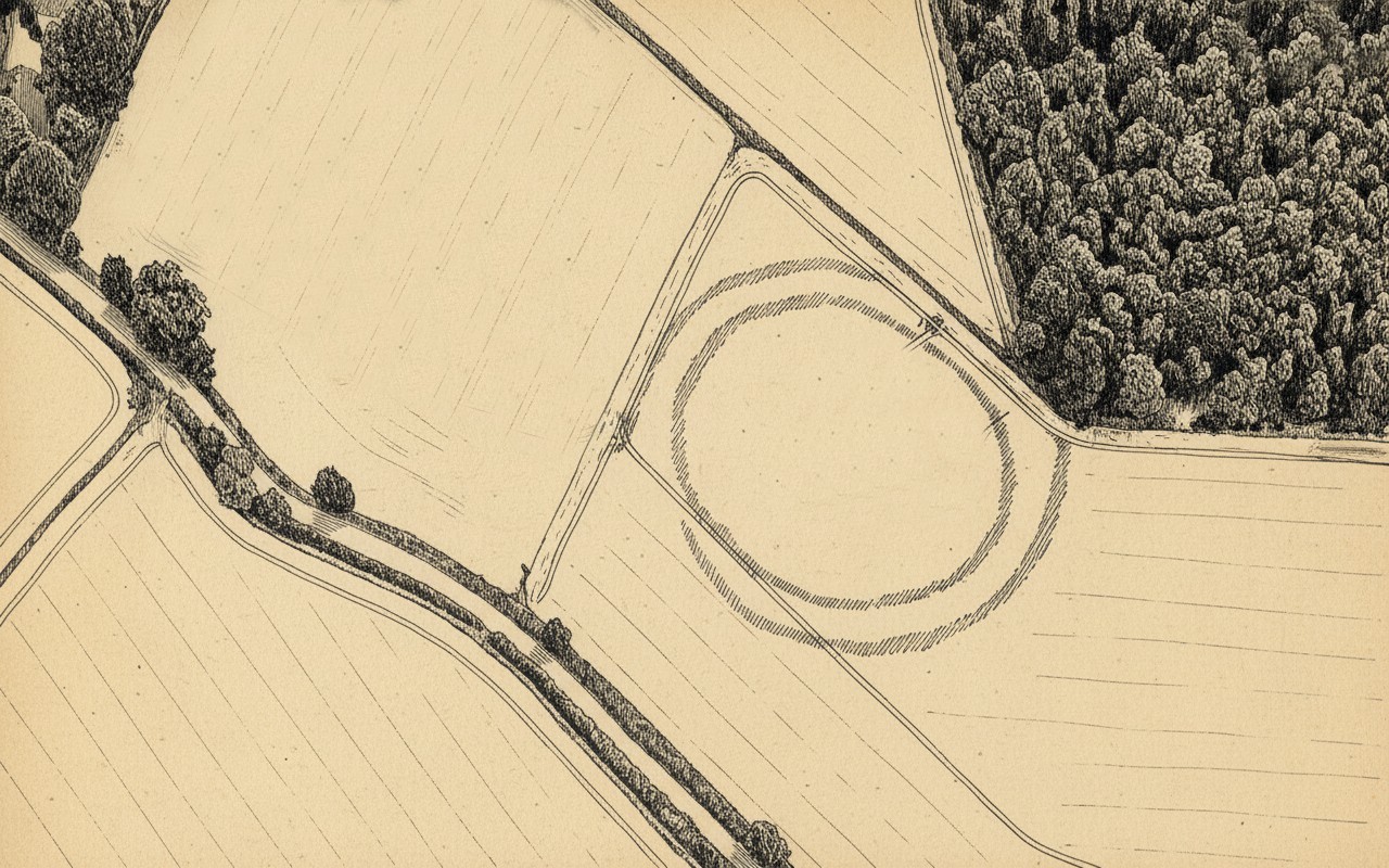
Just over a half-mile (1km) south-west of the major rock art complex at Castleton, in the fields just east of Gallamuir Farm on the north side of the B9124 road, could once be seen a decent double-ringed enclosure, prehistoric in nature. At ground level today there is nothing to be seen as agricultural practices have ever so slowly eroded it away. It wasn’t in a good state when the dudes from Royal Commission (1963) had a look at it in October, 1951—although they did tell us that some faint remnants were discernible, but it was fading fast! They wrote:
“No traces of this structure can normally be seen on the surface, but at the date of visit, when the site was covered with wheat stubble, stretches of both ditches were clearly visible, as shown on the plan (below), by reason of the stronger growth of the stubble overlying them. The ditches are from 20ft to 30ft apart, and the enclosed area measures 300ft from ESE to WNW, by about 240ft transversely. Two narrow gaps in the inner ditch on the north and east arcs respectively, may represent original entrances.”
Outline sketch of the enclosureRoyal Commission plan
Nothing remains of it today apart from the shadow-marks of its former existence when looked down from above. The double embankment that constituted the enclosure initially suggested it to be Iron Age in nature, akin to the larger hillforts up and down the country, but the outline is more consistent of a standard settlement enclosure. As far as I’m aware, no excavations have taken place here, so we’re at a loss to know whether the people living here had anything to do with the rock art just across the fields at Castleton. If we found that it had a Bronze Age or neolithic date, a connection could be likely. But we may have to look at the enclosure immediately north of the Castleton complex to be more sure of our petroglyphic culprits….
References:
Lock, Gary & Ralston, Ian, An Atlas of Hillforts of Great Britain and Ireland, Edinburgh University Press 2022.
Royal Commission on the Ancient & Historical Monuments Scotland, Stirling – volume 2, HMSO: Edinburgh 1963.
Royal Commission on the Ancient & Historical Monuments of Scotland, Archaeological Sites and Monuments of Stirling District, Central Region, Society of Antiquaries of Scotland 1979.
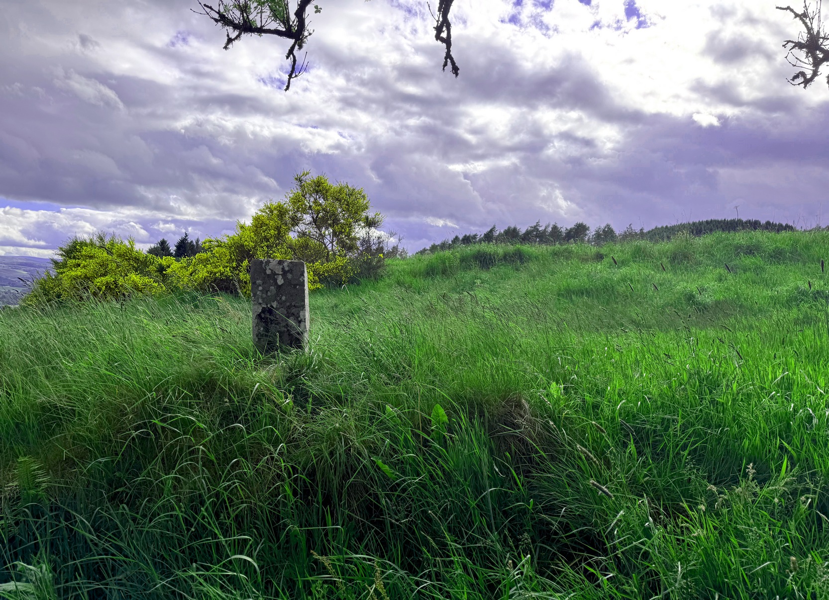
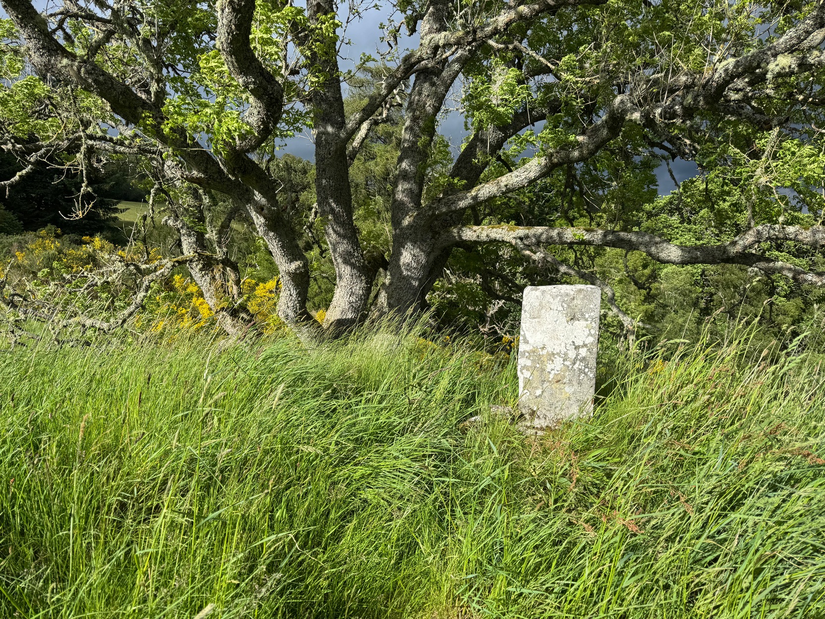
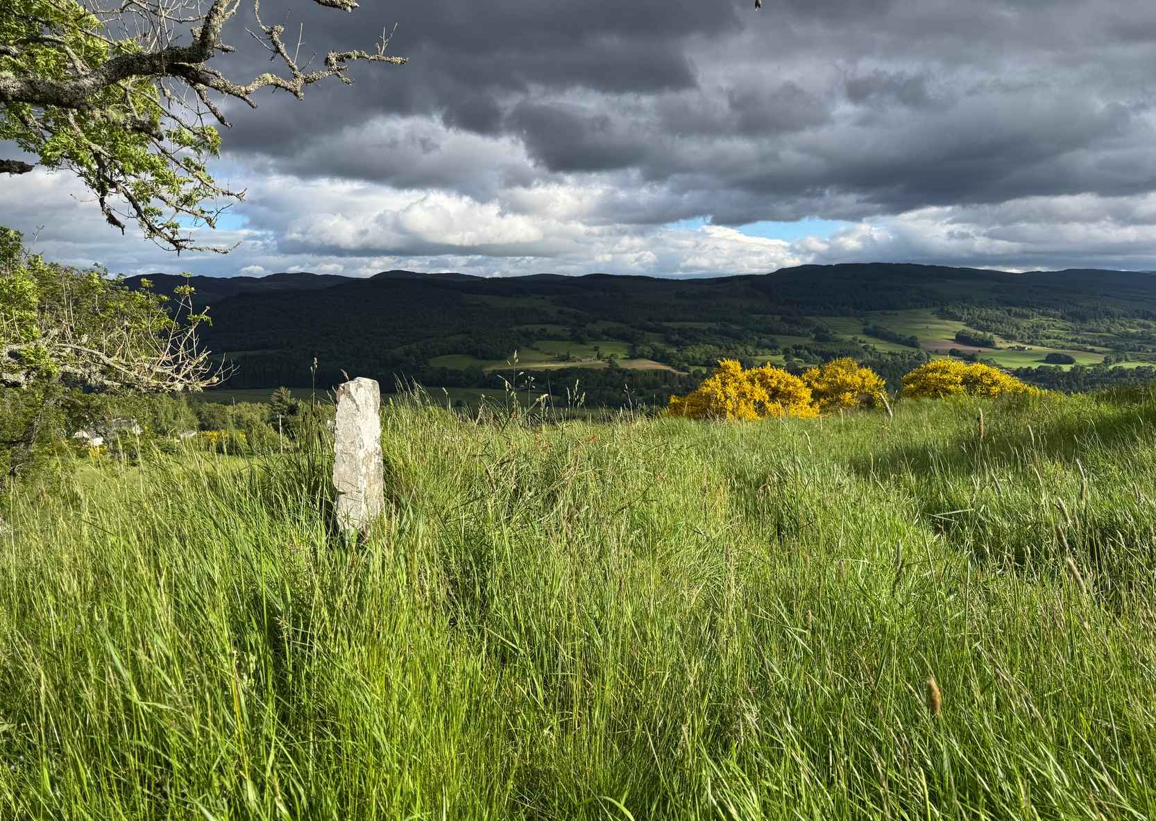
From the red phone-box at the road junction in Strathtay village, walk aling the road, east (slightly downhill) for less than 50 yards then turn left and walk up the track. After 70-80 yards, keep your eyes peeled for the footpath that runs up the slope into the tgrees (don’t head to the house in front of you). After a half-mile you reach the gorgeous old Tullypowrie farmhouse on your left; keep walking uphill for another 300 yards until your reach a large tree on your left, above which, sat on some very low walling, you’ll see a small upright stone.
Archaeology & History
Faint cross on western face
This little-known early christian carved stone, sitting on the vague remains of an old Roman Catholic church, located on what local folks used to call “the route to the stones” (meaning to the Clachan an Diridh, much to the minister’s considerable disdain), has had less said of it than the more ancient stone circle a little further up the footpath. But then, not much is known of either the carving or the church itself, whose remains can barely be seen amongst the grasses. But the upright ‘cross’ at least proclaims itself to the eye.
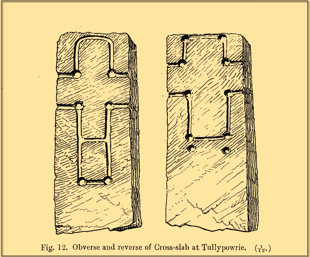
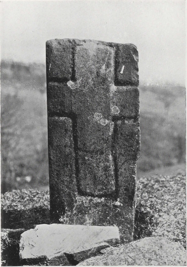
On our recent visit here, the crosses (on both side of the stone) were somewhat faint, as my photos show. But it wasn’t always this way. During a visit to nearby Aberfeldy in September 1900, the antiquarian Dave Landsborough (1901) found himself ambling about “among the ruins of a small hamlet” that was the olde settlement of Tullypowrie and came upon this little-known monument. He subsequently wrote an excellent description of the stone, which cannot be equalled. “The cross,” he told,
Landsborough’s sketch
“is of the rudest character, consisting of a schistose slab 30 inches in length, 11⅜ inches in width at the top, about half an inch wider at the bottom, and about 4½ inches in thickness. It is roughly squared at the top and sides, but at the bottom the base is unsquared, one side being longer than the other. On both faces of the slab a cross is formed by a shallow incised sinking, a little more than an inch in breadth, with circular sinkings slightly deeper than the rest of the outline at each corner of the shaft and summit of the cross, and at the intersections of the arms with the shaft and summit. The cross on the east face of the stone has its top almost level with the top of the slab, but the shaft does not reach nearly to the bottom. The top part of the cross above the arms is 4½ inches high by 4½ inches in width. The arms reach across the whole width of the slab, and the shaft is little more than the length of the part above the arms, the base being somewhat rounded. Below the termination of the shaft are two slight circular sinkings almost in line with the perpendicular outlines of the sides, but at unequal distances from their terminations, the one being 1½ inches and the other 2½ inches below the similar sinkings which mark the corners of the shaft. The cross on the west face of the slab is in every way similar, except that the shaft is longer, reaching to a length of 10½ inches below the arms, and the circular sinkings at the top are nearly effaced. It has, however, the curious feature of a slight cut-off at about the same length as the shaft of the other cross, but the circular sinkings occur at the top and bottom, and at the intersections as in the case of the other cross.
“The slab is not fastened in a socket, but is kept nearly erect leaning against a large stone, while smaller stones keep it firm at the back. I have since been told by the Rev. Mr McLean of Grandtully that the place where it stands is the site of an old and very little chapel, the south wall of which may still be recognised by its remaining foundations.”
Tullypowrie cross looking SDixon’s old photo
On the other side of the burn from here was the great Whooping Cough Well, with the heathen Clach na Buidseach against the wall of Tullypowrie Farm just below (subsequently moved to the field west of the cross). These sites (and others nearby) and the animistic traditions associated with them, probably had something to do with the positioning of the church here, and the cross would be the attempt to give a Christian veneer to usurp the more archaic natural practices. We don’t know that for sure, but it’s more than likely. The old Logierait schoolmaster James Kennedy (1927) makes constant references to the animistic lore of the region, which was legion until quite recently.
No additional lore, sadly, is known of this old cross, which is deemed to be medieval in origin. Both Mitchell (1923) and Dixon (1925) make mention of the monument in their respective guidebooks, but add no further information.
References:
Dixon, John H., Pitlochry, Past and Present, L. Mackay: Pitlochry 1925.
Kennedy, James, Folklore and Reminiscences of Strathtay and Grandtully, Munro Press: Perth 1927.
Landsborough, David, “Rubbings of both Faces of an Erect Incised Cross-slab, at Tullypowrie, near Grandtully, Perthshire,” in Proceedings Society of Antiquaries, Scotland, volume 35, 1901.
Mitchell, Hugh, Pitlochry District: Its Topography, Archaeology and History, L. Mackay: Pitlochry 1923.
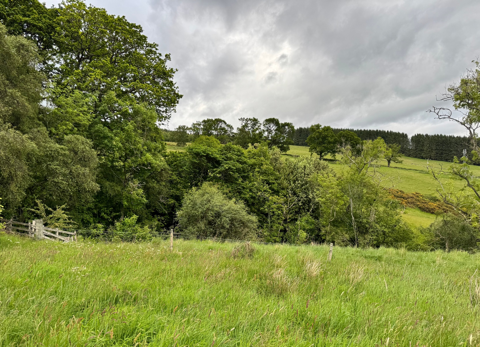
Park up at the red phone-box in Strathtay village (by the road junction) and walk east along the road (slightly downhill) for less than 50 yards, then turn left and walk up the track. 70-80 yards up, keep your eyes peeled for the distinct footpath on your right (don’t head up to the house) that runs into the trees and keep walking uphill for literally ½-mile where you’ll reach the gorgeous overgrown scented orchard of Tullypowrie farmhouse on the left. Keep walking along the path past the farm and, if you fancy, cross the burn (stream) anywhere hereby. The well is on the other side of the burn, somewhere…..
Archaeology & History
We ventured up here recently to look at several sites, but when we came to find this long lost well we were hindered severely by the mass of vegetation that was teeming with ticks—so thought it most sensible to come back here again at the end of winter when we’d have a clean slate of landscape to look at. (the ticks have got fucking awful in this neck o’ the woods in recent years!) It has almost fallen out of history, with no one writing about the place for more than a hundred years, yet it was a place of considerable importance in the folk traditions of Strathtay.
In some previously unpublished notes written by the historian Charles Robertson sometime at the beginning of the 20th century, he told of a lady from Pitlochry called Mrs Anderson who informed him of an important water source known locally as Sput na-fruith-chasd which,
“comes spouting out of a high rock on the east side of the Tullypowrie Burn opposite Tullypowrie farm, and was resorted to of old for the cure of whooping cough. The sufferer who came here and drank of the water always got better too.”
It was described by the Logierait schoolmaster James Kennedy (1927) as one of “the three most important (wells) in the Tay Valley”—and there are a lot of wells in the Tay Valley!
There’s a slight discrepancy regarding the exact location of the well: whilst Mr Robertson’s notes told that it was found “opposite Tullypowrie farm”, in Hugh Mitchell’s (1923) survey of local antiquities he told that,
“On the oppsite side of the burn from the mill there is a drip well, the water from which was for long regarded as a certain cure for whooping cough”—
which would place the well a hundred yards or so further upstream. (the very low-lying walls of the mill can just be discerned a short distance above the farmhouse) I’m sure that a good search of the area after Winter has laid the vegetation to rest will tell us one way or the other precisely where this curative well is hiding.
Across the burn from the well is the barely visible ruins of an old church: Roman Catholic according to tradition, with a singular short carved cross standing on the low remains of its eastern wall. Close to this, but now in the field a few hundred yards west, was the curious bullaun stone known as Clach na Buidseach, or Witchcraft Stone. This bullaun would seem to have been used in rites related to the Whooping Cough Well, but the precise nature of these rites has been lost.
References:
Dixon, John H., Pitlochry, Past and Present, L. Mackay: Pitlochry 1925.
Kennedy, James, Folklore and Reminiscences of Strathtay and Grandtully, Munro Press: Perth 1927.
Mitchell, Hugh, Pitlochry District: Its Topography, Archaeology and History, L. Mackay: Pitlochry 1923.
To find this carving, follow the same directions as if you’re visiting the carving I’ve simply labelled Netherglenny. From here, walk up the slope (north) barely twenty yards and you’ll see the folds of another elongated piece of rock, similar in form to the one you’ve just been to.
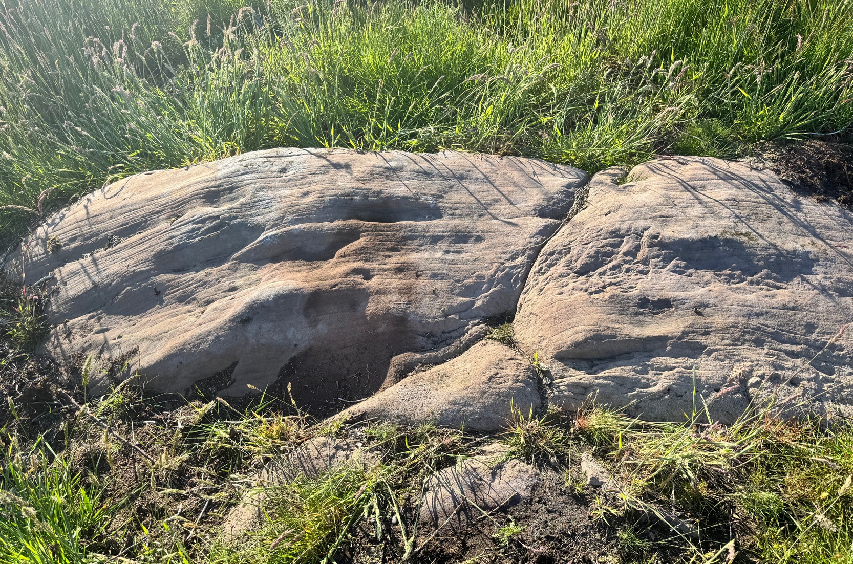
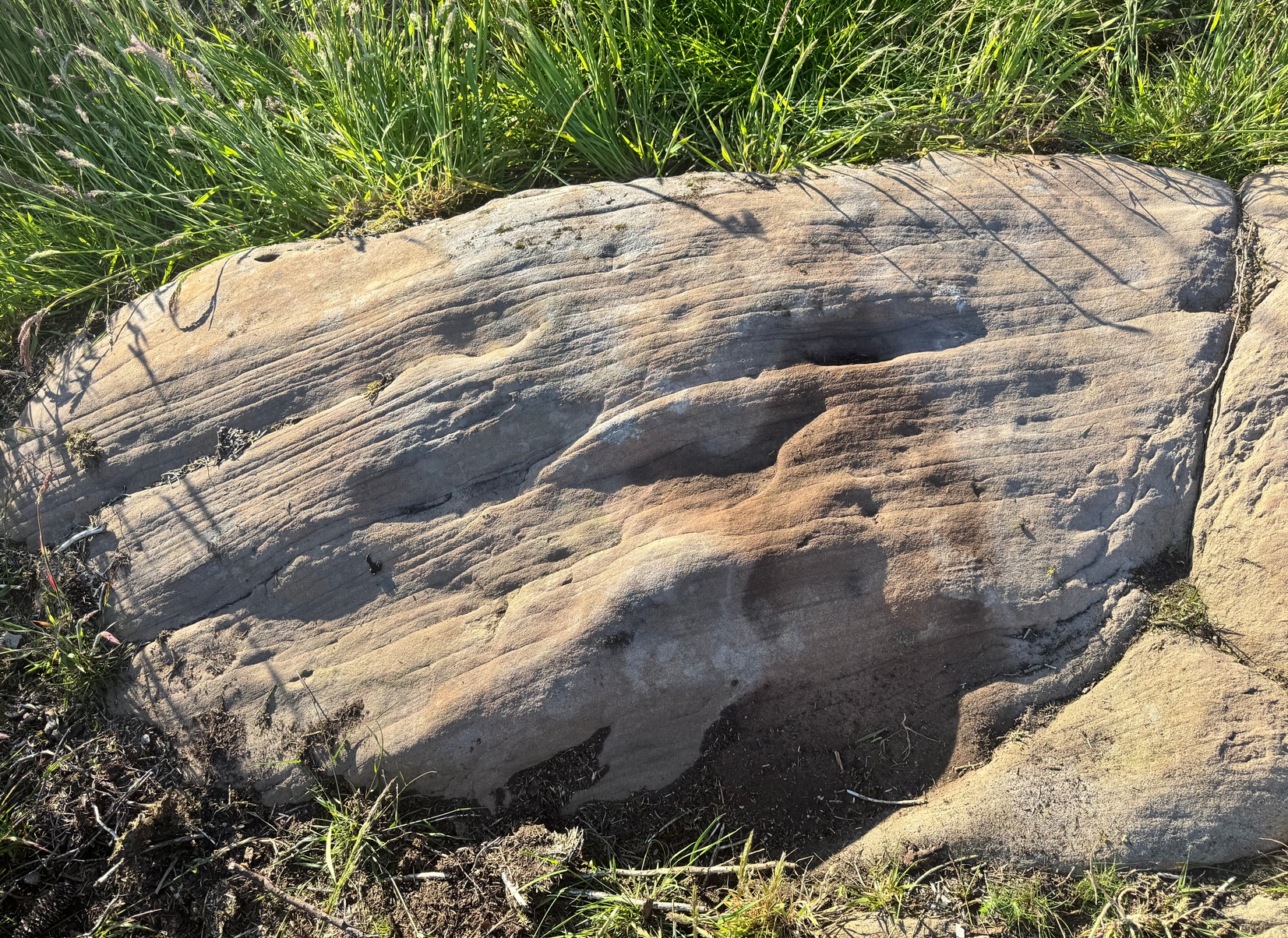
I found this stone when rushing near the end of a red hot day and needed to get back under some shelter, so I didn’t get chance to highlight it as I usually do. Hence, the info and the photos of the carving aren’t impressive. But then, the design on the stone isn’t impressive either. I could discern just two distinct cup-marks: one above the deep elongated slit (vulva-esque) and the other below it. The cup-mark above it comes out clearly in the photos; but the other one is just about hidden in the shadows. There may be a third possible cupmark close to the less visible one. I’ll get some better photos when I’m next up there (he sez, hopefully…)
Shallow cup, top-middle
This carving lies very close indeed to an official site entry known simply as a ‘Nether Glenny’ carving (grid-ref NN 56130 01969), which became lost when forestation took effect here more than 30 years ago. However, the description given to that stone, of “at least six cups on the upper surface of the boulder” isn’t consistent with the marks on this rock. There are several other marks on this stone that may give the impression of them being cup-marks, but they’re entirely natural. Hopefully we can recover the lost ‘official’ stone on our next visit.
(The entry title of this site needs amending, as the entire Menteith rock art complex (more than a hundred carvings in little over a square mile) needs re-assessing and assembled under a singular umbrella. The scattering of place-names, sometimes erroneously, relating to the many so-called ‘Nether Glenny’ carvings [dozens of them], is confusing unless you know the area intimately—and most people don’t! So forgive the title I’ve given this minimalist cup-marked stone. It will be adjusted when we’ve been back and correctly mapped the others in this locale. If anyone wants to help out in this project, please get in touch.)
We took the route up from the hidden Braeval car-park, on the left-side of the road, ⅔-mile (1km) east of the Aberfoyle roundabout (on the edge of town). From here, walk up the dirt-track and bear left 350 yards up where the track splits. Walk up here for 1½ miles, through and beyond the ruined forest until, on the far side of the remaining trees (they may have been cut when you’re reading this) the path eventually brings you out into pasture. At this point, veer immediate right and follow the fence/wall on your right for literally ⅓-mile (0.54 km). This is boggy and uneven all the way as there’s no path here. You’ve gone up and over a ridge and, as you’re coming down the slope, hop back over the wall where there’s a gap and walk about 30-40 yards into the debris. You’re damn close!
Archaeology & History
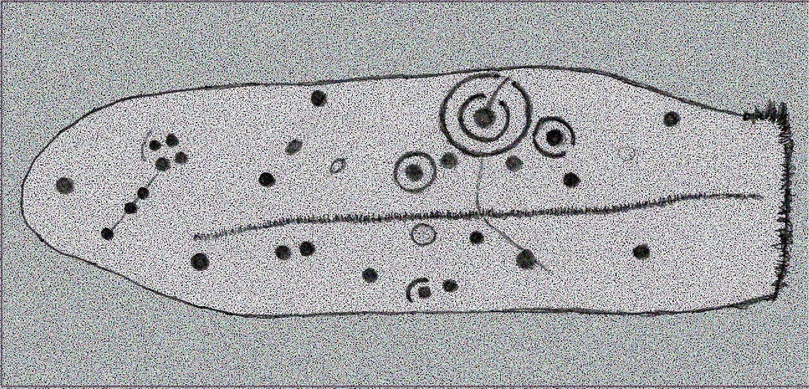
Rough sketch of design
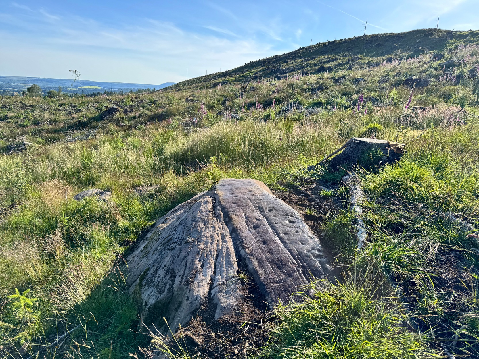
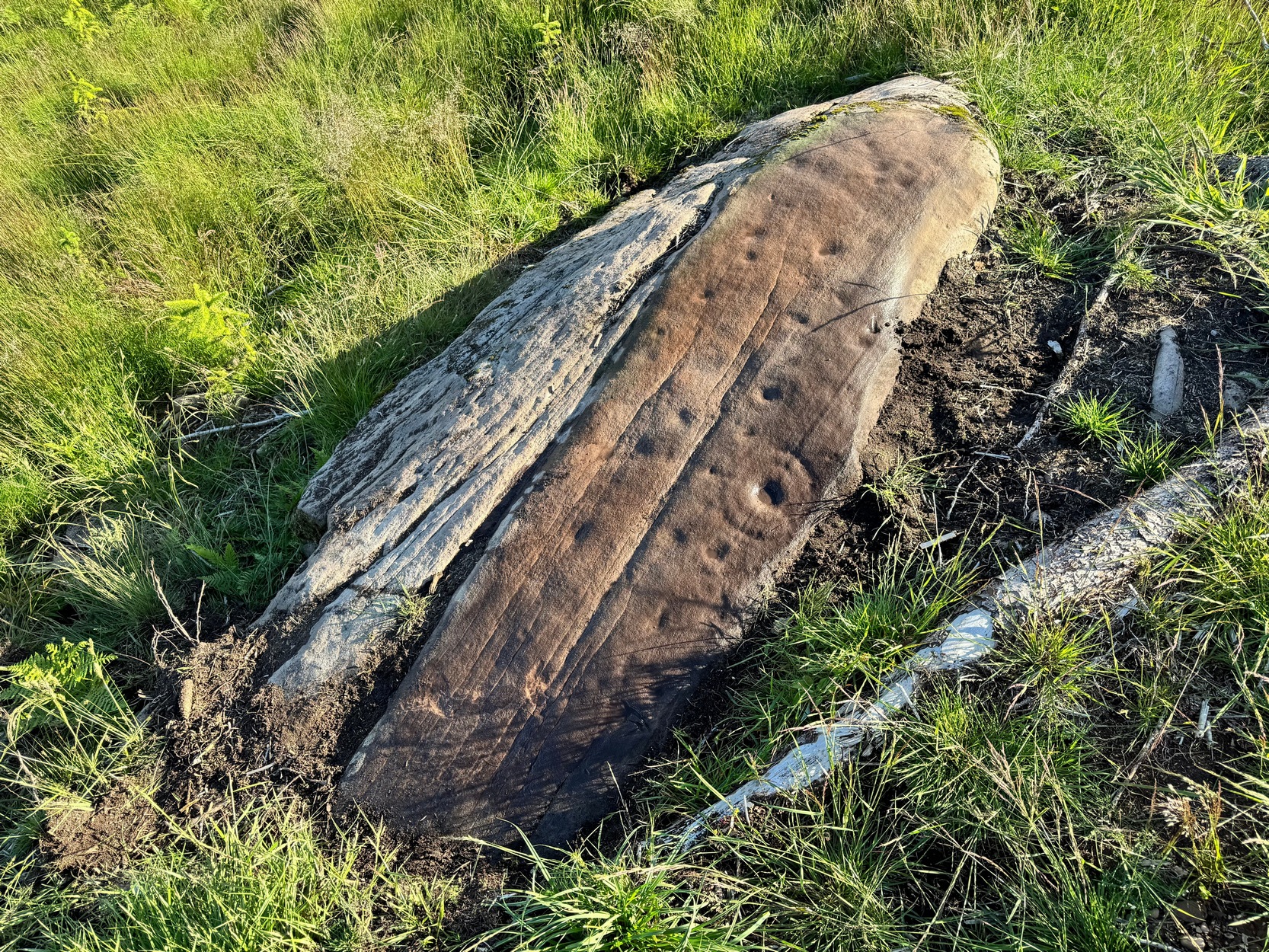
This is one of several previously unrecorded carvings I came across recently on the northwestern edge of the massive Ballochraggan rock art complex, on the slopes above the Lake of Menteith. I found it during one of the red-hot days we’ve just had —and, sadly, it had me running for home much quicker than usual! The heat beat me on this day (I’ve never been a lover of the sun), so hopefully you’ll forgive me if I missed a bit! 🙂 I was heading for the nearby Solar Stone carving near the bottom of the slope, when this partially-covered rock caught my eye—and I’m glad it did! For scattered along its long slender topmost surface, a number of the usual curious prehistoric symbols had been etched…
Western end of stonePetroglyph when wet!
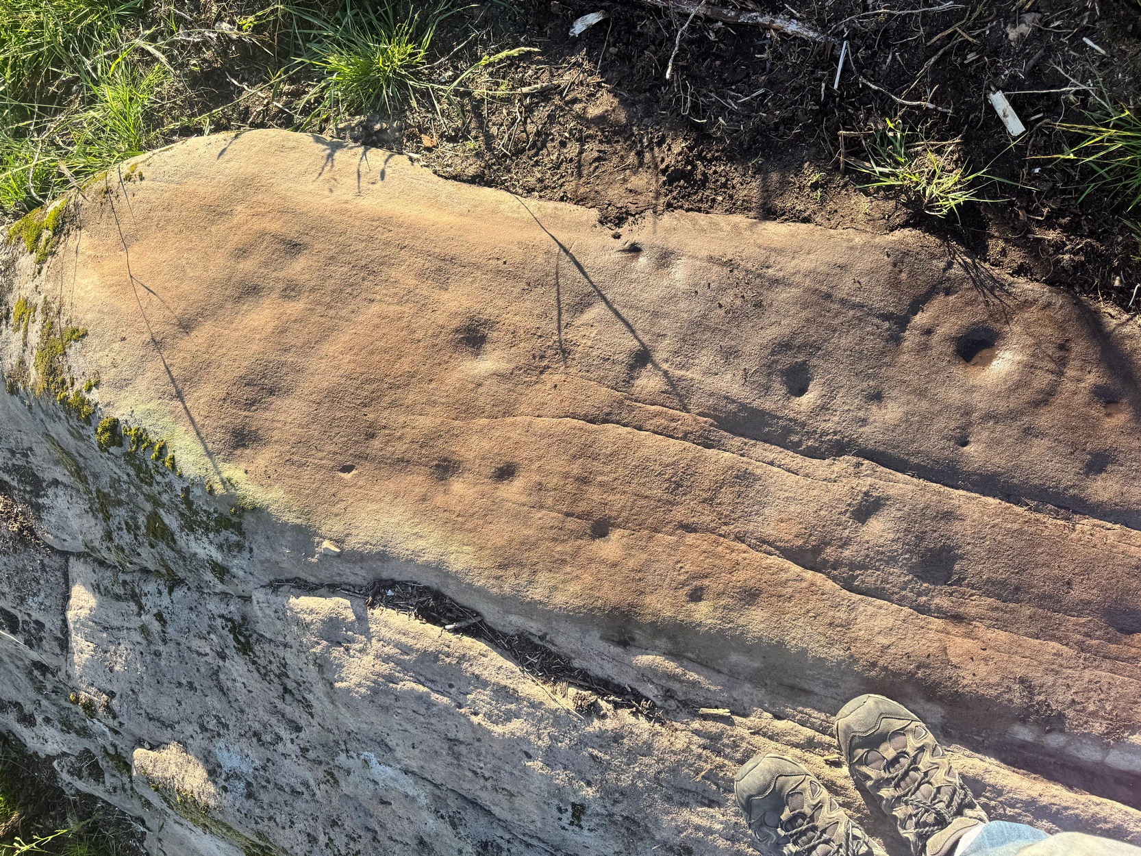
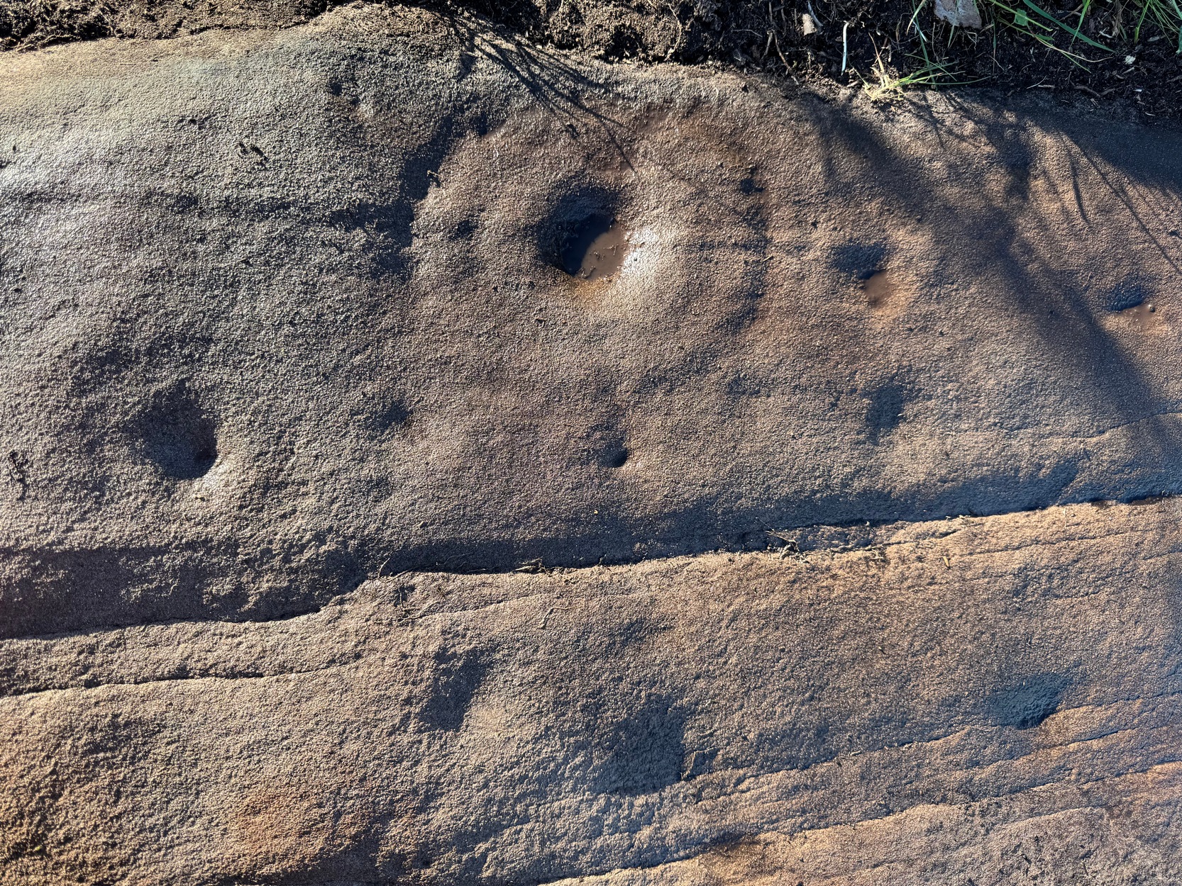
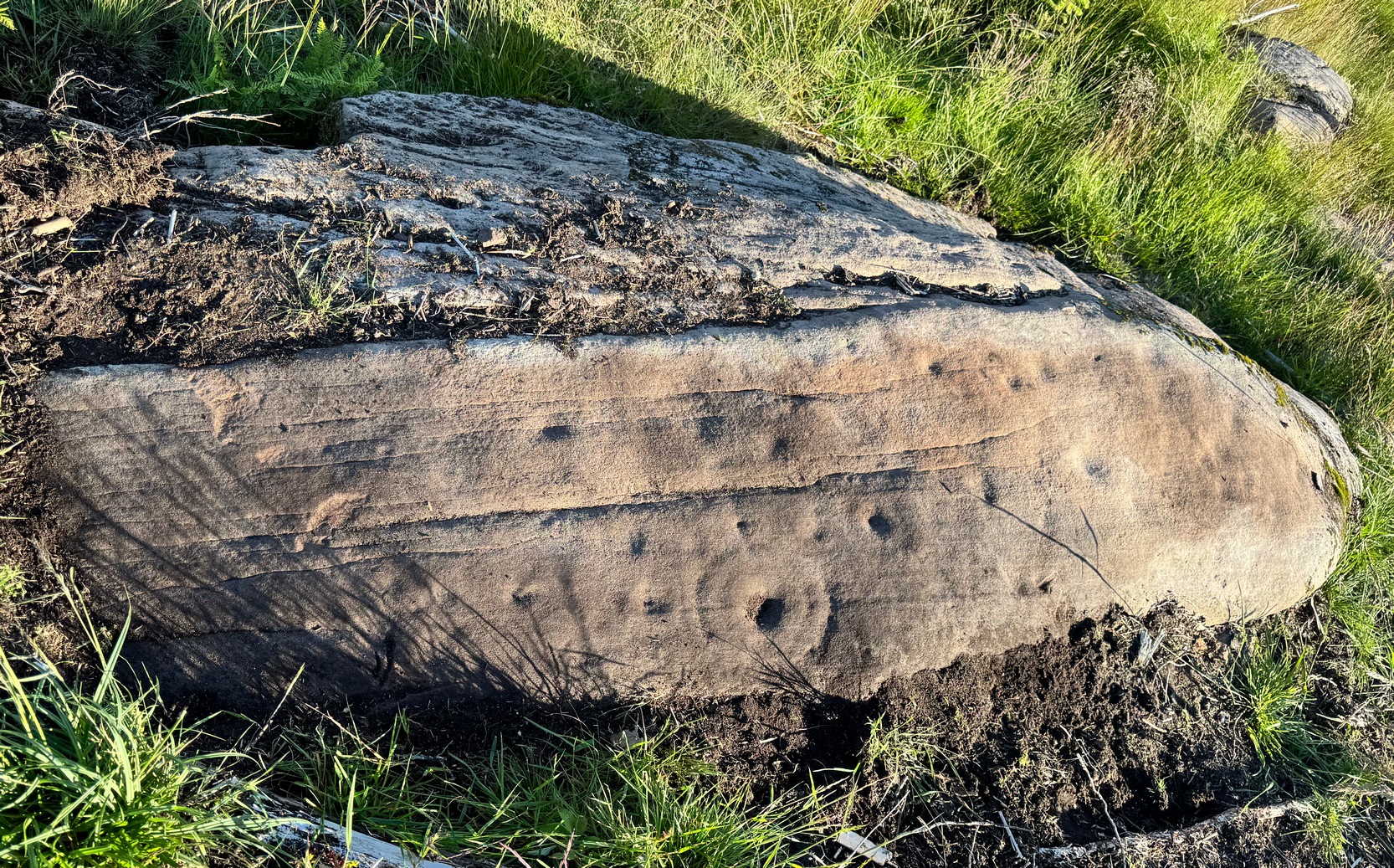
The first thing I noticed were a scatter of cup-marks at the western end of the stone: four of them in a close-knit cluster (this section reminded me of an old favourite on Shipley Glen), with several others seemingly running in a curved line down the slightly sloping stone with, possibly, one or two others also streaming away below this same cluster. But the main feature, as the photos and sketches illustrate, is the cup with a large double-ring near the middle of the stone, above a long natural crack that almost cuts the stone in half.
On either side of the double-ring are quite separate single cup-and-rings with (roughly) equal layers of erosion—although the central cups were probably re-carved, so to speak, many times over the centuries, as their erosion level is considerably less than that of the rings. This is a feature found at countless carvings across Britain and suggests regular “re-use” or rather re-animating the design on a regular basis. A faint half-ring can be seen round one of the smaller cups near the bottom of the carving. And a peculiar feature near the middle of the design is a simple ‘ring’ that was started but never finished (perhaps?), with no cup-mark in the centre. This is a feature found on quite a few Perthshire carvings, with some of the shallow ‘rings’ being nearly 12-inches across in some instances. Most odd!
Main double cup&ringLooking down at the design
Several of the single cup-marks on here appear to have started life as natural pock-marks in the stone, which would have made carving the design a little easier than just starting from scratch! And, about 10 yards below this carving, a small sloping rock has a distinct eroded ‘bowl’ on it, about six inches across and several inches deep and is perhaps relevant to this carving in a pragmatic sense (mulching colours, herbs, etc). These ‘bowls’—be they natural or enhanced—are much-overlooked features and their existence needs to be taken into consideration when they’re found within a mass of cup-and-ring stones, such as found here, on the outskirts of olde Aberfoyle. Check it out when you’re next up here…. and the cup-marked stone 20 yards further up the slope too. And lots of others!
Acknowledgements: Big thanks to Prof Hornby for getting us up here on a scorching day!
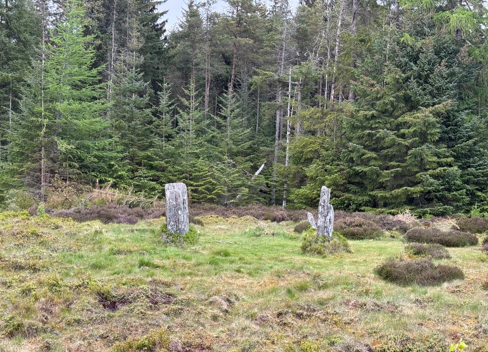
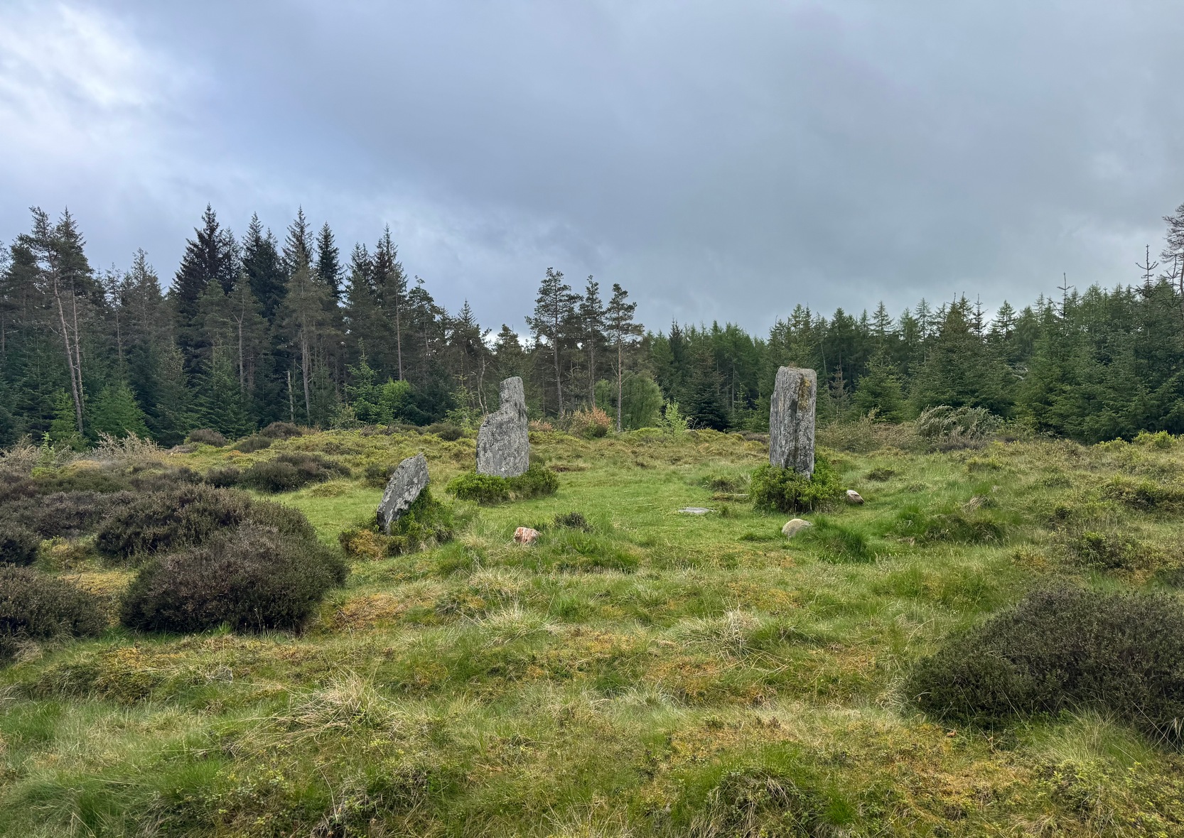
From Pitlochry town centre, walk down the A924 high street as if you’re going to the Blair Atholl Distillery, but just before it take the right-turn and go over the river, and just keeping walking along this road for a third-of-a-mile (0.5km) until your reach a small small on your left that swerves up the hill (there’s a little signpost here saying Cluny Path to Strathtay). Go up and across the main road, then just keeping walking up the dirt-track, which becomes a footpath, and heads further uphill into and through the woodland. Make a bittova daydream from the walk up here, making sure to keep to the path closest to the burn (stream) on your left. Eventually when it levels out, you’re very close. Just keep on the same track and, where it meets up with another, bear left and about 100 yards along, on a small rise in the trees on your right, you’ll see these old stones peeking out. Keep your wits about you!
Archaeology & History
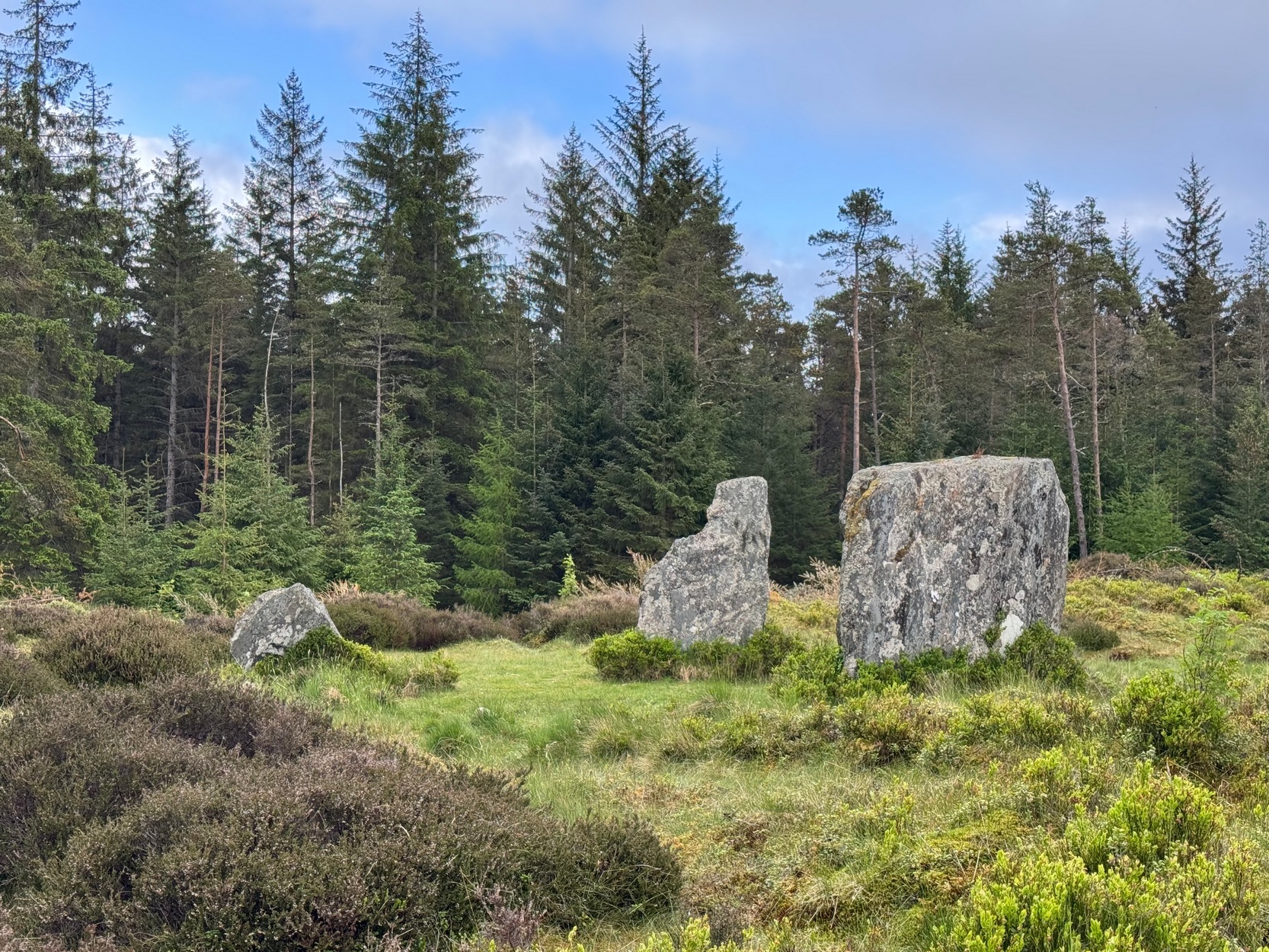
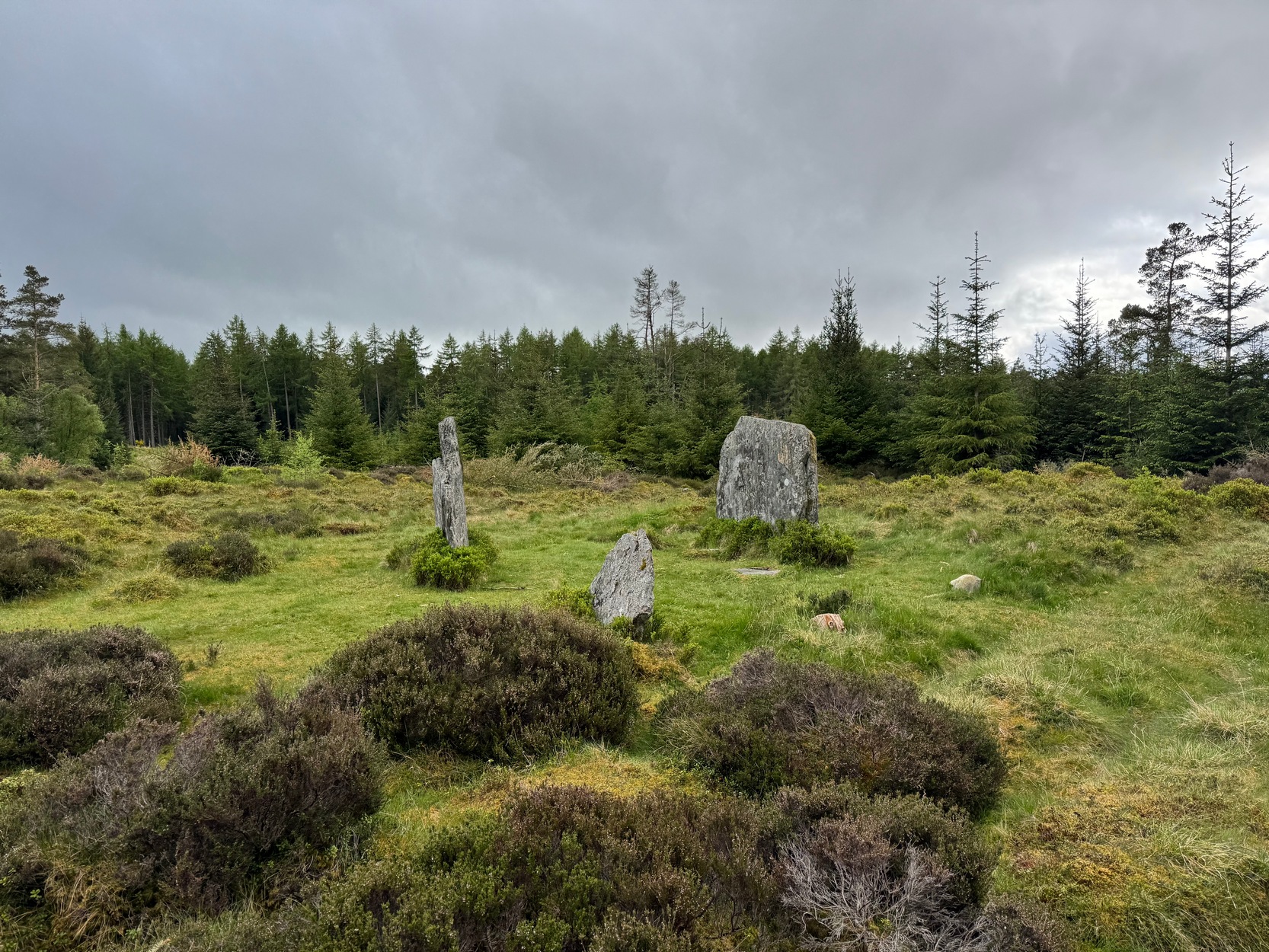
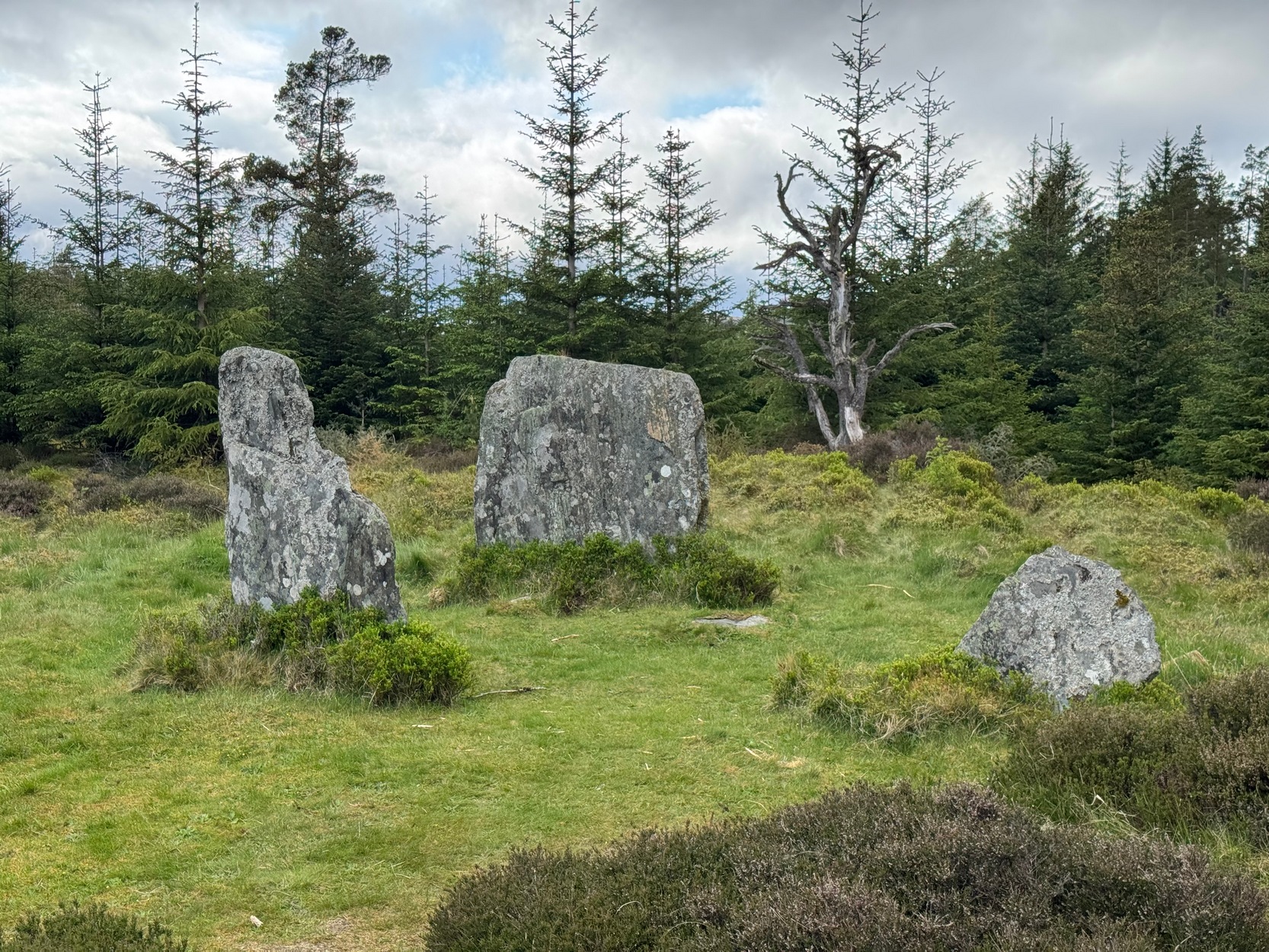
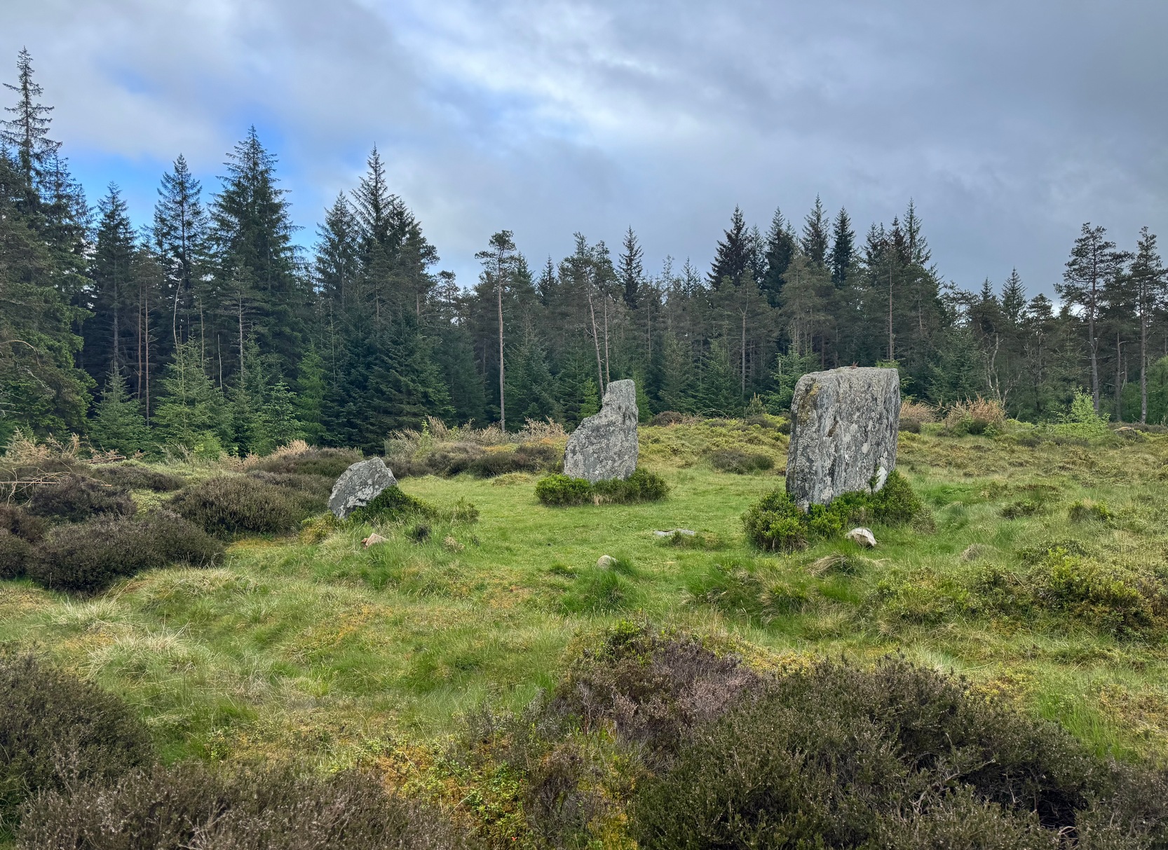
Clachan an Diridh looking E
Sat high up on open moorlands with views all round… is what this site used to look like. Sadly, the forestry commission have almost completely enclosed this prehistoric site, making any view of the surrounding landscape all but impossible. I’m not the first and won’t be the last person to be pissed-off by such thoughtlessness. Alexander Thom made mention of it too. After making an initial assessment of the astronomical alignments at these stones in 1967, “when we returned to measure the horizon we found that trees had been planted round the stones and so we failed.” (Thom 1990) Not good.
On my first visit here, as I entered this “stone circle” my first impression was that it wasn’t a circle at all, but the remnants of a megalithic stone row! Thom thought the same. It’s the slender thin stature of the stones that do it to you: they almost cut the air and point the enquiring nose dead straight along the same angle that all the stones have been deliberately aligned to. I assume they’ve had a similar effect on other people over the years.
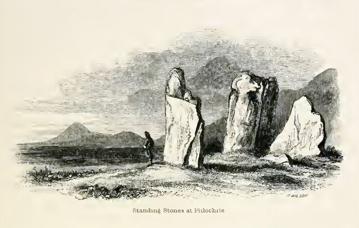
The Clachan an Diridh, or the Stones on the Ascent, were first mentioned in Dan Wilson’s (1851) major survey and who was so impressed by the view from here and its setting in the landscape that he compared its visage to Stonehenge. Were it not for the short-sightedness of the Forestry Commission destroying the view, most would no doubt agree with Wilson’s sentiments. From these olde stones, he told:
“One of the great level Highland moors stretches away beneath the eye, like a dark waveless lake, contrasting with the distant heights, among which Ben Lawers rears its pyramidal summit to an elevation of upwards of 4000 feet above the level of the sea. Amid this wild Highland landscape the huge standing stones, grey with the moss of ages, produce a singularly grand and imposing effect; and from the idea of lofty height which the distant mountains suggest, they convey a stronger impression of gigantic proportions than is produced even by the first sight of the giant monoliths of Salisbury Plain.”
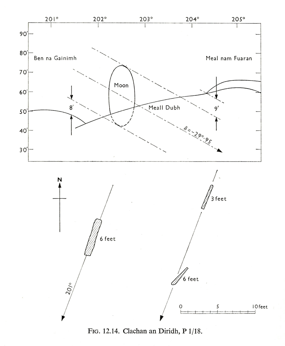
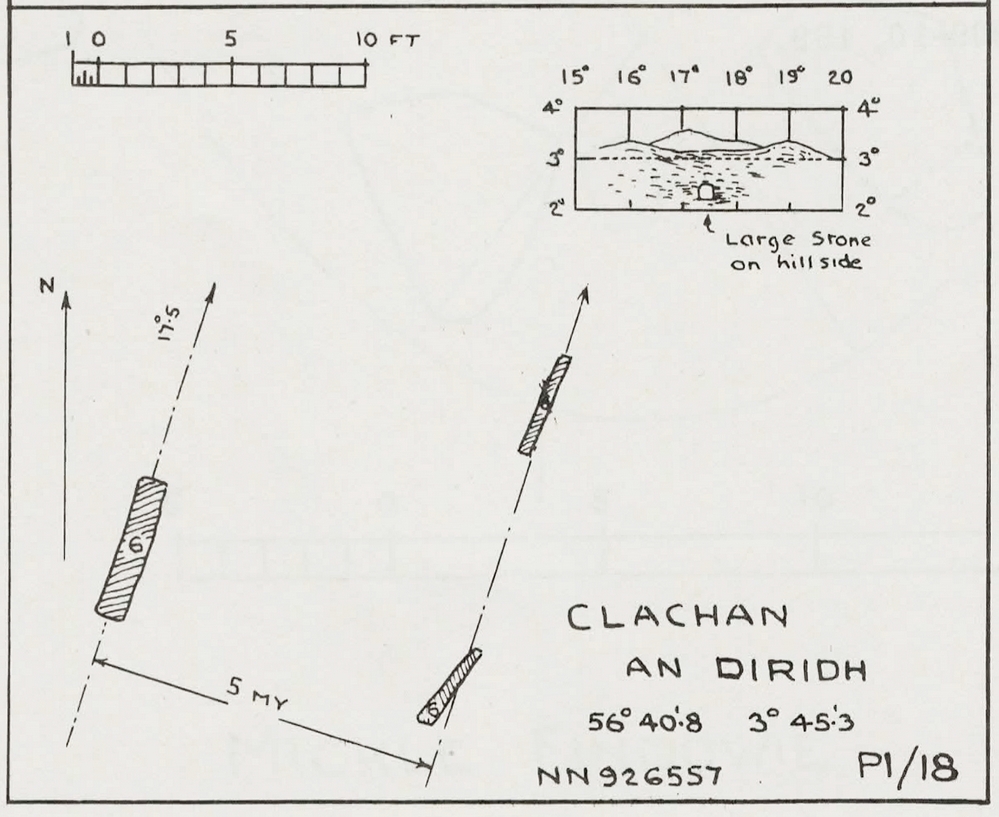
Thom’s initial moonset alignmentThom’s 1980 ground-plan with marker stone
The giant figure of Ben Lawers, if we could see it today, would rise to the southwest 20 miles (32km) from here; and the great pyramidal fairy mountain of Schiehallion would be equinox west, 13 miles (21km) away. Yet curiously when Alexander Thom surveyed the outlying hills, he didn’t think either of these mountains had any worth, astronomically speaking that is. Yet Lawers in particular would be the largest point on the southwestern horizon, rising in the distance, way beyond the wide rolling U-shaped glen of Strathtay to where the landscape changes into more rugged dynamic uplands. And the importance of Lawers as a place in prehistory is shown by the mass of petroglyphs across its slopes—particularly the side you could see from Clachan an Diridh.
Instead, Thom (1967) looked much further to the southwest—south-southwest in fact—where he initially thought that there was an alignment to the major southern moonset ten miles away above the rugged hill of Meall Dubh, framed on either side by the mountain peaks of Meall nam Fuaran and Beinn na Gainimh. Aubrey Burl (1988) told how Thom later discounted this alignment and instead turned his attention a full 180° where a large stone on the hillside to the north-northeast caught his theodolytic eye. This marked an alignment towards the peak of Ben Vrackie:
“There is little doubt,” he wrote, “that this is a lunar site showing perhaps…at the major standstill. Could one side of the southern 6ft high stone possibly have indicated the setting point of the Moon at minor standstill?” (Thom 1990)
Clachan an Diridh in 1851Clachan an Diridh, c.1920
Thom looked at these stones and the landscape with the mind of an astronomer, whereas I’m more in preference of the aborigine who sees the feel of the landscape to discern relationships and meanings. Sometimes, of course, the sky and the landscape come together and that universal mythic union of heaven and Earth finds importance at a site. I have little doubt that such a mythos was once known here, on the moorland plateau, under the clear stars with the darkness reaching to speak with Lawers and other bones of landscape in the solid darkness of mountain silhouettes and fading horizons. Many a sleep at this site would have touched minds with Wonder…
Anyway, all that aside…
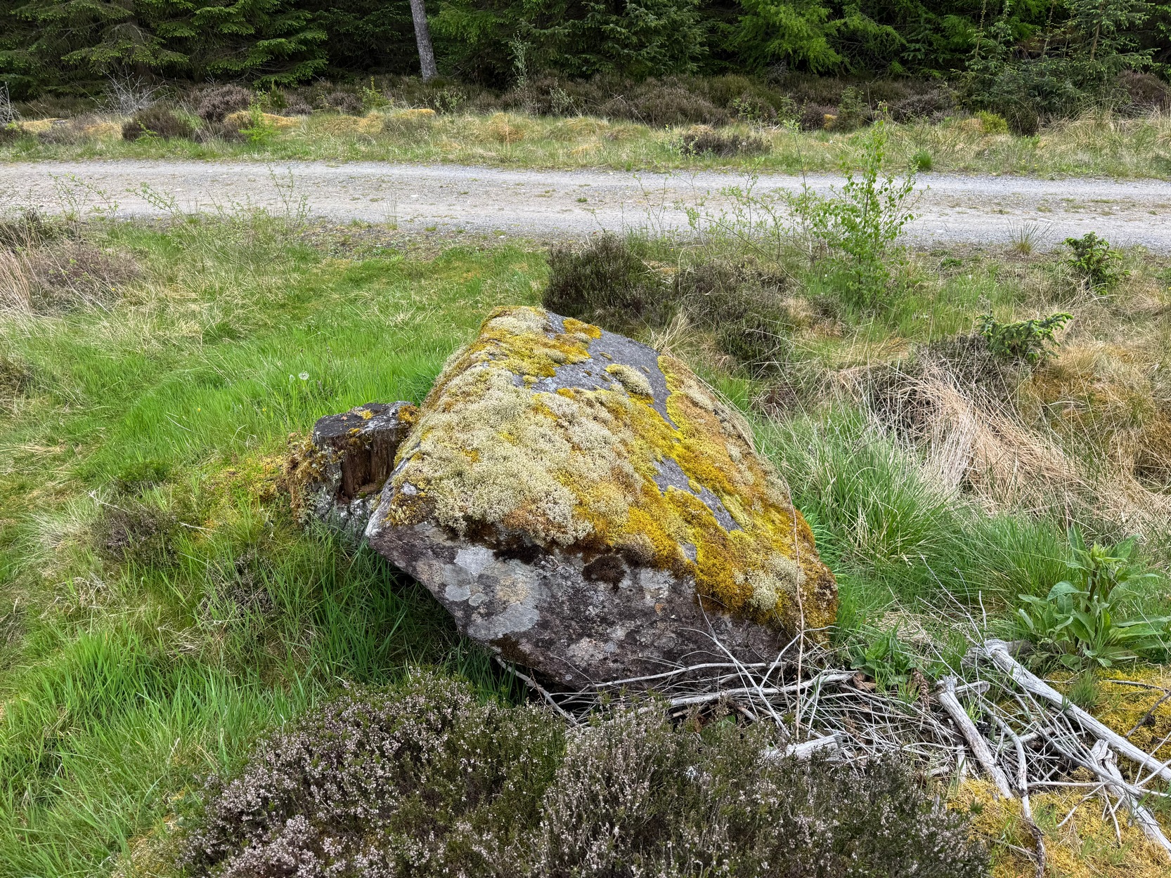
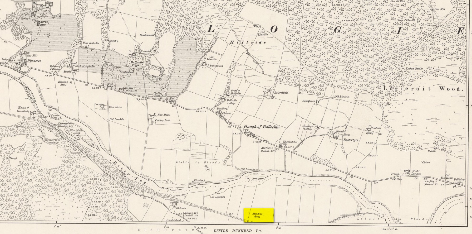
Large fallen stoneSite on the 1899 OS-map
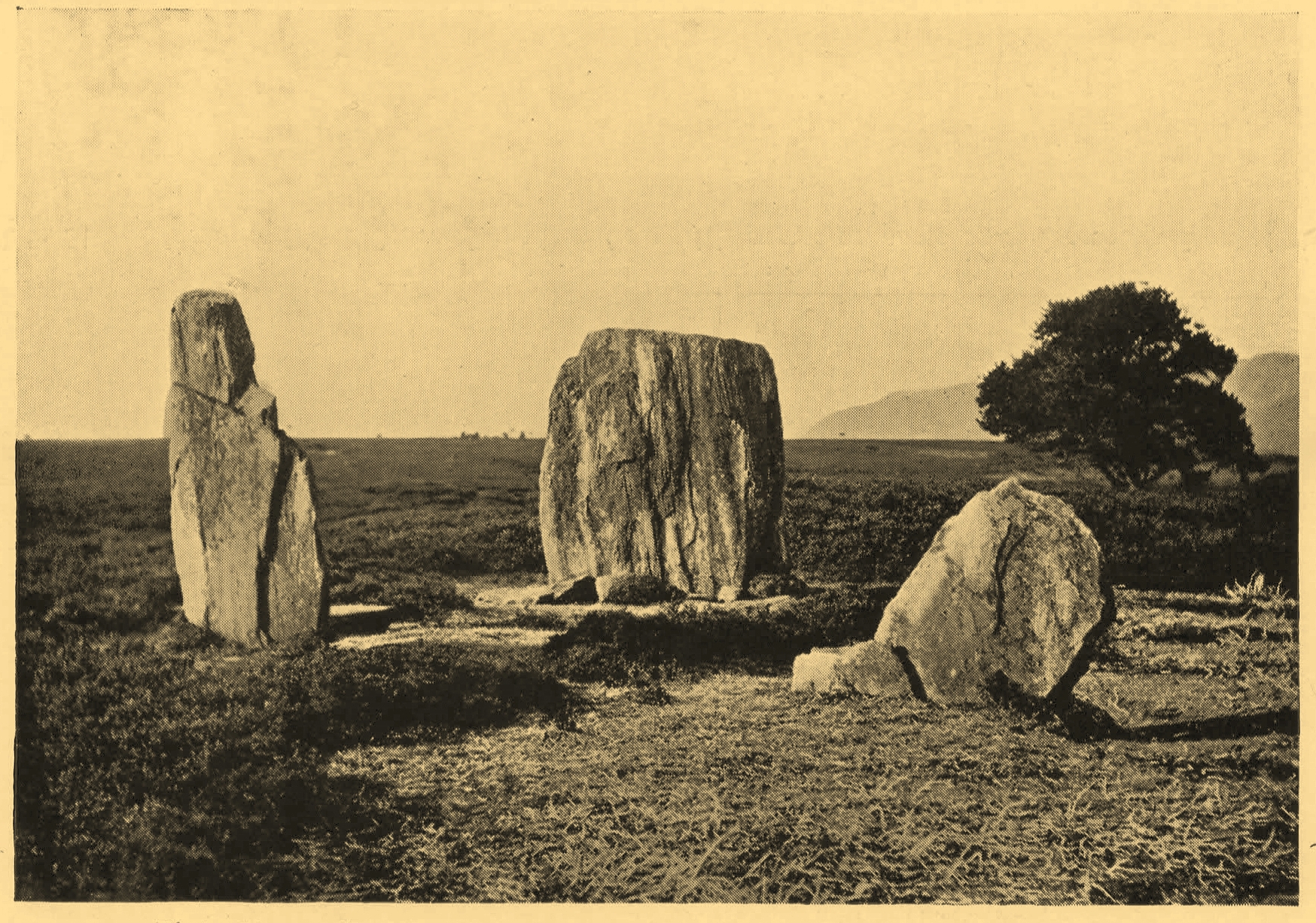
These megaliths have been classified as one of Aubrey Burl’s “four posters”, i.e., a rough square of four megalithic uprights, in spite of there only being three standing stones here. Even when Dan Wilson (1851) wrote about the place there were just three of them. However, down the slope from the stones, just off the recent trackside, there’s a decent contender for the fourth stone lying on its side in the undergrowth, half-covered in moss. It’s certainly fallen or rolled down the slope and its size and shape suggest that it may once have stood upright. Have a thoughtful fondle of it while you’re here.
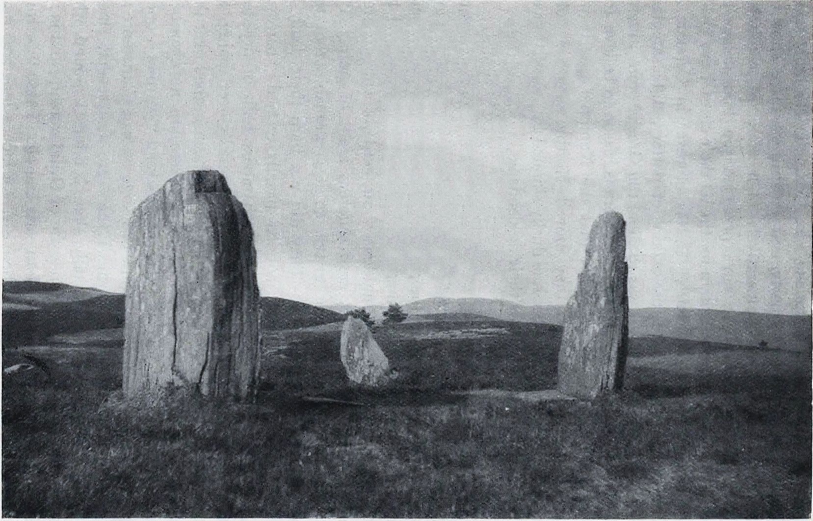
The ‘circle’ was highlighted on the 1899 OS-map and, a few years later, was visited and surveyed by the great Fred Coles (1908) and like Dan Wilson before him, told the view from here to be “very grand.” He continued:
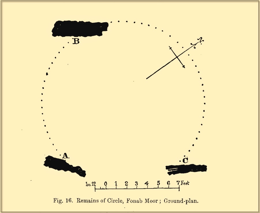
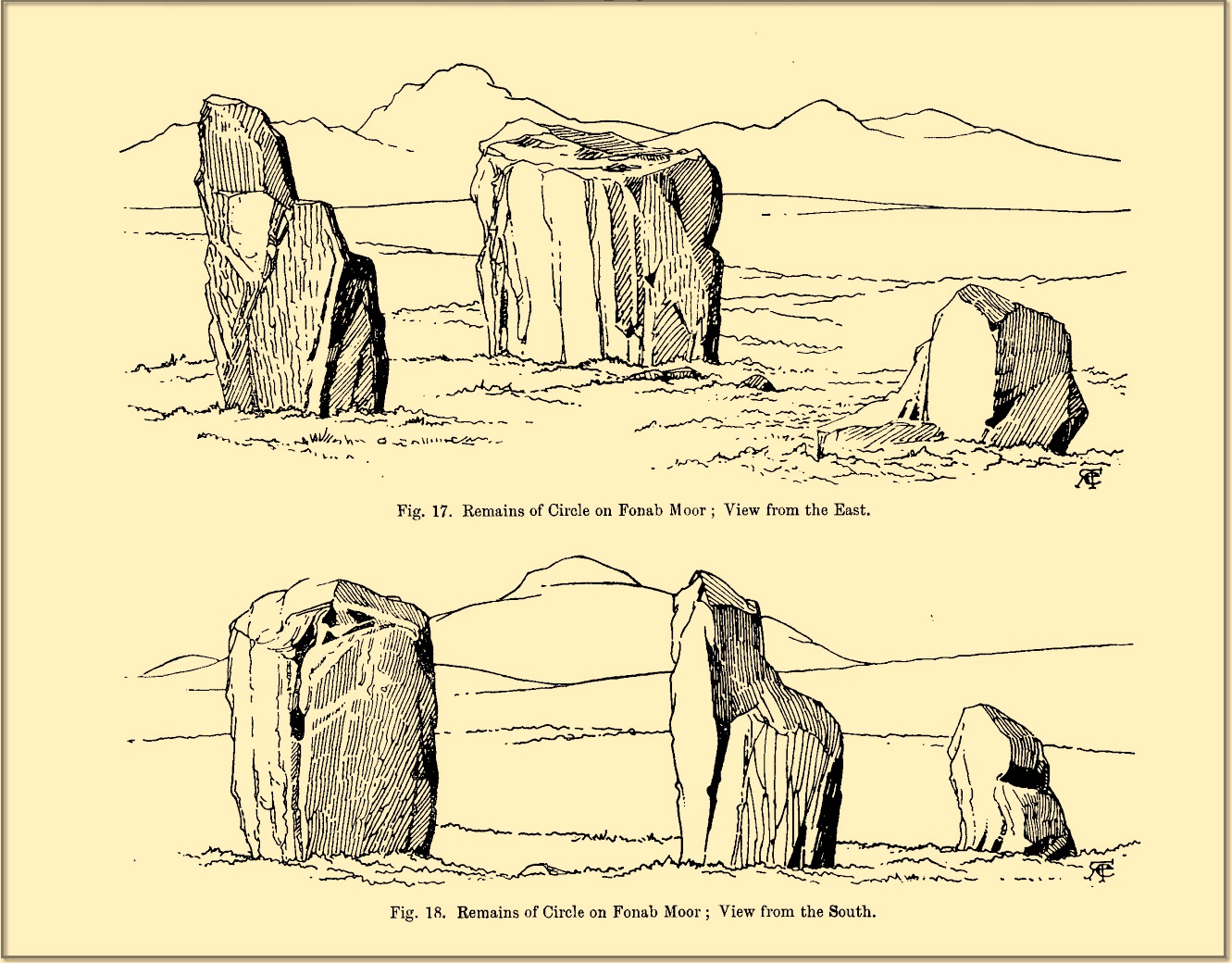
Coles 1906 planColes’ views, from S & E
“In local parlance this group is known as the Four Stones. This must be a fairly old name handed down through some generations; because, for at least fifty-seven years past, only three Standing Stones have remained in situ. These three Stones are arranged as shown in the plan…in a group forming in its now imperfect condition a triangle which, measured from the centres of the Stones, has its SE side 11 feet 6 inches long; its SW side 12 feet 3 inches ; and its north side 16 feet 3 inches. Fragments of the demolished fourth Stone lie about the ground; but there is no clear indication of its original position. The South Stone, A, is 3 feet 7 inches in breadth, 5 feet 10 inches in height, and from 12 to 4 inches in thickness. The West Stone, B, 6 feet in height, measures 5 feet at the back, and 4 feet 10 inches at the front, and is 18 inches in thickness. The East Stone, C, at its outer angle is 3 feet 3 inches above ground, and leans inward. All the blocks are of quartziferous gritty sandstone, the East Stone being particularly rough and fissured. A large fragment lying near it seems to be a portion of it. The Stones are set upon a fairly true Circle with a diameter of 15 feet 4 inches. One feature quickly arrests notice: this is, that the broader faces of these Stones are not set even approximately upon and in line with the circumference, but nearly parallel with each other—an arrangement quite unlike the setting of Stones in the many other Circles hitherto surveyed.”
When Burl (1988) added this site to his Four Posters survey he merely echoed Coles’ early description, adding that, in his view, the standing stones that we see today were probably, originally, “set out on the circumference of a circle 20ft (6.1m) in diameter.”
I think it’s likely that there would have been more prehistoric sites in the vicinity, but a notable oddity is the almost complete absence of other recorded sites anywhere nearby. Of course, if there was anything, those thoughtful Forestry Commission heads would have destroyed it. We are left, simply, with the old but reliable notes of Messrs Dixon (1923) and Mitchell (1925) who told that, in their days, other remains did exist nearby in the form of ancient cairns and hut circles—‘Pictish’ according to tradition. If we’re lucky, some damaged parts of them might still be found at the edges, a short distance to the north west…
Folklore
In Hugh MacMillan’s (1901) gorgeous literary sojourn along Strathtay, he strayed somewhat from his otherwise historical notices by telling that here,
“on the highest part of the moorland…is a group of ‘clachan iobairt’, or stones of worship, where the Druids of old performed their mysterious rites, going round the circle of standing stones from east to west with the sun, or the ‘car deasal’, the lucky side, when they wished to invoke a blessing upon their friends, and going round the circle in the opposite direction, from west to east, the ‘car tuathsel’, or unlucky side, when they wished to pronounce a curse upon their foes.”
Whether this was what Hugh Mitchell (1923) meant when he referred to the traditions surrounding Clachan an Dirirdh we don’t know, but he echoed MacMillan’s account (though made no reference of his words), also adding that it was a site that “was visited on the first of May” or Beltane by some local people….
References:
Burl, Aubrey, Four Posters: Bronze Age Stone Circles of Western Europe, BAR 195: Oxford 1988.
Burl, Aubrey, A Guide to the Stone Circles of Britain, Ireland and Brittany, New Haven & London 1995.
Burl, Aubrey, The Stone Circles of Britain, Ireland and Brittany, Yale University Press 2000.
Dixon, John H., Pitlochry, Past and Present, L. Mackay: Pitlochry 1925.
Kennedy, James, Folklore and Reminiscences of Strathtay and Grandtully, Munro Press: Perth 1927.
Liddell, Colin, Pitlochry – Heritage of a Highland District, PKDL: Perth 1993.
MacMillan, Hugh, The Highland Tay: From its Source to Dunkeld, H. Virtue: London 1901.
Mitchell, Hugh, Pitlochry District: Its Topography, Archaeology and History, L. Mackay: Pitlochry 1923.
Omand, Donald (ed.), The Perthshire Book, Birlinn: Edinburgh 1999.
Stevenson, J., “Prehistory,” in Omand’s The Perthshire Book, Edinburgh 1999.
Thom, Alexander, Megalithic Sites in Britain, Oxford University Press 1967.
Thom, Alexander, Megalithic Lunar Observatories, Oxford University Press 1971.
Thom, A., Thom, A.S. & Burl, H.A.W., Megalithic Rings, BAR: Oxford 1980.
Thom, A., Thom, A.S. & Burl, Aubrey, Stone Rows and Standing Stones – volume 2, BAR: Oxford 1990.
Wilson, Daniel, The Archaeology and Prehistoric Annals of Scotland, Sutherland & Knox: Edinburgh 1851.
Acknowledgements: Huge thanks for use of the Ordnance Survey map in this site profile, reproduced with the kind permission of the National Library of Scotland.