An Tiobairt, Kenmore, Perthshire

Healing Well (site of):  OS Grid Reference – NN 7667 4446

Also Known as:

  1. Town Well

Archaeology & History

On the narrow long and winding south-road along Loch Tay, from Kenmore towards Acharn, just a couple of fields past Portbane could once be seen, above the left-side of the road in the trees, a reputable healing well known by local people from Aberfeldy to Killin.  The regional historian William Gillies (1925; 1938) described its dying memory more than a hundred years ago.  Today, as the region is all but infested by little other than holiday-homers, there is little hope of finding actual locals who’ll know of the place.  Mr Gillies told the Well to be,

“about 1 mile west from Kenmore, and close to the public road leading to Acharn.  At one time it may have been a dip well, but, now the spring issues as a  strong spout from the bank. I  have not been able to ascertain for what ailment its waters were considered a remedy, but consumptive persons have been known to develop a great craving for this water and had it brought to them.  It is still called An Tiobairt, and no doubt gave its name to the old village which at one time was situated some distance above it on the farm, and which was known as Bal-na-tiobairt. The old dry stone walls may still be seen.”

The ancient village has long since gone.

After rainy days a good boggy arena may be had in the trees here—which is all that now remains of the curative waters… much like the even more important rag-well that once ran on the slopes above the nearby Acharn Falls.

References:

  1. Gillies, William A., “Notes on Old Wells and a Stone Circle at Kenmore“, in Proceedings Society of Antiquaries, Scotland, volume 59, 1925.
  2. Gillies, William A., In Famed Breadalbane, Munro Press: Perth 1938.
  3. Morris, Ruth & Frank, Scottish Healing Wells, Alethea: Sandy 1982.

© Paul Bennett, The Northern Antiquarian
Fuaran Barain, Acharn, Kenmore, Perthshire

Sacred Well:  OS Grid-Reference – NN 7580 4302

Also Known as:

  1. Acharn Well
  2. Barane’s Spring

Archaeology & History

I was up here again not long ago and forgot to check on the welfare of the waters here (bad of me, I know…), instead just walking past to have a gander at the impressive stone circle on the tops.  The site has been neglected, perhaps due to William Gilllies’ (1925) initial description of the place in the past tense.  In a short survey he did of some of the healing wells of the region, this one, “above the Falls and close to the old bridge known as Drochaid Bhragaid (the bridge of the brae)” was where,

“until a generation ago, people were in the  habit of going there to wish, when they threw in small offerings.  It has now fallen into neglect and is absorbed in the marsh.”

The spring and its muddy section can be seen on the west side of the waters, just above the old bridge, as affirmed in Gillies’ (1938) later magnum opus, where he found it to be named the Fuaran Barain, or Barane’s Well—although he failed to disclose the origin of the name and the stories behind it.  It was used as a rag well, as branches in the trees above the spring were bedecked with pieces of cloth, along with offerings being made, in the hope that the spirit of the waters would impart good welfare on celebrants with humility.  Sympathetic magick at ancient sites in this neck o’ the woods was widespread until very recently by many a local (the real stuff—not this neopagan or neo-druidic stuff).  It was simply a part of life whose traditions went way way back into ancestral memory—as things should be…

References:

  1. Gillies, William A., “Notes on Old Wells and a Stone Circle at Kenmore“, inProceedings Society of Antiquaries, Scotland, volume 59, 1925.
  2. Gillies, William A., In Famed Breadalbane, Munro Press: Perth 1938.

© Paul Bennett, The Northern Antiquarian
Sulphur Well, Earlston, Berwickshire

Healing Well (destroyed):  OS Grid Reference – NT 6122 3746?

Also Known as:

  1. Verter Well

Archaeology & History

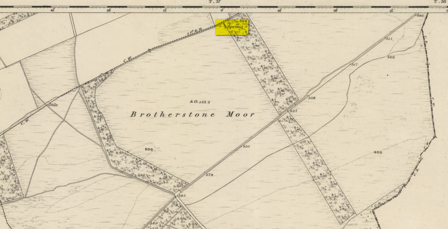
The old Sulphur Well…?

This once important medicinal spring was, sadly, lost to the world after countless centuries sometime in the early-to-mid-1800s. It was one of at least four Verter Wells, as local dialect described them, i.e., Virtue or curative wells, all in or around the parish of Earlston (or Earlstoun of olde).  It’s exact location would seem to have been forgotten, but based on the one and only description of the place—“in order that the knowledge…may not be lost”, said the writer, of it being “about a mile to the south of the Whitecleuch Well”, we come across, on the first Ordnance Survey map of the area of 1862, a ‘Spring’ of water some ¾-mile south of the Whitecleuch which may have been the place in question.  Another contender could be a ‘Well’ on the same map, but it’s nearly 1½ miles from the Whitecleuch, so I think the first one is more likely.

It was a Well of some considerable renown back in the day, as local writer James Wood (1891) told us:

“The water of this well, which came bubbling up in the heathery moor, was strongly impregnated with sulphur, and the late James Weatherstone, farmer of Shielfield, always attributed his cure of a serious internal complaint to his drinking, copiously every morning, of the water which he said ‘‘just tasted like gunpowder.”  About fifty years ago, however, this moor was ‘taken in’, and the medicinal spring fell a victim to the drainer.”

References:

  1. Wood, James, “Verter Wells,” in History of the Berwickshire Naturalists Club, volume 14, 1891.

Acknowledgements:  Huge thanks for use of the Ordnance Survey map in this site profile, reproduced with the kind permission of the National Library of Scotland.

© Paul Bennett, The Northern Antiquarian 
Silver Well, Ilkley Moor, West Yorkshire

Sacred Well (covered):  OS Grid Reference – SE 10425 46701

Archaeology & History

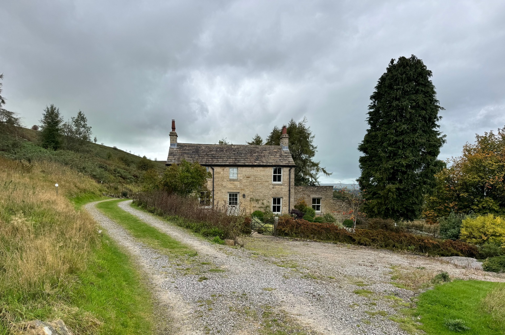
Silver Well cottage

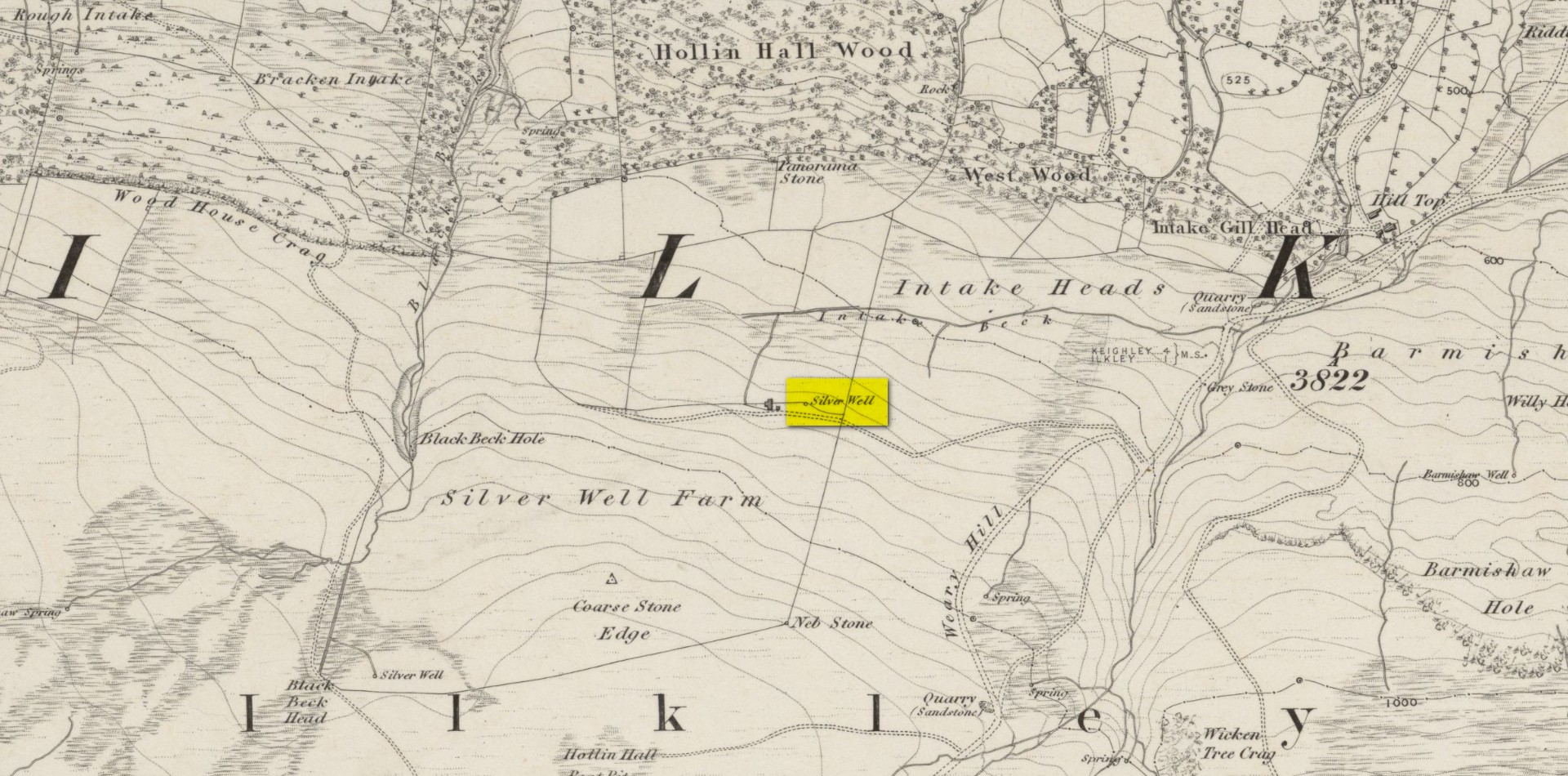
Highlighted on the earliest of the Ordnance Survey maps, this spring of water supplied the old cottage here for many a year.  Nowadays it has been covered—and has been like that for upwards of fifty years—although it was said to be in constant flow by those who lived here in earlier times.  When the Yorkshire holy wells writer Edna Whelan (1989) came here in the 1980s, the running water could still be heard beneath a pile of large stones that covered its source.  Today, stone slabs cover it over—but the water is still running below.  It had a reputation of never running dry, even in droughts.  I spoke with a local doctor in the late-1980s who told us that he was confident the Silver Well would always keep running and its water were fine to drink.  It’s a pity the source of the spring is covered over and, surely, is a case for being exposed and open for folk to use once again…

Silver Well on 1851 map

In Collyer & Turner’s (1885) magnum opus on Ilkley, they thought the Silver Well “was probably a holy well” —and it probably was something along those lines, depending on how precisely we define the word ‘holy’.  The notion that it may have been a place where, in earlier times, silver coins and other offerings were given to the spirit of the well in exhange for good health and fortune (as is found at springs and wells all over the world) was given a boost when, in the 1960s, a short distance east of Silver Well, was found a clutter of very old silver coins dating from the periods of Kings Edward I and II (13th and 14th Century).  The coins were donated to the British Museum where, I presume, they still live.  But they may have either come from this well, or were being deposited here.  We’ll probably never know for sure.  A number of other Silver Wells in Britain possess so-called holy associations.

References:

  1. Collyer, Robert & Turner, J.H., Ilkley: Ancient and Modern, William Walker: Otley 1885.
  2. Whelan, Edna & Taylor, Ian, Yorkshire Holy Wells and Sacred Springs, Northern Lights: Dunnington 1989.

Acknowledgements:  Huge thanks for use of the Ordnance Survey map in this site profile, reproduced with the kind permission of the National Library of Scotland.

© Paul Bennett, The Northern Antiquarian 

Chapel Lane Well, Crawshawbooth, Rossendale, Lancashire

Healing Well (destroyed):  OS Grid Reference – SD 8136 2585

Archaeology & History

The name of this seemingly lost site—Chapel Lane Well—suggests it may have possessed that traditional ‘holy’ association, but neither custom nor history has bedecked us with information to give certainty to such an idea.  Even the name of the road along which it was found was one ascribed only by local folk in the 19th Century, for the old maps show us it to have been Goodshaw Lane—but the locals in this neck o’ the woods preserved many an old way that fell foul of the boring Industrialist writers of that age.  Except for one, thankfully!

J.M. Mather was a true ambling rambler like my self, wandering off-path, in all weathers, and dreaming by the chimes of swirling waters in stream and spring alike, moving betwixt the roars of biting gales in wintry heights and quietudes of moorland nights gazing at falling stars.  And thankfully his pen left us with a smattering of old tales from the tongues of local folk not considered worthy by the Industrialists and christian historians of his time.  Mather, instead, wrote of the actual history of Rossendale: of the ways of the people and moods of the hills…

The Chapel Lane Well was on the left-side of the road as you head up to Goodshaw Chapel, just where the track leads off up to Folly Bank Farm: “a quaint looking house”, even in his day!  It was, he said, where “the legend of the Chapel Snake still survives.”

“Many years ago, when people came from the village beyond to draw from its waters, in the dusk of one evening an hysterical girl declared she saw a white snake in the liquid depths. The alarm soon spread, and for days none dared to approach, until the want of water and the toil entailed by having to wander further for it, led to a solemn conclave of villagers.  Amongst those composing it was a doughty sexton, who, seeing the fears of his friends, declared that he would shoot the snake. Armed with his gun, he cautiously approached. Seeing what he supposed to be the snake, lying in serpentine form, white upon the waters, he fired ; but when a careful inspection was made, the object of delusion was found to be a knitted garter. This, in the depths of the well, and seen by an hysterical girl, had led to the panic, the heroism of a sexton, and the final amusement of the neighbourhood.  The well is still there, and in use.”

But some time after Mather wrote those words, the waters were blocked and it has long since fallen into history.  As if to compensate and still flowing, are waters not far from here that were known as the abode of the great and dreadful fairy creature known as Jenny Greenteeth!

References:

  1. Mather, J. Marshall, Rambles Round Rossendale – volume 2, J.J. Riley: Rawtenstall 1894.

© Paul Bennett, The Northern Antiquarian 

St. Nicholas’ Well, Carlisle, Cumbria

Holy Well (destroyed):  OS Grid Reference – NY 405 551

Archaeology & History

On the far south-side of Botchergate running out of central Carlisle, could once be seen the Hospital of St. Nicholas that was mainly used for the treatment of lepers, and in a field very close by could once be found a healing well apparently dedicated to the saint, but which was destroyed following the construction of the railway through the town.  It was described by a Mrs Cartmell to the historian Henry Barnes (1906) who told him that it “had a great reputation, its water being considered a valuable remedy for sore legs, or sores on any part of the body”—hence being of value in the treatment of leprosy.

The site was described briefly in McIntire’s (1944) holy wells survey, where he added that in the 19th Century, “it was still visited in May by people who filled their ‘shaking bottles’ with the water.”  Beltane rites are common at holy wells.  The feast day of St. Nicholas is December 6.

References:

  1. Armstrong, A.M., Mawer, A., Stenton, F.M. & Dickins, B., The Place-Names of Cumberland – volume 1, Cambridge Univerity Press 1950.
  2. Barnes, Henry, “On a Stone Coffin and Chalice found at St. Nicholas’, Carlisle,” in Transactions Cumberland & Westmorland Antiquarian & Archaeological Society, volume 6 (Series 2), 1906.
  3. McIntire, Walter T., “The Holy Wells of Cumberland,” in Transactions Cumberland & Westmorland Antiquarian & Archaeological Society, volume 44 (New Series), 1944.

© Paul Bennett, The Northern Antiquarian 

St. Helen’s Well, Botcherby, Carlisle, Cumbria

Holy Well (lost):  OS Grid Reference – NY 42 55

Also Known as:

  1. St. Elena’s Well

Archaeology & History

There’s a possibility that some trace of this seemingly lost sacred well might still be found.  It was first described in 1233 CE as the fountain of St. Ellen and the land hereby was given to monks who lived here.  The stream which emerged from St. Helen’s fountain (fontis Sanctæ Elenæ), or well, was known as “the stream of the Holy Fountain of St. Elena”, and this was also mentioned in the same 13th Century charters, but sadly no traditions regarding the site were mentioned.  The waters however, were likely venerated around St. Helen’s feast day, of August 18.

The Well was found to the east-side of old Botcherby village (now swallowed into the expanding Carlisle suburbia), heading towards Scotby, with the description in the Charter indicating its source was much closer to Botcherby, perhaps just over the old township boundary.

When Walt McIntire (1944) did his survey of the region’s holy wells, he was as unsure about its location as I am, merely telling:

“”St. Helena’s Spring,” mentioned in a charter of Walter of Botcherby to the monks of Wetheral c. 1235 as situate between Botcherby and Scotby.”

So where was it? —or is it?  Are there any Carlisle historians out there who’ve found its hallowed spot…? (Note: the grid-ref I’ve given to this site is obviously an approximation)

References:

  1. Armstrong, A.M., Mawer, A., Stenton, F.M. & Dickins, B., The Place-Names of Cumberland – volume 1, Cambridge Univerity Press 1950.
  2. McIntire, Walter T., “The Holy Wells of Cumberland,” in Transactions Cumberland & Westmorland Antiquarian & Archaeological Society, volume 44 (New Series), 1944.
  3. Prescott, J.E. (ed.), Registry of the Priory of Wetherhal, Elliot Stock: London 1897.

Acknowledgements:  Huge thanks for use of the Ordnance Survey map in this site profile, reproduced with the kind permission of the National Library of Scotland.

© Paul Bennett, The Northern Antiquarian 

St. Cuthbert’s Well, Carlisle, Cumbria

Holy Well (destroyed):  OS Grid Reference – NY 400 559

Archaeology & History

In Walt McIntire’s (1944) survey of Cumbrian holy wells, he mentioned this one, long since covered over, near the middle of the old city, saying:

“‘St. Cuthbert’s Well,’” recorded by Bede in his account of St. Cuthbert’s visit to Carlisle in 685.  The site of this well is supposed to have been in the market-place, near the premises now occupied by Messrs. Thurnam & Son. It was formerly protected by a curious erection known as Carnaby’s folly, which subsequently was used as a fish market, until it was removed by the Corporation.”

The old well was mentioned in Jefferson’s (1838) early survey of the city, although he didn’t associate St. Cuthbert with the waters, merely telling,

“At the north end of the shambles was a draw-well, over which was a building supported by pillars, called Carnaby’s Folly.  Adjoining to this, was the fish market.  The shambles and the Folly were taken down in the latter end of the last century the latter having been purchased, at a great price, by the corporation.”

There is however, the St. Cuthbert’s Lane leading to the church dedicated to the same chap, previously known as St. Cuthbert’s Vennel and so-named as far back as 1378 CE.  The proximity of the old Market Cross to St. Cuthbert’s Lane suggests the usual association between sacred wells, old stone crosses and the gathering of traders and village folk alike.

Folklore

St Cuthbert’s feast was March 20 – a festival tacked on to the Spring Equinox.  He was a hermit and a saint of the early Northumbrian church in the Celtic tradition.

References:

  1. Armstrong, A.M., Mawer, A., Stenton, F.M. & Dickins, B., The Place-Names of Cumberland – volume 1, Cambridge Univerity Press 1950.
  2. Jefferson, Samuel, The History and Antiquities of Carlisle, S. Jefferson: Carlisle 1838.
  3. McIntire, Walter T., “The Holy Wells of Cumberland,” in Transactions Cumberland & Westmorland Antiquarian & Archaeological Society, volume 44 (New Series), 1944.

© Paul Bennett, The Northern Antiquarian