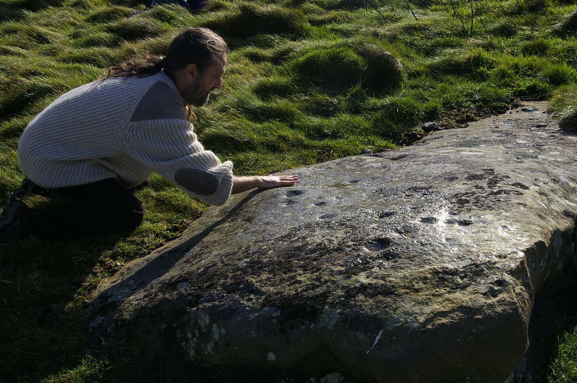
Dobrudden Necropolis, Baildon Moor, West Yorkshire

Cairns:  OS Grid Reference – SE 138 402

Getting Here

Easy one this!  Go up thru Baildon, on towards Baildon Moor over the cattle-grid.  Take your first left and go up for several hundred yards past the reservoir until you reach the track on the left which takes you onto the Low Plain, Baildon Moor.

Archaeology & History

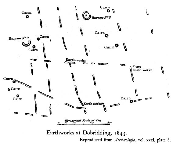
1845 plan of Cairns & Earthworks on Baildon Moor (after J.N.M. Colls)

In the year 1845, on the Low Plain on the western side of Baildon Hill, an intrepid archaeologist and historian, Mr. J.N.M. Colls, came across extensive earthworks and a number of prehistoric tombs in a very small area. Upon excavation, the ‘earthworks’ were found to be what sounds like neolithic walling running parallel to each other in a roughly north-south direction (north is the traditional direction for death).  Scattered amidst these lines he found more than a dozen cairns and barrows, along with remains of “a circle, or ring.”  Although the majority of what Colls wrote about has been destroyed, leaving only scanty remains of a once considerable archaeological arena, his lengthy description deserves being reprinted in full.  He wrote:

“This level (the Low Plain) bears numerous traces of earthworks or other embankments running in many cases parallel with one another, at distances varying from 50 to 80 yards apart, and intersected by other works of similar construction.  These earthworks can be remembered to have been from four to five feet in height; their bases nearly invariably appear to have been eight feet in diameter, composed of loose blocks of calliard, or close-grained sandstone, and earth.  The greater part of the stone has been torn away to make and repair the roads of the neighbouring district; and the surface of the earth has been so nearly levelled that it is only by the scattered and disfigured remains, carefully delineated upon my plan, that any idea can be formed of their original character.

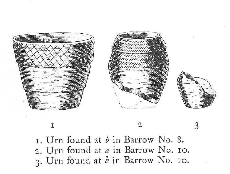
“In connection with these earthworks, and upon the north side of them, immediately above a steep fall to the next lower level (approx SE 1372 4020, Ed.), is a circle, or ring, formed originally of earthworks of precisely similar character, size and construction to those I have just described.  The diameter of this ring is about fifty feet; its interior area is perfectly level; but the earthwork forming its circumference has been defaced and torn up for a considerable extent for the stone it contained.  Circles of this nature have generally been termed druidical, from their presumed use as places of worship or sacrifice.  I therefore opened its centre, in the hope of finding some trace of fire confirmatory of its character; and commenced clearing away a layer of peat earth, of from 10-11 inches in depth.  I then found a layer of calliard boulders one-and-a-half feet in depth, the lower ones slightly burned, and resting upon a deposit of peat-ashes three inches in depth and from 2-3 feet in diameter (see Barrow No.8 in plan, Ed.).  This I should have concluded to be the remains of a beacon fire, but, upon continuing the excavations, I found about three feet SSE of this deposit of ashes (at point b on the plan) a rude urn standing in an upright position, at a depth of two feet from the surface, a layer of calliard stones having been removed from above it, one of which appeared to have covered it.  This urn was 12 inches in diameter and 9-10 inches in depth, of a circular or bowl shape, the upper stage of it being rudely ornamented by incised lines crossing each other at acute angles: it was filled with calcined bones (some remaining tolerably perfect), ashes and charcoal; and I selected some half-dozen of them as specimens, which Mr Keyworth, surgeon and lecturer on anatomy at York, has examined… He is of the opinion that they belonged to a very young subject, perhaps from 9-12 or 13 years of age; he thinks it possible however, that they may all have belonged to the same subject… The urn in which the were placed appears to have been rudely formed by the hand, without the assistance of a lathe; in substance about half-an-inch…it appears pretty evident that this urn has been formed of the black earth of the mountain and coal measures of which Baildon Hill is formed…

“A little to the west by south of the circle…are the almost obliterated remains of another circle (fig.9 on the plan), which I had not an opportunity of thoroughly examining; the slight traces remaining bear strong testimony of its character being similar to that of fig.8.

“Scattered over the surface of the Plain, and at irregular distances, cairns or heaps of stones, composed of bare sandstone and calliards (and not mixed with earth), frequently occur; they are generally about twenty feet in diameter and appear to have been originally 4 or 5 feet in height: these remains still require examination.  In passing over them, I remarked that some of the stones of which they and the earthworks near them were constructed, had marks, or characters, but so rude that a doubt remains whether they may not have been caused by the action of the atmosphere on the softer portions of the stone.”

Urns found near Dobrudden

This final remark seems to be the very first written intimation of the cup-and-ring marked stones which can still be found amidst the grasses in the very area Mr Colls described.  Sadly, much of the other remains shown in the drawing have been all but obliterated, or grown over.  However, the decent concentration of cup-and-ring stones in this small area (see other Baildon Moor entries), highlights once again an associated prevalence of these carvings with our ancestor’s notions of death.

Sadly, year by year, the important neolithic and Bronze Age english heritage remains across this upland ridge are slowly being destroyed.  The lack of attention and concern by regional archaeologists and local councillors, and the gradual encroachment of human erosion are the primary causative factors.  Hopefully there are some sincere archaeologists in the West Yorkshire region who will have the strength to correctly address this issue. Under previous archaeological administrators, Bradford Council have allowed for the complete destruction of giant tombs, stone circles and other important prehistoric remains in their region—a habit that seems not to be curtailed as they maintain a program of footpath “improvements” on local moors without any hands-on assessment of the archaeology on the ground.

…to be continued…

References:

  1. Baildon, W. Paley, Baildon and the Baildons – volume 1, St. Catherine Press: Adelphi 1913.
  2. Barnes, Bernard, Man and the Changing Landscape, Eaton Press: Wallasey 1982.
  3. Colls, J.N.M., ‘Letter upon some Early Remains Discovered in Yorkshire,’  in Archaeologia, volume 31, 1846.

© Paul Bennett, The Northern Antiquarian

The Kirk, Steeton, West Yorkshire

Legendary Rocks:  OS Grid Reference – SE 0418 4391

Also known as:

  1. Garlic Kirk

The Kirk, Hawkcliffe Woods, Steeton

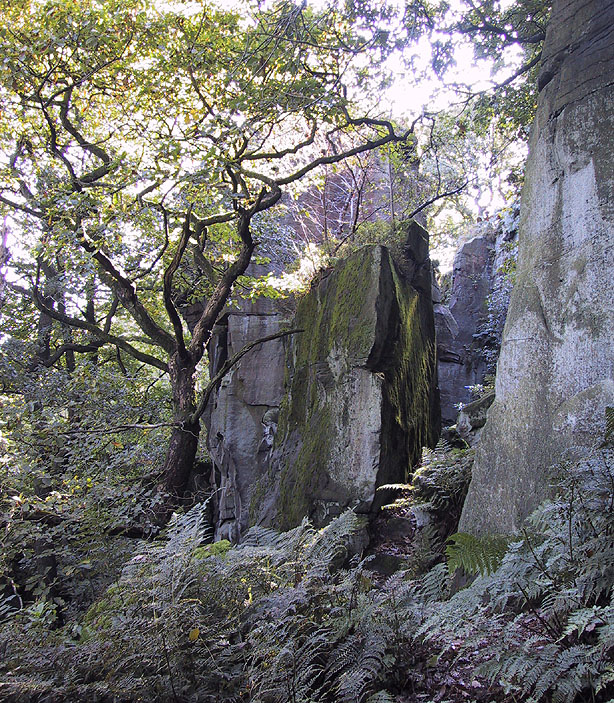
This is a stupendous site!  It looks like some of this may have been quarried, a long time ago, but it also seems that nothing at all has been written about it – even in the simple travelogues beloved by our Victorian historians.  To come across it quite by accident, as I did (only yesterday), was excellent!  When I first got here, by following the wooded ridge betwixt Hollins Lane and the main Keighley-to-Steeton road (A629), the place seemed brilliant; but as time went on and my amblings through the sometimes dense and also very old woodland were overcome by the dream of the place, I couldn’t believe how this place had become forgotten.  Adrenalin rushed through me for a while, but then it was the dream of the place again.  The memories here were ancient – and you could feel them.  In places there was the solace of darkness, beloved of those who know old trees and dangerous places.  For here, walk the wrong place too quickly and Death comes.  Broken limbs await in the curious gorges which just appear in the woods, only a yard wide, but 50-60 foot deep, only to vanish again away from sight a few yards later.  Caves and dark recesses, seemingly unknown, reach out to climb down.  And all round is the aged covering of lichens and mosses that know centuries.

Shown as 'Garlic Kirk' on 1853 map
Shown as ‘Garlic Kirk’ on 1853 map

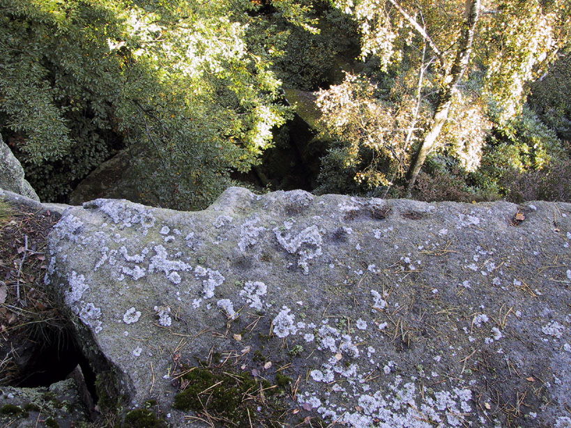
The Kirk itself – meaning simply, ‘place of worship’, in the old sense – is like something out of Lord of the Rings!  If you walk along its top, as I did, the great cliffs below come late to the senses.  A curious ridge of cup-markings, seemingly natural ones, stretch along the very edges of the drop – which stretches on for some distance.  And then as you walk along its edge, you find this great drop which looks north, is now on both sides of your feet!  It’s quite breathtaking!

Cup-markings on the edge (probably natural)

Trying to get down into the gorge below can be done, but it’s a bit dodgy!  If you aint agile and crazy, stick to doing it by walking round – a long way round…  Someone a few centuries back either cut into the rock, or laid steps, reaching into the mossy gorge, which runs to nowhere.

You can appreciate how this place would have been a sacred site:  it’s big, it’s old, it takes your breath away, and it looks across to the great Rivock Edge where many fine cup-and-ring stones were cut.  I’ll try and get some images of the place when I call here again in the very near future, but they’ll never capture the experience of being here.

Folklore

The only thing I have come across which seemingly relates to this great edifice, tells of a great cave in the woodland, which legend tells stretches many miles to the north and emerges at Bolton Abbey. (Clough 1886)  I wondered about the potential visibility factor in this legend and found it obviously didn’t work.  However, if you stand on a certain part of The Kirk and look north, a dip in the horizon enables us to see, far away, hills which rise up directly above the swastika-clad Bolton Abbey.  Twouldst be good to work out exactly which hill above the Abbey we can see from here.

On another issue, John Clough (1886) told that “on top of the rock there is a footprint and the initials of one of the Waites, who is said to have leaped over the chasm.”

References:

  1. Clough, John, History of Steeton, S. Billows: Keighley 1886.
  2. Gray, Johnnie, Through Airedale from Goole to Malham, Walker & Laycock: Leeds 1891.

© Paul Bennett, The Northern Antiquarian

Cowper’s Cross, Ilkley Moor, West Yorkshire

Cross:  OS Grid reference – SE 10223 45609

Also Known as:

  1. Cawper’s Cross

Getting Here

Site shown on 1851 map

From Ilkley town, head up the road as if you’re going to White Wells but keep following the moorland road up towards Whetstone Gate and the TV masts on the very tops (you’ll have to walk the last half-mile).  Shortly before you get them, you can’t miss this relic by the track-side on your right-hand side.

Archaeology & History

Possibly a christianised monolith, erected here in an attempt to divert local people away from the impressive Badger Stone where they may have held springtime gatherings.  There used to be an old monolith laid on the ground a few yards away from the cross, which may have stood upright before the cross was erected. Also on the south-facing side of the cross were four cup-markings, indicating great age.  These may also have been added when the cross was erected. (We know this occurred at other sites in the region, e.g., Churn Milk Joan, Midgley Moor, where such cup-marks were added sometime in the 15th or 16th century.)  However, thanks to some idiotic halfwits in more recent years going up here and vandalizing Cowper’s Cross, the prehistoric cup-markings that were on this relic have been destroyed.  The upright shaft of the cross that’s here now is a re-worked gatepost that replaced the old shaft with its authentic ‘pagan’ carvings.

1920s postcard of Cowper's Cross
1920s postcard of the Cross

But it’s had other bits of bad luck through the years.  The site was struck by lightning many years back, splitting the stone in half, but has since been rebuilt and stands adjacent to its original position, right next to the old Roman road that crosses Ilkley Moor.  Historian Allan Butterfield suggested this site to have originally been an old boundary markstone, christianised many centuries ago.  The name ‘Cowper’ derives from the local Ilkley family of Cawper.

Those of you interested in the early christian history of these moors should also have a look at the little-known Black Knoll Cross, less than a mile south of here in the middle of Morton Moor.

Folklore

Folklore relates that markets were held at this old stone cross many years ago. This gives added weight to the idea that the nearby cup-and-ring marked Badger Stone, where markets were probably held around the time of the equinoxes, was the original site for such gatherings.  Note that another site, the Reva Hill Cross, on the eastern side of this moor, has much the same history.

References:

  1. Bennett, Paul, The Old Stones of Elmet, Capall Bann: Chieveley 2001.
  2. Cowling, E.T., Rombald’s Way, William Walker: Otley 1946.

© Paul Bennett, The Northern Antiquarian 

Cob Stone Field, Keighley, West Yorkshire

Cup-Marked Stone:  OS Grid Reference – SE 00549 40888

Also Known as:

  1. Carving no.1 (Boughey & Vickerman)

Getting Here

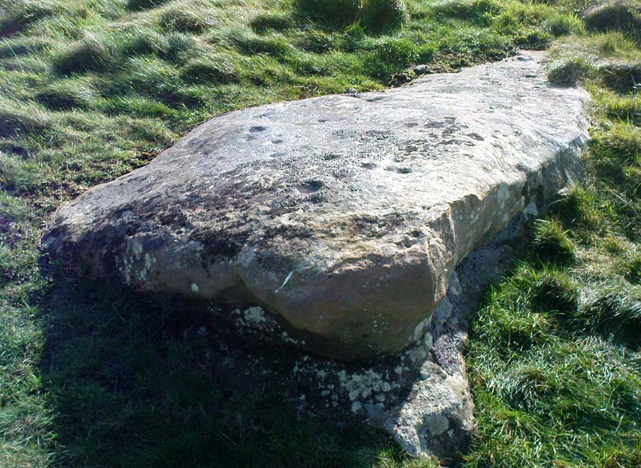
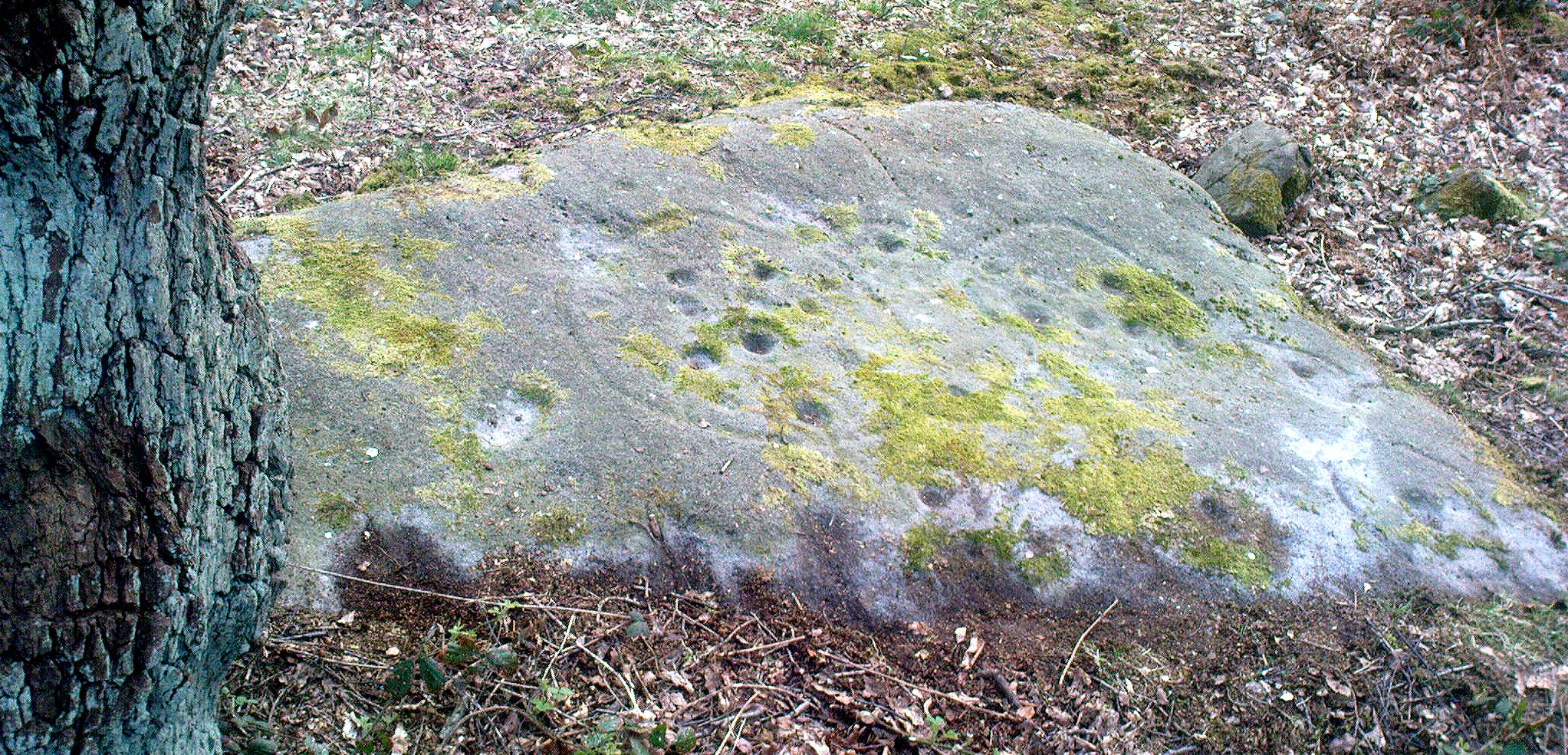
Cob Stone with cup-marks on top
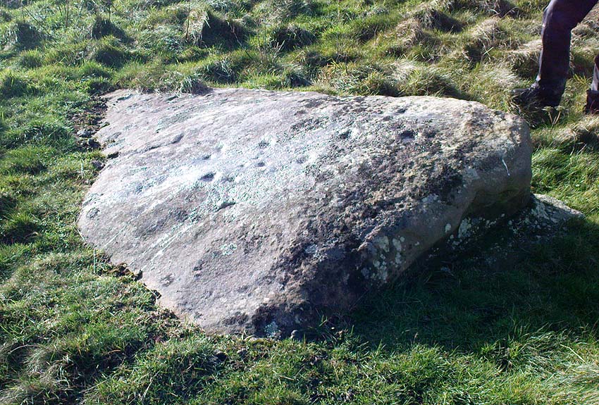
Cob Stone its cup-marks

Go through Laycock village and take the left turn along the lovely, hidden country lane towards Slippery Ford (called Todley Hall Road) until you get near the end of this beautiful wooded valley (called Newsholme Dean). Just by Grey Stones Hill, on your left, is a track heading down to a large farm building with numerous rocks and boulders in the fields either side of you.  Stop! – and look in the field on the right.

Archaeology & History

Cluster of cup-marks on top
Cluster of cup-marks

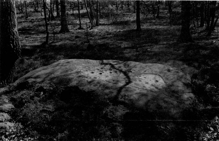
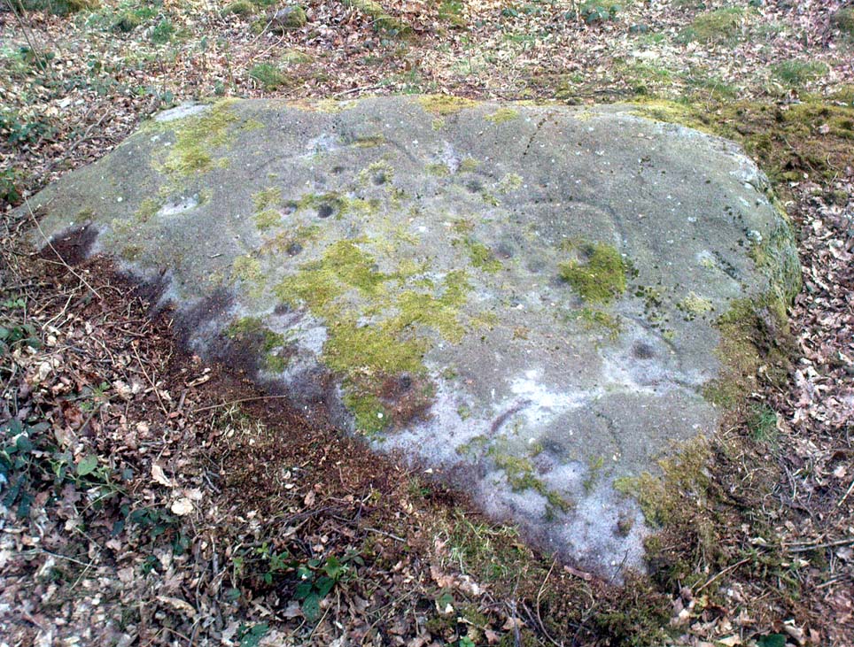
This particular stone is in the field to the right of the track, over the wall, right near the top of the field.  Described for the first time in Boughey & Vickerman’s (2003) survey where they describe “at least eight cups” on the rock; and it’s listed on the MAGIC Map survey as having 6 cups — which are the ones you can plainly see on the very top edge of the stone. What may be three other faint ones can be discerned on the sloping sides of the rock.

Cob Stone Field carving

Another ‘possible’ cup-marked stone can be seen lower down the field, past the large Cob Stone.  There is also another cup-marked stone in the adjacent field at SE 00610 40841 (listed as stone no.2 in Boughey & Vickerman, 2003) with apparently 17 cups on the large rock there, but this can be difficult to see unless lighting conditions are just right.

References:

  1. Boughey, Keith & Vickerman, E.A., Prehistoric Rock Art of the West Riding, West Yorkshire Archaeology Service 2003.

© Paul Bennett, The Northern Antiquarian


Calverley Woods (12), Leeds, West Yorkshire

Cup-Marked Stone:  OS Grid Reference – SE 2006 3790

Also Known as

  1. Carving no.12 (Boughey & Vickerman)

Getting Here

Lost Cup-Marked Stone, Calverley Woods

Troublesome really, as it’s got lost somewhere amidst the undergrowth.  From the valley bottom at Apperley Bridge, take the road-then-track which goes up thru the Calverley Cutting (as locals call it), turning left along the dirt-track just as the track begins to slope uphill.  Go past the detached house in the edge of the trees and shortly past there is a small footpath taking you into the trees on your left,  Walk down and along here, near the bottom of the tree-line above the walling.  If you find it, let us know!

Archaeology & History

Included in Boughey & Vickerman’s (2003) survey as ‘stone 12’ – it was first described by Sidney Jackson in 1954, who later gave us a map and drawing of the stone.  I looked for it several times x-number of years back, but never found it (though was led astray a little by the profusion of Amanitas in the locale!).  Comprising at least 18 cup-markings on a generally flat rock surface, to this day the carving remains unfound, though is probably under the herbage hereabouts.  The same fate seems to have befallen the West Woods 1 and West Woods 2 carvings in another part of the same woods.  Does anyone know what’s become of them?

References:

  1. Bennett, Paul, “The Undiscovered Old Stones of Calverley Woods,” in Earth no.2, 1986.
  2. Boughey, Keith & Vickerman, E.A., Prehistoric Rock Art of the West Riding, West Yorkshire Archaeology Service 2003.
  3. Jackson, Sidney (ed.), ‘Calverley Wood Cup-Marked Rock,’ in Bradford Cartwright Hall Archaeology Group Bulletin, 1:1, 1954.
  4. Jackson, Sidney (ed.), ‘Cup-Marked Boulder in Calverley Wood,’ in Bradford Cartwright Hall Archaeology Group Bulletin, 1:7, 1955.
  5. Jackson, Sidney (ed.), ‘Cup-and-Ring Boulders near Calverley,’ in Bradford Cartwright Hall Archaeology Group Bulletin, 1:16, 1956.

© Paul Bennett, The Northern Antiquarian 

Brackenhall Circle, Baildon Moor, West Yorkshire

Enclosure:  OS Grid Reference – SE 1305 3908

Also Known as:

  1. Brackenhall Ring
  2. Catstones Ring
  3. Soldier’s Trench

Getting Here

To get here, ask all and sundry where Shipley Glen is and, once there, head to the Brackenhall Countryside Centre. It’s less than 100 yards past it, right on the roadside (a coupla nice birches sit in its edge).

Archaeology & History

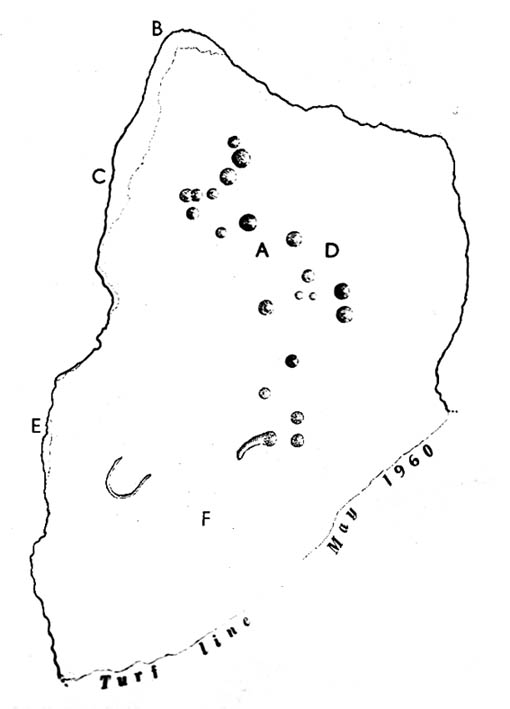
Lay-out of the Catstone's Ring (North is an approximation)
Lay-out of Catstone’s Ring

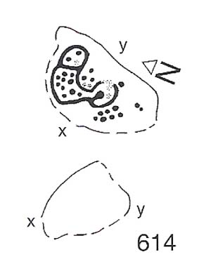
Described by many local writers over the years and marked on modern OS-maps as ‘The Soldier’s Trench,’ this curious double-ring of stones has long been somewhat of an archaeological anomaly.  The archaeologist John Barnatt thought it to be “almost certainly an enclosure, of indeterminate age”; and similarly so by Faull and Moorhouse (1981), who described it as a settlement or enclosure.  It has previously been classified as a ‘stone circle’ by archaeologists, and although I’ve added it to the listing of such sites here on TNA, I do so as a historical tradition, as the site aint a true megalithic ring.  Although we don’t know exactly what it was used for, we’re better using the term ‘enclosure’ for it.

The first description of the place was by J.N.M. Colls (1846).  When the pseudonymous Johnnie Gray (a.k.a. Harry Speight) got here he wrote:

“It comprises portion of an earthwork (which was perfect a few years ago), raised between two concentric circles, whose grater circumference is 137 yards, and diameter 57 yards north to south, and 39 yards east to west… There are unmistakable evidences about it of immense fires.”

Earliest known image (Glossop 1882)

At least two of the stones in this double-ringed complex have cup-markings etched on them; though Boughey and Vickerman (2003) report a third such carving, but doubt its authenticity.  They may be right.

Folklore

The other name for this site, the Soldier’s Trench, comes from an old tale which relates to the place being used as a camp by a group of soldier’s the night before they went into battle.

Drawing by John la Page (1951)

The site stands right next to a prominent geological fault (as any visitor clearly sees!).  It’s likely that this cleft in the Earth is one of the causative factors in the creation of numerous UFO phenomena that have been reported hereabouts through the years.  One large spherical object with a very slight ‘tail’ to the rear, travelled slowly over this site in the 1980s and was watched for several minutes slowly following the geological ridge up and round Baildon Hill to the north, fading back to Earth and eventually out of sight.

References:

  1. Baildon, W. Paley, Baildon and the Baildons – parts 1-15, Adelphi Press: London 1913-1926.
  2. Bennett, Paul, The Old Stones of Elmet, Capall Bann: Milverton 2001.
  3. Boughey, Keith & Vickerman, E.A., Prehistoric Rock Art of the West Riding, WYAS 2003.
  4. Colls, J.N.M., ‘Letter upon some Early Remains Discovered in Yorkshire,’ in Archaeologia 31, 1846.
  5. Faull, M.L. & Moorhouse, S.A. (eds.), West Yorkshire: An Archaeological Survey to AD 1500 – 4 volumes, WYMCC: Wakefield 1981.
  6. Glossop, William, ‘Ancient British Remains on Baildon Moor,’ in Bradford Antiquary, 1882.
  7. Gray, Johnnie, Through Airedale from Goole to Malham, Elliott Stock: London 1891.
  8. Hedges, John (ed.), The Carved Rocks on Rombald’s Moor, WYMCC: Wakefield 1986.
  9. la Page, John, The Story of Baildon, Byles: Bradford 1951.

© Paul Bennett, The Northern Antiquarian

Bent Head, Todmorden, West Yorkshire

Cup-Marked Stone:  OS Grid Reference – SD 9602 2587

Also Known as:

  1. Upper Eastwood Carving

Getting Here

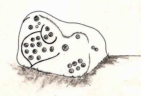
Bent Head cup-marking

From Todmorden go east on the A646 for less than a mile and take the Cross Stone road on your left.  Keep going all the way up till you hit the moorland edge road, where you’ll see the Great Rock (a massive boulder right by the roadside). Then go down Eastwood Lane, past the house where the lane swings right and here you’ll see a stile in the wall on the right (just after the next lane on your left).  Walk along this path, over the stiles in the walling until you reach a wooden stile. The carving is hereby!

Archaeology & History

This carving was described just once by Mr J.A. Heginbottom (1979) as, “a small cup-marked boulder in a stile 100 metres east of Bent Head, Todmorden.” A small, innocuous stone used in the drystone walling, it gives the distinct impression of being one of the many ‘portable’ cup-marked stones typical of those found in prehistoric cairns and other tombs — but the record-books speak of no such remains here; and various ambles about in search of such a potential tomb have drawn a blank. Nevertheless, the cup-markings here are pretty obvious once you see ’em (assuming the daylight aint overcast, which can hide the carvings sometimes).  About 2 feet long, about a foot wide and a foot high, this cup-marked portable is similar in size and form to the Nine Stones cup-marking, Derbyshire, recently found in walling very close to where an old tomb was recorded (though the Derbyshire one has only 2-3 cups).  Certainly worth a look if you’re in the area.

References:

  1. Heginbottom, J.A., The Prehistoric Rock Art of Upper Calderdale and the Surrounding Area, YAS: Leeds 1979.

© Paul Bennett, The Northern Antiquarian

Baildon Moor (171), West Yorkshire

Cup-Marked Stone:  OS Grid Reference – SE 13842 40268

Also Known as:

  1. Carving no.37 (Hedges)

Getting Here

W.P. Baildon’s sketch

Upon the heights of Baildon Hill, get to the Dobrudden Farm caravan site. 100 yards up the track leading from it (north), go into the tribbles of grassland immediately to your left.  Look around!

Archaeology & History

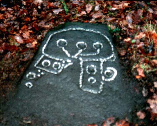
This is only a small stone and takes some finding when the grasses are long.  It’s found upon the once archaeologically rich High Plain with at least 17 cup-markings etched onto its surface.  A single prehistoric tomb appears to have accompanied the rock and its cup-marks.

It was first described by Mr Baildon (1913) in his magnum opus; then later catalogued in Hedges (1986) survey, a couple of years after I did my first drawing of this stone.

References:

  1. Baildon, W. Paley, Baildon and the Baildons – parts 1-15, Adelphi: London 1913-1926.
  2. Bennett, Paul, Megalithic Ramblings between Ilkley and Baildon, unpublished: Shipley 1982.
  3. Boughey, Keith & Vickerman, E.A., Prehistoric Rock Art of the West Riding, WYAS: Leeds 2003.
  4. Hedges, John, The Carved Rocks on Rombald’s Moor, WYMCC: Wakefield 1986.

© Paul Bennett, The Northern Antiquarian

Baildon Moor (152), West Yorkshire

Cup-Marked Stone:  OS Grid Reference – SE 13743 40161

Also Known as:

  1. Carving no.24 (Hedges)

Getting Here

If you wanna find this, get onto the Low Plain north of the Dobrudden caravan park and its about 10 yards off the path running north from there, not too far from the other Baildon Hill carvings.  Scramble about a bit & you’ll find it.

Archaeology & History

W.P. Baildon’s early sketch

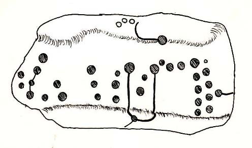
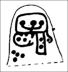
Don’t ask me why, but I really like this carving. It’s one of the many I first saw on these moors when wandering about up here when I was 10-12 years old — and they had an effect on me.  I call this one of the “primary design” stones, i.e., a number of CRs on this moor (and everywhere else for that matter) appears to have a central design feature. (I’ll point out the others as I post ’em) Some folk think it’s just the slant of the local rock-artist…I think it’s summat a bit different…  Local astronomer Gordon Holmes (1997) found a similar pattern here and thought they may have represented star formations, but this is unlikely.

It was first described and illustrated by W. Paley Baildon (1913), way before Mr Jackson (1955) resurrected its attention for archaeologists.

References:

  1. Baildon, W. Paley, Baildon and the Baildons (parts 1-15), St. Catherines: Adelphi 1913-26.
  2. Boughey, K.J.S. & Vickerman, E.A., Prehistoric Rock Art of the West Riding, WYAS: Leeds 2003.
  3. Hedges, John (ed.), The Carved Rocks of Rombald’s Moor, WYMCC: Wakefield 1986.
  4. Holmes, Gordon, 2000 BC – A Neolithic Solstice Odyssey, SASRG 1997.
  5. Jackson, Sidney, ‘Cup-and-Ring Boulders of Baildon Moor,’ in Cartwright Hall Archaeology Group Bulletin, 1:7, 1955.

© Paul Bennett, The Northern Antiquarian
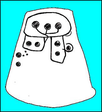

Baildon Moor (146), West Yorkshire

Cup-Marked Stone:  OS Grid Reference – SE 13666 39756

Also Known as:

  1. Carving no.19 (Hedges)
  2. Carving no.146 (Boughey & Vickerman)

Getting Here

South of Dobrudden caravan park, heading towards the wall, you’ll stumble across this old carving in the tribbly grass. Zigzag about and keep your eyes peeled!

First known drawing (W.P. Baildon 1913)

Archaeology & History

First described by W. Paley Baildon in his monumental 15-part study (1913) of the region, this carving was then later included in John Hedges (1986) survey as ‘Baildon stone 19.’  It was then catalogued as stone 146 in Boughey & Vickerman’s (2003) updated and expanded survey.

Modern drawing (after Hedges 1986)

This carving was one of several in the Baildon Moor complex that was thought by local astronomer Gordon Holmes (1997) to possibly represent heavenly constellations, with Pleiades and Cassiopeia being primary contenders amidst the scattering of carved cups on this stone.  This was something I explored in my own research on the possible nature of these carvings in the 1980s, but found that although it seemed a good idea, it was pretty unlikely (unfortunately!).  The nature of this and other stones related to the other prehistoric remains where, in bygone days, many prehistoric cairns scattered this grassy moorland plain.  The carving was more related to the cosmology of death and the psychogeography of spirit worlds: a factor understood at many other cup-and-rings across the country.

References:

  1. Baildon, W. Paley, Baildon and the Baildons – parts 1-15, Adelphi: London 1913-1926.
  2. Boughey, Keith & Vickerman, E.A., Prehistoric Rock Art of the West Riding, WYAS: Leeds 2003.
  3. Cowling, Eric T., Rombald’s Way, William Walker: Otley 1946.
  4. Hedges, John, The Carved Rocks on Rombald’s Moor, WYMCC: Wakefield 1986.
  5. Holmes, Gordon, 2000 BC – A Neolithic Odyssey, SASRG: Baildon 1997.

© Paul Bennett, The Northern Antiquarian