Cup-Marked Stone: OS Grid Reference – SE 11835 58006
Take the A59 road from Harrogate and Skipton and at the very top of the moors near the Gill Head Enclosures, take the small Kex Ghyll road up past the disused quarry works north for a mile or so. At the junction go left, past the Outdoor Centre, thru West End up Whit Moor Road, then go left down to Brays Cross Farm and over the ford. Note the clump of trees on the moors to the west and take the path there. Once here, a large outcrop of rocks will be seen about 150 yards on the moor to the west. That’s the spot! Otherwise, follow the directions of the legendary wandering Teddy!
Archaeology & History
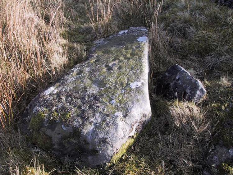
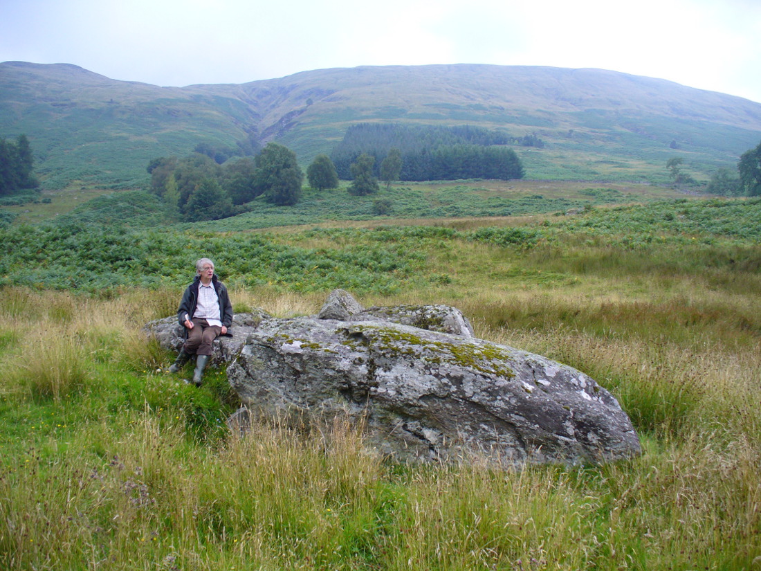
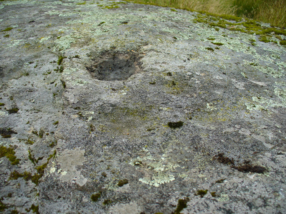
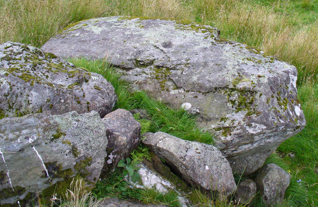
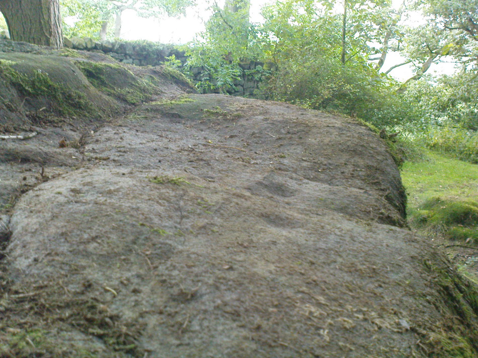
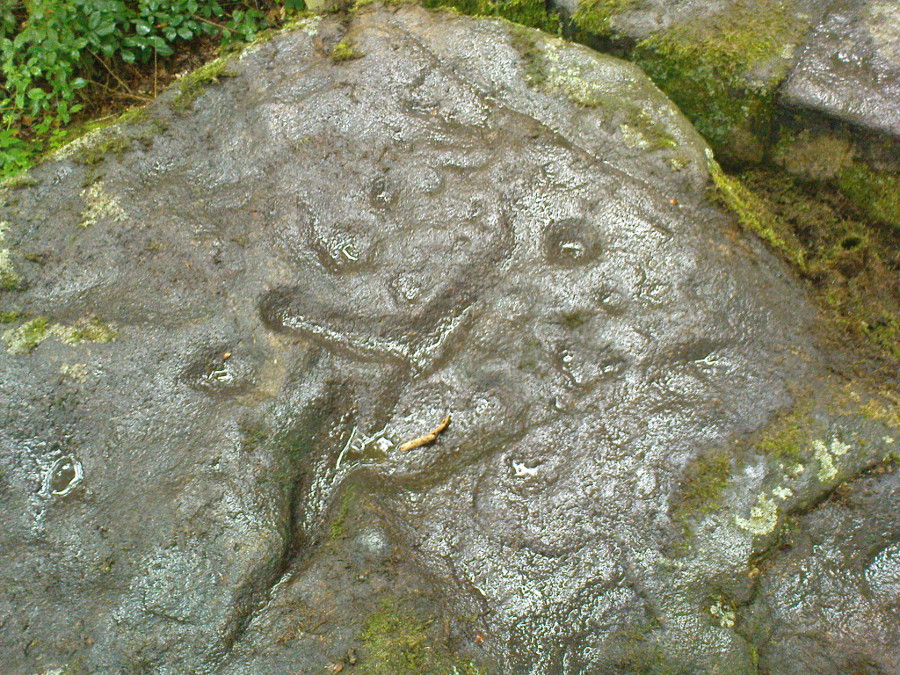
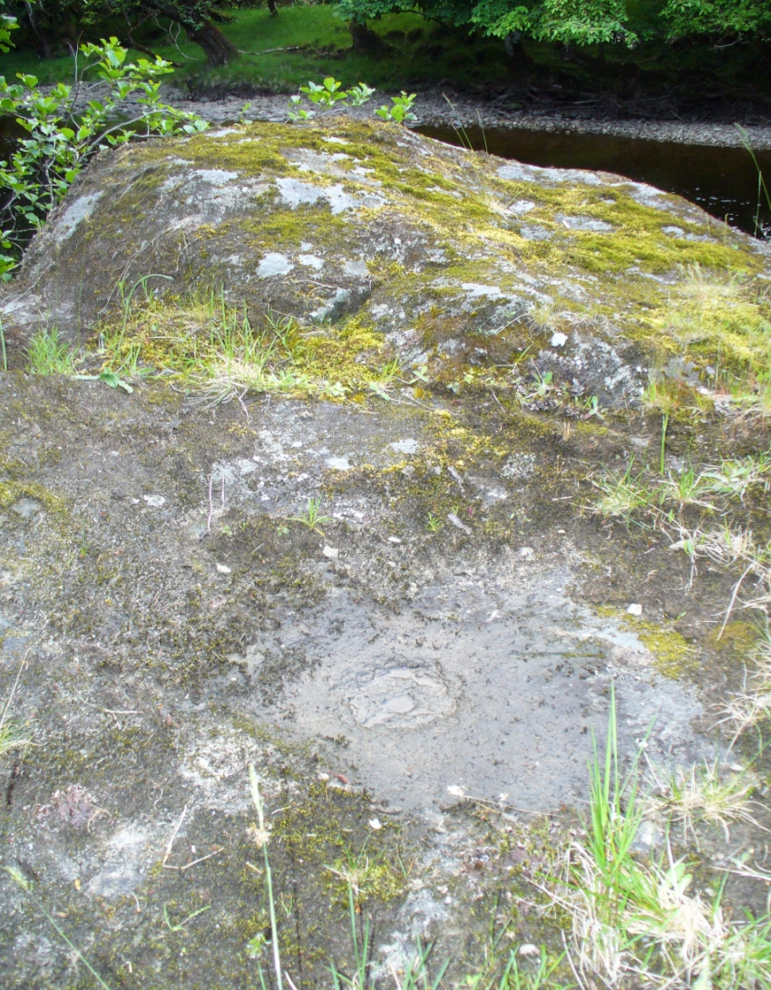
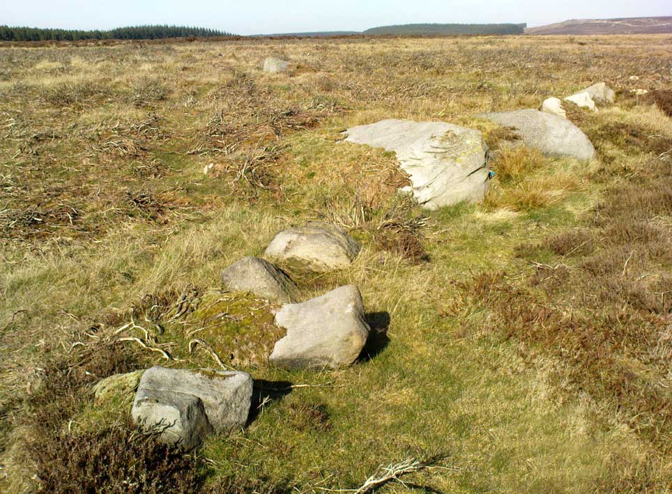
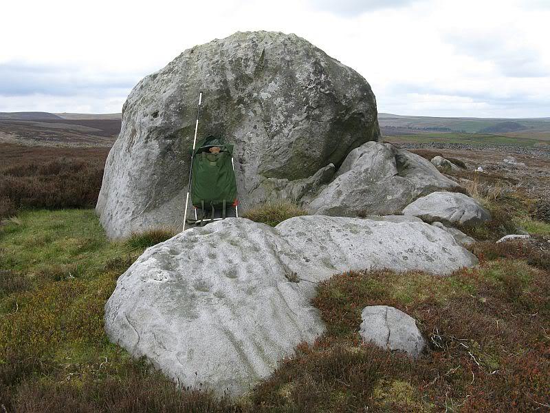
This dramatic looking outcrop of rocks rising out of the ground a half-mile due west of Bray farmhouse has long been known as the rocks of the ravens: oracular birds of ill-omen in all peasant traditions, yet carrier birds of shamans in their Underworld ventures, from accounts in Russia and Scandinavia, through the Scottish highlands and into Yorkshire’s northern hills, as folklore records show. Whether such mythical figures used the Raven Stones here for such magick, we have no firm accounts; but the existence of the many cup-markings on this particular rock (and others in the outcrop) show that animistic traditions of some form or another occurred here in prehistoric times at the very least.

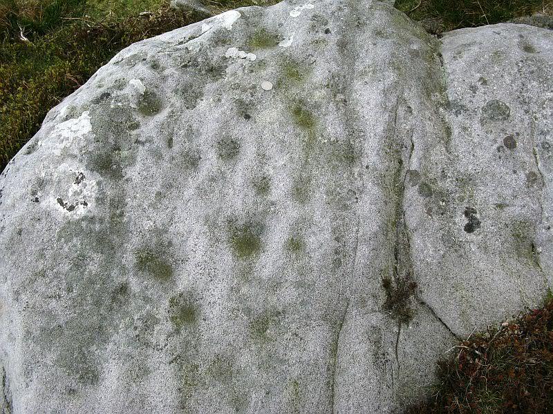
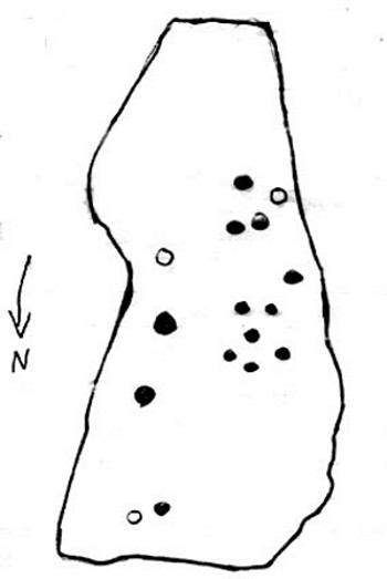
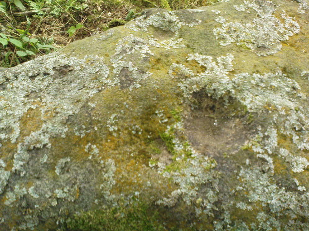
Records of this place as an archaeological spot are scant indeed. It is passed with barely a mention by those Victorian antiquarian giants, Bogg, Grainge and Speight. The rock art students Boughey & Vickerman (2003) give the wrong grid reference here, but added the site to their inventory, saying only that it is “long, low, exposed bedrock. 22-25 cups; some very weathered and smooth.” A series of channels runs down the slope of the stone, but there are probably natural. However, a cup-and-line does occur on the eastern side of the carving.
References:
- Armstrong, Edward A., The Folklore of Birds, Collins: London 1958.
- Boughey, Keith & Vickerman, E.A., Prehistoric Rock Art of the West Riding, WYAS: Wakefield 2003.
Links:
Acknowledgements: Huge thanks for QDanT & Teddy for the fine photos of the Raven Stone carving!
© Paul Bennett, The Northern Antiquarian