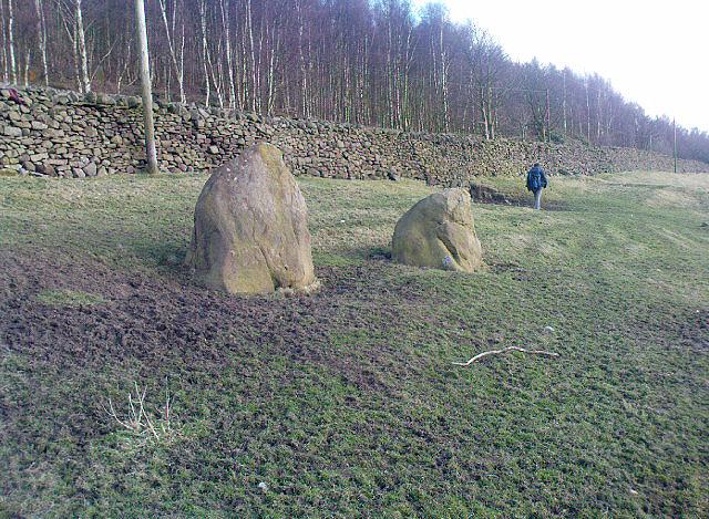
Take the single-track country lane between Farnhill and Low Bradley until you reach Hamblethorpe farmhouse. Where the birch woodland is on the slope going uphill, the field on the other side of the road, protected by walling, is where the stones are, just south of the farmhouse. There’s nowhere to park any car hereabouts, so it’s best walking here.
Archaeology & History
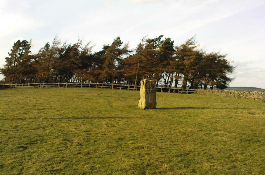
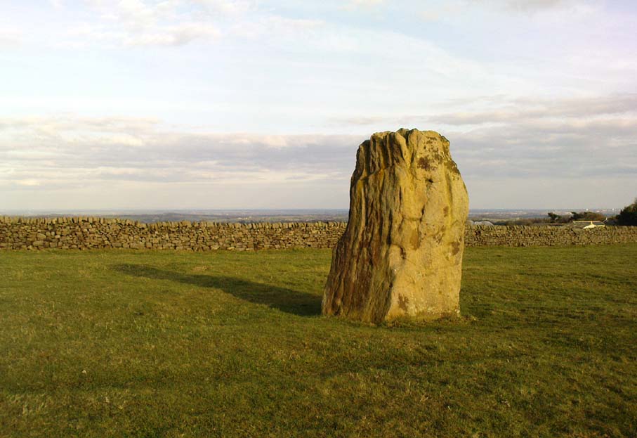
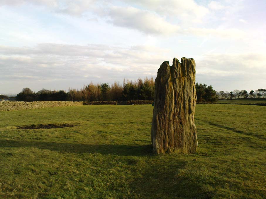
It seems that nothing has previously been written of this place. Hidden away at the top of the field we find two curious-looking standing stones: one nearly six-feet tall, and its companion about four-feet. They’re near the bottom of the slope from the giant Round Cairn and Long Cairn tombs of Low Bradley Moor, several hundred yards to the east— and were it not for the fact that they have a distinctive Castlerigg-like appearance about them, perhaps I wouldn’t have given them a second chance. Curious earthworks are in the same field, to which written records also appear silent. Tis a lovely little spot…
Stone Circle (destroyed): OS Grid Reference – NJ 2691 5985
Also Known as:
Haerstanes
Harestones
Archaeology & History
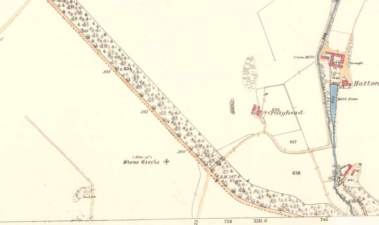
Haer Stanes on the 1871 map
This site had already passed into memory when the Ordnance Survey lads visited the area in 1870, but at least they included it on their early survey. Fred Coles (1906) described this site in his essay on the megaliths of Banffshire, where once could be found perhaps five stone circles close to each other – but all are now gone! Bloody disgraceful really. When Coles explored here, although the site was still shown on maps, little could be seen of the place.
“On the farm,” he wrote, “we heard long-handed-down tradition of the Circle, and the site was, rather vaguely, pointed out.” But there was nothing there. He described one reference to the place written by a Mr James Morrison, who said, “We have remains of two so-called Druid Circles, and during the last half-century three others have been swept away. One of these was in horse-shoe form and was called the Haer Stanes.” The same writer later says, “These stones were unfortunately found to lie in the line of a road then formed (1830) and were ignominiously tumbled down the slope on which for ages they had rested, and buried in a gravel pit by the side of the road.”
References:
Cole, Fred, ‘Report on Stone Circles Surveyed in the North-East of Scotland…’, in Proceedings of the Society of Antiquaries, Scotland, volume 40, Edinburgh 1906.
Although cited as being on Weston Moor, it is closer to Askwith village. From the village, take the north road and shortly before reaching the T-junction, park-up (somewhere!). There’s a small copse of trees on your right and fields above them – that’s where you’re heading. You might have to bimble about a bit before the rock catches your attention, but it’s worth the wandering. Look around!
Archaeology & History
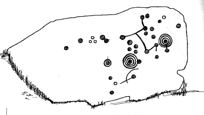
Sketch of the design c.1985
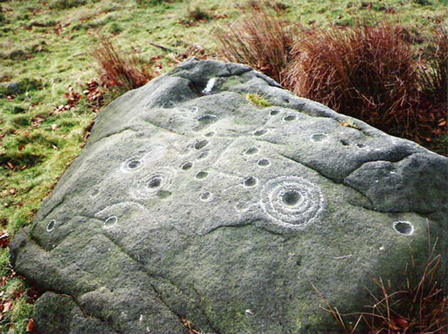
This is an excellent, archetypal cup-and-ring stone that’ll be loved by any real rock art student! Cups-and-multiple rings are the main visual feature to this stone, along with another 20 single cups and another primary cup-and-ring, all on a medium-sized sloping rock face. The carving was first described by Cowling & Hartley (1937). Since their initial discovery, several other writers have mentioned it with little further comment. The smaller but impressive double cup-and-ring carving 543 can be seen at the bottom left of the woodland in front of you – well worth seeing if you’re visiting here!
References:
Boughey, Keith & Vickerman, E.A., Prehistoric Rock Art of the West Riding, West Yorkshire Archaeology Service 2003.
Cowling, Eric T., Rombald’s Way, William Walker: Otley 1946.
Cowling, E.T. & Hartley, ‘Cup-and-Ring Markings to the North of Otley,’ in Yorkshire Archaeological Journal, 33, 1937.
Hotham, John Paul, Halos and Horizons, Hotham Publishing: Leeds 2021.
The best way to get here it is to head from the Cow and Calf Hotel up the hillside to where the great rock is sticking out (the Pancake Stone). From here, head straight onto the moor toward the Idol Stone — close to the Idol Rock which you can see 400 yards south in front of you. From here, follow the footpath up the hill before you and keep on the path towards Lanshaw Lass. About 100 yards on, turn straight west into the heather and keep your eye towards the south. About 250 yards on, about 100 yards away from the Green Crag Top cup-marked boulder, you’ll see it!
Archaeology & History
One of very few solitary standing stones on Ilkley Moor, and one which I relocated after The Old Stones of Elmet (2001) had gone to press — which was a great pity. Nearly four feet tall, this is a good chunky monolith which stands close to being on line with the summer solstice alignment from the nearby Twelve Apostles stone circle. (I was gonna call it the Summer Stone, but thought better of it!)
There’s another recumbent stone, more than five feet tall when erected, 200 yards northwest of here. (This is also very close to being in line with with our chunky monolith, plus the Twelve Apostles. Anyone out there with a GPS who can check if this possible alignment is the last remnant of a summer solstice stone row? It probably isn’t, but it’d be good to find out.) On the same moorland level, heading back down, when the heather’s burnt back you’ll find a number of prehistoric tombs along the edge of the ridge. These don’t appear to be in the archaeological registers.
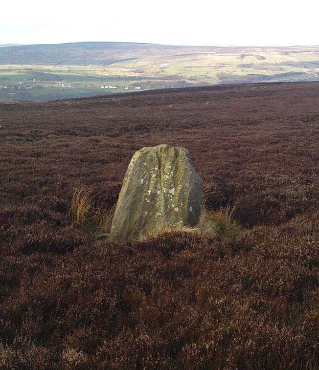
Follow the directions to reach the Great Skirtful of Stones giant cairn (very worryingly being encroached upon, illegally [it’s a protected monument], by employees of Bradford Council digging tracks into its edges). Walk less than 100 yards to the east, down the slight moorland slope (Leeds & Otley Chevin are in the distance). You’re here!
Archaeology & History
This is a very intriguing site. Intriguing because we don’t actually know what it is! It’s best seen at the end of winter, shortly after the heather-burning’s been done; but if there’s been no burning here, after a year or two it’s almost impossible to find!
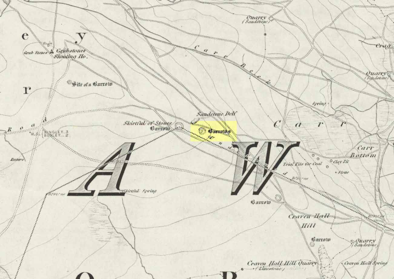
Great Skirtful Ring on 1851 mapColls’ 1846 plan
Despite it being only a short distance east of the Great Skirtful giant cairn, very little has been written about it (a surprise in itself!) – but this is down the failings of archaeological professionals in the area, who still neglect this incredible prehistoric arean. It was first described in Mr J.N.M. Colls’ (1846) survey of sites in the region, where he thought it to be a prehistoric camp. Several years later the Ordnance Survey lads visited here and deemed it to be prehistoric barrows, which doesn’t seem true. Nearly a hundred years later, the great northern antiquarian Eric Cowling (1946) who saw fit to describe it as an “enclosure” — so I’m copying his idea so I don’t get into too much trouble! Thinking it to be a Bronze Age monument, he wrote:
“On the main ridge of Rombald’s Moor and about eighty yards to the east of the Great Skirtful barrow, is a small circular enclosure with a diameter of twenty yards. There appears to have been an entrance on the eastern side, which is protected by a short length of banking to the east.”
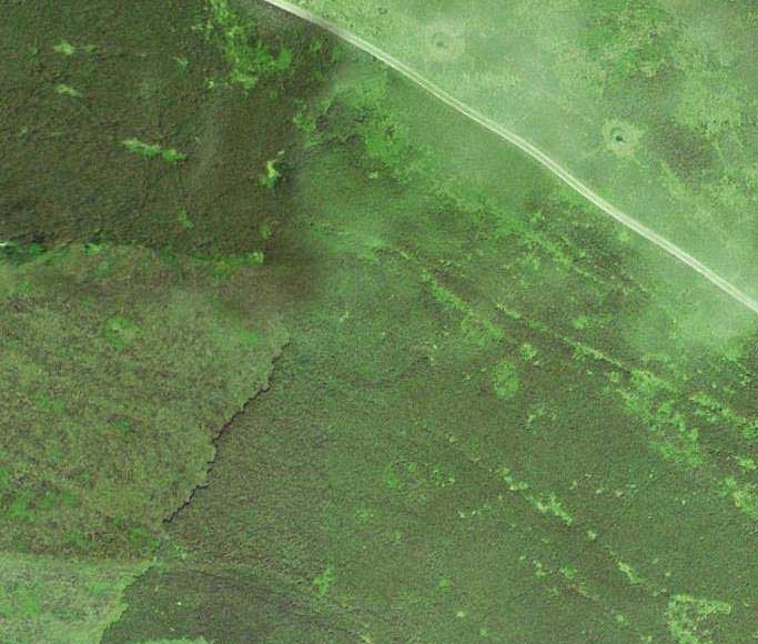
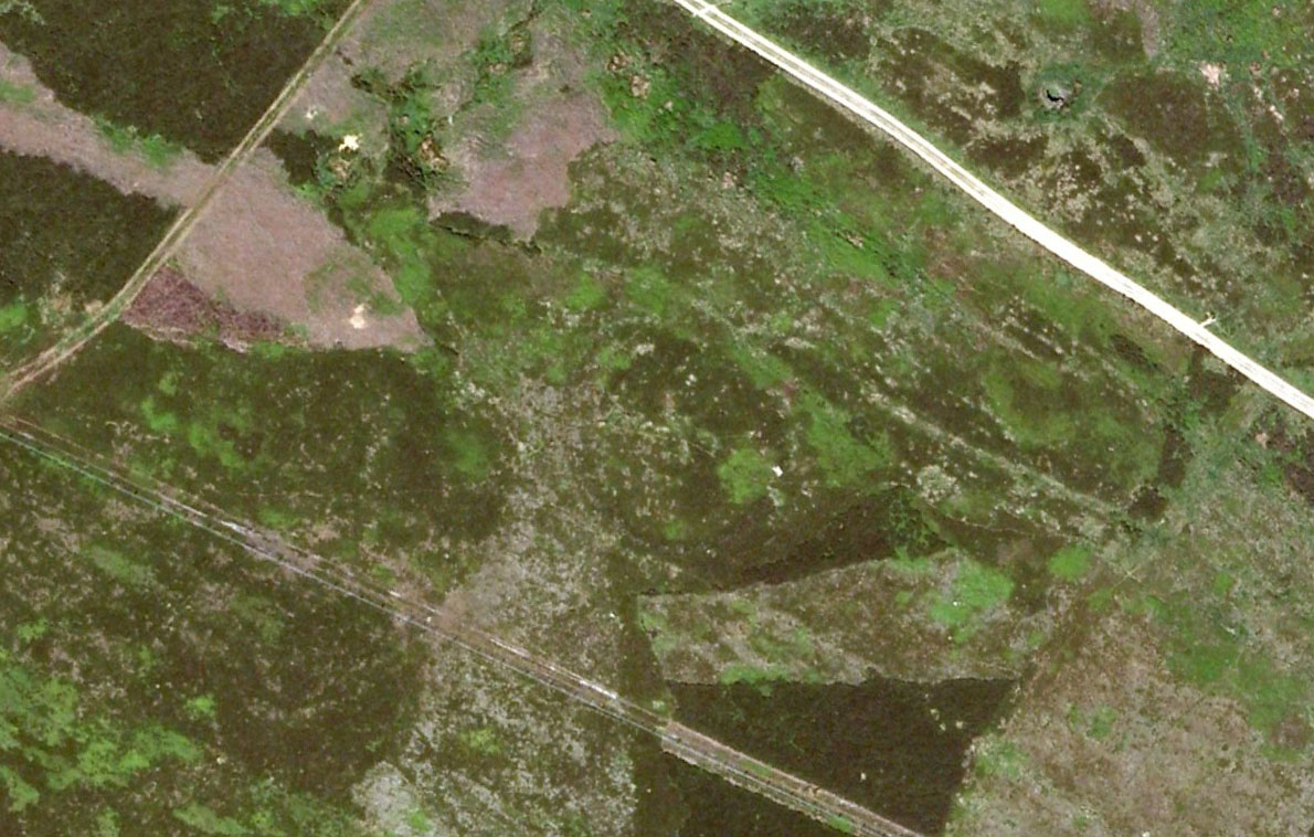
Aerial image, 2002Aerial image, 2009
The “length of banking” he described didn’t seem apparent when we visited the site yesterday (23.3.09), but we intend a further exploration of this and the adjacent monuments in the coming weeks and hope to locate it!
Interestingly, the archaeologists Faull & Moorhouse (1981:1:103), in their otherwise fine survey, actually doubted this place as having any prehistoric status, without giving any reason why—which was a big mistake. No doubt they spent too much time in offices and board meetings instead of getting out a bit more! Unless evidence to the contrary can be strongly presented, this site must be classed as undoubtedly prehistoric in nature (Bronze Age or Iron Age certainly) and almost certainly had something to do with rituals of the dead.
Great Skirtful Ring embankmentSouthern edge of the ring
From outer edge to outer edge the ‘ring’ measures 102 feet across, N-S, and with a rough maximum 101 feet E-W, being diameter, being some 300 feet in circumference. When you look at the site at ground level it appears to be an almost perfect ring, consisting of an embankment little more than 2 feet high at the most, with entrances both east and west. However, as the aerial images show, the perfect circle aint quite so perfect! But at ground level, there’s a certain uniformity about it. The embankment is in very good condition around much of the ring, with only slight damage in certain parts. The western opening strongly implies a direct relationship with the Great Skirtful cairn — which would infer this monument to have more of a ritual nature rather than the simple domestic enclosure, inferred by Colls and Cowling. Adding to this we find a tumulus 100 yards east and the remains of several other cairns nearby, making the site almost hemmed in by death-sites. A prehistoric cemetery is a short distance further down the moorland slopes to the east. Add also the fact that the Burley Moor stone avenue runs immediately south and the death-motif has to be increased.
What do I think it is? Not sure! The thought that it’s a previously unrecognized henge has crossed my mind…but henge monuments aren’t things that I’m very clued-up on, so wouldn’t like to say for sure. If there are any university archaeology students out there who are into getting their feet dirty, give this site a look-over. It’s intriguing, in very good condition, and could do with an accurate ID!
References:
Bennett, Paul, The Old Stones of Elmet, Capall Bann: Chieveley 2001.
Colls, J.N.M., ‘Letter upon some Early Remains Discovered in Yorkshire,’ in Archaeologia, volume 31, 1846.
Cowling, Eric T., Rombald’s Way, William Walker: Otley 1946.
Faull, M.L. & Moorhouse, S.A. (eds), West Yorkshire: An Archaeological Survey – volume 1, WYMCC: Wakefield 1981.
As you enter the top eastern end of Glencoe, take the only tiny road to your left (south) into Glen Etive, past the great Buachaille Etive Mor (she kills four or five folk a year, so a local told me, as if to remind me who’s boss!), past Dalness for another couple of miles until you hit Invercarnan (watch you don’t miss it). Behind you are the great falls screaming down the mountain slopes on Buachaille’s south-side; but on the east-side of the road another 500 yards down (you’ll have to gerrout and walk down near the riverside – if you hit the tidgy bridge, you’ve missed it) on the far side of the trees behind the singular house, the little mound can be seen.
Archaeology & History
Down this awesome valley (perhaps mi favourite – it’s difficult to say) is very very little in terms of ancient remains – at least according to the record books. I find this hard to believe. Etive is scattered with various ancient legends of hero-figures and mythical creatures, and harbours geological features, waterfalls and magic unlike anywhere else in these great mountains. The tomb here is only a small one, but it’s pretty well-preserved. It’s about 30 feet across and three or four feet high. Described by the Royal Commission lads, thus:
“One of the best-preserved cairns in Lorn is situated in pasture on the west bank of the River Etive, some 700m south of Invercharnan. Bowl-shaped in profile, it measures 8.25m in diameter by 1.6m in height, and has been constructed with a kerb of boulders on which a second retaining course of stones has been carefully set.”
…Tis an utterly gorgeous arena. The cairn is good – but it’s the land upon which it rests that truly holds you. I was just ambling here – and the rain didn’t stop for three solid days, but I could have stayed amidst its blessing for an eternity. On the walk back up to my tent, two mature stags came out from the trees and enacted a play-fight right in front of me, careless of me being there. It was utterly superb to watch! I was saturated, cold, hungry – but watching this stopped it all. I bimbled back to mi tent in that dreamy state beloved of such places when the elements are alive.
Anyway – back to normality! Just north of the old tomb – which I didn’t know at the time as I had no decent map – is found the ‘Crag of the Cailleach’ (a favourite creature of mine); and there are also a couple of old fairy place-names a few hundred yards to the southeast. There’s got to be more ancient stuff around here tat are off the record-books. Bimbling expeditions are a-calling…!
References:
Barnett, T. Ratcliffe, The Land of Lorne and the Isles of Rest, W. & R. Chambers: Edinburgh 1933.
Royal Commission on the Ancient & Historical Monuments of Scotland, Argyll – volume 2: Lorn, HMSO: Edinburgh 1974.
Easy enough to get to – and a lovely place to behold for an amble! From Settle, take the B6479 road up to Horton-in-Ribblesdale (ask a local if you’re too dumb to find it!), turning right at Stainforth and up the single-track road towards Pen-y-Ghent. Keep yer eyes peeled for Rainscar – you’ve about a mile to go. If you end up at Pen-y-Ghent House you’ve gone past ’em. Turn back for 2-300 yards. It’s on the right-hand side of the road as you’re coming up, about 100 yards up the footpath.
Archaeology & History
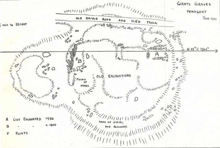
The Giants’ Graves (after W. Bennett, YAJ 1937)
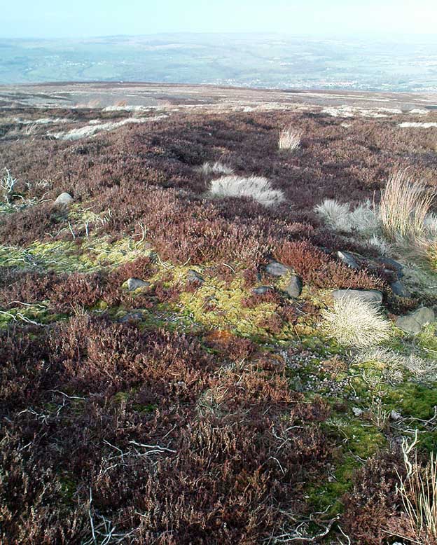
The earliest description I’ve found of this is in Terence Dunham Whitaker’s History and Antiquities of Craven (1878), where he reckoned the remains here to be of Danish origin. The same thing was professed by the southerner, archdeacon W. Boyd, who said as such to the local people hereabouts more than 100 years ago, but they thought him a bit stupid and laughed at his notions! (though it does seem that Boyd wasn’t liked locally, tending to think himself better than the local people, who told him very little of local lore and legend) Describing the remains, Whitaker said there were skeletons found in the tombs:
“The bodies have been inclosed in a sort of rude Kist vaen, consisting of limestone pitched on edge, within which they appear to have been artificially bedded in peat earth.”
But Harry Speight (1892) doubted this, saying that Whitaker never even visited the site! When he went here he told us that,
“What is left at present are a few mounds of earth, the largest, which is divided into two, and lies north and south, measures about 28 feet by 25 feet. There is another apparent grave-mound on the east side of it, and again to the north is an oblong excavation or trench, 7 feet wide and nearly 30 feet long, in which several bodies or coffins may have been deposited. Several large oblong stones lay flay upon the ground beside the graves, but these were removed a few years ago and degraded to the service of gate-posts.”
The site was excavated in June 1936 by Arthur Raistrick and W. Bennett (1937) after they had been badly damaged and the stones robbed for walling and other profane building operations. Herein were found two burial cists with fragments of human bones in each tomb. In Bennett’s short account he told:
“The site consists of a nearly circular bank, about eight feet wide, and in parts two feet high, surrounding a much disturbed area. Within the area are the remains of two cists and a number of hollows that certainly represent other similar structures. The farmer tells of the removal of more than twenty large stones from these hollows, for use as gateposts, wall throughs and drain covers.* The bank encloses an area fifty-four feet east to west…and fifty feet north to south. At the west end there is a smaller bank, roughly in form of a circular apse, extending a further thirty feet. Many large boulders and vast quantities of smaller stone are incorporated in the bank.
“Near the east end, with its axis bearing N75E, is a cist — three stones in position. This was cleared to a depth of eighteen inches, and though no floor stone was present, among the sifted soil were found (i) broken bones, including parts of humourus, axis, vertebrae, ulna, ribs and cranium, all human; (ii) five teeth — two molars, one wisdom tooth, and two incisors, which appear to represent tow individuals. Sir Arthur Keith reports that the bones submitted to his examination may represent more than one adult person, and there is also a fragment of a child’s tibia. Most of the limb bones belong to a man of medium stature… He suggests from the condition of the bones a person of the Iron Age. While this is possible with a secondary interment in the area, it is rather unlikely, as all the bones came from within the built cists, and not from the earthen part of the mound, where secondary burials would be expected.
“At the west end are two large stones, the side stones of cists or of a chamber. The ground in front of them has been excavated many years ago…and partially refilled with boulders… Within the small extension on the west a trial excavation showed eighteen inches to two feet of random boulders, and beneath them, on the old sub-soil surface, two inches of fine grey sand, with two small flints — one of them a well-worked blade. These probably pre-date the construction of the circle.
“The whole site is suggestive of a multiple cist burial mound, or even a “passage grave” type. The obvious hollows, from which many of the larger stones have been lifted, are aligned in a parallel series, along an axis N75E, directed towards the two remaining large stones at the west, which may be part of a chamber wall and not part of a cist.”
Recent archaeological analysis has suggested these may be the remains of an old chambered cairn, although there is today far too much damage that’s been done to give us an accurate portrayal of what this originally looked like. The Dawson Close prehistoric settlement is less than half-a-mile further up the ridge.
Folklore
The folklore here is simple: these are the graves of giants who lived in the valley of Littondale in ancient times.
References:
Bennett, Walter, ‘Giants’ Graves, Penyghent,’ in Yorkshire Archaeological Journal, part 131, 1937.
Boyd, W. & Shuffrey, W.A., Littondale Past and Present, Richard Jackson: Leeds 1893.
Feather, Stuart & Manby, T.G., ‘Prehistoric Chambered Tombs of the Pennines,’ in YAJ 42, 1970.
Speight, Harry, The Craven and North-West Yorkshire Highlands, Elliott Stock: London 1892.
Whitaker, Thomas Dunham, History and Antiquities of the Deanery of Craven, Joseph Dodgson: Leeds 1878 (3rd edition).
* It might be worthwhile exploring the local gateposts and walls to see if any of these covering stones had cup-and-rings carved on them, as was traditional in many parts of Yorkshire and northern England.
Stone Circle (destroyed): OS Grid Reference – NT 774 292
Also known as:
Five Stones
The Tryst
Archaeology & History
Less than a mile northwest of the hillfort on Linton Hill, modern OS-maps show the field-name of ‘Five Stone Field’ which is where, in bygone years, another important stone circle once stood. Today unfortunately, not a single stone remains. As the Scottish Royal Commission (1956) lads told:
“About a mile NE of Frogden, on the N side of the road between Frogden and Greenlees, there were formerly five or six upright stones forming a circle, ‘about the size of a cock-pit’ (1792 Statistical Account). This circle, which was adopted as a rendezvous by Border raiders in the Middle Ages and became known as The Tryst, has long since disappeared, but its approximate site is indicated on the OS map by the name Five…Stone Field.”
Folklore
One of many stone circles used as an old moot, or gathering spot. This was described in one of the many footnotes to Sir Walter Scott’s (1802) Minstrelsy of the Scottish Border, in which he told:
“At Linton, in Roxburghshire, there is a circle of stones surrounding a smooth plot of turf, called the Tryst, or place of appointment, which tradition avers to have been the rendezvous of the neighbouring warriors. The name of the leader was cut in the turf, and the arrangement of the letters announced to his followers the course which he had taken.”
This tradition was echoed around the same period in Robert Forsyth’s (1805) massive work on the history of Scottish life and landscape, saying:
“In different parishes, such as Moorbattle, Linton, and others, are to be found what are called tryst stanes. These are great stones commonly situated on high grounds. They are placed perpendicularly in rows, not unfrequently in a circular direction. It is said, as also the name imports, that in times of hostility they marked the places of resort for the borderers when they were assembling for any expedition of importance.”
References:
Burl, Aubrey, The Stone Circles of Britain, Ireland and Brittany, Yale University Press 2000.
Forsyth, Robert, The Beauties of Scotland – volume 2, Thomas Bonar: Edinburgh 1805.
Royal Commission on the Ancient & Historical Monuments of Scotland, Roxburghshire – volume 1, HMSO: Edinburgh 1956.
Scott, Walter, Minstrelsy of the Scottish Border, James Ballantyne: Kelso 1802.
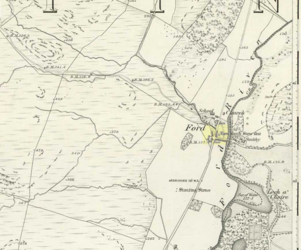
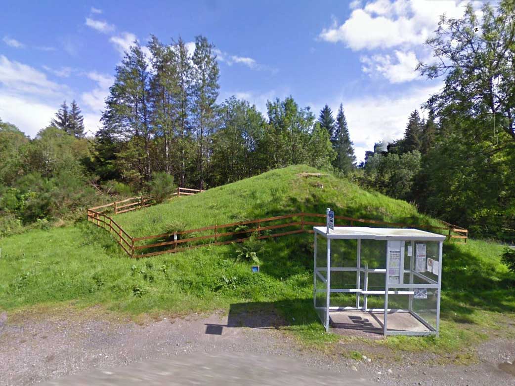
Although I describe this site in association with the township of Kilmartin, it is in fact several miles north of there – but I reckoned that if I say it’s near Kilmartin, then those of you who don’t really know this region, will have some idea of its locale. So – from Lochgilphead, go up north thru Kilmartin, another coupla miles on, till you reach the small road to your right (signposted ‘Ford’). Just keep driving for a couple more miles until you hit the village. If you park by the only shop, you’re just past the old tomb. Diagonally across on the opposite side of the road from the Ford Hotel, right by the road-junction, just before the little shop, you’ll see a notable rounded mound overgrown in shrubs. Embedded in this are the remains of an old tomb.
Archaeology & History
Ford tumulus (photo, couresty J. Reid)
This typical-looking fairy-mound just by the road junction in the village is where me and my daughter used to scramble around, sometimes playing and sometimes seeing if we could find anything of note in this ancient hillock, but all trace of any prehistoric stonework seems to be well-buried. When excavators explored the site in bygone times, a small stone cist was found, which aligned (yet again) north-south and measured internally, roughly, 3ft x 2ft. Only small!
A food vessel in Edinburgh’s central museum, “found in a cist in the neighbourhood of the lower end of Loch Awe” is thought to have come from this tomb.
References:
Royal Commission on the Ancient & Historical Monuments of Scotland, Argyll – volume 6: Mid-Argyll and Cowal, HMSO 1988.
A half-mile south of the superb Brimham Rocks complex, take the straight road south until you hit the second farmhouse (and accompanying caravans). Go up the public footpath past Highfield Farm and just check with the landowner’s permission to wander his land if you want to see the stone. They’re OK about it if you ask. The lady there is very amiable and will tell you what’s what, giving directions right to it, telling us it was off the footpath in the middle of one of his fields.
Archaeology & History
Archaeology texts are, once more, silent about this stone (and other monuments in the region), making you wonder just what the hell some of them are paid for! The stone appears to have given its name to the land upon which it stands which, as the locals tell, “has always been known as standing stone hill.” And no wonder — it’s a bloody decent standing stone! On its northern face we find well-eroded lines running down the stone, similar to the weathering found on the Devil’s Arrows a few miles to the east.
Standing Stone Hill stoneLooking south
Although just over 6-feet tall, this is a solid bulky old fella. But the spot he presently occupies isn’t his original standing place. He was found knocked over and lying on the ground in the middle of the 20th century, slightly out of position. But he was thankfully stood back upright by the local land-owners sometime in the 1960s, where he’s been stood ever since. It must have been one helluva job! And making it more difficult was the intriguing geological nature of the Earth right beneath this field. As the lady who now own the land told us,
“When the fields were tilled we found that all of them were easy to turn over, except the one with the stone in it! There’s virtually no soil of any depth to write home about,” she said. “It stands on only a few inches of soil and then you hit solid rock right underneath it. All the other fields are OK – but this one’s the odd one out.”
And before the fields were farmed, just over a hundred years ago, all this land was covered in moorland heather. Then the land was enclosed, the Earth’s heathland stripped out of existence and turned over to agriculture. But thankfully the standing stone was left here. It makes you wonder what else was destroyed when the moorlands were industrialised…
The stone does get a brief mention in Boughey & Vickerman’s (2003) Prehistoric Rock Art of the West Riding, where they mention there being “three possible cups in (a) line on one side” of the standing stone, but these are little more than Nature’s handiwork and nowt else. There are a couple of other cup-and-rings nearby which are the real thing – but the ‘cups’ on this stone aint man-made.