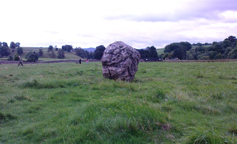
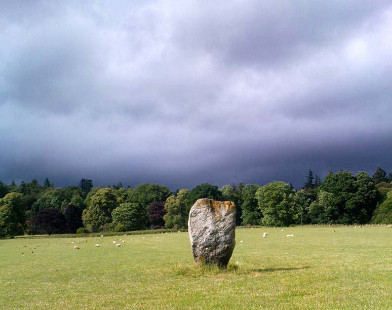
Going thru Pitlochry town, turn up the A924 road for about a mile till you hit the Moulin Inn on your left-hand side. Just past here, take the road left and continue for 2-300 yards until the stone in the field stands out on your right-hands side. Y’ can’t really miss it!
Archaeology & History
I should mebbe have this site entered as a ‘stone circle’ and not just an old monolith, as numerous other standing stones were in close attendant not too long ago and it was said to have been a circle. Certainly when the great Fred Coles (1908) talked about this place, he
“was informed by the tenant, Mr Reid…that many years ago, in his grandfather’s time, “there were several more stones standing”, all smaller than this monolith and that, upon the orders given by Mrs Grant Ferguson of Baledmund, some of these were saved from total demolition, and are supposed to be lying half-buried in the field to this day.”
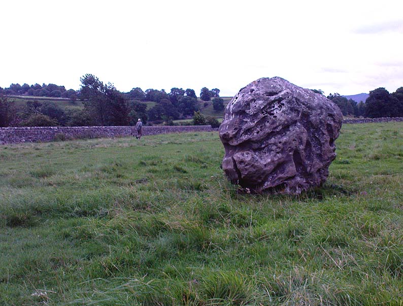
…and here’s the big man close-up
Though I imagine these remnants have now been removed. Aerial images, when conditions are just right, might prove fruitful here.
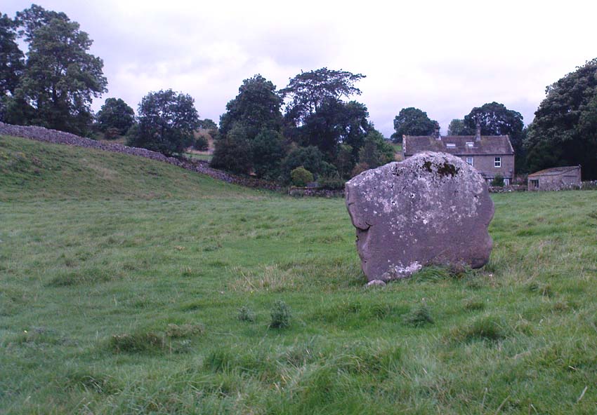
But the solitary stone still standing here is quite a big fella. Heavily encrusted with quartz and more than 7 feet tall, it’s a nice fat chunky thing, with its lower half being somewhat slimmer than the top. Well worth having a look at!
Folklore
Once an old moot site, folklore also tells that an old market was once held here (there was some other folklore I had of this place, but can’t for the life of me find it at the moment!).
As you go through Pitlochry’s main street, watch out for the right-turn up the A924 road. Go up here for perhaps a mile. You’ll know you’re getting close as you pass the Moulin pub and the seeming avenue of trees opens on either side of the road. A coupla hundred yards up into the trees, there’s the left-turn up the Balnakeilly driveway. Stop! It’s on your left.
Archaeology & History
The Balnakeilly Monolith
Knocking on for nine-feet tall, there’s some debate as to the archaic authenticity on this standing stone. Ian Armit and his mate (1998) certainly wondered whether this was an ancient stone or not and, gotta say, when I came up here a coupla weeks back, I got the same impression. It doesn’t have that feel about it which comes from the real olde ones; but this could be due to it having been moved in the not-too-distant past. Though when Alan Reid wrote about it in 1911 he told us that,
“it bears marks of having been…worked slightly into shape by some pointed tool whose traces are plainly seen on several of its angles.”
Not something you’d find on monoliths that are a few thousand years old! But if this stone was moved when the entrance to Balnakeilly drive was done, or the road widened, this could account for such markings. We could do with digging into any archives that may exist about Balnakeilly or the Pitlochry roads to see if there’s any record of this stone to end the debate once and for all. Tis a good site to visit though – check it out!
Follow the directions to reach the Man Stone carving. Walk up the sloping hillside from there until you reach the top. From there, walk down the slope heading slightly to your left. You’ll find it!
Archaeology & History
A small upright stone, less than three feet tall, but once a little taller as you’ll see that it’s head has been knocked off in the not-too-distant future and lies on the ground by its side. A small scatter of what seems like possible cairn-material lies around its base, but not enough to imply that a tomb of any sort was ever here (aswell as that, the position on the slope seems wrong).
A curious little thing, without archaeological companions. When we came here the other day, we explored the ground all round the stone as all the heather had been burnt back; but there was nothing anywhere near it to give a hint as to why it stands here, alone, at what seems like a strange spot two-thirds the way up a moorland slope. It’s been speculated that in the middle of its more north-facing side there is a cup-mark on it, but this is very dubious and, in my opinion, should be discounted as such. The marking is a gun-shot wound – and more recent ones have just been added, as seen in the photo.
This supposedly 10-12th century carving — found in the early 1940s and handed to the Scottish National Museum in Edinburgh by Mr A. Sanderson — took my interest by virtue of the distinct swastika design carved on the face of the stone.* The fact that it’s etched onto what’s thought to be the remains of an old christian cross shouldn’t be too surprising: we find it on numerous other old stone crosses, church bells and other religious remains.
This example was only carved on one side of the stone, which measures some 18-inches high and just 9 inches across. The top of the stone has a design typical of many early crosses from between the 9th to 14th century; whilst the curvaceous line on the lower-right also typifies imagery found on many crosses from this period — some of which appear to be based on cup-and-ring imagery. However, no such cup-and-rings seem to have been in evidence where this cross-remain was found. Very little else is known about its history.
Although it aint quite as old as Ilkley’s Swastika Stone, this is still a fascinating carved stone indeed!
References:
Royal Commission on the Ancient & Historical Monuments of Scotland, Peeblesshire – volume 1, HMSO: Edinburgh 1967.
Stevenson, Robert B.K., ‘The Inchyra Stone and some other Unpublished Early Christian Monuments’, in PSAS 92, 1961.
* To those who don’t know, the swastika symbol has been used by people from around 20,000 BC onwards and has only very recently gained a bad press. It’s a symbol that needs to be reclaimed, through education, and put back into its proper mythic place where it belongs – away from any Nazi dip-shits, whose retarded actions pale into insignificance when it comes to the primal archaic nature of this old form.
Standing Stone (destroyed): OS Grid Reference – SE 299 612
Also Known as:
Temple Yarmer
Archaeology & History
It was the legendary Harry Speight who described this in his monumental historico-topographical exploration of the Nidd valley in the 1890s. Nothing else, it seems, has been said of the place, though something of considerable archaeological importance was once here. Not only does he tell of the previous existence of “a large circular enclosure…the outer ditch having a circumference of nearly 1000 yards” at Yarmer Head, but,
“In the hollow on the east side of this hill was formerly a large natural marsh or lakelet, near which remains the base of an immense menhir or standing monolith, erected doubtless in heathen days to commemorate a great victory, or perhaps a treaty.”
The stone is not shown on the early OS-maps (although they did miss quite a lot of sites), and whatever its reason for being here might never be known as all traces of this giant monolith appears (yet again) to have vanished. There is an ancient boundary line immediately below the hill, on its eastern side, so perhaps the stone was an ancient marker along this. Do any local folk round Nidd know owt more about this once important megalithic site?
References:
Speight, Harry, Nidderdale and the Garden of the Nidd, Elliot Stock: London 1894.
Standing Stone (destroyed?): OS Grid Reference – SE 1765 5032
Archaeology & History
Eric Cowling (1946) described this lost or destroyed stone as “a squat standing stone at junction of the Askwith bridge-path with the Otley-Timble highway, saying how it gave its name to Stoop Hill, “which it surmounts.” But in several ambles here in search of this old stone, we’ve yet to locate it; though we did find the Stoup Hill cup-marking and possible neighbour on the southern edge of the hilltop.
Folklore
In days of olde, the ‘Old Man’ was the fabled companion of the legendary ‘Old Woman,’ or great cailleach (the christian cult stupidly, somehow, turned this mythic figure into their ‘devil’ – to which it has no relationship whatsoever). Although no specific folktale remains here, the name of this lost stone tells that it had some mythic tale underscoring it; perhaps simply that it marked the burial of some forgotten chief or elder.
Takes a bitta getting to this one, right at the far end of the road, leading to nowhere – so those of us who like Scotland for its vast expanses of ‘middle o’ nowhere’ should like it! From Port Ellen, travel along the A846 eastwards, all the way to the where it ends in Ardbeg. But the smaller track road continues up the coast. Keep going – and keep going all the way up; past the ‘stone circle’ of Ardilistry, past the standing stone of Trudernish, right to the very end where the track leads you to the farmhouse of Ardtalla. Once here, you’ll see the stone about 20 yards west of the farm.
Archaeology & History
This old stone is only 4-foot-tall, leaning slightly, but—as I recall from many years back—”it’s cute!” (sad aren’t I?!) All the way up here to see a small monolith! Even the Royal Commission (1984) lads didn’t have much to say about it, merely:
“This standing stone is situated 18m NW of the SW gable of Ardtalla farmhouse. Leaning slightly to the SSE, it measures 0.48m by 0.48m at the base and 1.25m in height.”
But if you like walking, the rest of the route up the coast is excellent. Stick yer tent in the small woodland by the fort a mile or two further north, then bring your attention to the legendary Beinn na Cailleach, if the heathen within you stirs…
References:
Royal Commission on the Ancient & Historical Monuments of Scotland, Argyll – volume 5: Islay, Jura, Colonsay and Oronsay, HMSO: Edinburgh 1984.
One of two ways to get here really. The easiest is from Sutton-in-Craven: go through the village and up the steep hill (don’t take the right turn as you start up the hill). Go all the way up until the hill starts to level out and on the left-side of the road you’ll notice a boundary stone stood upright (this is the Sutton Stoop). Stop here. Of the 2 gates, climb over the top-most one and walk down the path into the adjacent field, heading over to the gap a couple of hundred yards away where the gate to another field is. That’s it!
Archaeology & History
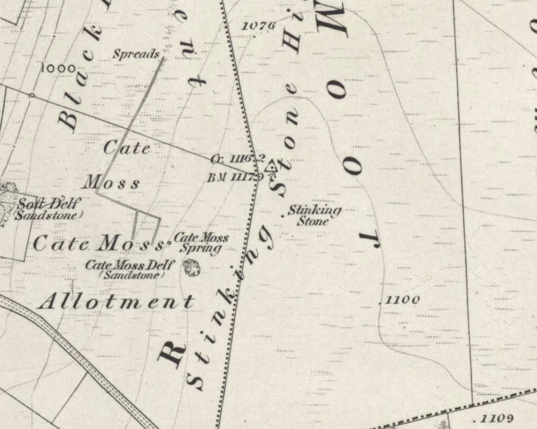
Stinking Stone, Steeton
Now here’s a weird one. With a name like this you’d expect there to be plenty of info or historical comments. But despite all the books and journals in my huge library, aswell as visiting town libraries and exploring the resources on-line, there’s nowt written about this ‘ere spot. Not a jot! Even the usually satisfactory place-name fellas have a thing-or-two to say about sites with names such as this—but even their old tomes are closed-lipped. Hmmmmm…..
I visited the place several times to try ascertain what this site was, thinking — perhaps — that it was an old boundary stone whose name had been convoluted from some older, more obvious title.* The nearby Sutton Stoop boundary stone, right by the roadside, seemed a good indicator to such an assumption, as it was a recognised boundary marker with written history and a meeting point along the local perambulation. But the curiously-named Stinking Stone was neither on the same line, nor ever had been according to old records, and couldn’t be located either. There had been obvious quarrying and other industrial destruction along the hilltop where the old stone was marked and it seemed logical to assume that it had been destroyed in bygone years by that usual breed of capitalist industrial halfwits. Until a psilocybin venture one afternoon, last season…
Twas a lovely sunny day, though windy on the tops as usual. I was out with a couple of neophytes showing them Psilocybes and various other species, chewing them here and there and talking the way of healthy usage. We passed by an old well, long forgotten, before heading onto Stinking Stone Hill. Bimbling somewhat, and ruminating about the moss of colour, we decided to sit by the walling in-field and dream for a short while. As we hit the old gate the Stinking Stone came up right before us. Literally!
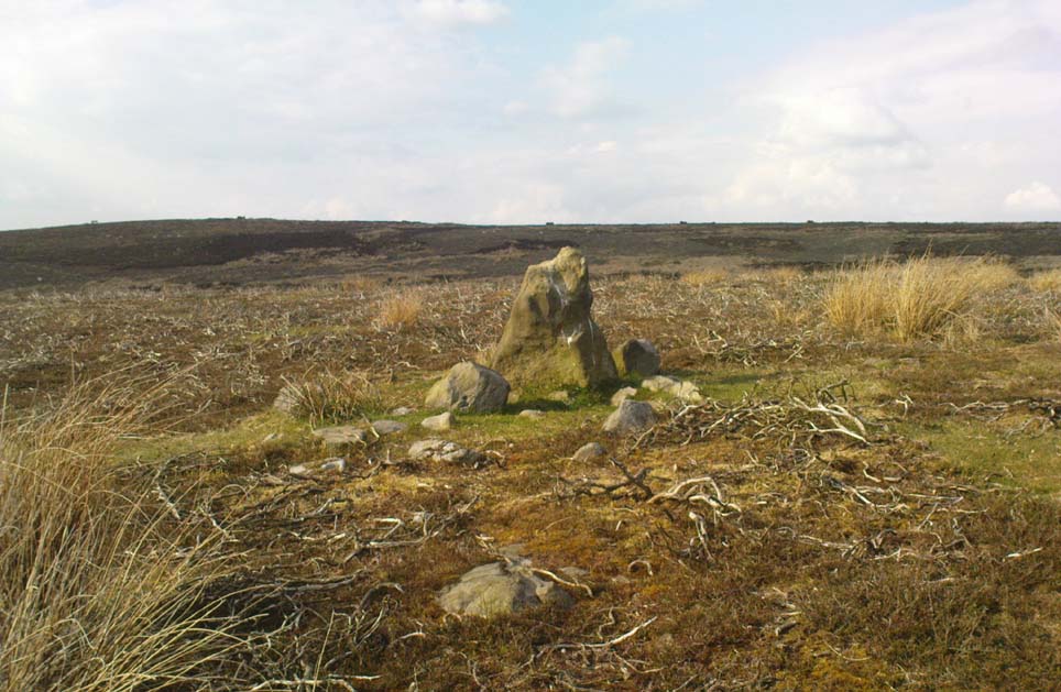
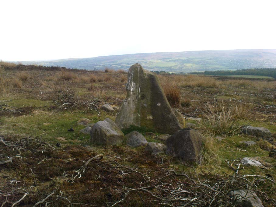
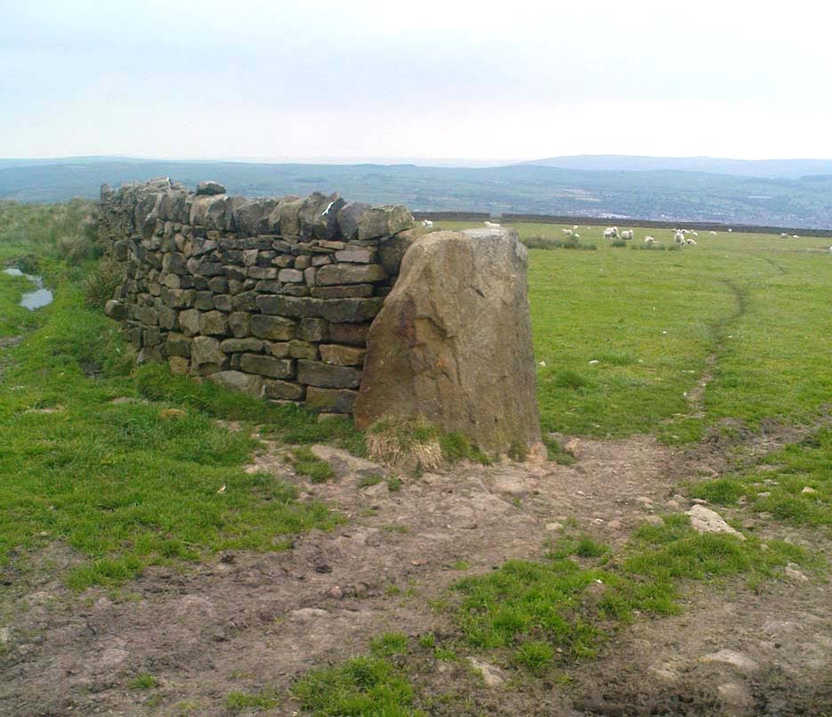
There in the old walling, blunt as you like, stood this four-and-a-half-foot tall standing stone, smoothed on one side by a short aeon of weathering, upright and proud as if it had been stood there for centuries, awaiting attention! I exclaimed a few triumphant expletives; rubbed myself here and there over the old thing, then sat for a while behind the wind with the old upright, solidly embedded in old earth — then awaited the dream…
Twas a good day…
And then I returned home and later sought what I could on a possible etymology. Around the hilltop a hundred yards away were small depressions and the faded remains of industrial workings, like I said; and with this in mind the awesome Mr Wright (1905) told us about the existence of ‘Stinking coals’, “an inferior kind of coal” no less. Referring us to a work from 1818, we’re told,
“The Stinking-coal is noted for containing a great proportion of sulphuret of iron, thick seams or layers of these pyrites running in it. In consequence of this it cannot be used for smelting purposes.”
Another account from 1868 telling us that:
“On opening the body, it contains a strong sulphureous smell, characteristic of the disease; hence it is called the stinking ill; and the stomach and bowels are prodigiously distended with air, having the same intolerable foetor.”
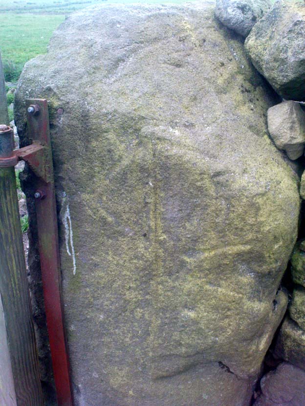
Worn metal scratches, made when dragged here?
This old worn gatepost however, perhaps has a history that only goes back a few centuries. It has been cleaved in half, as you’ll see if you visit it; but its western face is old and worn and it’s been embedded in the ground for a long time. On its northern face are the curious etchings of carvings, which are more akin to wounds from some past offence (perhaps when it was split in half), cleaved by metal toolings and dragged by farmers to be fixed in into present spot. It’s history may not be truly ancient. Twouldst be good to know for sure though…
References:
Wright, Joseph, The English Dialect Dictionary – volume 5, Henry Frowde: Oxford 1905.
* ‘Stinking’, stone-king or King Stone? Unlikely though…
There’s considerable Bronze- and Iron-Age archaeology all round here (cairns, settlements, earthworks and more), but it seems that the once-proud standing stone highlighted on the 1899 Ordnance Survey map found on the higher ground a half-mile north of Middlesknowes, no longer stands where it had been standing for all those thousands of years. What, pray, has become of it…?
References:
Royal Commission on the Ancient & Historical Monuments of Scotland, Roxburghshire – volume 2, HMSO: Edinburgh 1956.
Just get to the top of the hill thru the village and where the sharp bend turns, you’ll find one of the monoliths up against the wall above the roadside (hard to find in the undergrowth sometimes!). The other stone is on the eastern side of the road through Lidstone from the A44, halfway into the village itself.
Archaeology & History
Lidstone monolith
There are two small stones to be found in the lovely little hamlet of Lidstone. The main one—Leodwin’s Stone—is at coordinate SP 35517 24656; and the smaller stone further up the hill is at SP 35487 24627. First described in a treatise from 1235 AD as Lidenstan, the great place-name writer Ekwall (1940) thought this derived from ‘Leodwine’s Stone.” A few years later Gelling (1954) told us that “there is a monolith at Lidstone”, which she thought gave rise to the place-name, and not some chap named Leodwine. Whichever it may be, we certainly have two small upright stones here — both worth having a look at if such things take your interest. (Tom Wilson and I included them in our short survey of the standing stones of the region in 1999) Further up at the top of the hill from here are the remains of an old tumulus.
Folklore
Said by Caroline Pumphrey (1990) to be the resting place of old King Lud, one of England’s last great pagan kings; another local writer Elsie Corbett (1962) also told a tale well-known to folklore students about this little monolith. She related how a local man they knew as Mr Hitchcock told them,
“that they used to kid the boys there by telling them that when the stone hears the clock strike twelve it goes down to the stream to drink, and that it was just a ‘catch’ because there was no striking clock in the first place; but it is a ‘catch’ tacked onto some tale that must have been told in the hamlet long ages before there were clocks at all.”
The said stream is a short distance due north of here, down the little valley. The tale may come from it once acting as a shadow-marker, highlighting midday when the sun was high in the sky due south. Makes sense of the folktale anyway!
References:
Bennett, Paul & Wilson, Tom, The Old Stones of Rollright and District, Cockley: London 1999.
Corbett, Elsie, A History of Spelsbury, Cheney & Sons: Banbury 1962.
Ekwall, Eilert, Oxford Dictionary of Place-Names, OUP: Oxford 1940.
Gelling, Margaret, The Place-Names of Oxfordshire – volume 2, Cambridge University Press 1954.
Pumphrey, Caroline, Charlbury of our Childhood, Sessions Books: York 1990.